Country guide
United Kingdom
223 sacred sites across 27 regions.
Traditions present in United Kingdom
Prominent site types
Alba / Scotland
16 sites
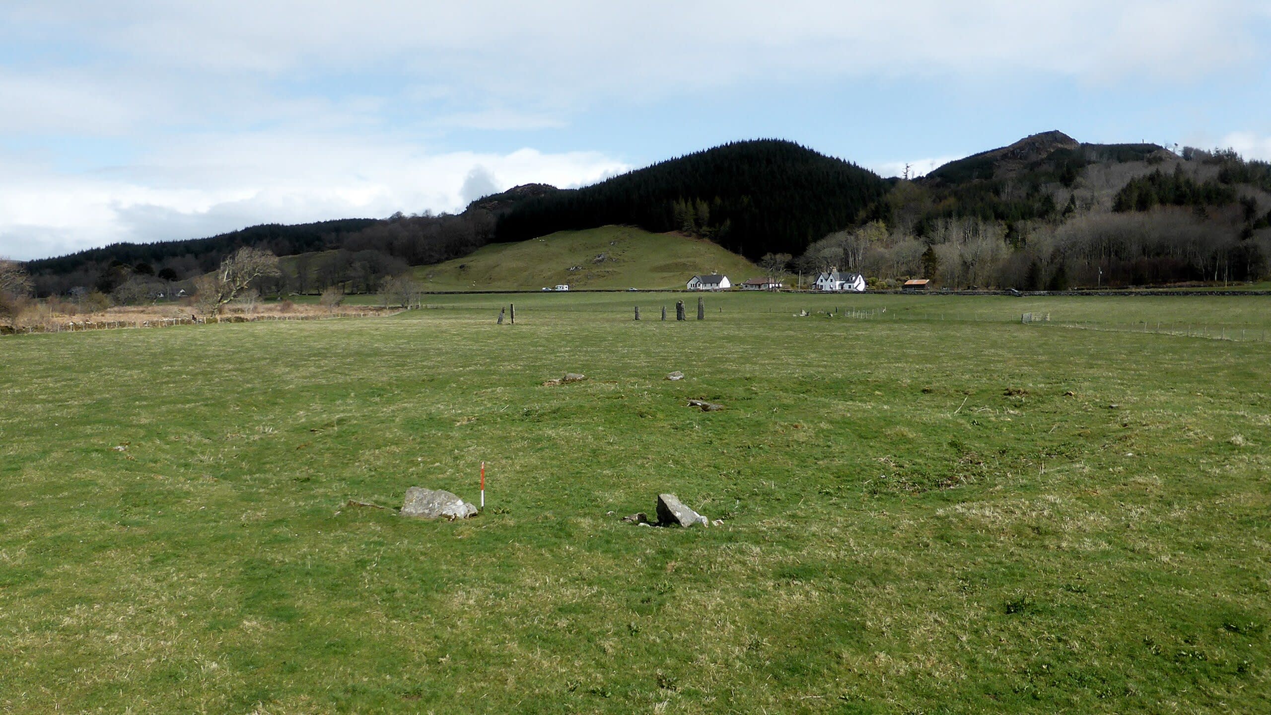
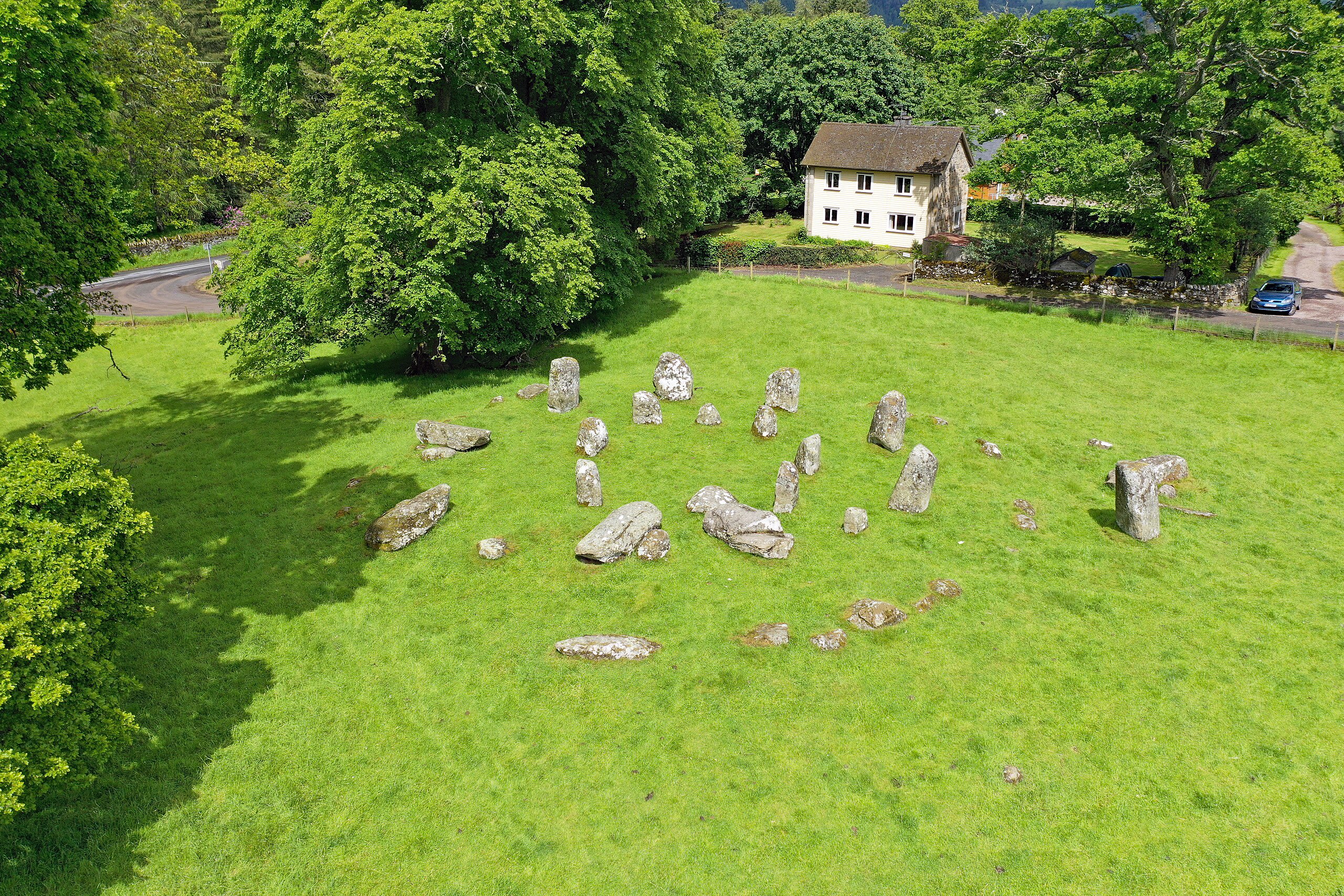
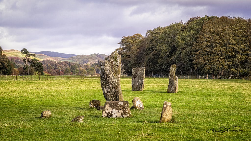
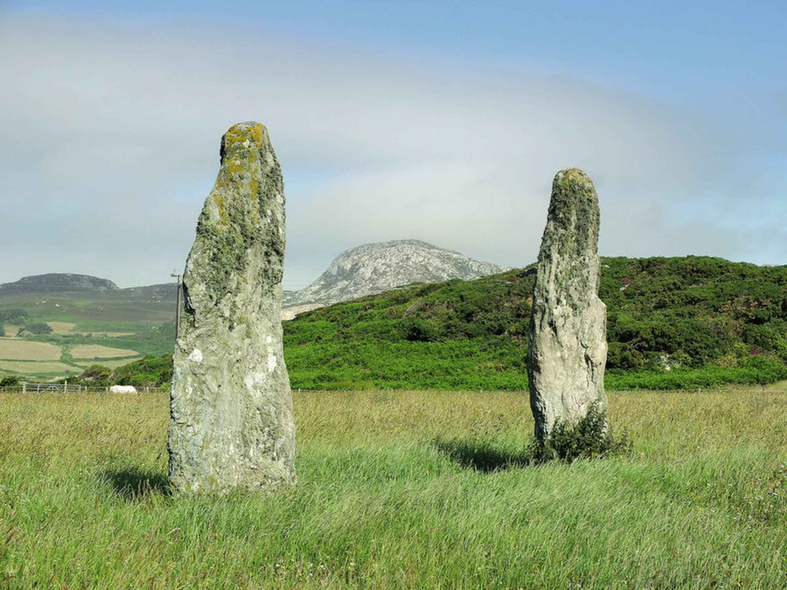
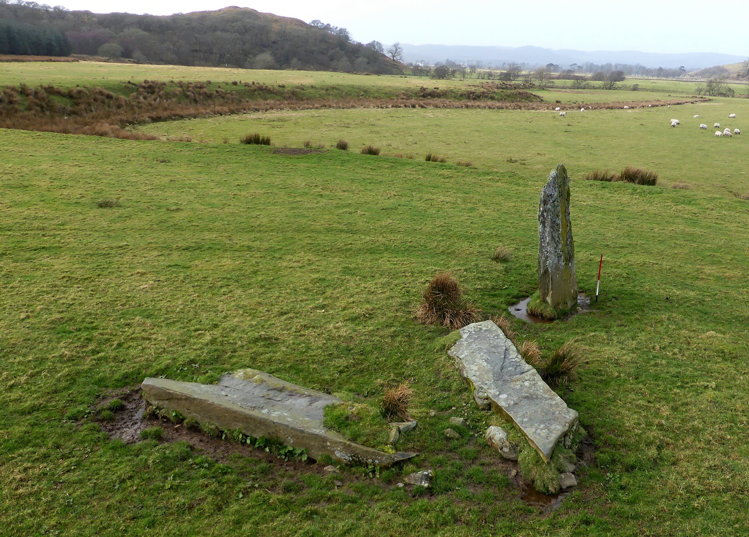
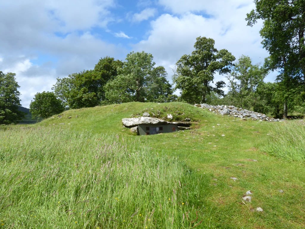
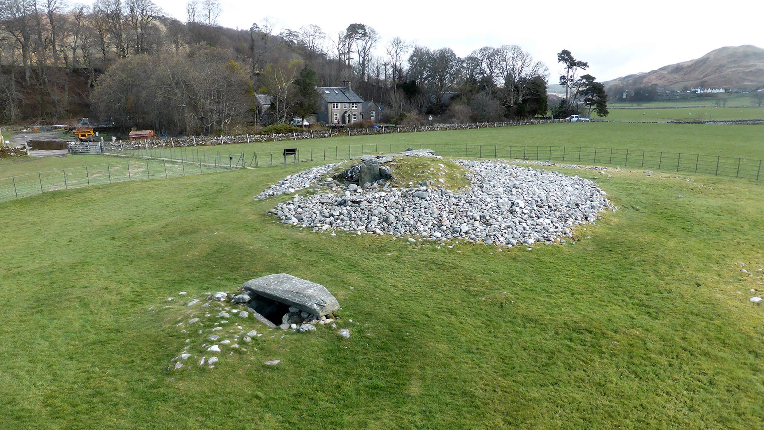
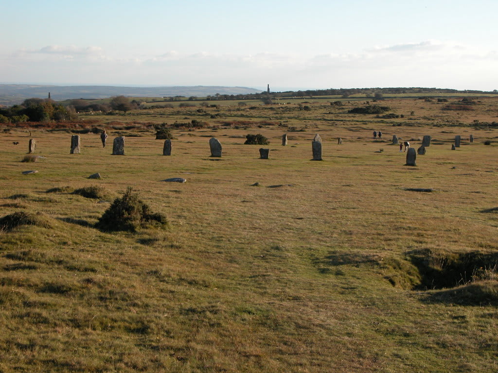
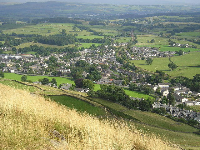
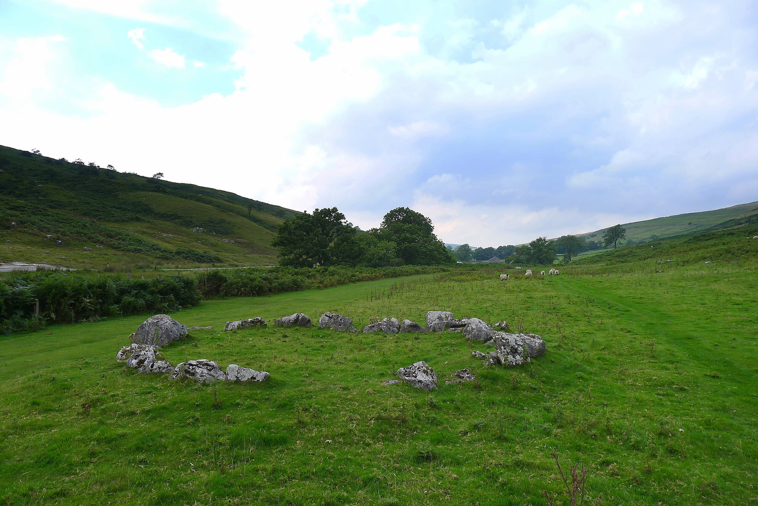
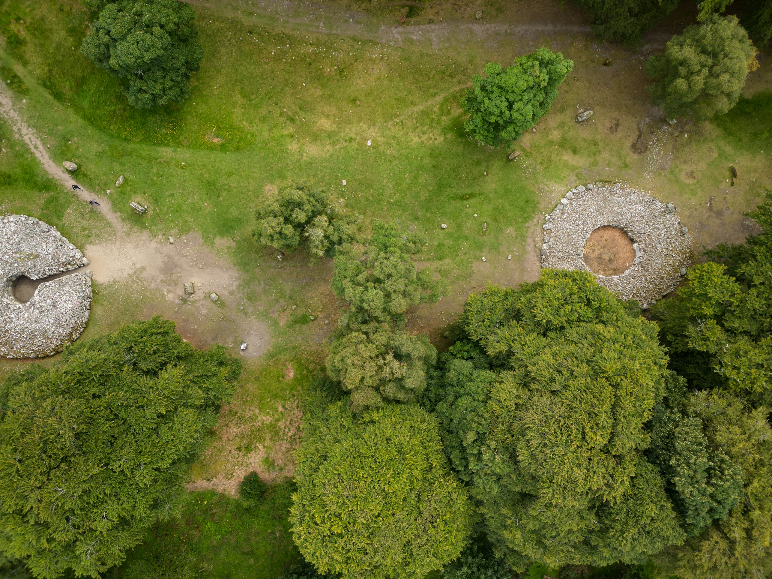
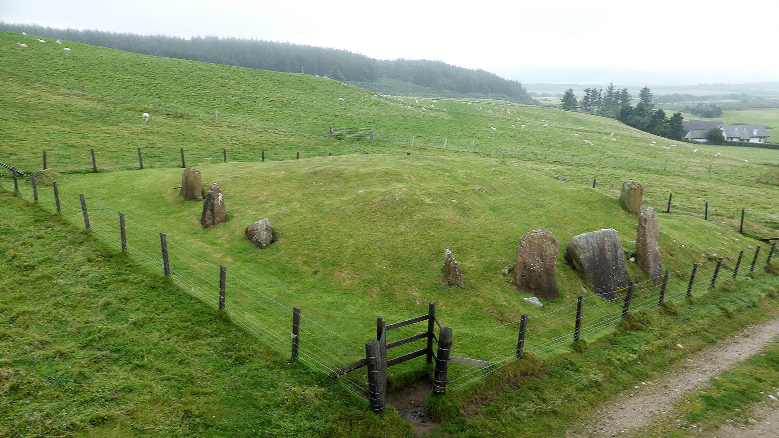
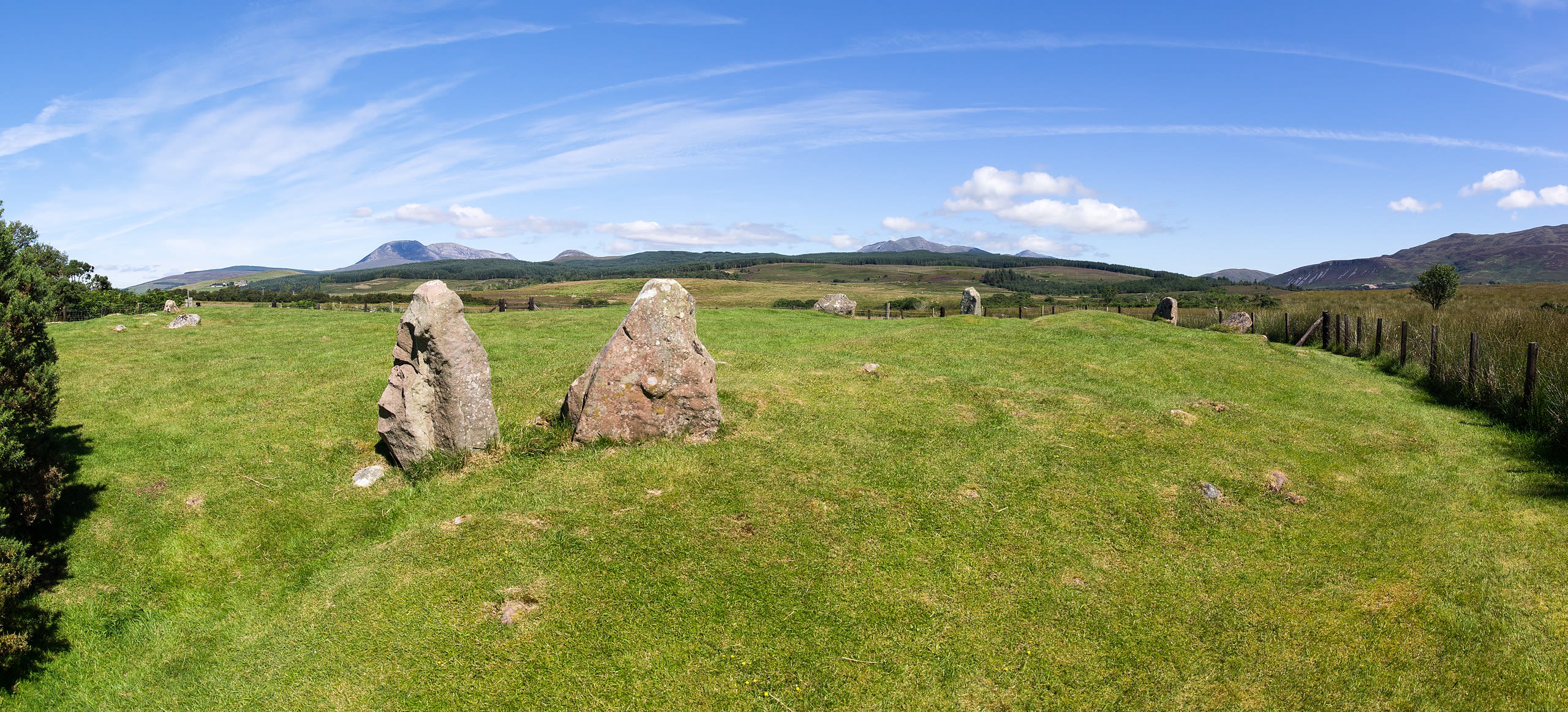
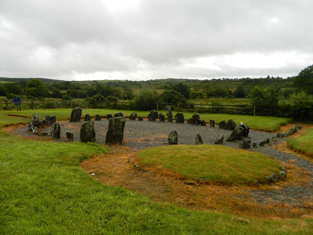
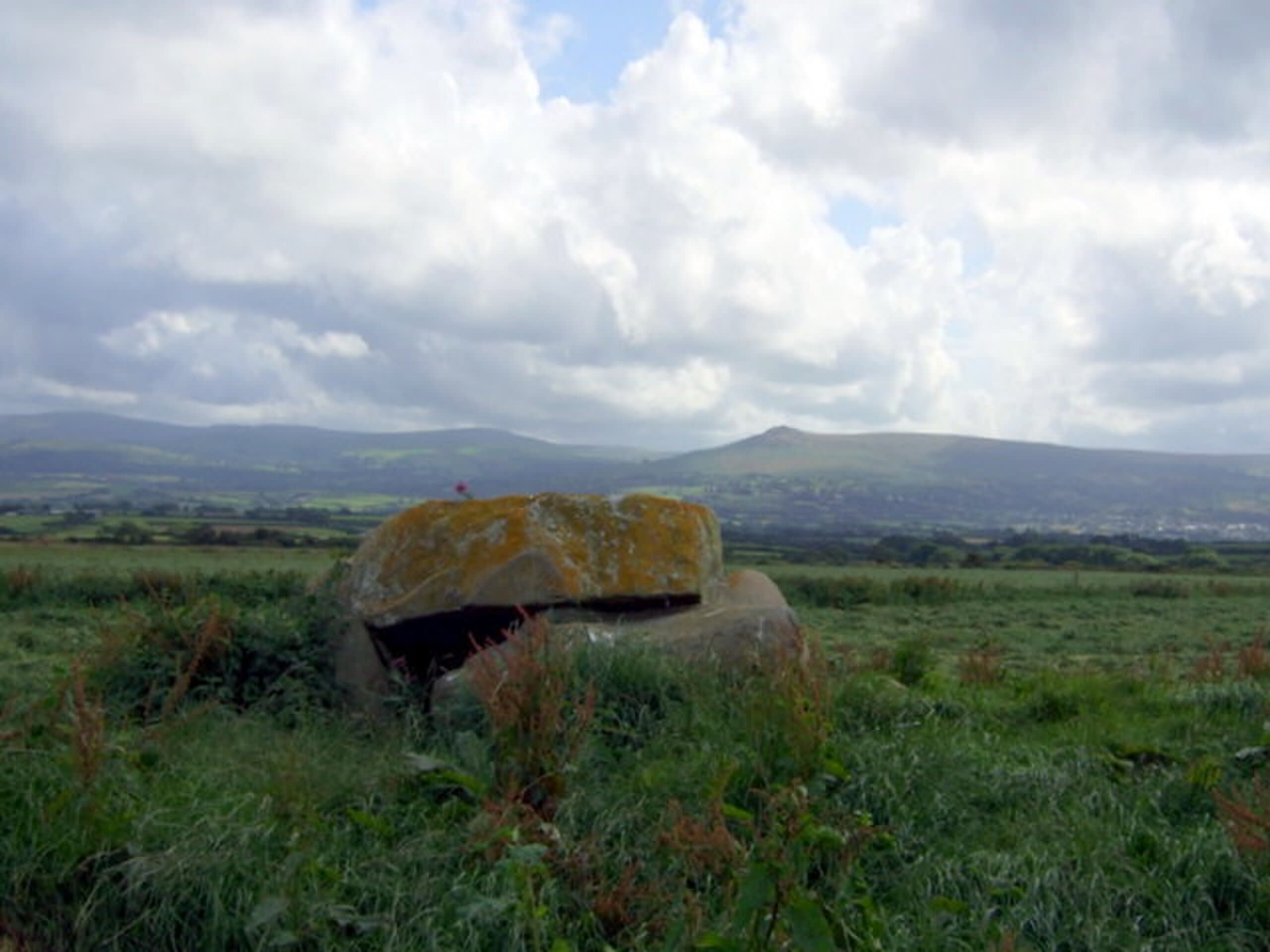
Ballymeanoch Neolithic site, Kilmartin Glen
Kilmartin, Alba / Scotland, United Kingdom
Ballymeanoch Neolithic site, Kilmartin Glen is a neolithic site of sacred significance. Approximate coordinates: 56.10898, -5.47998. Attributes: built, cultural, archaeological. Tradition: Prehistoric. Located in Alba / Scotland, United Kingdom.
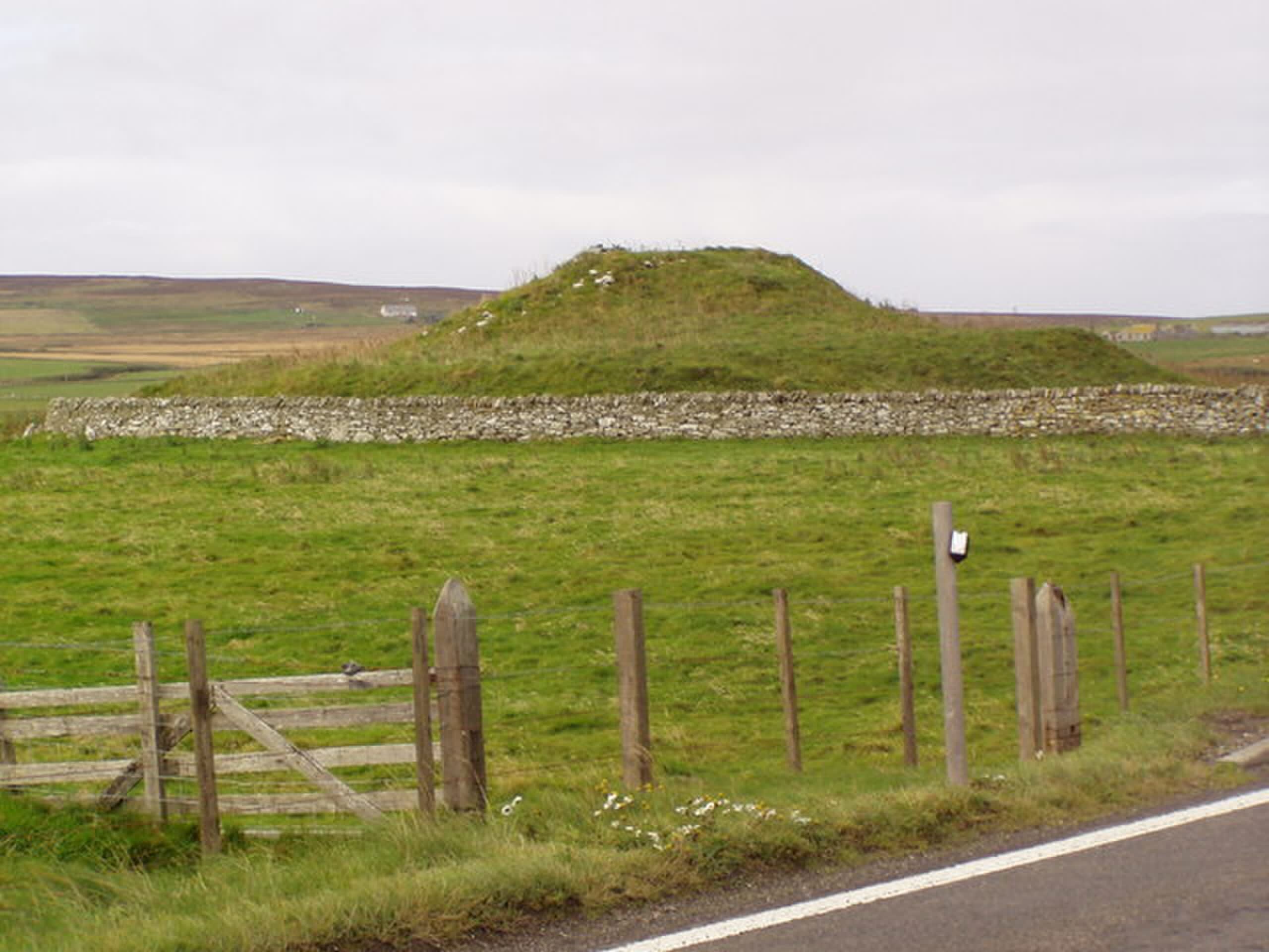
Cairn of Get
Ulbster, Alba / Scotland, United Kingdom
Cairn of Get is a cairn of sacred significance. Approximate coordinates: 58.35313, -3.17511. Attributes: built, cultural, archaeological. Located in Alba / Scotland, United Kingdom.
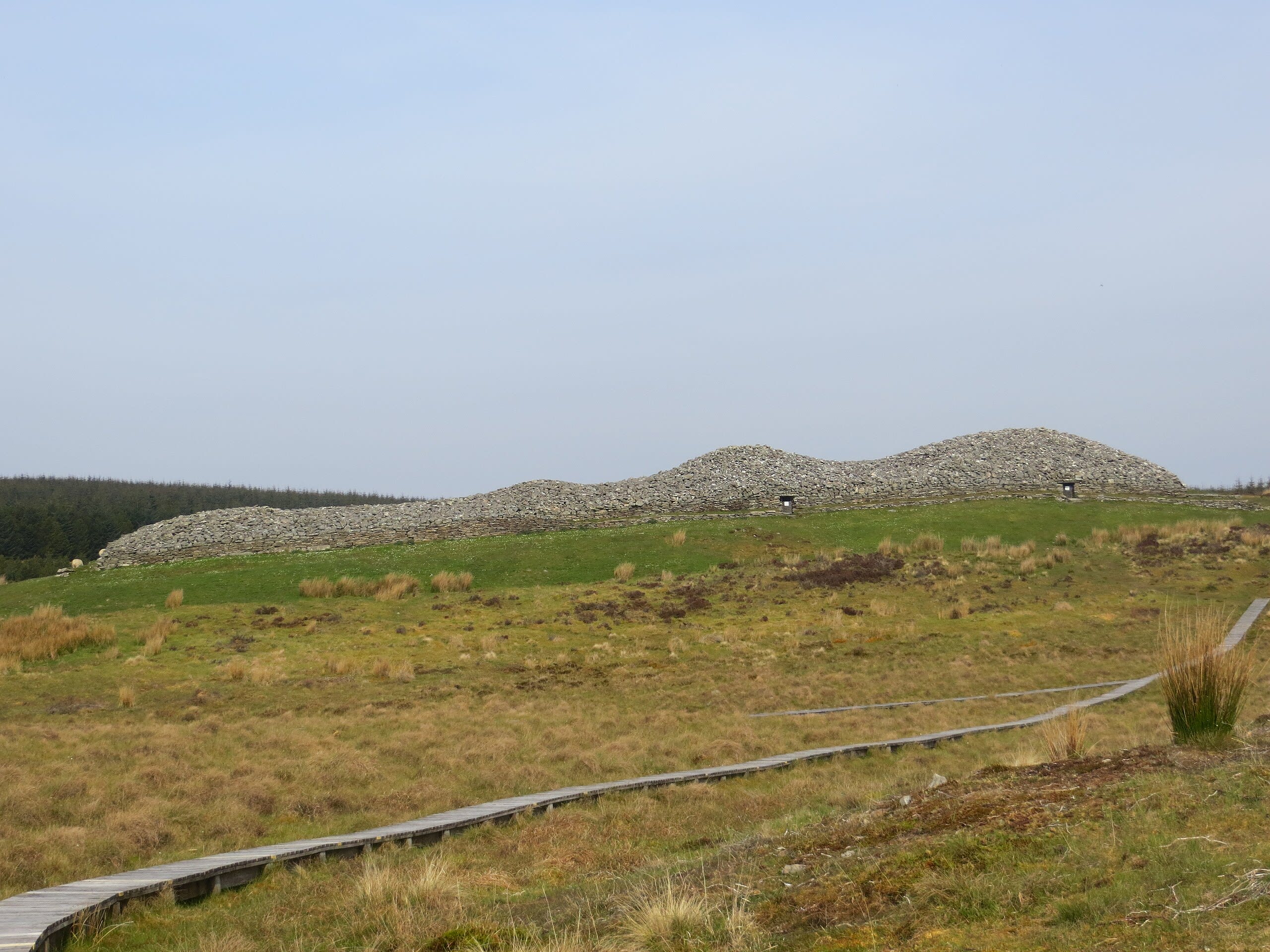
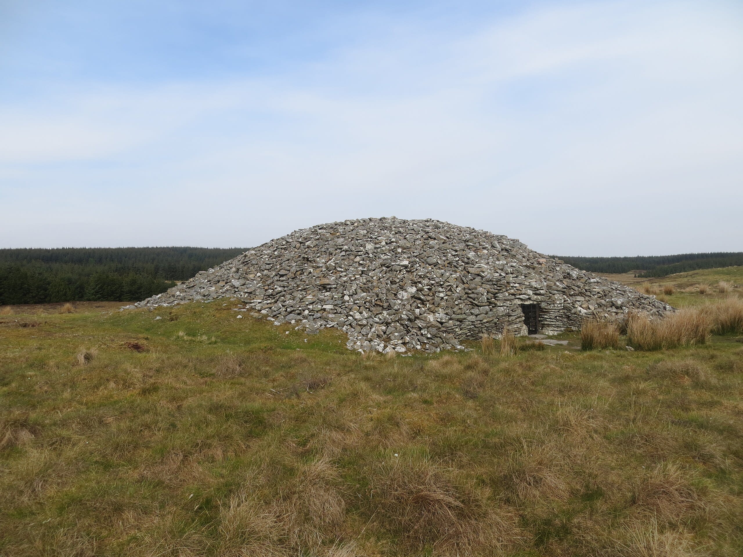
Camster Cairns
Lybster, Alba / Scotland, United Kingdom
Camster Cairns is a cairn of sacred significance. Approximate coordinates: 58.37909, -3.26423. Attributes: built, cultural, archaeological. Located in Alba / Scotland, United Kingdom.
Corrimony Cairn
Drumnadrochit, Alba / Scotland, United Kingdom
Corrimony Cairn is a cairn of sacred significance. Approximate coordinates: 57.33448, -4.68782. Attributes: built, cultural, archaeological. Located in Alba / Scotland, United Kingdom.
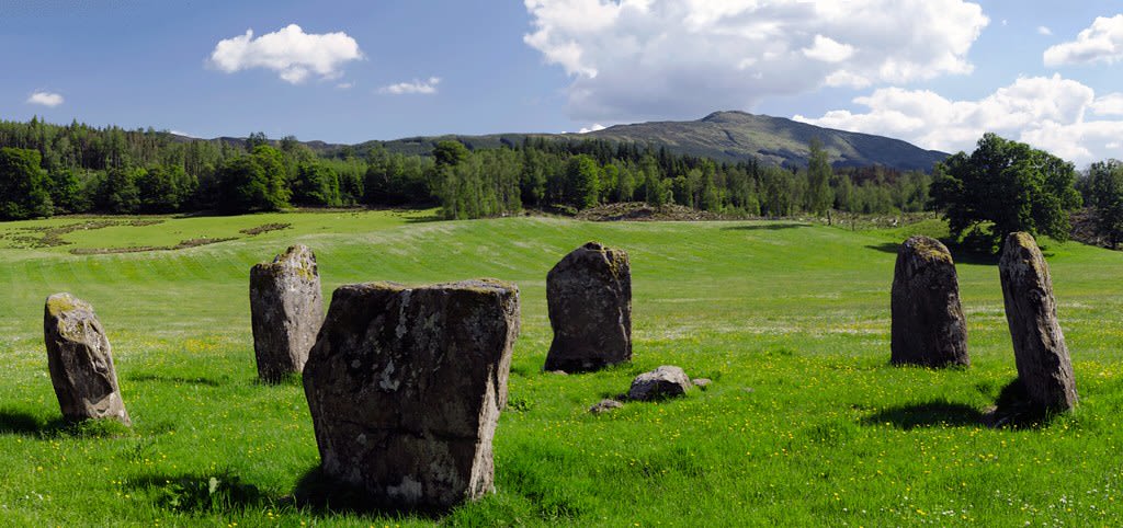
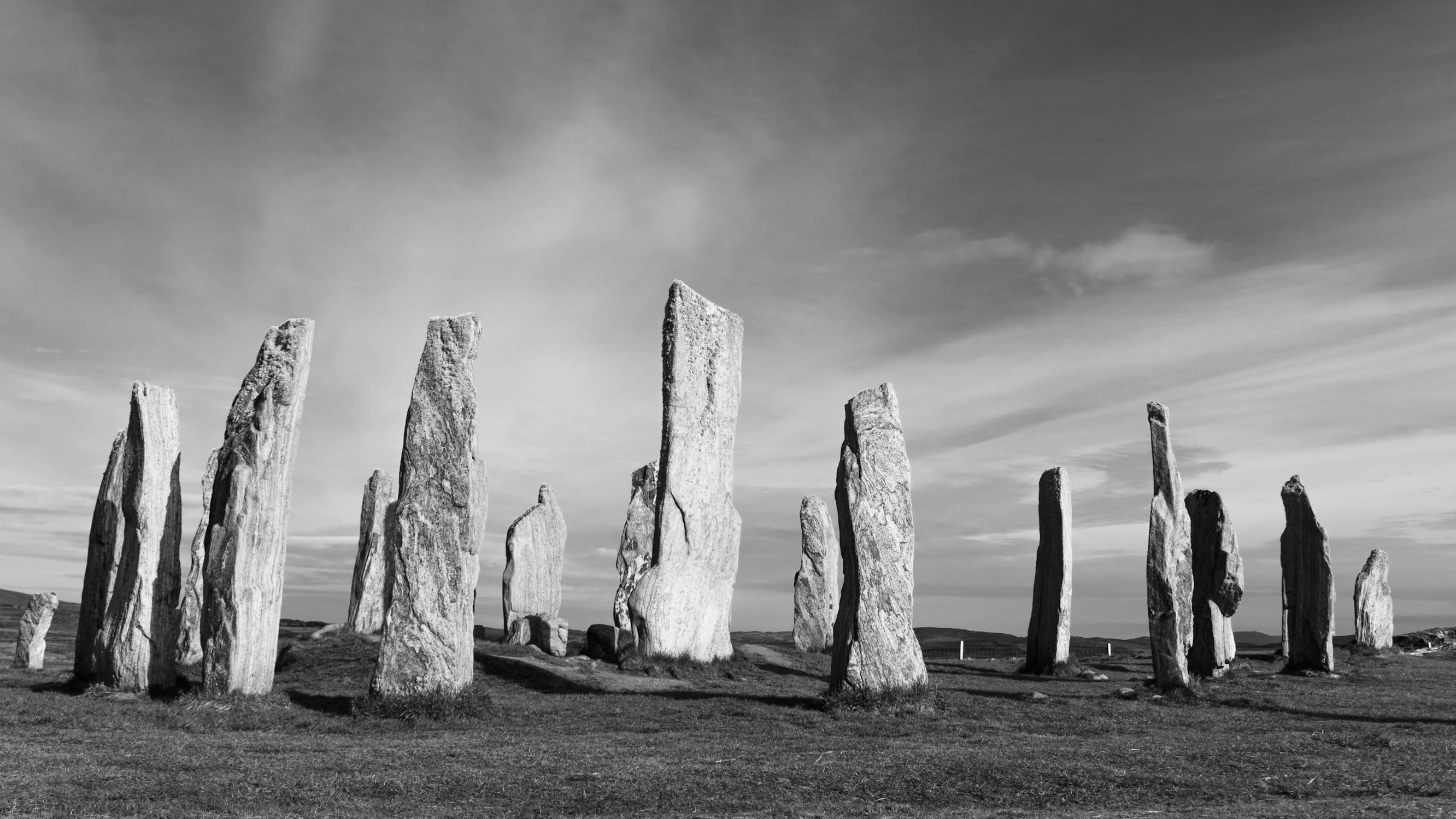
Croft Moraig Stone Circle, Aberfeldy
Aberfeldy, Alba / Scotland, United Kingdom
Croft Moraig Stone Circle, Aberfeldy is a stone circle of sacred significance. Approximate coordinates: 56.60181, -3.96030. Attributes: built, cultural, archaeological. Located in Alba / Scotland, United Kingdom.
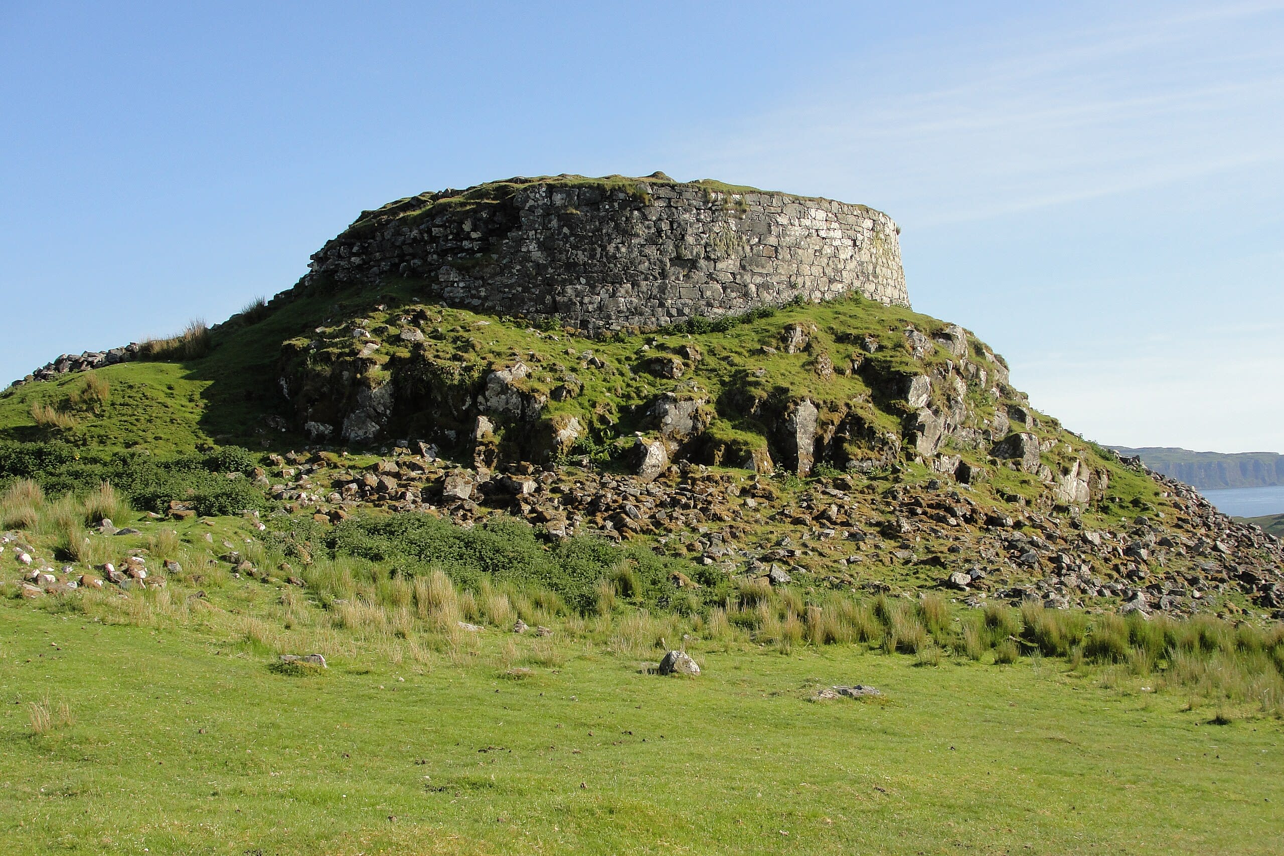
Dun Beag, Struan, Isle of Skye, Scotland
Struan, Alba / Scotland, United Kingdom
Dun Beag, Struan, Isle of Skye, Scotland is a broch of sacred significance. Approximate coordinates: 57.36024, -6.42573. Attributes: built, cultural, archaeological. Located in Alba / Scotland, United Kingdom.
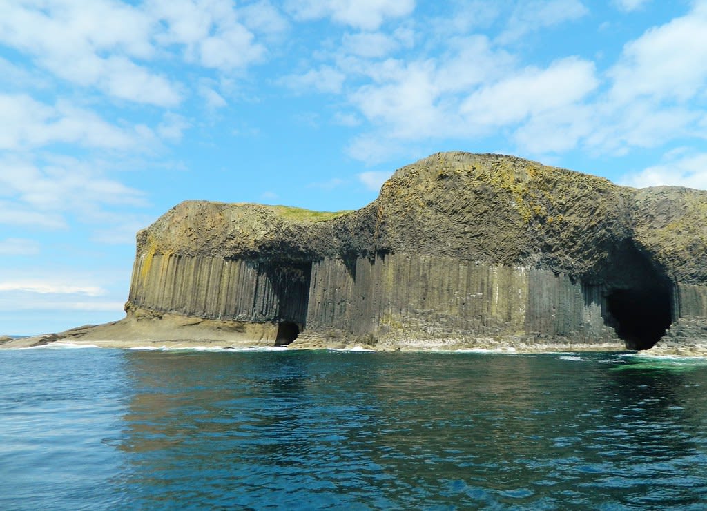
Fingal’s Cave, Island of Staffa, Scotland
Staffa Island, Alba / Scotland, United Kingdom
Fingal’s Cave, Island of Staffa, Scotland is a cave of sacred significance. Approximate coordinates: 56.43137, -6.34139. Attributes: natural, cultural. Located in Alba / Scotland, United Kingdom.
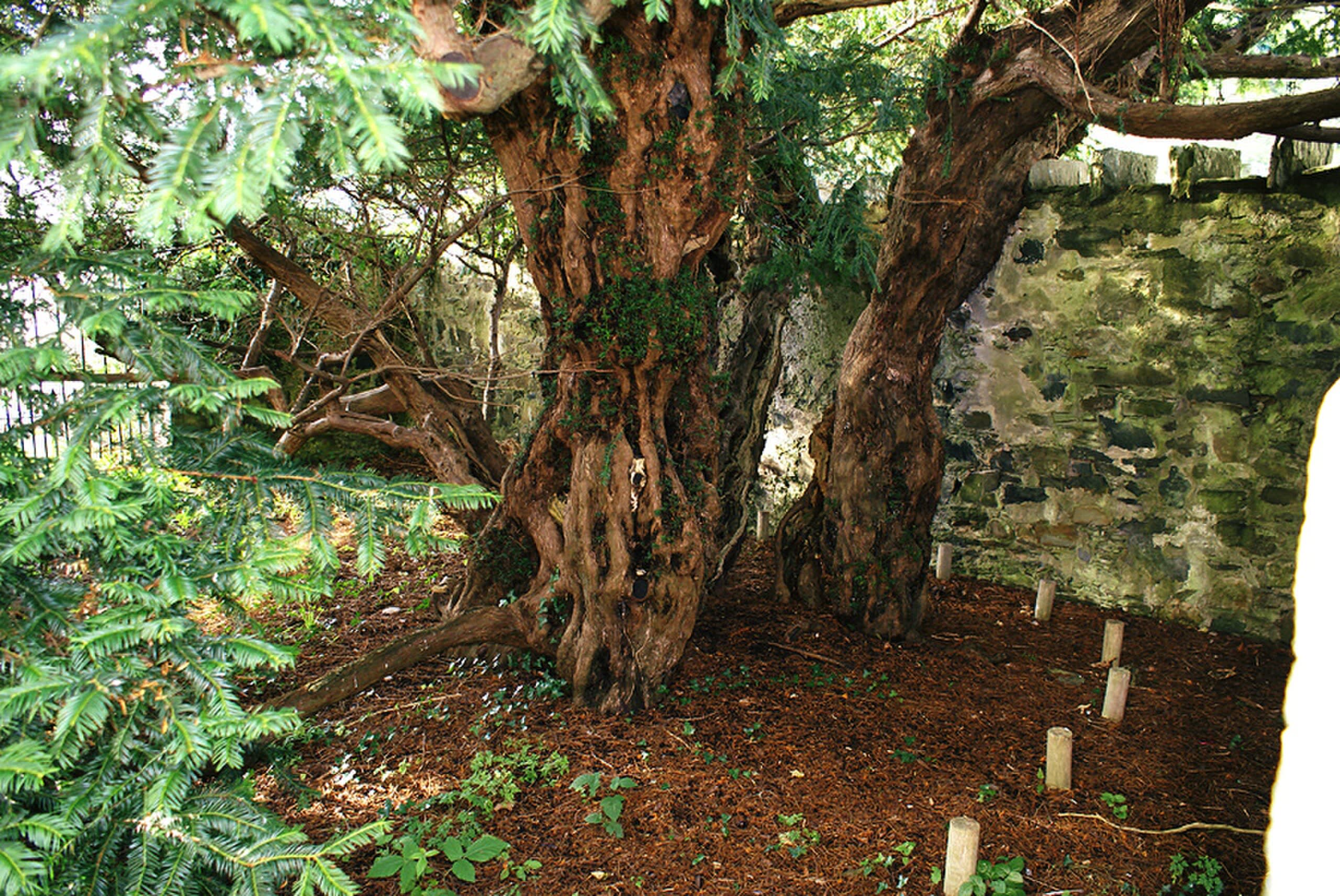
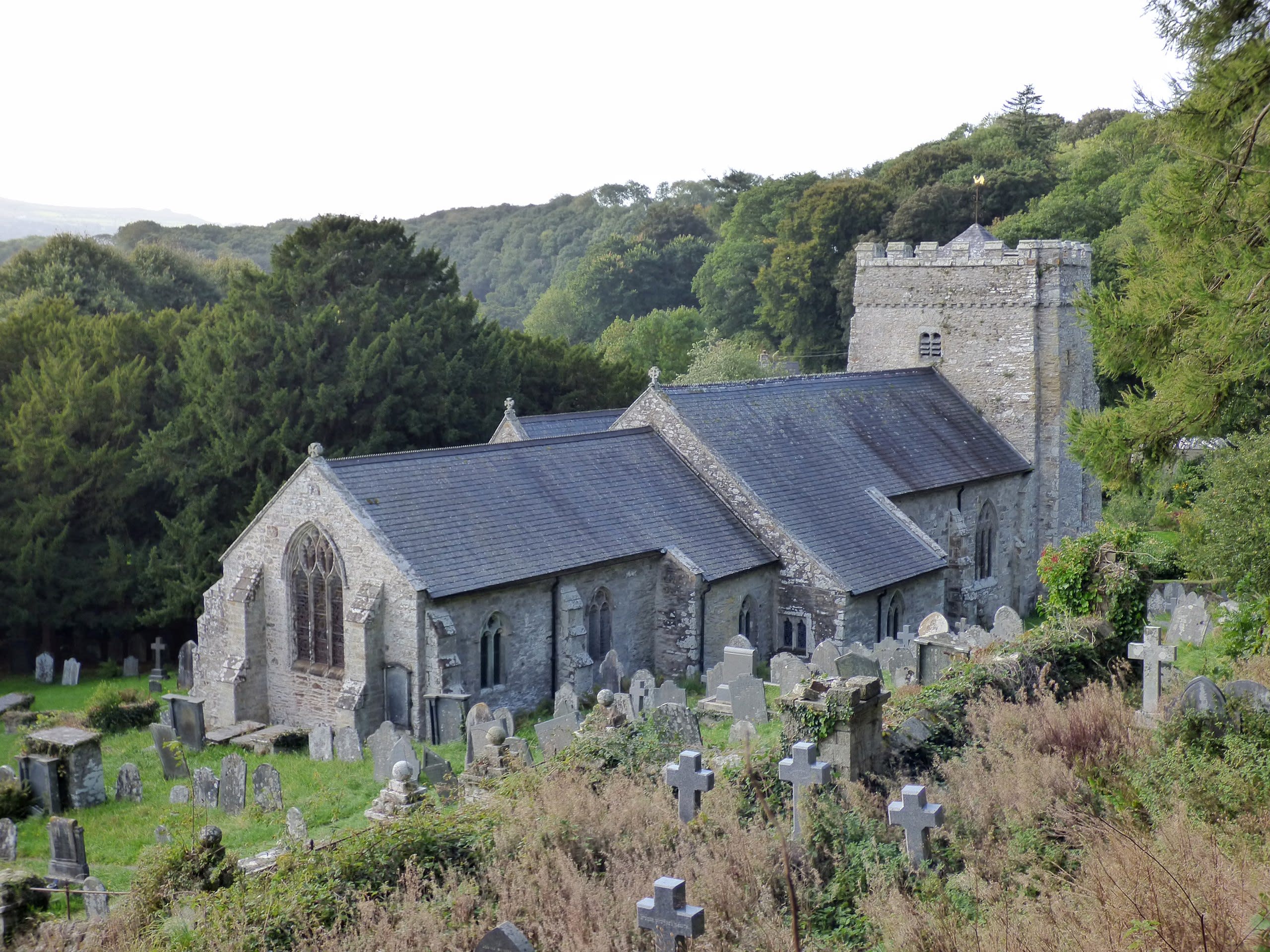
Fortingall Yew Tree and Church, Perthshire, Scotland
Fortingall, Alba / Scotland, United Kingdom
Fortingall Yew Tree and Church, Perthshire, Scotland is a church and tree of sacred significance. Approximate coordinates: 56.59821, -4.05095. Attributes: built, natural, cultural. Located in Alba / Scotland, United Kingdom.
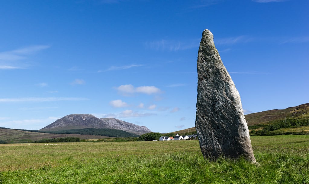
Healabhal Mhor, Isle of Skye, Scotland
Dunvegan, Alba / Scotland, United Kingdom
Healabhal Mhor, Isle of Skye, Scotland is a mountain of sacred significance. Approximate coordinates: 57.40550, -6.63203. Attributes: natural. Located in Alba / Scotland, United Kingdom.
Kinnell stone circle, Killin
Killin, Alba / Scotland, United Kingdom
Kinnell stone circle, Killin is a stone circle of sacred significance. Approximate coordinates: 56.46561, -4.31094. Attributes: built, cultural, archaeological. Located in Alba / Scotland, United Kingdom.
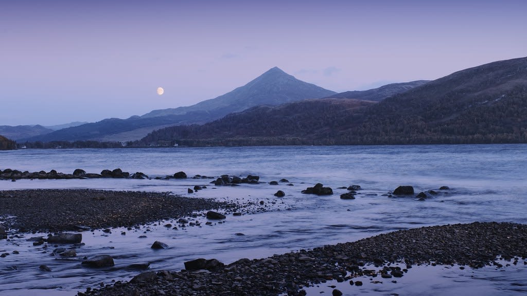
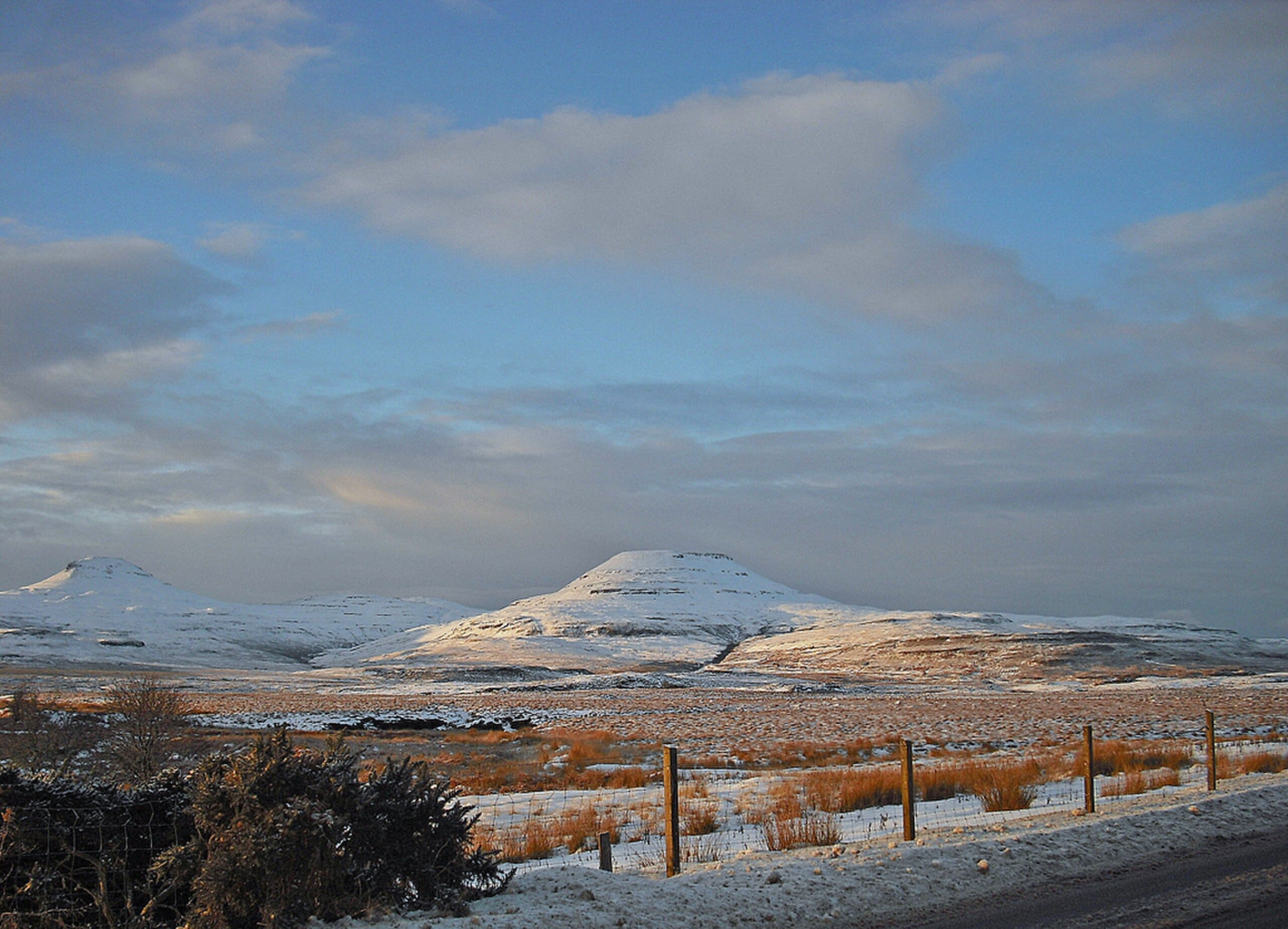
Mount Schiehallion, Scotland
Aberfeldy, Alba / Scotland, United Kingdom
Mount Schiehallion, Scotland is a site of sacred significance. Approximate coordinates: 56.66683, -4.10014. Located in Alba / Scotland, United Kingdom.
Mt. Beinn-na-Greine, Portree, Scotland
Portree, Alba / Scotland, United Kingdom
Mt. Beinn-na-Greine, Portree, Scotland is a site of sacred significance. Approximate coordinates: 57.39383, -6.22969. Located in Alba / Scotland, United Kingdom.
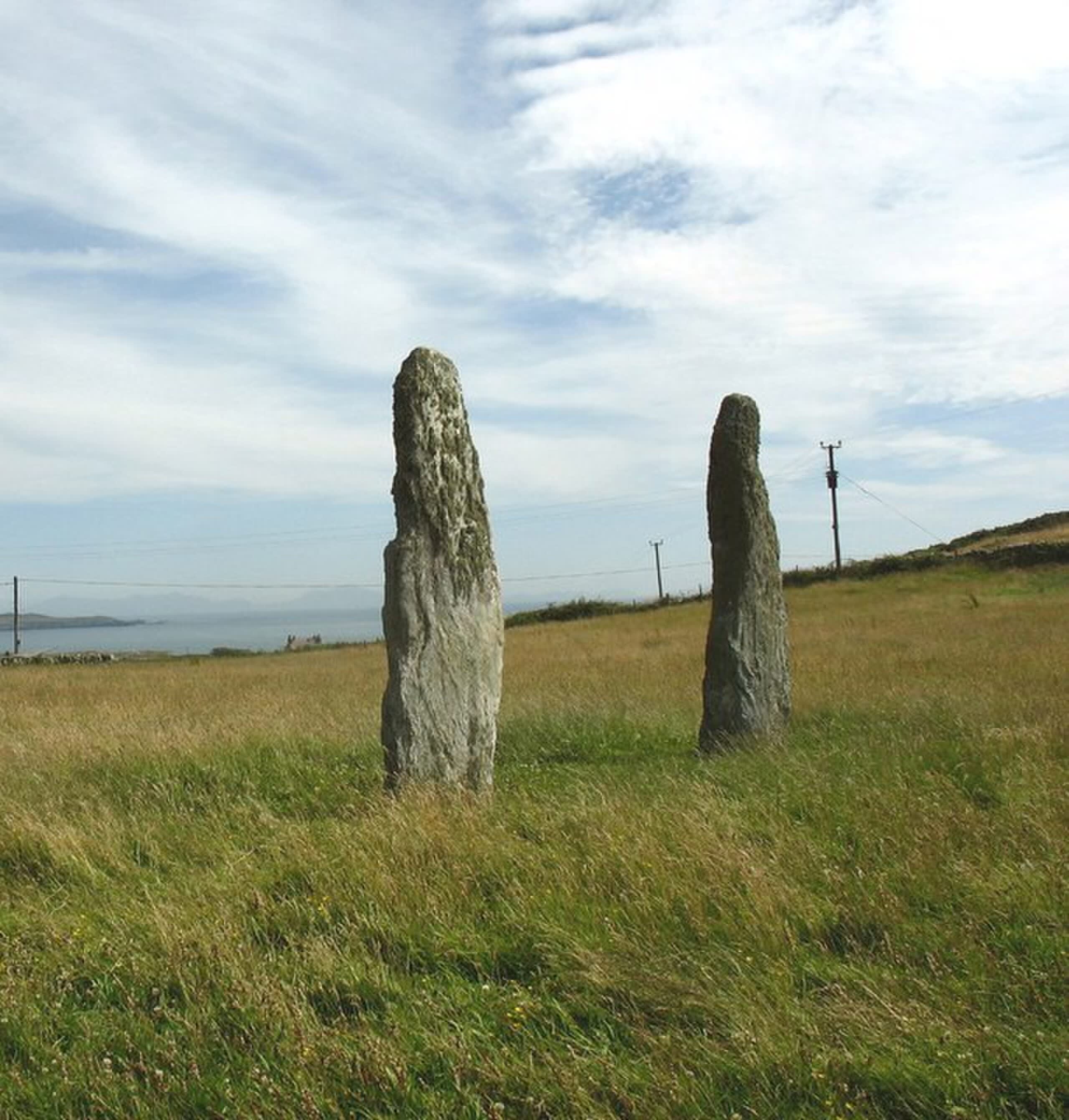
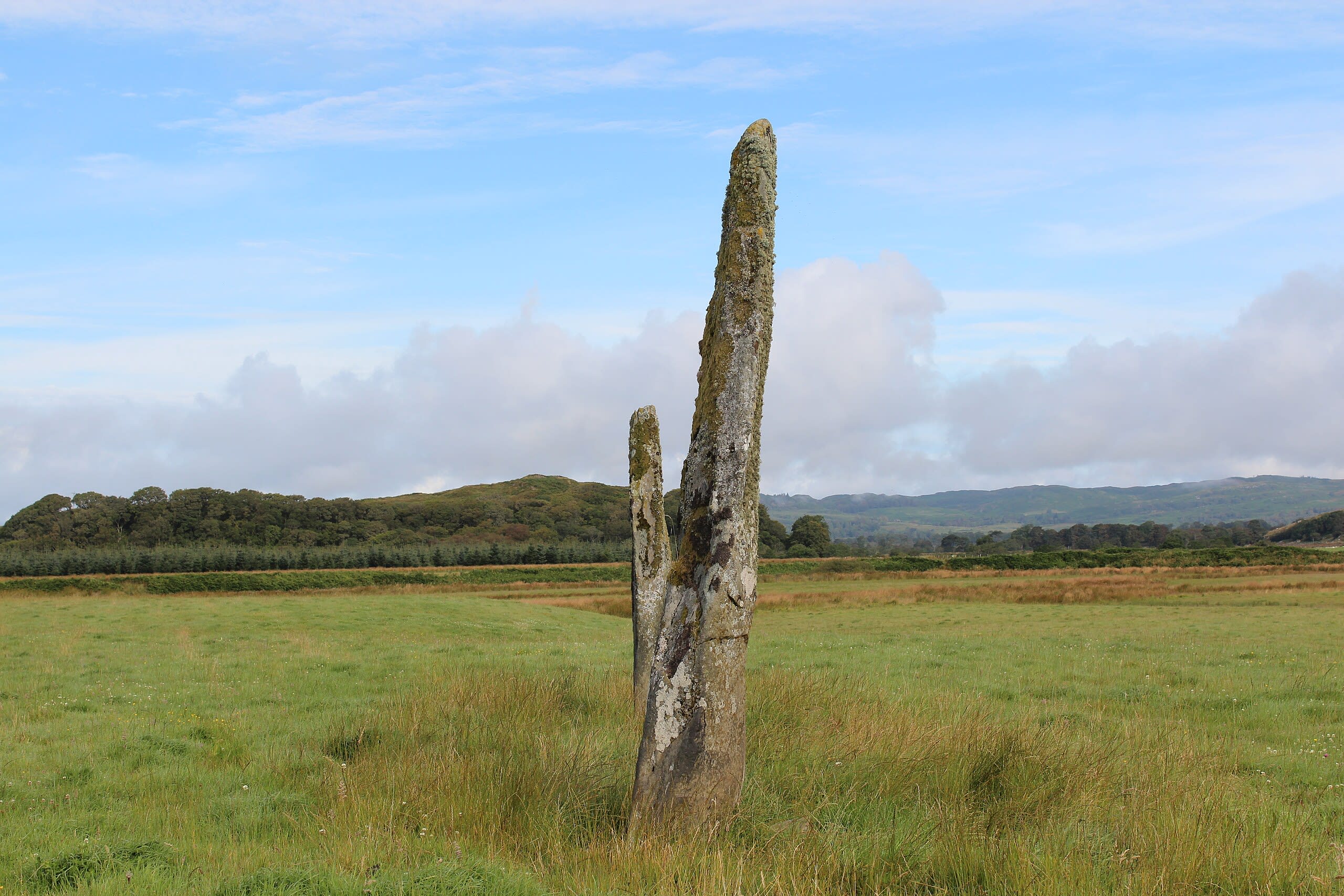
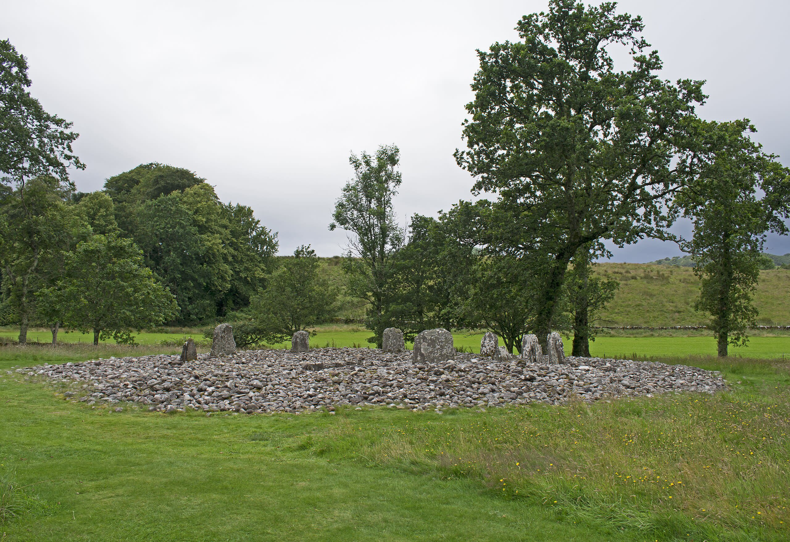
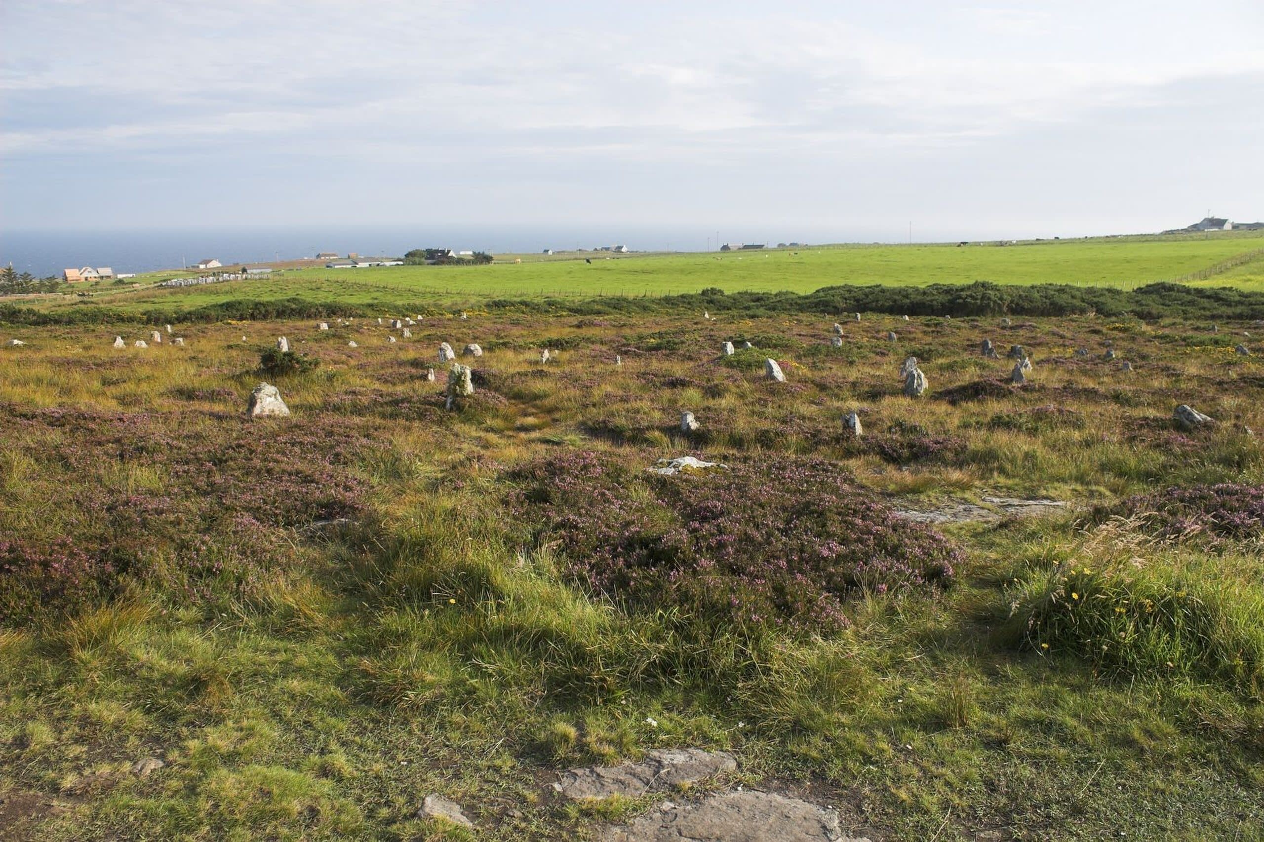
Nether Largie standing stones, Argyll, Scotland
Kilmartin, Alba / Scotland, United Kingdom
Nether Largie standing stones, Argyll, Scotland is a site of sacred significance. Approximate coordinates: 56.12170, -5.49540. Located in Alba / Scotland, United Kingdom.
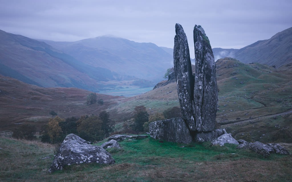
Praying Hands of Mary
Fortingall, Alba / Scotland, United Kingdom
Praying Hands of Mary is a site of sacred significance. Approximate coordinates: 56.60122, -4.07460. Located in Alba / Scotland, United Kingdom.
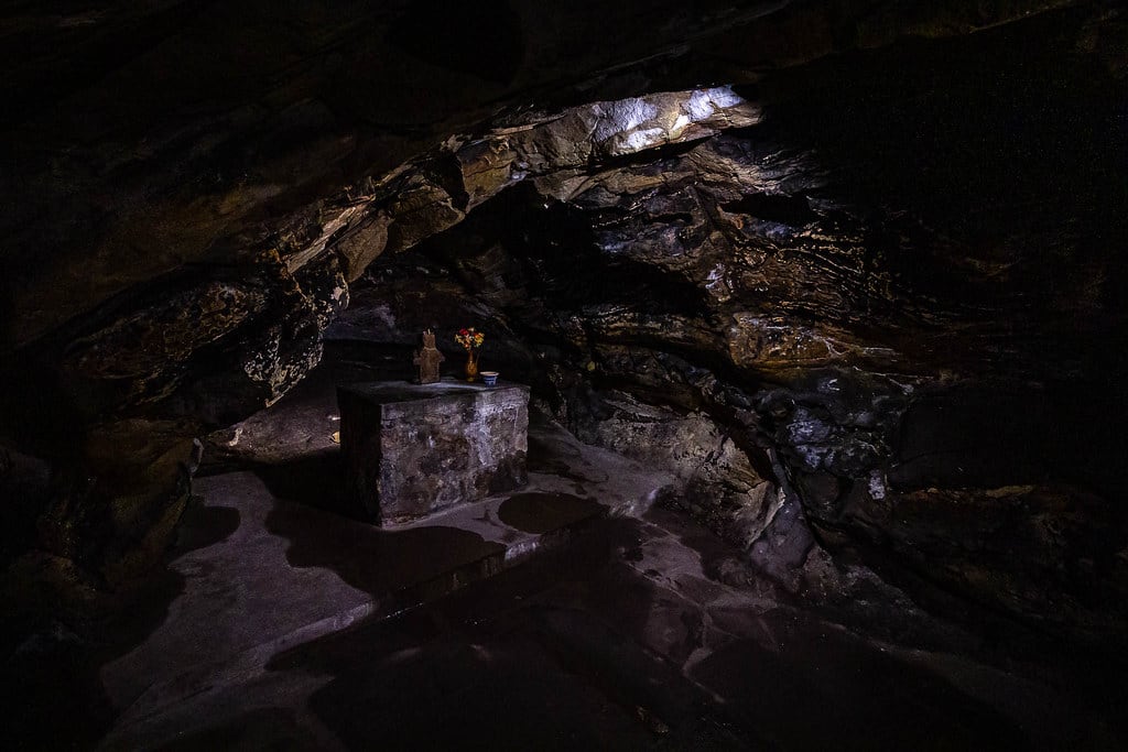
St. Fillan’s Cave, Pittenweem, Scotland
Pittenweem, Alba / Scotland, United Kingdom
St. Fillan’s Cave, Pittenweem, Scotland is a site of sacred significance. Approximate coordinates: 56.21323, -2.72752. Located in Alba / Scotland, United Kingdom.
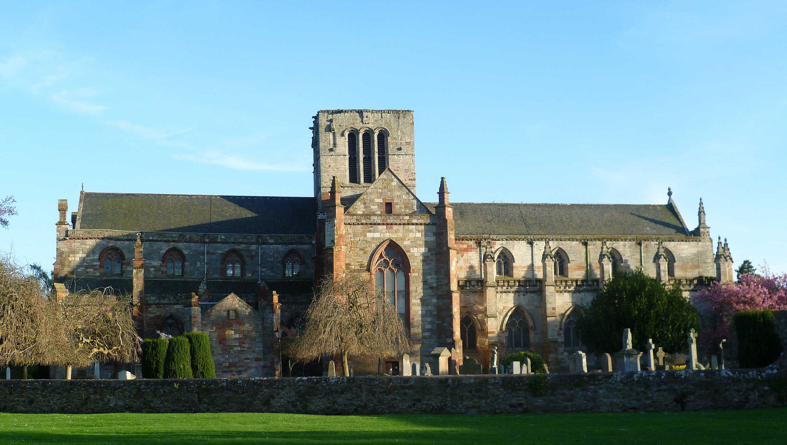
St. Mary’s Church, Haddington, Scotland
Haddington, Alba / Scotland, United Kingdom
St. Mary’s Church, Haddington, Scotland is a site of sacred significance. Approximate coordinates: 55.95315, -2.77241. Located in Alba / Scotland, United Kingdom.
Anglesey
3 sites
Meini Hirion standing stones
Holyhead, Anglesey, United Kingdom
Meini Hirion standing stones is a site of sacred significance. Approximate coordinates: 53.39659, -4.46204. Located in Cymru / Wales, United Kingdom.
Penrhos Feiliw standing stones
Holyhead, Anglesey, United Kingdom
Penrhos Feiliw standing stones is a site of sacred significance. Approximate coordinates: 53.29570, -4.66178. Located in Cymru / Wales, United Kingdom.
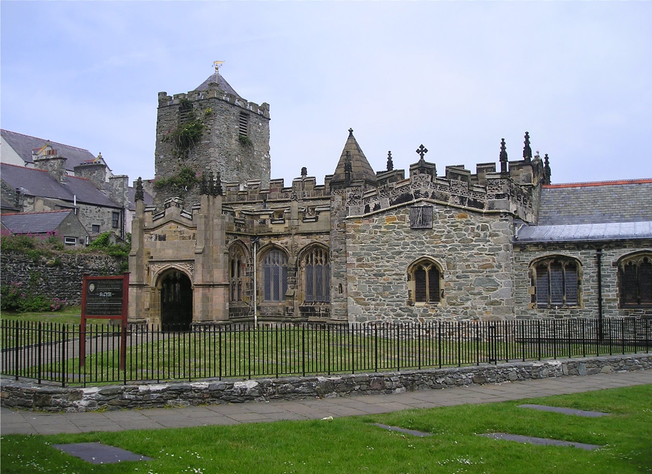
St. Cybi’s Church
Holyhead, Anglesey, United Kingdom
St. Cybi’s Church is a site of sacred significance. Approximate coordinates: 53.31144, -4.63254. Located in Cymru / Wales, United Kingdom.
Argyll and Bute
17 sites
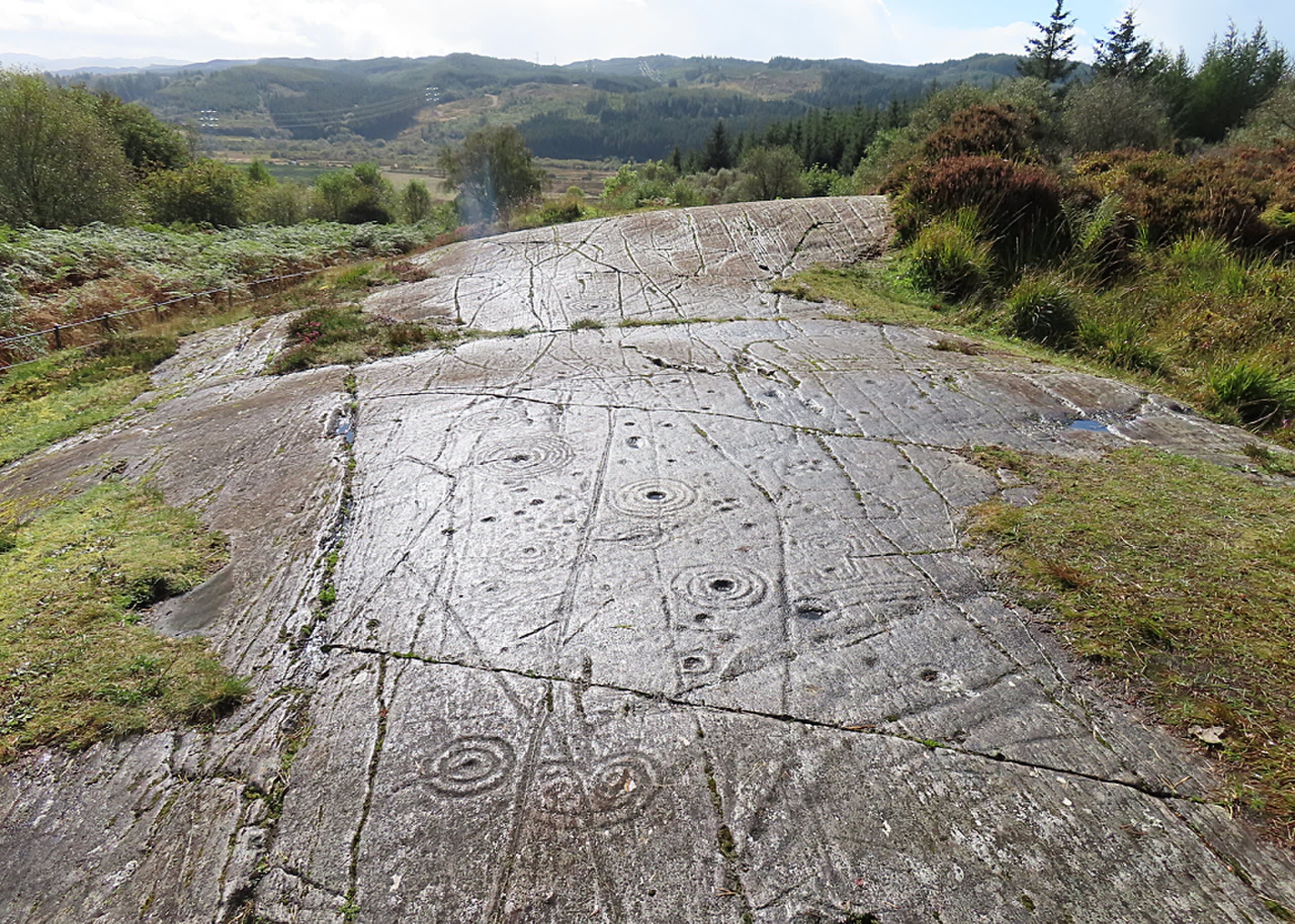
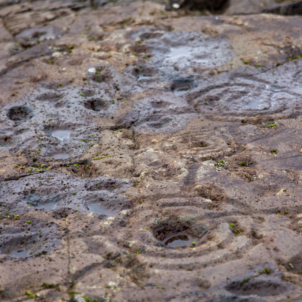
Achnabreck Rock Art Sites
Lochgilphead, Argyll and Bute, United Kingdom
Achnabreck Rock Art Sites in Lochgilphead, Argyll and Bute, United Kingdom.
Ballygowan Rock Art
Kilmartin, Argyll and Bute, United Kingdom
Ballygowan Rock Art in Kilmartin, Argyll and Bute, United Kingdom.
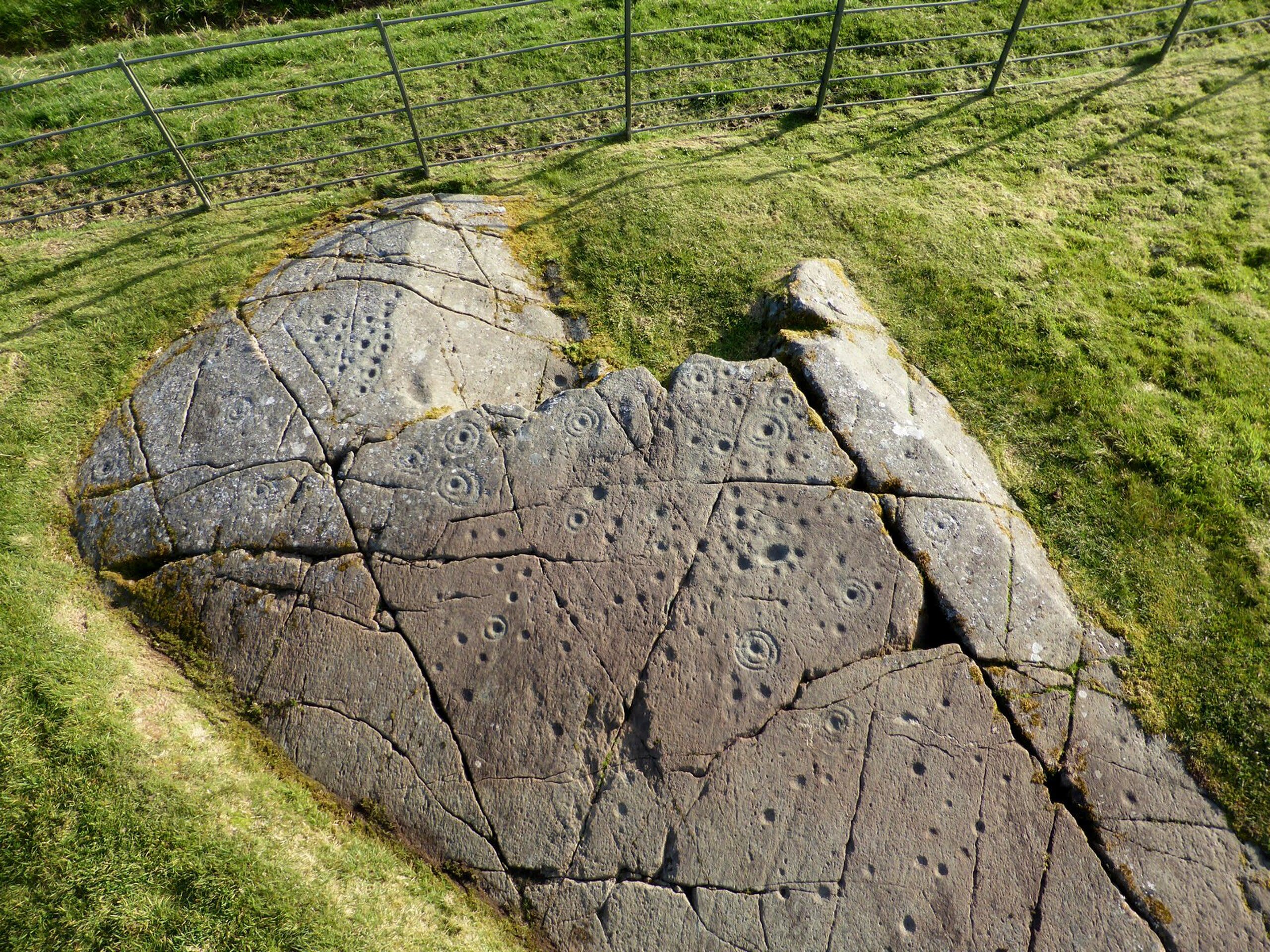
Baluachraig Cup and Ring Marks
Kilmartin, Argyll and Bute, United Kingdom
Baluachraig Cup and Ring Marks in Kilmartin, Argyll and Bute, United Kingdom.
Dunamuck North Stone Row
Kilmartin, Argyll and Bute, United Kingdom
Dunamuck North Stone Row in Kilmartin, Argyll and Bute, United Kingdom.
Dunamuck South Stone Row
Kilmichael Glassary, Argyll and Bute, United Kingdom
Dunamuck South Stone Row in Kilmichael Glassary, Argyll and Bute, United Kingdom.
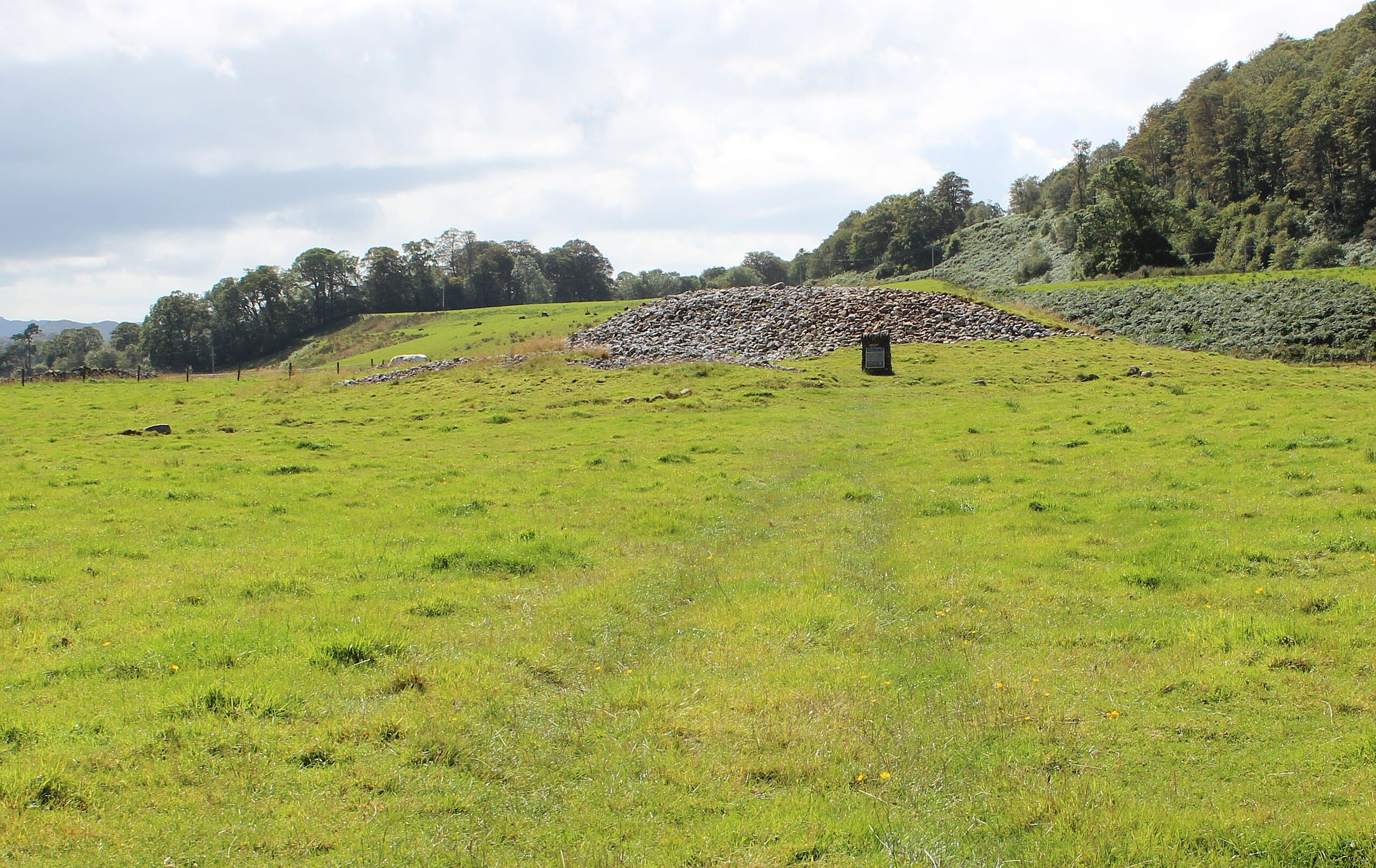
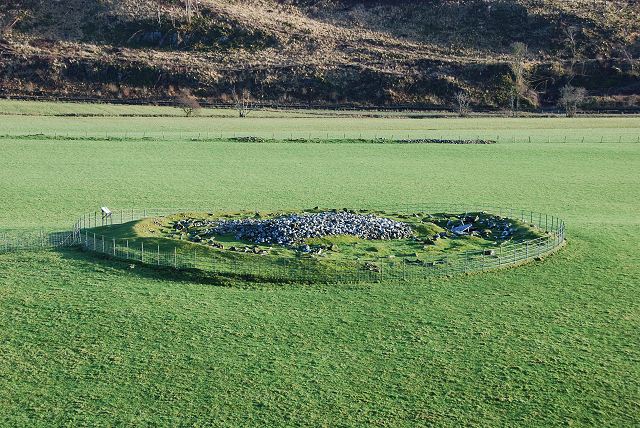
Dunchraigaig Cairn
Kilmartin, Argyll and Bute, United Kingdom
Dunchraigaig Cairn in Kilmartin, Argyll and Bute, United Kingdom.
Glebe Cairn
Kilmartin, Argyll and Bute, United Kingdom
Glebe Cairn in Kilmartin, Argyll and Bute, United Kingdom.
Hill of the Angels
Iona, Argyll and Bute, United Kingdom
Hill of the Angels in Iona, Argyll and Bute, United Kingdom.
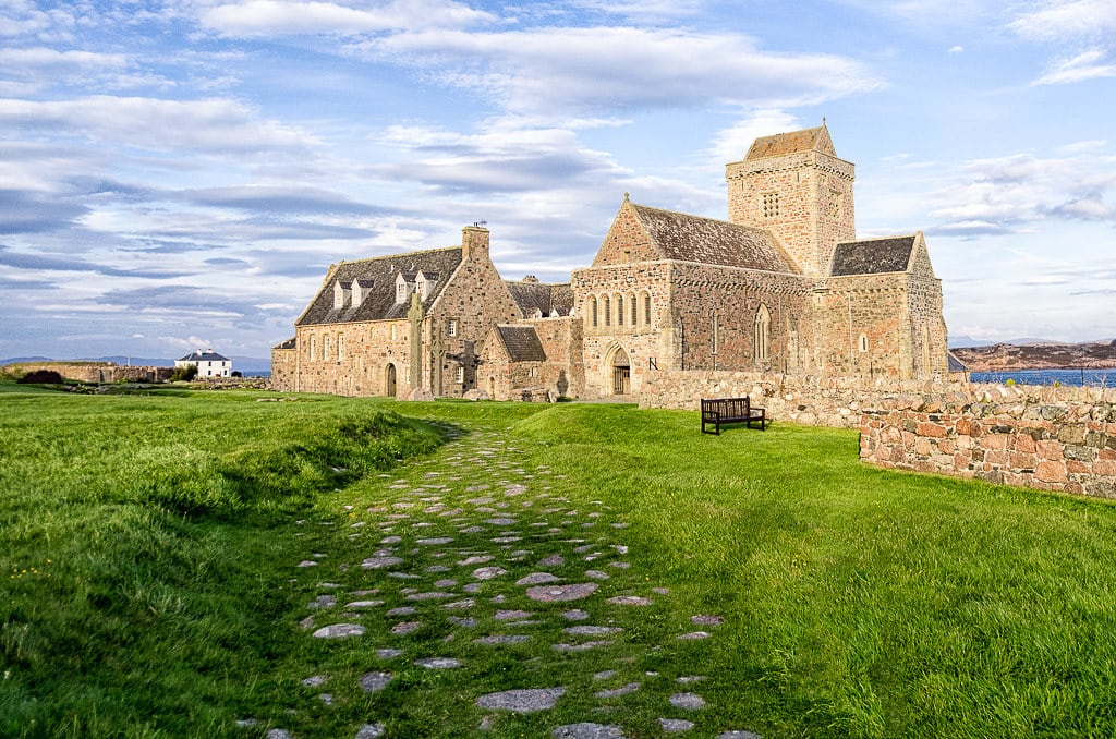
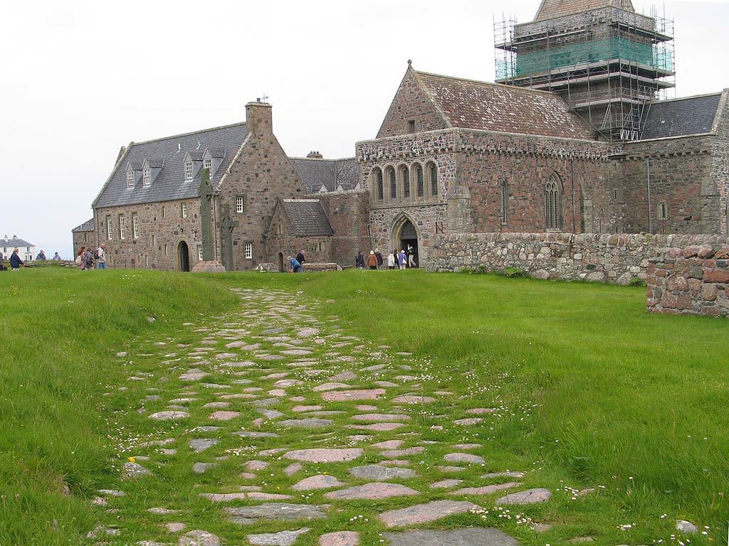
Iona Abbey
Isle of Iona, Argyll and Bute, United Kingdom
Iona Abbey in Isle of Iona, Argyll and Bute, United Kingdom.
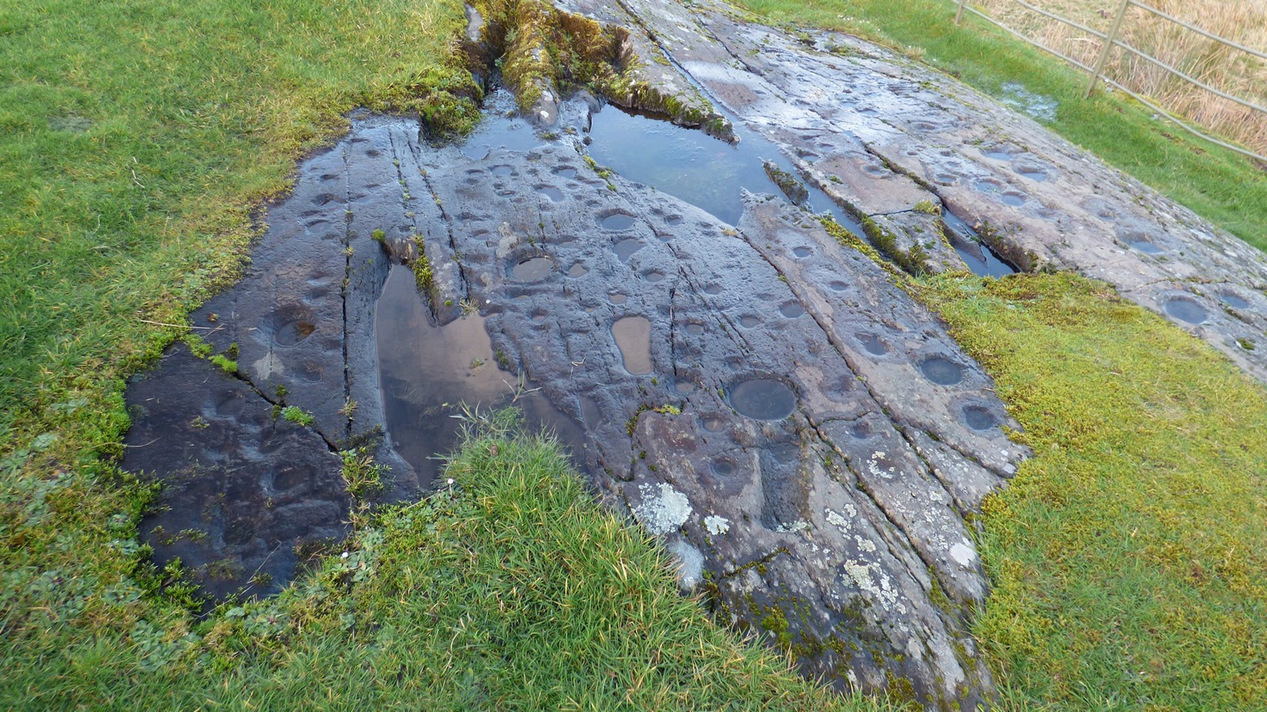
Kilmichael Glassary Cup and Ring Marks
Lochgilphead, Argyll and Bute, United Kingdom
Kilmichael Glassary Cup and Ring Marks in Lochgilphead, Argyll and Bute, United Kingdom.
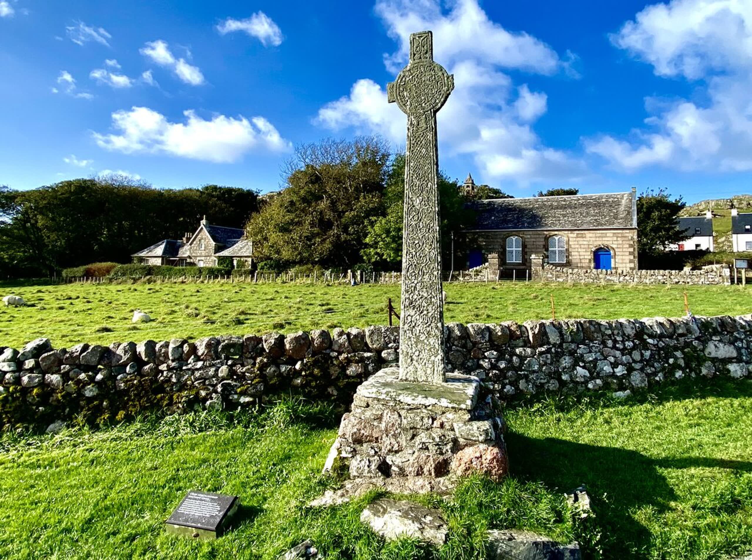
MacLean's Cross
Iona, Argyll and Bute, United Kingdom
MacLean's Cross in Iona, Argyll and Bute, United Kingdom.
Nether Largie Mid Cairn
Kilmartin, Argyll and Bute, United Kingdom
Nether Largie Mid Cairn in Kilmartin, Argyll and Bute, United Kingdom.
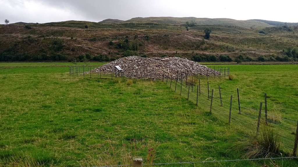
Nether Largie North Cairn
Kilmartin, Argyll and Bute, United Kingdom
Nether Largie North Cairn in Kilmartin, Argyll and Bute, United Kingdom.
Nether Largie South Cairn
Kilmartin, Argyll and Bute, United Kingdom
Nether Largie South Cairn in Kilmartin, Argyll and Bute, United Kingdom.
Ri Cruin Cairn
Kilmartin, Argyll and Bute, United Kingdom
Ri Cruin Cairn in Kilmartin, Argyll and Bute, United Kingdom.
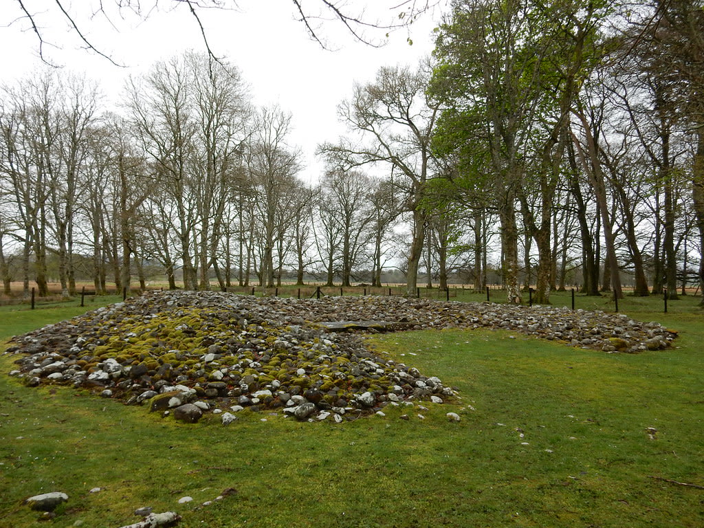
Temple Wood Stone Circle
Kilmartin, Argyll and Bute, United Kingdom
Temple Wood Stone Circle in Kilmartin, Argyll and Bute, United Kingdom.
The Street of the Dead
Iona, Argyll and Bute, United Kingdom
The Street of the Dead in Iona, Argyll and Bute, United Kingdom.
Caithness
8 sites
Bruan Broch
Lybster, Caithness, United Kingdom
Bruan Broch in Lybster, Caithness, United Kingdom.
Camster Cairns - The Long Cairn
Lybster, Caithness, United Kingdom
Camster Cairns - The Long Cairn in Lybster, Caithness, United Kingdom.
Camster Cairns - The Round Cairn
Lybster, Caithness, United Kingdom
Camster Cairns - The Round Cairn in Lybster, Caithness, United Kingdom.
Dunbeath Broch
Dunbeath, Caithness, United Kingdom
Dunbeath Broch in Dunbeath, Caithness, United Kingdom.
Hill o' Many Stanes
Lybster, Caithness, United Kingdom
Hill o' Many Stanes in Lybster, Caithness, United Kingdom.
Ousdale Broch
Helmsdale, Caithness, United Kingdom
Ousdale Broch in Helmsdale, Caithness, United Kingdom.
Upper Borgue Broch
Dunbeath, Caithness, United Kingdom
Upper Borgue Broch in Dunbeath, Caithness, United Kingdom.
Yarrows Broch
Thrumster, Caithness, United Kingdom
Yarrows Broch in Thrumster, Caithness, United Kingdom.
Ceredigion
1 sites
Cornwall
6 sites
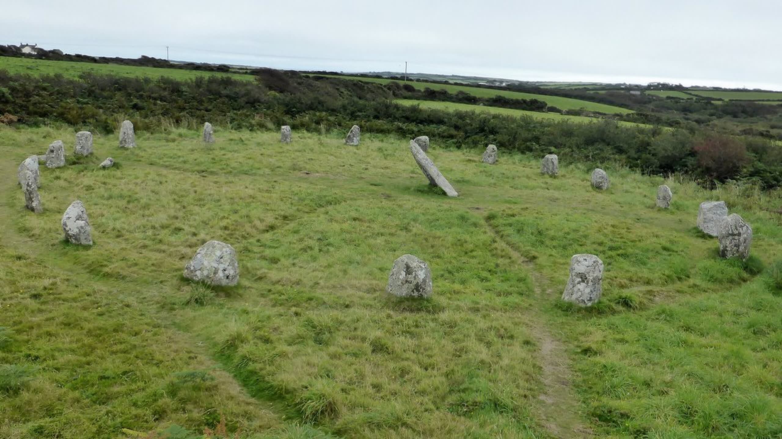
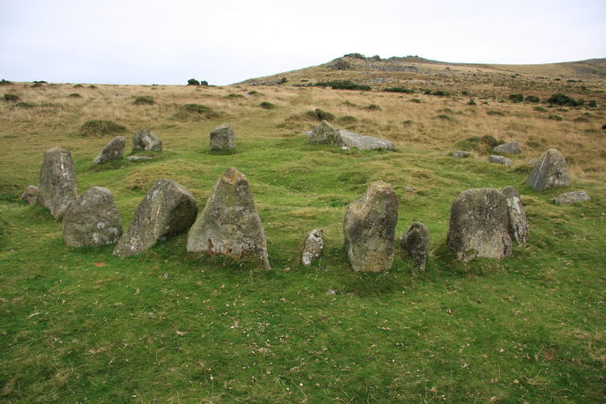
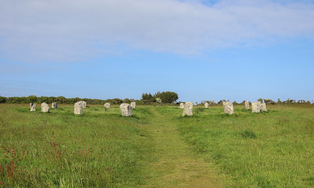
Boscawen-un Stone Circle
St Buryan, Cornwall, United Kingdom
Boscawen-un Stone Circle is a stone circle of sacred significance. Approximate coordinates: 50.08983, -5.61929. Attributes: built, cultural, archaeological, ceremonial. Located in England, United Kingdom.
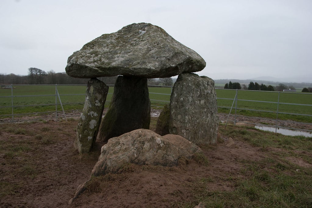
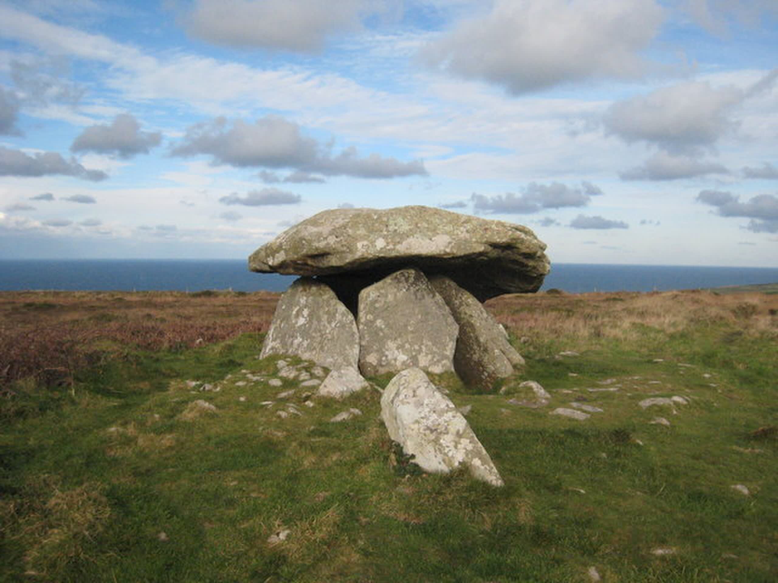
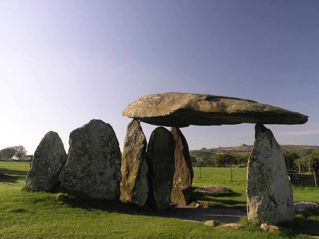
Carwynnen Quoit
Camborne, Cornwall, United Kingdom
Carwynnen Quoit is a dolmen of sacred significance. Approximate coordinates: 50.18825, -5.29340. Attributes: built, cultural, archaeological. Carwynnen Quoit (grid reference SW650372) is a dolmen belonging to the Neolithic period, at Carwynnen near Camborne in west Cornwall. It is also known as The Giant s Quoit , The Giant s Frying Pan , Pendarvis Quoit and Pendarves Quoit . It collapsed in 1966 and was re-erected in 2014. Located in England, United Kingdom.
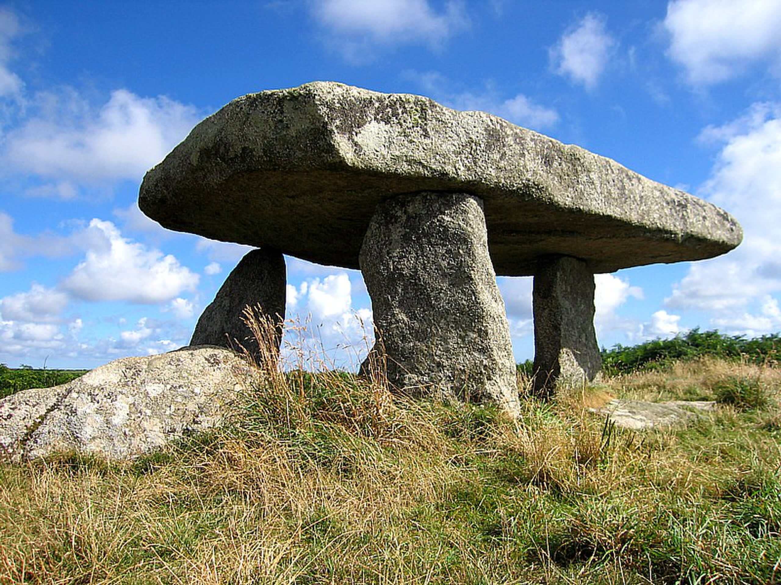
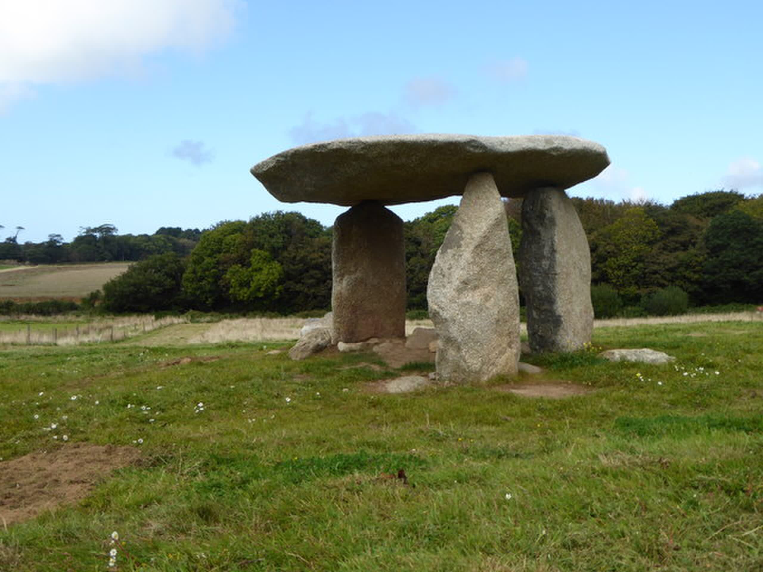
Lanyon Quoit
Madron, Cornwall, United Kingdom
Lanyon Quoit is a dolmen of sacred significance. Approximate coordinates: 50.14738, -5.59910. Attributes: built, cultural, archaeological. Lanyon Quoit is a dolmen in Cornwall, England, United Kingdom, 2 miles southeast of Morvah. It collapsed in a storm in 1815 and was re-erected nine years later, and as a result the dolmen is now very different from its original appearance. Located in England, United Kingdom.
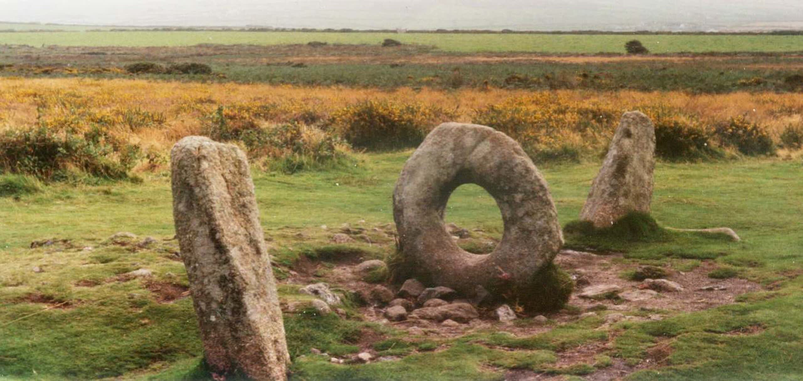
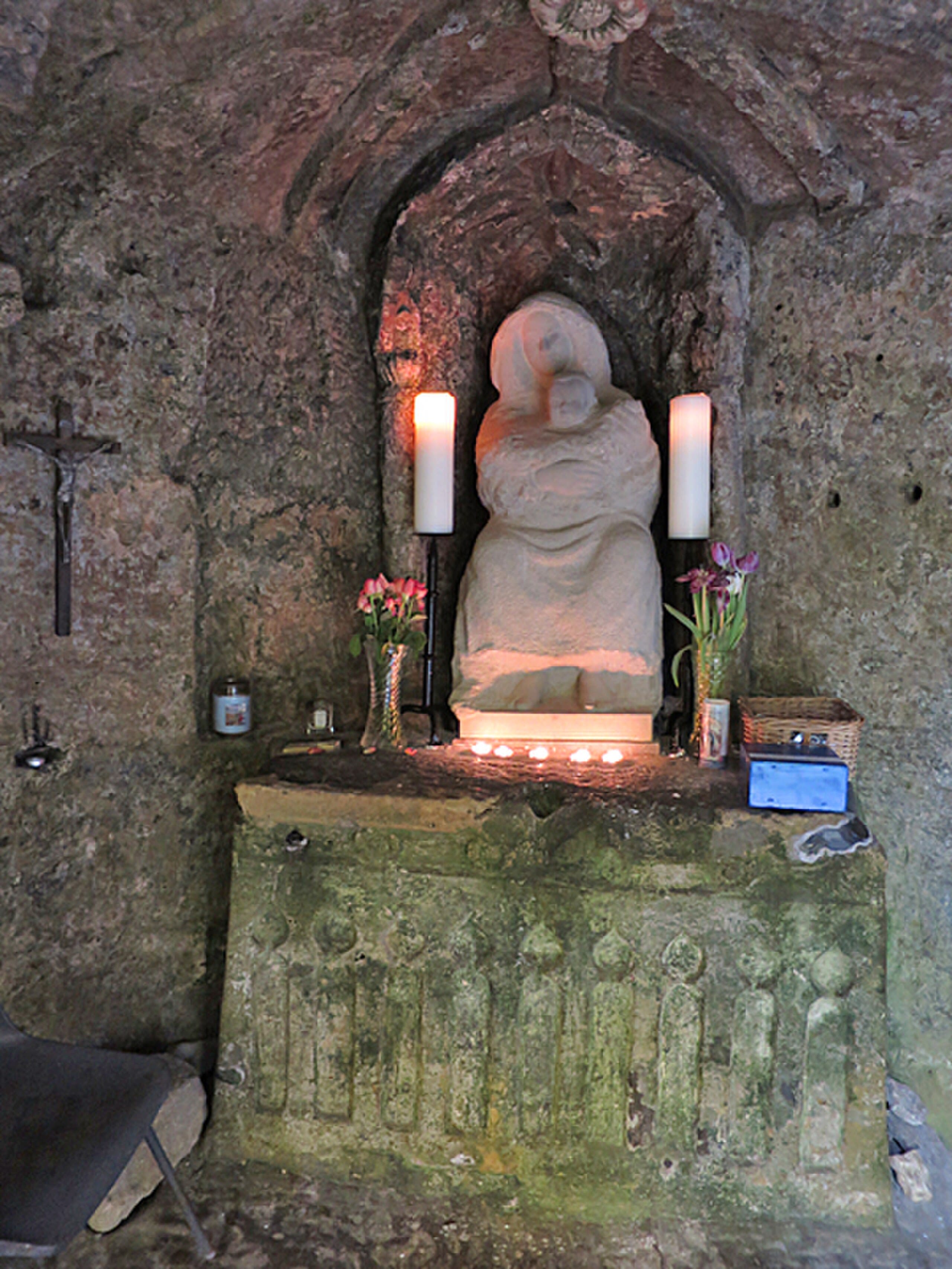
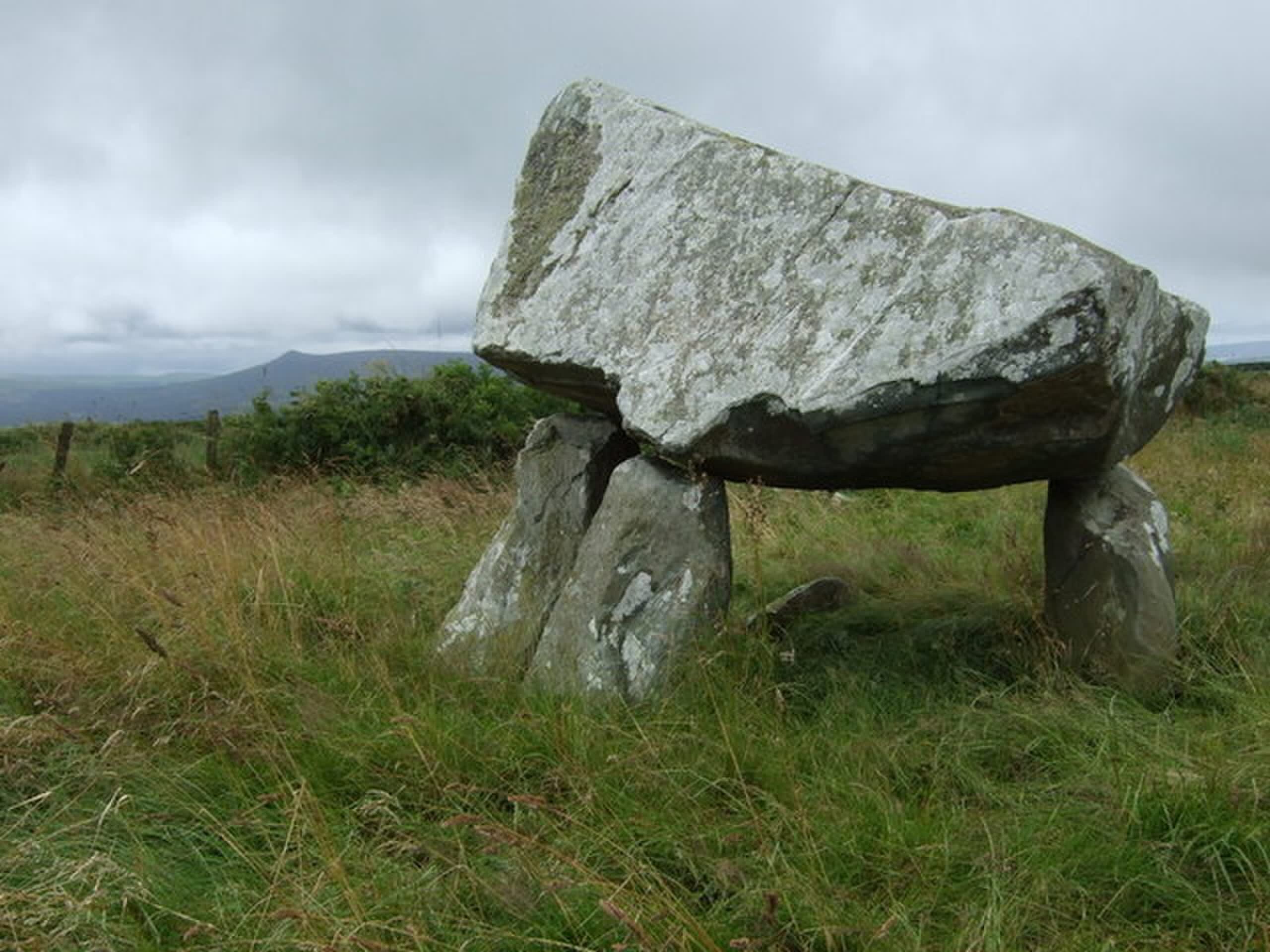
Mên-an-Tol
Morvah, Cornwall, United Kingdom
On the West Penwith moor, three stones stand against the sky—but it is the middle stone that draws seekers from around the world. Men-an-Tol, the Stone of the Hole, features a precisely carved circular opening large enough for an adult to pass through. For as long as anyone can remember, people have crawled through this granite portal seeking healing: children with rickets, adults with back pain, women hoping to conceive. The practice continues today. Whatever purpose Bronze Age people had in creating this unique stone, its invitation remains: pass through, and something changes.
Nine Maidens stone ring, Cornwall
St. Columb Major, Cornwall, United Kingdom
Nine Maidens stone ring, Cornwall is a site of sacred significance. Approximate coordinates: 50.16056, -5.59374. Located in England, United Kingdom.
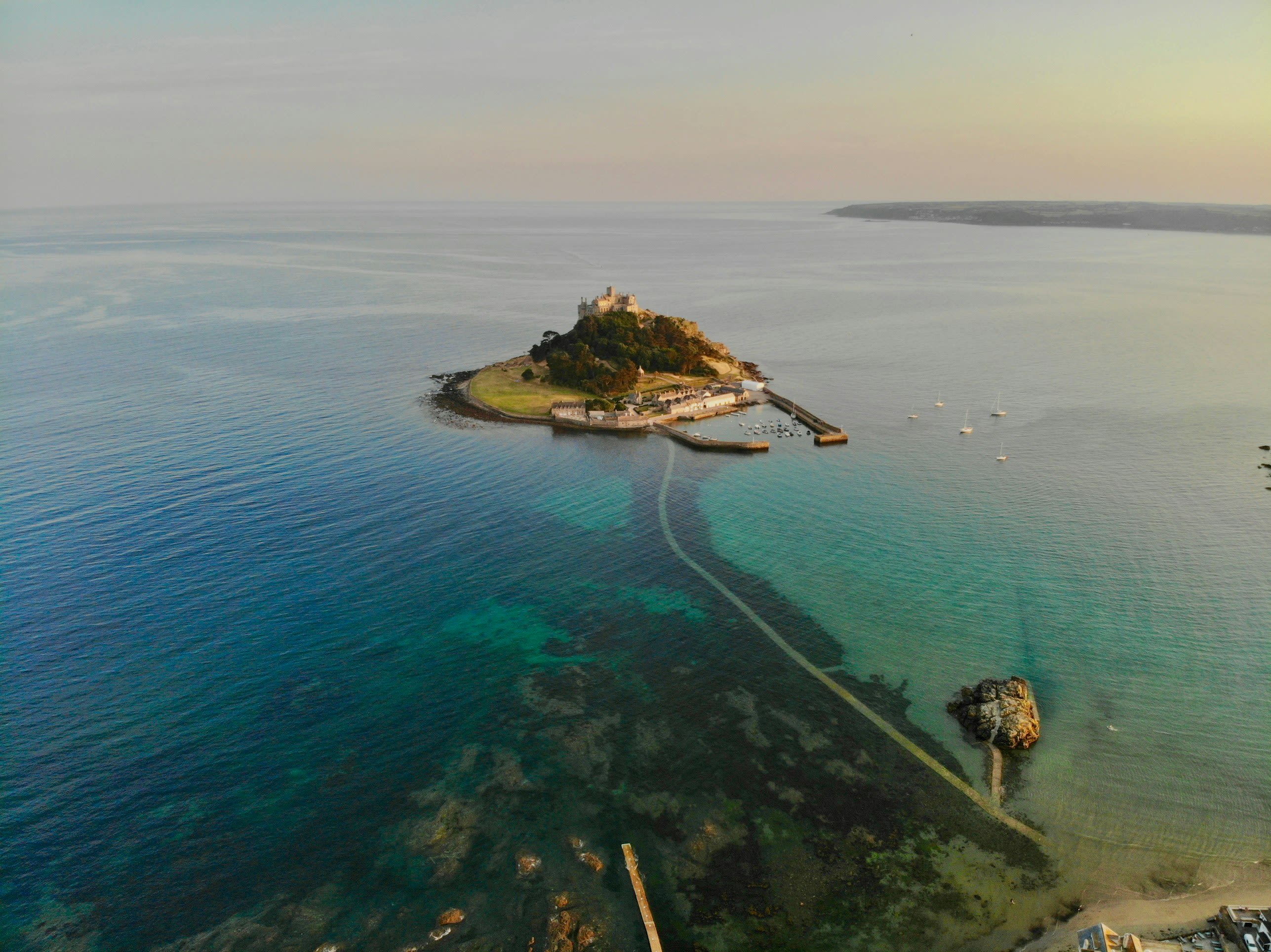
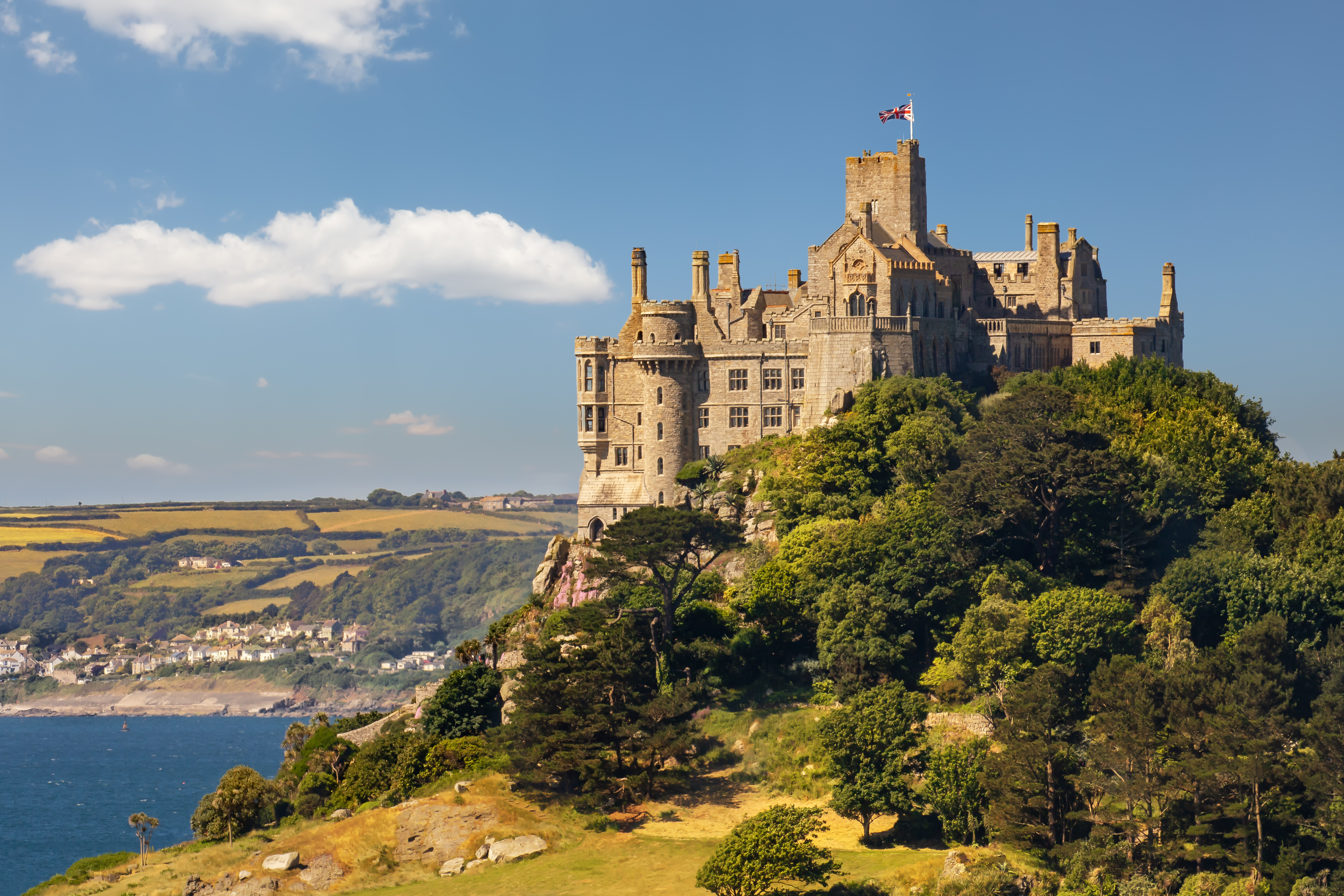
St. Michael's Mount
Marazion, Cornwall, United Kingdom
St. Michael's Mount is a site of sacred significance. Approximate coordinates: 50.11733, -5.47759. Located in England, United Kingdom.
Cumbria
1 sites
Cymru / Wales
3 sites
Bodowyr Dolmen
Llangaffo, Cymru / Wales, United Kingdom
Bodowyr Dolmen is a dolmen of sacred significance. Approximate coordinates: 53.18827, -4.30301. Attributes: built, cultural, archaeological. Located in Cymru / Wales, United Kingdom.
Cadair Idris
Dolgellau, Cymru / Wales, United Kingdom
Cadair Idris is a mountain of sacred significance. Approximate coordinates: 52.69938, -3.90805. Attributes: natural, cultural. Cadair Idris or Cader Idris is a mountain in the Meirionnydd area of Gwynedd, Wales. It lies at the southern end of the Snowdonia National Park near the town of Dolgellau. The peak, which is one of the most popular in Wales for walkers and hikers, is composed largely of Ordovician igneous rocks, with classic glacial erosion features such as cwms, moraines, striated rocks, and roches moutonnées. Located in Cymru / Wales, United Kingdom.
Carn Ingli
Newport, Cymru / Wales, United Kingdom
Carn Ingli is a mountain of sacred significance. Approximate coordinates: 51.99930, -4.82397. Attributes: natural. Carn Ingli (Welsh: [karn ˈɪŋli]) is a Site of Special Scientific Interest (SSSI) in the Preseli Hills, Pembrokeshire, Wales. It was designated a SSSI in January 1954 in an attempt to protect its fragile biological elements. The site has an area of 428.4 hectares (1,059 acres) and is managed by Natural Resources Wales. Located in Cymru / Wales, United Kingdom.
Devon
1 sites
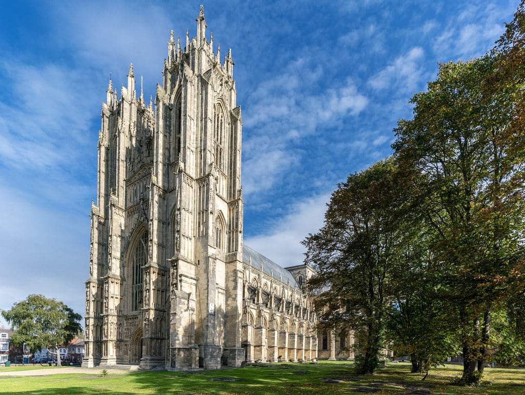
East Riding of Yorkshire
1 sites
England
68 sites

Abbots Way between Buckfast Abbey and Tavistock Abbey, Dartmoor, England
Teignbridge, England, United Kingdom
Abbots Way between Buckfast Abbey and Tavistock Abbey, Dartmoor, England is a pathway of sacred significance. Approximate coordinates: 50.49270, -3.77565. Attributes: natural, cultural, pilgrimage. Tradition: Christianity.
Adam and Eve Stones, Avebury
Beckhampton, England, United Kingdom
Adam and Eve Stones, Avebury is a megalithic monument of sacred significance. Approximate coordinates: 51.42282, -1.87328. Attributes: built, cultural, archaeological.
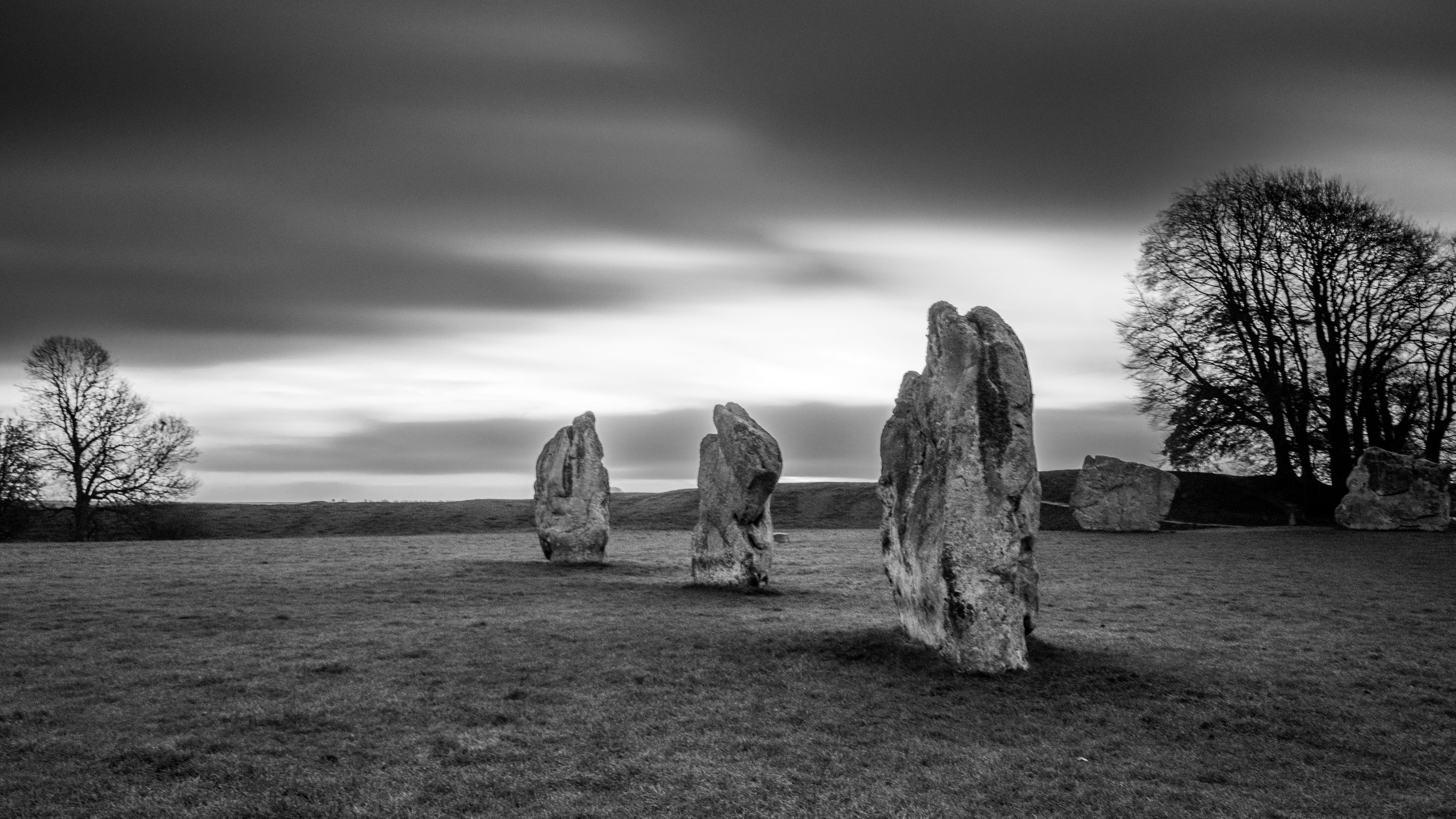
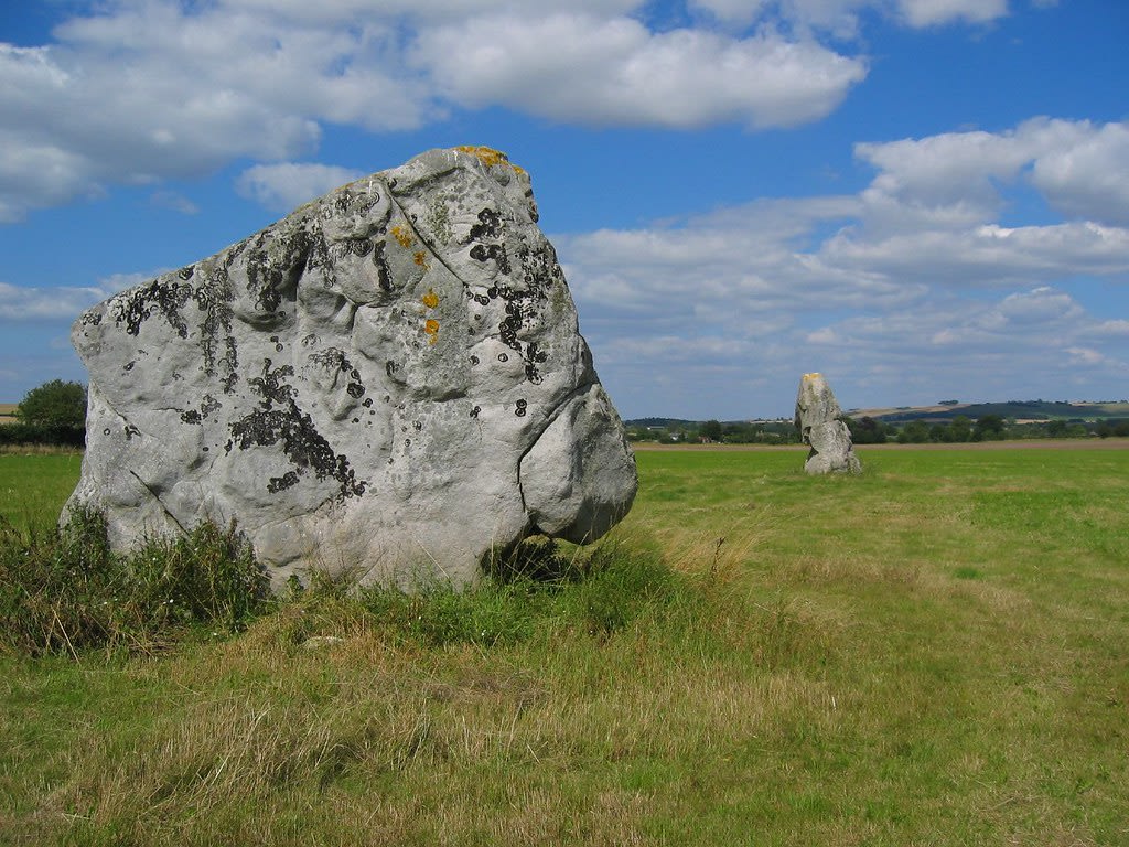
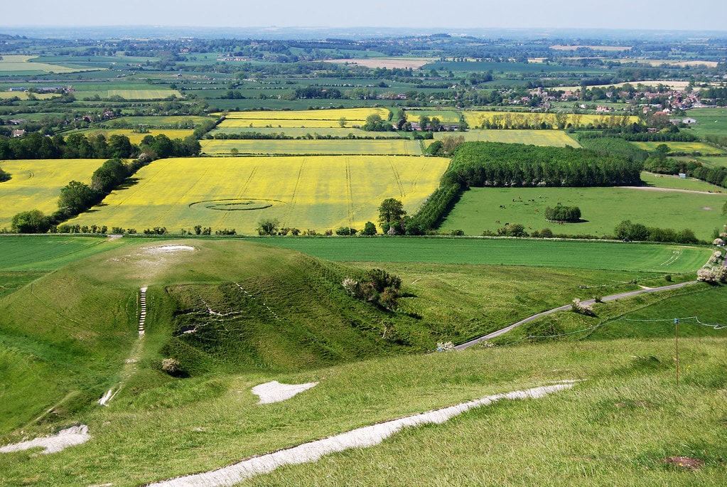
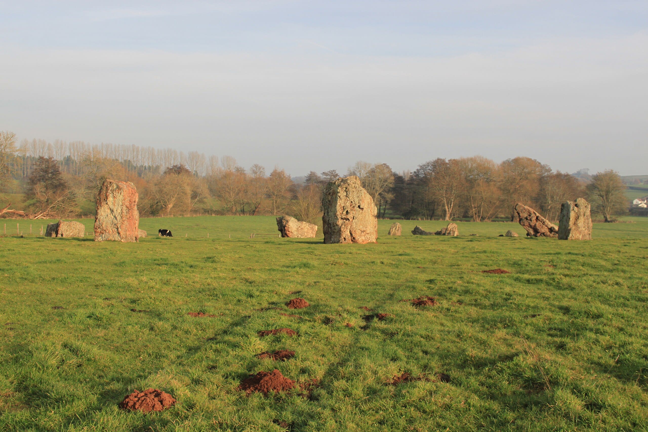
Avebury
Avebury, England, United Kingdom
Avebury is a stone circle of sacred significance. Approximate coordinates: 51.42890, -1.85487. Attributes: built, cultural, archaeological, ceremonial. Tradition: Pagan. Recognized as a UNESCO World Heritage Site. Avebury () is a Neolithic henge monument containing three stone circles, around the village of Avebury in Wiltshire, in south-west England. One of the best-known prehistoric sites in Britain, it contains the largest megalithic stone circle in the world. It is both a tourist attraction and a place of religious importance to contemporary pagans. Constructed over several hundred years in the third millennium BC, during the Neolithic, or New Stone Age, the monument comprises a large henge (a bank and a ditch) with a large outer stone circle and two separate smaller stone circles situated inside the centre of the monument. Its original purpose is unknown, although archaeologists believe that it was most likely used for some form of ritual or ceremony. The Avebury monument is a part of a larger prehistoric landscape containing several older monuments nearby, including West Kennet Long Barrow, Windmill Hill and Silbury Hill. By the Iron Age, the site had been effectively abandoned, with some evidence of human activity on the site during the Roman period. During the Early Middle Ages, a village first began to be built around the monument, eventually extending into it. In the late medieval and early modern periods, local people destroyed many of the standing stones around the henge, both for religious and practical reasons. The antiquarians John Aubrey and William Stukeley took an interest in Avebury during the 17th and 18th centuries, respectively, and recorded much of the site between various phases of destruction. Archaeological investigation followed in the 20th century, with Harold St George Gray leading an excavation of the bank and ditch, and Alexander Keiller overseeing a project to reconstruct much of the monument. Avebury is managed by the National Trust. It has been designated a Scheduled Ancient Monument, as well as a World Heritage Site, in the latter capacity being seen as a part of the wider prehistoric landscape of Wiltshire known as Stonehenge, Avebury and Associated Sites. About 480 people live in 235 homes in the village of Avebury and its associated settlement of Avebury Trusloe, and in the nearby hamlets of Beckhampton and West Kennett. Located in England, United Kingdom.
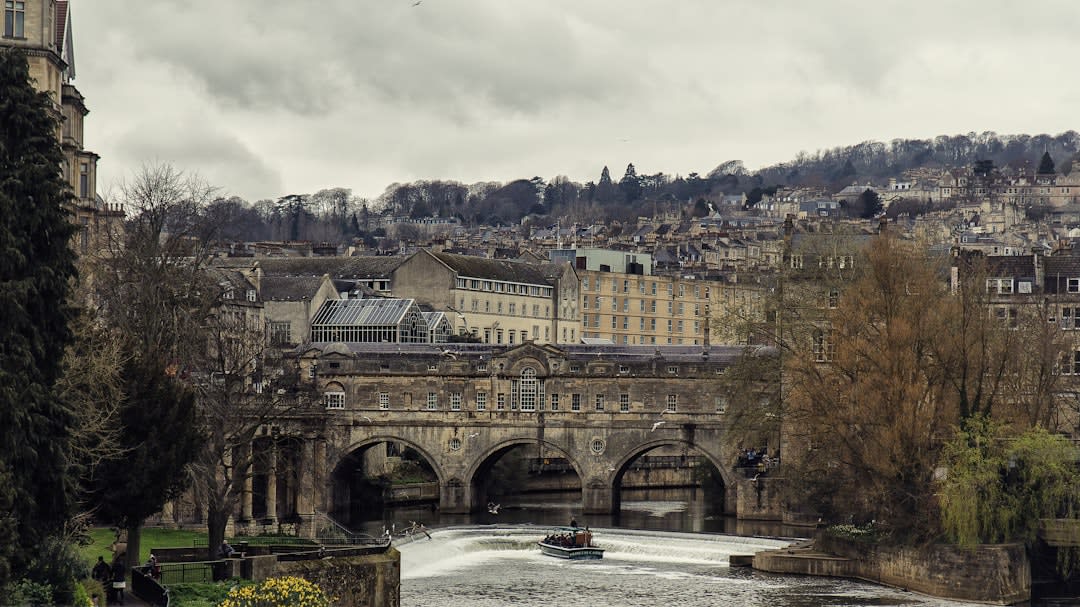
Bath
Bath, England, United Kingdom
Bath is a thermae of sacred significance. Approximate coordinates: 51.38148, -2.35873. Attributes: built, cultural, archaeological. Tradition: Christianity. Bath may refer to: Bathing, immersion in a fluid Bathtub, a large open container for water, in which a person may wash their body Public bathing, a public place where people bathe Thermae, ancient Roman public bathing facilities Located in Bath, England, United Kingdom.
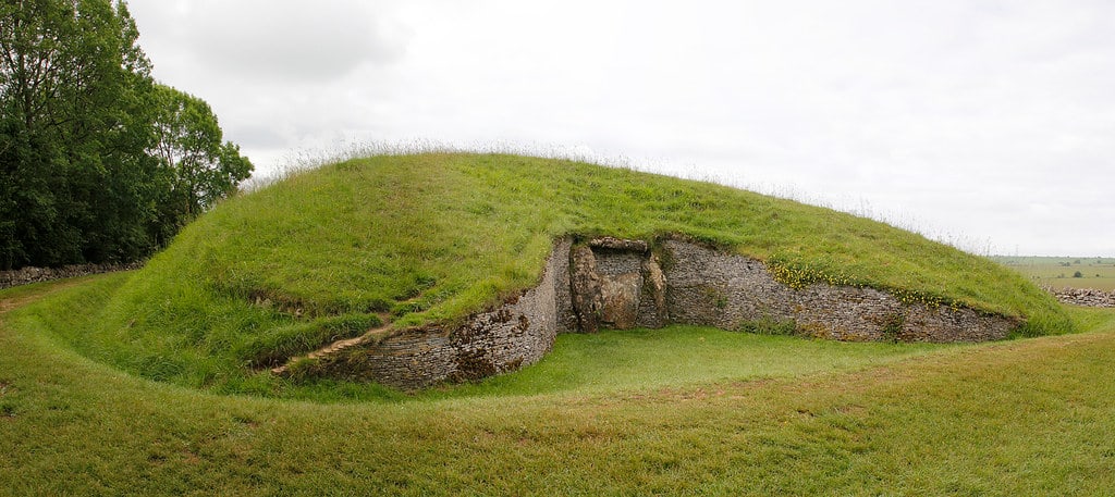
Belas Knap Long Barrow
Tewkesbury, England, United Kingdom
Belas Knap Long Barrow is a long barrow of sacred significance. Approximate coordinates: 51.92764, -1.97081. Attributes: built, cultural, archaeological. Located in Tewkesbury, England, United Kingdom.
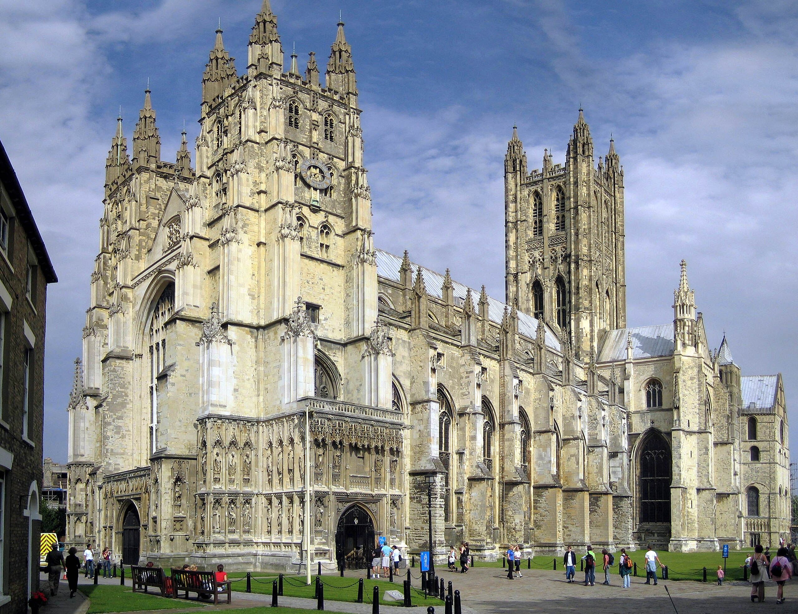
Canterbury Cathedral
Canterbury, England, United Kingdom
Canterbury is a cathedral of sacred significance. Approximate coordinates: 51.27980, 1.08280. Attributes: built, cultural, pilgrimage. Tradition: Christianity. Associated figure: Archbishop of Canterbury. Recognized as a UNESCO World Heritage Site. Canterbury ( , ) is a city and UNESCO World Heritage Site, in the county of Kent, England; it was a county borough until 1974. It lies on the River Stour. The city has a mild oceanic climate. Canterbury is a popular tourist destination, with the city s economy heavily reliant upon tourism, alongside higher education and retail. As of 2011, the city s population was over 55,000, including a substantial number of students and one of the highest student-to-permanent-resident ratios in Britain. The site of the city has been occupied since Paleolithic times and served as the capital of the Celtic Cantiaci and Jute Kingdom of Kent. Many historical structures fill the area, including a city wall founded in Roman times and rebuilt in the 14th century, the Westgate Towers museum, the ruins of St Augustine s Abbey, the Norman Canterbury Castle, and the oldest extant school in the world, the King s School. Modern additions include the Marlowe Theatre and Kent County Cricket Club s St Lawrence Ground. Canterbury Cathedral is known for its architecture, its music, and for being the seat of the Archbishop of Canterbury; it receives a million visitors per year. Located in Canterbury, England, United Kingdom.
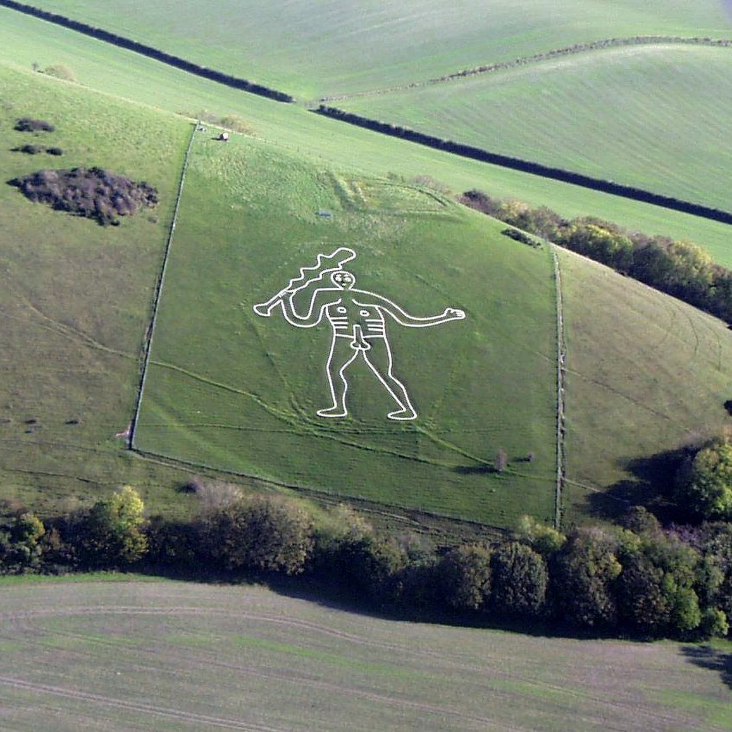
Cerne Abas Giant
Cerne Abbas, England, United Kingdom
Cerne Abas is a hill figure of sacred significance. Approximate coordinates: 50.81371, -2.47453. Attributes: cultural, archaeological. Located in England, United Kingdom.
Chanctonbury Rings, Findon, West Sussex, England
Horsham, England, United Kingdom
Chanctonbury Rings, Findon, West Sussex, England is a hill fort of sacred significance. Approximate coordinates: 50.89675, -0.38106. Attributes: built, cultural, archaeological. Located in Horsham, England, United Kingdom.
Chapel of Our Lady of the Crag, Knaresborough, England
Knaresborough, England, United Kingdom
Chapel of Our Lady of the Crag, Knaresborough, England is a chapel of sacred significance. Approximate coordinates: 54.00283, -1.46556. Attributes: built, cultural. Tradition: Christianity. Associated figure: Our Lady. Located in England, United Kingdom.
Chun Quoit
Bojewyan, England, United Kingdom
Chun Quoit is a megalithic burial site of sacred significance. Approximate coordinates: 50.14859, -5.63770. Attributes: built, cultural, archaeological. Located in England, United Kingdom.
Church of St Frideswide, Oxford, England
Oxford, England, United Kingdom
Church of St Frideswide, Oxford, England is a church of sacred significance. Approximate coordinates: 51.75218, -1.27475. Attributes: built, cultural. Tradition: Christianity. Associated figure: St Frideswide. Located in Oxford, England, United Kingdom.
Church of St. Mary and St. Edwin, Evesham, England
Wychavon, England, United Kingdom
Church of St. Mary and St. Edwin, Evesham, England is a church of sacred significance. Approximate coordinates: 52.09663, -1.94618. Attributes: built, cultural. Tradition: Christianity. Associated figure: St. Mary and St. Edwin. Located in Wychavon, England, United Kingdom.
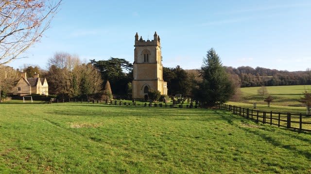
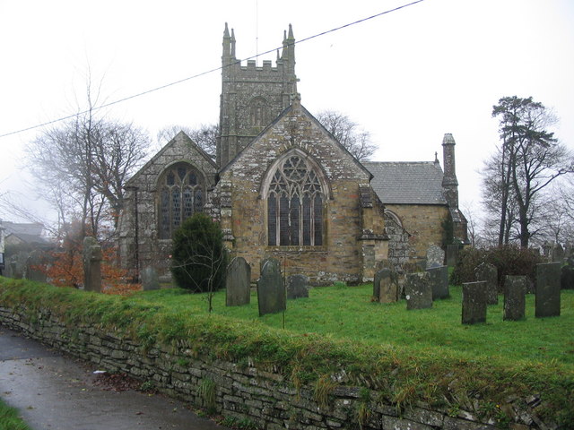
Church of St. Mary’s
Cotswold District, England, United Kingdom
St. Mary’s Church, Temple Guiting, England is a site of sacred significance. Approximate coordinates: 51.94901, -1.86848. Located in Cotswold, England, United Kingdom.
Cissbury Ring, Findon, West Sussex, England
Worthing, England, United Kingdom
Cissbury Ring, Findon, West Sussex, England is a neolithic flint mines of sacred significance. Approximate coordinates: 50.86046, -0.38325. Attributes: built, cultural, archaeological. Located in Worthing, England, United Kingdom.
Cornwall
Penzance, England, United Kingdom
Cornwall is a ceremonial county of sacred significance. Approximate coordinates: 50.11870, -5.53827. Attributes: natural, cultural, archaeological, ceremonial. Tradition: Celtic. Mythological context: Celtic. Cornwall ( ; Cornish: Kernow [ˈkɛrnɔʊ] or [ˈkɛrnɔ]) is a ceremonial county in South West England. It is also one of the Celtic nations and the homeland of the Cornish people. The county is bordered by the Atlantic Ocean to the north and west, Devon to the east, and the English Channel to the south. The largest urban area is the Redruth and Camborne conurbation. The county is predominantly rural, with an area of 1,375 square miles (3,562 km2) and population of 568,210. After the Redruth-Camborne conurbation, the largest settlements are Falmouth, Penzance, Newquay, St Austell, and Truro. For local government purposes most of Cornwall is a unitary authority area, with the Isles of Scilly governed by a unique local authority. The Cornish nationalist movement disputes the constitutional status of Cornwall and seeks greater autonomy within the United Kingdom. Cornwall is the westernmost part of the South West Peninsula, and the southernmost county within the United Kingdom. Its coastline is characterised by steep cliffs and, to the south, several rias, including those at the mouths of the rivers Fal and Fowey. It includes the southernmost point on Great Britain, Lizard Point, and forms a large part of the Cornwall National Landscape. The national landscape also includes Bodmin Moor, an upland outcrop of the Cornubian batholith granite formation. The county contains many short rivers; the longest is the Tamar, which forms the border with Devon. Cornwall had a minor Roman presence, and later formed part of the Brittonic kingdom of Dumnonia. From the 7th century, the Britons in the South West increasingly came into conflict with the expanding Anglo-Saxon kingdom of Wessex, eventually being pushed west of the Tamar; by the Norman Conquest Cornwall was administered as part of England, though it retained its own culture. The remainder of the Middle Ages and Early Modern Period were relatively settled, with Cornwall developing its tin mining industry and becoming a duchy in 1337. During the Industrial Revolution, the tin and copper mines were expanded and then declined, with china clay extraction becoming a major industry. Railways were built, leading to a growth of tourism in the 20th century. The Cornish language became extinct as a living community language at the end of the 18th century, but is now being revived. Located in England, United Kingdom.
Devil’s Quoits
West Oxfordshire, England, United Kingdom
Devil’s Quoits is a megalithic circle of sacred significance. Approximate coordinates: 51.74001, -1.40589. Attributes: built, cultural, archaeological. Located in West Oxfordshire, England, United Kingdom.
Dragon Hill
Vale of White Horse, England, United Kingdom
Dragon Hill, Uffington, England is a hill of sacred significance. Approximate coordinates: 51.57927, -1.56846. Attributes: natural, cultural, archaeological. Mythological context: Dragon. Located in Vale of White Horse, England, United Kingdom.
Duddo Five Stones, Duddo
Duddo, England, United Kingdom
Duddo Five Stones, Duddo is a stone circle of sacred significance. Approximate coordinates: 55.68681, -2.11204. Attributes: built, cultural, archaeological. Located in England, United Kingdom.
Duloe Stone Circle
Tredinnick, England, United Kingdom
Duloe Stone Circle is a stone circle of sacred significance. Approximate coordinates: 50.39808, -4.48351. Attributes: built, cultural, archaeological. Duloe stone circle or Duloe circle is a stone circle near the village of Duloe, located 5 miles (8.0 km) from Looe in southeast Cornwall, England, UK. Located in England, United Kingdom.
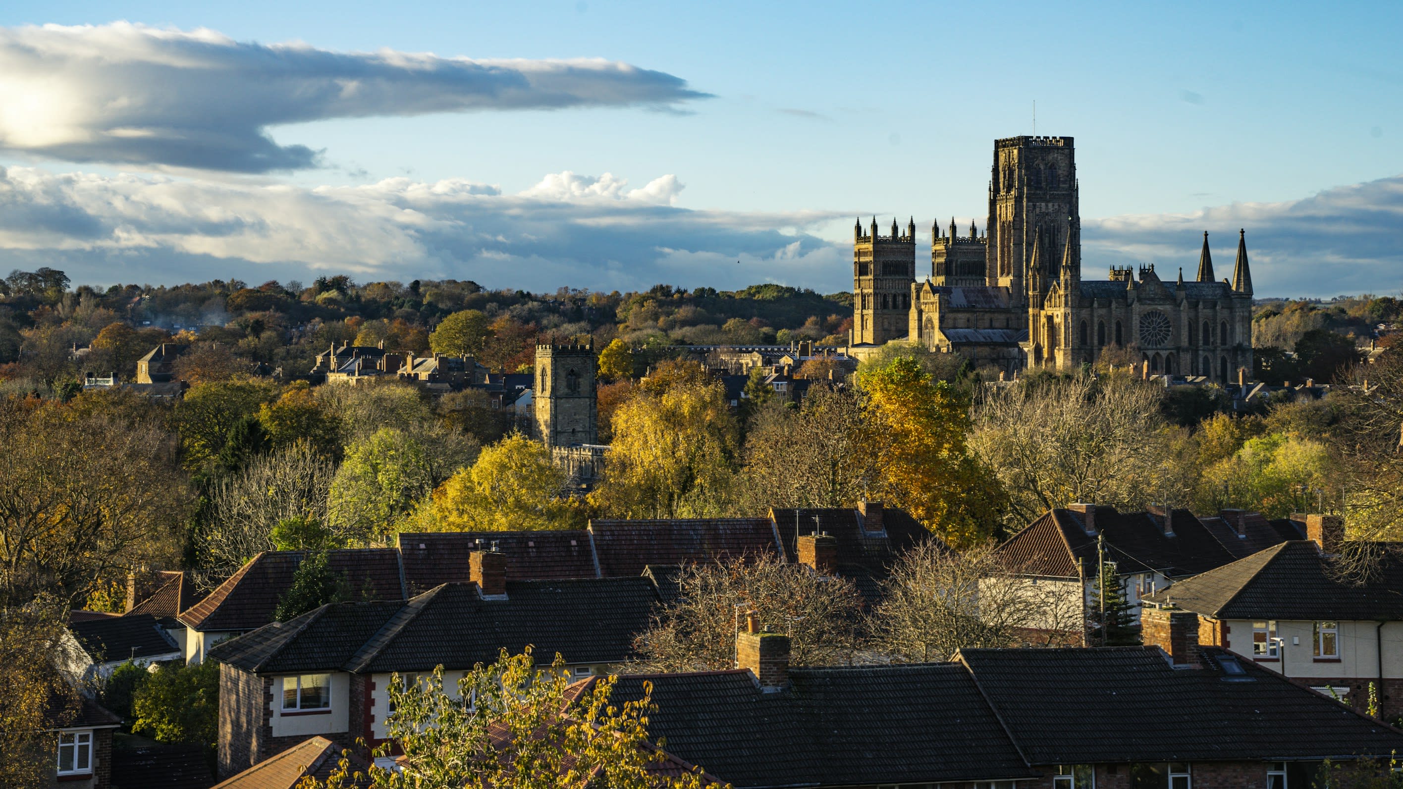
Durham Cathedral
Durham, England, United Kingdom
Durham is a cathedral of sacred significance. Approximate coordinates: 54.77323, -1.57639. Attributes: built, cultural, pilgrimage. Tradition: Christianity. Recognized as a UNESCO World Heritage Site. Durham most commonly refers to: Durham, England, a cathedral city in north east England County Durham, a ceremonial county which includes Durham Durham, North Carolina, a city in North Carolina, United States Durham may also refer to: Located in Durham, England, United Kingdom.

Ely Cathedral
Ely, England, United Kingdom
Ely Cathedral is a cathedral of sacred significance. Approximate coordinates: 52.39866, 0.26378. Attributes: built, cultural, pilgrimage, ceremonial. Tradition: Christianity. Associated figure: St Etheldreda and St Peter. Ely Cathedral, formally the Cathedral Church of the Holy and Undivided Trinity of Ely, is an Anglican cathedral in the city of Ely, Cambridgeshire, England. The cathedral can trace its origin to the abbey founded in Ely in 672 by St Æthelthryth (also called Etheldreda). The earliest parts of the present building date to 1083, and it was granted cathedral status in 1109. Until the Reformation, the cathedral was dedicated to St Etheldreda and St Peter, at which point it was refounded as the Cathedral Church of the Holy and Undivided Trinity of Ely. It is the cathedral of the Diocese of Ely, which covers most of Cambridgeshire and western Norfolk, Essex, and Bedfordshire. It is the seat of the Bishop of Ely and a suffragan bishop, the Bishop of Huntingdon. Architecturally, Ely Cathedral is outstanding both for its scale and stylistic details. Having been built in a monumental Romanesque style, the galilee porch, lady chapel and choir were rebuilt in an exuberant Decorated Gothic. Its most notable feature is the central octagonal tower, with lantern above, which provides a unique internal space and, along with the West Tower, dominates the surrounding landscape. The cathedral is a major tourist destination, receiving around 250,000 visitors per year, and sustains a daily pattern of morning and evening services. Located in East Cambridgeshire, England, United Kingdom.
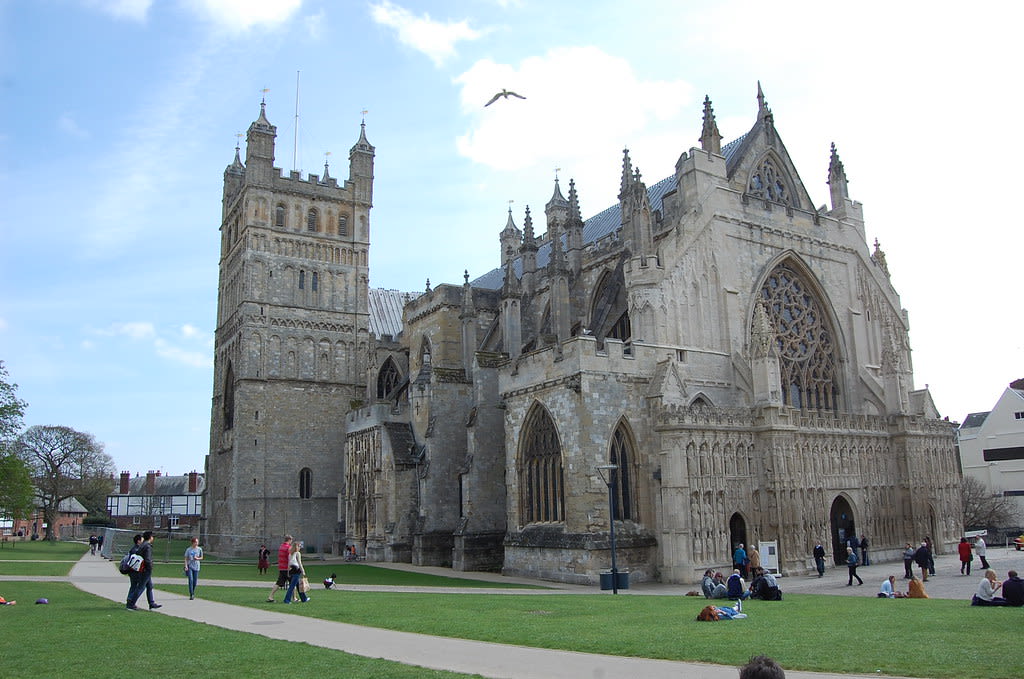
Exeter Cathedral
Exeter, England, United Kingdom
Exeter Cathedral is a cathedral of sacred significance. Approximate coordinates: 50.72254, -3.52991. Attributes: built, cultural. Tradition: Anglican. Associated figure: Saint Peter. Exeter Cathedral, properly known as the Cathedral Church of Saint Peter in Exeter, is an Anglican cathedral, and the seat of the Bishop of Exeter, in the city of Exeter, Devon, in South West England. The present building was complete by about 1400 and has several notable features, including an early set of misericords, an astronomical clock and the longest uninterrupted medieval stone vaulted ceiling in the world. Located in Exeter, England, United Kingdom.

Fernworthy Stone Circle
West Devon, England, United Kingdom
Fernworthy Stone Circle is a stone circle of sacred significance. Approximate coordinates: 50.64118, -3.90377. Attributes: built, cultural, archaeological. Located in West Devon, England, United Kingdom.

Glastonbury
Glastonbury, England, United Kingdom
Glastonbury is a town of sacred significance. Approximate coordinates: 51.14473, -2.69869. Attributes: built, cultural, archaeological, pilgrimage. Tradition: Christianity. Associated figure: St John the Baptist. Mythological context: Christian and Arthurian legends. Glastonbury ( GLAST-ən-bər-ee, UK also GLAHST-) is a town and civil parish in Somerset, England, situated at a dry point on the low-lying Somerset Levels, 23 miles (37 km) south of Bristol. The town had a population of 8,932 in the 2011 census. Glastonbury is less than 1 mile (2 km) across the River Brue from Street, which is now larger than Glastonbury. Evidence from timber trackways such as the Sweet Track show that the town has been inhabited since Neolithic times. Glastonbury Lake Village was an Iron Age village, close to the old course of the River Brue and Sharpham Park approximately 2 miles (3 km) west of Glastonbury, that dates back to the Bronze Age. Centwine was the first Saxon patron of Glastonbury Abbey, which dominated the town for the next 700 years. One of the most important abbeys in England, it was the site of Edmund Ironside s coronation as King of England in 1016. Many of the oldest surviving buildings in the town, including the Tribunal, George Hotel and Pilgrims Inn and the Somerset Rural Life Museum, which is based at the site of a 14th-century abbey manor barn, often referred to as a tithe barn, are associated with the abbey. The Church of St John the Baptist dates from the 15th century. The town became a centre for commerce, which led to the construction of the market cross, Glastonbury Canal and the Glastonbury and Street railway station, the largest station on the original Somerset and Dorset Railway. The Brue Valley Living Landscape is a conservation project managed by the Somerset Wildlife Trust and nearby is the Ham Wall National Nature Reserve. Glastonbury has been described as having a New Age community, and possibly being where New Age beliefs originated at the turn of the twentieth century. It is notable for myths and legends often related to Glastonbury Tor, concerning Joseph of Arimathea, the Holy Grail and King Arthur. Joseph is said to have arrived in Glastonbury and stuck his staff into the ground, when it flowered miraculously into the Glastonbury Thorn. The presence of a landscape zodiac around the town has been suggested but no evidence has been discovered. The Glastonbury Festival, held in the nearby village of Pilton, takes its name from the town. Located in England, United Kingdom.
Hurlers Stone Circles
Cornwall, England, United Kingdom
Hurlers Stone Circles is a stone circles of sacred significance. Approximate coordinates: 50.51661, -4.45806. Attributes: built, cultural, archaeological, ceremonial. Located in England, United Kingdom.

Keswick
Cumberland, England, United Kingdom
Keswick is a stone circle of sacred significance. Approximate coordinates: 54.60282, -3.09840. Attributes: built, cultural, archaeological. Keswick may refer to: Located in England, United Kingdom.

Knaresborough
Knaresborough, England, United Kingdom
Knaresborough is a cave of sacred significance. Approximate coordinates: 54.00873, -1.47488. Attributes: natural, cultural. Associated figure: Mother Shipton. Mythological context: English folklore. Knaresborough ( NAIRZ-bər-ə) is a market and spa town and civil parish on the River Nidd in North Yorkshire, England. It is three miles (five kilometres) east of Harrogate and was in the Borough of Harrogate until April 2023. Located in England, United Kingdom.

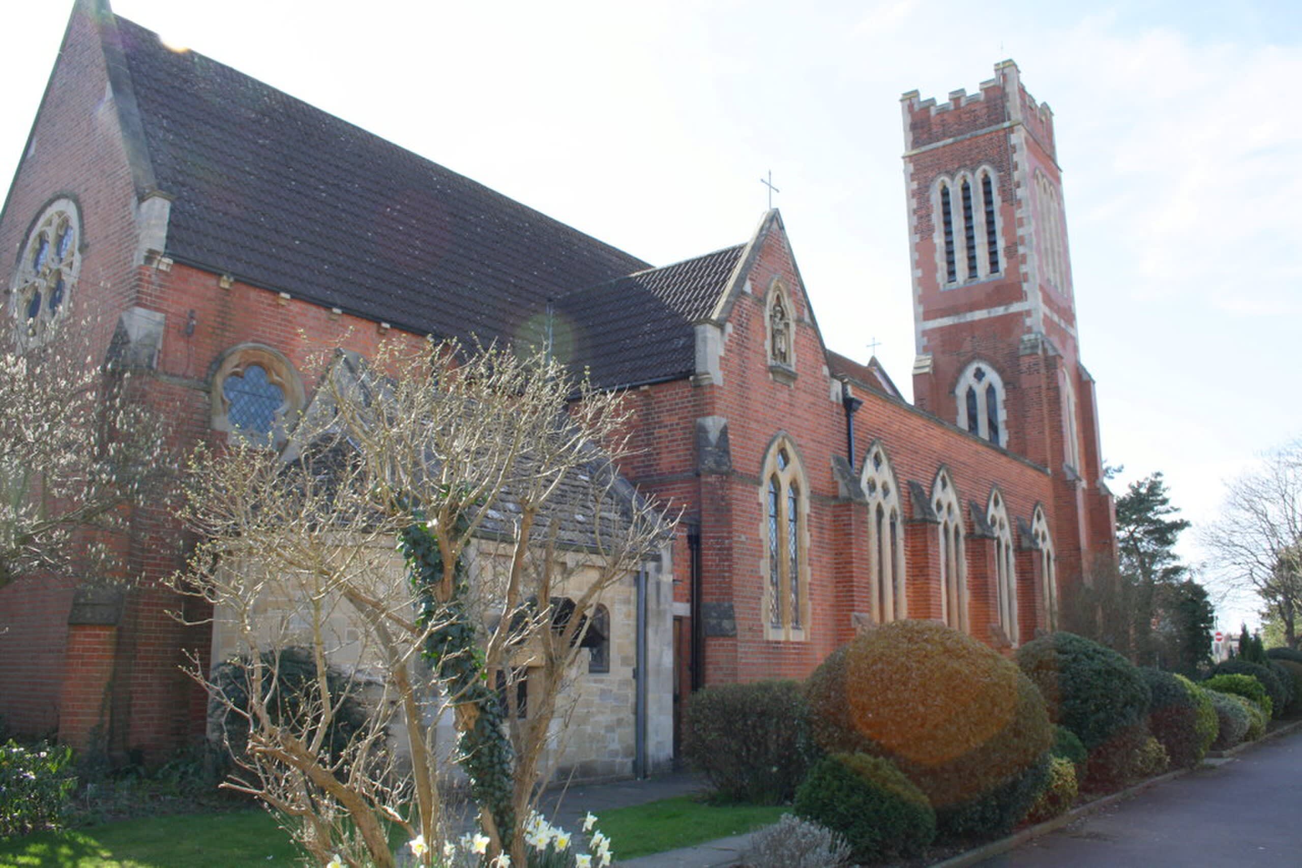
Ladyewell Marian Shrine, Fernyhalgh, England
Preston, England, United Kingdom
Ladyewell Marian Shrine, Fernyhalgh, England is a shrine of sacred significance. Approximate coordinates: 53.79700, -2.67536. Attributes: built, cultural, pilgrimage. Tradition: Christianity. Associated figure: Virgin Mary. Located in Preston, England, United Kingdom.

Lincoln
Lincoln, England, United Kingdom
Lincoln is a cathedral of sacred significance. Approximate coordinates: 53.23430, -0.53602. Attributes: built, cultural, pilgrimage. Tradition: Christianity. Lincoln most commonly refers to: Abraham Lincoln (1809–1865), the 16th president of the United States Lincoln, England, cathedral city and county town of Lincolnshire, England Lincoln, Nebraska, the capital of Nebraska, U.S. Lincoln (name), a surname and given name Lincoln Motor Company, a Ford brand Lincoln may also refer to: Located in Lincoln, England, United Kingdom.
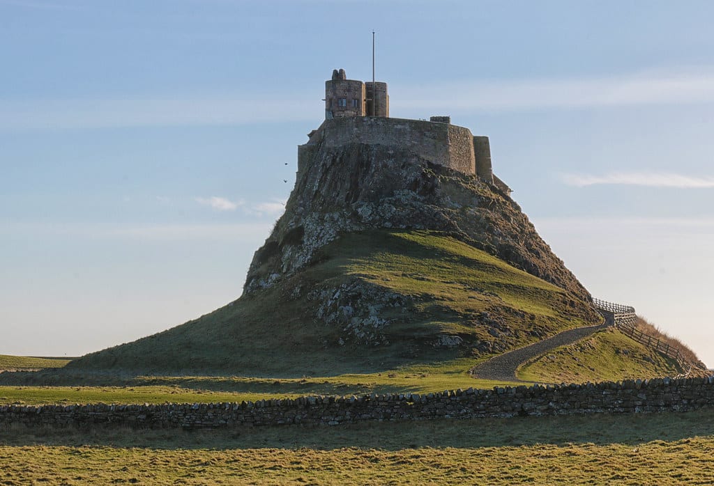
Lindisfarne
Holy Island, England, United Kingdom
Lindisfarne is a monastery of sacred significance. Approximate coordinates: 55.66932, -1.80193. Attributes: built, natural, cultural, archaeological, pilgrimage. Tradition: Christianity. Associated figure: Saints Aidan, Cuthbert, Eadfrith, and Eadberht of Lindisfarne. Lindisfarne, also known as Holy Island, is a tidal island off the northeast coast of England, which constitutes the civil parish of Holy Island in Northumberland. Holy Island has a recorded history from the 6th century AD; it was an important centre of Celtic Christianity under Saints Aidan, Cuthbert, Eadfrith, and Eadberht of Lindisfarne. The island was originally home to a monastery, which was destroyed during the Viking invasions but re-established as a priory following the Norman Conquest of England. Other notable sites built on the island are St Mary the Virgin parish church (originally built AD 635 and restored in 1860), Lindisfarne Castle, several lighthouses and other navigational markers, and a complex network of lime kilns. In the present day, the island is an Area of Outstanding Natural Beauty and a hotspot for historical tourism and bird watching. As of February 2020, the island had three pubs, a hotel and a post office as well as a museum. Located in England, United Kingdom.

London
London, England, United Kingdom
London is a site of sacred significance. Approximate coordinates: 51.49963, -0.12834. London is the capital and largest city of both England and the United Kingdom, with a population of 8,866,180 in 2022. Its wider metropolitan area is the largest in Western Europe, with a population of 14.9 million. London stands on the River Thames in southeast England, at the head of a 50-mile (80 km) tidal estuary down to the North Sea, and has been a major settlement for nearly 2,000 years. Its ancient core and financial centre, the City of London, was founded by the Romans as Londinium and has retained its medieval boundaries. The City of Westminster, to the west of the City of London, has been the centuries-long host of the national government and parliament. London grew rapidly in the 19th century, becoming the world s largest city at the time. Since the 19th century, the name London has referred to the metropolis around the City of London, historically split between the counties of Middlesex, Essex, Surrey, Kent, and Hertfordshire, which since 1965 has largely comprised the administrative area of Greater London, governed by 33 local authorities and the Greater London Authority. As one of the world s major global cities, London exerts a strong influence on world art, entertainment, fashion, commerce, finance, education, healthcare, media, science, technology, tourism, transport, and communications. London is Europe’s most economically powerful city, and is one of the world s major financial centres. London hosts Europe s largest concentration of higher education institutions, comprising over 50 universities and colleges and enrolling more than 500,000 students as of 2023. It is home to several of the world s leading academic institutions: Imperial College London, internationally recognised for its excellence in natural and applied sciences, and University College London (UCL), a comprehensive research-intensive university, consistently rank among the top ten globally. Other notable institutions include King s College London (KCL), highly regarded in law, humanities, and health sciences; the London School of Economics (LSE), globally prominent in social sciences and economics; and specialised institutions such as the Royal College of Art (RCA), Royal Academy of Music (RAM), the Royal Academy of Dramatic Art (RADA), the School of Oriental and African Studies (SOAS), and London Business School (LBS). It is the most visited city in Europe and has the world s busiest city airport system. The London Underground is the world s oldest rapid transit system. London s diverse cultures encompass over 300 languages. The 2023 population of Greater London of just under 10 million made it Europe s third-most populous city, accounting for 13.4% of the United Kingdom s population and over 16% of England s population. The Greater London Built-up Area is the fourth-most populous in Europe, with about 9.8 million inhabitants as of 2011. The London metropolitan area is the third-most populous in Europe, with about 14 million inhabitants as of 2016, making London a megacity. Four World Heritage Sites are located in London: Kew Gardens; the Tower of London; the site featuring the Palace of Westminster, Church of St. Margaret, and Westminster Abbey; and the historic settlement in Greenwich where the Royal Observatory defines the prime meridian (0° longitude) and Greenwich Mean Time. Other landmarks include Buckingham Palace, the London Eye, Piccadilly Circus, St Paul s Cathedral, Tower Bridge, and Trafalgar Square. The city has the most museums, art galleries, libraries, and cultural venues in the UK, including the British Museum, National Gallery, Natural History Museum, Tate Modern, British Library, and numerous West End theatres. Important sporting events held in London include the FA Cup Final, the Wimbledon Tennis Championships, and the London Marathon. It became the first city to host three Summer Olympic Games upon hosting the 2012 Summer Olympics. Located in City of Westminster, England, United Kingdom.
Long Meg and Her Daughters stone ring
Little Salkeld, England, United Kingdom
Long Meg and Her Daughters stone ring is a site of sacred significance. Approximate coordinates: 54.72772, -2.66694. Located in England, United Kingdom.
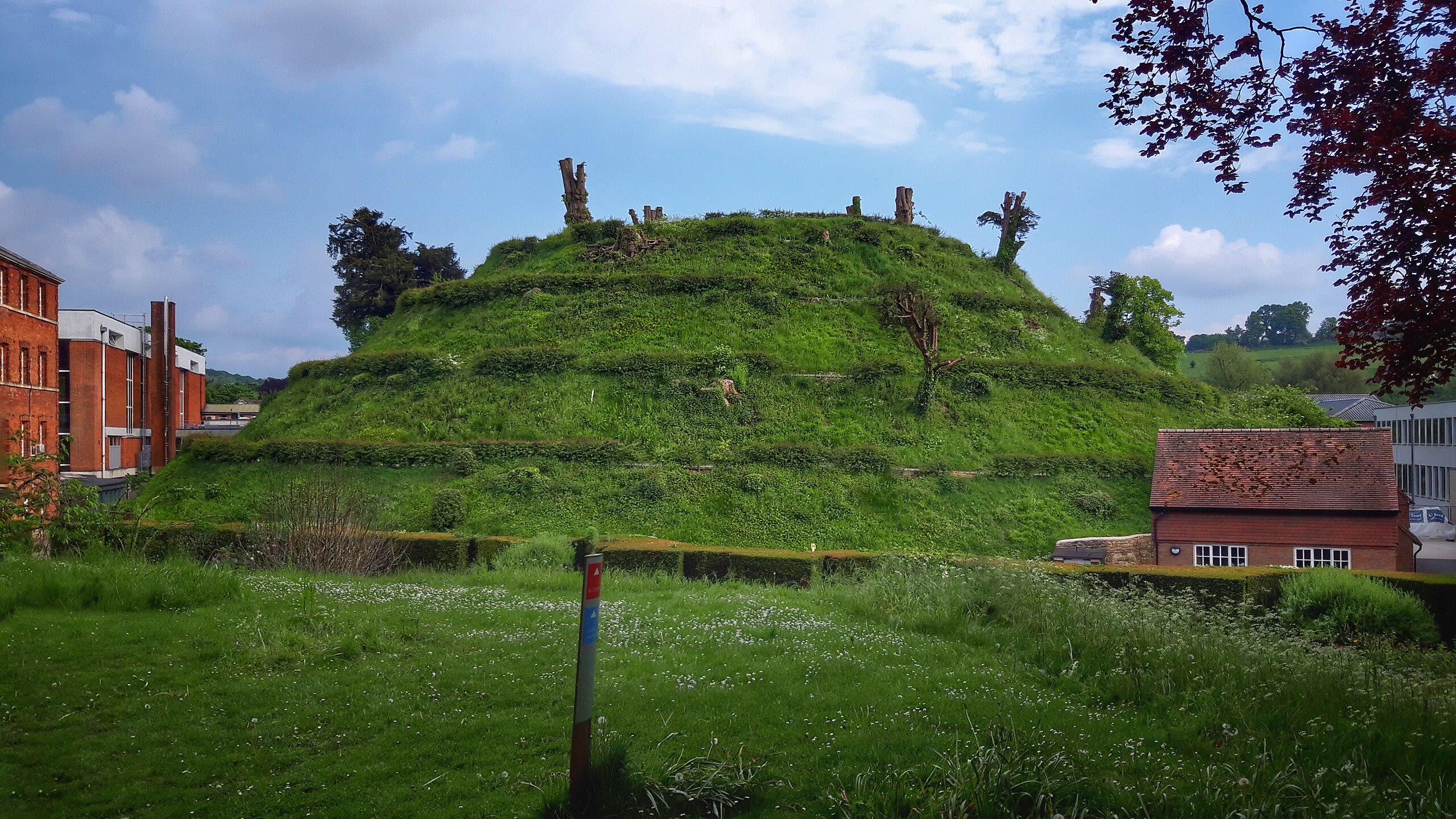
Marlborough Mound
Marlborough, England, United Kingdom
Marlborough Mound, Wiltshire, England is a mound of sacred significance. Approximate coordinates: 51.41664, -1.73711. Attributes: built, cultural, archaeological. Located in England, United Kingdom.
Merry Maidens Stone Circle
Lamorna, England, United Kingdom
Merry Maidens Stone Circle is a site of sacred significance. Approximate coordinates: 50.06513, -5.58873. Located in England, United Kingdom.
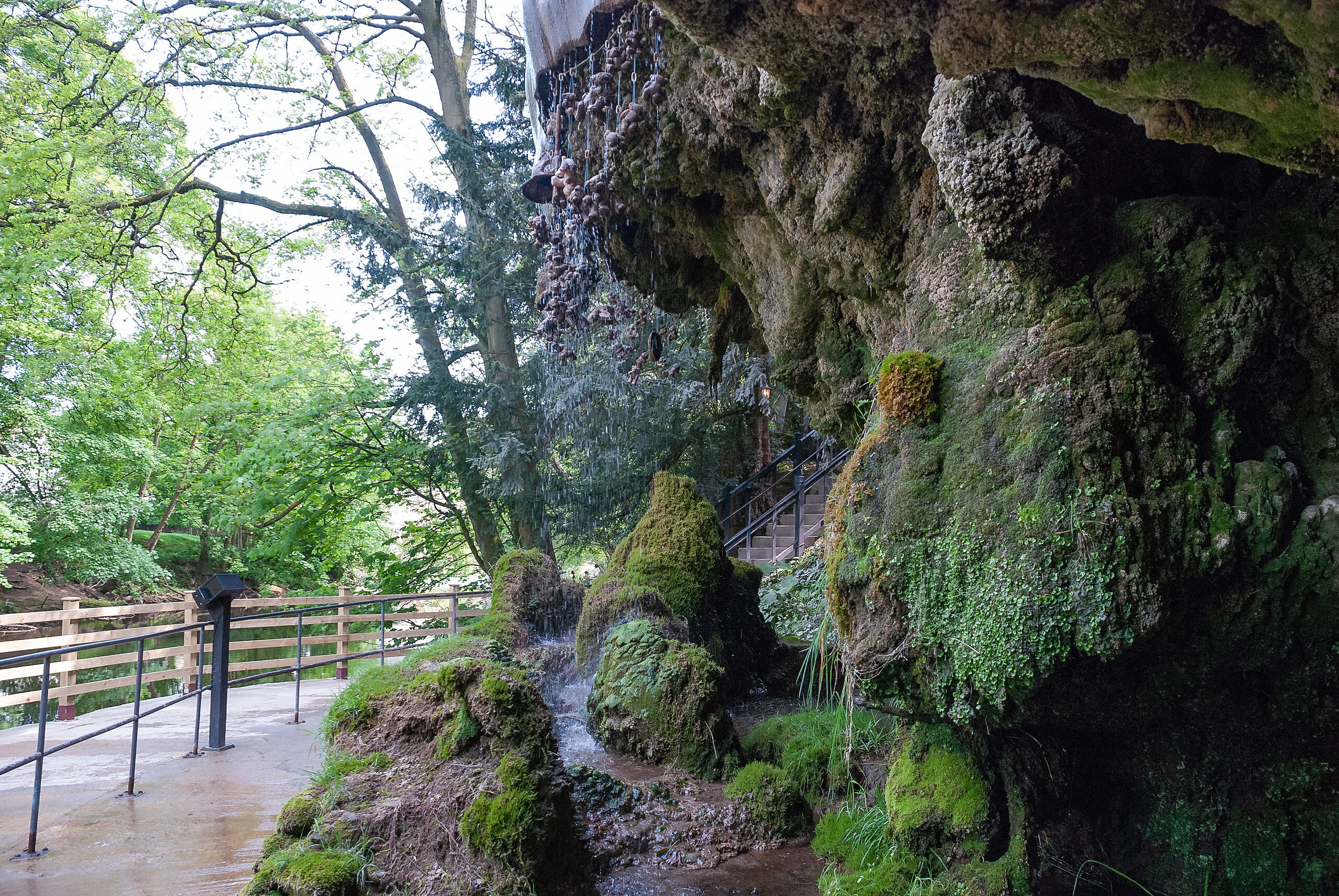
Mother Shipton’s Cave, Knaresborough, England
Knaresborough, England, United Kingdom
Mother Shipton’s Cave, Knaresborough, England is a site of sacred significance. Approximate coordinates: 54.00871, -1.47485. Located in England, United Kingdom.

Nine Stones Circle
West Devon, England, United Kingdom
Nine Stones Circle is a site of sacred significance. Approximate coordinates: 50.71863, -3.96712. Located in West Devon, England, United Kingdom.
Nine Stones Close Stone Circle, Youlgreave
Derbyshire Dales, England, United Kingdom
Nine Stones Close Stone Circle, Youlgreave is a site of sacred significance. Approximate coordinates: 53.16046, -1.66443. Located in Derbyshire Dales, England, United Kingdom.
Oddendale Stone Ring, Oddendale, United Kingdom
Shap, England, United Kingdom
Oddendale Stone Ring, Oddendale, United Kingdom is a site of sacred significance. Approximate coordinates: 54.50984, -2.63163. Located in England, United Kingdom.
Our Lady and St. Annes Church
Reading, England, United Kingdom
Our Lady & St. Annes Church is a site of sacred significance. Approximate coordinates: 51.46790, -0.96685. Located in England, United Kingdom.
Our Lady of Caversham
Reading, England, United Kingdom
Our Lady of Caversham, Reading, England is a site of sacred significance. Approximate coordinates: 51.46784, -0.96687. Located in England, United Kingdom.

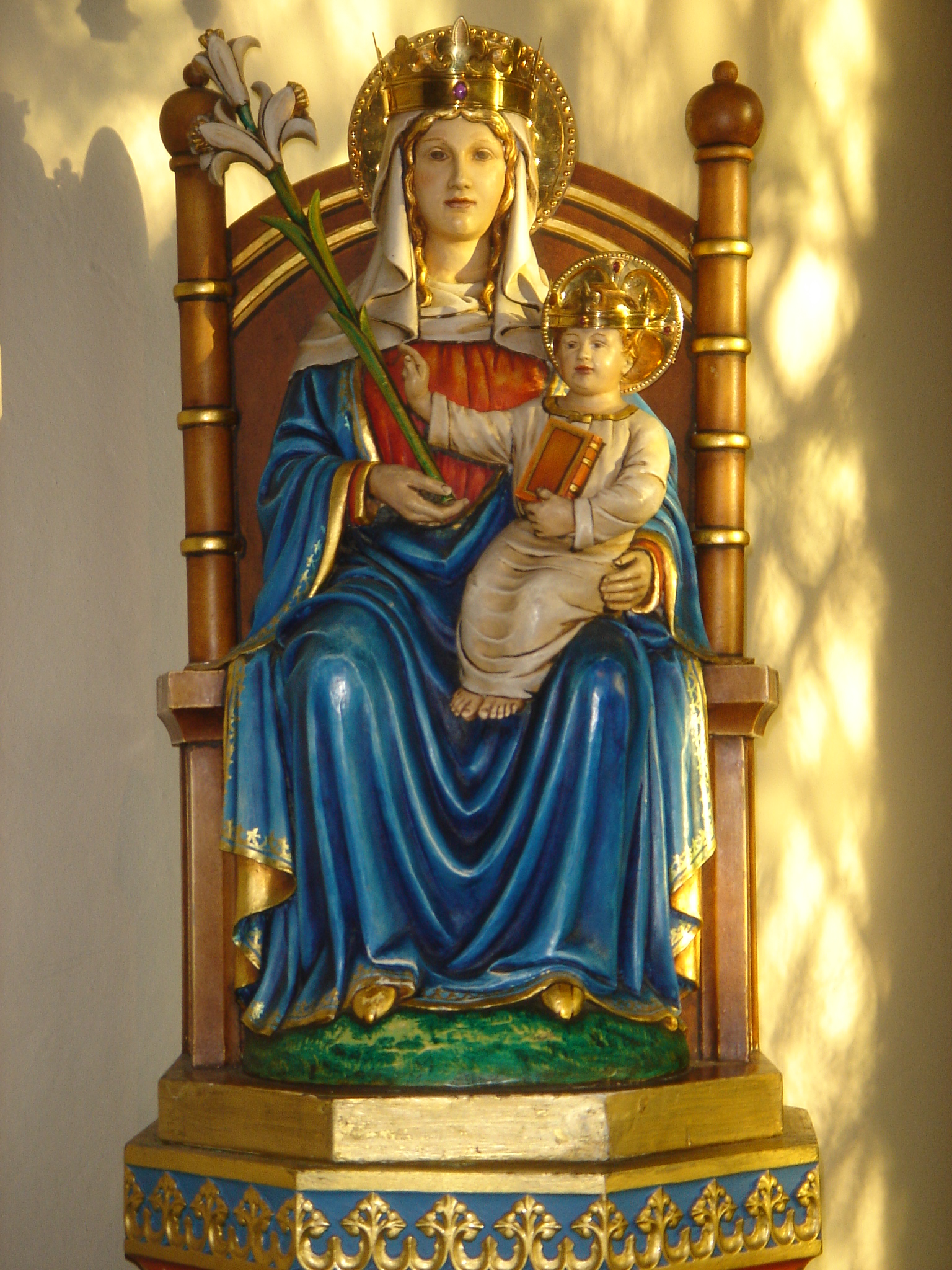
Our Lady of Czestochowa (Camden Town)
London, England, United Kingdom
Black Madonna shrine known for Belgian connection, historic devotion from Halle, England
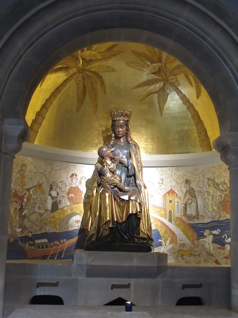
Our Lady of Walsingham
North Norfolk, England, United Kingdom
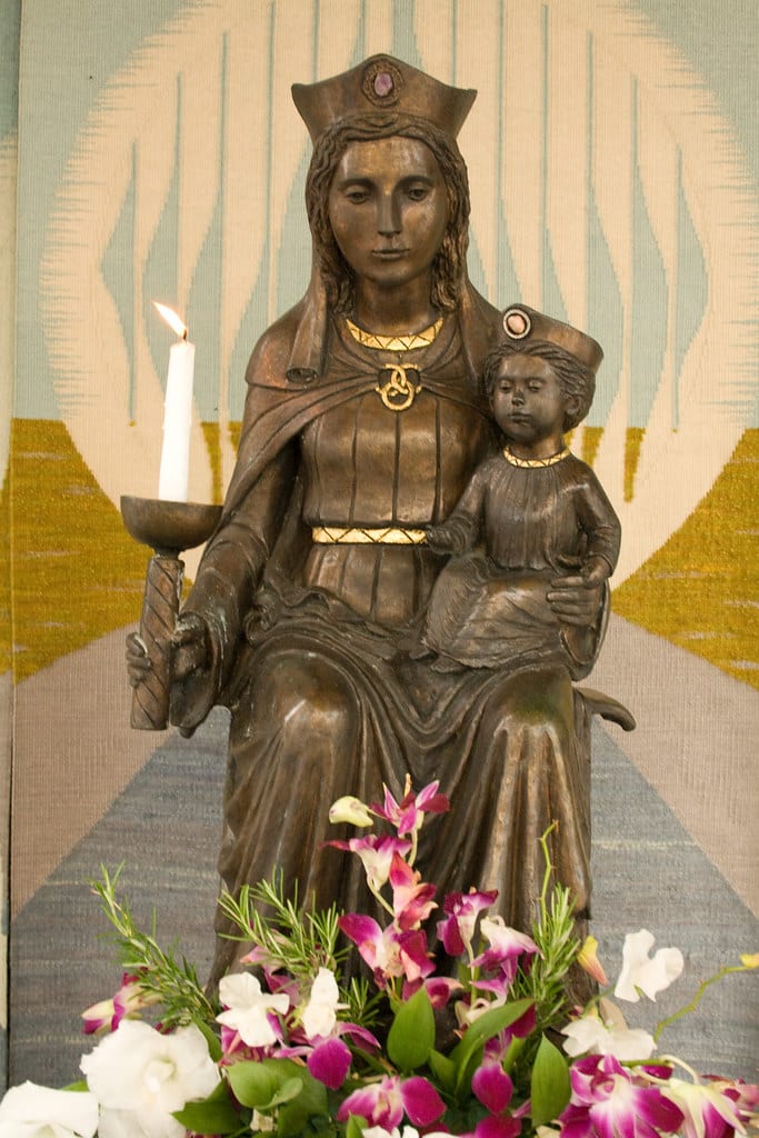
Our Lady of Walsingham is a site of sacred significance. Approximate coordinates: 52.89466, 0.87592. Our Lady of Walsingham is a title given to Mary, the mother of Jesus, venerated by Catholics and high church Anglicans. The title is linked to a Marian apparition that, according to tradition, was experienced by Lady Richeldis de Faverches, an Anglo-Saxon noblewoman, in 1061 in the village of Walsingham, Norfolk, England. Lady Richeldis was said to have been instructed to build a replica of the Holy House, the home of the Holy Family in Nazareth. The shrine became a major pilgrimage site and her son, Geoffrey de Faverches, later entrusted its guardianship to others. Before his death, he left instructions for the foundation of a priory in Walsingham, which was established sometime between 1146 and 1174. This priory was eventually placed under the care of the Canons Regular of Saint Augustine. During the Middle Ages, Walsingham grew into one of England s most significant pilgrimage destinations, attracting royalty and commoners alike. Though the original shrine was dismantled during the English Reformation, the tradition of pilgrimage to Walsingham was revived in the late 19th and 20th centuries and it remains a significant centre for devotion among both Catholics and Anglicans. By a papal rescript issued on 6 February 1897, Pope Leo XIII blessed a venerated image for the restored medieval sanctuary of Our Lady of Walsingham. The image was sent from Rome and placed in the Holy House Chapel at the newly built Catholic parish church of King s Lynn on 19 August 1897. The following day, the first post-Reformation pilgrimage took place from King s Lynn to the Slipper Chapel in Walsingham, which had been purchased by Charlotte Boyd in 1895 and restored for Catholic use. Approximately 40–50 Catholics participated in this first public pilgrimage to Walsingham, initiating an annual pilgrimage traditionally held at Whitsun (the Feast of Pentecost). This continued until 1934, when the Slipper Chapel was declared the Roman Catholic National Shrine of Our Lady of Walsingham. On 15 August 1954, Pope Pius XII granted a canonical coronation to the venerated image of Our Lady of Walsingham. The coronation was carried out by the papal nuncio, Bishop Gerald O Hara, with a gold crown funded by female devotees. The image is now enshrined in the Basilica of Our Lady of Walsingham. The feast day of Our Lady of Walsingham is observed on 24 September in both the Anglican and Catholic churches. Anglicans, particularly those in the Society of Our Lady of Walsingham and at the Anglican Shrine of Our Lady of Walsingham, also commemorate an additional feast of translation on 15 October each year, marking the anniversary of the translation of the image from Walsingham s parish church to the shrine church in 1931. In the United States, some local churches recognise 15 October as the principal feast of Our Lady of Walsingham, including the Episcopal Church (Anglican Communion) and Western Rite Orthodox churches of the Russian Orthodox Church Outside of Russia and the Antiochian Orthodox Christian Archdiocese of North America. Located in North Norfolk, England, United Kingdom.
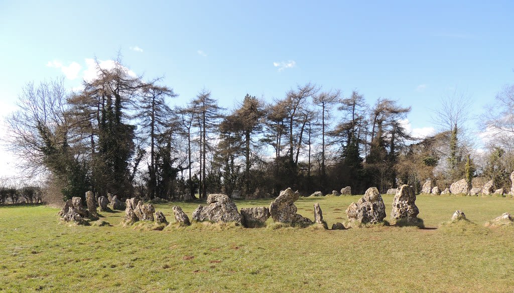
Rollright Stones
West Oxfordshire, England, United Kingdom
Rollright Stones is a site of sacred significance. Approximate coordinates: 51.97551, -1.57081. The Rollright Stones are a complex of three Neolithic and Bronze Age megalithic monuments near the village of Long Compton, on the borders of Oxfordshire and Warwickshire. Constructed from local oolitic limestone, the three monuments, now known as the King s Men and the Whispering Knights in Oxfordshire and the King Stone in Warwickshire, are distinct in their design and purpose. They were built at different periods in late prehistory. During the period when the three monuments were erected, there was a continuous tradition of ritual behaviour on sacred ground, from the 4th to the 2nd millennium BCE. The first to be constructed was the Whispering Knights, a dolmen that dates to the Early or Middle Neolithic period. It was likely to have been used as a place of burial. This was followed by the King s Men, a stone circle that was constructed in the Late Neolithic or Early Bronze Age; unusually, it has parallels to other circles located further north, in the Lake District, implying a trade-based or ritual connection. The third monument, the King Stone, is a single monolith. Although its construction has not been dated, the dominant theory amongst archaeologists is that it was a Bronze Age grave marker. The British philologist Richard Coates has proposed that the name Rollright is from the Brittonic phrase *rodland rïx wheel enclosure groove , where *rïx groove refers to a narrow valley near Great Rollright and *rodland wheel enclosure refers to the King s Men circle. By the Early Modern period, folkloric stories had developed about the Stones, telling of how they had once been a king and his knights who had been turned to stone by a witch. Such stories continued to be taught amongst local people well into the 19th century. Meanwhile, antiquarians such as William Camden, John Aubrey and William Stukeley had begun to take an interest in the monuments. Fuller archaeological investigations were undertaken in the 20th century, culminating in excavations run by George Lambrick in the 1980s. The site is listed by Historic England as a scheduled monument and was first designated in 1882. In the 20th century, the stones became an important site for adherents of various forms of Contemporary Paganism, as well as for other esotericists, who hold magico-religious ceremonies there. They also began to be referred to more widely in popular culture, being featured in television, literature, music and art. Located in West Oxfordshire, England, United Kingdom.
Rudston Monolith
Rudston, England, United Kingdom
Rudston Monolith is a site of sacred significance. Approximate coordinates: 54.09390, -0.32256. The Rudston Monolith at over 25 feet (7.6 m) is the tallest monolith (standing stone) in the United Kingdom. It is situated in the churchyard in the village of Rudston (grid reference TA 098 678) in the East Riding of Yorkshire. Located in England, United Kingdom.
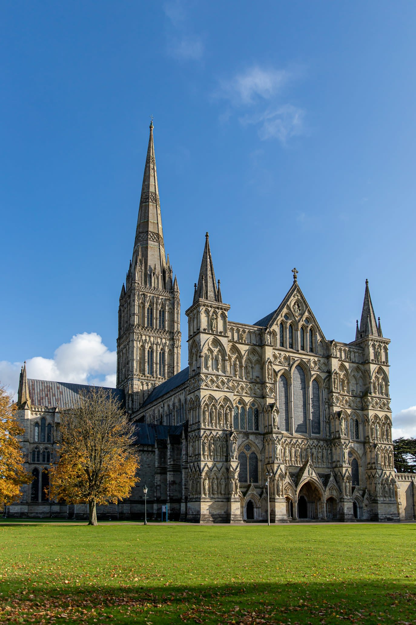
Salisbury Cathedral
Salisbury, England, United Kingdom
Salisbury is a site of sacred significance. Approximate coordinates: 51.06491, -1.79729. Salisbury ( SAWLZ-bər-ee, locally SAWZ-bər-ee) is a cathedral city and civil parish in Wiltshire, England with a population of 41,820, at the confluence of the rivers Avon, Nadder and Bourne. The city is approximately 20 miles (30 kilometres) from Southampton and 30 miles (50 kilometres) from Bath. Salisbury is in the southeast of Wiltshire, near the edge of Salisbury Plain. An ancient cathedral was north of the present city at Old Sarum. A new cathedral was built near the meeting of the rivers and a settlement grew up around it, which received a city charter in 1227 as New Sarum. This continued to be its official name until 2009, when Salisbury City Council was established. Salisbury railway station is an interchange between the West of England Line and the Wessex Main Line. Stonehenge, a UNESCO World Heritage Site, is 8 miles (13 kilometres) northwest of Salisbury. Located in England, United Kingdom.
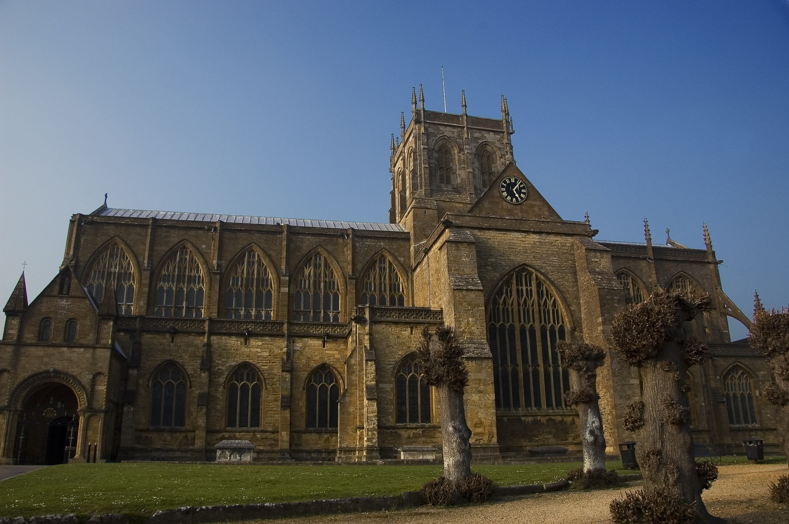
Sherborne Abbey
Sherborne, England, United Kingdom
Sherborne Abbey is a site of sacred significance. Approximate coordinates: 50.94671, -2.51663. Sherborne Abbey, otherwise the Abbey Church of St. Mary the Virgin, is a Church of England church in Sherborne in the English county of Dorset. It was a Saxon cathedral (705–1075), a Benedictine abbey church (998–1539), before becoming a Church of England parish church in 1539 during the dissolution of the monasteries. Located in England, United Kingdom.
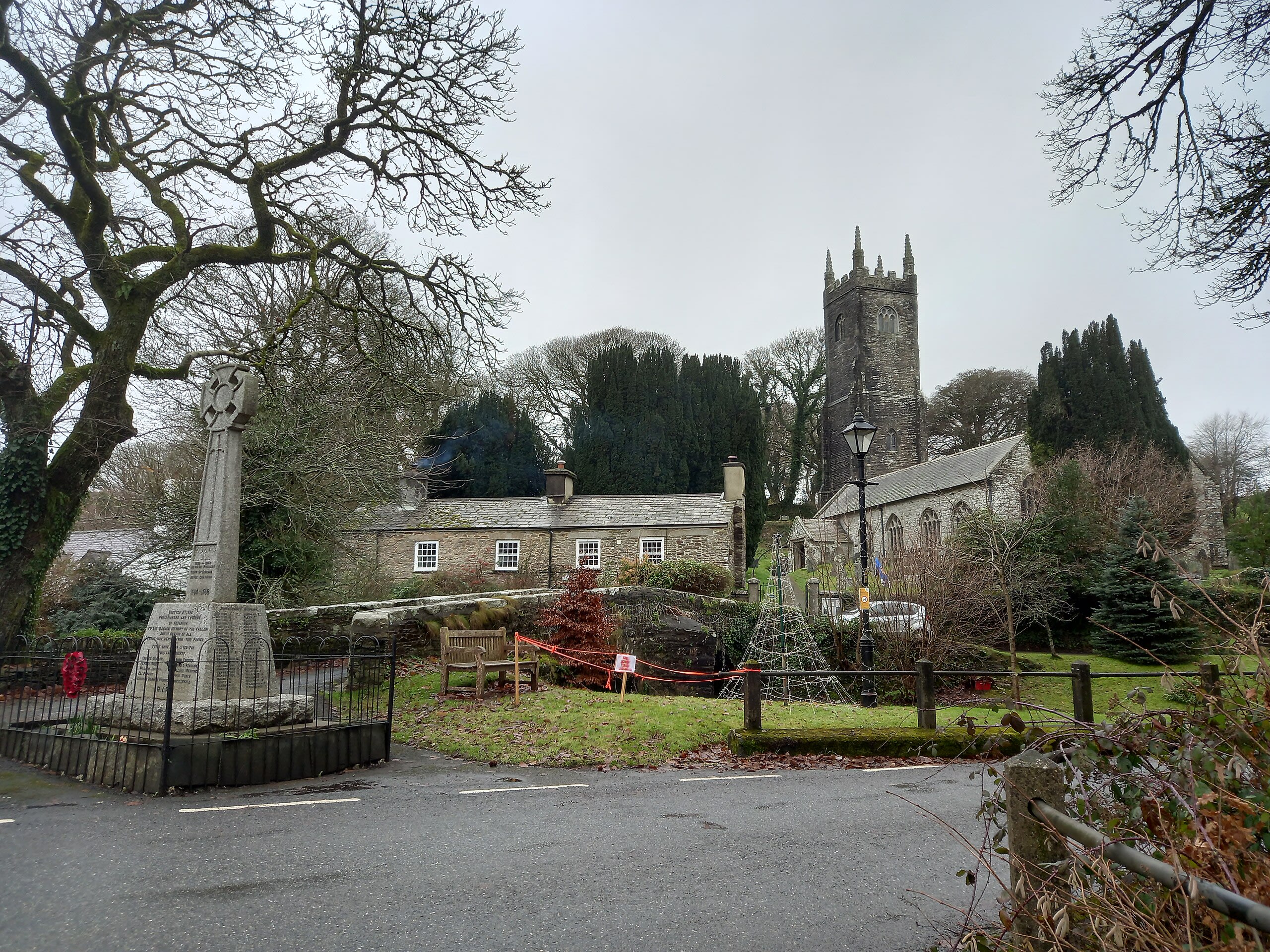
St Nonna’s Church, Altarnun
Altarnun, England, United Kingdom
St Nonna’s Church, Altarnun is a site of sacred significance. Approximate coordinates: 50.60462, -4.51291. Located in England, United Kingdom.
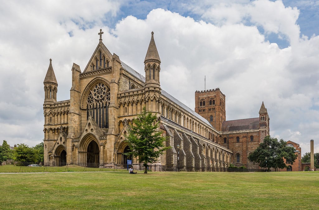
St. Albans Cathedral, St Albans, United Kingdom
St Albans, England, United Kingdom
St. Albans Cathedral, St Albans, United Kingdom is a site of sacred significance. Approximate coordinates: 51.75046, -0.34234. Located in St Albans, England, United Kingdom.

St. Albans Cathedral, St. Albans, England
St Albans, England, United Kingdom
St. Albans Cathedral, St. Albans, England is a site of sacred significance. Approximate coordinates: 51.75046, -0.34234. Located in St Albans, England, United Kingdom.
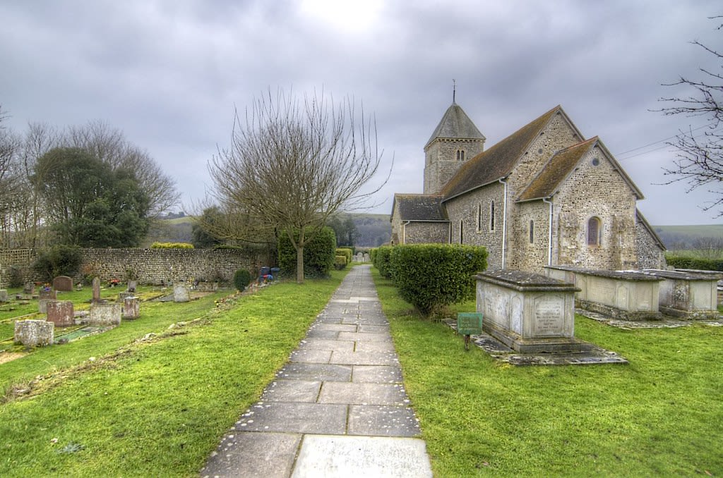
St. Andrew’s Church, Bishopstone, England
Seaford, England, United Kingdom
St. Andrew’s Church, Bishopstone, England is a site of sacred significance. Approximate coordinates: 50.78973, 0.08760. Located in Lewes, England, United Kingdom.
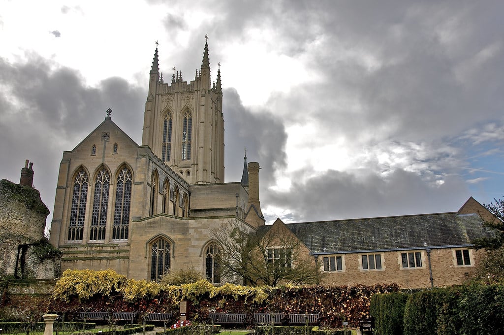
St. Edmundsbury Cathedral
West Suffolk, England, United Kingdom
St. Edmundsbury Cathedral is a site of sacred significance. Approximate coordinates: 52.24389, 0.71722. St Edmundsbury Cathedral (formally entitled the Cathedral Church of St James and St Edmund) is the cathedral for the Church of England s Diocese of St Edmundsbury and Ipswich. It is the seat of the Bishop of St Edmundsbury and Ipswich and is in Bury St Edmunds in Suffolk. Originating in the 11th century, it was rebuilt in the 12th and 16th centuries as a parish church and became a cathedral in 1914; it has been considerably enlarged in recent decades. Located in West Suffolk, England, United Kingdom.
St. Eustachius Church
West Devon, England, United Kingdom
St. Eustachius Church is a site of sacred significance. Approximate coordinates: 50.54985, -4.14517. Located in West Devon, England, United Kingdom.
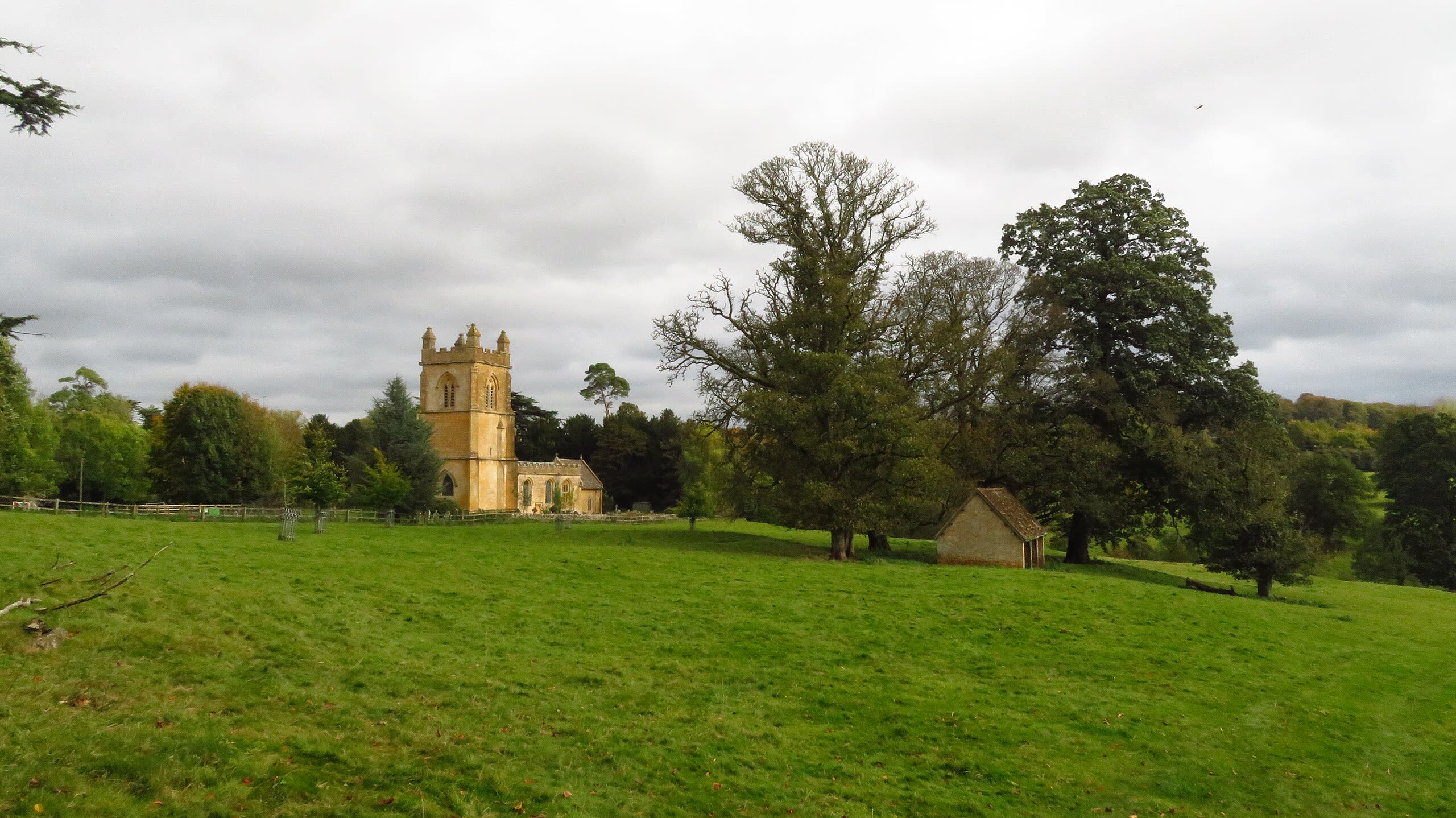
St. Mary Church, Temple Guitling
Cotswold District, England, United Kingdom
St. Mary Church, Temple Guitling is a site of sacred significance. Approximate coordinates: 51.94903, -1.86849. Located in Cotswold, England, United Kingdom.
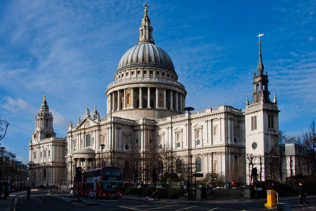
St. Paul’s Cathedral, London, England
City of London, England, United Kingdom
St. Paul’s Cathedral, London, England is a site of sacred significance. Approximate coordinates: 51.51385, -0.09835. Located in City of London, England, United Kingdom.
St. Withburga’s Well
Breckland District, England, United Kingdom
St. Withburga’s Well is a site of sacred significance. Approximate coordinates: 52.68102, 0.93735. Located in Breckland, England, United Kingdom.
Stanton Drew stone ring
Stanton Drew, England, United Kingdom
Stanton Drew stone ring is a site of sacred significance. Approximate coordinates: 51.36737, -2.57556. Located in England, United Kingdom.
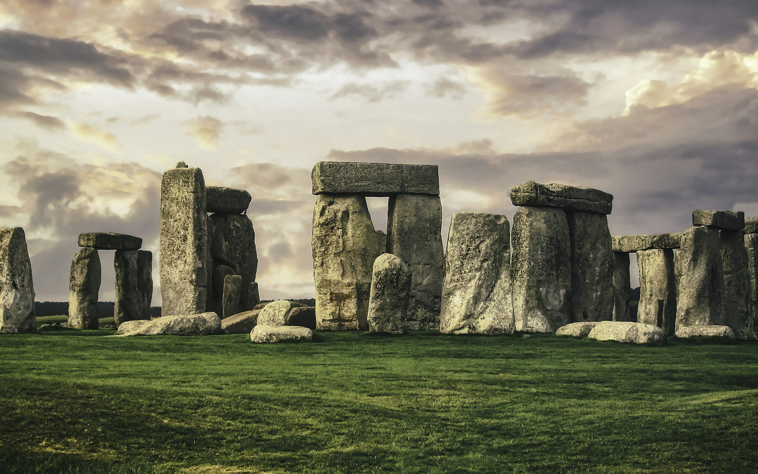
Stonehenge
West Amesbury, England, United Kingdom
Stonehenge is a site of sacred significance. Approximate coordinates: 51.17888, -1.82621. Stonehenge is a prehistoric megalithic structure on Salisbury Plain in Wiltshire, England, two miles (3 km) west of Amesbury. It consists of an outer ring of vertical sarsen standing stones, each around 13 feet (4.0 m) high, seven feet (2.1 m) wide, and weighing around 25 tons, topped by connecting horizontal lintel stones, held in place with mortise and tenon joints, a feature unique among contemporary monuments. Inside is a ring of smaller bluestones. Inside these are free-standing trilithons, two bulkier vertical sarsens joined by one lintel. The whole monument, now ruinous, is aligned towards the sunrise on the summer solstice and sunset on the winter solstice. The stones are set within earthworks in the middle of the densest complex of Neolithic and Bronze Age monuments in England, including several hundred tumuli (burial mounds). Stonehenge was constructed in several phases beginning about 3100 BC and continuing until about 1600 BC. The famous circle of large sarsen stones were placed between 2600 BC and 2400 BC. The surrounding circular earth bank and ditch, which constitute the earliest phase of the monument, have been dated to about 3100 BC. Radiocarbon dating suggests that the bluestones were given their current positions between 2400 and 2200 BC, although they may have been at the site as early as 3000 BC. One of the most famous landmarks in the United Kingdom, Stonehenge is regarded as a British cultural icon. It has been a legally protected scheduled monument since the Ancient Monuments Protection Act 1882 was passed. The site and its surroundings were added to UNESCO s list of World Heritage Sites in 1986. Stonehenge is owned by the Crown and managed by English Heritage; the surrounding land is owned by the National Trust. Stonehenge could have been a burial ground from its earliest beginnings. Deposits containing human bone date from as early as 3000 BC, when the ditch and bank were first dug, and continued for at least another 500 years. Located in England, United Kingdom.
Swinside Stone Circle
Cumberland, England, United Kingdom
Swinside Stone Circle is a site of sacred significance. Approximate coordinates: 54.28249, -3.27393. Located in England, United Kingdom.
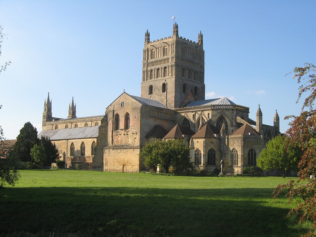
Tewkesbury Abbey
Tewkesbury, England, United Kingdom
Tewkesbury Abbey is a site of sacred significance. Approximate coordinates: 51.99034, -2.16088. The Abbey Church of St Mary the Virgin, Tewkesbury, commonly known as Tewkesbury Abbey, is located in the town of Tewkesbury in the ceremonial county of Gloucestershire, England. A former Benedictine monastery, it is now a parish church. Considered one of the finest examples of Norman architecture in Britain, it has probably the largest and finest Romanesque crossing tower in England. Tewkesbury had been a centre for worship since the 7th century. A priory was established there in the 10th century. The present building was started in the early 12th century. It was unsuccessfully used as a sanctuary in the Wars of the Roses. After the dissolution of the monasteries, Tewkesbury Abbey became the parish church for the town. George Gilbert Scott led the restoration of the building in the late 19th century. The church and churchyard within the abbey precincts include tombs and memorials to many of the aristocracy of the area. Services have been high church but now include Parish Eucharist, choral Mass, and Evensong. These services are accompanied by one of the church s three organs and choirs. There is a ring of twelve bells, hung for change ringing. Located in Tewkesbury, England, United Kingdom.
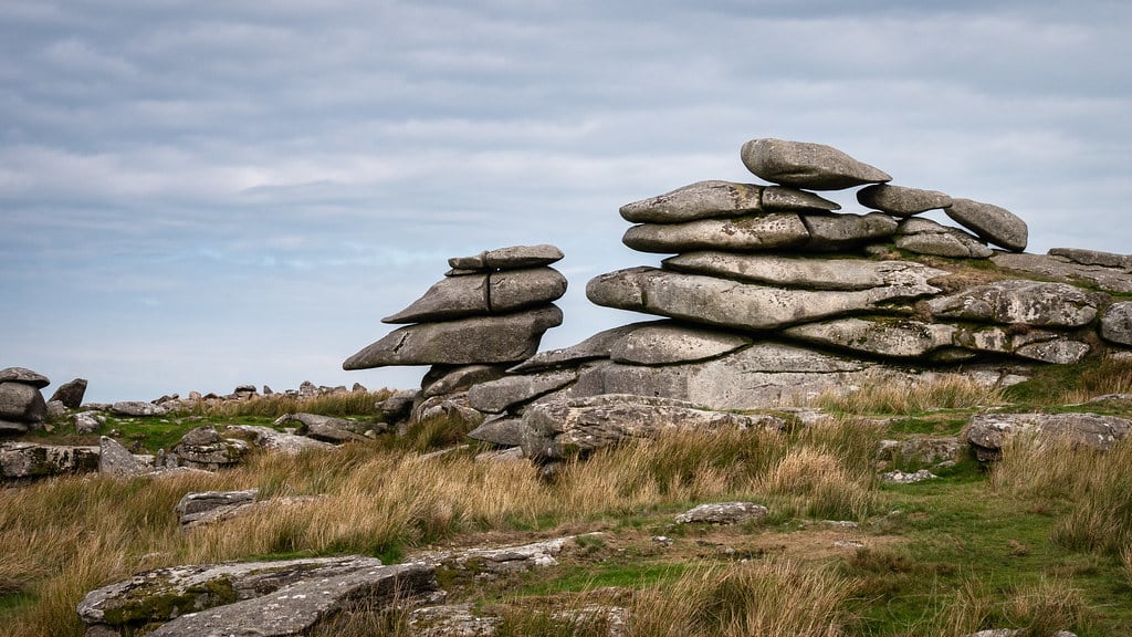
The Cheesewring
Henwood, England, United Kingdom
The Cheesewring is a site of sacred significance. Approximate coordinates: 50.52537, -4.45930. The Cheesewring (Cornish: Keuswask) is a granite tor in Cornwall, England, situated on the eastern flank of Bodmin Moor on Stowe s Hill in the parish of Linkinhorne approximately one mile northwest of the village of Minions and four miles (6 km) north of Liskeard. It is a natural geological formation, a rock outcrop of granite slabs formed by weathering. The name derives from the resemblance of the piled slabs to a stack of cheeses in a traditional cider press. Wilkie Collins described the Cheesewring in 1861 in his book Rambles Beyond Railways: If a man dreams of a great pile of stones in a nightmare, he would dream of such a pile as the Cheesewring. All the heaviest and largest of the seven thick slabs of which it is composed are at the top; all the lightest and smallest at the bottom. It rises perpendicularly to a height of thirty-two feet, without lateral support of any kind. The fifth and sixth rocks are of immense size and thickness, and overhang fearfully all round the four lower rocks which support them. All are perfectly irregular; the projections of one do not fit into the interstices of another; they are heaped up loosely in their extraordinary top-heavy form on slanting ground, half way down a steep hill. Located adjacent to the Cheesewring Quarry (which supplied the granite cladding for the structure of Tower Bridge, London) and surrounded by other granite formations, this landmark was threatened with destruction in the late nineteenth century by the proximity of blasting operations, but was saved as a result of local activism. Located in England, United Kingdom.
The Devils Arrows
Boroughbridge, England, United Kingdom
The Devils Arrows is a site of sacred significance. Approximate coordinates: 54.09323, -1.40370. Located in England, United Kingdom.

Tintagel
Tintagel, England, United Kingdom
Tintagel is a site of sacred significance. Approximate coordinates: 50.66728, -4.75851. Located in England, United Kingdom.
Trethevy Quoit
St Cleer, England, United Kingdom
Trethevy Quoit is a site of sacred significance. Approximate coordinates: 50.49320, -4.45540. Trethevy Quoit (Cornish: Koyt Tredhewi) is a well-preserved megalithic structure between St Cleer and Darite in Cornwall, England, United Kingdom. It is known locally as the giant s house . Standing 9 feet (2.7 m) high, it consists of five standing stones capped by a large slab and was added to the Heritage at Risk Register in 2017. Located in England, United Kingdom.
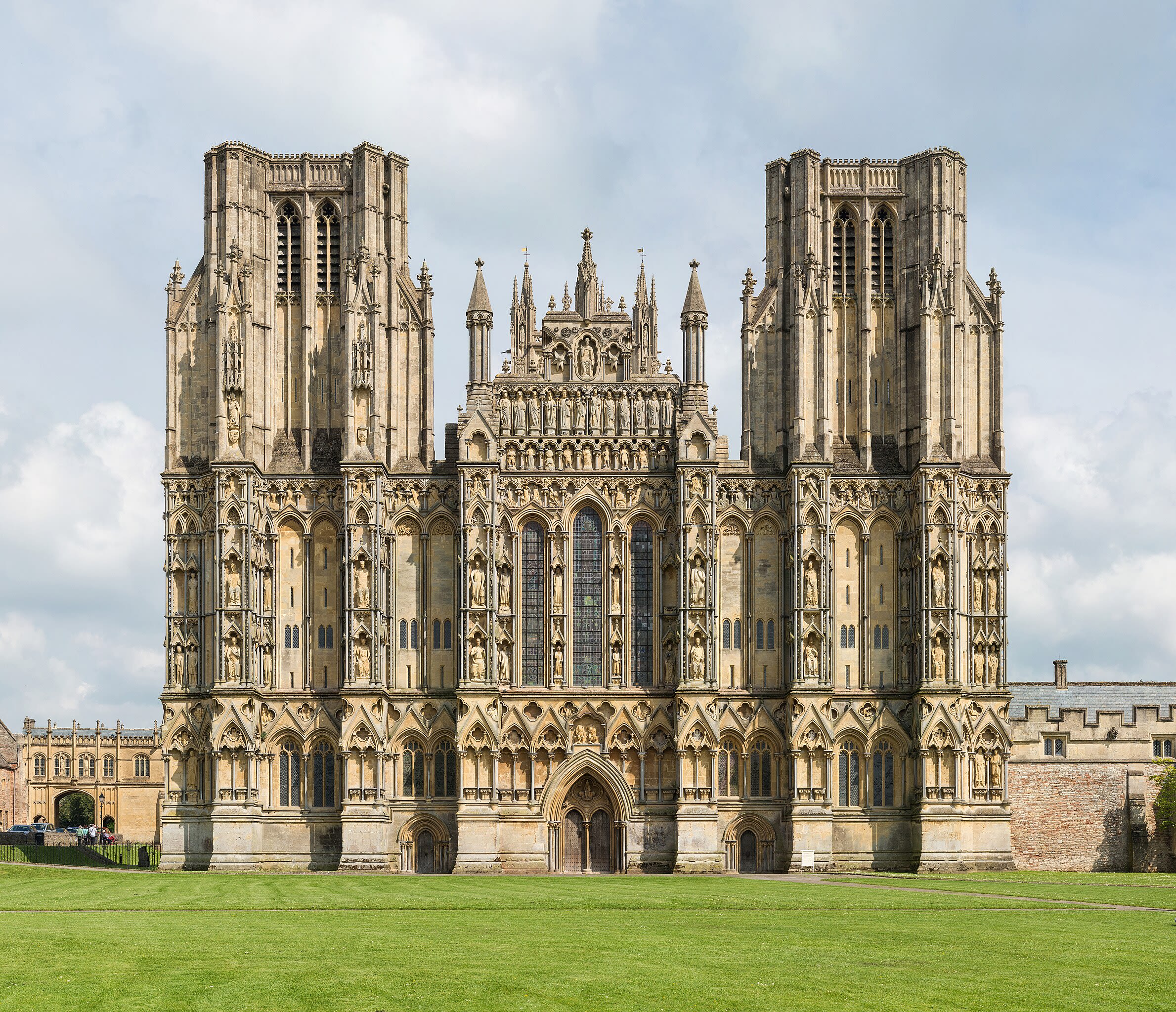
Wells Cathedral
Wells, England, United Kingdom
Wells Cathedral is a site of sacred significance. Approximate coordinates: 51.21045, -2.64341. Wells Cathedral, formally the Cathedral Church of St Andrew, is a Church of England cathedral in Wells, Somerset, England. It is the seat of the bishop of Bath and Wells and the mother church of the diocese of Bath and Wells. There are daily Church of England services in the building, and in 2023 it was reported to receive over 300,000 visitors per year. The cathedral is a Grade I listed building. The cathedral precincts contain the Bishop s Palace and several buildings linked to its medieval chapter of secular canons, including the fifteenth-century Vicars Close. The earliest record of a church on the present site is a charter of 766. A bishopric was established in 909, however in 1090 the cathedral of the diocese was moved to Bath Abbey and remained there until Wells became co-cathedral in 1218. The remains of the tenth-century cathedral lie to the south of the present building, beneath the cloister. The present cathedral has a cruciform plan with a chapter house attached to the north and a cloister to the south, and is largely the result of two building campaigns which took place between c. 1180 to c. 1260 and c. 1285 to c. 1345. The western half of the cathedral, including the nave and western transepts, belongs primarily to the first building phase and is constructed in the Early English style of Gothic architecture. The east end, including the lady chapel, eastern transepts, chapter house, and central tower, belongs to the second phase and uses the Decorated Gothic style; it also retains much medieval stained glass. Two towers were added to the west front between 1385 and 1410 in the Perpendicular Gothic style, and the cloisters were remodelled in the same style between 1420 and 1508. The cathedral was restored over the course of the nineteenth and early twentieth centuries. Wells has been called unquestionably one of the most beautiful and most poetic of English cathedrals. The architectural historian John Harvey sees it as Europe s first truly Gothic structure, breaking from the last constraints of the Romanesque style. The west front, which contains 300 sculpted figures, has been described by Harvey as the supreme triumph of the combined plastic arts in England , however the architectural historian Nikolaus Pevsner described it as spare , with harsh uprights and horizontals [...] like steel scaffolding . Located in England, United Kingdom.
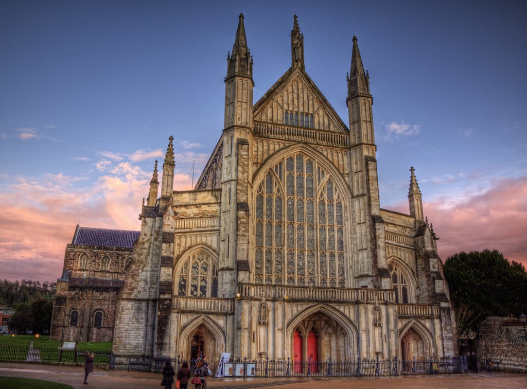
Winchester Cathedral
Winchester, England, United Kingdom
Winchester is a site of sacred significance. Approximate coordinates: 51.06069, -1.31315. Winchester (, ) is a cathedral city in Hampshire, England. The city lies at the heart of the wider City of Winchester, a local government district, at the western end of the South Downs National Park, on the River Itchen. It is 60 miles (97 km) south-west of London and 14 miles (23 km) from Southampton, its nearest city. At the 2021 census, the built-up area of Winchester had a population of 48,478. The wider City of Winchester district includes towns such as Alresford and Bishop s Waltham and had a population of 127,439 in 2021. Winchester is the county town of Hampshire and contains the head offices of Hampshire County Council. Winchester developed from the Roman town of Venta Belgarum, which in turn developed from an Iron Age oppidum. Winchester was one of if not the most important cities in England until the Norman conquest in the eleventh century. It now has become one of the most expensive and affluent areas in the United Kingdom. The city s major landmark is Winchester Cathedral. The city is also home to the University of Winchester and Winchester College, the oldest public school in the United Kingdom still using its original buildings. Located in Winchester, England, United Kingdom.
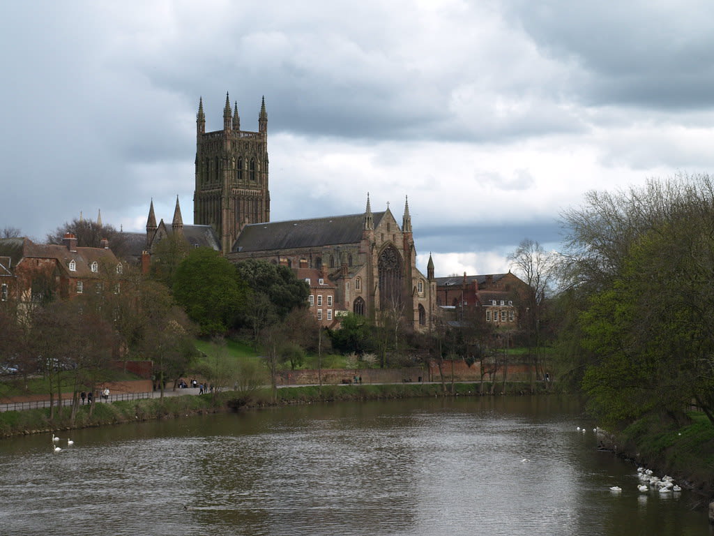
Worcester Cathedral
Worcester, England, United Kingdom
Worcester Cathedral is a site of sacred significance. Approximate coordinates: 52.18873, -2.22071. Worcester Cathedral, formally the Cathedral Church of Christ and Blessed Mary the Virgin, is a Church of England cathedral in Worcester, England. The cathedral is the seat of the bishop of Worcester and is the mother church of the diocese of Worcester; it is administered by its dean and chapter. The cathedral is a grade I listed building and part of a scheduled monument. The cathedral was founded in 680. The earliest surviving fabric dates from 1084, when the cathedral was rebuilt in the Romanesque style by Bishop Wulfstan. The chapter house dates from 1120, and the nave was extended in the 1170s. Between 1224 and 1269 the east end was rebuilt in the Early English Gothic style. The remainder of the nave was rebuilt in the 1360s, and the exquisite central tower completed in 1374. The cathedral retains a set of medieval misericords, now set into Victorian choir stalls; the cathedral was heavily restored in the nineteenth century, and contains a set of furnishings by George Gilbert Scott. It contains several funerary monuments, including those of King John; Arthur, Prince of Wales; and the prime minister Stanley Baldwin. Located in Worcester, England, United Kingdom.
Yockenthwaite stone circle
Buckden, England, United Kingdom
Yockenthwaite stone circle is a site of sacred significance. Approximate coordinates: 54.20990, -2.15508. Located in England, United Kingdom.

York
York, England, United Kingdom
York is a site of sacred significance. Approximate coordinates: 53.96233, -1.08192. York is a cathedral city in North Yorkshire, England, with Roman origins, sited at the confluence of the rivers Ouse and Foss. The city has many historic buildings and other structures, such as a minster, castle, and city walls, all of which are Grade I listed. It is the largest settlement and the administrative centre of the wider City of York district. It is located 27 miles (43 km) north-east of Leeds, 90 miles (140 km) south of Newcastle upon Tyne and 207 miles (333 km) north of London. York s built-up area had a recorded population of 141,685 at the 2021 census. The city was founded under the name of Eboracum in AD 71. It then became the capital of Britannia Inferior, a province of the Roman Empire, and was later the capital of the kingdoms of Deira, Northumbria and Scandinavian York. In the Middle Ages it became the northern England ecclesiastical province s centre, and grew as a wool-trading centre. In the 19th century it became a major railway network hub and confectionery-manufacturing centre. In the Second World War York was bombed in the Baedeker Blitz. Although York was less targeted during the war than other, more industrialised northern cities, several historic buildings were gutted and restoration took place up until the 1960s. Historic local governance of the city was as a county corporate, not included in the county s riding system. The city has since been locally governed as a municipal borough, county borough, and since 1996, a non-metropolitan district (the City of York), which also includes surrounding villages and rural areas, and the town of Haxby. The current district s local council, City of York Council, is responsible for providing all local services and facilities throughout this area. Located in York, England, United Kingdom.
Gloucestershire
1 sites
Gwynedd
4 sites
Clynnog Fawr Dolmen
Clynnog Fawr, Gwynedd, United Kingdom
Clynnog Fawr Dolmen is a dolmen of sacred significance. Approximate coordinates: 53.01968, -4.37403. Attributes: built, cultural, archaeological. Located in Cymru / Wales, United Kingdom.
St. Beuno shrine and well, Clynnog Fawr, Wales
Clynnog Fawr, Gwynedd, United Kingdom
St. Beuno shrine and well, Clynnog Fawr, Wales is a site of sacred significance. Approximate coordinates: 53.02103, -4.36513. Located in Cymru / Wales, United Kingdom.
St. Beuno’s Church and Well, Clynnog Fawr, Wales
Clynnog Fawr, Gwynedd, United Kingdom
St. Beuno’s Church and Well, Clynnog Fawr, Wales is a site of sacred significance. Approximate coordinates: 53.02105, -4.36517. Located in Cymru / Wales, United Kingdom.
St. Mary’s Church, Dolgellau
Dolgellau, Gwynedd, United Kingdom
St. Mary’s Church, Dolgellau is a site of sacred significance. Approximate coordinates: 52.74317, -3.88671. Located in Cymru / Wales, United Kingdom.
Highland
1 sites
Isle of Lewis
1 sites
Midlothian
1 sites

Monmouthshire
2 sites
Harold’s Stones
Trellech, Monmouthshire, United Kingdom
Harold’s Stones is a megalithic site of sacred significance. Approximate coordinates: 51.74277, -2.72659. Attributes: cultural, archaeological. Located in Cymru / Wales, United Kingdom.
The Virtuous Well
Trellech, Monmouthshire, United Kingdom
The Virtuous Well is a site of sacred significance. Approximate coordinates: 51.74248, -2.72113. Located in Cymru / Wales, United Kingdom.
North Ayrshire
6 sites
Auchagallon Curved Cairn
Machrie, North Ayrshire, United Kingdom
Auchagallon Curved Cairn in Machrie, North Ayrshire, United Kingdom.
Auchencar Standing Stone
Machrie, North Ayrshire, United Kingdom
Auchencar Standing Stone in Machrie, North Ayrshire, United Kingdom.
Giants' Graves
Whiting Bay, North Ayrshire, United Kingdom
Giants' Graves in Whiting Bay, North Ayrshire, United Kingdom.
Machrie Moor Stone Circles
Machrie, North Ayrshire, United Kingdom
Machrie Moor Stone Circles in Machrie, North Ayrshire, United Kingdom.
Moss Farm Road Stone Circle
Machrie, North Ayrshire, United Kingdom
Moss Farm Road Stone Circle in Machrie, North Ayrshire, United Kingdom.
Torrylin Cairn
Kilmory, North Ayrshire, United Kingdom
Torrylin Cairn in Kilmory, North Ayrshire, United Kingdom.
Northern Ireland
11 sites

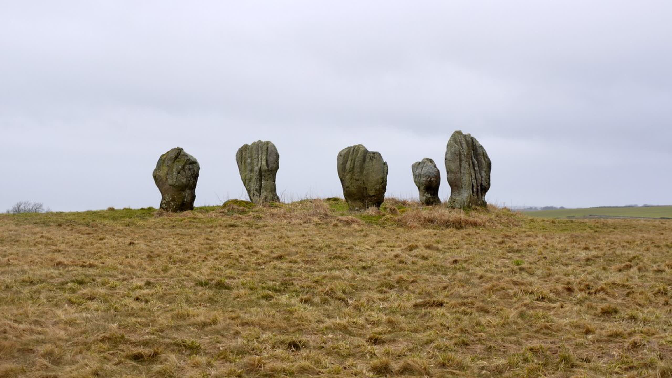
Ballynaglogh Standing Stones, Ballycastle, Northern Ireland
Ballyvoy, Northern Ireland, United Kingdom
Ballynaglogh Standing Stones, Ballycastle, Northern Ireland is a standing stones of sacred significance. Approximate coordinates: 55.20063, -6.19803. Attributes: built, cultural, archaeological. Located in Causeway Coast and Glens District, Northern Ireland / Tuaisceart Éireann, United Kingdom.
Ballynoe Stone Circle, Downpatrick, Ireland
Downpatrick, Northern Ireland, United Kingdom
Ballynoe Stone Circle, Downpatrick, Ireland is a stone circle of sacred significance. Approximate coordinates: 54.29072, -5.72588. Attributes: built, cultural, archaeological. Located in Northern Ireland / Tuaisceart Éireann, United Kingdom.
Cranfield Church, Antrim, Northern Ireland
Antrim and Newtownabbey District, Northern Ireland, United Kingdom
Cranfield Church, Antrim, Northern Ireland is a church of sacred significance. Approximate coordinates: 54.70415, -6.36343. Attributes: built, cultural. Tradition: Christianity. Located in Antrim and Newtownabbey District, Northern Ireland / Tuaisceart Éireann, United Kingdom.

Downpatrick
Downpatrick, Northern Ireland, United Kingdom
Downpatrick is a town of sacred significance. Approximate coordinates: 54.32382, -5.67662. Attributes: built, cultural, pilgrimage. Tradition: Christianity. Associated figure: St. Patrick. Downpatrick (from Irish Dún Pádraig, meaning Patrick s fort ) is a town in County Down, Northern Ireland. It is on the Lecale peninsula, about 21 mi (34 km) south of Belfast. In the Middle Ages, it was the capital of the Dál Fiatach, the main ruling dynasty of Ulaid. Its cathedral is said to be the burial place of Saint Patrick. Today, it is the county town of Down and the joint headquarters of Newry, Mourne and Down District Council. Downpatrick had a population of 11,545 according to the 2021 Census. Located in Northern Ireland / Tuaisceart Éireann, United Kingdom.
Drumskinny Stone Circle, Drumskinny, Ireland
County Fermanagh, Northern Ireland, United Kingdom
Drumskinny Stone Circle, Drumskinny, Ireland is a stone circle of sacred significance. Approximate coordinates: 54.58431, -7.69009. Attributes: built, cultural, archaeological. Located in Northern Ireland / Tuaisceart Éireann, United Kingdom.
Eamhain Mhacha
Armagh, Northern Ireland, United Kingdom
Eamhain Mhacha is a fort of sacred significance. Approximate coordinates: 54.34785, -6.69740. Attributes: built, cultural, archaeological, ceremonial. Tradition: pagan. Mythological context: Ulaidh. Located in Armagh, Northern Ireland / Tuaisceart Éireann, United Kingdom.
Giant’s Ring, Belfast, Northern Ireland
Belfast, Northern Ireland, United Kingdom
Giant’s Ring, Belfast, Northern Ireland is a henge of sacred significance. Approximate coordinates: 54.54024, -5.94994. Attributes: built, cultural, archaeological, ceremonial. Tradition: Prehistoric. Located in Belfast City District, Northern Ireland / Tuaisceart Éireann, United Kingdom.

Navan megalithic era site, Armagh, Ireland
Armagh, Northern Ireland, United Kingdom
Navan megalithic era site, Armagh, Ireland is a site of sacred significance. Approximate coordinates: 54.34370, -6.70216. Located in Armagh, Northern Ireland / Tuaisceart Éireann, United Kingdom.
St. Patrick’s Cathedral, Armagh, Ireland
Armagh, Northern Ireland, United Kingdom
St. Patrick’s Cathedral, Armagh, Ireland is a site of sacred significance. Approximate coordinates: 54.35264, -6.65897. Located in Armagh, Northern Ireland / Tuaisceart Éireann, United Kingdom.
St. Patrick’s Holy Well, Belcoo, Ireland
Belcoo, Northern Ireland, United Kingdom
St. Patrick’s Holy Well, Belcoo, Ireland is a site of sacred significance. Approximate coordinates: 54.30604, -7.88388. Located in Northern Ireland / Tuaisceart Éireann, United Kingdom.
Struell Wells, Downpatrick, Northern Ireland
Downpatrick, Northern Ireland, United Kingdom
Struell Wells, Downpatrick, Northern Ireland is a site of sacred significance. Approximate coordinates: 54.32400, -5.67744. Located in Northern Ireland / Tuaisceart Éireann, United Kingdom.
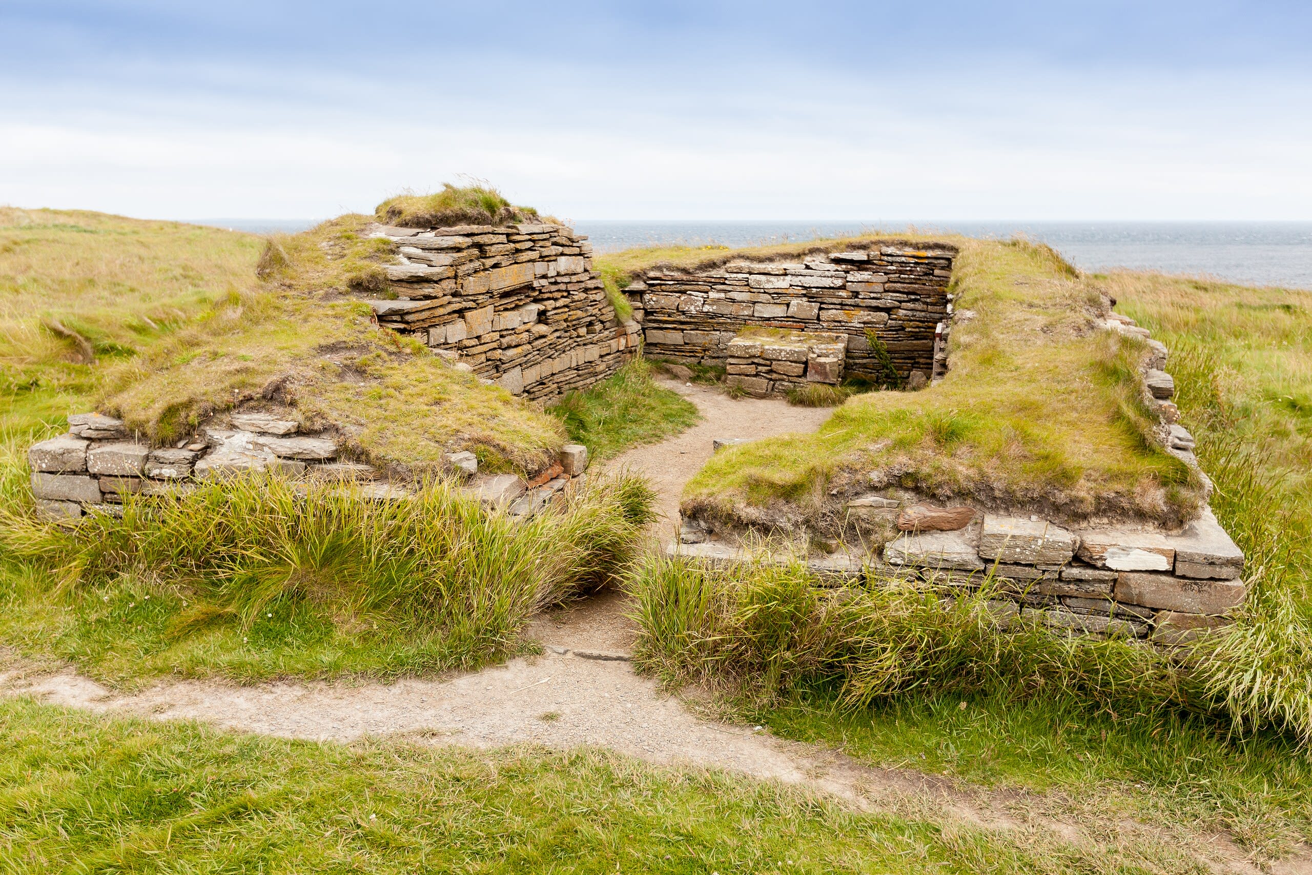
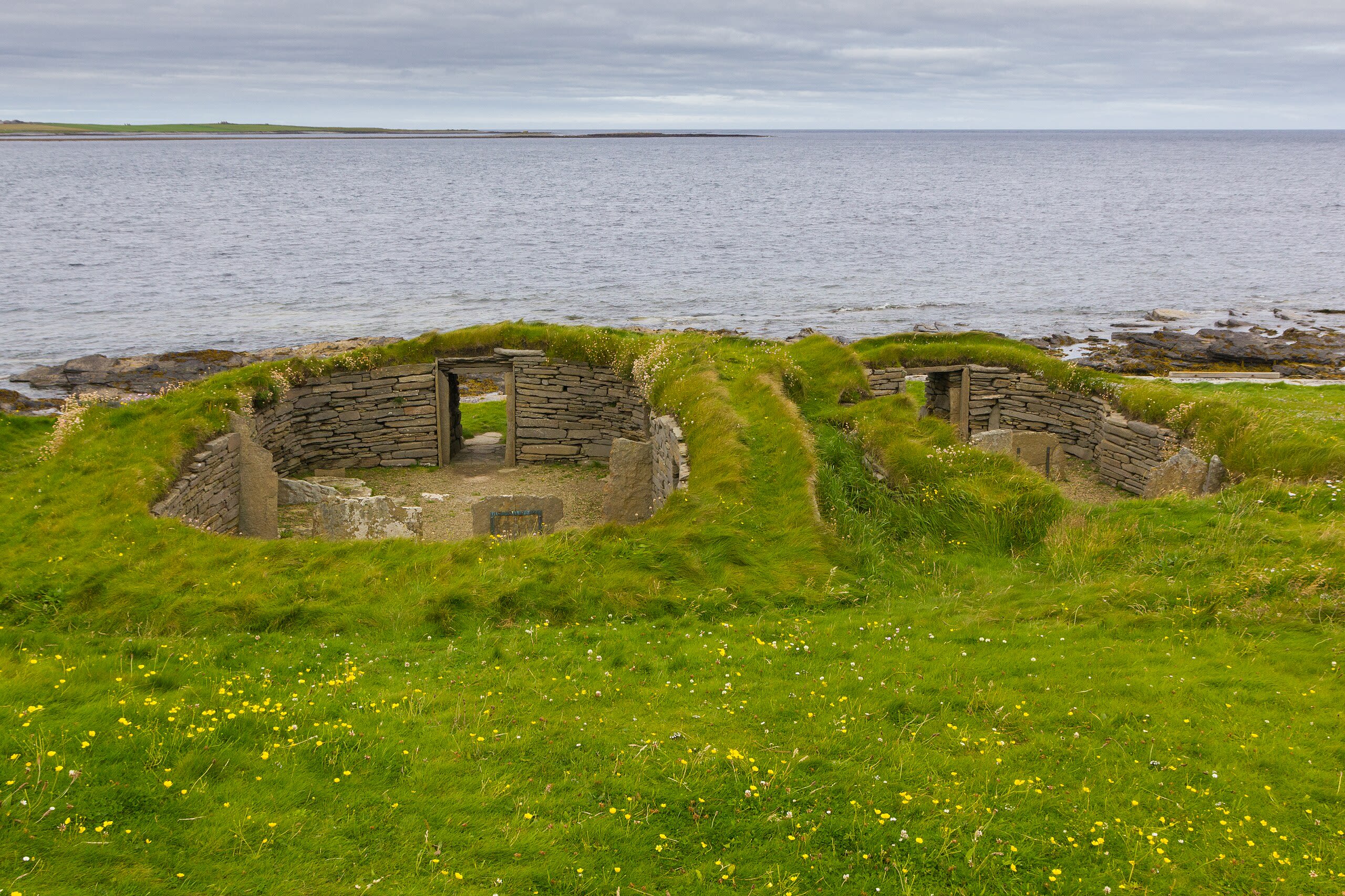
Orkney
2 sites
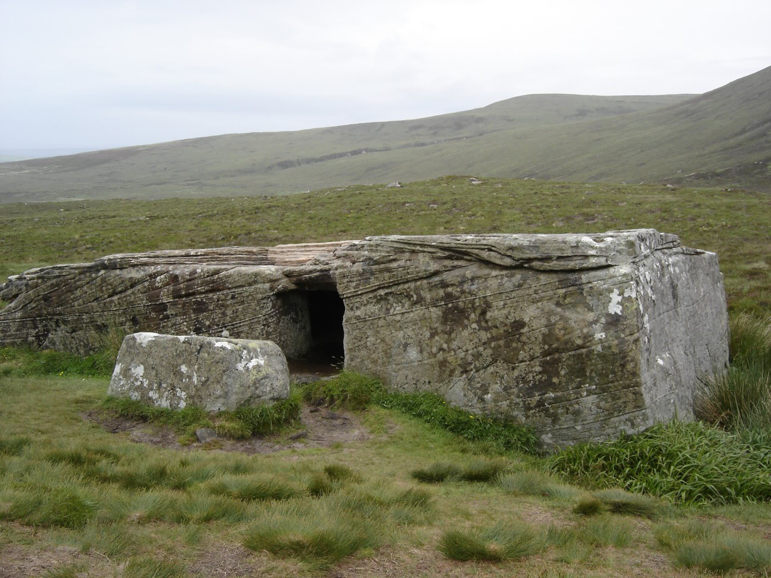
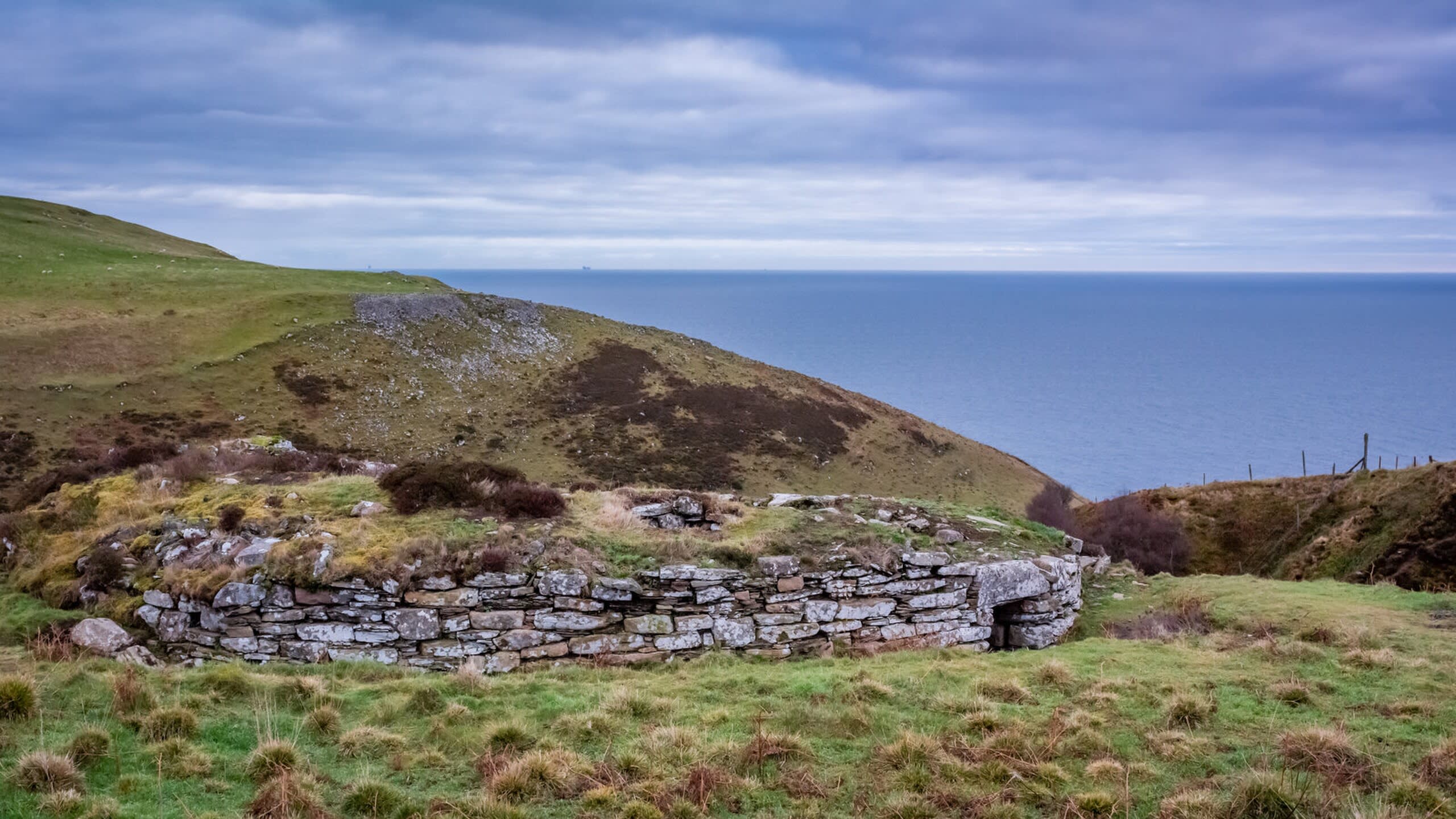
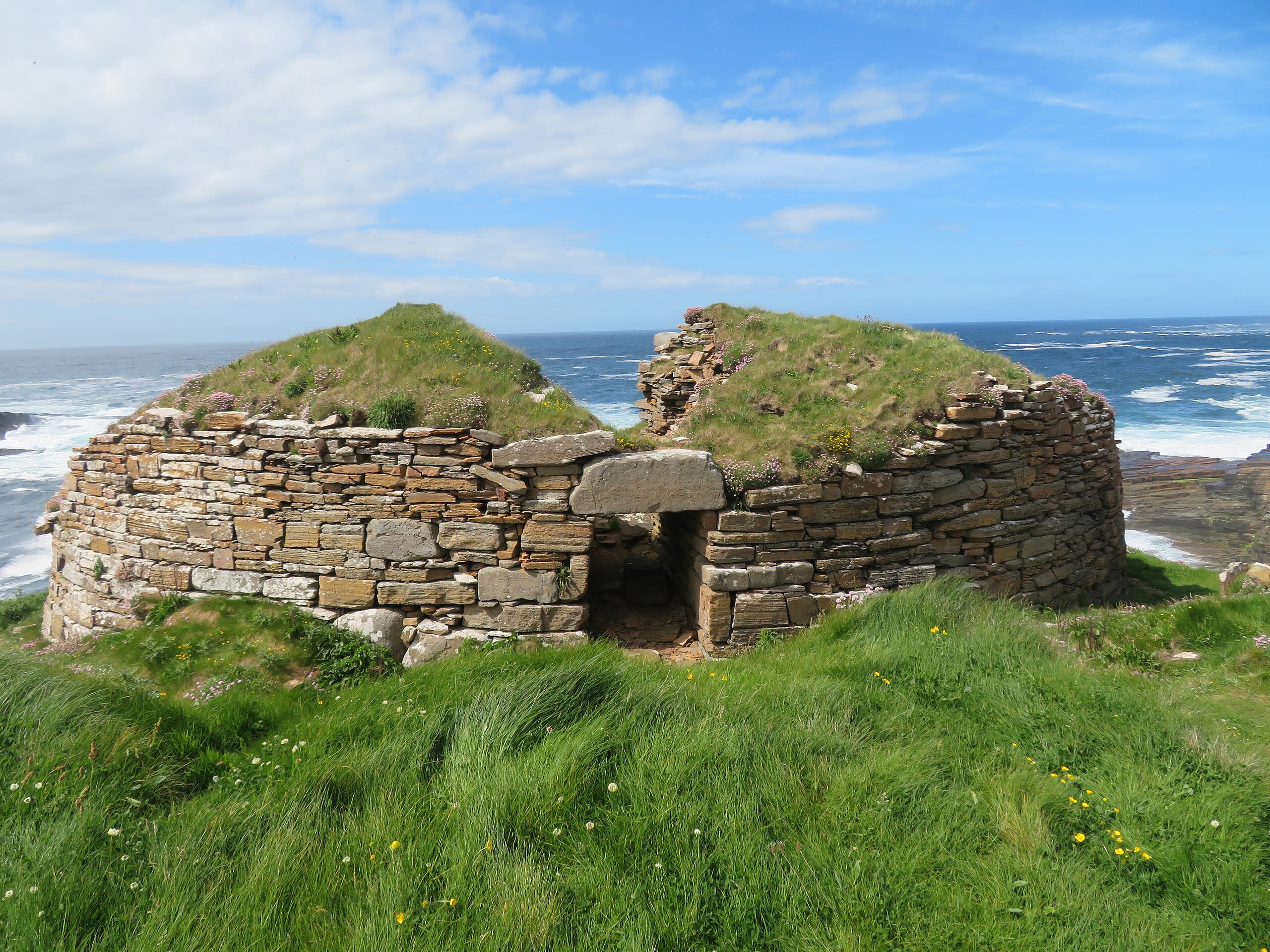
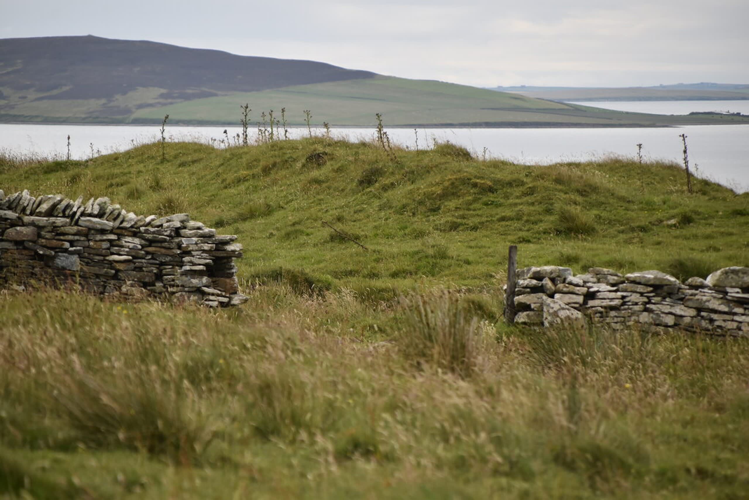
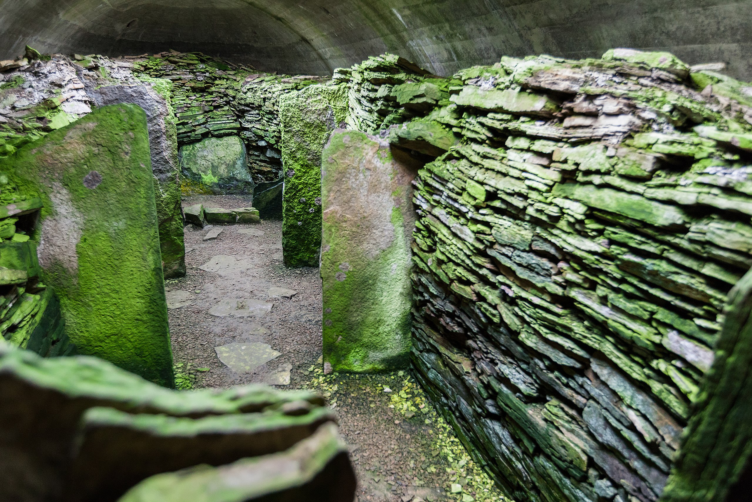
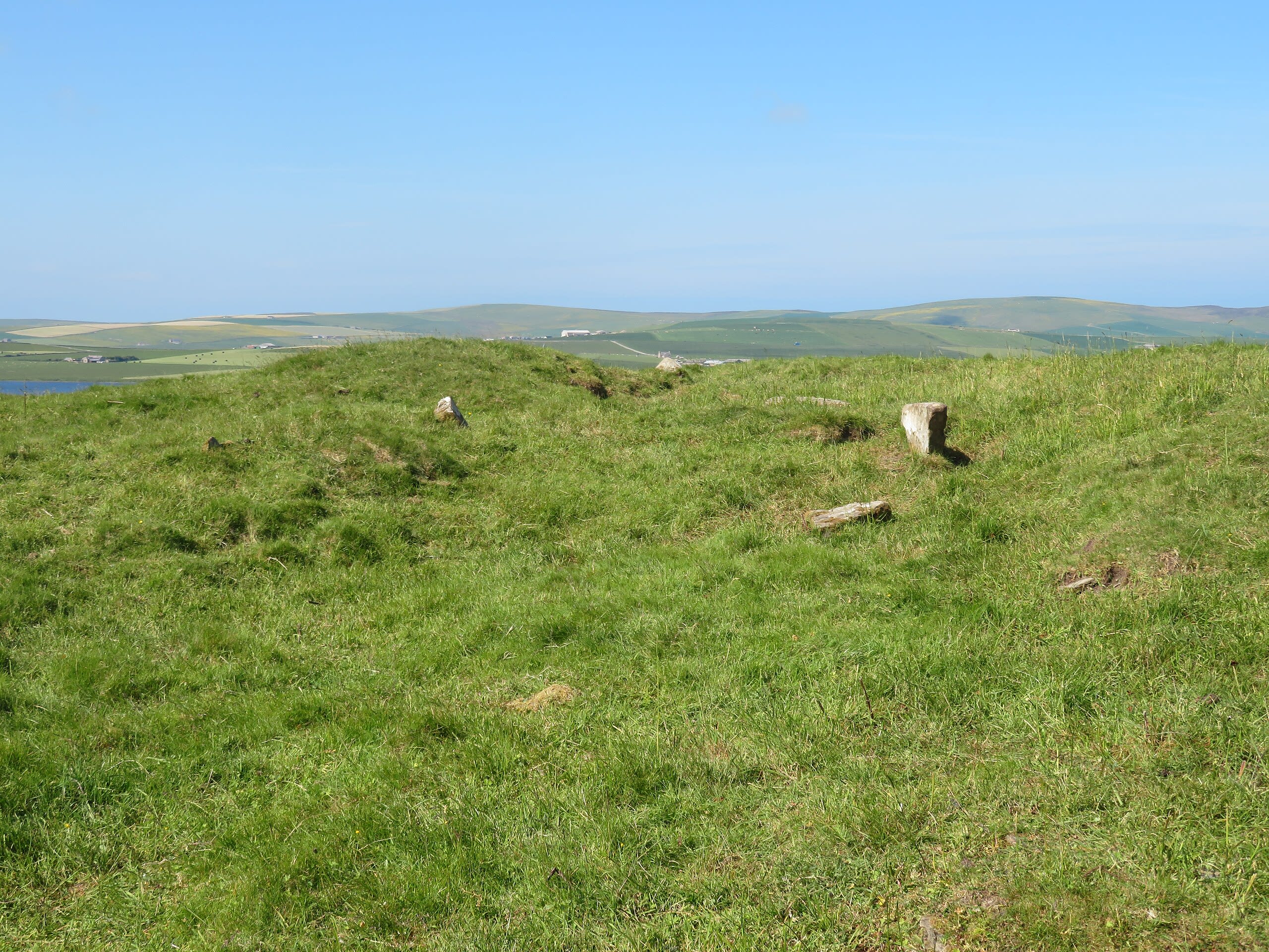
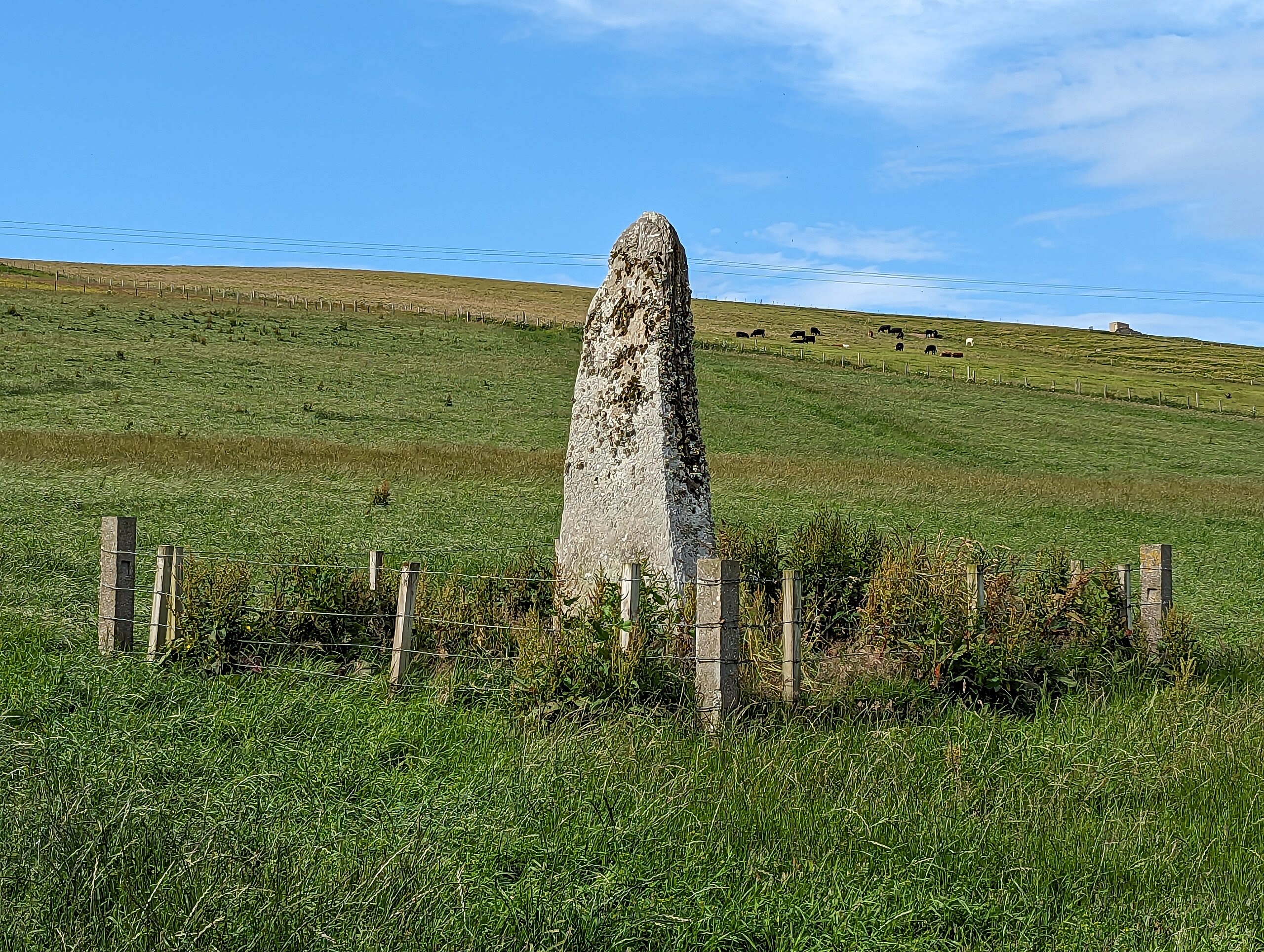
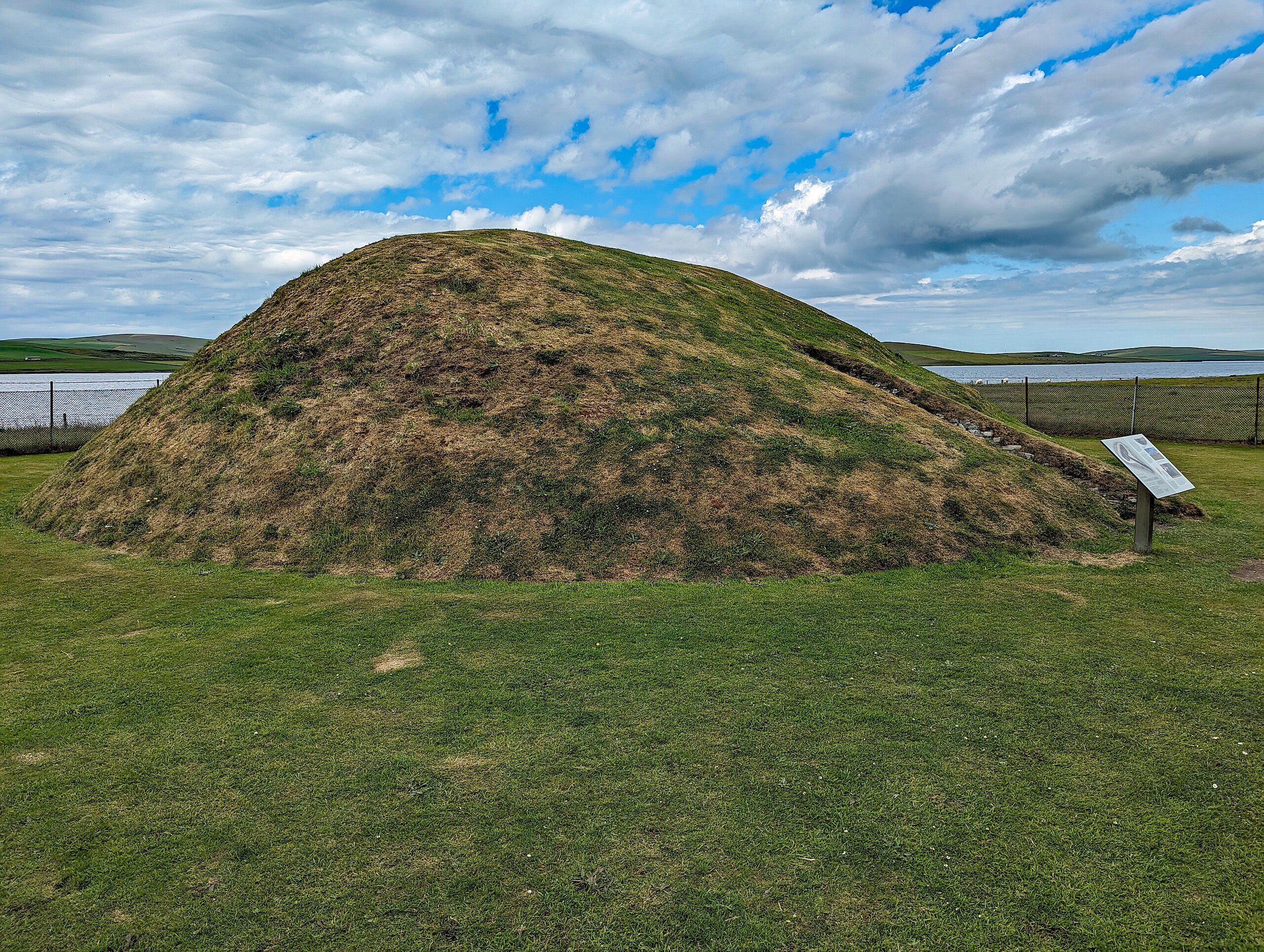
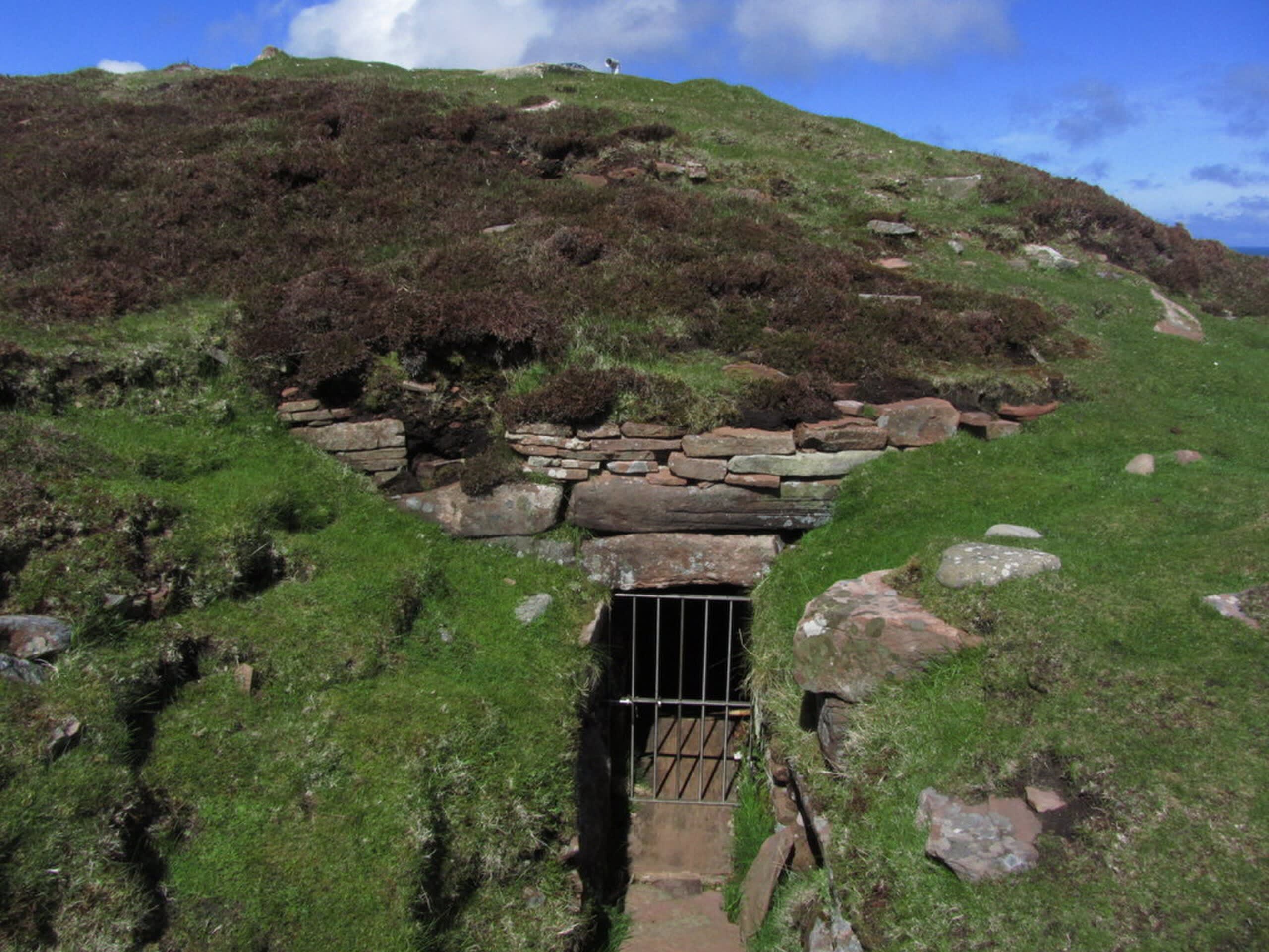
Dwarfie Stane (Dwarf's Stone)
Hoy, Orkney, United Kingdom
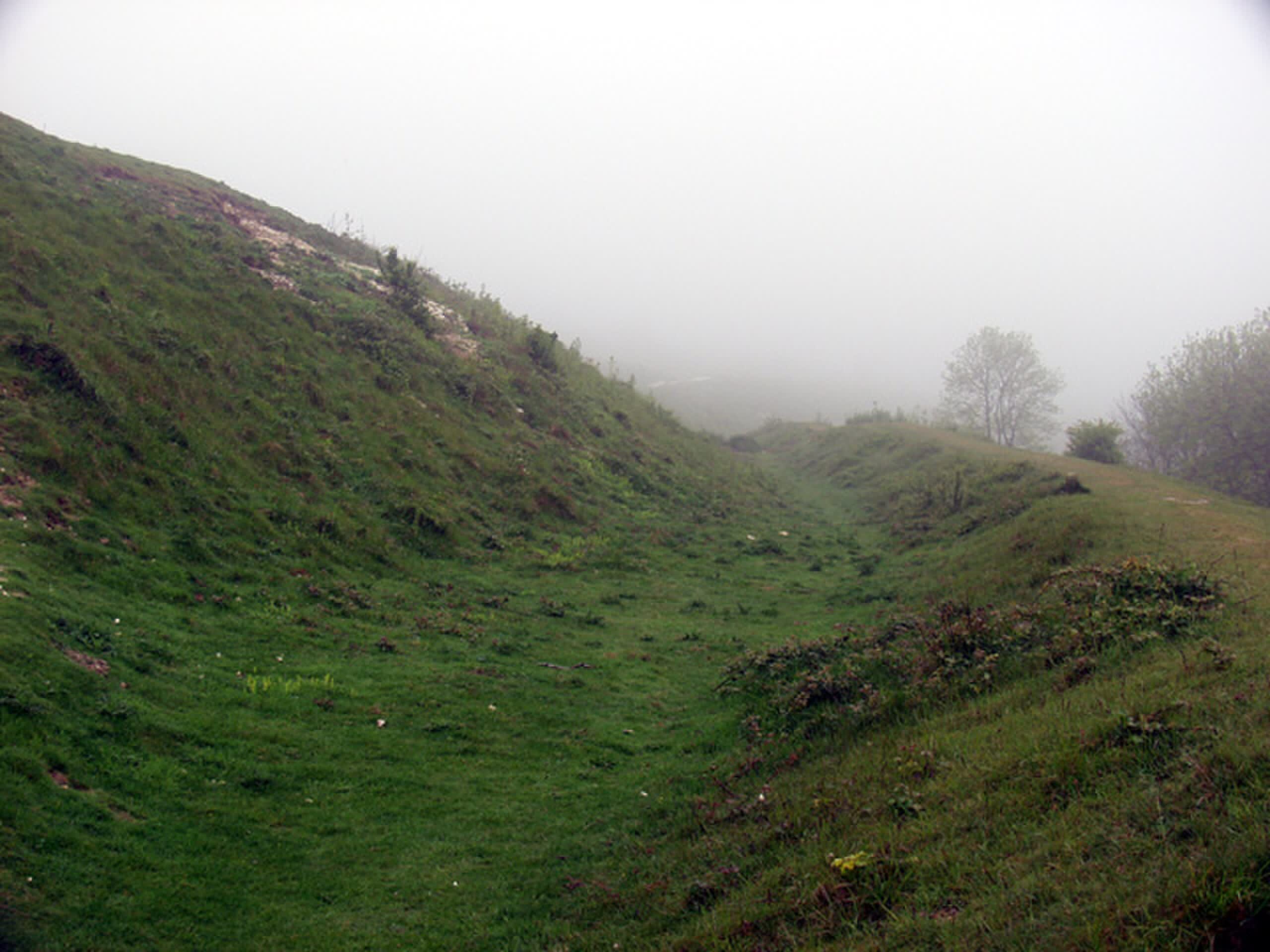
In a steep-sided valley on the island of Hoy, a massive block of red sandstone lies in desolate peatland. Look closer and you find an entrance—a square opening cut into the rock. Enter if you can fit, and you crawl into a chamber hollowed out 5,000 years ago using only stone tools and antler picks. This is the Dwarfie Stane, the only Neolithic rock-cut tomb in Britain. Norse settlers called it Dvergasteinn, the Dwarf Stone, associating it with supernatural beings who lived in rock. The cramped chambers seemed fit for diminutive creatures. Today's visitors squeeze through the same entrance, occupying space shaped by Neolithic hands.
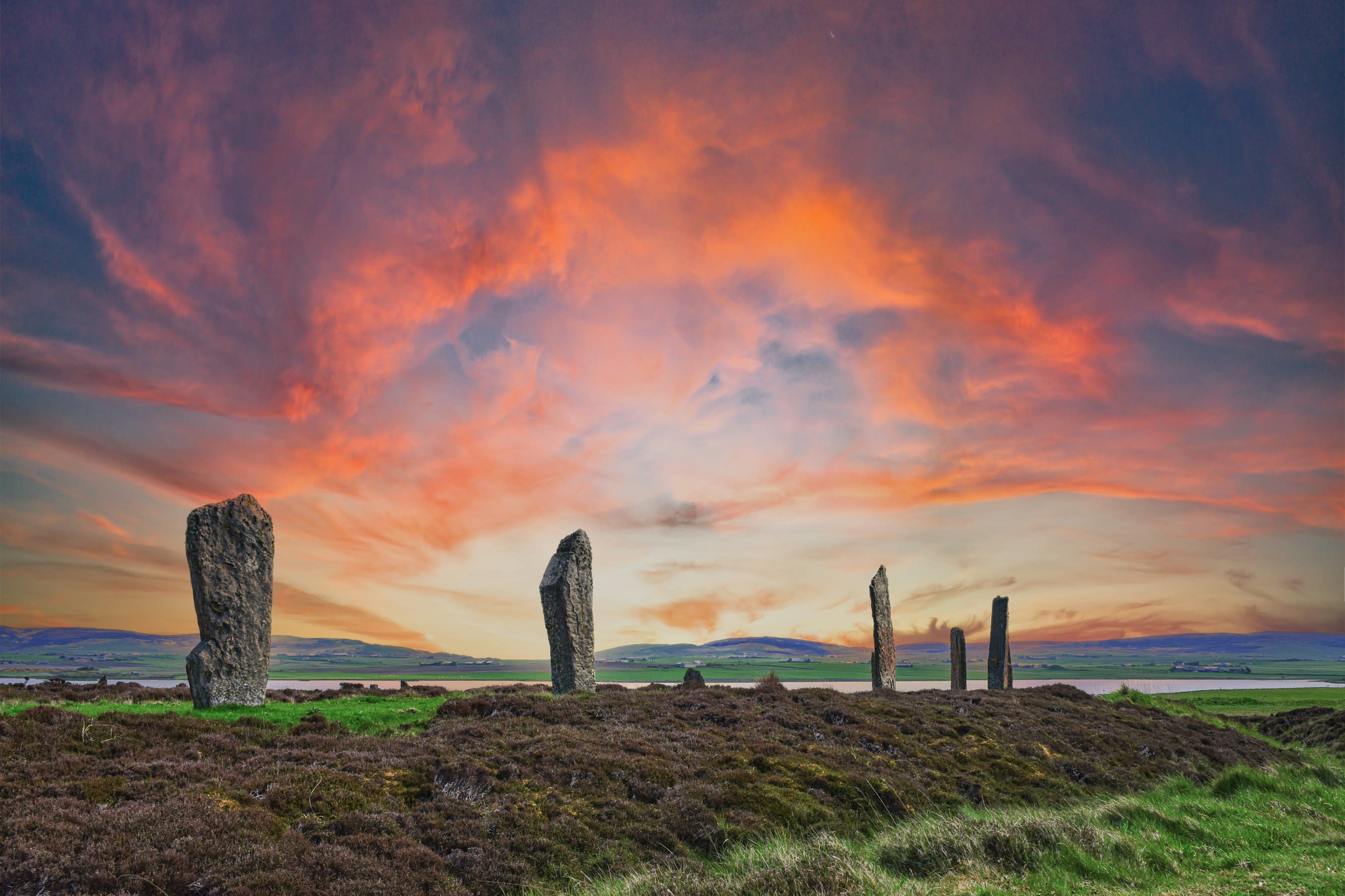
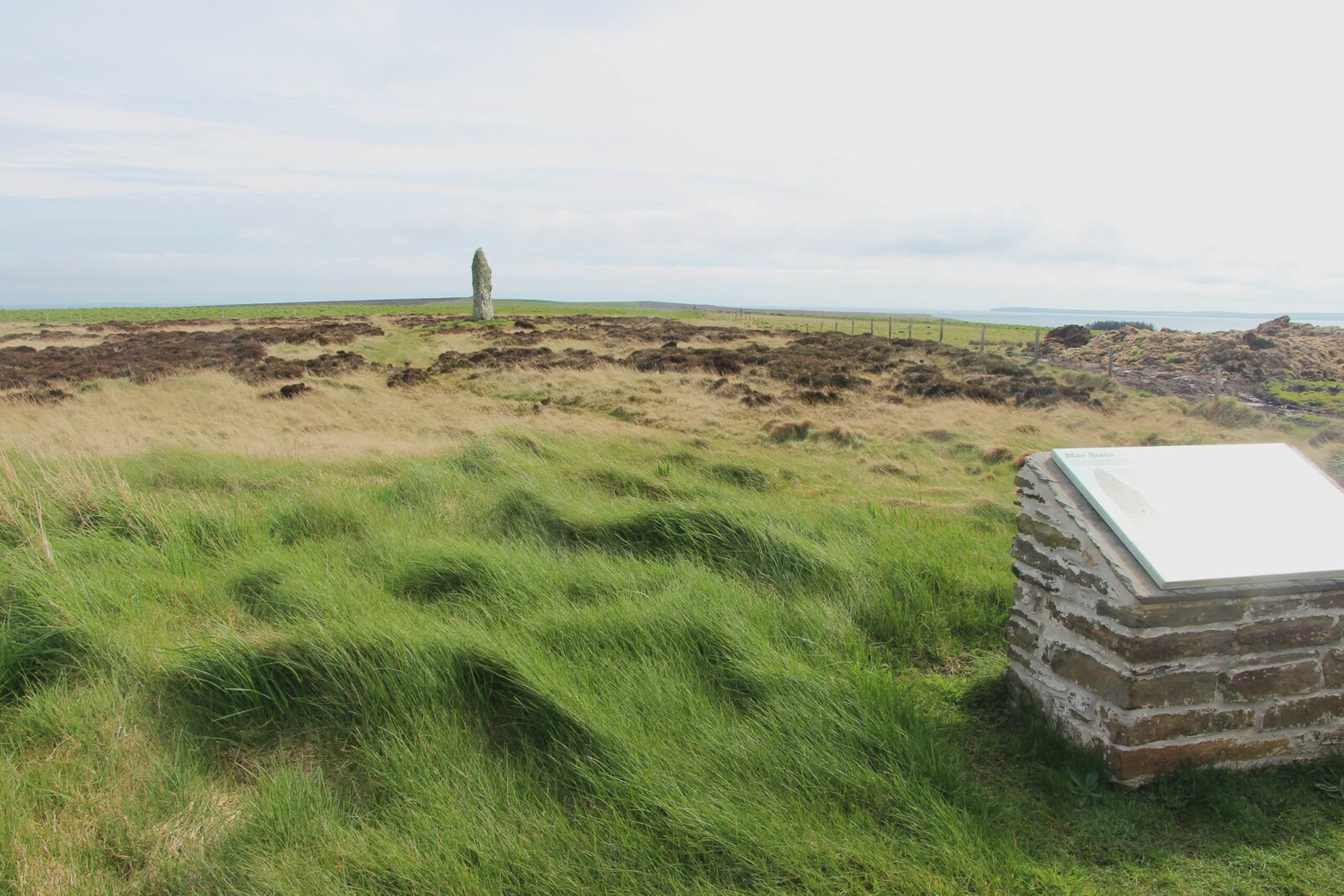
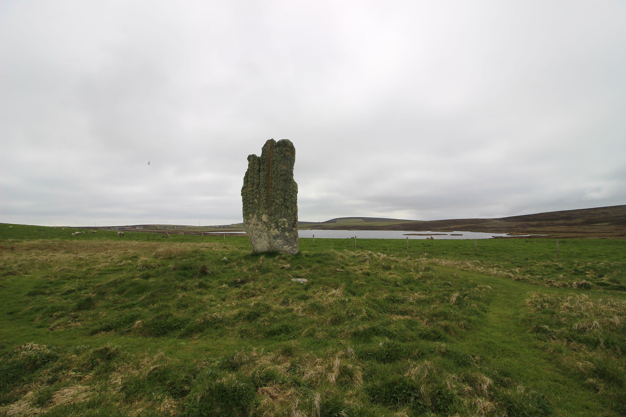
Ring of Brodgar
Stromness, Orkney, United Kingdom
Ring of Brodgar is a site of sacred significance. Approximate coordinates: 59.00150, -3.22978. The Ring of Brodgar (or Brogar, or Ring o Brodgar) is a Neolithic henge and stone circle about 6 miles north-east of Stromness on Mainland, the largest island in Orkney, Scotland. It is part of the UNESCO World Heritage Site known as the Heart of Neolithic Orkney. Located in Alba / Scotland, United Kingdom.
Orkney Islands
28 sites
Banks Chambered Tomb
South Ronaldsay, Orkney Islands, United Kingdom
Banks Chambered Tomb in South Ronaldsay, Orkney Islands, United Kingdom.
Blackhammer Chambered Cairn
Rousay, Orkney Islands, United Kingdom
Blackhammer Chambered Cairn in Rousay, Orkney Islands, United Kingdom.
Broch of Borwick
Sandwick, Orkney Islands, United Kingdom
Broch of Borwick in Sandwick, Orkney Islands, United Kingdom.
Broch of Burrian
North Ronaldsay, Orkney Islands, United Kingdom
Broch of Burrian in North Ronaldsay, Orkney Islands, United Kingdom.
Broch of Gurness
Evie, Orkney Islands, United Kingdom
Broch of Gurness in Evie, Orkney Islands, United Kingdom.
Brough of Birsay
Birsay, Orkney Islands, United Kingdom
Brough of Birsay in Birsay, Orkney Islands, United Kingdom.
Brough of Deerness Chapel
Deerness, Orkney Islands, United Kingdom
Brough of Deerness Chapel in Deerness, Orkney Islands, United Kingdom.
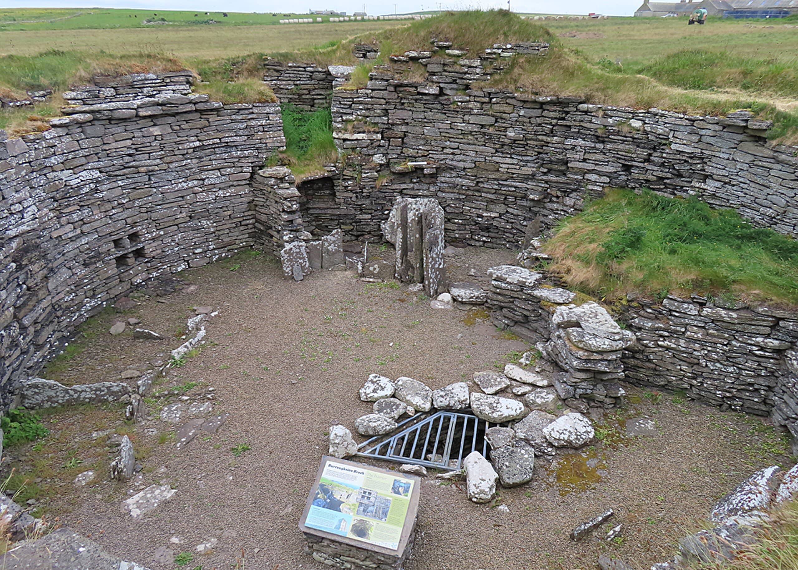
Burroughston Broch
Shapinsay, Orkney Islands, United Kingdom
Burroughston Broch in Shapinsay, Orkney Islands, United Kingdom.
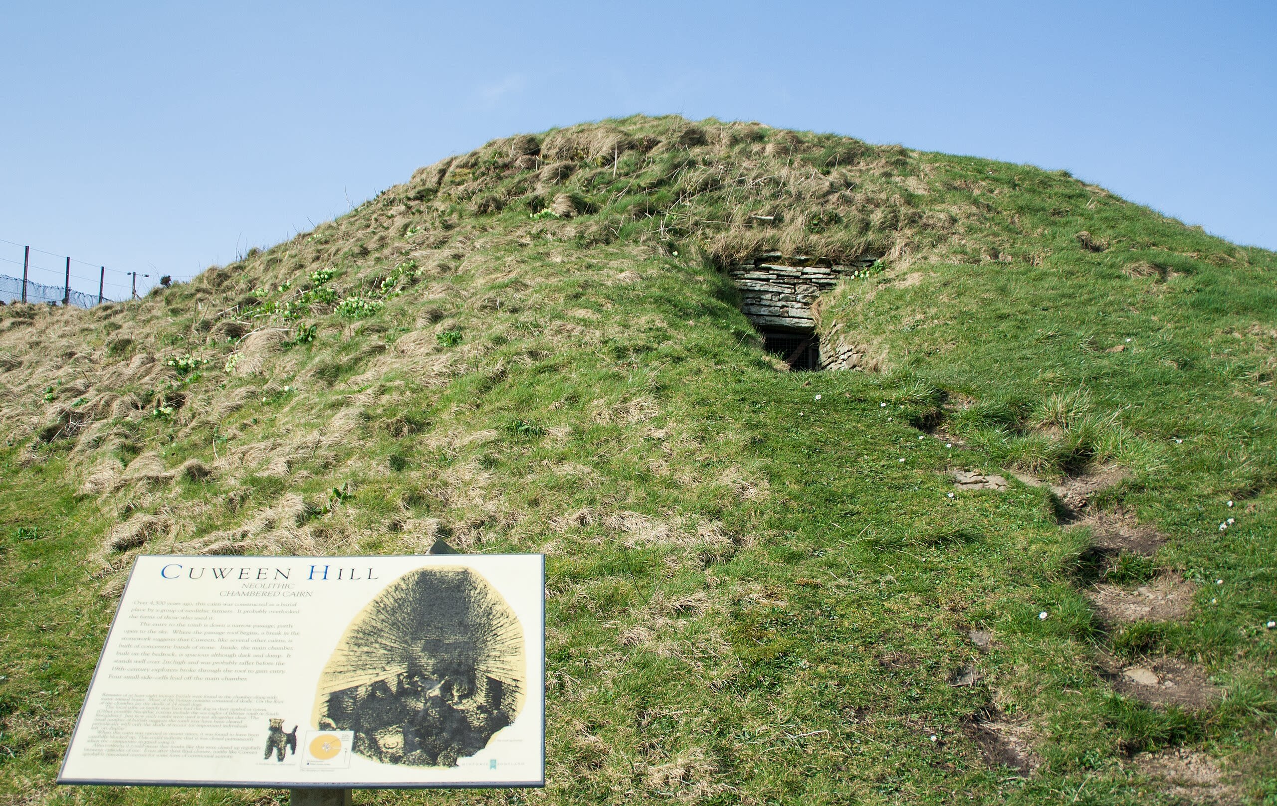
Cuween Hill Chambered Cairn
Kirkwall, Orkney Islands, United Kingdom
Cuween Hill Chambered Cairn in Kirkwall, Orkney Islands, United Kingdom.
Knap of Howar
Papa Westray, Orkney Islands, United Kingdom
Knap of Howar in Papa Westray, Orkney Islands, United Kingdom.
Knowe of Lairo
Rousay, Orkney Islands, United Kingdom
Knowe of Lairo in Rousay, Orkney Islands, United Kingdom.
Knowe of Yarso
Rousay, Orkney Islands, United Kingdom
Knowe of Yarso in Rousay, Orkney Islands, United Kingdom.
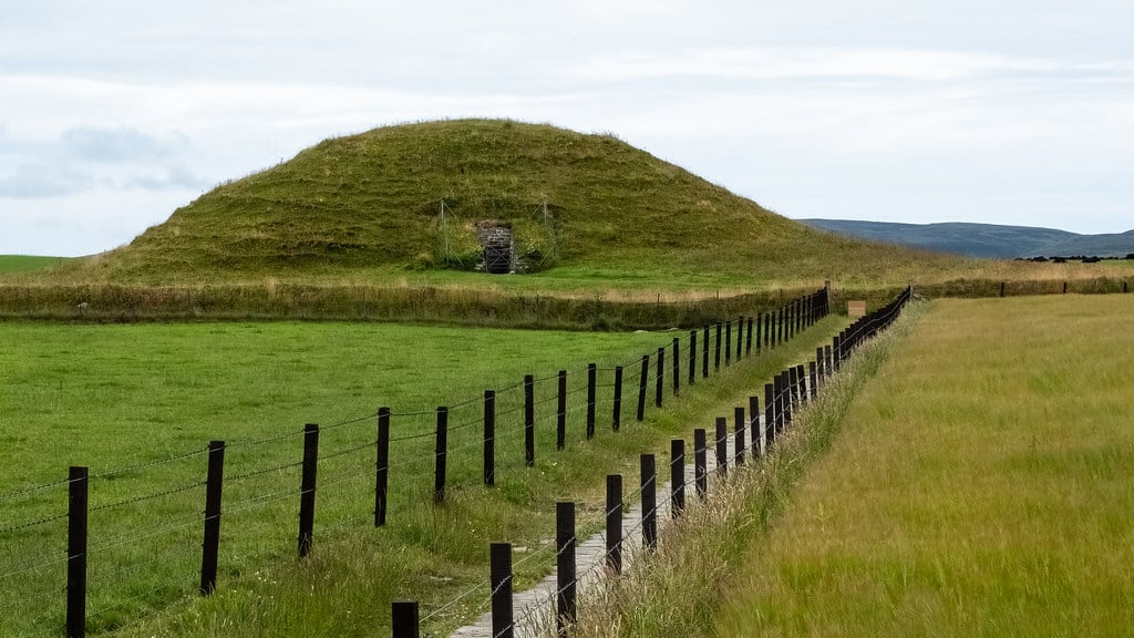
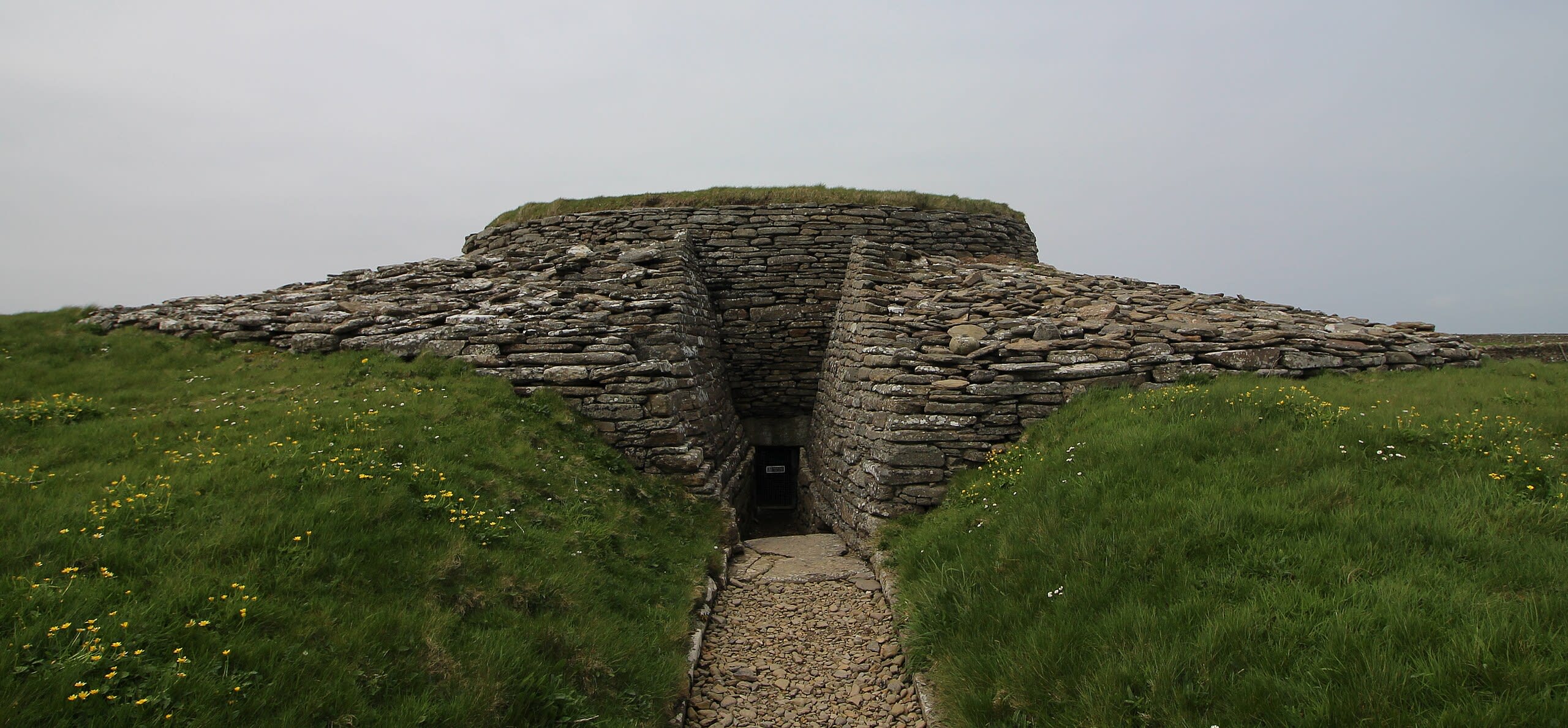
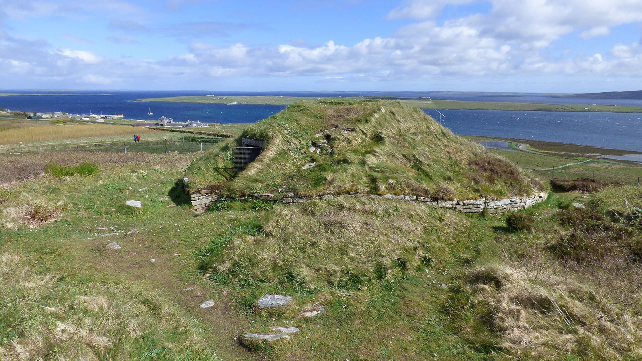
Maeshowe Chambered Cairn
Stenness, Orkney Islands, United Kingdom
Maeshowe Chambered Cairn in Stenness, Orkney Islands, United Kingdom.
Midhowe Broch
Rousay, Orkney Islands, United Kingdom
Midhowe Broch in Rousay, Orkney Islands, United Kingdom.
Midhowe Chambered Cairn
Rousay, Orkney Islands, United Kingdom
Midhowe Chambered Cairn in Rousay, Orkney Islands, United Kingdom.
Mor Stein
Shapinsay, Orkney Islands, United Kingdom
Mor Stein in Shapinsay, Orkney Islands, United Kingdom.
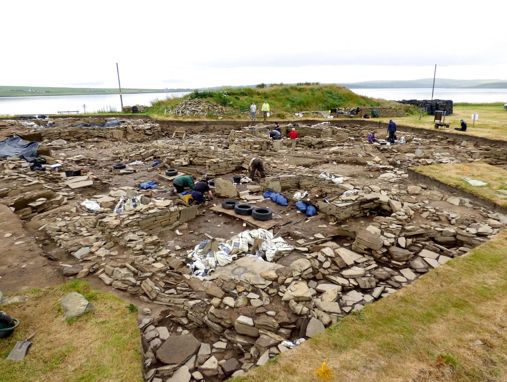
Ness of Brodgar
Stenness, Orkney Islands, United Kingdom
Ness of Brodgar in Stenness, Orkney Islands, United Kingdom.
Quoyness Chambered Cairn
Sanday, Orkney Islands, United Kingdom
Quoyness Chambered Cairn in Sanday, Orkney Islands, United Kingdom.
Ring of Bookan
Stromness, Orkney Islands, United Kingdom
Ring of Bookan in Stromness, Orkney Islands, United Kingdom.
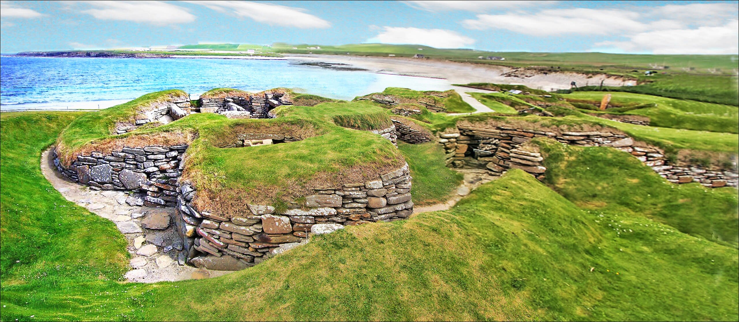
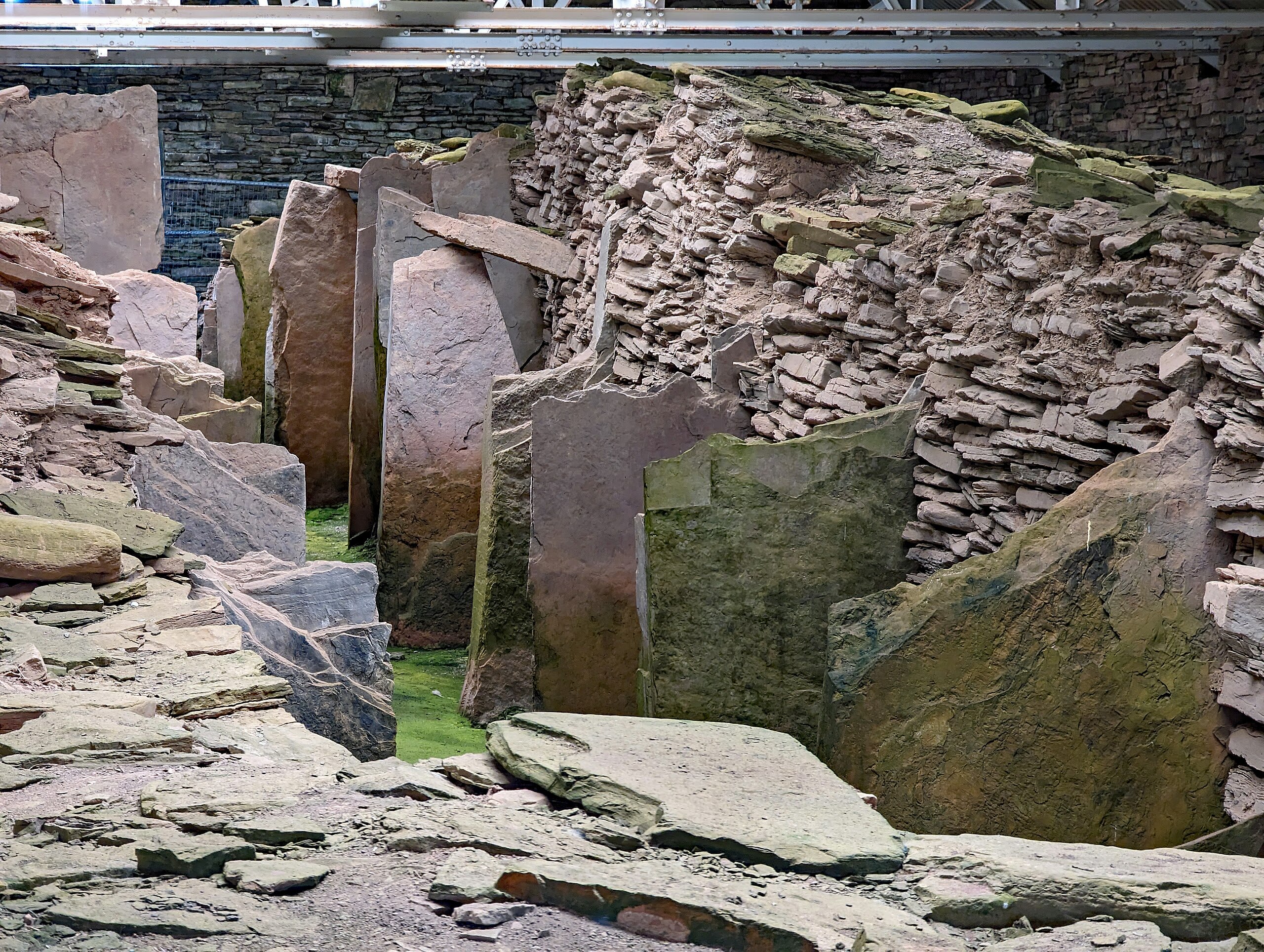
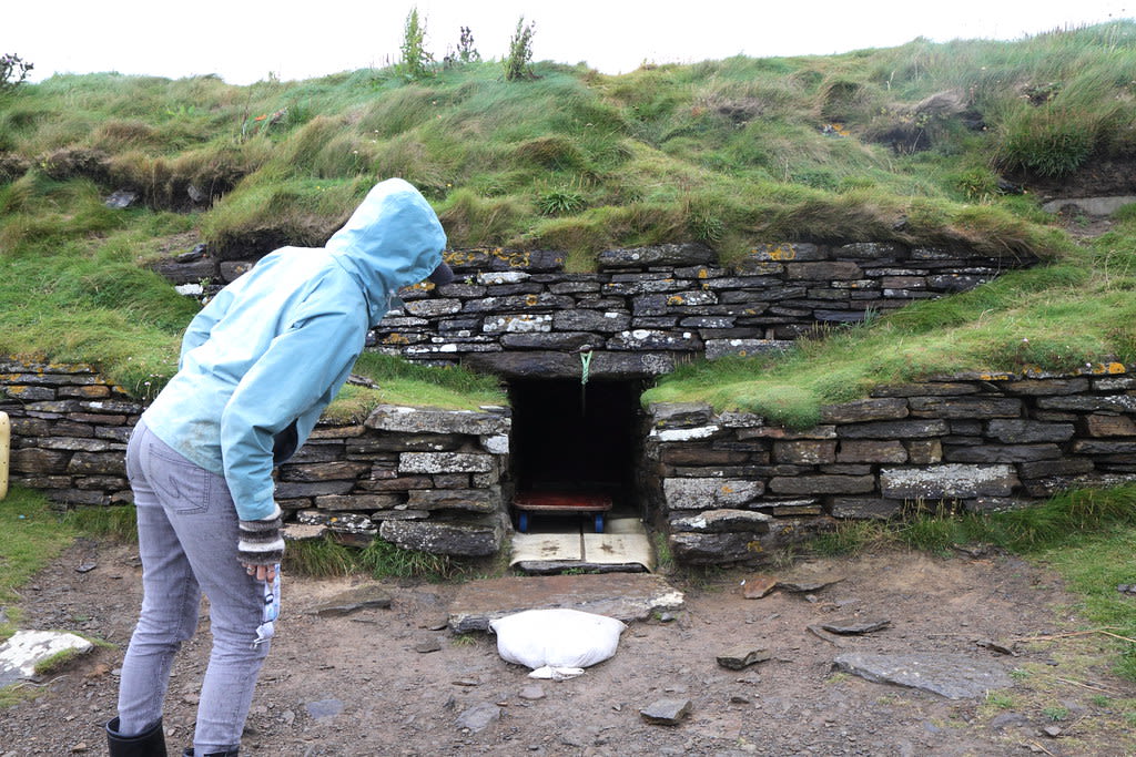
Skara Brae Prehistoric Village
Sandwick, Orkney Islands, United Kingdom
Skara Brae Prehistoric Village in Sandwick, Orkney Islands, United Kingdom.
Standing Stone of Hollandstoun
North Ronaldsay, Orkney Islands, United Kingdom
Standing Stone of Hollandstoun in North Ronaldsay, Orkney Islands, United Kingdom.
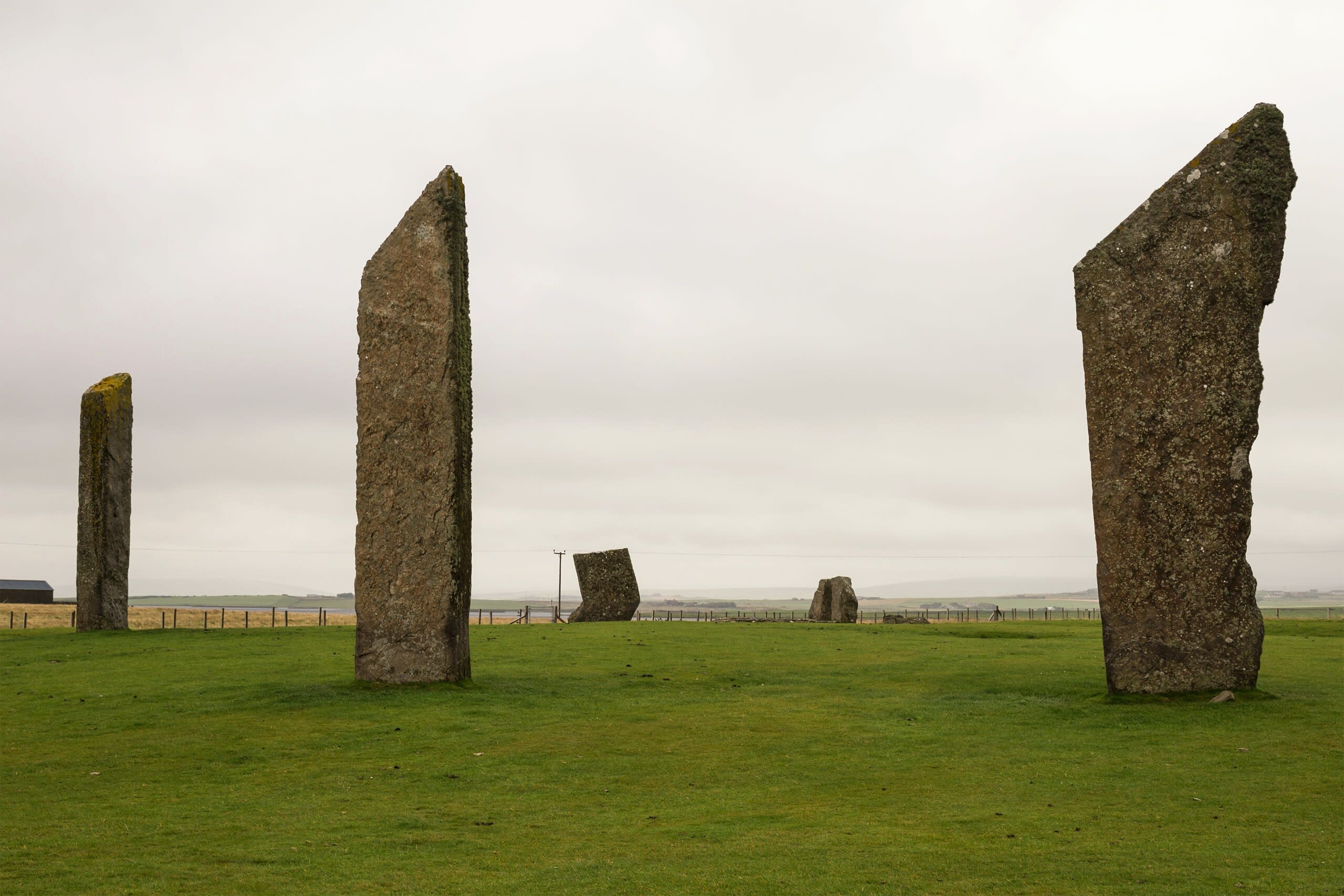
Standing Stones of Stenness
Stenness, Orkney Islands, United Kingdom
Standing Stones of Stenness in Stenness, Orkney Islands, United Kingdom.
Stone 'O Quoybune
Birsay, Orkney Islands, United Kingdom
Stone 'O Quoybune in Birsay, Orkney Islands, United Kingdom.
Taversoe Tuick Chambered Cairn
Rousay, Orkney Islands, United Kingdom
Taversoe Tuick Chambered Cairn in Rousay, Orkney Islands, United Kingdom.
The Setter Stone
Eday, Orkney Islands, United Kingdom
The Setter Stone in Eday, Orkney Islands, United Kingdom.
Tomb of Eagles
South Ronaldsay, Orkney Islands, United Kingdom
Tomb of Eagles in South Ronaldsay, Orkney Islands, United Kingdom.
Unstan Chambered Cairn
Stenness, Orkney Islands, United Kingdom
Unstan Chambered Cairn in Stenness, Orkney Islands, United Kingdom.
Vinquoy Chambered Cairn
Eday, Orkney Islands, United Kingdom
Vinquoy Chambered Cairn in Eday, Orkney Islands, United Kingdom.
Pembrokeshire
8 sites

Gors Fawr stone ring, Mynachlog-ddu, Dyfed, England
Mynachlog-ddu, Pembrokeshire, United Kingdom
Gors Fawr stone ring, Mynachlog-ddu, Dyfed, England is a stone circle of sacred significance. Approximate coordinates: 51.93157, -4.71464. Attributes: built, cultural, archaeological, ceremonial. Located in Cymru / Wales, United Kingdom.
Llech-y-tribedd
Moylgrove, Pembrokeshire, United Kingdom
Llech-y-tribedd in Moylgrove, Pembrokeshire, Wales, United Kingdom.
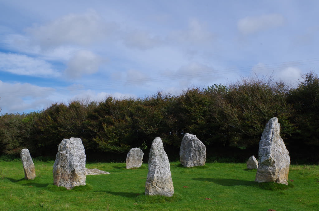
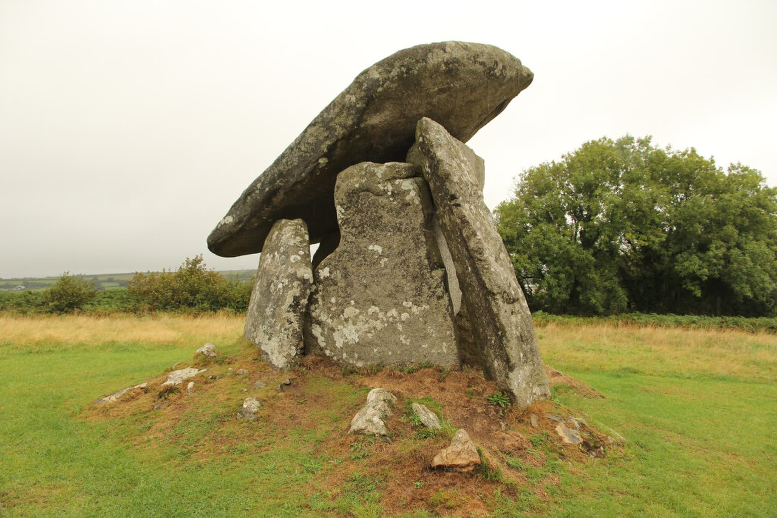
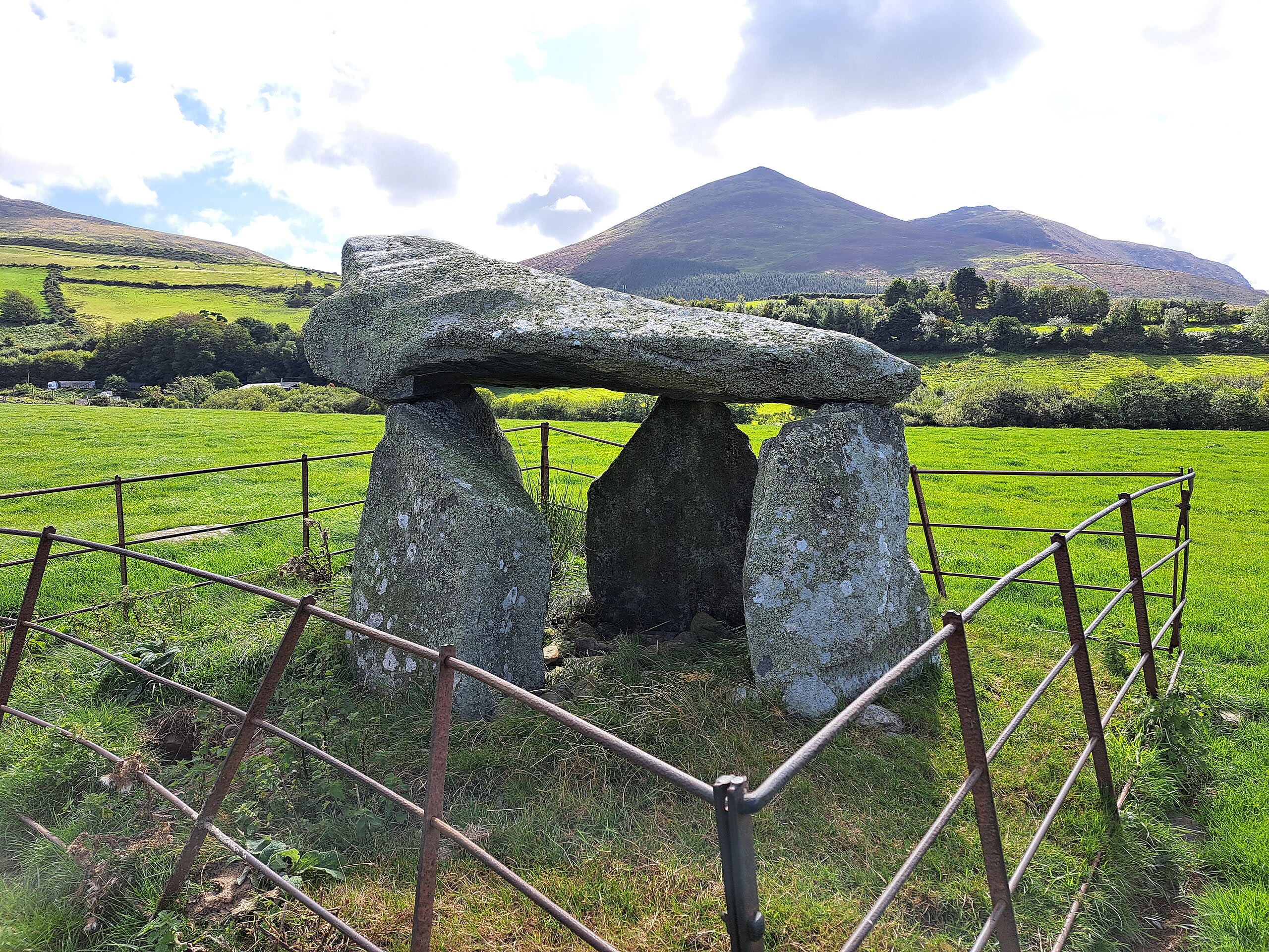
Pentre Ifan Dolmen
Nevern, Pembrokeshire, United Kingdom
Pentre Ifan Dolmen is a site of sacred significance. Approximate coordinates: 51.99898, -4.77001. Located in Cymru / Wales, United Kingdom.
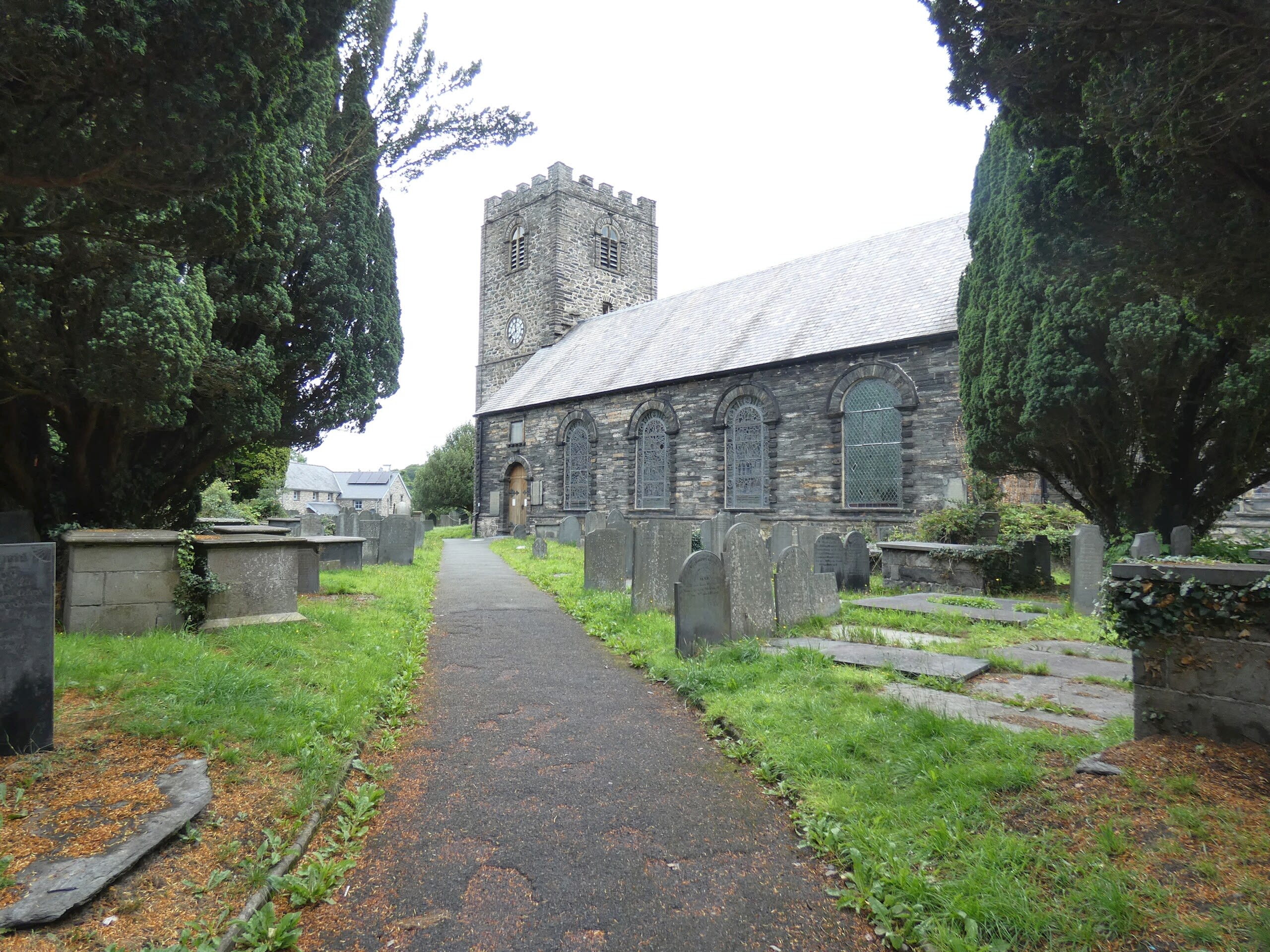
St Brynach’s Church
Nevern, Pembrokeshire, United Kingdom
St Brynach’s Church is a site of sacred significance. Approximate coordinates: 52.02540, -4.79514. Located in Cymru / Wales, United Kingdom.
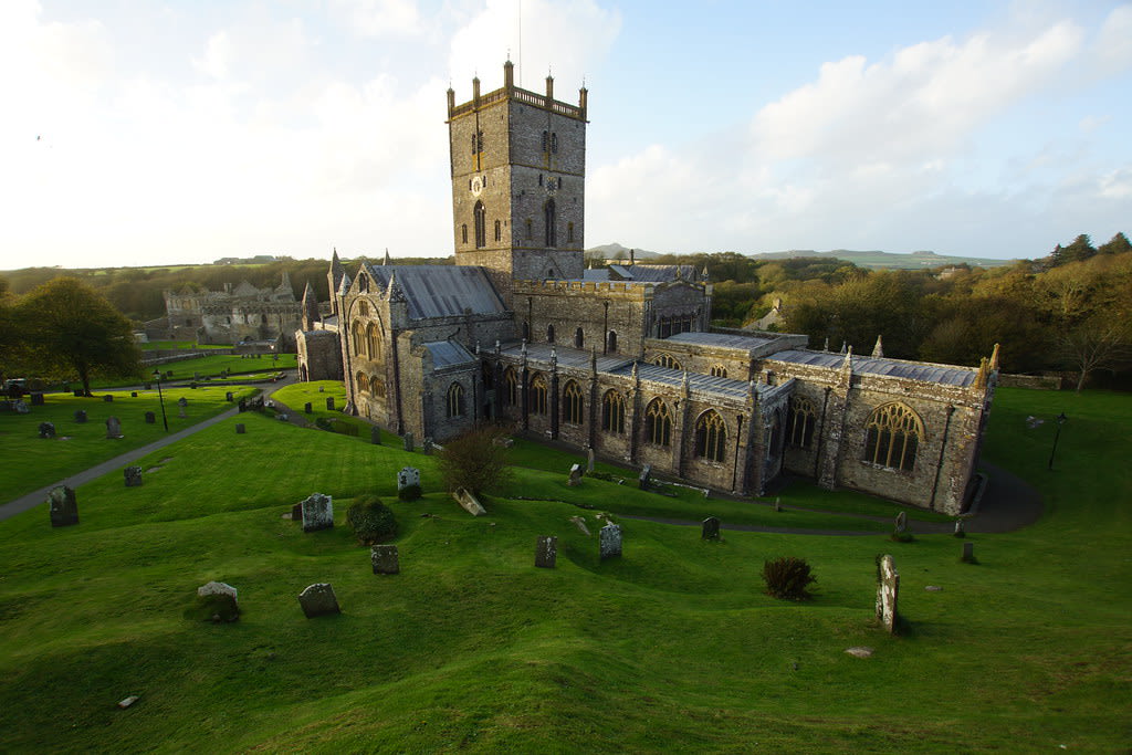
St David’s Cathedral
St Davids, Pembrokeshire, United Kingdom
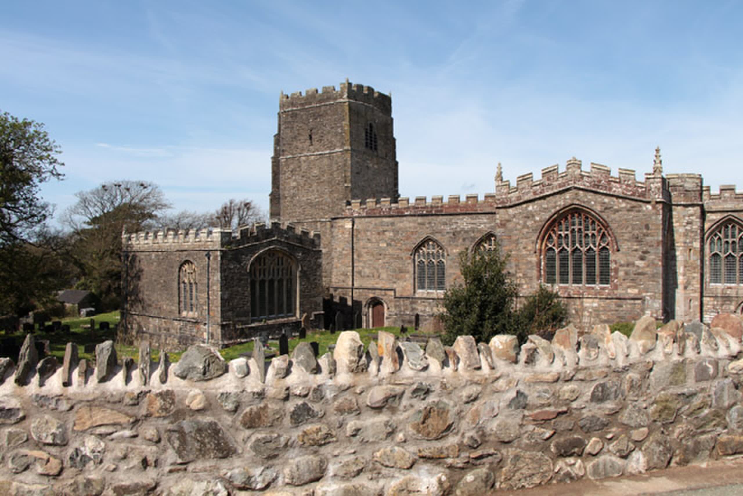
St David’s Cathedral is a site of sacred significance. Approximate coordinates: 51.88198, -5.26834. St Davids Cathedral (Welsh: Eglwys Gadeiriol Tyddewi) is a Church in Wales cathedral situated in St Davids, Britain s smallest city, in the county of Pembrokeshire, near the most westerly point of Wales. Located in St Davids, Cymru / Wales, United Kingdom.
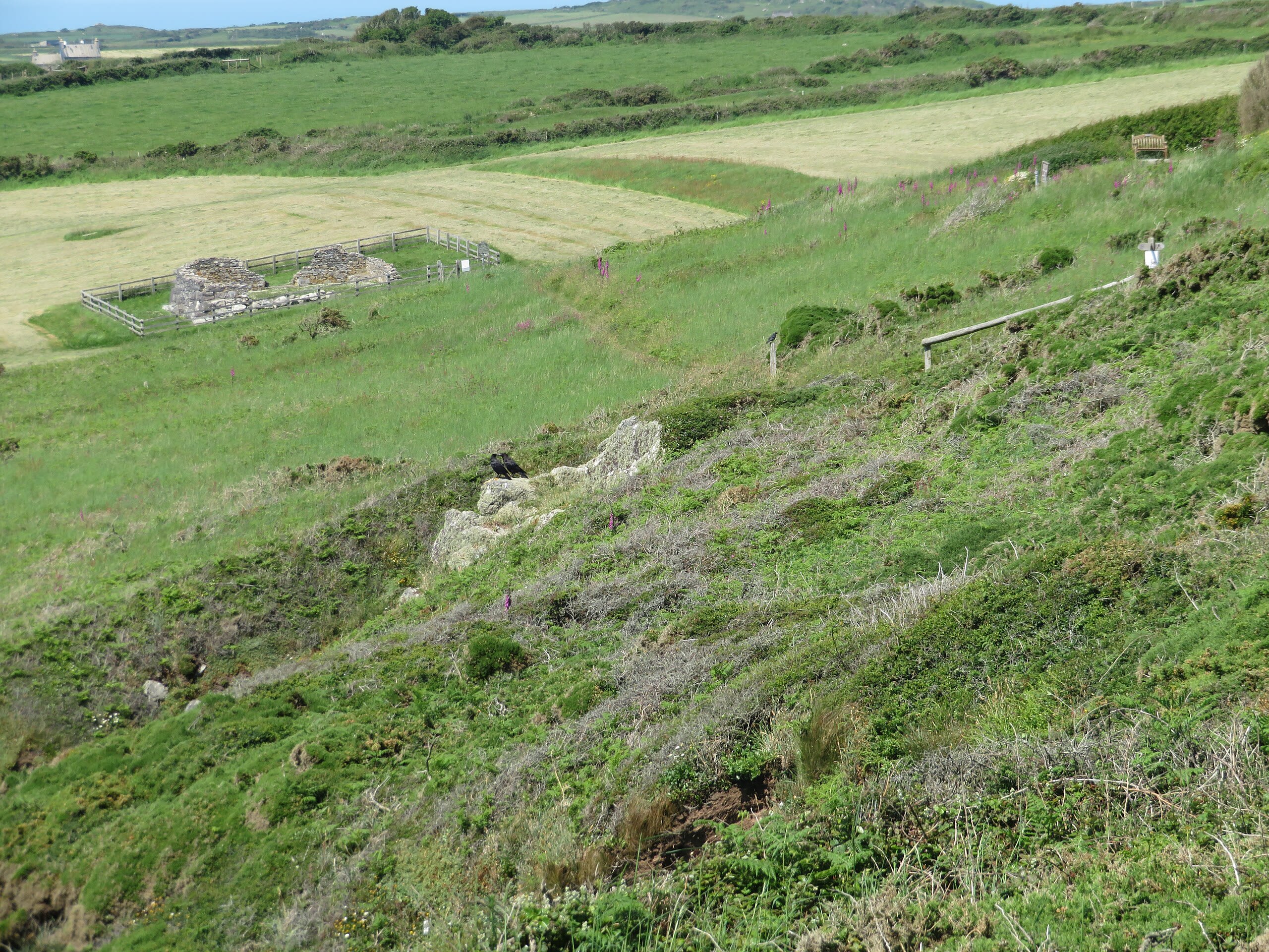
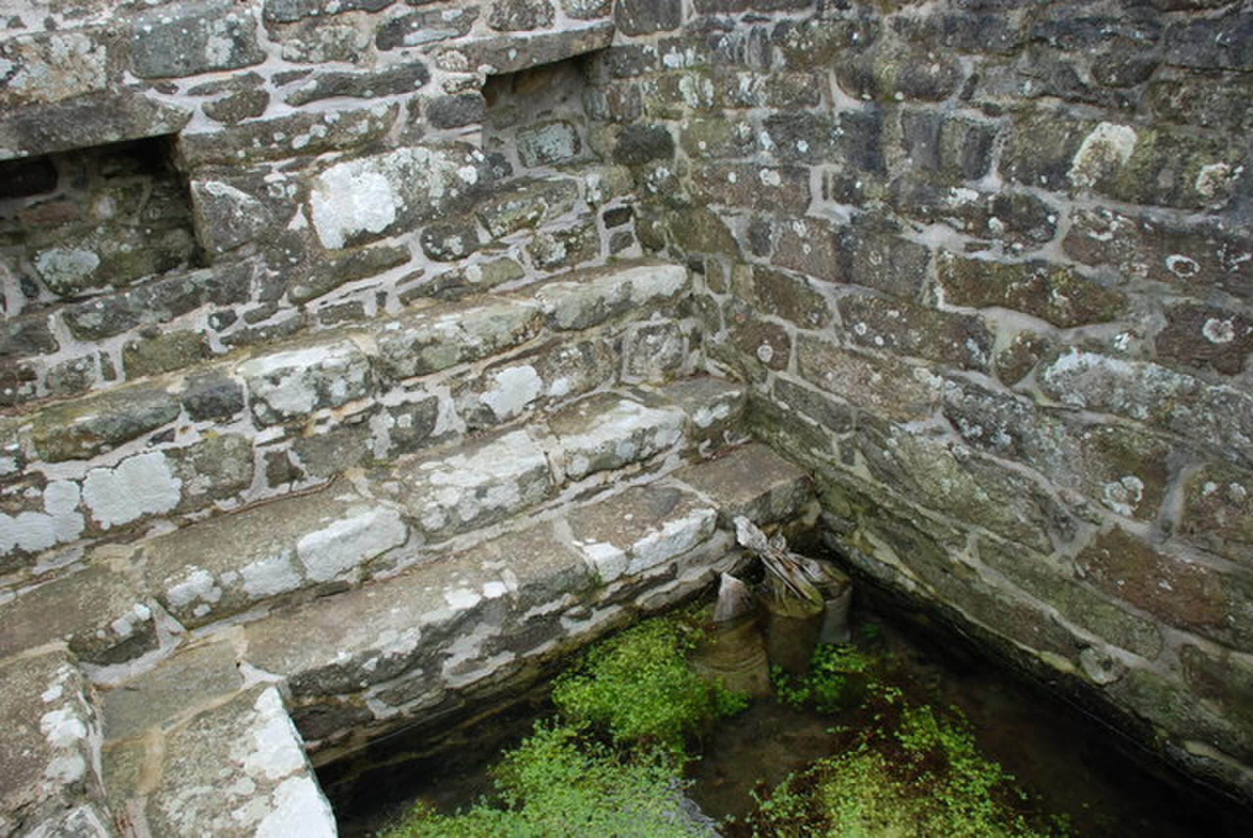
St Non’s Chapel and Well
St Davids, Pembrokeshire, United Kingdom
St Non’s Chapel and Well is a site of sacred significance. Approximate coordinates: 51.87224, -5.26874. Located in St Davids, Cymru / Wales, United Kingdom.
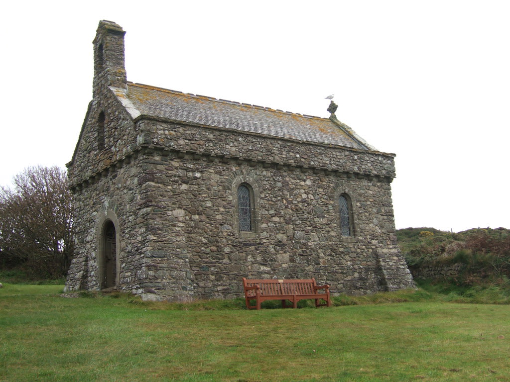
St. Davids and St. Non's, Wales
St Davids, Pembrokeshire, United Kingdom
St. Davids and St. Non's, Wales is a site of sacred significance. Approximate coordinates: 51.87217, -5.26882. Located in St Davids, Cymru / Wales, United Kingdom.
Trellyffaint Burial Chamber
Nevern, Pembrokeshire, United Kingdom
Trellyffaint Burial Chamber in Nevern, Pembrokeshire, Wales, United Kingdom.
Scotland
7 sites
Dunadd sacred hill, Lochgilphead, Scotland
Bridgend, Scotland, United Kingdom
Dunadd sacred hill, Lochgilphead, Scotland is a hill of sacred significance. Approximate coordinates: 56.08601, -5.47842. Attributes: natural, cultural, archaeological. Located in Alba / Scotland, United Kingdom.

Easter Aquorthies Stone Ring
Aberdeenshire, Scotland, United Kingdom
Easter Aquorthies Stone Ring is a stone circle of sacred significance. Approximate coordinates: 57.27702, -2.44555. Attributes: built, cultural, archaeological. Located in Alba / Scotland, United Kingdom.

Iona
The Village, Scotland, United Kingdom
Iona is a monastery of sacred significance. Approximate coordinates: 56.33505, -6.39150. Attributes: built, cultural, pilgrimage. Tradition: Christianity. Associated figure: Saint Columba. Iona (; Scottish Gaelic: Ì Chaluim Chille [ˈiː ˈxal̪ˠɪm ˈçiʎə] , sometimes simply Ì) is an island in the Inner Hebrides, off the Ross of Mull on the western coast of Scotland. It is mainly known for Iona Abbey, though there are other buildings on the island. Iona Abbey was a centre of Gaelic monasticism for three centuries and is today known for its relative tranquility and natural environment. It is a tourist destination and a place for spiritual retreats. Its modern Scottish Gaelic name means Iona of (Saint) Columba (formerly anglicised as Icolmkill ). In 2019, Iona s estimated population was 120. In March 1980, the Hugh Fraser Foundation donated much of the main island (and its off-lying islands) to the current owner, the National Trust for Scotland. The abbey and some church buildings are owned by the Iona Cathedral Trust. One publication, describing the religious significance of the island, says that the island is known as the birthplace of Celtic Christianity in Scotland,” and notes that “St Columba came here in the year 563 to establish the Abbey, which still stands . Located in Alba / Scotland, United Kingdom.

Mt. Healabhal, Isle of Skye, Scotland
Dunvegan, Scotland, United Kingdom
Mt. Healabhal, Isle of Skye, Scotland is a site of sacred significance. Approximate coordinates: 57.38542, -6.61961. Located in Alba / Scotland, United Kingdom.
Shrine of Cailleach, Tigh nam Bodach, near Glen Lyon, Scotland
Perth and Kinross, Scotland, United Kingdom
Shrine of Cailleach, Tigh nam Bodach, near Glen Lyon, Scotland is a site of sacred significance. Approximate coordinates: 56.54837, -4.63599. Located in Alba / Scotland, United Kingdom.
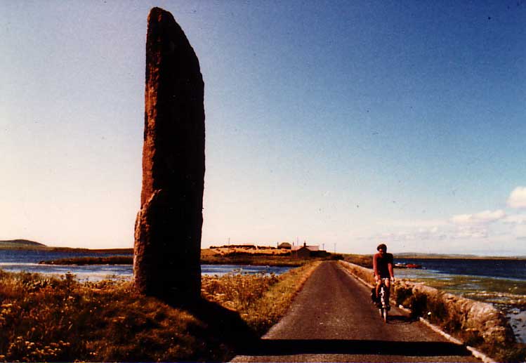
Stenness
Stenness, Scotland, United Kingdom
Stenness is a site of sacred significance. Approximate coordinates: 58.99405, -3.20806. Stenness (pronounced ) (Old Norse: Steinnes; Norn: Stennes) is a village and parish on the Orkney Mainland in Scotland. It contains several notable prehistoric monuments including the Standing Stones of Stenness and the Ring of Brodgar. Located in Alba / Scotland, United Kingdom.

Temple Wood megalithic site, Argyll, Scotland
Argyll and Bute, Scotland, United Kingdom
Temple Wood megalithic site, Argyll, Scotland is a site of sacred significance. Approximate coordinates: 56.12381, -5.49849. Located in Alba / Scotland, United Kingdom.
Shetland
4 sites
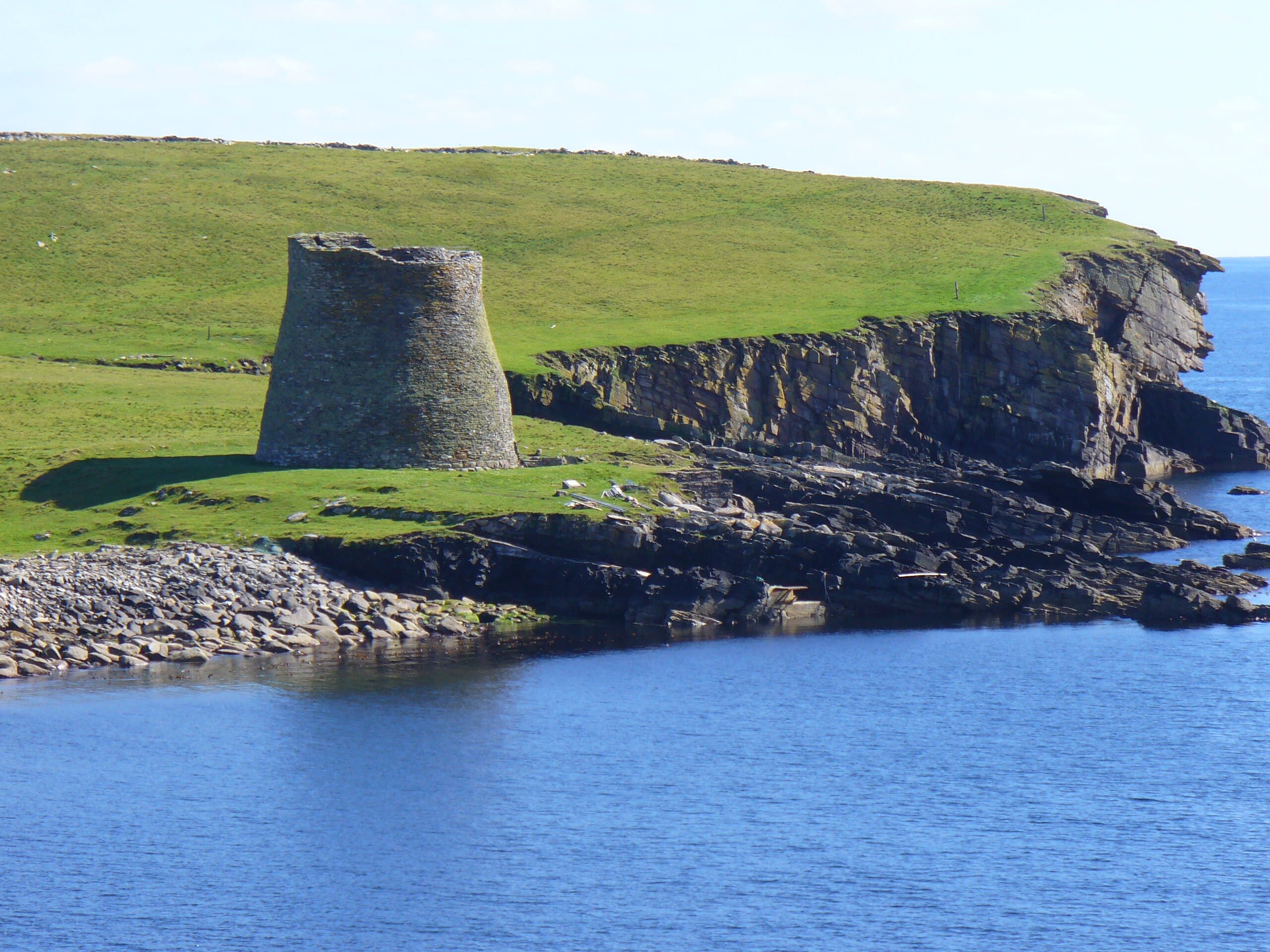
Broch of Mousa
Mousa, Shetland, United Kingdom
Broch of Mousa in Mousa, Shetland, United Kingdom.
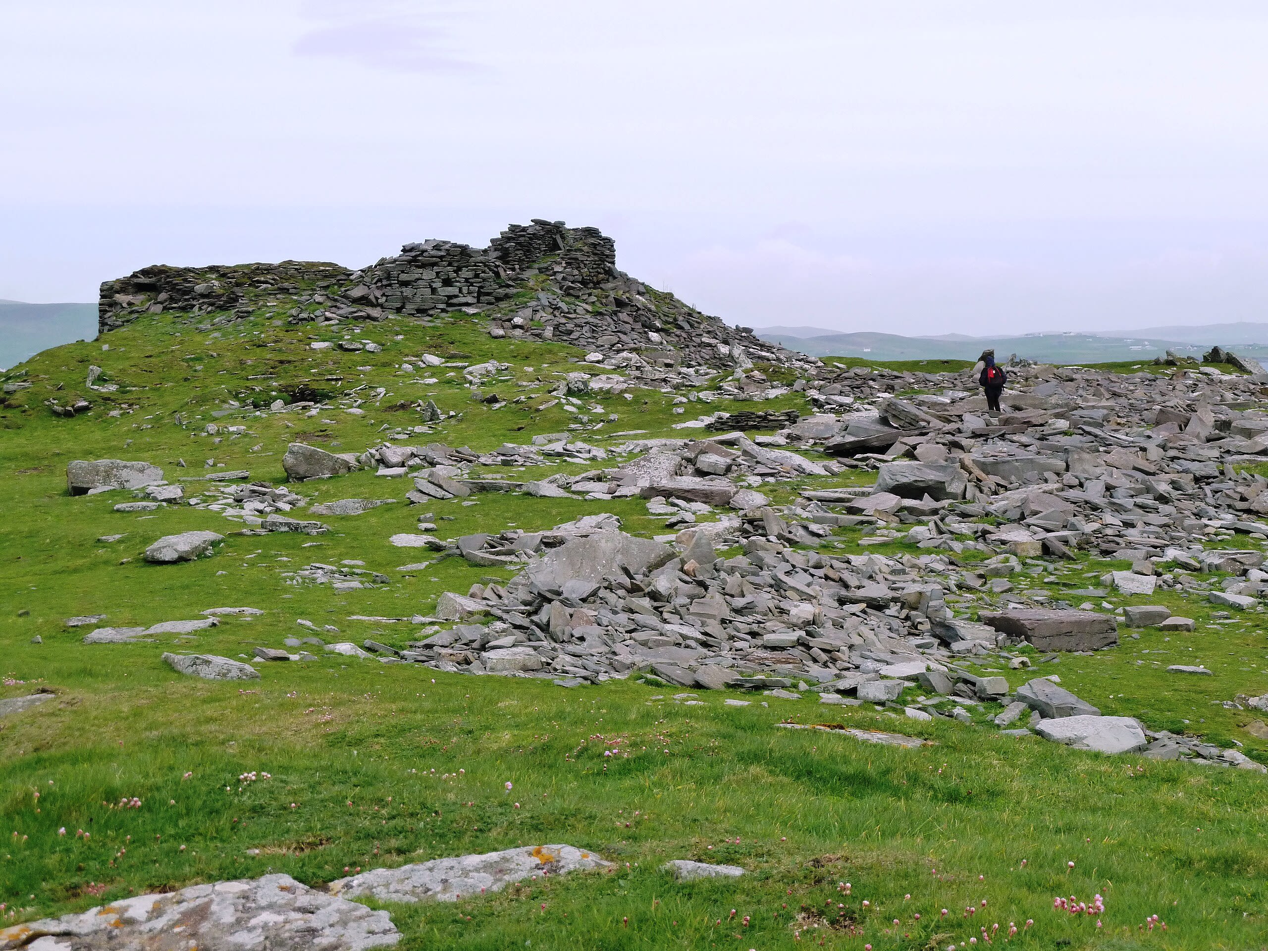
Burraland Broch
Trondra, Shetland, United Kingdom
Burraland Broch in Trondra, Shetland, United Kingdom.
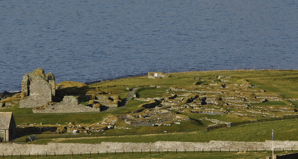
Jarlshof Prehistoric and Norse Settlement
Sumburgh, Shetland, United Kingdom
Jarlshof Prehistoric and Norse Settlement in Sumburgh, Shetland, United Kingdom.
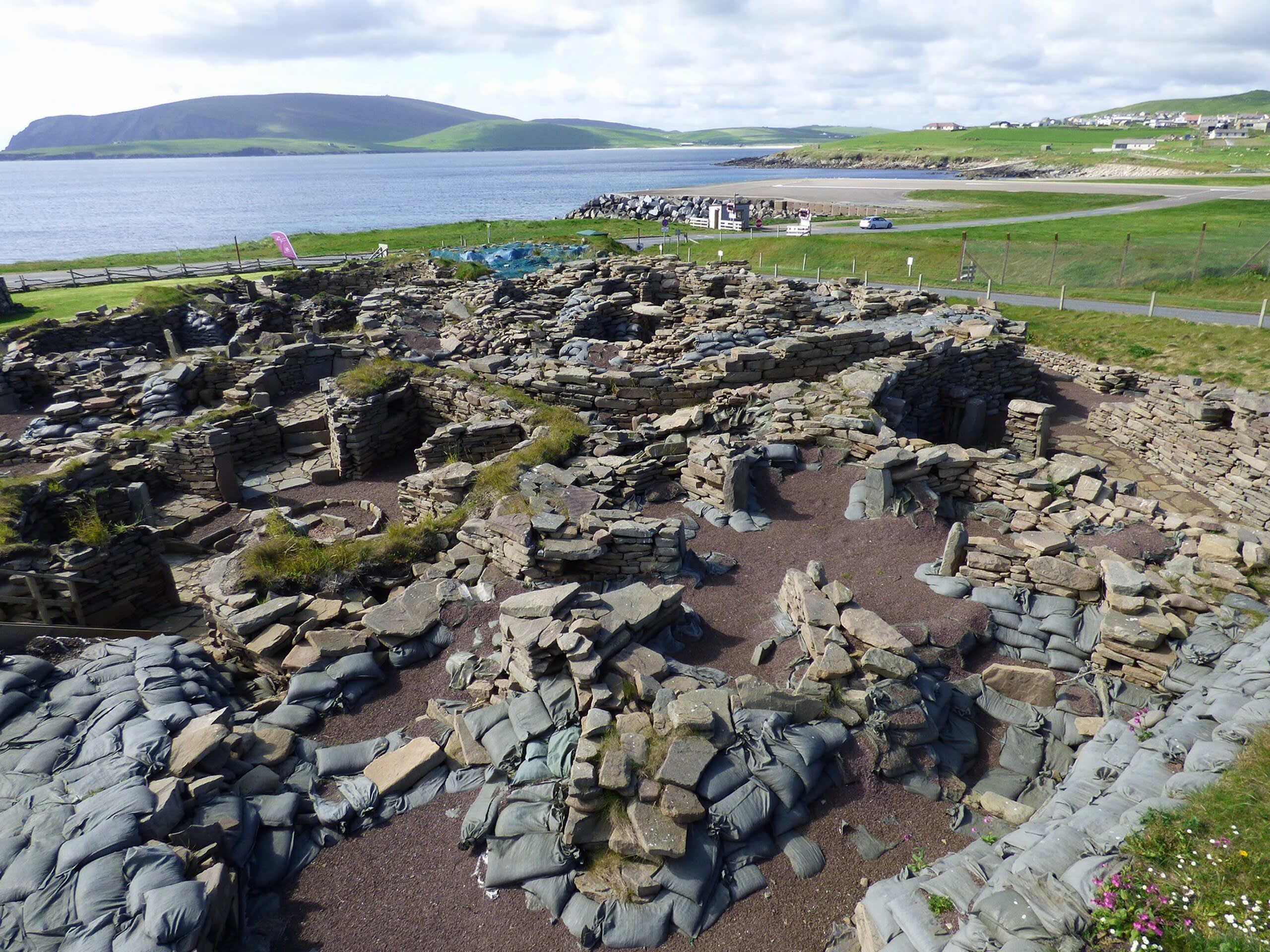
Old Scatness Broch and Iron Age Village
Virkie, Shetland, United Kingdom
Old Scatness Broch and Iron Age Village in Virkie, Shetland, United Kingdom.
Somerset
8 sites

Bride's Mound
Glastonbury, Somerset, United Kingdom
Behind an industrial estate on Glastonbury's western edge, a small mound rises from a field. Few visitors find it. Those who do discover something remarkable: the oldest documented Christian monastic site in Britain, sacred to both goddess and saint, where the fire traditions of Celtic Brigid and the relics of Saint Brigid once converged. Each Imbolc, pilgrims still walk from the White Spring to honor her here—whichever form of her they recognize.
Chalice Well Gardens
Glastonbury, Somerset, United Kingdom
At the foot of Glastonbury Tor, iron-stained waters have flowed without ceasing for over two thousand years. Christian pilgrims come seeking the Holy Grail. Goddess devotees honor the sacred feminine. Pagans mark the wheel of the year. Yet beneath all interpretations, the spring simply flows—red, constant, indifferent to the meanings we bring, open to all who come seeking.
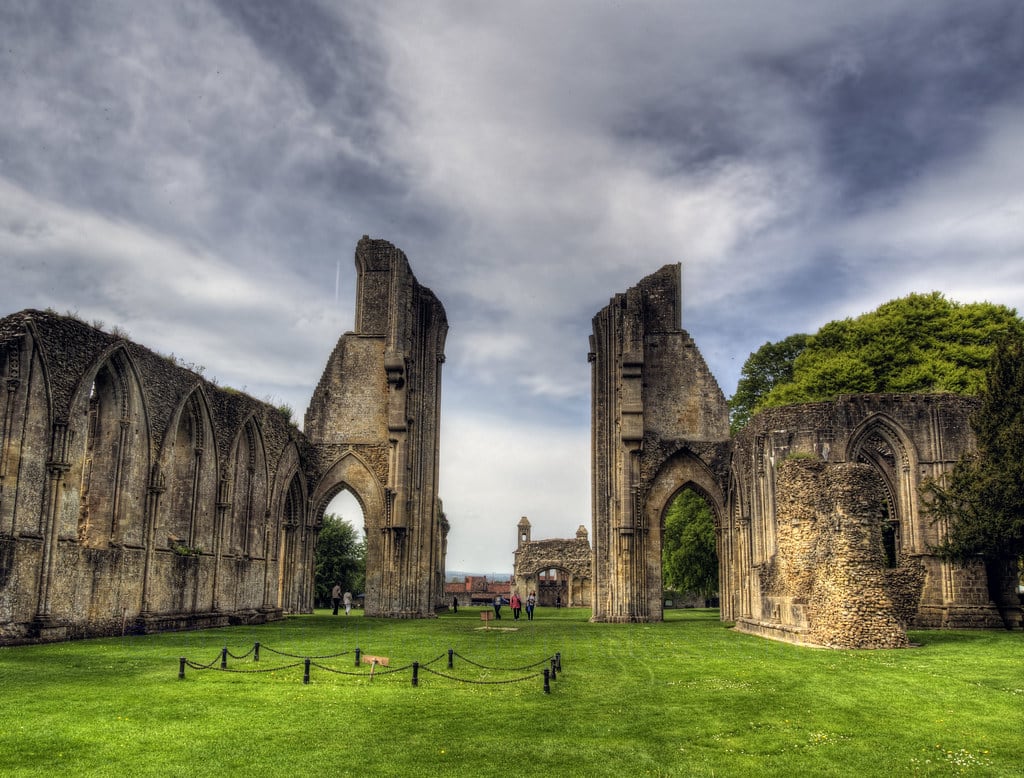
Glastonbury Abbey
Glastonbury, Somerset, United Kingdom
Glastonbury Abbey was once the second richest monastery in England, claiming to be the oldest Christian foundation in Britain. Today its ruins stand open to sky—walls that once enclosed a thousand years of prayer, the site where monks announced they had found King Arthur's grave, the ground where Abbot Whiting was dragged to his execution. What remains invites contemplation of what was lost and what endures.
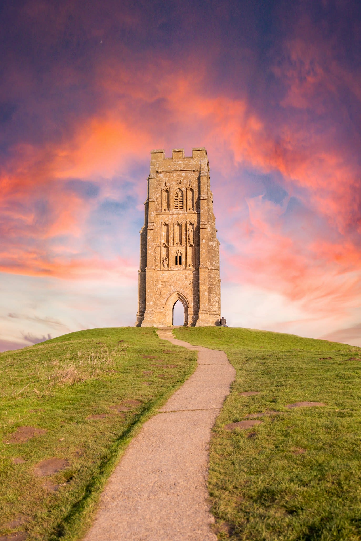
Glastonbury Tor
Glastonbury, Somerset, United Kingdom
Rising 158 meters above the Somerset Levels, Glastonbury Tor has drawn seekers for millennia. Celtic tradition holds it as a gateway to Annwn, the Otherworld. Christian legend claims Joseph of Arimathea buried the Holy Grail at its foot.
St John's Church
Glastonbury, Somerset, United Kingdom
On Glastonbury's High Street stands a church where prayers have risen for eight centuries. St. John the Baptist is not a museum of legend but a working parish church—Sunday Eucharist, weekday morning prayer, weddings and funerals. Yet within its walls, medieval treasures connect to Glastonbury's deepest stories: a cope worn by the last abbot before his execution, a fragment of a Joseph of Arimathea shrine, and in the churchyard, the Holy Thorn from which a sprig is sent to the monarch each Christmas.
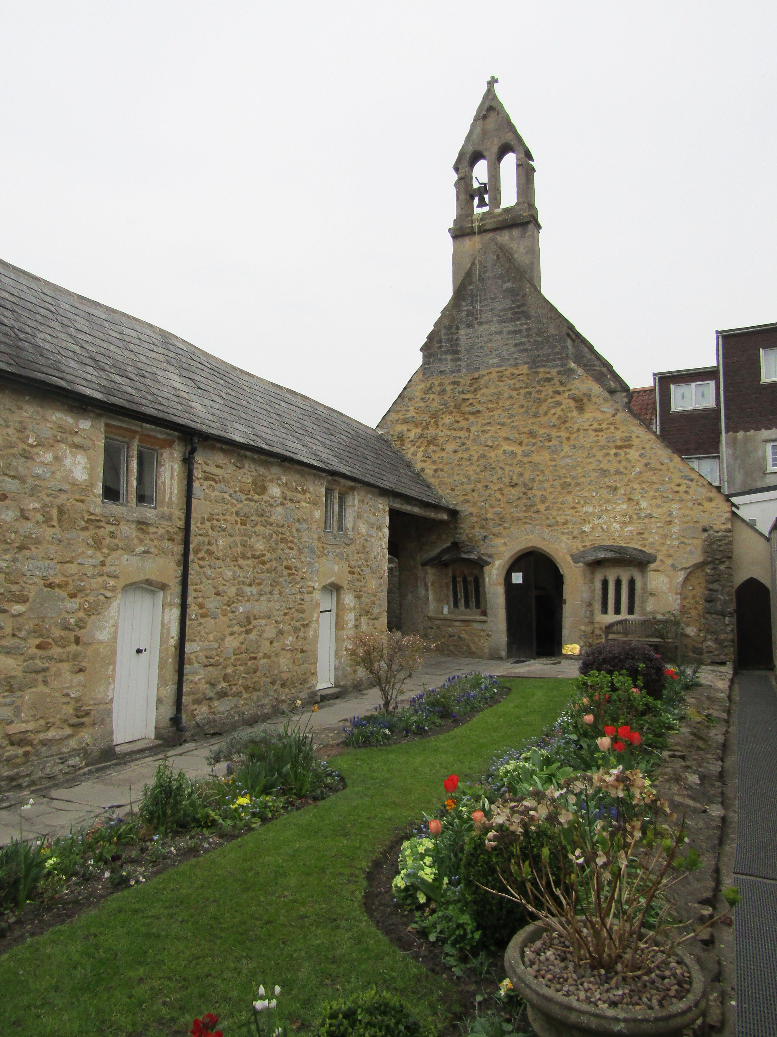
St Margaret's Chapel
Glastonbury, Somerset, United Kingdom
Behind a passageway on Magdalene Street, a small chapel and garden offer what Glastonbury's busier sites cannot: genuine quiet. Since the 11th century, this place has welcomed weary travelers. Today, as part of the Quiet Garden Movement, St Margaret's continues the ancient work of hospitality—not through programs or teaching, but through simple presence and stillness.
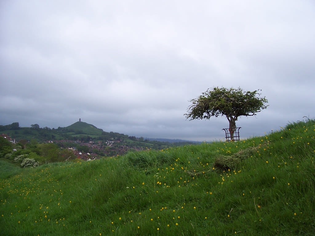
Wearyall Hill & Holy Thorn
Glastonbury, Somerset, United Kingdom
An open hilltop rises above Glastonbury, marking where—according to legend—Joseph of Arimathea first set foot in Britain. Exhausted from his journey, he planted his staff in the earth. By morning, it had taken root and burst into flower. The Holy Thorn that grows here still blooms at Christmas, defying both season and repeated vandalism. Pilgrims climb the hill to stand where British Christianity, in one telling, began.
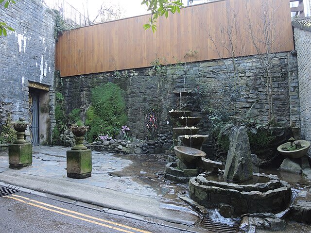
White Spring Temple
Glastonbury, Somerset, United Kingdom
Step from daylight into darkness. The White Spring Temple occupies a Victorian well house at the base of Glastonbury Tor, where calcite-white waters have flowed for millennia. Hundreds of candles illuminate shrines to Brigid, Our Lady of Avalon, and the King of Faery. This is an active temple where seekers come to bathe in cold, purifying waters and sit in silence at the threshold between worlds.
Sutherland
5 sites
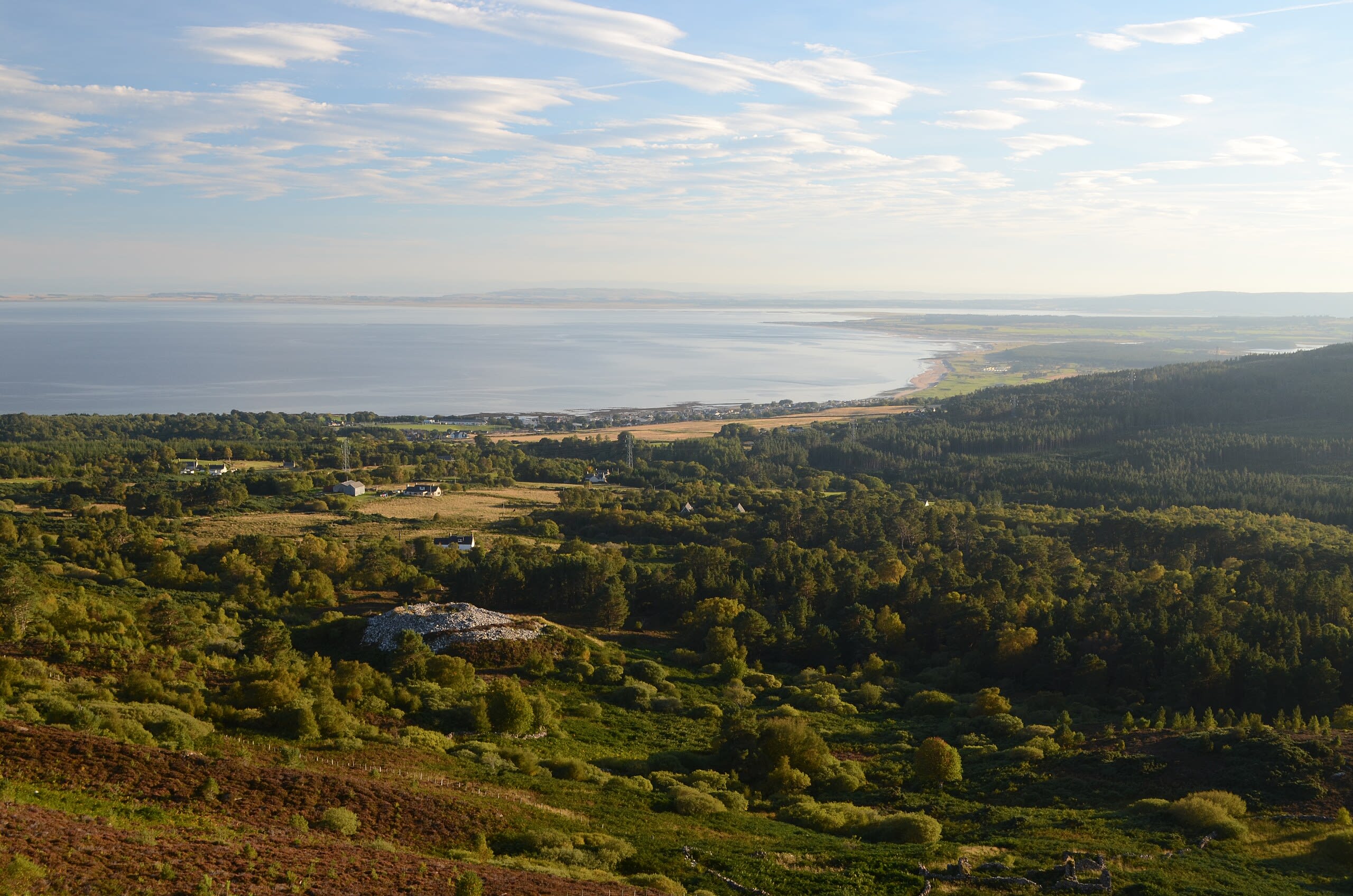
Backies Broch
Golspie, Sutherland, United Kingdom
Backies Broch in Golspie, Sutherland, United Kingdom.
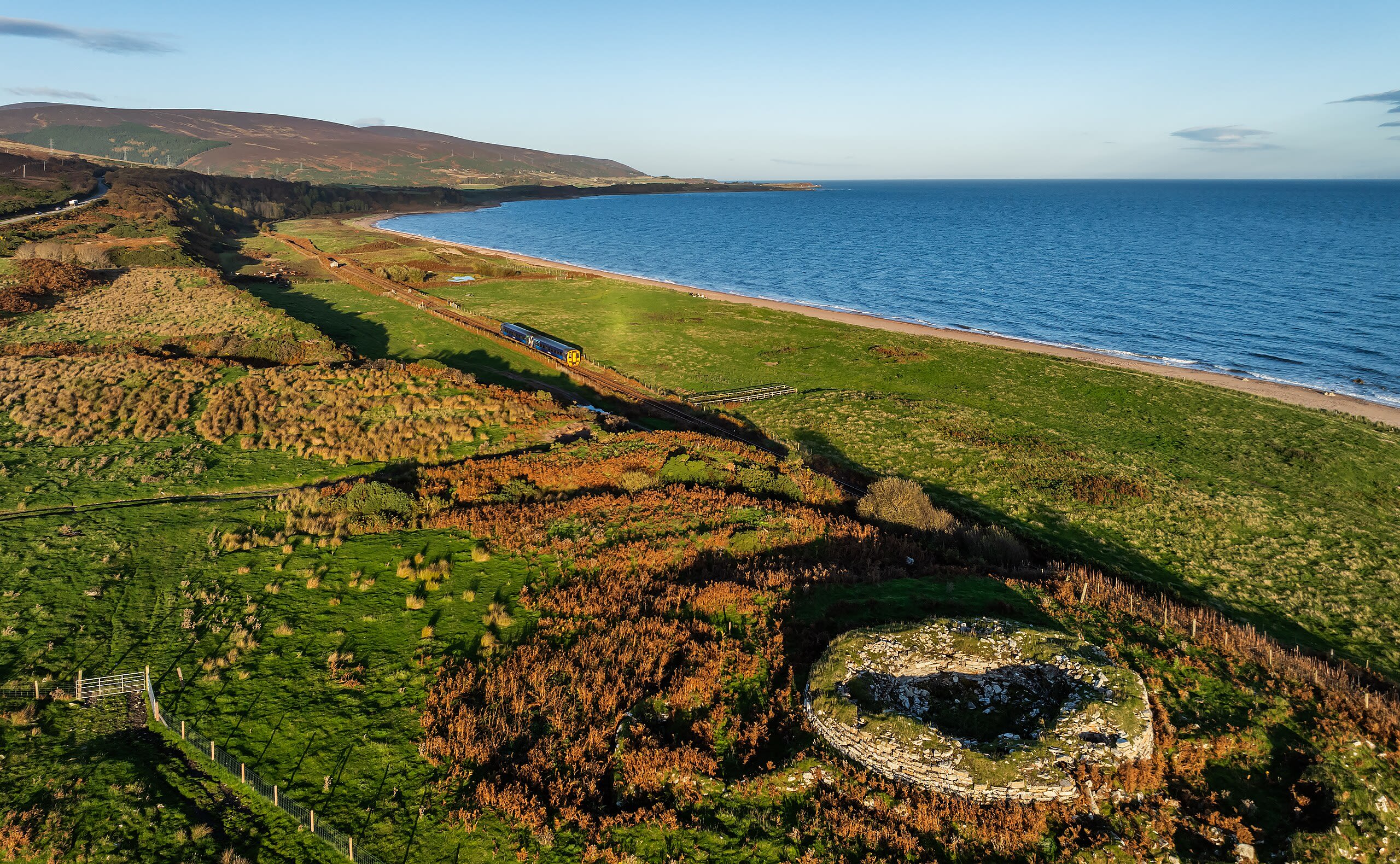
Brora Pictish Cairn
Brora, Sutherland, United Kingdom
Brora Pictish Cairn in Brora, Sutherland, United Kingdom.
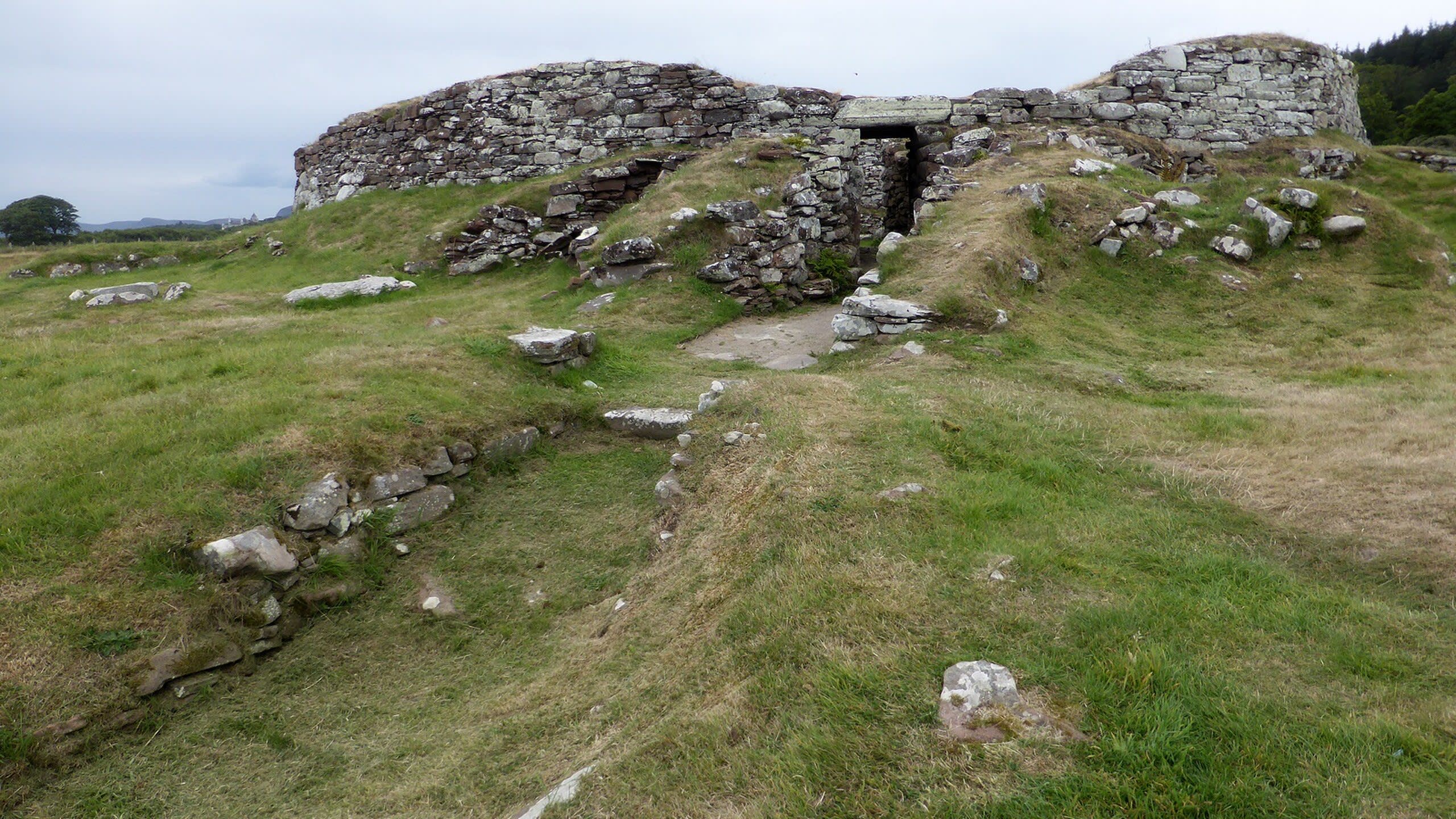
Carn Liath Broch
Golspie, Sutherland, United Kingdom
Carn Liath Broch in Golspie, Sutherland, United Kingdom.
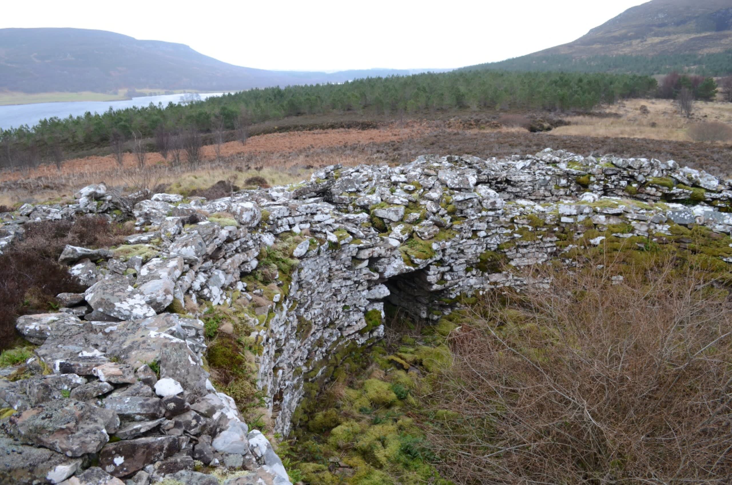
Carrol Broch
Brora, Sutherland, United Kingdom
Carrol Broch in Brora, Sutherland, United Kingdom.
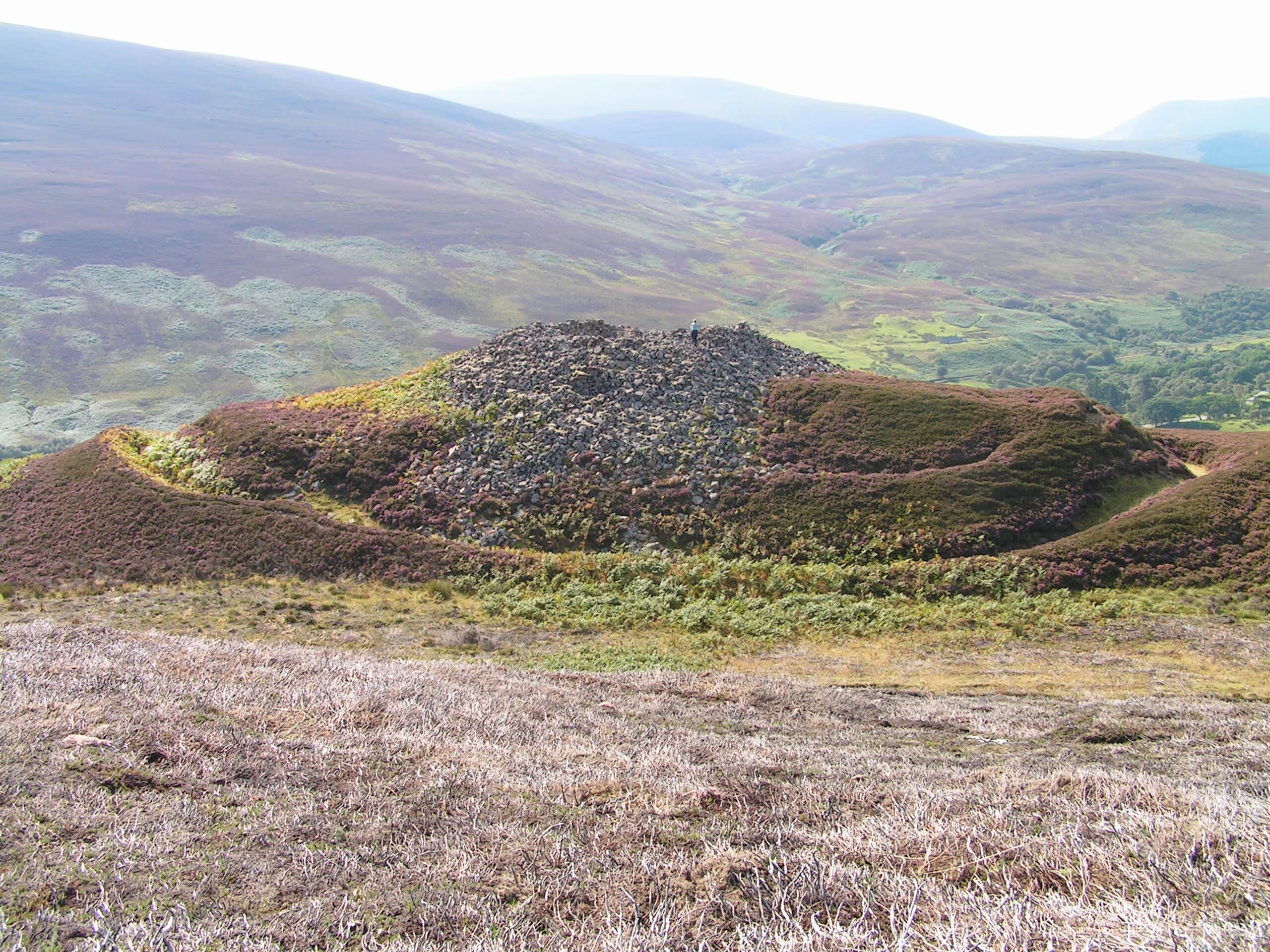
Kilphedir Broch
Kilphedir, Sutherland, United Kingdom
Kilphedir Broch in Kilphedir, Sutherland, United Kingdom.
Wales
9 sites

Bardsey Island
Gwynedd, Wales, United Kingdom
Bardsey Island is a island of sacred significance. Approximate coordinates: 52.76331, -4.78618. Attributes: built, natural, cultural, archaeological, pilgrimage. Tradition: Christianity. Associated figure: Saint Cadfan. Mythological context: Welsh. Bardsey Island (Welsh: Ynys Enlli), known as the legendary Island of 20,000 Saints , is located 1.9 miles (3.1 km) off the Llŷn Peninsula in the Welsh county of Gwynedd. The Welsh name means The Island in the Currents , while its English name refers to the Island of the Bards , or possibly the Viking chieftain, Barda . At 179 hectares (440 acres; 0.69 sq mi) in area it is the fourth largest offshore island in Wales, with a population of 11. The north east rises steeply from the sea to a height of 548 feet (167 m) at Mynydd Enlli, which is a Marilyn, while the western plain is low and relatively flat cultivated farmland. To the south the island narrows to an isthmus, connecting a peninsula on which the lighthouse stands. Since 1974 it has been included in the community of Aberdaron. The island has been an important religious site since the 6th century, when it is said that the Welsh king Einion Frenin and Saint Cadfan founded a monastery there. In medieval times it was a major centre of pilgrimage and, by 1212, belonged to the Augustinian Canons Regular. The monastery was dissolved and its buildings demolished by Henry VIII in 1537, but the island remains an attraction for pilgrims, marking the end point of the North Wales Pilgrims Way. Bardsey Island is famous for its wildlife and rugged scenery. A bird observatory was established in 1953. It is a nesting place for Manx shearwaters and choughs, with rare plants, and habitats undisturbed by modern farming practices. The waters around the island attract dolphins and porpoises and grey seals. In 2023, the island became the first site in Europe to be awarded International Dark Sky Sanctuary certification. Located in Cymru / Wales, United Kingdom.

Carn Ingli Holy Mountain, Wales
Newport, Wales, United Kingdom
Carn Ingli Holy Mountain, Wales is a mountain of sacred significance. Approximate coordinates: 51.99933, -4.82458. Attributes: natural, cultural. Located in Cymru / Wales, United Kingdom.
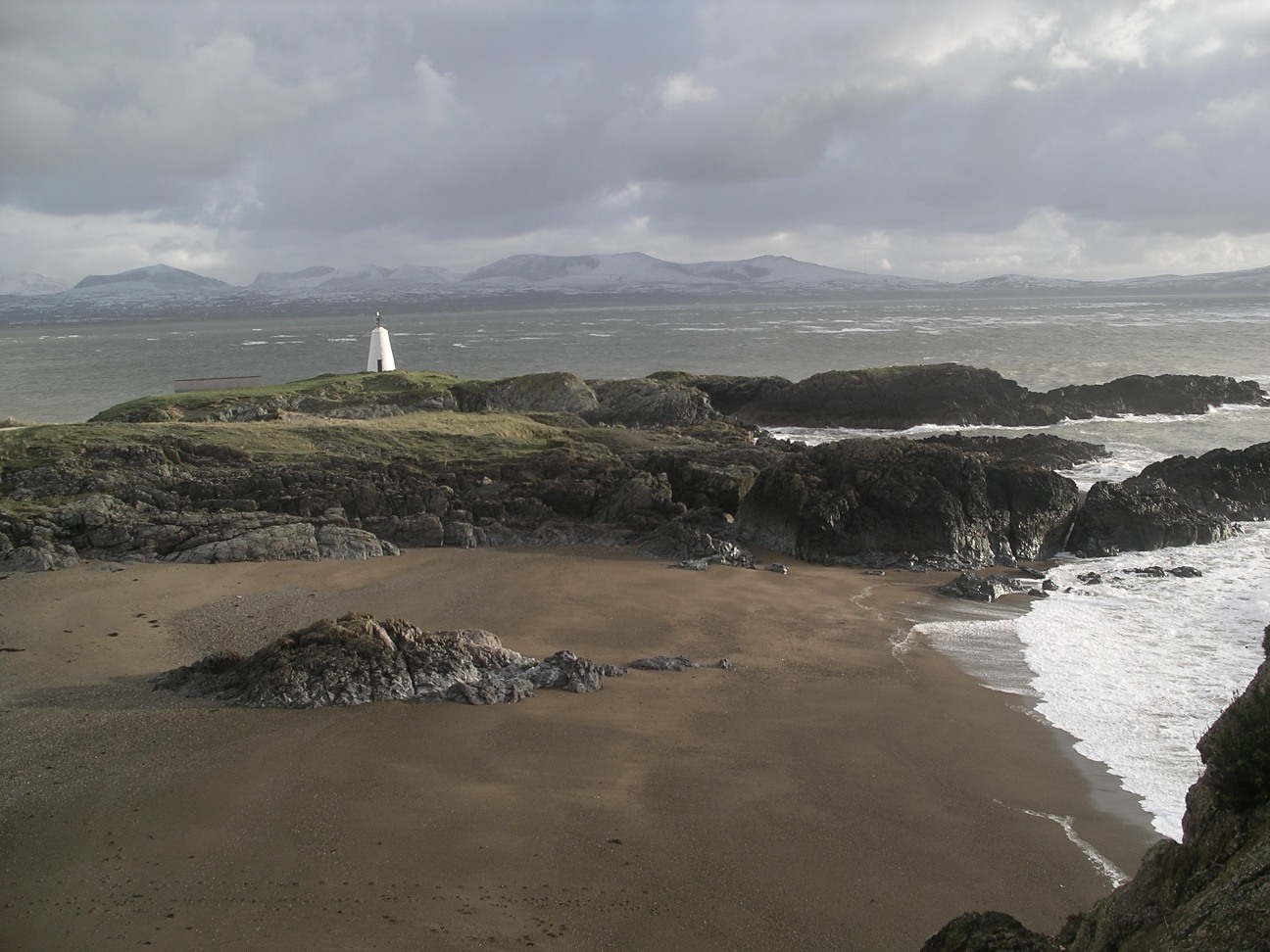
Ffynnon Santes Gwenfaen well
Trearddur, Wales, United Kingdom
Ffynnon Santes Gwenfaen well is a well of sacred significance. Approximate coordinates: 53.24738, -4.60995. Attributes: natural, cultural, pilgrimage. Tradition: Christianity. Associated figure: St Gwenfaen. Located in Cymru / Wales, United Kingdom.

Holywell
Holywell, Wales, United Kingdom
Holywell is a church of sacred significance. Approximate coordinates: 53.27725, -3.22362. Attributes: built, cultural. Associated figure: St. Winifred. Holywell may refer to: Located in Cymru / Wales, United Kingdom.

Llangolen
Llangollen, Wales, United Kingdom
Llangolen is a castle of sacred significance. Approximate coordinates: 52.97933, -3.15888. Attributes: built, cultural, archaeological. Located in Cymru / Wales, United Kingdom.

Lligwy Dolmen
Moelfre, Wales, United Kingdom
Lligwy Dolmen is a site of sacred significance. Approximate coordinates: 53.34995, -4.25289. Located in Cymru / Wales, United Kingdom.

Mt. Cadair Idris, Wales
Gwynedd, Wales, United Kingdom
Mt. Cadair Idris, Wales is a site of sacred significance. Approximate coordinates: 52.69938, -3.90805. Located in Cymru / Wales, United Kingdom.

St. Mary’s Abbey, Bardsey Island
Gwynedd, Wales, United Kingdom
St. Mary’s Abbey, Bardsey Island is a site of sacred significance. Approximate coordinates: 52.76427, -4.78757. Located in Cymru / Wales, United Kingdom.
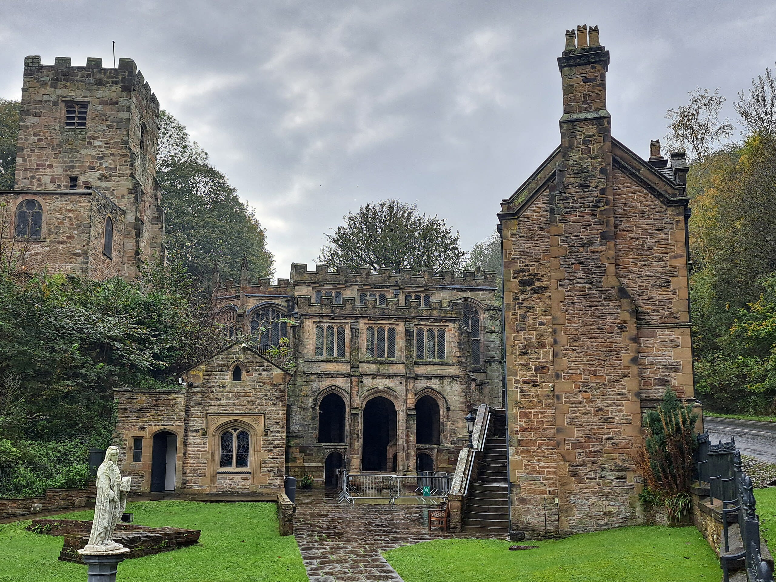
St. Winefride’s Well
Holywell, Wales, United Kingdom
St. Winefride’s Well is a site of sacred significance. Approximate coordinates: 53.27764, -3.22317. Located in Cymru / Wales, United Kingdom.