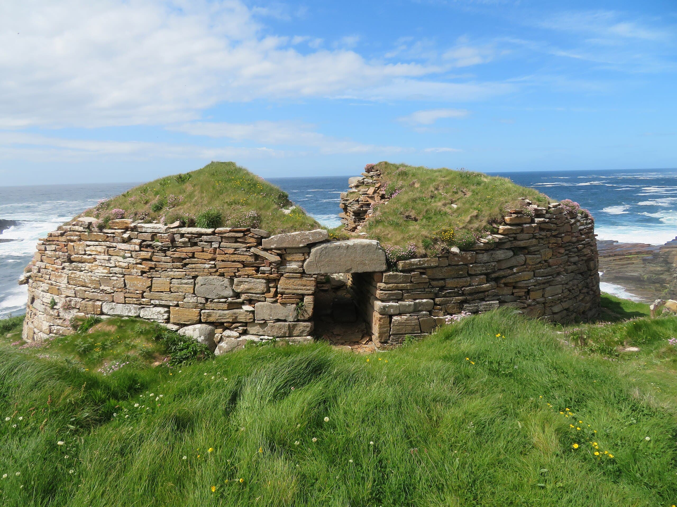
Broch of Borwick
An Iron Age tower on the edge of the Atlantic, half-claimed by the sea it once overlooked
Sandwick, Orkney Islands, United Kingdom
At A Glance
- Coordinates
- 59.0310, -3.3534
- Suggested Duration
- 90 minutes to 2 hours including the walk from Yesnaby car park (approximately 1.2 km each way). Allow additional time to explore the broader Yesnaby coastline and sea stacks.
Pilgrim Tips
- Windproof and waterproof clothing essential. The headland is fully exposed to the Atlantic. Sturdy walking boots required for the uneven coastal path. Bring warm layers even in summer.
- Permitted. The dramatic setting provides extraordinary compositions. Take care when positioning near the cliff edge for photographs.
- The broch is a scheduled ancient monument. Do not remove stones, dig, or use metal detectors. The western side of the broch is open to a twenty-metre cliff drop. Exercise extreme caution near the edge, particularly in wet or windy conditions. The cliff is actively eroding.
Overview
The Broch of Borwick stands on a crumbling headland above the Atlantic on Orkney's west coast, a stone tower built around 500 BC and occupied for over a thousand years. Its western half has fallen into the sea. What remains is a testament to the Iron Age impulse to build something lasting in one of the most exposed places imaginable. Beneath the broch, a cave called Hell's Mouth opens to the waves. A massive ditch once separated the promontory from the mainland, marking the threshold between the everyday world and whatever this place meant to those who chose to live here.
On a narrow promontory at Yesnaby, where Orkney's west coast meets the open Atlantic, the remains of a stone tower rise from the grass. The Broch of Borwick was built around 500 BC, a circular structure of dry-stone masonry with walls up to five metres thick and an interior space seven metres across. For over a thousand years, people lived within these walls, twenty metres above the sea, exposed to every storm the Atlantic could deliver.
The broch is half gone now. Coastal erosion has taken the entire western arc of the building, and the cliff edge runs through what was once the interior. The eastern half survives, its walls standing to a height of two and a half metres, the entrance passage still traceable. The ruin is not diminished by its incompleteness. If anything, the broken edge sharpens the encounter, making visible the contest between human construction and geological time.
Beneath the broch, invisible from above, a sea cave called Hell's Mouth opens into the cliff face. The name is not infernal but Norse. Hellir means cave, and the Norse settlers who arrived centuries after the broch was abandoned named it for what they found: a dark opening in the rock below an ancient mound. Long before excavation revealed the broch's true nature, local tradition linked the mound above to the cave below.
A ditch forty-nine metres long and up to eighteen metres wide once cut across the headland behind the broch, flanked by a rampart nearly three metres high. This was not a casual boundary. It was a deliberate act of separation, isolating the promontory from the land beyond. Whatever this place was, dwelling or stronghold, farmstead or something more, its builders wanted it set apart.
Context And Lineage
The Broch of Borwick is an Iron Age promontory fort with broch, built around 500 BC on Orkney's Atlantic west coast. It was occupied for over a thousand years, excavated in 1881, and is now a scheduled ancient monument. The broch is one of over a hundred recorded in Orkney, part of a building tradition unique to northern and western Scotland.
Around 500 BC, an Iron Age community chose a narrow headland at Yesnaby to build their home. They cut a ditch forty-nine metres long across the neck of the promontory, piling the spoil into a rampart nearly three metres high. Beyond this barrier, on the promontory's highest point, they raised a circular tower of dry-stone masonry.
The tower was built from the local Old Red Sandstone, its walls constructed in the double-walled technique characteristic of brochs: two concentric skins of stone with a void between them that allowed for internal galleries, stairways, and scarcements to support upper floors. The original interior measured 7.3 metres across, large enough for a substantial household. Outside the tower, a cluster of outbuildings served the functions of daily life.
The broch was not built in isolation. Across Orkney and the Scottish Highlands and Islands, at least seven hundred brochs rose during the centuries between 600 BC and AD 100. These towers were the defining architecture of their age, expressions of technical skill, social ambition, and the relationship between a community and its landscape. Whether primarily defensive, residential, or symbolic, they were monumental. At Borwick, the combination of ditch, rampart, and tower on an already-isolated headland suggests a place of considerable importance.
The broch endured. Centuries after its original construction, new occupants arrived. They inserted an additional wall skin into the interior, reducing the diameter to 4.9 metres and subdividing the space into compartments. They left behind bone combs that date this secondary phase to between AD 300 and 700. These later inhabitants looked out from the same walls at the same sea, though the world around them had changed entirely.
No continuous tradition connects the Iron Age and early medieval inhabitants of the broch to any modern community. The site's significance is understood through archaeological investigation and heritage management. The name Borwick itself preserves Old Norse etymology, from borg (fortification) and vik (bay), indicating that Norse settlers who arrived after the broch's abandonment recognised it as a landmark.
William Watt of Skaill
Excavator
Why This Place Is Sacred
The Broch of Borwick draws its power from the collision of human persistence and elemental force. For a millennium, people chose to live on this exposed headland, and the Atlantic has been taking it back ever since. The cave beneath the tower, the ditch behind it, and the vast sea before it create a threshold landscape where the boundary between the built world and the natural one is palpable and dissolving.
There are places where the land itself seems to thin, where the ordinary solidity of the ground gives way to something less certain. The Broch of Borwick is one of these. The cliff is eroding. The western wall has fallen into the sea. The floor of the broch ends where the rock ends, and beyond that is air and then water and then the open Atlantic reaching toward Iceland and beyond.
What remains is enough to feel the shape of what was. The walls are massive, three and a half to five metres thick, built without mortar from the Old Red Sandstone that forms the Orkney bedrock. The builders understood their material and their environment. They created a structure that endured for over a thousand years in one of the most exposed positions in northern Europe. This was not survival but statement.
Beneath the broch, Hell's Mouth opens to the sea. Across the broader Orkney landscape, subterranean chambers found within or beneath broch settlements have been reinterpreted in recent decades. The discovery of Minehowe, an underground structure of broch-like architecture that is unmistakably ritual in purpose, has changed how archaeologists understand these spaces. The wells and underground passages at the Broch of Gurness and The Cairns appear to serve no practical function. They may instead represent an Iron Age engagement with what lies below, a relationship between the world of light and the world of stone and water.
At Borwick, this relationship is not architectural but geological. The cave was not built; it was there before the broch and will be there after the last stone falls. The broch was placed above it, and whether this was coincidence or intention, the effect is the same: a tower of human making balanced above a void shaped by the sea.
The ditch behind the broch completes the separation. Once you crossed it, you left the ordinary headland and entered a defined space. The broch sat at the end of a promontory made into a kind of island, bounded by sea on three sides and by human decision on the fourth. This is what makes a place thin: not supernatural presence but the intensity of human choice inscribed into a landscape that is itself extreme.
Constructed around 500 BC as a fortified dwelling, likely a high-status farmstead. The massive walls, outbuildings, and defensive ditch suggest a community of social importance. The broch's dimensions and construction quality are consistent with the Orkney norm for creating a stable base for a tall tower.
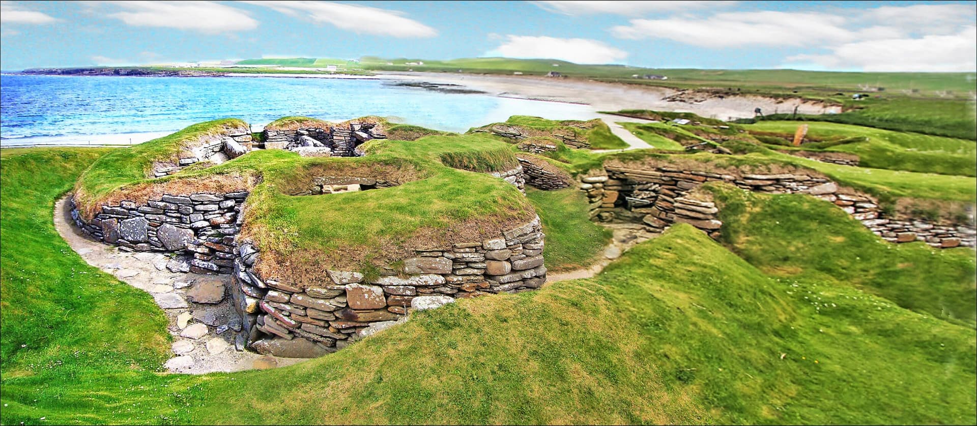
The broch was occupied in at least two distinct phases. The original interior diameter of 7.3 metres was later reduced to 4.9 metres through the insertion of an additional wall skin, and the interior was subdivided into compartments. Bone combs recovered during excavation suggest the secondary occupation phase dates to AD 300-700. The site was excavated in 1881 by William Watt of Skaill, who also excavated Skara Brae. Since then, coastal erosion has continued to claim the western portion of the structure. The broch is now a scheduled ancient monument.
Traditions And Practice
No active ritual practices take place at the Broch of Borwick. The site invites contemplative walking and silent engagement with the coastal landscape. The approach from Yesnaby along the cliff path is itself a practice of attention and exposure.
The Iron Age communities who built and inhabited the broch lived a life shaped by the sea and the stone. The artefacts recovered, including bone combs and deposits of ash, bone, and shell, speak to a domestic existence sustained over centuries. The massive defensive ditch and rampart suggest community organisation and collective labour. Across Orkney, Iron Age communities likely practised a form of Celtic polytheism, worshipping deities associated with the natural world and agricultural cycles. The subterranean features found at other Orkney brochs hint at a ritual dimension to broch life that may have extended to the relationship between the Borwick tower and the Hell's Mouth cave beneath it.
Visitors walk the coastal path from Yesnaby to reach the broch, an approach that functions as an informal pilgrimage through an exposed and elemental landscape. The site attracts those drawn to ancient places, coastal walks, and the particular atmosphere of Orkney's Atlantic edge. Photography and quiet contemplation are the primary activities.
Walk slowly along the coastal path from Yesnaby. Let the wind and the sound of the sea accompany the approach. At the broch, take time to trace the curve of the surviving walls and to stand where the interior meets the cliff edge. Notice the thickness of the walls and consider the centuries of habitation they contained. If conditions allow, sit in the shelter of the eastern wall and let the sound of the sea below enter your awareness. The walk back along the coast offers time to absorb what you have seen.
Iron Age Broch-Building and Community Life
HistoricalThe broch was constructed around 500 BC as part of a building tradition that produced over seven hundred towers across Scotland. These structures represented the highest expression of Iron Age architecture in the region, combining sophisticated dry-stone engineering with social statement. The Borwick broch, with its massive walls, defensive ditch, outbuildings, and over a thousand years of occupation, represents a sustained commitment to place that transcended any single generation. The secondary occupation phase, with its modified interior and bone comb artefacts, demonstrates continuity of use well into the period when new cultural forces, including Christianity and Norse expansion, were reshaping the northern world.
Construction and maintenance of a monumental stone tower using the double-walled technique. Community organisation sufficient to cut a 49-metre ditch and build a 3-metre rampart. Domestic life in an extreme coastal environment over centuries. Reoccupation and structural modification during the later centuries of use.
Experience And Perspectives
Walk north from the Yesnaby car park along the coastal path, following the cliff edge for just over a kilometre. The broch appears on a promontory ahead, its surviving eastern walls standing against the sky. The approach on foot builds a gradual awareness of the landscape's exposure. Inside the ruin, the western edge is open to the drop. The experience is one of elemental encounter.
The walk begins at the Yesnaby car park, off the B9056 south of Skara Brae. There is nothing to prepare you for the coast. The car park sits on gentle ground, but within minutes of walking north the Atlantic reveals itself, a vast grey-green presence that dominates every view from this point onward.
The coastal path follows the cliff edge. It is uneven, sometimes muddy, and requires attention. On the left, the land falls away to rock platforms and sea stacks carved from the Old Red Sandstone. On the right, Orkney's interior rolls eastward in low green hills. The wind is constant. It has shaped everything here, the grass, the few wildflowers, the posture of anyone who walks this path.
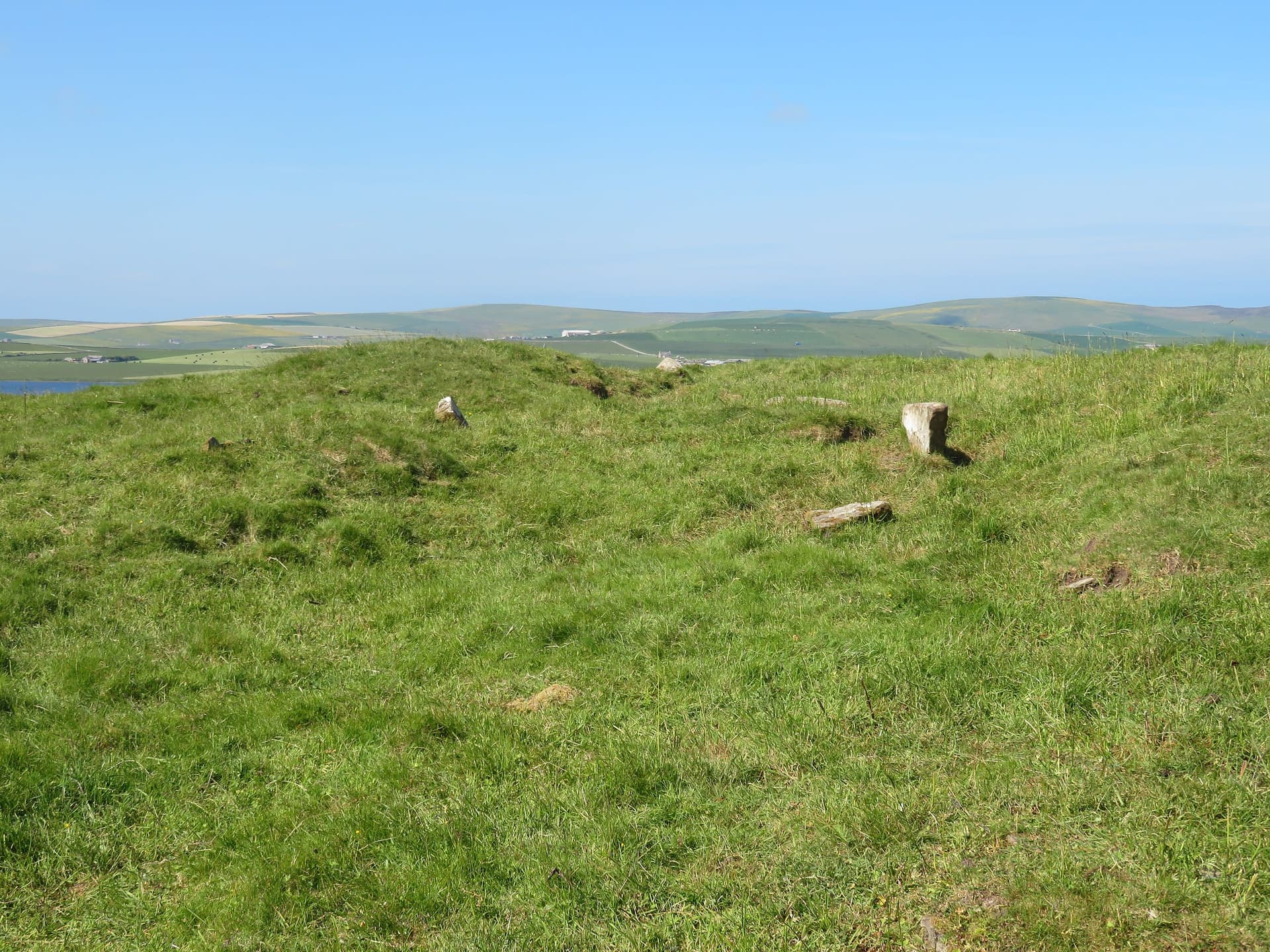
After roughly twenty minutes, the broch appears ahead on its promontory. From a distance, it reads as a low mound, indistinguishable from the natural landforms until you are close enough to see the coursed masonry. The approach narrows as the headland tapers. The remains of the great ditch are visible as a depression in the ground, though much of the rampart has been levelled by time.
Entering the broch requires care. The eastern entrance passage is still identifiable, leading into an interior that now ends at the cliff edge. The western wall is gone. Standing inside, you occupy a half-circle of stone with the open Atlantic as the missing half. The scale of the walls is impressive even in ruin. At their base, they are five metres thick, substantial enough to have contained galleries and stairways within their mass.
Look down from the western edge, carefully, and the cliff drops twenty metres to the sea. Somewhere below, though invisible from above, Hell's Mouth opens into the rock. The sea enters the cave, and on stormy days the sound of it reverberates through the headland.
Look north along the coast toward Marwick Head and the Brough of Birsay. Look south toward the Yesnaby sea stacks. You are standing in a place that people chose to inhabit for a thousand years, and the reason is not immediately obvious. There is no shelter here, no harbour, no gentle land. What there is, is a position of extraordinary command, a place from which the sea and the sky and the approaching horizon are held in a single view.
Sit with the wind. Let the scale of the place settle. The broch asks for nothing. It simply remains, for now, until the cliff takes more.
The Broch of Borwick is located approximately 1.2 km north of the Yesnaby car park on Mainland Orkney, accessible via the B9056. The broch stands on a cliff-top promontory 20 metres above the sea. The walk follows the coastal path and takes approximately 20 minutes each way.
The Broch of Borwick can be understood as an archaeological monument, as a study in Iron Age social organisation and construction, as an example of the relationship between human habitation and extreme landscape, or as a meditation on impermanence and the persistence of human intention against elemental forces.
Archaeologists classify the site as a promontory fort with broch, one of over one hundred recorded brochs in Orkney. Recent scholarship has moved away from purely defensive interpretations, suggesting brochs functioned as monumental markers of social status and community identity. The secondary occupation phase, indicated by bone combs dating to AD 300-700 and the insertion of a secondary wall skin, demonstrates the site's continued importance well into the Pictish period. The presence of Hell's Mouth cave beneath the broch, in the context of the broader reinterpretation of subterranean features at Orkney broch sites following the discovery of Minehowe, raises questions about possible ritual dimensions that have not been investigated archaeologically at Borwick.
No oral tradition specific to the broch's Iron Age inhabitants survives. The name Borwick preserves Old Norse etymology, indicating that Norse settlers recognised the site as a notable landmark. Local folklore connected the mound above to the Hell's Mouth cave below before excavation revealed the broch's structure.
Some visitors and writers exploring sacred landscape perceive the broch's cliff-top position and the cave beneath it as expressing a deliberate relationship between the worlds above and below. The dramatic setting and the broch's gradual surrender to the Atlantic have drawn those who see in such places a metaphor for the boundary between the human world and forces that exceed human control.
The precise relationship between the broch and Hell's Mouth cave has never been archaeologically investigated. Whether the cave was accessed from within the broch or used in any ritual capacity remains unknown. The full extent of William Watt's 1881 finds is incompletely documented. How much of the original structure has been lost to erosion cannot be determined. The identity and beliefs of those who built and inhabited the broch are unrecoverable from the archaeological record alone.
Visit Planning
Freely accessible at all times, located a 20-minute walk north along the coast from the Yesnaby car park. No admission charge. No facilities at the site. Allow 90 minutes for the walk and visit. A car is necessary to reach Yesnaby.
No facilities at the site or the Yesnaby car park. Nearest services in Stromness (approximately 10 km south) including hotels, restaurants, and shops. Accommodation also available in Kirkwall (approximately 25 km east). Orkney is accessible by ferry from Scrabster and Aberdeen, and by air from Scottish mainland airports.
Treat the broch with respect as an ancient monument and a place of significant archaeological value. Exercise extreme caution near the cliff edge. Leave no trace.
The Broch of Borwick is a scheduled ancient monument, protected under Scottish law. The site is freely accessible and unfenced, which places the responsibility for its care on each visitor. The walls that remain have stood for two and a half thousand years. They deserve the same attentive care that any ancient structure commands. Do not climb on the walls, remove stones, or disturb the ground. The Scottish Outdoor Access Code applies.
The greater concern at this site is physical safety. The western half of the broch has collapsed into the sea, and the cliff edge now runs through the interior of the building. The drop is twenty metres to rocks and water. The cliff is composed of Old Red Sandstone, which erodes readily, and sections of the edge may be unstable. In wet conditions or high winds, the risk increases substantially. Keep well back from the western edge. Supervise children closely.
Windproof and waterproof clothing essential. The headland is fully exposed to the Atlantic. Sturdy walking boots required for the uneven coastal path. Bring warm layers even in summer.
Permitted. The dramatic setting provides extraordinary compositions. Take care when positioning near the cliff edge for photographs.
Do not leave offerings, coins, or objects on the monument. It is a scheduled monument and disturbance is a legal offence.
The broch is a scheduled ancient monument under Scottish law. Any disturbance, excavation, or use of metal detectors is prohibited without permission from Historic Environment Scotland.
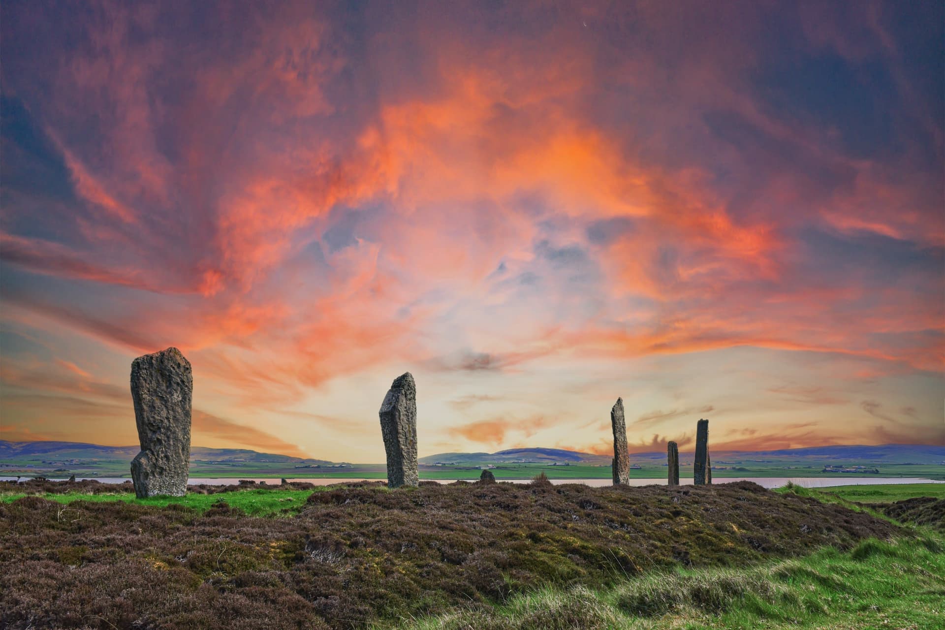
Sacred Cluster
Nearby sacred places create the location cluster described in the growth plan. This block is intentionally crawlable and links into the wider regional graph.