Heritage collection
UNESCO World Heritage Sacred Sites
A browsable collection of UNESCO-tagged sacred places across living pilgrimage routes, historic sanctuaries, and cultural landscapes.
Showing 89 UNESCO-linked sacred sites.
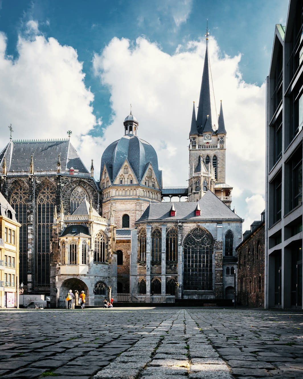
Aachen Cathedral
Aachen, North Rhine-Westphalia, Germany
Aachen is a cathedral of sacred significance. Approximate coordinates: 50.77472, 6.08392. Attributes: built, cultural, pilgrimage, ceremonial. Tradition: Christianity. Recognized as a UNESCO World Heritage Site. Aachen is the 13th-largest city in North Rhine-Westphalia and the 27th-largest city of Germany, with around 261,000 inhabitants. Aachen is located at the northern foothills of the High Fens and the Eifel Mountains. It sits on the Wurm River, a tributary of the Rur, and together with Mönchengladbach, it is the only larger German city in the drainage basin of the Meuse. It is the westernmost larger city in Germany, lying approximately 61 km (38 mi) west of Cologne and Bonn, directly bordering Belgium in the southwest, and the Netherlands in the northwest. The city lies in the Meuse–Rhine Euroregion and is the seat of the district of Aachen (Städteregion Aachen). The once Celtic settlement was equipped with several thermae in the course of colonization by Roman pioneers settling at the warm Aachen thermal springs around the 1st century. After the withdrawal of the Roman troops, the vicus Aquae Granni was Frankized around the 5th century. This was followed by a period of sedentism under first Merovingian and then Carolingian rule. With the completion of the Carolingian Palace of Aachen at the transition to the 9th century, Aachen was constituted as the main royal residence of the Frankish Empire ruled by Charlemagne. Because of that the city is sometimes called cradle of Europe . After the Treaty of Verdun, the city was within the borders of Middle Francia, until it became part of East Francia after the Treaty of Meerssen (870). It subsequently was part of the Holy Roman Empire and was granted city rights in 1166 by Emperor Frederick Barbarossa, becoming an imperial city. It served as the coronation site where 31 Holy Roman Emperors were crowned Kings of the Germans from 936 to 1531, until Frankfurt am Main became the preferred place of coronation. One of Germany s leading institutes of higher education in technology, the RWTH Aachen University (Rheinisch-Westfälisch Technische Hochschule Aachen), is located in the city. Its university hospital Uniklinikum Aachen is Europe s largest single-building hospital. Aachen s industries include science, engineering and information technology. In 2009, Aachen was ranked eighth among cities in Germany for innovation. The regional dialect spoken in the city is a Central Franconian, Ripuarian variant with strong Limburgish influences from the dialects in the neighbouring Netherlands. As a Rhenish city, Aachen is one of the main centres of carnival celebrations in Germany, along with Cologne and Mainz. The culinary specialty for which the city is best known is Aachener Printen, a type of gingerbread.
Abu Mena
Izbat Muhammad Farid, Alexandria, Egypt
Abu Mena is a monastery complex of sacred significance. Approximate coordinates: 30.85156, 29.66615. Attributes: built, cultural, archaeological, pilgrimage. Tradition: Christianity. Associated figure: St. Menas of Alexandria. Recognized as a UNESCO World Heritage Site. Abu Mena (also spelled Abu Mina; Coptic: ⲁⲃⲃⲁ ⲙⲏⲛⲁ; Arabic: أبو مينا, romanized: Abū Mīnā pronounced [æbuˈmæyːnæ]) was a town, monastery complex and Christian pilgrimage centre in Late Antique Egypt, about 50 km (31 mi) southwest of Alexandria, near New Borg El Arab city. Its remains were designated a World Heritage Site in 1979 for the site s importance in early Christianity. There are very few standing remains, but the foundations of most major buildings, such as the great basilica, are easily discernible. Recent agricultural efforts in the area have led to a significant rise in the water table, which has caused a number of the site s buildings to collapse or become unstable. The site was added to the List of World Heritage in Danger in 2001. Authorities were forced to place sand in the bases of buildings that are most endangered in the site.
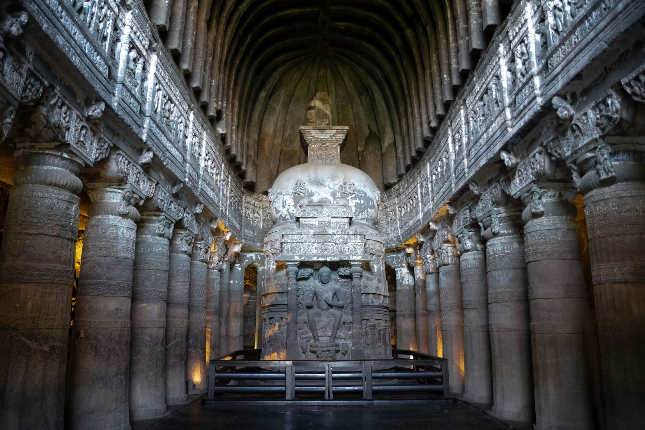
Ajanta caves, Maharashtra
Phardapur, Maharashtra, India
Ajanta caves, Maharashtra is a cave of sacred significance. Approximate coordinates: 20.55186, 75.70325. Attributes: natural, cultural, archaeological, pilgrimage, ceremonial. Tradition: Buddhist, Hindu, Jain; also recognized in Interfaith contexts. Recognized as a UNESCO World Heritage Site. Located in Maharashtra, India.
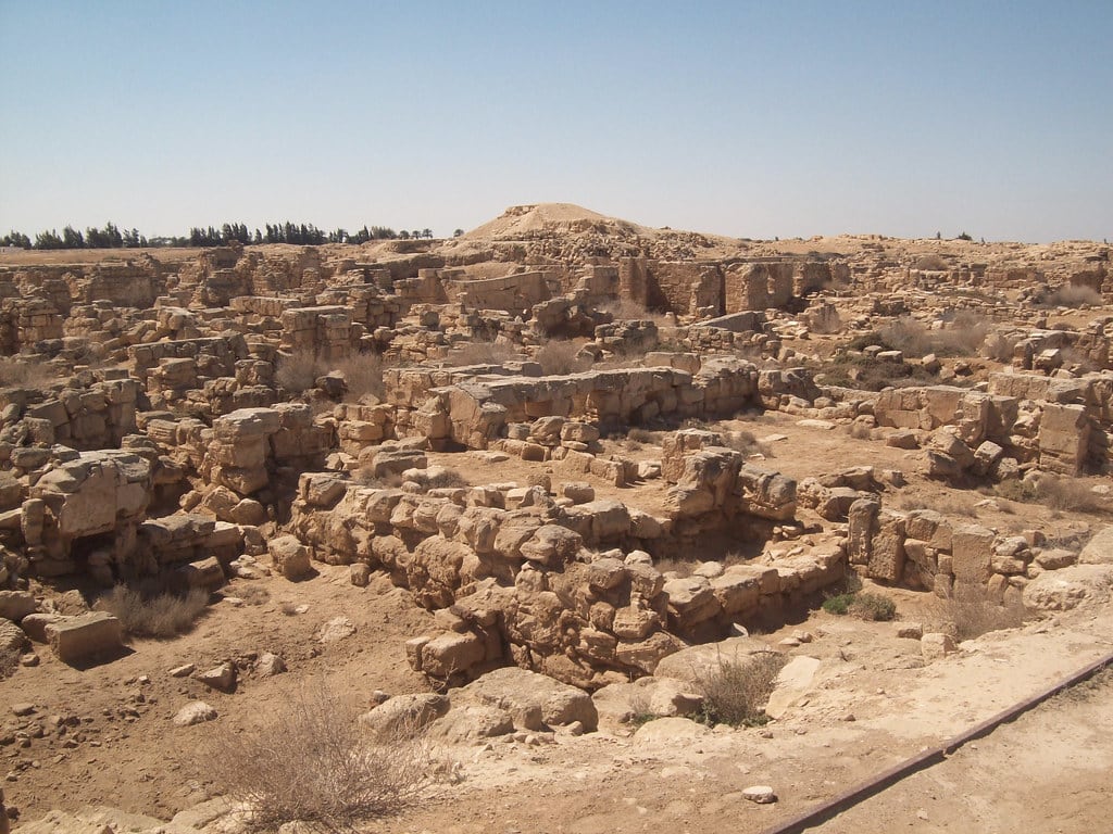
Ancient Jericho/Tell es-Sultan
Jericho, West Bank, Palestinian Territories
Jericho is a city of sacred significance. Approximate coordinates: 31.87446, 35.43044. Attributes: built, cultural, archaeological, pilgrimage. Tradition: Christianity. Associated figure: Christ. Mythological context: Biblical. Recognized as a UNESCO World Heritage Site. Jericho ( JERR-ik-oh; Arabic: أريحا, romanized: Arīḥā, IPA: [ʔaˈriːħaː] ) is a city in the West Bank, Palestine; it is the administrative seat of the Jericho Governorate of Palestine. Jericho is located in the Jordan Valley, with the Jordan River to the east and Jerusalem to the west. In 2017, it had a population of 20,907. From the end of the era of Mandatory Palestine, the city was annexed and ruled by Jordan from 1949 to 1967 and, with the rest of the West Bank, has been subject to Israeli occupation since 1967; administrative control was handed over to the Palestinian Authority in 1994. Jericho is among the oldest cities in the world, and it is also the city with the oldest known defensive wall. Archaeologists have unearthed the remains of more than 20 successive settlements in Jericho, the first of which dates back 11,000 years (to 9000 BCE), almost to the very beginning of the Holocene epoch of the Earth s history. Copious springs in and around the city have attracted human habitation for thousands of years. Jericho is described in the Bible as the city of palm trees . In 2023, the archaeological site in the center of the city, known as Tell es-Sultan / Old Jericho, was inscribed in UNESCO s list as a World Heritage Site in the State of Palestine, and described as the oldest fortified city in the world . Located in الضفة الغربية, Palestinian Territory.
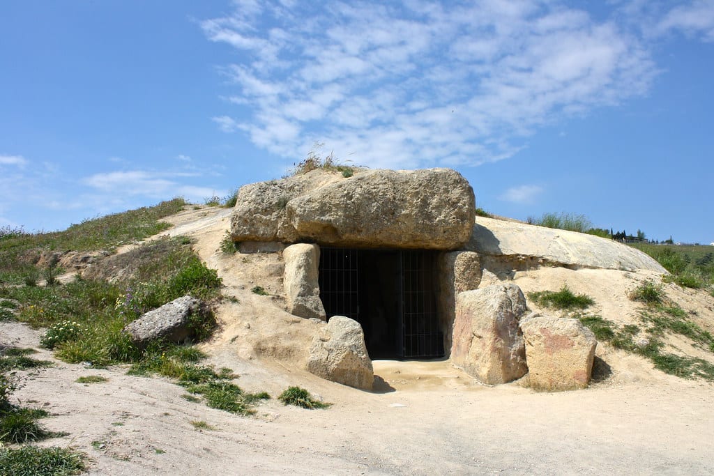
Antequera, Dolmen de Menga
Antequera, Andalusia, Spain
Antequera, Dolmen de Menga is a dolmen of sacred significance. Approximate coordinates: 37.02411, -4.54837. Attributes: built, cultural, archaeological. Recognized as a UNESCO World Heritage Site. Located in Antequera, Andalucía, España.
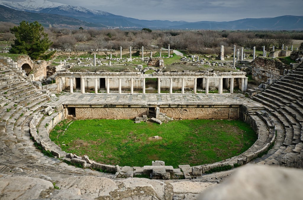
Aphrodisias
Karacasu, Aydın, Turkey
Aphrodisias is a ancient city of sacred significance. Approximate coordinates: 37.70918, 28.72357. Attributes: built, cultural, archaeological. Tradition: Hellenistic Greek. Associated figure: Aphrodite. Mythological context: Greek Mythology. Recognized as a UNESCO World Heritage Site. Aphrodisias (; Ancient Greek: Ἀφροδισιάς, romanized: Aphrodisiás) was a Hellenistic Greek city in the historic Caria cultural region of western Asia Minor, today s Anatolia in Turkey. It is located near the modern village of Geyre, about 100 km (62 mi) east/inland from the coast of the Aegean Sea, and 230 km (140 mi) southeast of İzmir. Aphrodisias was named after Aphrodite, the Greek goddess of love, who had here her unique cult image, the Aphrodite of Aphrodisias. According to the Suda, a Byzantine encyclopedic compilation, before the city became known as Aphrodisias (c. 3rd century BC) it had three previous Greek names: Lelégōn Pólis (Λελέγων πόλις, City of the Leleges ), Megálē Pólis (Μεγάλη Πόλις, Great City ), and Ninóē (Νινόη). Sometime before 640, in the Late Antique period when it was within the Byzantine Empire, the city was renamed Stauropolis (Σταυρούπολις, City of the Cross ). In 2017, it was inscribed on the UNESCO World Heritage Site list. Located in Karacasu, Ege Bölgesi, Turkey.
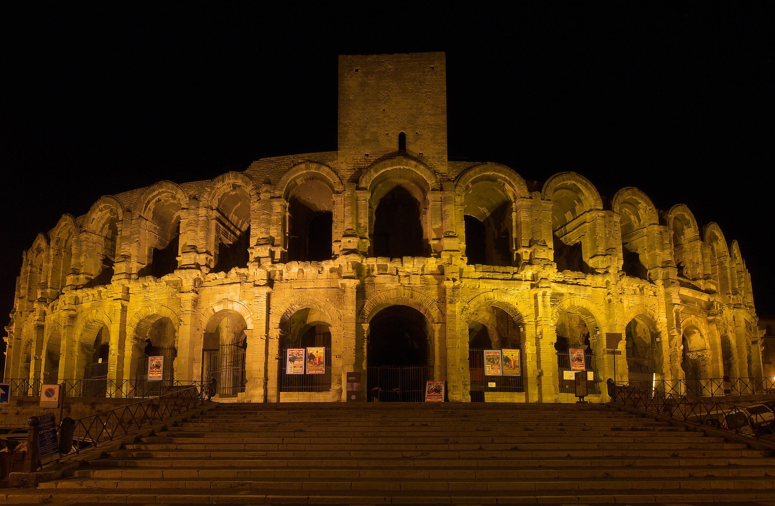
Arles
Arles, Provence-Alpes-Côte d'Azur, France
Arles is a city of sacred significance. Approximate coordinates: 43.67663, 4.62787. Attributes: built, cultural, archaeological. Tradition: Christianity. Associated figure: St. Trophime. Recognized as a UNESCO World Heritage Site. Arles ( ARL(Z), US also AR-əl, French: [aʁl]; Provençal: Arle [ˈaʀle] in both classical and Mistralian norms; Classical Latin: Arelate) is a coastal city and commune in the South of France, a subprefecture in the Bouches-du-Rhône department of the Provence-Alpes-Côte d Azur region, in the former province of Provence. A large part of the Camargue, the largest wetlands in France, is located within the territory of the commune, which is the largest in Metropolitan France in terms of geographic territory. In non-metropolitan France, Maripasoula in French Guiana is the largest French commune in general. The commune s land area is roughly similar to that of Singapore. The city has a long history, and was of considerable importance in the Roman province of Gallia Narbonensis. The Roman and Romanesque Monuments of Arles were listed as UNESCO World Heritage Sites in 1981 for their testimony to the history of the region. The city is famous for being the archdiocese of Caesarius of Arles and Hilary of Arles. Additionally, many artists have lived and worked in this area, including Pablo Picasso, Paul Gauguin and Jacques Réattu. The Dutch post-Impressionist painter Vincent van Gogh lived in Arles from 1888 to 1889, and produced over 300 paintings and drawings during his time there. These are held in internationally known museums and private collections around the world. An international photography festival has been held annually in the city since 1970. Located in Arles, Provence-Alpes-Côte d'Azur, France.
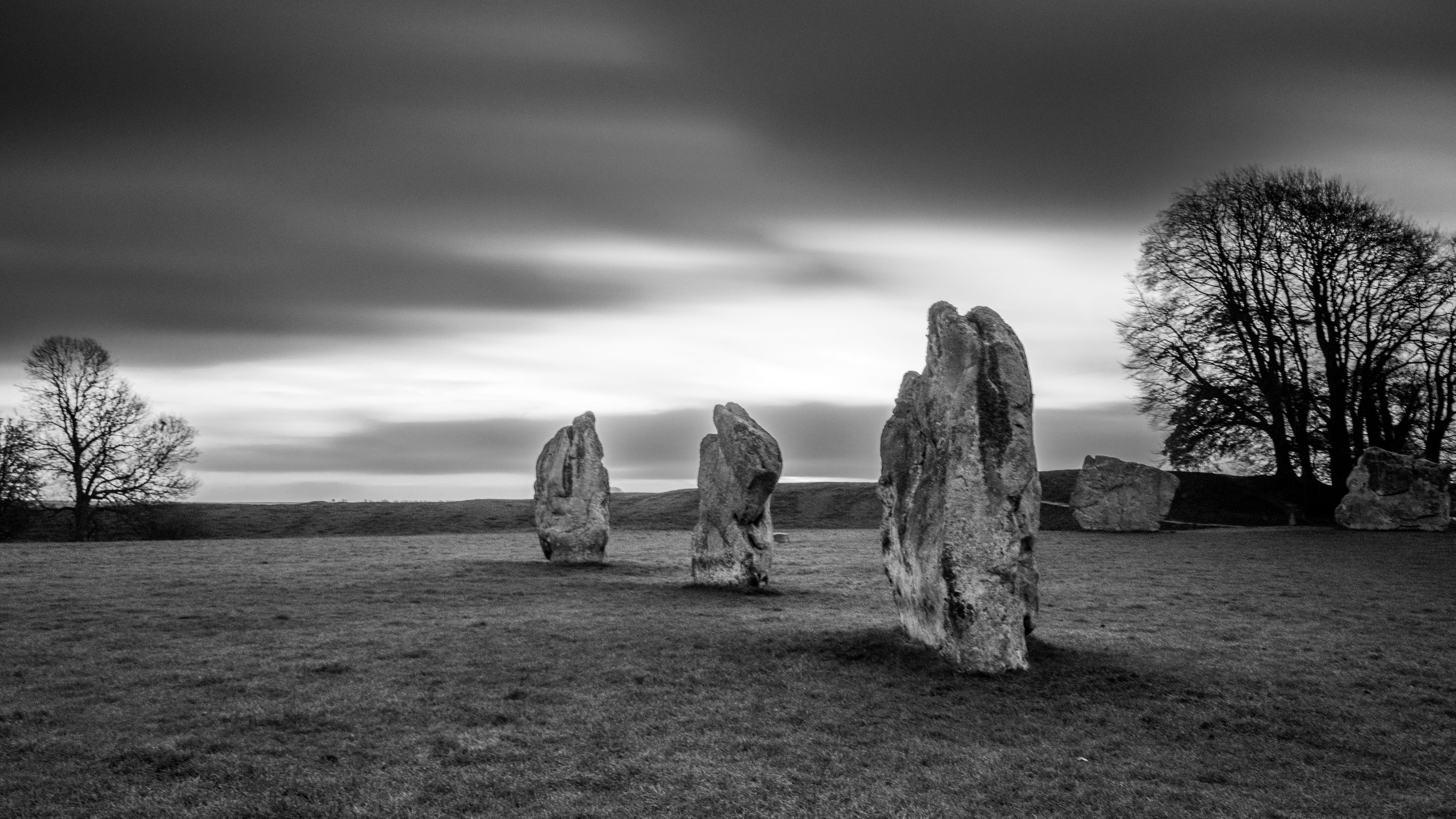
Avebury
Avebury, England, United Kingdom
Avebury is a stone circle of sacred significance. Approximate coordinates: 51.42890, -1.85487. Attributes: built, cultural, archaeological, ceremonial. Tradition: Pagan. Recognized as a UNESCO World Heritage Site. Avebury () is a Neolithic henge monument containing three stone circles, around the village of Avebury in Wiltshire, in south-west England. One of the best-known prehistoric sites in Britain, it contains the largest megalithic stone circle in the world. It is both a tourist attraction and a place of religious importance to contemporary pagans. Constructed over several hundred years in the third millennium BC, during the Neolithic, or New Stone Age, the monument comprises a large henge (a bank and a ditch) with a large outer stone circle and two separate smaller stone circles situated inside the centre of the monument. Its original purpose is unknown, although archaeologists believe that it was most likely used for some form of ritual or ceremony. The Avebury monument is a part of a larger prehistoric landscape containing several older monuments nearby, including West Kennet Long Barrow, Windmill Hill and Silbury Hill. By the Iron Age, the site had been effectively abandoned, with some evidence of human activity on the site during the Roman period. During the Early Middle Ages, a village first began to be built around the monument, eventually extending into it. In the late medieval and early modern periods, local people destroyed many of the standing stones around the henge, both for religious and practical reasons. The antiquarians John Aubrey and William Stukeley took an interest in Avebury during the 17th and 18th centuries, respectively, and recorded much of the site between various phases of destruction. Archaeological investigation followed in the 20th century, with Harold St George Gray leading an excavation of the bank and ditch, and Alexander Keiller overseeing a project to reconstruct much of the monument. Avebury is managed by the National Trust. It has been designated a Scheduled Ancient Monument, as well as a World Heritage Site, in the latter capacity being seen as a part of the wider prehistoric landscape of Wiltshire known as Stonehenge, Avebury and Associated Sites. About 480 people live in 235 homes in the village of Avebury and its associated settlement of Avebury Trusloe, and in the nearby hamlets of Beckhampton and West Kennett. Located in England, United Kingdom.
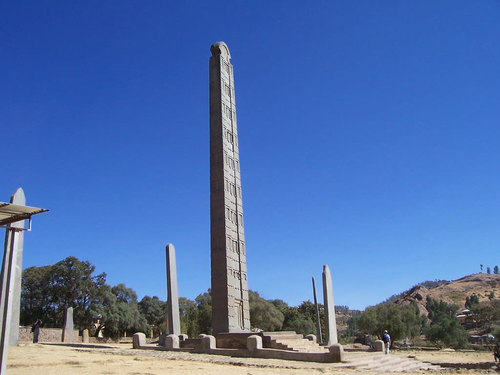
Axum
Axum, Tigray, Ethiopia
Axum is a church and archaeological site of sacred significance. Approximate coordinates: 14.13037, 38.71956. Attributes: built, cultural, archaeological, pilgrimage. Tradition: Christianity. Associated figure: St. Mary of Zion. Mythological context: Ark of the Covenant. Recognized as a UNESCO World Heritage Site. Axum, also spelled Aksum ( ), is a town in the Tigray Region of Ethiopia with a population of 66,900 residents (as of 2015). It is the site of the historic capital of the Aksumite Empire. Axum is located in the Central Zone of the Tigray Region, near the base of the Adwa mountains. It has an elevation of 2,131 metres (6,991 feet) and is surrounded by La ilay Maychew, a separately administered woreda of the Tigray region. In 1980, UNESCO added Axum s archaeological sites to its list of World Heritage Sites due to their historic value. Prior to the beginning of the Tigray War in 2020, Axum was a leading tourist destination for foreign visitors. Located in ትግራይ تجراى, ኢትዮጵያ إثيوبيا.
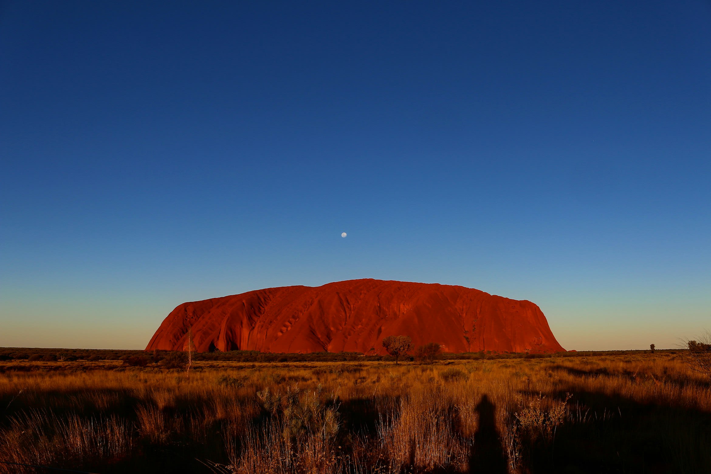
Ayers Rock (Uluru)
Macdonnell Region, Australia
Ayers Rock (Uluru) is a aboriginal sacred site of sacred significance. Approximate coordinates: -25.34453, 131.03643. Attributes: natural, cultural. Tradition: Aboriginal. Mythological context: Aboriginal mythology. Recognized as a UNESCO World Heritage Site. Located in Macdonnell Region, Australia.

Bagan
Nyaung-U, Mandalay, Myanmar
Bagan is a ancient city of sacred significance. Approximate coordinates: 21.16796, 94.86690. Attributes: built, cultural, archaeological, pilgrimage. Tradition: Buddhism. Recognized as a UNESCO World Heritage Site. Bagan ( bə-GAN; Burmese: ပုဂံ Băgam [bəɡàɰ̃]; formerly Pagan) is an ancient city and a UNESCO World Heritage Site in the Mandalay Region of Myanmar. From the 9th to 13th centuries, the city was the capital of the Pagan Kingdom, the first kingdom that unified the regions that would later constitute Myanmar. During the kingdom s height between the 11th and 13th centuries, more than 10,000 Buddhist temples, pagodas and monasteries were constructed in the Bagan plains alone, of which the remains of over 2200 temples and pagodas survive. The Bagan Archaeological Zone is a main attraction for the country s nascent tourism industry. Located in ညောင်ဦး, မန္တလေးတိုင်း, မြန်မာ.
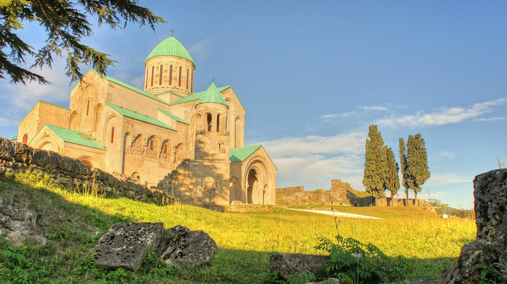
Bagrati Cathedral, Kutaisi
Kutaisi, Imereti, Georgia
Kutaisi is a city of sacred significance. Approximate coordinates: 42.27723, 42.70430. Attributes: built, cultural, pilgrimage. Tradition: Christianity. Recognized as a UNESCO World Heritage Site. Kutaisi ( koo-TY-see, Georgian: ქუთაისი pronounced [ˈkʰut̪ʰais̪i] ) is a city in the Imereti region of the Republic of Georgia. One of the oldest continuously inhabited cities in the world, it is the fourth-most populous city in Georgia after Tbilisi, Batumi and Rustavi. It lies 221 kilometres (137 miles) west of Tbilisi, on the Rioni River, and is the capital of Imereti. Historically one of the major cities of Georgia, it served as the political center of Colchis in the Middle Ages as the capital of the Kingdom of Abkhazia and Kingdom of Georgia and later as the capital of the Kingdom of Imereti. From October 2012 to December 2018, Kutaisi was the seat of the Parliament of Georgia as an effort to decentralize the Georgian government. Located in ქუთაისი, იმერეთი, საქართველო.
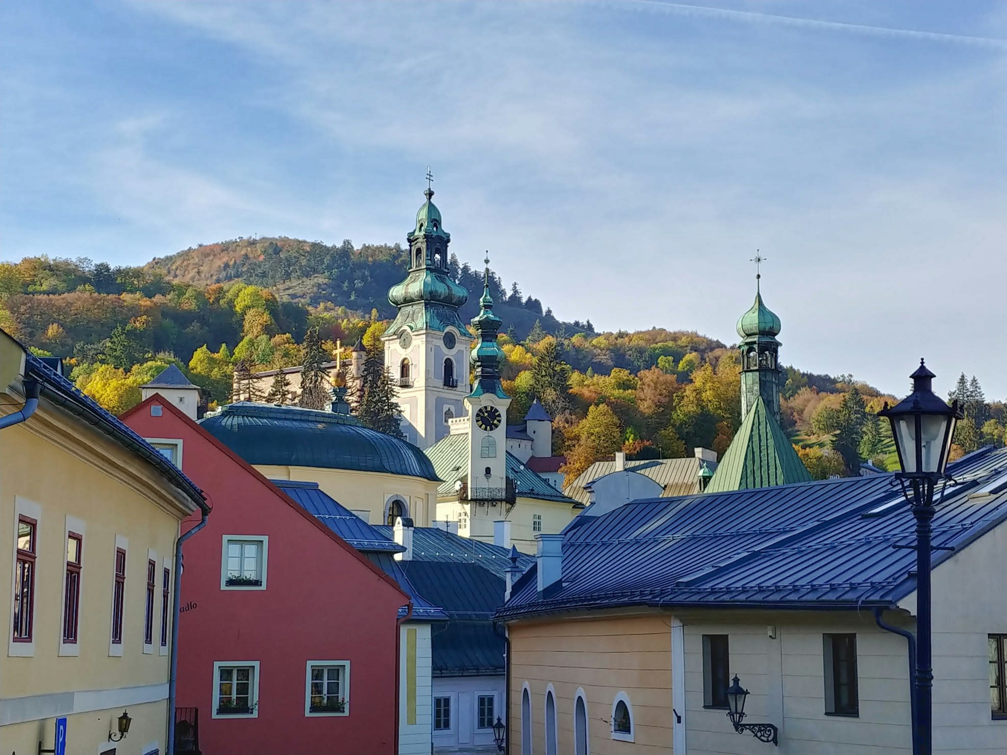
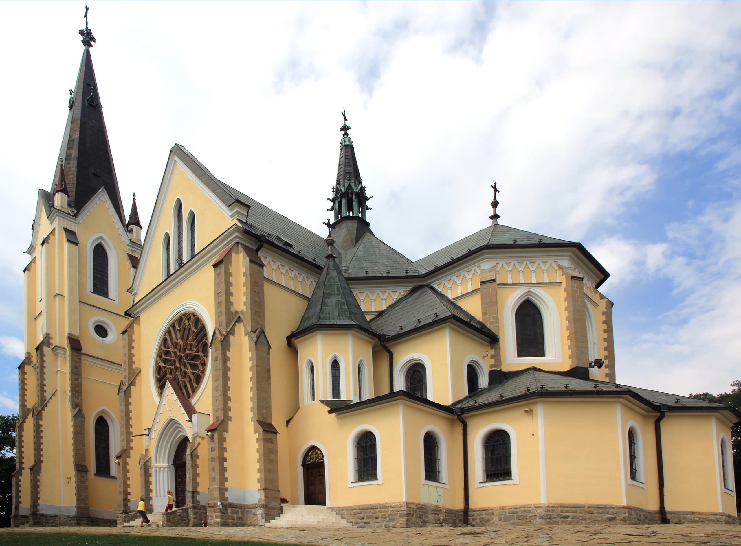
Banská Stiavnica, Calvary
Banská Štiavnica, Region of Banská Bystrica, Slovakia
Banská Stiavnica, Calvary is a calvary of sacred significance. Approximate coordinates: 48.46175, 18.91177. Attributes: built, cultural, pilgrimage, ceremonial. Tradition: Christianity. Associated figure: Jesus Christ. Recognized as a UNESCO World Heritage Site. Located in Banská Štiavnica, Banskobystrický kraj, Slovensko.
Basilica of the Visitation of the Blessed Virgin Mary, Marian Hill in Levoča, Slovakia
Levoča, Prešov Region, Slovakia
Basilica of the Visitation of the Blessed Virgin Mary, Marian Hill in Levoča, Slovakia is a basilica of sacred significance. Approximate coordinates: 49.04338, 20.59775. Attributes: built, cultural, pilgrimage. Tradition: Christianity. Associated figure: Blessed Virgin Mary. Recognized as a UNESCO World Heritage Site. Located in Levoča, Prešovský kraj, Slovensko.
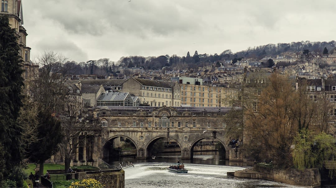
Bath
Bath, England, United Kingdom
Bath is a thermae of sacred significance. Approximate coordinates: 51.38148, -2.35873. Attributes: built, cultural, archaeological. Tradition: Christianity. Bath may refer to: Bathing, immersion in a fluid Bathtub, a large open container for water, in which a person may wash their body Public bathing, a public place where people bathe Thermae, ancient Roman public bathing facilities Located in Bath, England, United Kingdom.
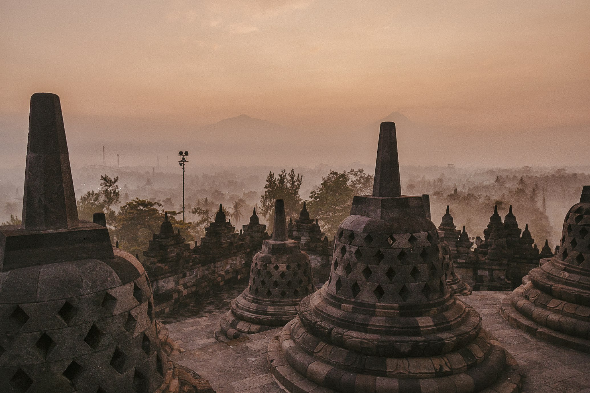
Borobudur
Desa Borobudur, Central Java, Indonesia
Borobudur is a buddhist temple of sacred significance. Approximate coordinates: -7.60787, 110.20375. Attributes: built, cultural, archaeological, pilgrimage. Tradition: Buddhism. Associated figure: Buddha. Recognized as a UNESCO World Heritage Site. Borobudur, also transcribed Barabudur (Indonesian: Candi Borobudur, Javanese: ꦕꦤ꧀ꦝꦶꦧꦫꦧꦸꦝꦸꦂ, romanized: Candhi Barabudhur), is a 9th-century Mahayana Buddhist temple in Magelang Regency, near the city of Magelang and the town of Muntilan, in Central Java, Indonesia. Constructed of gray andesite-like stone, the temple consists of nine stacked platforms, six square and three circular, topped by a central dome. It is decorated with 2,672 relief panels and originally 504 Buddha statues. The central dome is surrounded by 72 Buddha statues, each seated inside a perforated stupa. The monument guides pilgrims through an extensive system of stairways and corridors with 1,460 narrative relief panels on the walls and the balustrades. Borobudur has one of the world s most extensive collections of Buddhist reliefs. Built during the reign of the Sailendra Dynasty, the temple design follows Javanese Buddhist architecture, which blends the Indonesian indigenous tradition of ancestor worship and the Buddhist concept of attaining nirvāṇa. The monument is a shrine to the Buddha and a place for Buddhist pilgrimage. Evidence suggests that Borobudur was constructed in the 8th century and subsequently abandoned following the 14th-century decline of Hindu kingdoms in Java and the Javanese conversion to Islam. Worldwide knowledge of its existence was sparked in 1814 by Sir Thomas Stamford Raffles, then the British ruler of Java, who was advised of its location by native Indonesians. Borobudur has since been preserved through several restorations. The largest restoration project was completed in 1983 by the Indonesian government and UNESCO, followed by the monument s listing as a UNESCO World Heritage Site. Borobudur is the largest Buddhist temple in the world, and ranks with Bagan in Myanmar and Angkor Wat in Cambodia as one of the great archeological sites of Southeast Asia. Borobudur remains popular for pilgrimage, with Buddhists in Indonesia celebrating Vesak Day at the monument. Among Indonesia s tourist attractions, Borobudur is the most-visited monument. Located in Jawa Tengah, Indonesia.
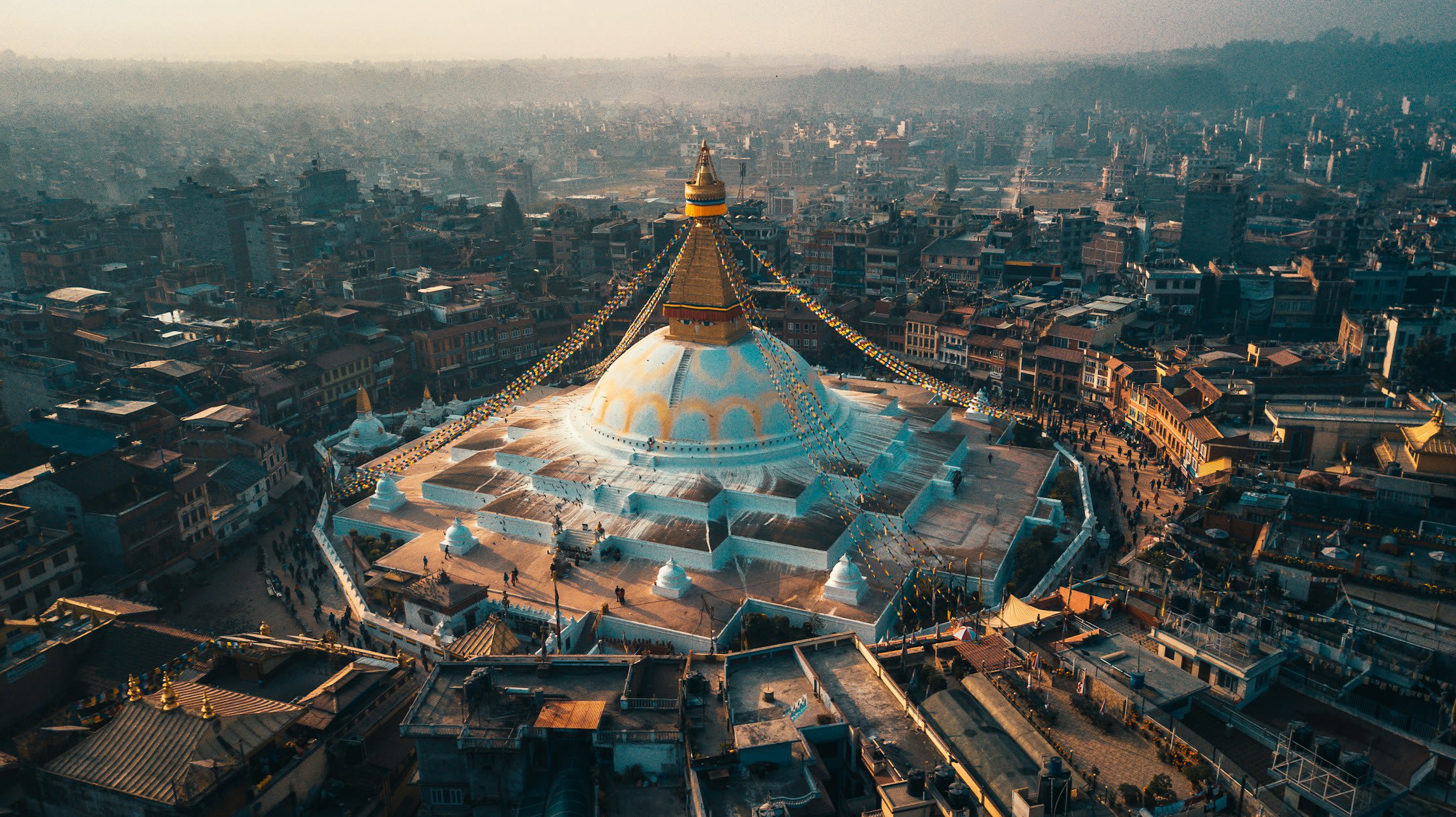
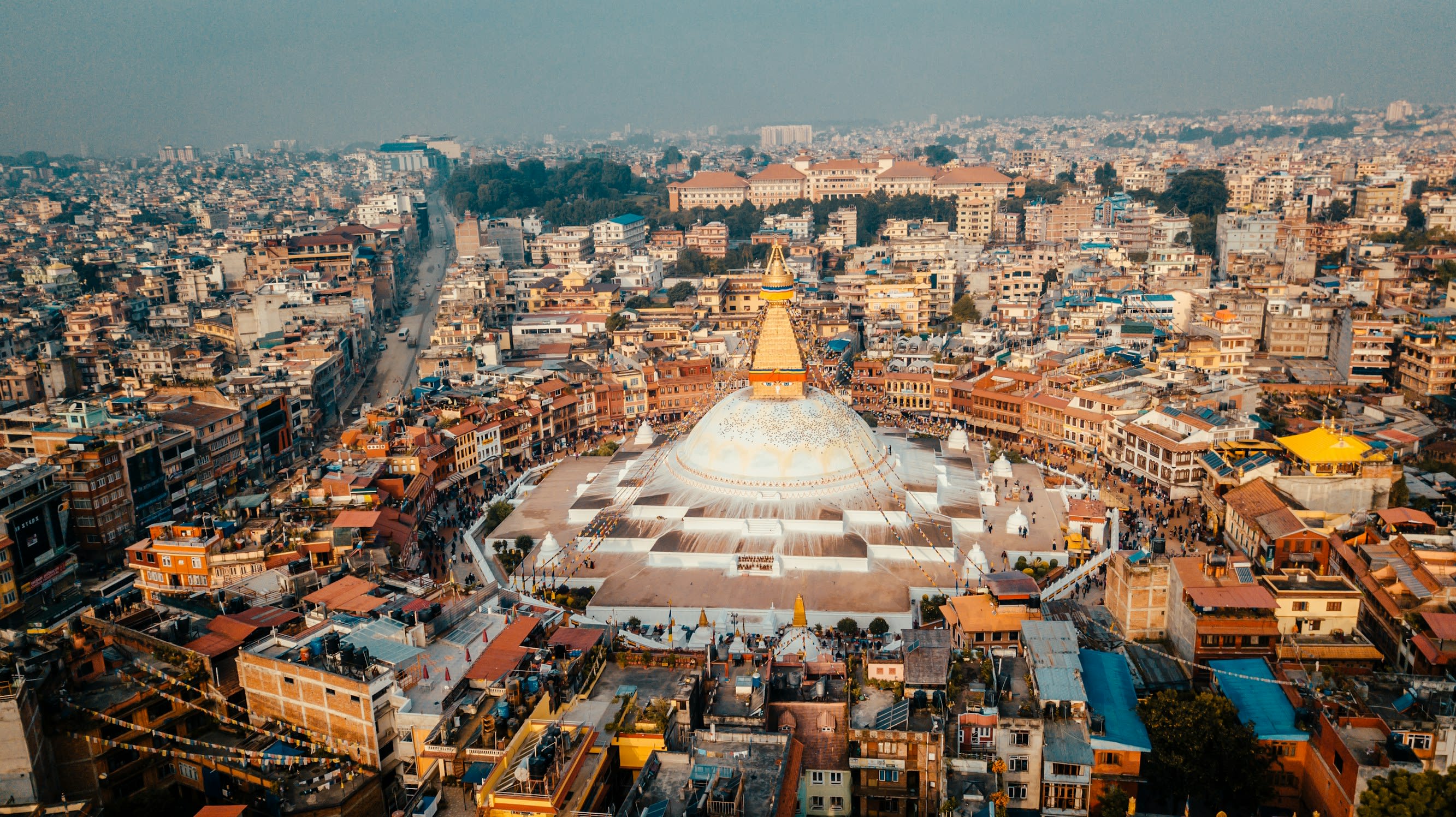
Boudhnath (Boudha)
Gokarneshwar Municipality, Bagamati Province, Nepal
Boudhnath is a buddhist temple of sacred significance. Approximate coordinates: 27.72168, 85.36192. Attributes: built, cultural, pilgrimage. Tradition: Buddhism. Located in काठमाडौँ महानगरपालिका, बागमती प्रदेश, नेपाल.
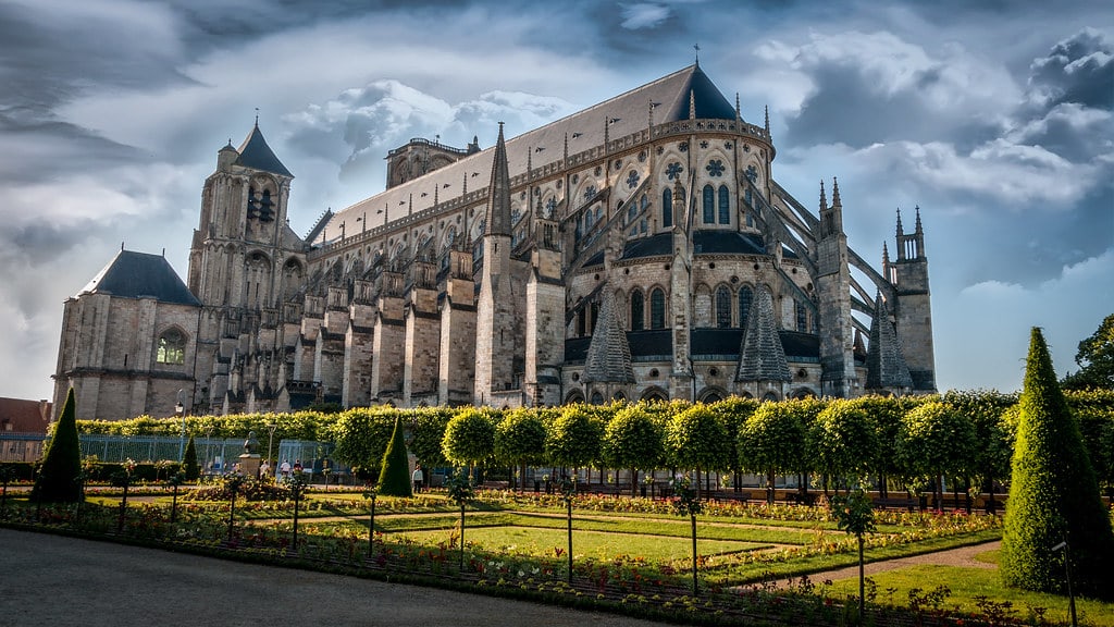
Bourges Cathedral
Bourges, Centre-Val de Loire, France
Bourges is a cathedral of sacred significance. Approximate coordinates: 47.08216, 2.39921. Attributes: built, cultural. Tradition: Christianity. Associated figure: St. Etienne. Recognized as a UNESCO World Heritage Site. Bourges ( BOORZH; French: [buʁʒ] ; Borges in Berrichon) is a commune in central France on the river Yèvre. It is the capital of the department of Cher, and also was the capital city of the former province of Berry. Located in Bourges, Centre-Val de Loire, France.
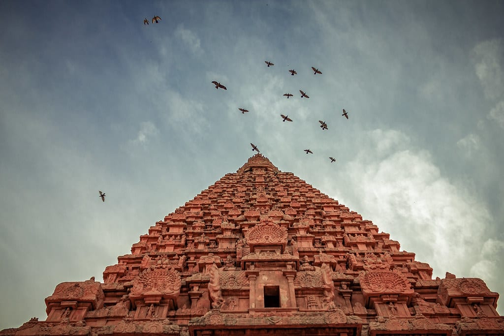
Brihadeeswara Temple, Thanjavur, Tamil Nadu
Thanjavur, Tamil Nadu, India
Brihadeeswara Temple, Thanjavur, Tamil Nadu is a religious of sacred significance. Approximate coordinates: 10.78278, 79.13185. Attributes: built, cultural, pilgrimage. Tradition: Hinduism. Associated figure: Lord Shiva. Recognized as a UNESCO World Heritage Site. Located in Thanjavur, Tamil Nadu, India.
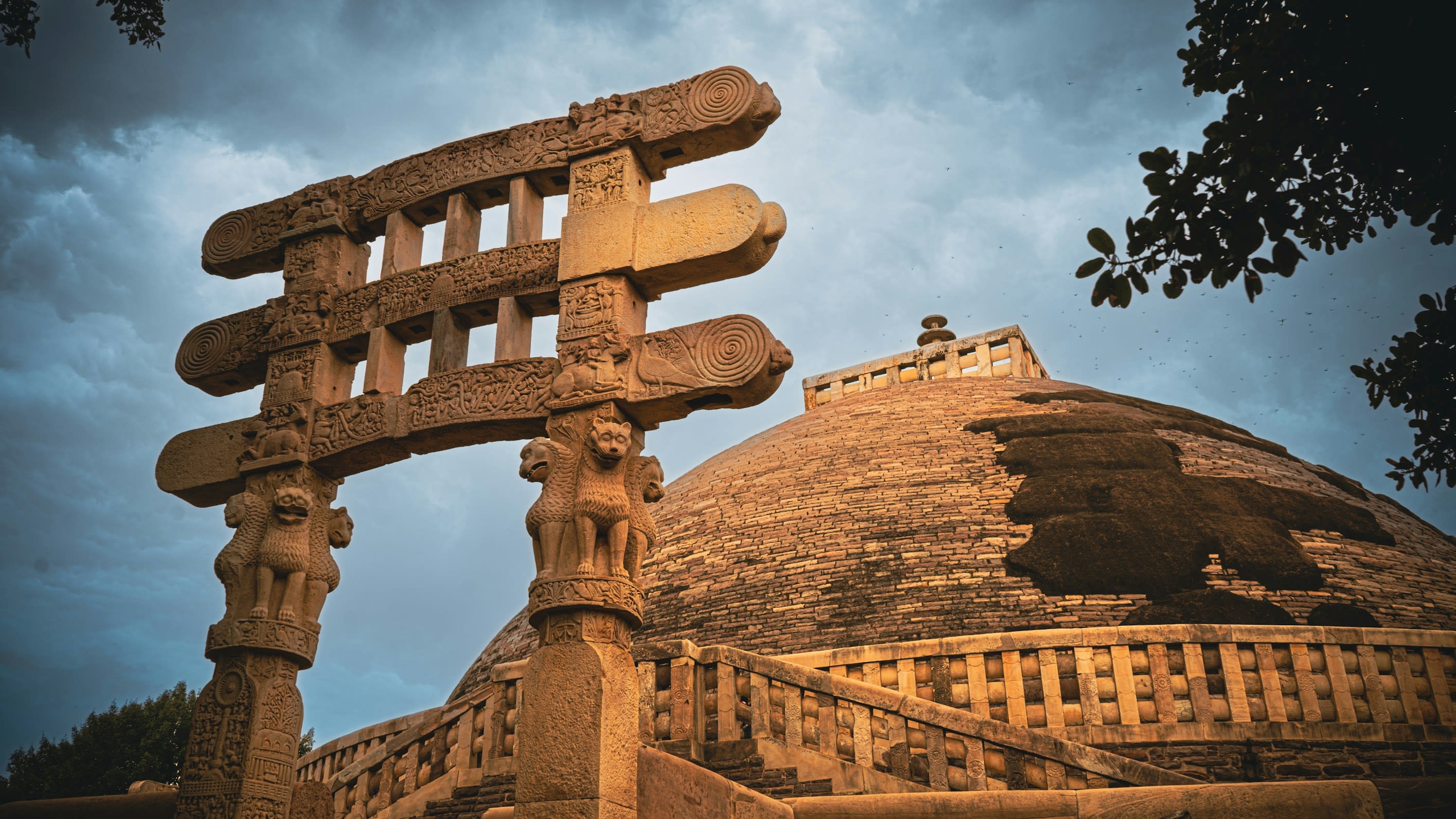
Buddhist Monuments at Sanchi
Amkhera, Madhya Pradesh, India
Buddhist Stupas, Sanchi, Madhya Pradesh is a stupa of sacred significance. Approximate coordinates: 23.47937, 77.73966. Attributes: built, cultural, archaeological, pilgrimage. Tradition: Buddhism. Recognized as a UNESCO World Heritage Site. Located in Madhya Pradesh, India.
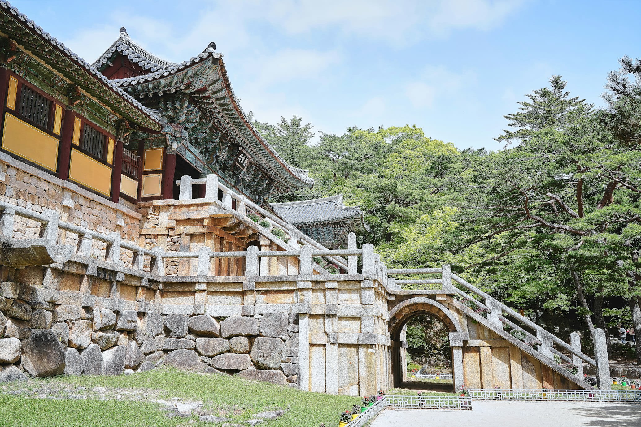
Bulguksa Temple
Gyeongju-si, North Gyeongsang, South Korea
Bulguk-sa is a temple of sacred significance. Approximate coordinates: 35.79012, 129.33207. Attributes: built, cultural, pilgrimage, ceremonial. Tradition: Buddhism. Associated figure: Buddha. Recognized as a UNESCO World Heritage Site. Located in 경주시, 대한민국.
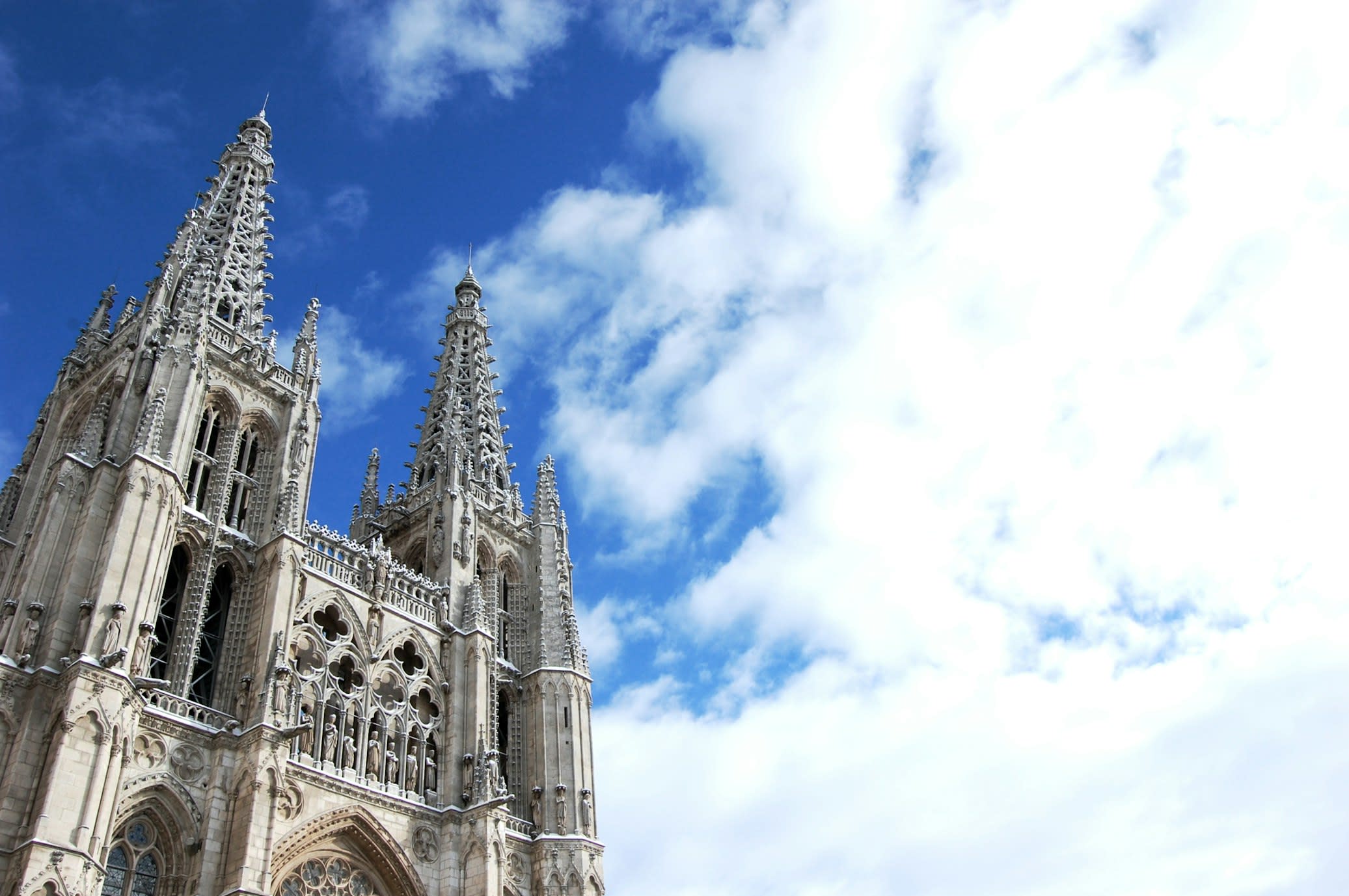
Burgos Cathedral
Burgos, Castile and León, Spain
Burgos is a cathedral of sacred significance. Approximate coordinates: 42.34079, -3.70438. Attributes: built, cultural, pilgrimage. Tradition: Christianity. Recognized as a UNESCO World Heritage Site. Burgos (Spanish: [ˈbuɾɣos] ) is a city in Spain located in the autonomous community of Castile and León. It is the capital and most populous municipality of the province of Burgos. Burgos is situated in the north of the Iberian Peninsula, on the confluence of the Arlanzón river tributaries and at the edge of the central plateau. The municipality has a population of about 180,000 inhabitants. The Camino de Santiago pilgrimage route runs through Burgos. Founded in 885 by the second Count of Castile, Diego Rodríguez Porcelos, Burgos soon became the leading city of the embryonic County of Castile. The 11th century chieftain Rodrigo Díaz de Vivar (El Cid) had connections with the city: born near Burgos, he was raised and educated there. Burgos experienced a long decline from the 17th century onwards. Burgos became the headquarters of the Francoist proto-government (1936–1939) following the start of the Spanish Civil War. Declared in 1964 as Pole of Industrial Promotion and in 1969 as Pole of Industrial Development, the city has grown since then in terms of economic activity. At the regional level, Burgos forms part of an economic axis together with the cities of Valladolid and Palencia. In 2008, the international Burgos Airport started to service commercial flights. The Museum of Human Evolution opened in Burgos in 2010. It features remains of the first hominins in Europe, who lived in the area 750,000–800,000 years ago. The Cathedral of Burgos is a World Heritage Site. Burgos was selected as the Spanish Gastronomy Capital of 2013. In 2015 UNESCO named it City of Gastronomy , and it has been part of the Creative Cities Network since then. Located in Burgos, Castilla y León, España.
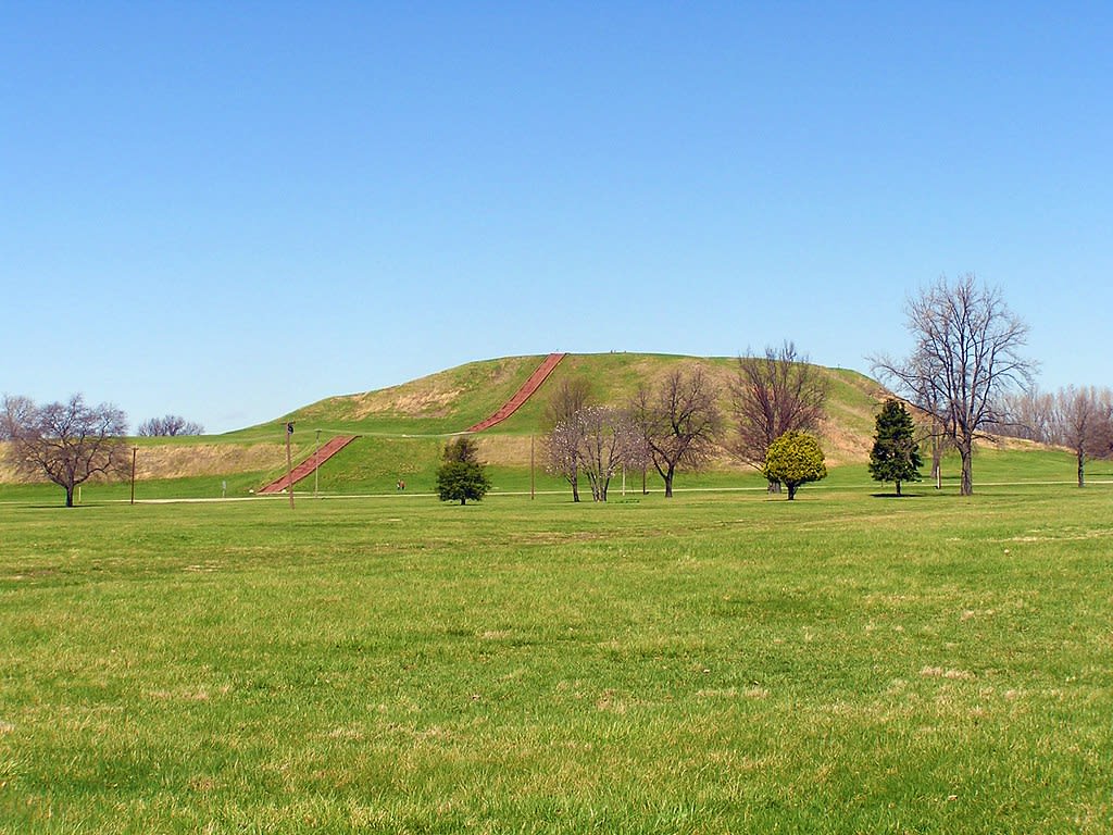
Cahokia Mounds, Collinsville, Illinois
Collinsville, Illinois, United States
Cahokia Mounds, Collinsville, Illinois is a mound of sacred significance. Approximate coordinates: 38.65506, -90.06182. Attributes: built, cultural, archaeological. Tradition: Native American. Recognized as a UNESCO World Heritage Site. Located in Collinsville, Illinois, United States.
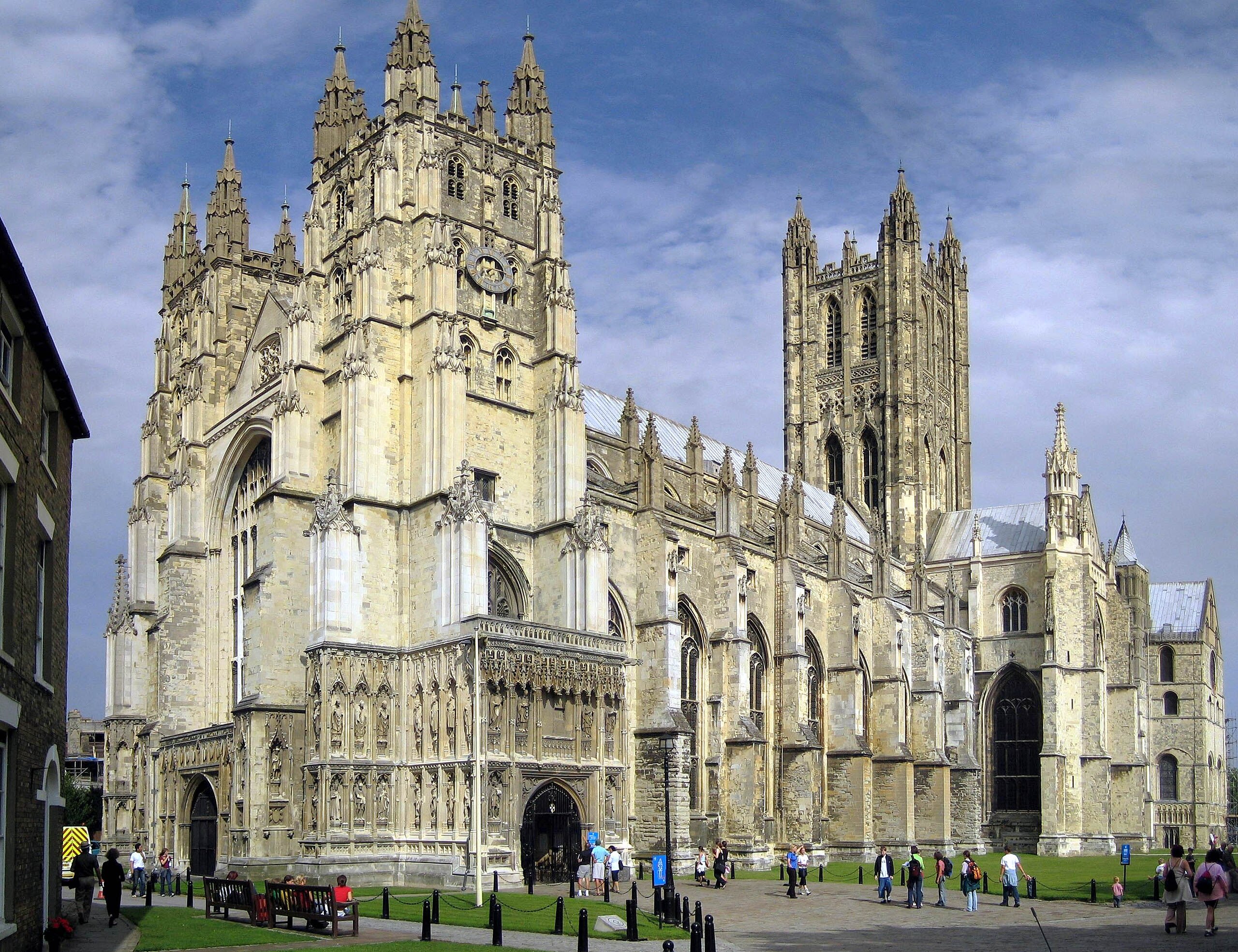
Canterbury Cathedral
Canterbury, England, United Kingdom
Canterbury is a cathedral of sacred significance. Approximate coordinates: 51.27980, 1.08280. Attributes: built, cultural, pilgrimage. Tradition: Christianity. Associated figure: Archbishop of Canterbury. Recognized as a UNESCO World Heritage Site. Canterbury ( , ) is a city and UNESCO World Heritage Site, in the county of Kent, England; it was a county borough until 1974. It lies on the River Stour. The city has a mild oceanic climate. Canterbury is a popular tourist destination, with the city s economy heavily reliant upon tourism, alongside higher education and retail. As of 2011, the city s population was over 55,000, including a substantial number of students and one of the highest student-to-permanent-resident ratios in Britain. The site of the city has been occupied since Paleolithic times and served as the capital of the Celtic Cantiaci and Jute Kingdom of Kent. Many historical structures fill the area, including a city wall founded in Roman times and rebuilt in the 14th century, the Westgate Towers museum, the ruins of St Augustine s Abbey, the Norman Canterbury Castle, and the oldest extant school in the world, the King s School. Modern additions include the Marlowe Theatre and Kent County Cricket Club s St Lawrence Ground. Canterbury Cathedral is known for its architecture, its music, and for being the seat of the Archbishop of Canterbury; it receives a million visitors per year. Located in Canterbury, England, United Kingdom.
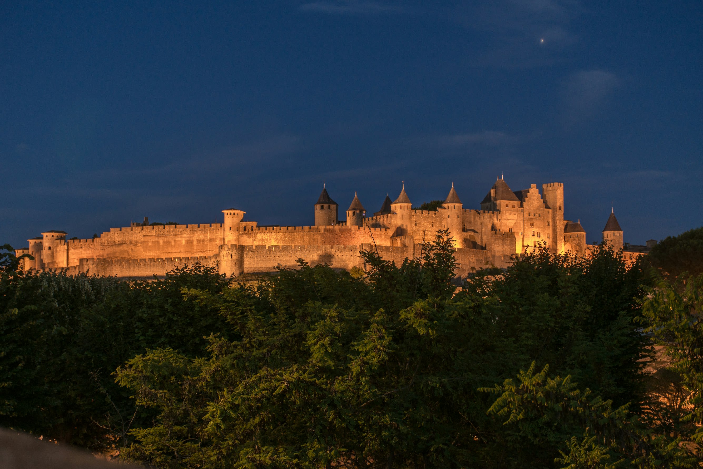
Carcassonne
Carcassonne, Occitania, France
Carcassonne is a fortified city of sacred significance. Approximate coordinates: 43.20508, 2.36325. Attributes: built, cultural, archaeological. Tradition: Christian. Associated figure: St. Nazaire. Recognized as a UNESCO World Heritage Site. Carcassonne is a French fortified city in the department of Aude, region of Occitania. It is the prefecture of the department. Inhabited since the Neolithic Period, Carcassonne is located in the plain of the Aude between historic trade routes, linking the Atlantic to the Mediterranean Sea and the Massif Central to the Pyrénées. Its strategic importance was quickly recognised by the Romans, who occupied its hilltop until the demise of the Western Roman Empire. In the fifth century, the region of Septimania was taken over by the Visigoths, who founded the city of Carcassonne in the newly established Visigothic Kingdom. Its citadel, known as the Cité de Carcassonne, is a medieval fortress dating back to the Gallo-Roman period and restored by the theorist and architect Eugène Viollet-le-Duc between 1853 and 1879. It was added to the UNESCO list of World Heritage Sites in 1997 because of the exceptional preservation and restoration of the medieval citadel. Consequently, Carcassonne relies heavily on tourism but also counts manufacturing and winemaking as some of its other key economic sectors. Located in Carcassonne, Occitanie, France.
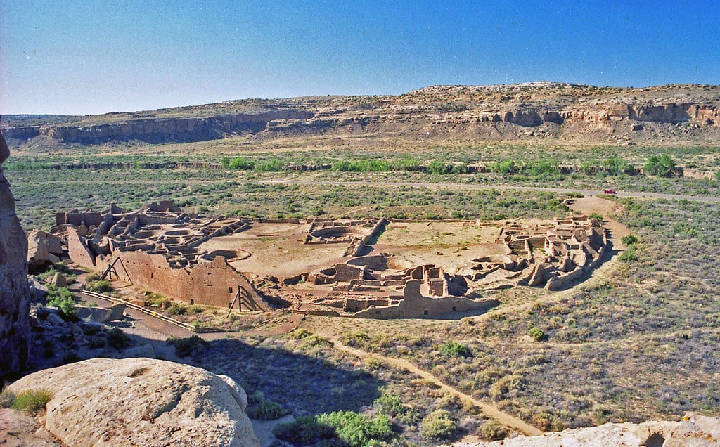
Chaco Canyon, New Mexico
San Juan County, New Mexico, United States
Chaco Canyon, New Mexico is a historical park of sacred significance. Approximate coordinates: 36.05909, -107.95784. Attributes: built, cultural, archaeological, ceremonial. Tradition: Anasazi Indian. Recognized as a UNESCO World Heritage Site. Located in New Mexico, United States.
Changu Narayan Temple
Bhaktapur, Bagmati Province, Nepal
Changu Narayan is a temple of sacred significance. Approximate coordinates: 27.71640, 85.42781. Attributes: built, cultural, pilgrimage. Tradition: Hinduism, Buddhism; also recognized in Interfaith contexts. Located in चाँगुनारायण नगरपालिका, बागमती प्रदेश, नेपाल.
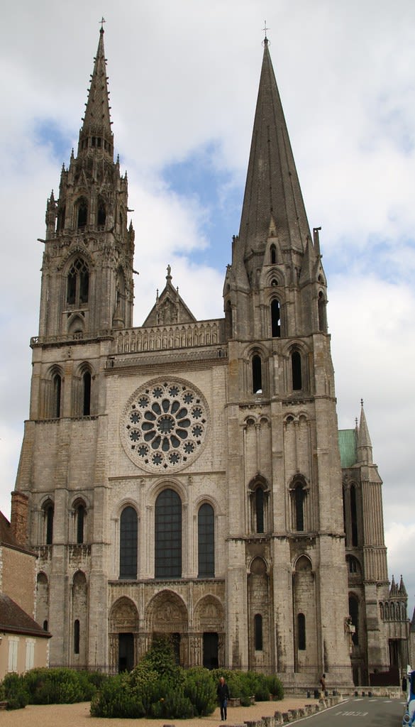
Chartres Cathedral
Chartres, Centre-Val de Loire, France
Chartres is a cathedral of sacred significance. Approximate coordinates: 48.44780, 1.48784. Attributes: built, cultural, pilgrimage. Tradition: Christianity. Associated figure: Our Lady of Chartres. Recognized as a UNESCO World Heritage Site. Chartres (French pronunciation: [ʃaʁtʁ] ) is the prefecture of the Eure-et-Loir department in the Centre-Val de Loire region in France. It is located about 90 km (56 mi) southwest of Paris. At the 2019 census, there were 170,763 inhabitants in the metropolitan area of Chartres (as defined by the INSEE), 38,534 of whom lived in the city (commune) of Chartres proper. Chartres is famous worldwide for its cathedral. Mostly constructed between 1193 and 1250, this Gothic cathedral is in an exceptional state of preservation. The majority of the original stained glass windows survive intact, while the architecture has seen only minor changes since the early 13th century. Part of the old town, including most of the library associated with the School of Chartres, was destroyed by Allied bombs in 1944. Located in Chartres, Centre-Val de Loire, France.
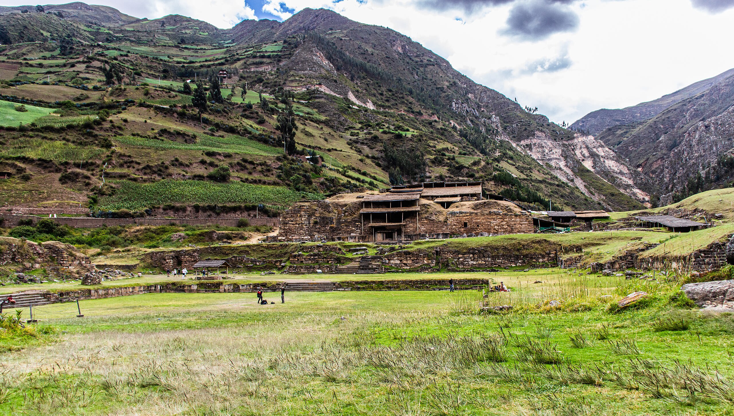
Chavín de Huántar
Chavín de Huantar, Ancash, Peru
Chavín de Huántar is a archaeological site of sacred significance. Approximate coordinates: -9.59367, -77.17734. Attributes: built, cultural, archaeological, ceremonial. Tradition: Chavín. Recognized as a UNESCO World Heritage Site. Chavín de Huántar is an archaeological site in Peru, containing ruins and artifacts constructed as early as 1200 BC, and occupied until around 400–500 BC by the Chavín, a major pre-Inca culture. The site is located in the Ancash Region, 434 kilometers (270 mi) north of Lima, at an elevation of 3,180 meters (10,430 ft), east of the Cordillera Blanca at the start of the Conchucos Valley. Chavín de Huántar has been designated as a UNESCO World Heritage Site. Some of the Chavín relics from this archaeological site are on display in the Museo de la Nación in Lima and the Museo Nacional de Chavín in Chavín itself. Occupation at Chavín de Huántar has been carbon-dated to at least 3000 BC, with ceremonial center activity occurring primarily toward the end of the second millennium, and through the middle of the first millennium BC. While the fairly large population was based on an agricultural economy, the city s location at the headwaters of the Marañón River, between the coast and the jungle, made it an ideal location for the dissemination and collection of both ideas and material goods. This archaeological site is a large ceremonial center that has revealed a great deal about the Chavín culture. Chavín de Huántar served as a gathering place for people of the region to come together and worship. The transformation of the center into a valley-dominating monument made it a pan-regional place of importance. People went to Chavín de Huántar as a center: to attend and participate in rituals, consult an oracle, or enter a cult. Findings at Chavín de Huántar indicate that social instability and upheaval began to occur between 500 and 300 BC, at the same time that the larger Chavín culture began to decline. Large ceremonial sites were abandoned, some unfinished, and were replaced by villages and agricultural land. At Chavín de Huántar, no later than 500 BC, a small village replaced the Circular Plaza. The plaza was occupied by a succession of cultural groups, and residents salvaged building stones and stone carvings to use in house walls. Multiple occupation floors indicate the village was continuously occupied through the 1940s. Located in Chavín de Huantar, Ancash, Peru.
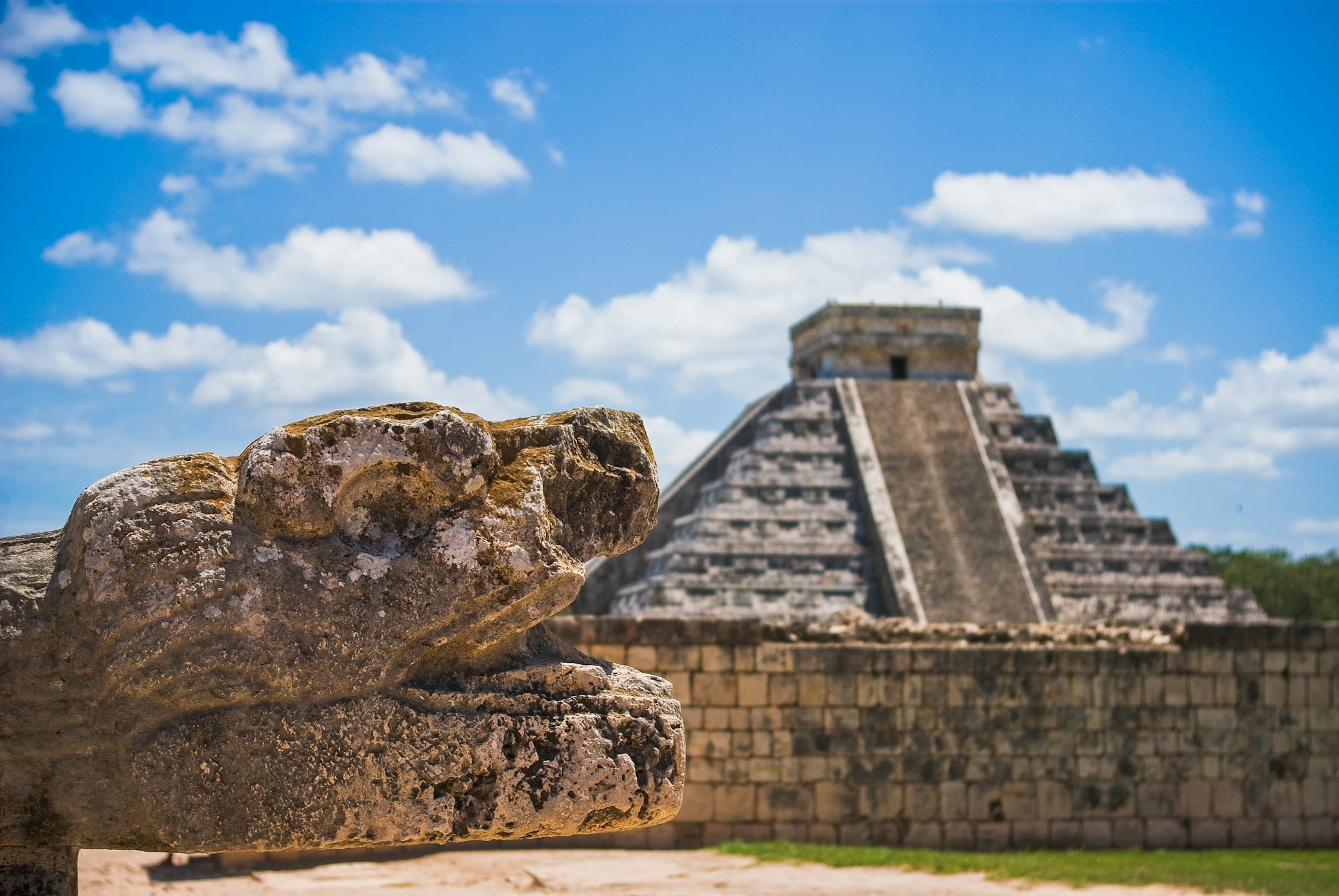
Chichen Itza
Pisté, Yucatán, Mexico
Chichen Itza is a pre-columbian city of sacred significance. Approximate coordinates: 20.68322, -88.57075. Attributes: built, cultural, archaeological, pilgrimage, ceremonial. Tradition: Maya. Mythological context: Mesoamerican. Recognized as a UNESCO World Heritage Site. Chichén Itzá (often spelled Chichen Itza in English and traditional Yucatec Maya) was a large pre-Columbian city built by the Maya people of the Terminal Classic period. The archeological site is located in Tinúm Municipality, Yucatán State, Mexico. Chichén Itzá was a major focal point in the Northern Maya Lowlands from the Late Classic (c. AD 600–900) through the Terminal Classic (c. AD 800–900) and into the early portion of the Postclassic period (c. AD 900–1200). The site exhibits a multitude of architectural styles, reminiscent of styles seen in central Mexico and of the Puuc and Chenes styles of the Northern Maya lowlands. The presence of central Mexican styles was once thought to have been representative of direct migration or even conquest from central Mexico, but most contemporary interpretations view the presence of these non-Maya styles more as the result of cultural diffusion. Chichén Itzá was one of the largest Maya cities and it was likely to have been one of the mythical great cities, or Tollans, referred to in later Mesoamerican literature. The city may have had the most diverse population in the Maya world, a factor that could have contributed to the variety of architectural styles at the site. The ruins of Chichén Itzá are federal property, and the site s stewardship is maintained by Mexico s Instituto Nacional de Antropología e Historia (National Institute of Anthropology and History). The land under the monuments had been privately owned until 29 March 2010, when it was purchased by the state of Yucatán. Chichén Itzá is one of the most visited archeological sites in Mexico with over 2.6 million tourists in 2017. Located in Yucatán, Mexico.
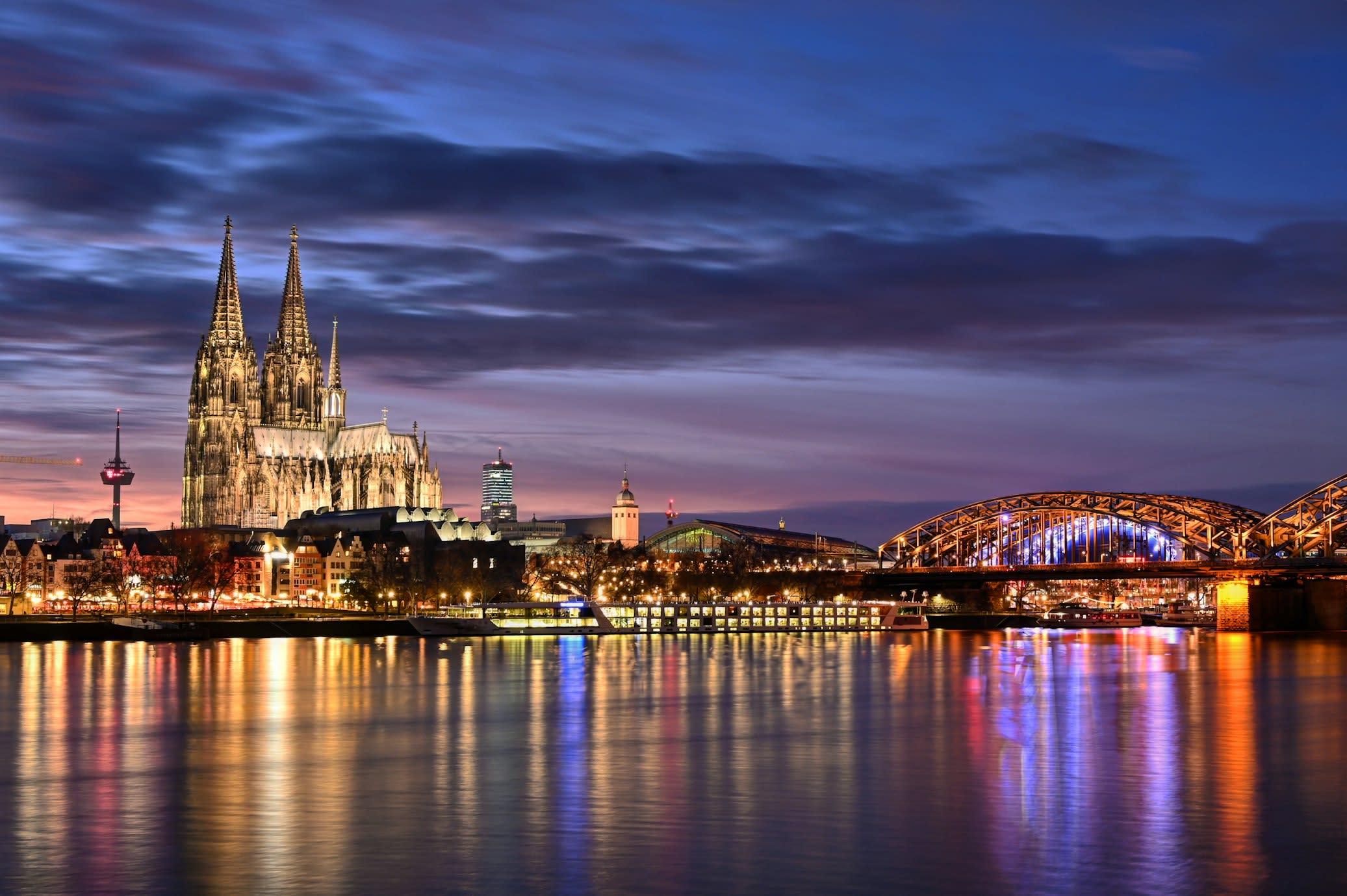
Cologne Cathedral
Köln, Nordrhein-Westfalen, Germany
Cologne is a cathedral of sacred significance. Approximate coordinates: 50.94128, 6.95828. Attributes: built, cultural, pilgrimage. Tradition: Christianity. Associated figure: Three Kings. Recognized as a UNESCO World Heritage Site. Cologne ( kə-LOHN; German: Köln [kœln] ; Kölsch: Kölle [ˈkœlə] ) is the largest city of the German state of North Rhine-Westphalia and the fourth-most populous city of Germany with nearly 1.1 million inhabitants in the city proper and over 3.1 million people in the Cologne Bonn urban region. Cologne is also part of the Rhine-Ruhr metropolitan region, the second biggest metropolitan region by GDP in the European Union. Centered on the left (west) bank of the Rhine, Cologne is located on the River Rhine (Lower Rhine), about 35 km (22 mi) southeast of the North Rhine-Westphalia state capital Düsseldorf and 25 km (16 mi) northwest of Bonn, the former capital of West Germany. The city s medieval Cologne Cathedral (Kölner Dom) was the world s tallest building from 1880 to 1890 and is today the third-tallest church and tallest cathedral in the world. It was constructed to house the Shrine of the Three Kings and is a globally recognized landmark and one of the most visited sights and pilgrimage destinations in Europe. The cityscape is further shaped by the Twelve Romanesque churches of Cologne. Cologne is famous for Eau de Cologne, which has been produced in the city since 1709; cologne has since come to be a generic term. Cologne was founded and established in Germanic Ubii territory in the 1st century CE as the Roman Colonia Agrippina, hence its name. Agrippina was later dropped (except in Latin), and Colonia became the name of the city in its own right, which developed into modern German as Köln. Cologne, the French version of the city s name, has become standard in English as well. Cologne functioned as the capital of the Roman province of Germania Inferior and as the headquarters of the Roman military in the region until occupied by the Franks in 462. During the Middle Ages the city flourished as being located on one of the most important major trade routes between eastern and western Europe (including the Brabant Road, Via Regia and Publica). Cologne was a free imperial city of the Holy Roman Empire and one of the major members of the trade union Hanseatic League. It was one of the largest European cities in medieval and renaissance times. Prior to World War II, the city had undergone occupations by the French (1794–1815) and the British (1918–1926), and was part of Prussia beginning in 1815. Cologne was one of the most heavily bombed cities in Germany during World War II. The bombing reduced the population by 93% mainly due to evacuation, and destroyed around 80% of the millennia-old city center. The post-war rebuilding has resulted in a mixed cityscape, restoring most major historic landmarks like city gates and churches (31 of them being Romanesque). The city nowadays consists of around 25% pre World War II buildings and boasts around 9,000 historic buildings. Cologne is a major cultural center for the Rhineland; it hosts more than 30 museums and hundreds of galleries. There are many institutions of higher education, most notably the University of Cologne, one of Europe s oldest and largest universities; the Technical University of Cologne, Germany s largest university of applied sciences; and the German Sport University Cologne. It hosts three Max Planck science institutes and is a major research hub for the aerospace industry, with the German Aerospace Center and the European Astronaut Centre headquarters. Lufthansa, Europe s largest airline, have their main corporate headquarters in Cologne. It also has a significant chemical and automobile industry. Cologne Bonn Airport is a regional hub, the main airport for the region being Düsseldorf Airport. The Cologne Trade Fair hosts a number of trade shows. Located in Köln, Nordrhein-Westfalen, Germany.
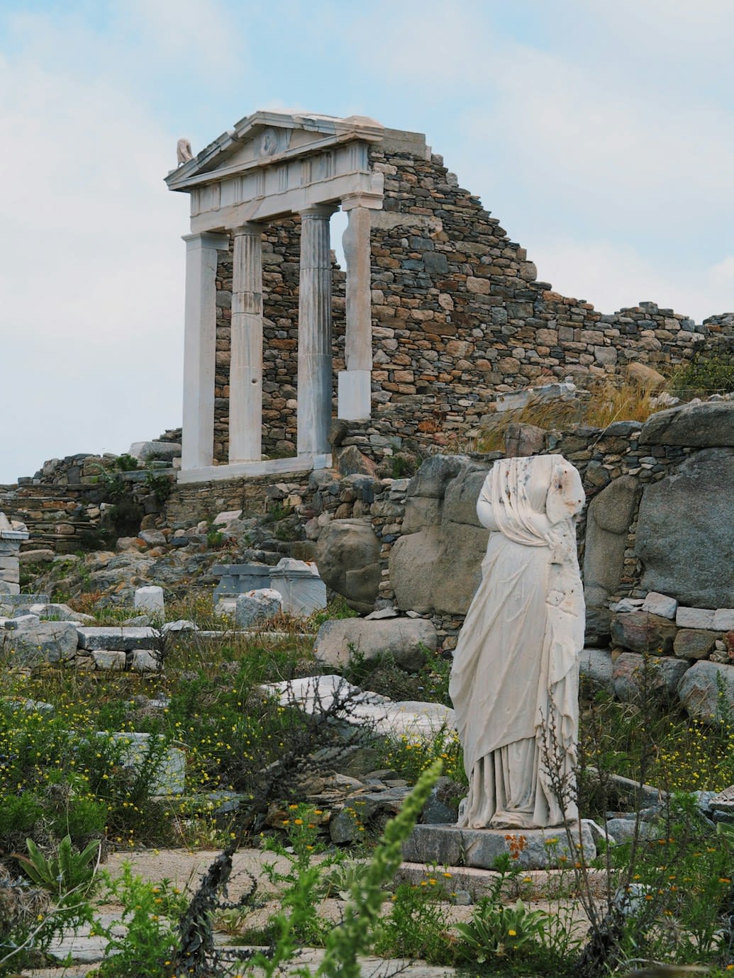
Delos
Municipality of Mykonos, Aegean, Greece
Delos is a mythological and archaeological of sacred significance. Approximate coordinates: 37.40112, 25.26923. Attributes: built, natural, cultural, archaeological, ceremonial. Tradition: Greek Mythology. Associated figure: Apollo, Artemis, Dionysus, Zeus, Athena. Mythological context: Birthplace of Apollo and Artemis. Recognized as a UNESCO World Heritage Site. Delos (; Greek: Δήλος [ˈðilos]; Attic Greek: Δῆλος Dêlos, Doric Greek: Δᾶλος Dâlos), is a small Greek island near Mykonos, close to the centre of the Cyclades archipelago. Though only 3.43 km2 (1.32 sq mi) in area, it is one of the most important mythological, historical, and archaeological sites in Greece. The ongoing excavations in the island are among the most extensive in the Mediterranean, and many of the artifacts found are displayed at the Archaeological Museum of Delos and the National Archaeological Museum of Athens. Delos had a position as a holy sanctuary for a millennium before Olympian Greek mythology made it the birthplace of Apollo and Artemis. From its Sacred Harbour are visible the three conical mounds that have identified landscapes sacred to a goddess (presumably Athena). Another site, retaining its Pre-Greek name Mount Cynthus, is crowned with a sanctuary of Zeus. In 1990, UNESCO added Delos to the World Heritage List, citing its exceptional archaeological site which conveys the image of a great cosmopolitan Mediterranean port , its influence on the development of Greek architecture, and its sacred importance throughout Ancient Greece. Located in Δήμος Μυκόνου, Αποκεντρωμένη Διοίκηση Αιγαίου, Ελλάς.
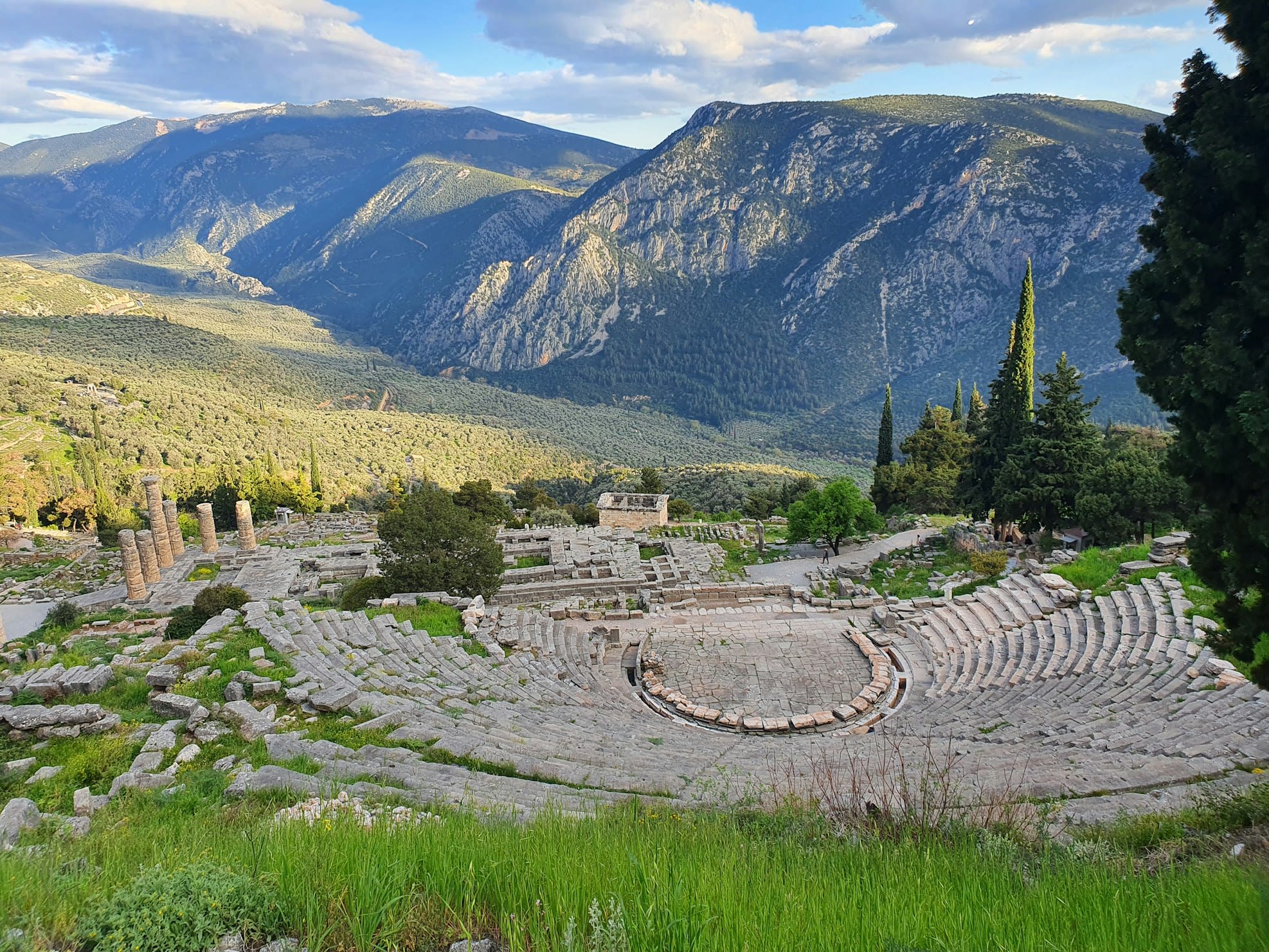
Delphi
Municipal Unit of Delphi, Thessaly and Central Greece, Greece
Delphi is a ancient sacred precinct of sacred significance. Approximate coordinates: 38.48235, 22.50123. Attributes: built, natural, cultural, archaeological, pilgrimage, ceremonial. Tradition: Ancient Greek. Associated figure: Apollo. Mythological context: Greek Mythology. Recognized as a UNESCO World Heritage Site. Delphi (; Greek: Δελφοί [ðelˈfi]), in legend previously called Pytho (Πυθώ), was an ancient sacred precinct and the seat of Pythia, the major oracle who was consulted about important decisions throughout the ancient classical world. The ancient Greeks considered the centre of the world to be in Delphi, marked by the stone monument known as the Omphalos of Delphi (navel). According to the Suda, Delphi took its name from the Delphyne, the she-serpent (drakaina) who lived there and was killed by the god Apollo (in other accounts the serpent was the male serpent (drakon) Python). The sacred precinct occupies a delineated region on the south-western slope of Mount Parnassus. It is now an extensive archaeological site, and since 1938 a part of Parnassos National Park. The precinct is recognized by UNESCO as a World Heritage Site in having had a great influence in the ancient world, as evidenced by the various monuments built there by most of the important ancient Greek city-states, demonstrating their fundamental Hellenic unity. Adjacent to the sacred precinct is a small modern town of the same name. Located in Δημοτική Ενότητα Δελφών, Αποκεντρωμένη Διοίκηση Θεσσαλίας - Στερεάς Ελλάδος, Ελλάς.
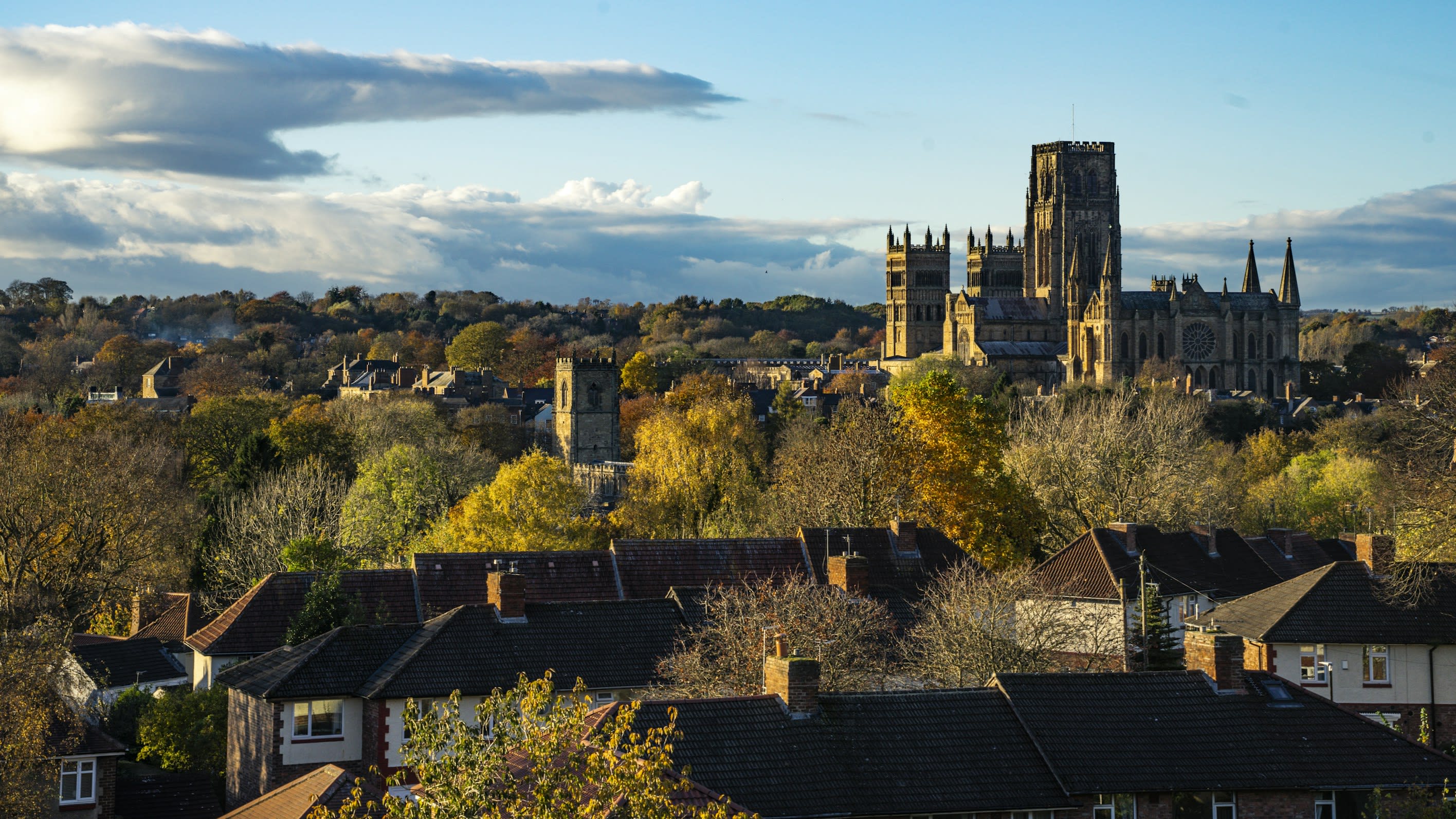
Durham Cathedral
Durham, England, United Kingdom
Durham is a cathedral of sacred significance. Approximate coordinates: 54.77323, -1.57639. Attributes: built, cultural, pilgrimage. Tradition: Christianity. Recognized as a UNESCO World Heritage Site. Durham most commonly refers to: Durham, England, a cathedral city in north east England County Durham, a ceremonial county which includes Durham Durham, North Carolina, a city in North Carolina, United States Durham may also refer to: Located in Durham, England, United Kingdom.
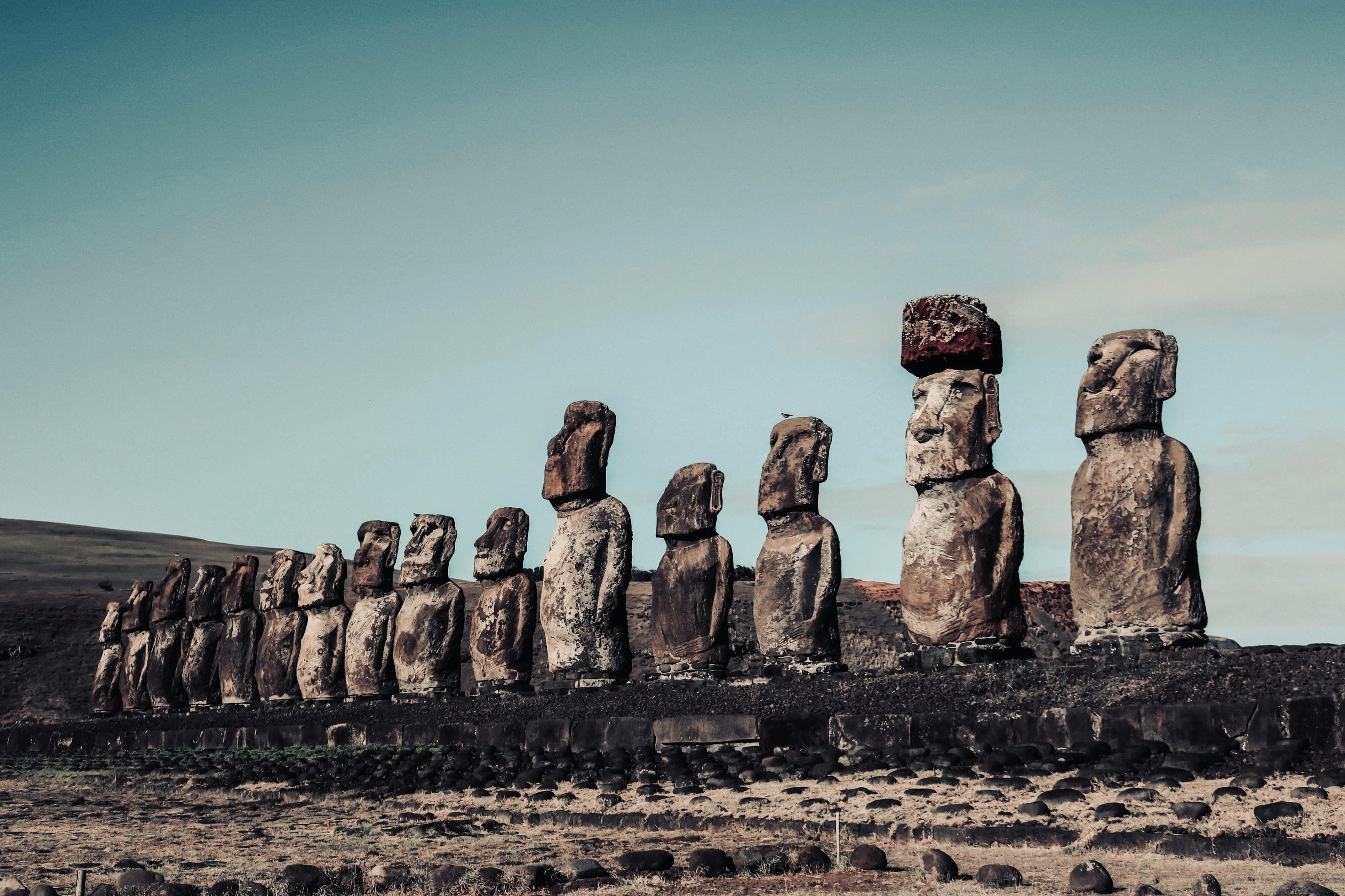
Easter Island
Easter Island, Valparaiso Region, Chile
Easter Island is a historical of sacred significance. Approximate coordinates: -27.10375, -109.36478. Attributes: built, natural, cultural, archaeological, ceremonial. Tradition: Polynesian. Mythological context: Rapa Nui. Recognized as a UNESCO World Heritage Site. Easter Island (Spanish: Isla de Pascua, [ˈisla ðe ˈpaskwa]; Rapa Nui: Rapa Nui, [ˈɾapa ˈnu.i]) is an island and special territory of Chile in the southeastern Pacific Ocean, at the southeasternmost point of the Polynesian Triangle in Oceania. The island is renowned for its nearly 1,000 extant monumental statues, called moai, which were created by the early Rapa Nui people. In 1995, UNESCO named Easter Island a World Heritage Site, with much of the island protected within Rapa Nui National Park. Experts differ on when the island s Polynesian inhabitants first reached the island. While many in the research community cited evidence that they arrived around the year 800, a 2007 study provided compelling evidence suggesting their arrival was closer to 1200. The inhabitants created a thriving and industrious culture, as evidenced by the island s numerous enormous stone moai and other artifacts. But land clearing for cultivation and the introduction of the Polynesian rat led to gradual deforestation. By the time of European arrival in 1722, the island s population was estimated to be 2,000 to 3,000. European diseases, Peruvian slave raiding expeditions in the 1860s, and emigration to other islands such as Tahiti further depleted the population, reducing it to a low of 111 native inhabitants in 1877. Chile annexed Easter Island in 1888. In 1966, the Rapa Nui were granted Chilean citizenship. In 2007, the island gained the constitutional status of special territory (Spanish: territorio especial). Administratively, it belongs to the Valparaíso Region, constituting a single commune (Isla de Pascua) of the Province of Isla de Pascua. The 2017 Chilean census registered 7,750 people on the island, of which 3,512 (45%) identified as Rapa Nui. Easter Island is one of the world s most remote inhabited islands. The nearest inhabited land (around 50 residents in 2013) is Pitcairn Island, 2,075 kilometres (1,289 mi) away; the nearest town with a population over 500 is Rikitea, on the island of Mangareva, 2,606 km (1,619 mi) away; the nearest continental point lies in central Chile, 3,512 km (2,182 mi) away. Located in Isla de Pascua, Región de Valparaíso, Chile.
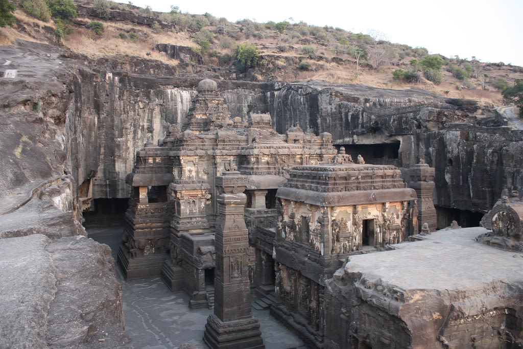
Ellora caves, Maharashtra
Khuldabad, Maharashtra, India
Ellora caves, Maharashtra is a cave temple of sacred significance. Approximate coordinates: 20.02582, 75.17800. Attributes: built, cultural, archaeological, pilgrimage. Tradition: Hindu, Buddhist, Jain; also recognized in Interfaith contexts. Recognized as a UNESCO World Heritage Site. Located in Maharashtra, India.
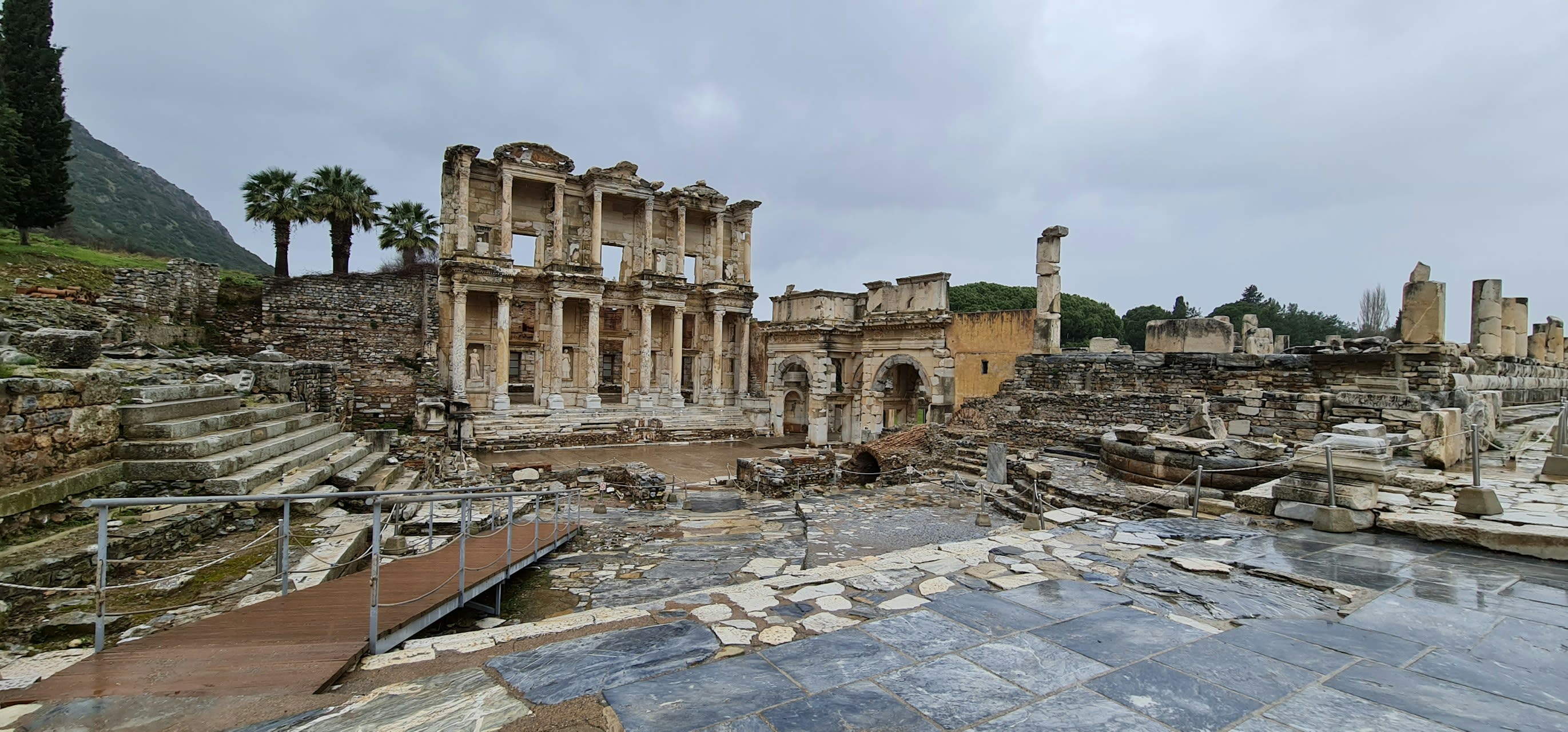
Ephesus
Selçuk, Aegean Region, Turkey
Ephesus is a ancient city of sacred significance. Approximate coordinates: 37.91240, 27.33276. Attributes: built, cultural, archaeological, pilgrimage. Tradition: Ancient Greek. Associated figure: Artemis. Mythological context: Ancient Greek Mythology. Recognized as a UNESCO World Heritage Site. Ephesus (; Ancient Greek: Ἔφεσος, romanized: Éphesos; Turkish: Efes; may ultimately derive from Hittite: 𒀀𒉺𒀀𒊭, romanized: Apāša) was an ancient Greek city on the coast of Ionia, in present-day Selçuk in İzmir Province, Turkey. It was built in the 10th century BC on the site of Apasa, the former Arzawan capital, by Attic and Ionian Greek colonists. During the Classical Greek era, it was one of twelve cities that were members of the Ionian League. The city came under the control of the Roman Republic in 129 BC. The city was famous in its day for the nearby Temple of Artemis (completed around 550 BC), which has been designated one of the Seven Wonders of the Ancient World. Its many monumental buildings included the Library of Celsus and a theatre capable of holding 24,000 spectators. Ephesus was a recipient city of one of the Pauline epistles and one of the seven churches of Asia addressed in the Book of Revelation. The Gospel of John may have been written there, and it was the site of several 5th-century Christian Councils (Council of Ephesus). The city was destroyed by the Goths in 263. Although it was afterwards rebuilt, its importance as a port and commercial centre declined as the harbour was slowly silted up by the Küçükmenderes River. In 614, it was partially destroyed by an earthquake. Today, the ruins of Ephesus are a favourite international and local tourist attraction, being accessible from Adnan Menderes Airport and from the resort town Kuşadası. In 2015, the ruins were designated a UNESCO World Heritage Site. Located in Selçuk, Ege Bölgesi, Turkey.
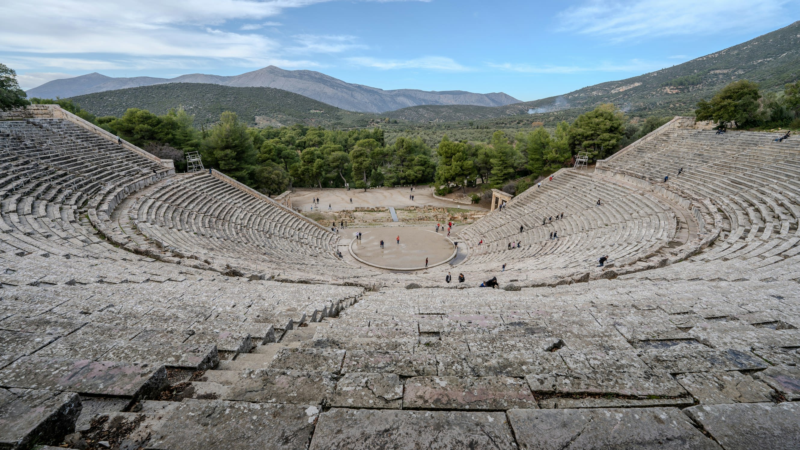
Epidauros
Municipal Unit of Epidavros, Peloponnese, Western Greece and the Ionian, Greece
Epidauros is a sanctuary of sacred significance. Approximate coordinates: 37.63345, 23.16023. Attributes: built, cultural, archaeological, pilgrimage, ceremonial. Tradition: Ancient Greek. Associated figure: Apollo Maleatas. Mythological context: Greek Mythology. Recognized as a UNESCO World Heritage Site. Located in Δημοτική Ενότητα Επιδαύρου, Αποκεντρωμένη Διοίκηση Πελοποννήσου, Δυτικής Ελλάδας και Ιονίου, Ελλάς.
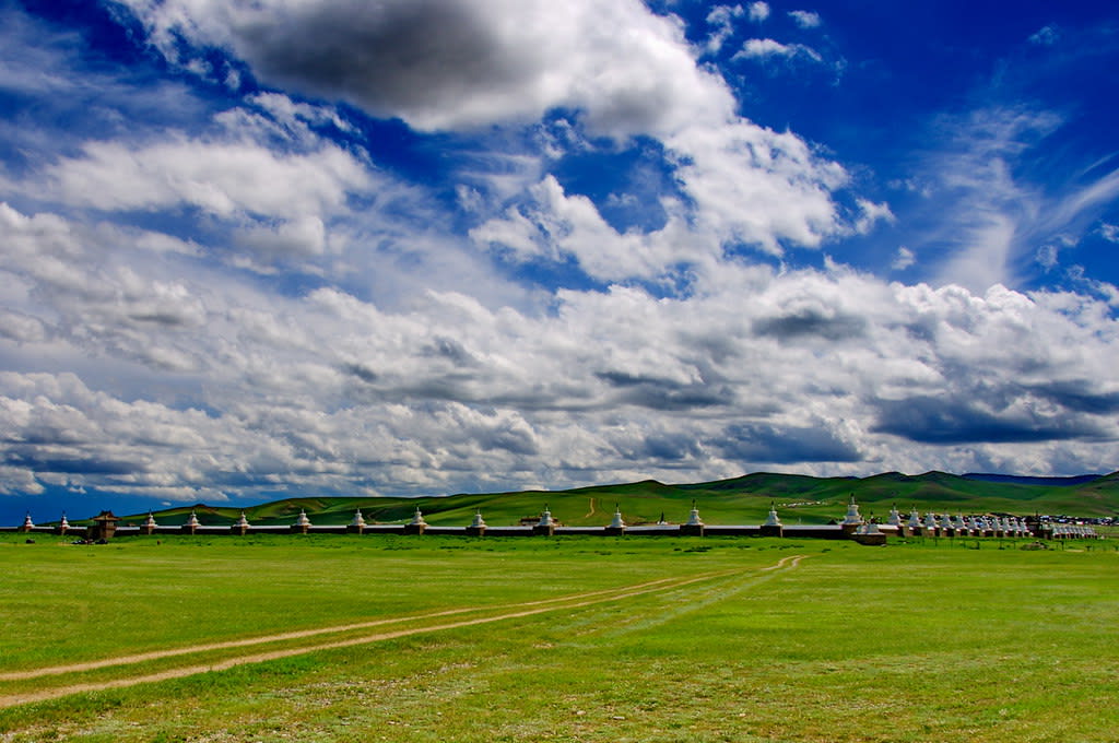
Erdene Zuu Monastery
Kharkhorin, Övörkhangai Province, Mongolia
Erdene Zuu Monastery is a monastery of sacred significance. Approximate coordinates: 47.20154, 102.84333. Attributes: built, cultural, pilgrimage, ceremonial. Tradition: Buddhism. Recognized as a UNESCO World Heritage Site. The Erdene Zuu Monastery (Mongolian: Эрдэнэ Зуу хийд, romanized: Erdene Zuu khiid) is probably the earliest surviving Buddhist monastery in Mongolia. Located in Kharkhorin, Övörkhangai Province, it is part of the Orkhon Valley Cultural Landscape World Heritage Site. The monastery is affiliated with the Gelug sect of Tibetan Buddhism. Located in Хархорин ᠬᠠᠷᠠᠬᠣᠷᠢᠨ, Өвөрхангай ᠥᠪᠦᠷᠬᠠᠩᠭ᠋ᠠᠢ, Монгол улс ᠮᠤᠩᠭᠤᠯ ᠤᠯᠤᠰ.
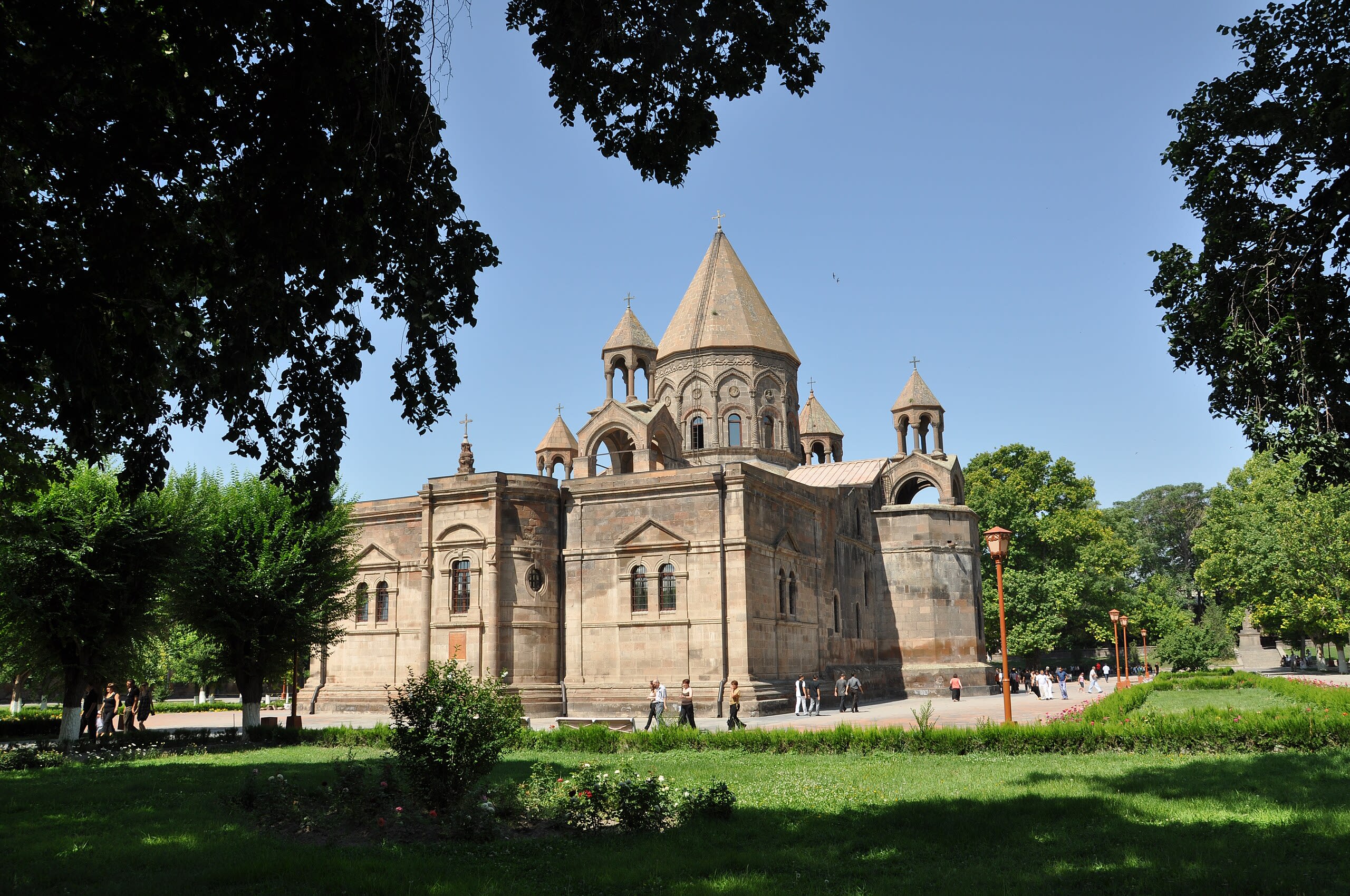
Etchmiadzin Cathedral
Vagharshapat, Armavir Province, Armenia
Etchmiadzin Cathedral is a cathedral of sacred significance. Approximate coordinates: 40.16186, 44.29060. Attributes: built, cultural, pilgrimage. Recognized as a UNESCO World Heritage Site. Located in Վաղարշապատ, Արմավիրի մարզ, Հայաստան.
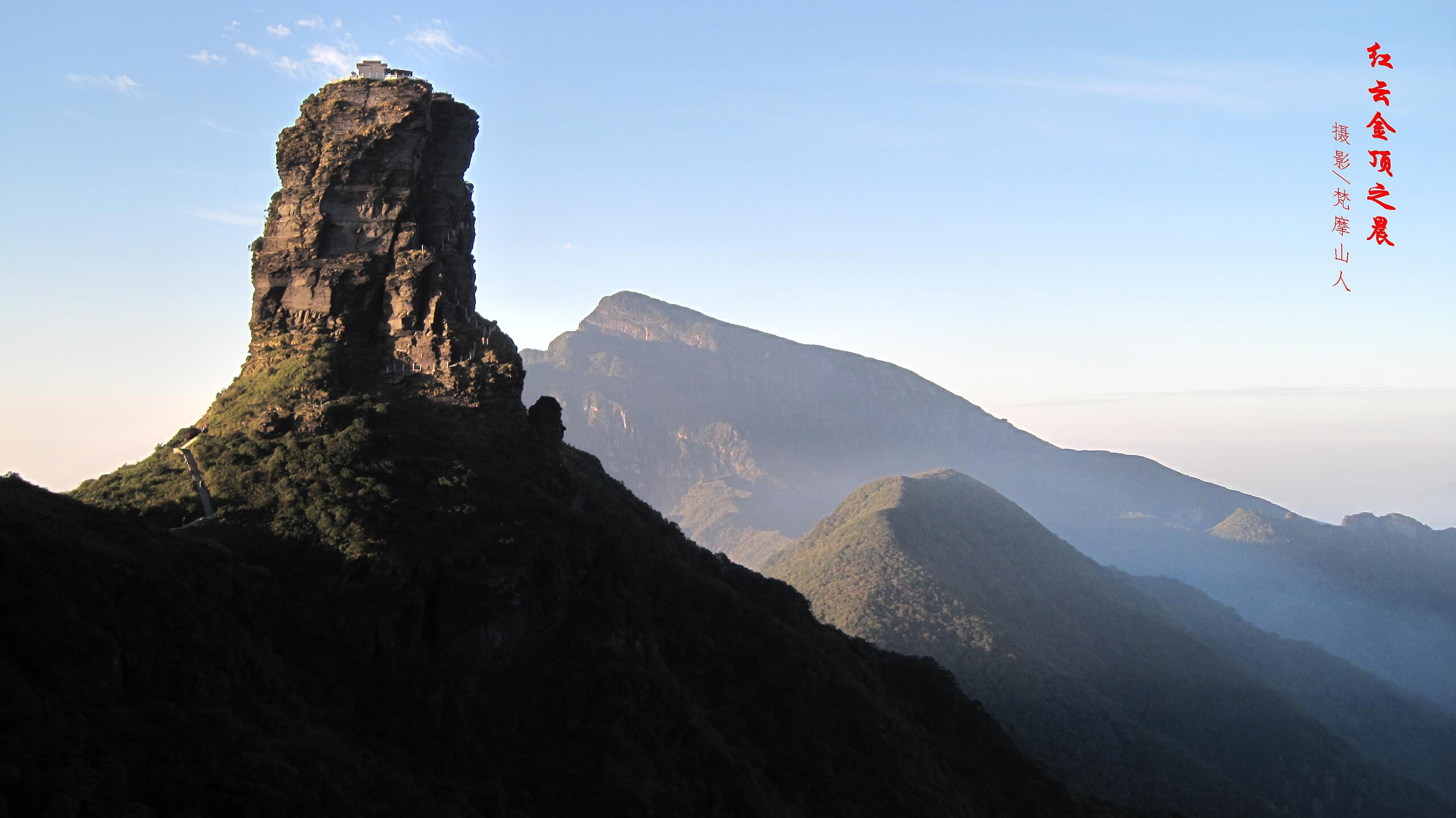
Fanjingshan mountain and temple, Tongren
Tongren, Guizhou, China
Fanjingshan mountain and temple, Tongren is a mountain and temple of sacred significance. Approximate coordinates: 27.92028, 108.69028. Attributes: built, natural, cultural, pilgrimage. Tradition: Buddhism. Associated figure: Buddha. Mythological context: Buddhist mythology. Recognized as a UNESCO World Heritage Site. Located in 贵州省, China.
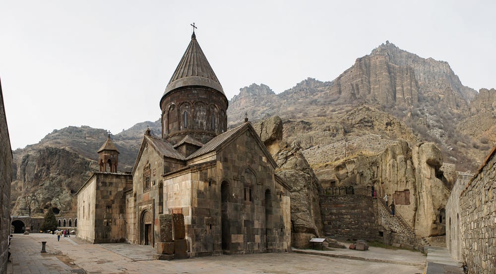
Geghard Monastery
Goght, Kotayk Province, Armenia
Geghard Monastery is a monastery of sacred significance. Approximate coordinates: 40.14029, 44.81787. Attributes: built, cultural, pilgrimage. Tradition: Christianity. Recognized as a UNESCO World Heritage Site. Located in Կոտայքի մարզ, Հայաստան.
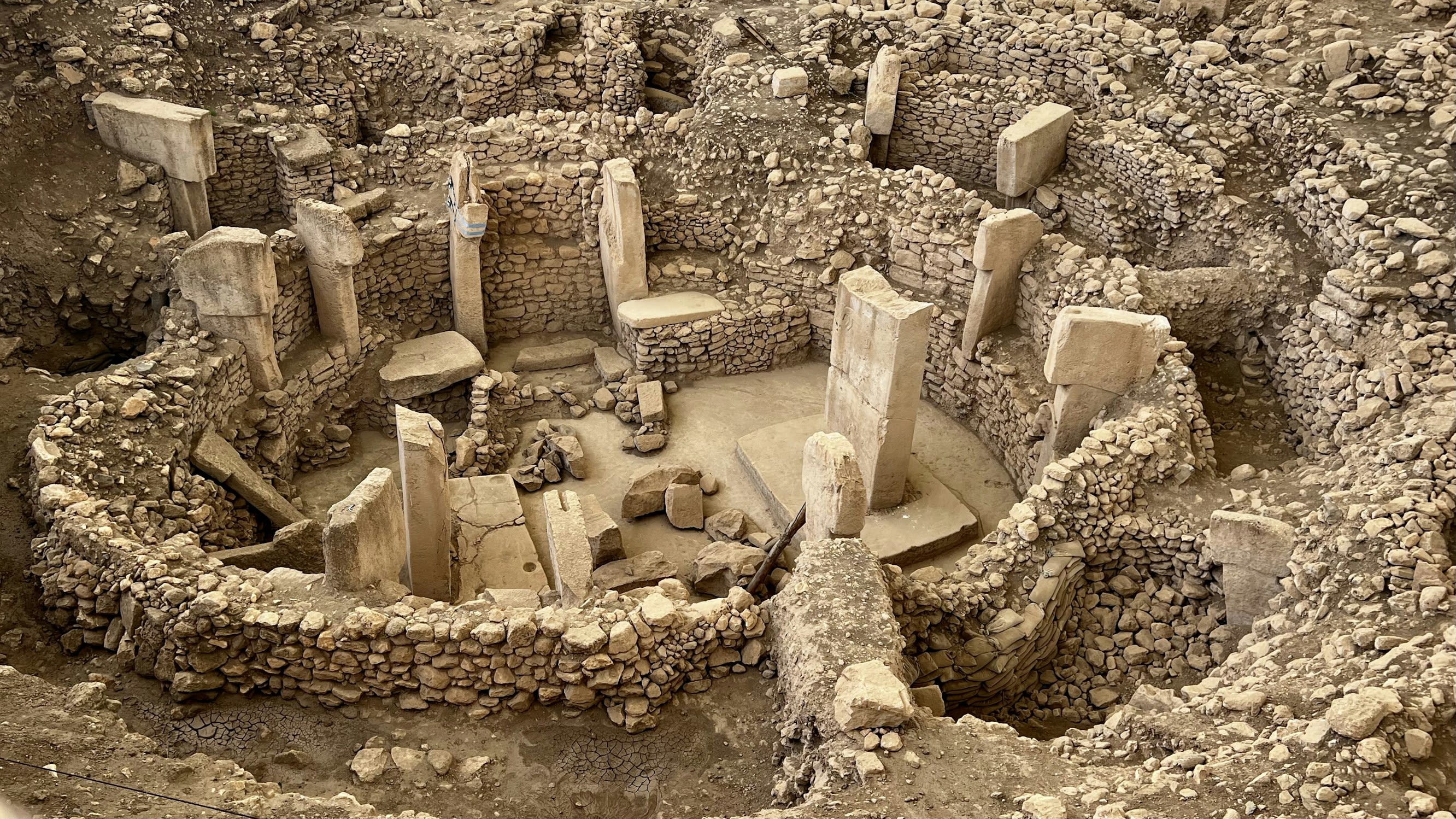
Göbekli Tepe
Haliliye, Şanlıurfa, Turkey
Göbekli Tepe is a neolithic archaeological site of sacred significance. Approximate coordinates: 37.22318, 38.92248. Attributes: built, cultural, archaeological, ceremonial. Tradition: Pre-Pottery Neolithic. Recognized as a UNESCO World Heritage Site. Göbekli Tepe (Turkish: [ɟœbecˈli teˈpe], Potbelly Hill ; Kurdish: Girê Mirazan or Xerabreşkê, Wish Hill ) is a Neolithic archaeological site in Upper Mesopotamia (al-Jazira) in modern-day Turkey. The settlement was inhabited from around 9500 BCE to at least 8000 BCE, during the Pre-Pottery Neolithic. It is famous for its large circular structures that contain massive stone pillars – among the world s oldest known megaliths. Many of these pillars are decorated with anthropomorphic details, clothing, and sculptural reliefs of wild animals, providing archaeologists rare insights into prehistoric religion and the particular iconography of the period. The 15 m (50 ft) high, 8 ha (20-acre) tell is densely covered with ancient domestic structures and other small buildings, quarries, and stone-cut cisterns from the Neolithic, as well as some traces of activity from later periods. The site was first used at the dawn of the southwest Asian Neolithic period, which marked the appearance of the oldest permanent human settlements anywhere in the world. Prehistorians link this Neolithic Revolution to the advent of agriculture but disagree on whether farming caused people to settle down or vice versa. Göbekli Tepe, a monumental complex built on a rocky mountaintop with no clear evidence of agricultural cultivation, has played a prominent role in this debate. Recent findings suggest a settlement at Göbekli Tepe, with domestic structures, extensive cereal processing, a water supply, and tools associated with daily life. This contrasts with a previous interpretation of the site as a sanctuary used by nomads, with few or no permanent inhabitants. No definitive purpose has been determined for the megalithic structures, which have been popularly described as the world s first temple[s] . They were likely roofed and appear to have regularly collapsed, been inundated by slope slides, and subsequently repaired or rebuilt. The architecture and iconography are similar to other contemporary sites in the vicinity, such as Karahan Tepe. The site was first noted in a 1963 archaeological survey. German archaeologist Klaus Schmidt recognised its significance in 1994 and began excavations there the following year. After he died in 2014, work continued as a joint project of Istanbul University, Şanlıurfa Museum, and the German Archaeological Institute, under the direction of Turkish prehistorian Necmi Karul. Göbekli Tepe was designated a UNESCO World Heritage Site in 2018, recognising its outstanding universal value as one of the first manifestations of human-made monumental architecture . As of 2021, around 10% of the site has been excavated. Additional areas were examined by geophysical surveys, which showed the mound to contain at least 20 large enclosures. Located in Haliliye, Güneydoğu Anadolu Bölgesi, Turkey.
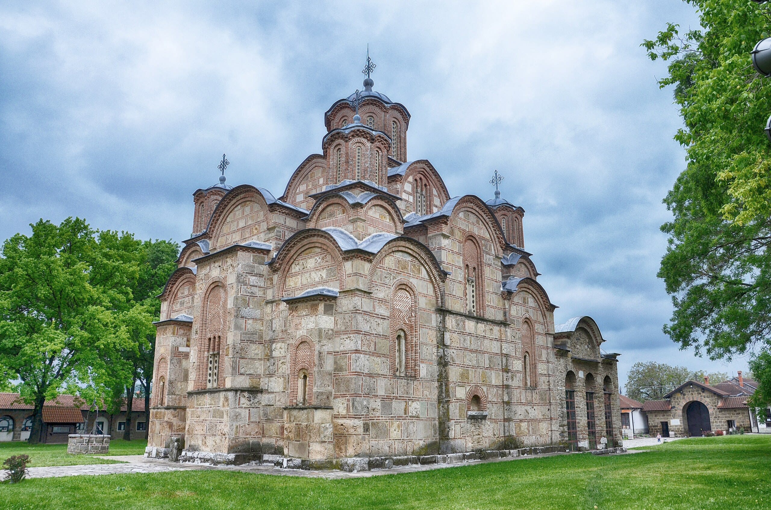
Gračanica Monastery
Gračanica, Kosovo
Gračanica Monastery is a monastery of sacred significance. Approximate coordinates: 42.59848, 21.19349. Attributes: built, cultural, pilgrimage. Tradition: Serbian Orthodox. Associated figure: King Stefan Milutin. Recognized as a UNESCO World Heritage Site. The Gračanica Monastery (Serbian: Манастир Грачаница, romanized: Manastir Gračanica; Albanian: Manastiri i Graçanicës) is a Serbian Orthodox monastery located in Kosovo. It was built by the Serbian king Stefan Milutin in 1321. The monastery was declared a Monument of Culture of Exceptional Importance in 1990, and on 13 July 2006 it was placed on UNESCO s World Heritage List under the name of Medieval Monuments in Kosovo as an extension of the Visoki Dečani site, which was overall placed on the List of World Heritage in Danger. The Gračanica Monastery is one of King Milutin s last monumental endowments. The monastery is located in Gračanica, a Serbian enclave in the close vicinity of Lipjan, the old residence of bishops of Lipljan. Located in Gračanica, Kosova / Kosovo.
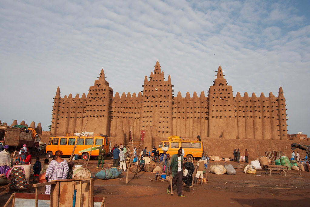
Great Mosque of Djenné
Djenné, Mopti, Mali
Djenne is a mosque of sacred significance. Approximate coordinates: 13.90517, -4.55542. Attributes: built, cultural. Tradition: Islamic. Recognized as a UNESCO World Heritage Site. Located in Djenné, Mopti, Mali.
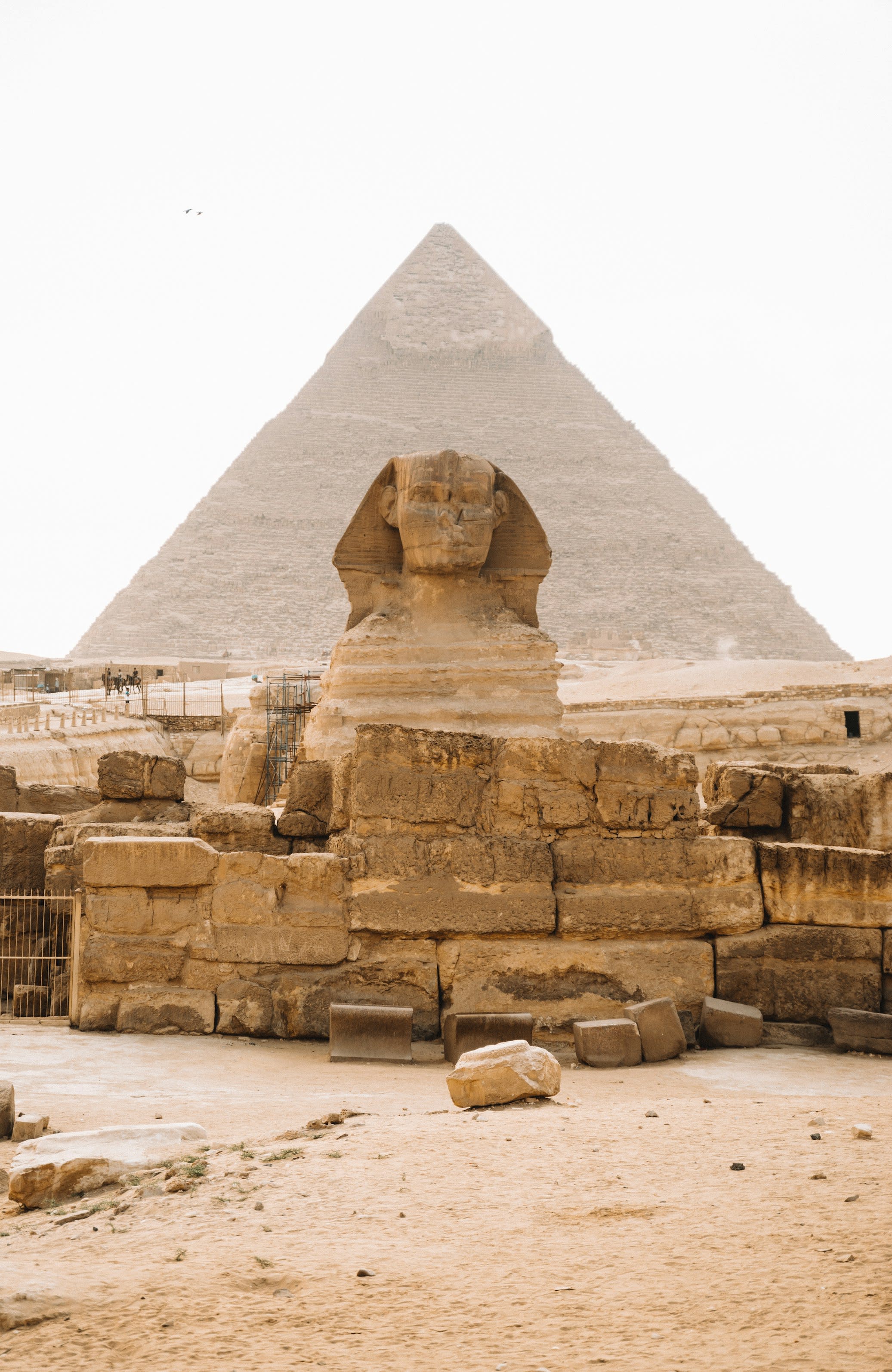
Great Pyramid of Giza
Giza, Giza, Egypt
Great Pyramid of Giza is a pyramid of sacred significance. Approximate coordinates: 29.97924, 31.13420. Attributes: built, cultural, archaeological. Tradition: Ancient Egyptian. Associated figure: Khufu. Mythological context: Ancient Egyptian mythology. Recognized as a UNESCO World Heritage Site. The Great Pyramid of Giza is the largest Egyptian pyramid. It served as the tomb of pharaoh Khufu, who ruled during the Fourth Dynasty of the Old Kingdom. Built c. 2600 BC, over a period of about 26 years, the pyramid is the oldest of the Seven Wonders of the Ancient World, and the only wonder that has remained largely intact. It is the most famous monument of the Giza pyramid complex, which is part of the UNESCO World Heritage Site Memphis and its Necropolis . It is situated at the northeastern end of the line of the three main pyramids at Giza. Initially standing at 146.6 metres (481 feet), the Great Pyramid was the world s tallest human-made structure for more than 3,800 years. Over time, most of the smooth white limestone casing was removed, which lowered the pyramid s height to the current 138.5 metres (454.4 ft); what is seen today is the underlying core structure. The base was measured to be about 230.3 metres (755.6 ft) square, giving a volume of roughly 2.6 million cubic metres (92 million cubic feet), which includes an internal hillock. The dimensions of the pyramid were 280 royal cubits (146.7 m; 481.4 ft) high, a base length of 440 cubits (230.6 m; 756.4 ft), with a seked of 5+1/2 palms (a slope of 51°50 40 ). The Great Pyramid was built by quarrying an estimated 2.3 million large blocks, weighing 6 million tonnes in total. The majority of the stones are not uniform in size or shape, and are only roughly dressed. The outside layers were bound together by mortar. Primarily local limestone from the Giza Plateau was used for its construction. Other blocks were imported by boat on the Nile: white limestone from Tura for the casing, and blocks of granite from Aswan, weighing up to 80 tonnes, for the King s Chamber structure. There are three known chambers inside of the Great Pyramid. The lowest was cut into the bedrock, upon which the pyramid was built, but remained unfinished. The so-called Queen s Chamber and King s Chamber, which contain a granite sarcophagus, are above ground, within the pyramid structure. Hemiunu, Khufu s vizier, is believed by some to be the architect of the Great Pyramid. Many varying scientific and alternative hypotheses attempt to explain the exact construction techniques, but, as is the case for other such structures, there is no definite consensus. The funerary complex around the pyramid consisted of two mortuary temples connected by a causeway (one close to the pyramid and one near the Nile); tombs for the immediate family and court of Khufu, including three smaller pyramids for Khufu s wives; an even smaller satellite pyramid ; and five buried solar barques. Located in الجيزة, الجيزة, Egypt.
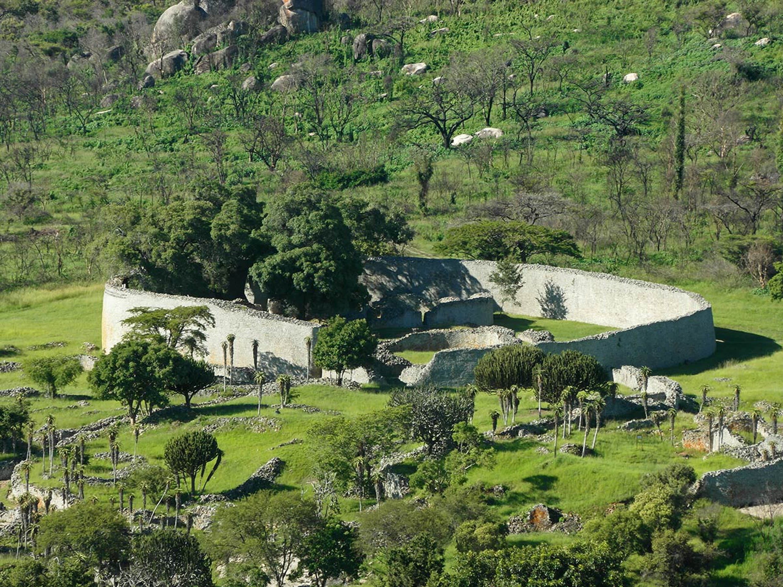
Great Zimbabwe
Nemanwa Growth Point, Masvingo Province, Zimbabwe
Great Zimbabwe is a ancient city of sacred significance. Approximate coordinates: -20.27133, 30.93313. Attributes: built, cultural, archaeological, ceremonial. Tradition: Shona. Recognized as a UNESCO World Heritage Site. Great Zimbabwe was a city in the south-eastern hills of the modern country of Zimbabwe, near Masvingo. It was settled from 1000 AD, and served as the capital of the Kingdom of Zimbabwe from the 13th century. It is the largest stone structure in precolonial Southern Africa. Major construction on the city began in the 11th century until the 15th century, and it was abandoned in the 16th or 17th century. The edifices were erected by ancestors of the Shona people, currently located in Zimbabwe and nearby countries. The stone city spans an area of 7.22 square kilometres (2.79 sq mi) and could have housed up to 18,000 people at its peak, giving it a population density of approximately 2,500 inhabitants per square kilometre (6,500/sq mi). The Zimbabwe state centred on it likely covered 50,000 km² (19,000 sq mi). It is recognised as a World Heritage Site by UNESCO. The site of Great Zimbabwe is composed of the Hill Complex, the Valley Complex, and the Great Enclosure (constructed at different times), and contained area for commoner housing within the perimeter walls. There is disagreement on the functions of the complexes among scholars. Some consider them to have been residences for the royals and elites at different periods of the site, while others infer them to have had separate functions. The Great Enclosure, with its 11 m (36 ft) high dry stone walls (that is, constructed without mortar), was built during the 13th and 14th centuries, and likely served as the royal residence, with demarcated public spaces for rituals. The earliest document mentioning the Great Zimbabwe ruins was in 1531 by Vicente Pegado, captain of the Portuguese garrison of Sofala on the coast of modern-day Mozambique, who recorded it as Symbaoe. The first confirmed visits by Europeans were in the late 19th century, with investigations of the site starting in 1871. Great Zimbabwe and surrounding sites were looted by European antiquarians between the 1890s and 1920s. Some later studies of the monument were controversial, as the white government of Rhodesia pressured archaeologists to deny its construction by black Africans. Its African origin only became consensus by the 1950s. Great Zimbabwe has since been adopted as a national monument by the Zimbabwean government, and the modern independent state was named after it. The word great distinguishes the site from the many smaller ruins, known as zimbabwes , spread across the Zimbabwe Highveld. There are around 200 such sites in Southern Africa, such as Bumbusi in Zimbabwe and Manyikeni in Mozambique, with monumental, mortarless walls. Located in Masvingo, Zimbabwe.
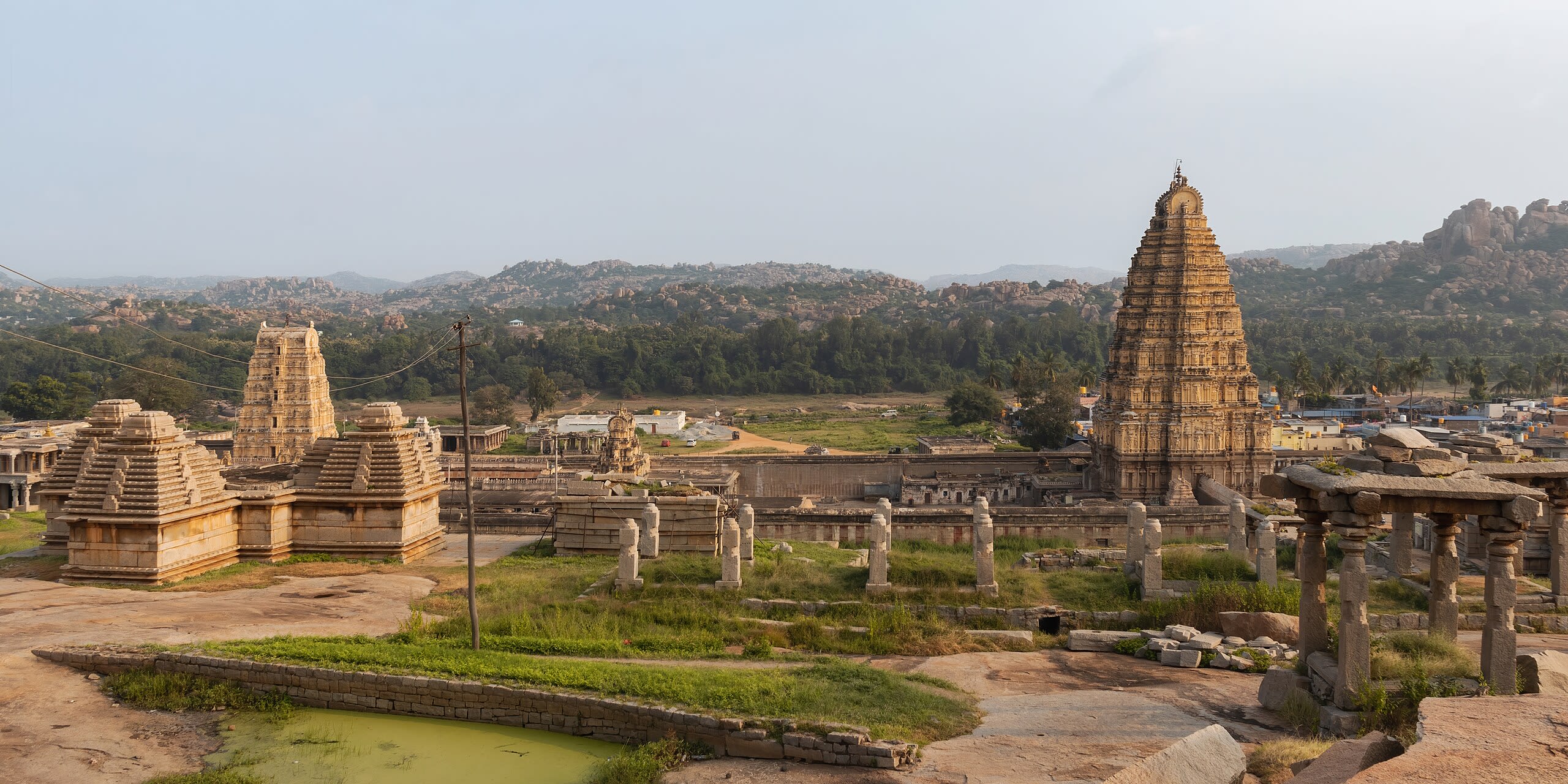
Group of Monuments at Hampi
Hampi, Karnataka, India
Kodandarama Temple, Hampi, Karnataka is a temple of sacred significance. Approximate coordinates: 15.33598, 76.46843. Attributes: built, cultural, archaeological, pilgrimage. Tradition: Hinduism. Associated figure: Rama. Mythological context: Ramayana. Recognized as a UNESCO World Heritage Site. Located in Hosapete, Karnataka, India.
Gyeongju Historic Area
Gyeongju, North Gyeongsang, South Korea
Gyeongju City is a temple of sacred significance. Approximate coordinates: 35.78988, 129.33196. Attributes: built, cultural, pilgrimage. Tradition: Buddhism. Associated figure: Buddha. Recognized as a UNESCO World Heritage Site. Located in 경주시, 대한민국.
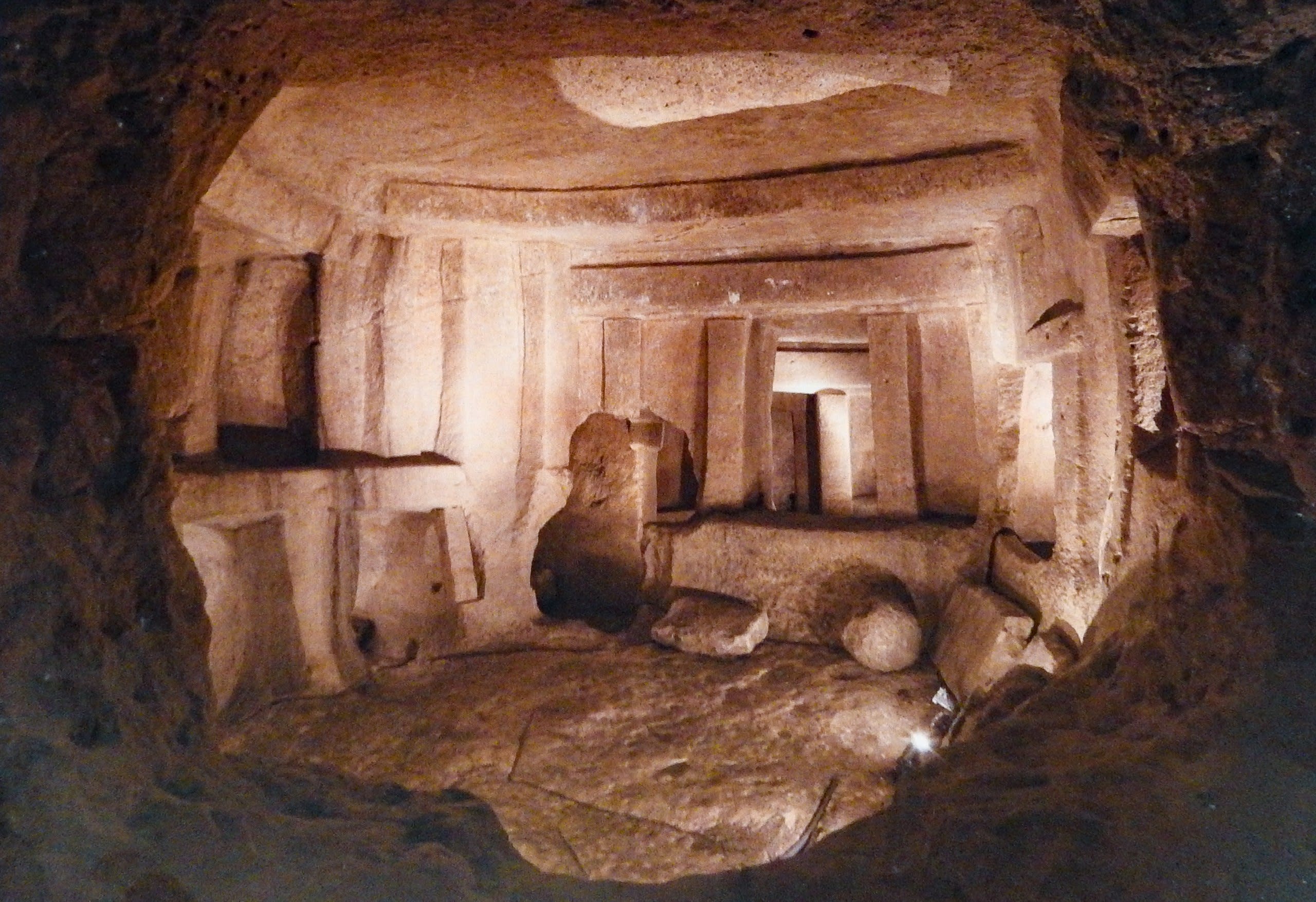
Hal Saflieni Hypogeum
Paola, South Eastern Region, Malta
Hal Saflieni Hypogeum is a hypogeum of sacred significance. Approximate coordinates: 35.86957, 14.50689. Attributes: built, cultural, archaeological. Recognized as a UNESCO World Heritage Site. Located in Raħal Ġdid, Xlokk, Malta.
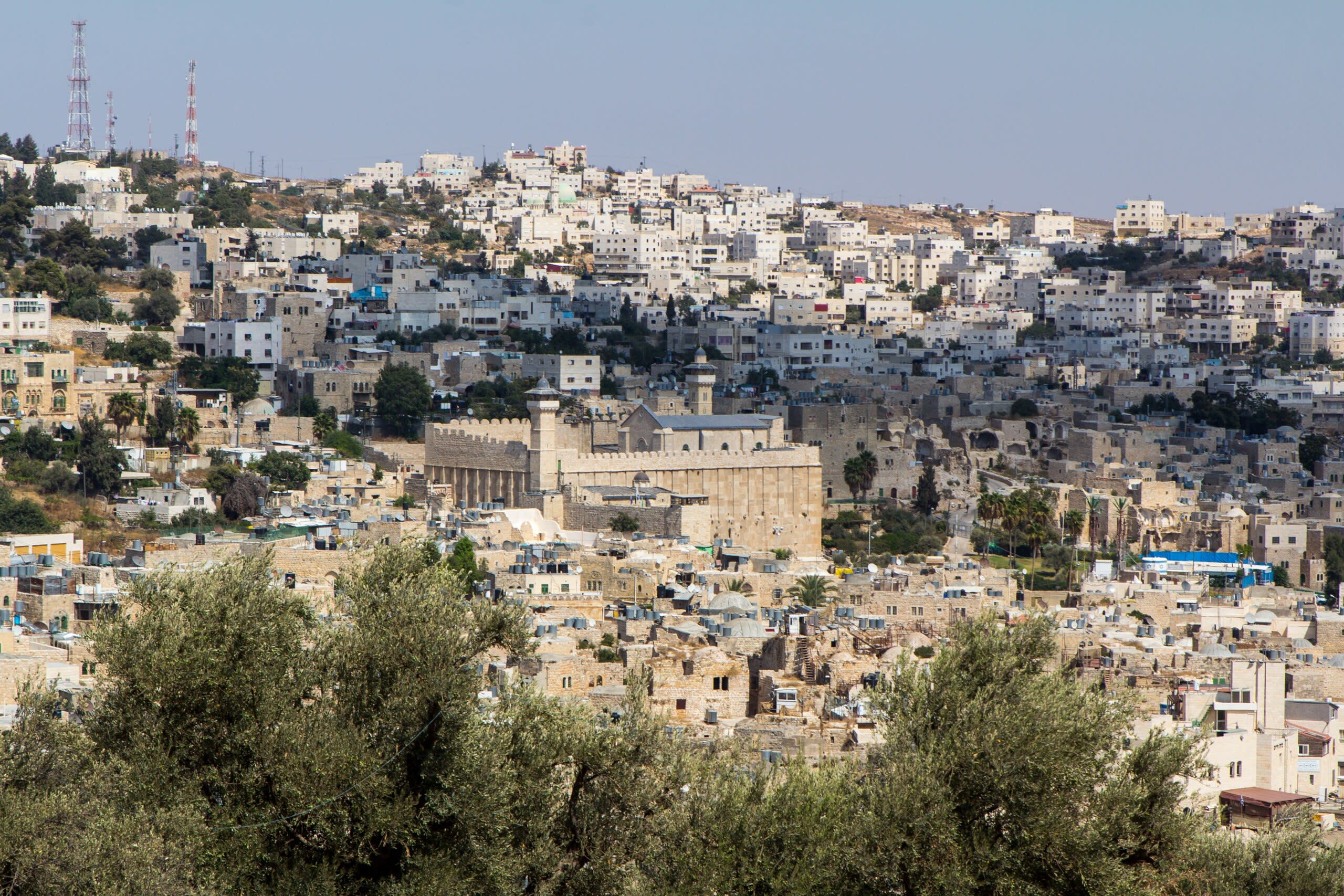
Hebron/Al-Khalil Old Town
Hebron, Judea and Samaria, Palestinian Territories
Hebron is a burial site of sacred significance. Approximate coordinates: 31.52470, 35.11072. Attributes: built, cultural, archaeological, pilgrimage. Tradition: Abrahamic; also recognized in Judaism, Christianity, Islam contexts. Associated figure: Abraham, Sarah, Isaac, Rebecca, Jacob, Leah. Mythological context: Biblical. Recognized as a UNESCO World Heritage Site. Hebron (; Arabic: الخليل al-Khalīl, or خَلِيل الرَّحْمَن Khalīl al-Raḥmān; Hebrew: חֶבְרוֹן Ḥevrōn, ) is a Palestinian city in the southern West Bank, 30 kilometres (19 mi) south of Jerusalem. Hebron is capital of the West Bank s largest governorate, known as Hebron Governorate. With a population of 201,063 in the city limits, the adjacent metropolitan area within the governorate is home to over 700,000 people. Hebron spans across an area of 74.1 square kilometres (28.6 sq mi). It is the third largest city in the country, followed by Gaza and Jerusalem. The city is often considered one of the four holy cities in Judaism as well as in Islam and Christianity. It is considered one of the oldest cities in the Levant. According to the Bible, Abraham settled in Hebron and bought the Cave of the Patriarchs as burial place for his wife Sarah. Biblical tradition holds that the patriarchs Abraham, Isaac, and Jacob, along with their wives Sarah, Rebecca, and Leah, were buried in the cave. The city is also recognized in the Bible as the place where David was anointed king of Israel. Following the Babylonian captivity, the Edomites settled in Hebron. During the first century BCE, Herod the Great built the wall that still surrounds the Cave of the Patriarchs, which later became a church, and then a mosque. With the exception of a brief Crusader control, successive Muslim dynasties ruled Hebron from the 6th century CE until the Ottoman Empire s dissolution following World War I, when the city became part of British Mandatory Palestine. The 1929 riots and the Arab uprising of 1936–39 led the British government to evacuate the Jewish community from Hebron. The 1948 Arab–Israeli War saw the entire West Bank, including Hebron, occupied and annexed by Jordan, and since the 1967 Six-Day War, the city has been under Israeli military occupation. Following Israeli occupation, Jewish presence was restored in the city. Since the 1997 Hebron Protocol, most of Hebron has been governed by the Palestinian National Authority. The city is often described as a microcosm of the Israeli–Palestinian conflict and the Israeli occupation of the West Bank. The 1997 protocol divided the city into two sectors—H1 Hebron, controlled by the Palestinian National Authority, and H2 Hebron, managed by Israeli authorities. All security arrangements and travel permits for local residents are coordinated between the Palestinian Authority and Israel via the COGAT. The Jewish settlers have their own governing municipal body, the Committee of the Jewish Community of Hebron. The largest city in the southern West Bank, Hebron is chief commercial and industrial center in the region. It is a busy hub of trade, generating roughly a third of the area s GDP, largely due to the sale of limestone from quarries in its area. Hebron has a local reputation for its grapes, figs, ceramics, plastics, pottery workshops, metalworking and glassblowing industry. The city is home to numerous shopping malls. The Old City of Hebron features narrow, winding streets, flat-roofed stone houses, and old bazaars. It is recognized as a World Heritage Site by the UNESCO. Hebron is also known as a regional educational and medical hub. Located in الخليل, الضفة الغربية, Palestinian Territory.
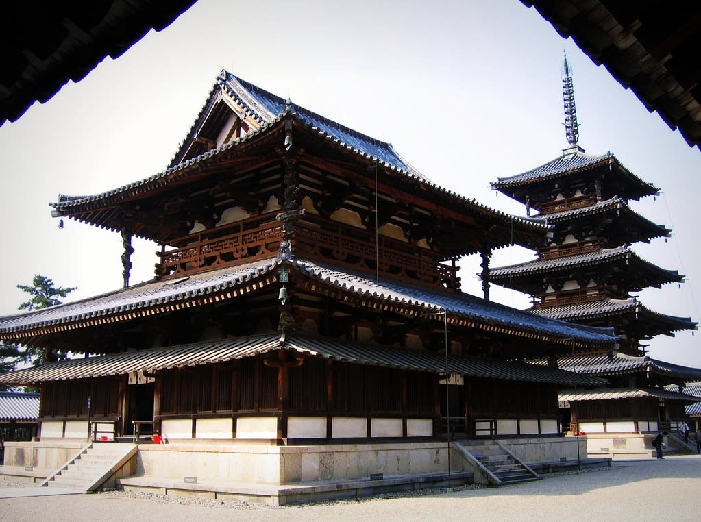
Horyuji
Ikaruga, Nara Prefecture, Japan
The pagoda and main hall of Hōryū-ji have stood for over 1,300 years—the oldest surviving wooden structures on earth. Founded by Prince Shōtoku in 607 CE to fulfill his father's dying wish, the temple became Japan's first UNESCO World Heritage Site and remains a living repository of Buddhist practice. Within its halls and treasure houses, over 180 National Treasures preserve the artistic flowering of early Japanese Buddhism. In the octagonal Yumedono, a hidden Buddha awaits those who visit during its brief seasonal openings.
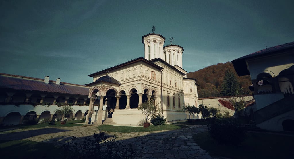
Hurezi (Horezu) Monastery
Romanii de Jos, Vâlcea, Romania
Hurezi Monastery, Romania is a monastery of sacred significance. Approximate coordinates: 45.16990, 24.00730. Attributes: built, cultural, pilgrimage. Recognized as a UNESCO World Heritage Site. Located in Horezu, Vâlcea, Romania.
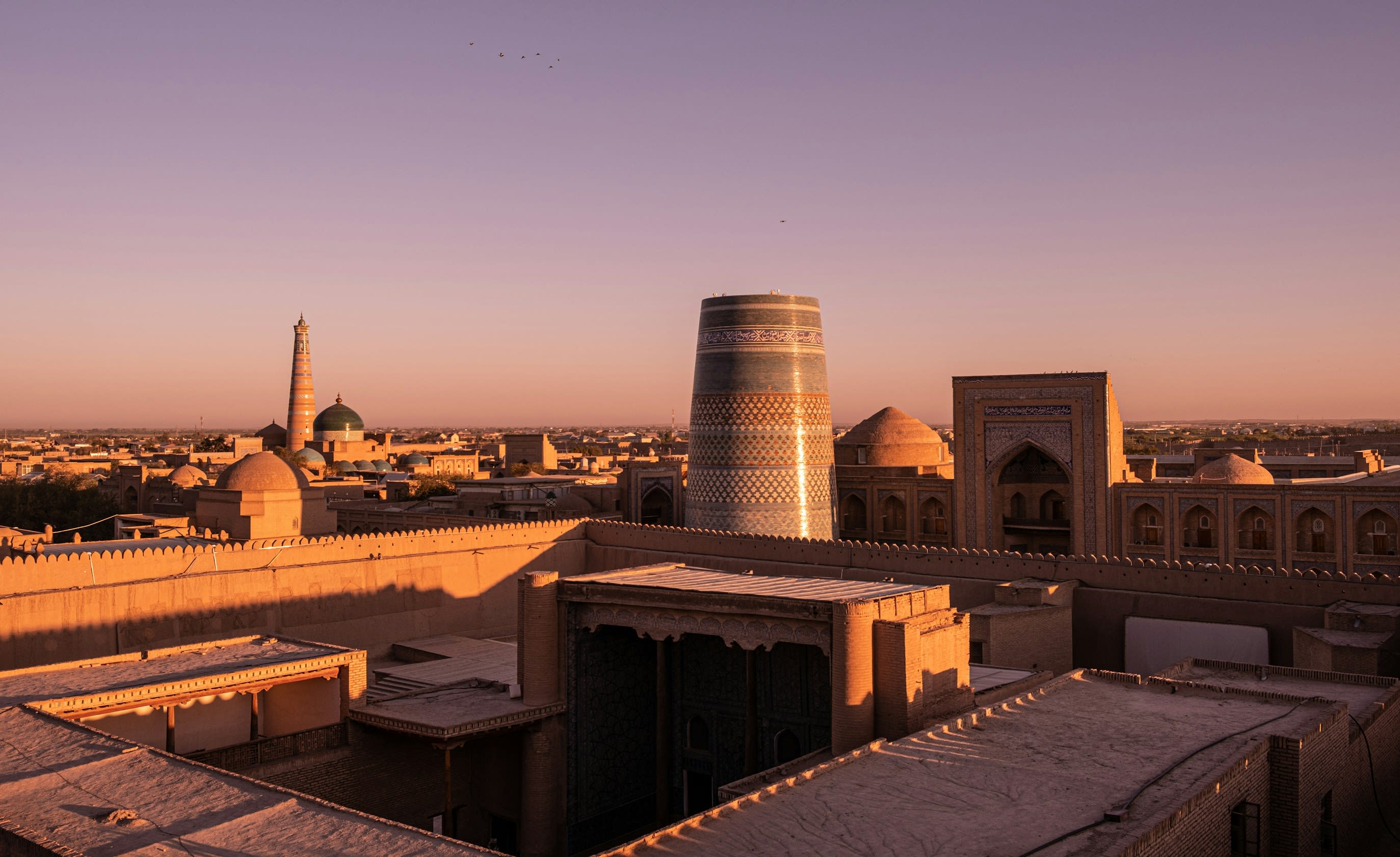
Itchan Kala
Khiva, Xorazm Region, Uzbekistan
Itchan Kala is a historic town of sacred significance. Approximate coordinates: 41.37775, 60.35977. Attributes: built, cultural. Tradition: Islamic. Recognized as a UNESCO World Heritage Site. Itchan Kala (Uzbek: Ichan-Qаl’а) is the walled inner town of the city of Khiva, Uzbekistan. Since 1990, it has been protected as a World Heritage Site. The old town retains more than 50 historic monuments and 250 old houses, dating primarily from the eighteenth or nineteenth centuries. Juma Mosque, for instance, was established in the tenth century and rebuilt from 1788 to 1789, although its celebrated hypostyle hall still retains 112 columns taken from ancient structures. Notable buildings in Itchan Kala are Konya Ark, Juma Mosque, Ak Mosque, Hasanmurod Qushbegi mosque, madrasahs of Alla-Kulli-Khan, Muhammad Aminkhon, Muhammad Rakhimkhon, Mausoleums of Pahlavon Mahmoud, Sayid Allavuddin, Shergozikhon as well as caravanserais and markets. Located in Xorazm Viloyati, Oʻzbekiston.
Jain temples of Khajuraho
Jatkra, Madhya Pradesh, India
Jain and Hindu Temples, Khajuraho, Madhya Pradesh is a temple of sacred significance. Approximate coordinates: 24.82969, 79.92067. Attributes: built, cultural, archaeological, pilgrimage. Tradition: Jainism, Hinduism. Recognized as a UNESCO World Heritage Site. Located in Madhya Pradesh, India.
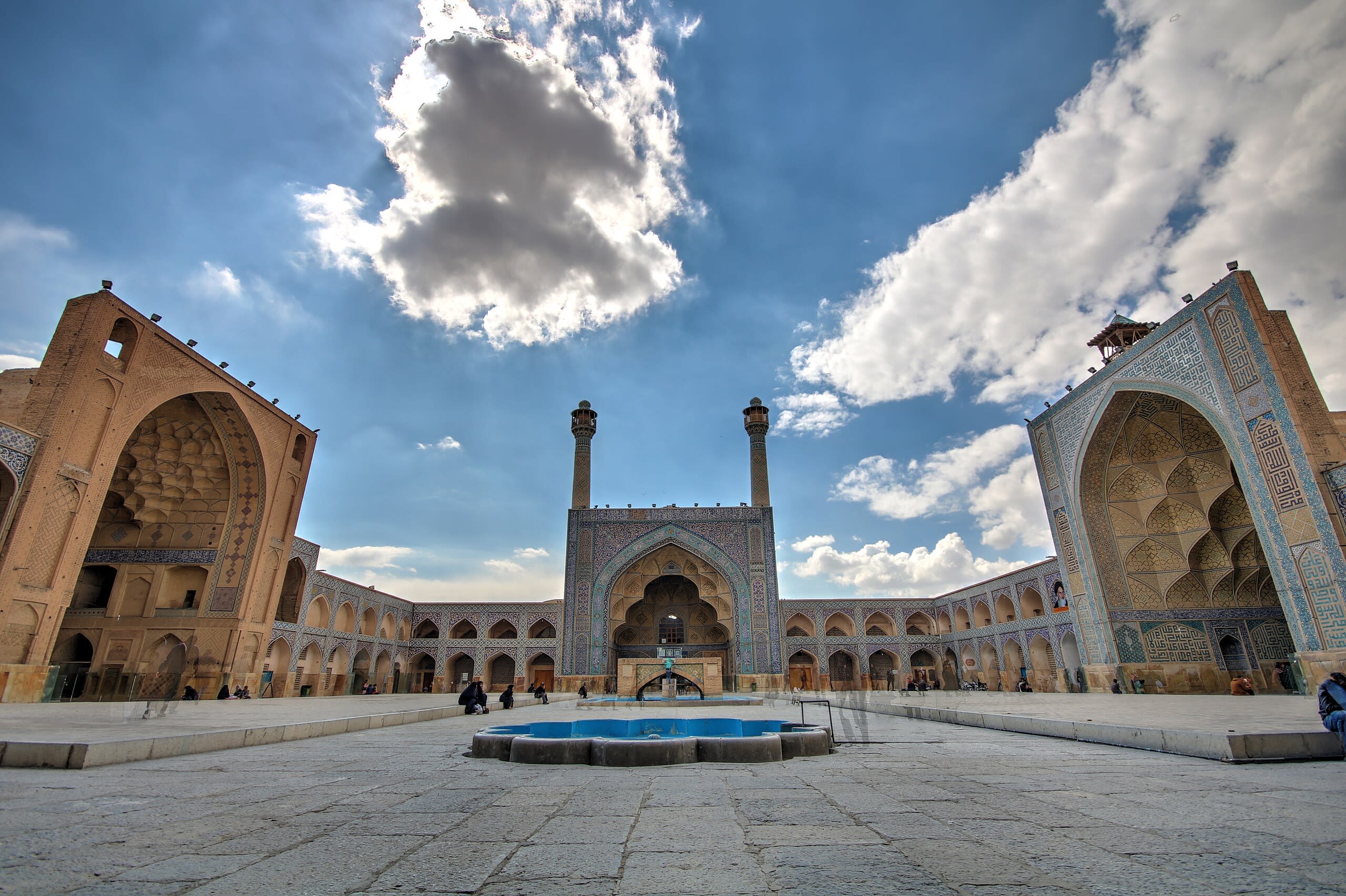
Jame' Mosque of Isfahan
Isfahan, Isfahan, Iran
No description available yet.
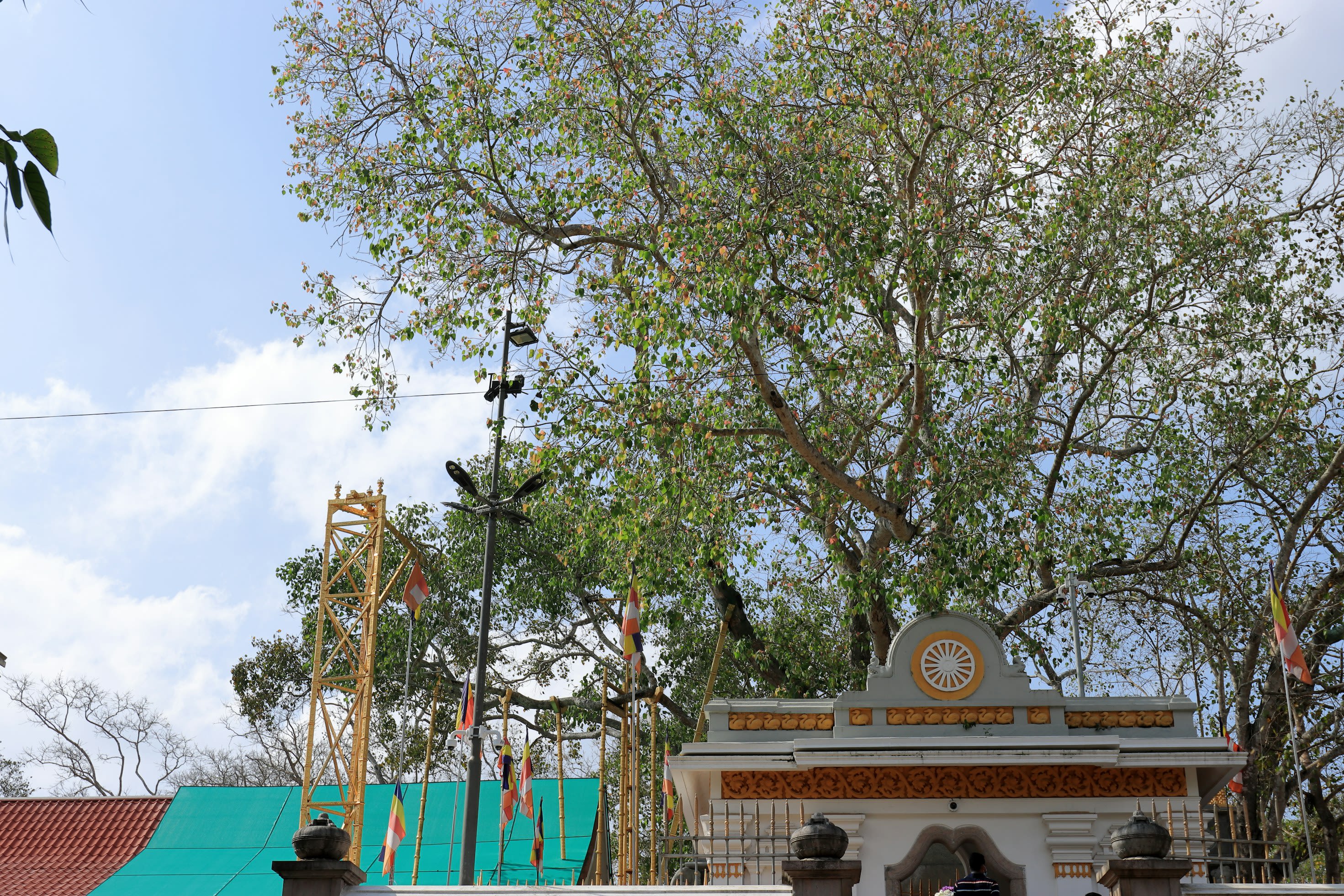
Jaya Sri Maha Bodhi
Anuradhapura, North Central Province, Sri Lanka
Jaya Sri Maha Bodhi is a sacred tree of sacred significance. Approximate coordinates: 8.34480, 80.39724. Attributes: natural, cultural, pilgrimage, ceremonial. Tradition: Buddhism. Associated figure: Siddhartha Gautama (Buddha). Mythological context: It is believed to be a tree grown from a cutting of the southern branch from the historical sacred bo tree, Sri Maha Bodhi, under which Siddhartha Gautama (Buddha) attained enlightenment.. Recognized as a UNESCO World Heritage Site. Jaya Sri Maha Bodhi Tree is a sacred bo tree (Ficus religiosa) in Mahamewuna Garden in the historical city of Anuradhapura, Sri Lanka. It is believed to be a tree grown from a cutting of the southern branch from the historical sacred bo tree, Sri Maha Bodhi, which was destroyed during the time of Emperor Ashoka, at Bodh Gaya in India, under which Siddhartha Gautama (Buddha) attained enlightenment. In 236 BC, the Buddhist nun Sangamitta Maha Theri, a daughter of Indian Ashoka, brought the tree cutting to Sri Lanka during the reign of Sinhalese King Devanampiya Tissa.[1] At more than 2,300 years old, it is the oldest living human-planted tree in the world with a known planting date. The Mahāvaṃsa, or the great chronicle of the Sinhalese, provides an elaborate account of the establishment of the Jaya Sri Maha Bodhi on the Island and the subsequent development of the site as a major Buddhist pilgrimage site. Today, the Jaya Sri Maha Bodhi is situated on a high terrace, about 6.5 meters above the ground, and surrounded by 4 other lower-level terraces with Bo trees called Parivara Bodhi planted for its protection. The site is currently administered by the Chief High Priest of Atamasthana and the Atamasthana Palakasabha, the administrative body of the Atamasthana. It receives millions of pilgrims each year. The site is open to visitors and continuously hosts numerous acts of worship throughout the year. However, access to the uppermost terrace where the bo tree is located is restricted due to the old age of the tree and various acts of vandalism it has endured throughout history, including a terrorist attack by the LTTE in 1985, where around 146 pilgrims were massacred. Located in Anuradhapura, North Central Province, Sri Lanka.
Jokhang Temple
Chengguan District, Tibet, China
Jokhang Temple is a temple of sacred significance. Approximate coordinates: 29.65025, 91.13382. Attributes: built, cultural, pilgrimage. Tradition: Tibetan Buddhism. Recognized as a UNESCO World Heritage Site. Located in 城关区 ཁྲིན་ཀོན་ཆུས།, 西藏自治区 བོད་རང་སྐྱོང་ལྗོངས།, China.
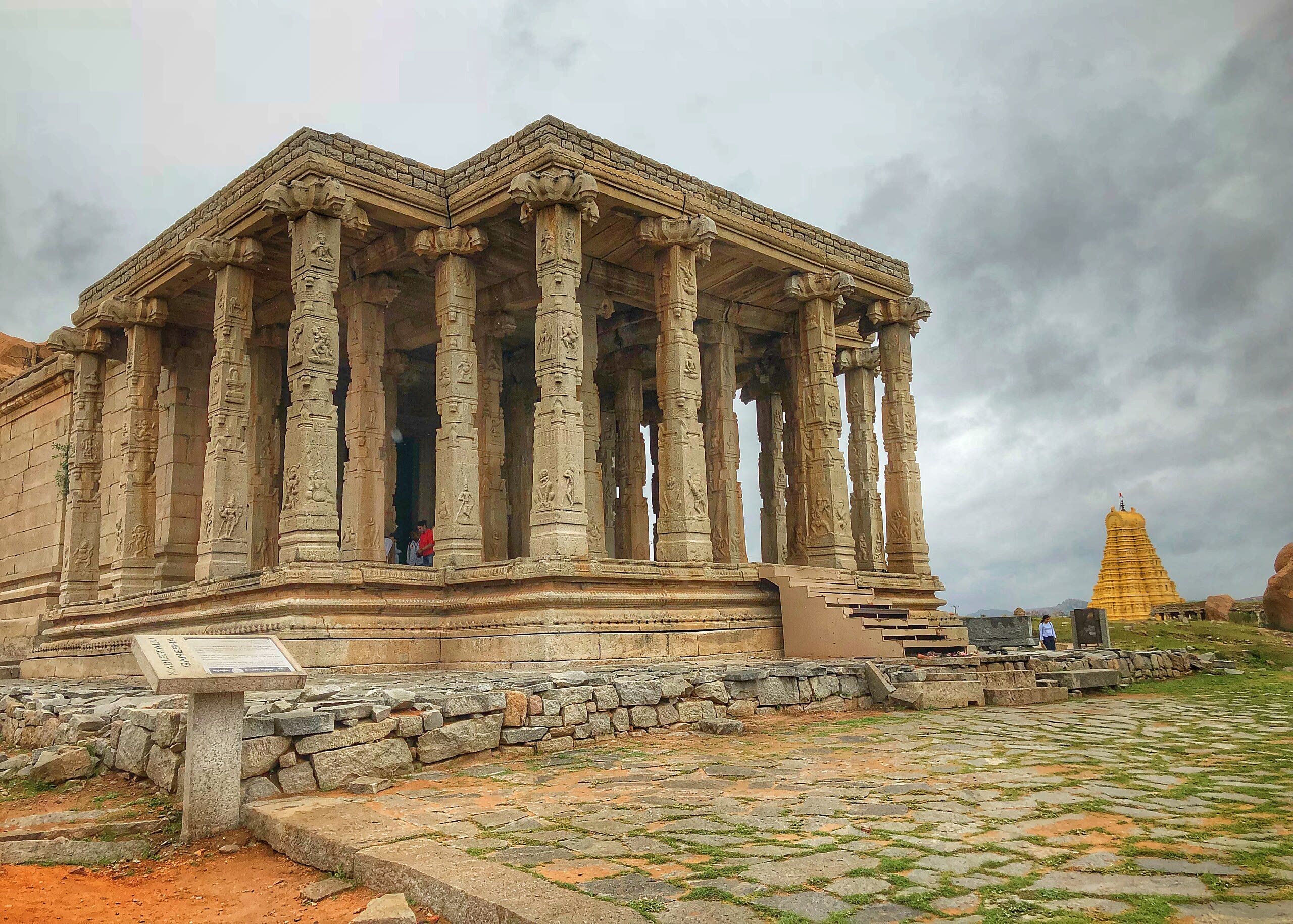
Kadalekalu Ganesha Temple, Hampi, Karnataka
Hampi, Karnataka, India
Kadalekalu Ganesha Temple, Hampi, Karnataka is a temple of sacred significance. Approximate coordinates: 15.33283, 76.46122. Attributes: built, cultural, archaeological, pilgrimage. Tradition: Hinduism. Associated figure: Ganesha. Mythological context: Hindu Mythology. Recognized as a UNESCO World Heritage Site. Located in Hosapete, Karnataka, India.
Kakadu National Park
West Arnhem Region, Australia
Kakadu National Park is a national park of sacred significance. Approximate coordinates: -13.09229, 132.39377. Attributes: natural, cultural, archaeological. Tradition: Aboriginal. Recognized as a UNESCO World Heritage Site. Kakadu National Park is a protected area in the Northern Territory of Australia, 171 km (106 mi) southeast of Darwin. It is a World Heritage Site. Kakadu is also gazetted as a locality, covering the same area as the national park, with 313 people recorded living there in the 2016 Australian census. Kakadu National Park is located within the Alligator Rivers Region of the Northern Territory, covering an area of 19,804 km2 (7,646 sq mi), extending nearly 200 kilometres (124 mi) from north to south and over 100 kilometres (62 mi) from east to west. It is roughly the size of Wales or one-third the size of Tasmania, and is the second-largest national park in Australia, after the Munga-Thirri–Simpson Desert National Park. Most of the region is owned by the Aboriginal traditional owners, who have occupied the land for around 60,000 years and, today, manage the park jointly with Parks Australia. It is highly ecologically and biologically diverse, hosting a wide range of habitats and flora and fauna. It also includes a rich heritage of Aboriginal rock art, including highly significant sites, such as Ubirr. Kakadu is fully protected by the EPBC Act. The Ranger Uranium Mine site, one of the most productive uranium mines in the world until it ceased operations in January 2021, is surrounded by the park. Domestic Asian water buffalo, which are now an established feral population and invasive environmental pests, were released into the area in the late 19th century. Feral pigs, cats, red foxes and rabbits are further examples of invasive species, all of which compete with and wreak havoc upon the sensitive, unique ecosystems of the Northern Territory, and of the whole of Australia. These species were intentionally brought to the continent by the early settlers, pastoralists, and missionaries. The European presence, albeit less than in more populated regions (on the east and west coasts), was still felt. In Kakadu, missionaries established a mission at Oenpelli (present-day Gunbalanya) in 1925. A few pastoralists, crocodile-hunters and wood cutters also made a living in the area at various times up until the early 20th century. The area was progressively given protected status from the 1970s onward. Located in West Arnhem Region, Australia.
Kakatiya Rudreshwara Ramappa Temple, Telangana
Palampet, Telangana, India
Kakatiya Rudreshwara Ramappa Temple, Telangana is a temple of sacred significance. Approximate coordinates: 18.25928, 79.94332. Attributes: built, cultural, archaeological, pilgrimage. Tradition: Hinduism. Associated figure: Lord Shiva. Recognized as a UNESCO World Heritage Site. Located in Telangana, India.
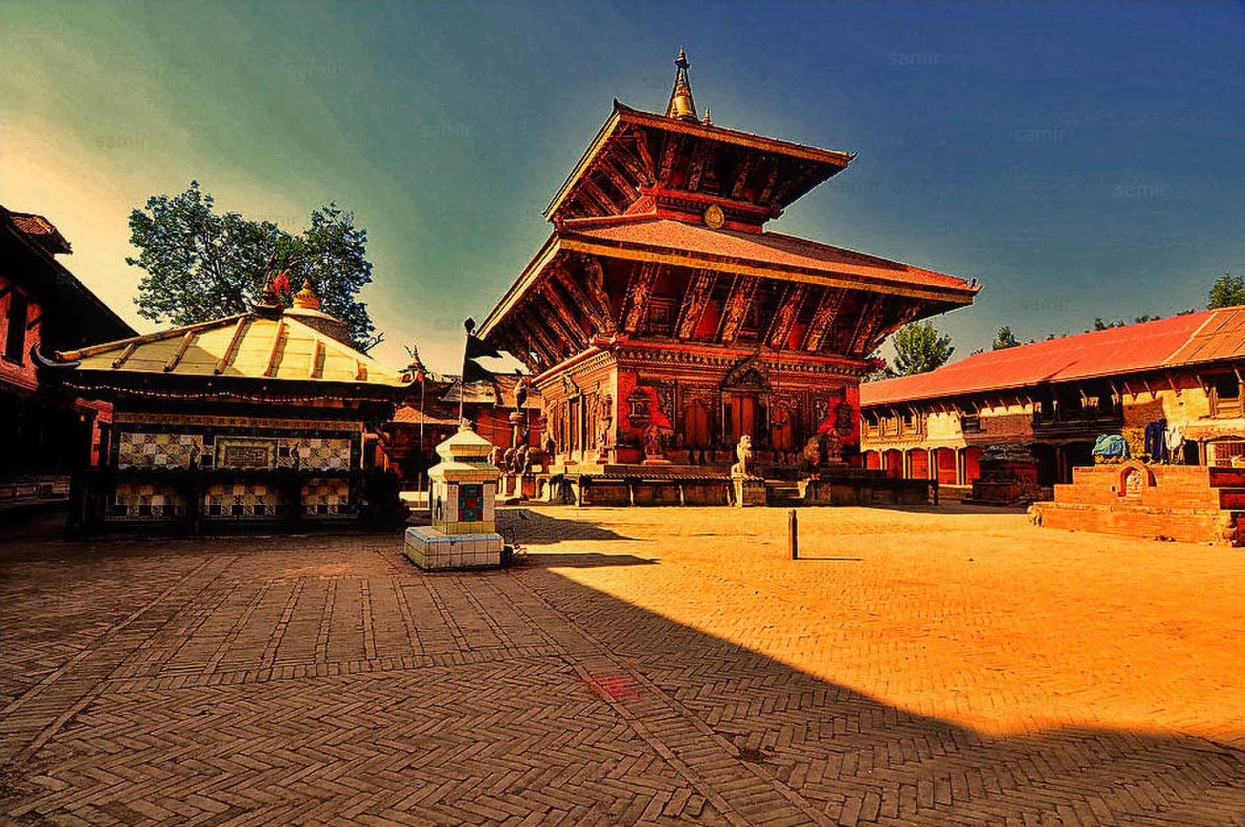
Kathmandu Valley
Kathmandu, Bagmati Province, Nepal
Kathmandu is a city of sacred significance. Approximate coordinates: 27.71271, 85.33081. Attributes: built, cultural, pilgrimage, ceremonial. Tradition: Hinduism; also recognized in Hinduism, Buddhism contexts. Associated figure: Pashupatinath, Matsyendranath. Mythological context: Hindu mythology. Recognized as a UNESCO World Heritage Site. Kathmandu, officially the Kathmandu Metropolitan City, is the seat of federal government and the most populous city in Nepal. As of the 2021 Nepal census, there were 845,767 inhabitants living in 105,649 households and approximately 4 million people in its surrounding agglomeration. It is located in the Kathmandu Valley, a large valley surrounded by hills in central Nepal, at an altitude of 4,344 feet (1,324 metres) above sea level. The city is one of the oldest continuously inhabited places in the world, founded in the 2nd century AD. The valley was historically called the Nepal Mandala (the name for the cosmic elements of water Dha mandala in Newari, and cosmos), and has been the home of the Newar people, a cosmopolitan urban civilization in the Himalayan foothills. The city was the royal capital of the Kingdom of Nepal and hosts palaces, mansions and gardens built by the Nepali aristocracy. It has been home to the headquarters of the South Asian Association for Regional Cooperation (SAARC) since 1985. Today, it is the seat of government of the Federal Democratic Republic of Nepal, established in 2008, and is part of Bagmati Province. Kathmandu is and has been for many years the centre of Nepal s history, art, culture, and economy. It has a multi-ethnic population within a Hindu majority. Religious and cultural festivities form a major part of the lives of people residing in Kathmandu. Tourism is an important part of the economy in the city. In 2013, Kathmandu was ranked third among the top ten upcoming travel destinations in the world by TripAdvisor, and ranked first in Asia. The city is considered the gateway to the Nepal Himalayas and is home to several World Heritage Sites: the Durbar Square, Swayambhu Mahachaitya, Bouddha and Pashupatinath. Kathmandu valley is growing at 4 per cent per year according to the World Bank in 2010, making it one of the fastest-growing metropolitan areas in South Asia, and the first region in Nepal to face the unprecedented challenges of rapid urbanization and modernization at a metropolitan scale. It is the largest metropolitan area located in the Himalayas. Located in काठमाडौँ महानगरपालिका, बागमती प्रदेश, नेपाल.
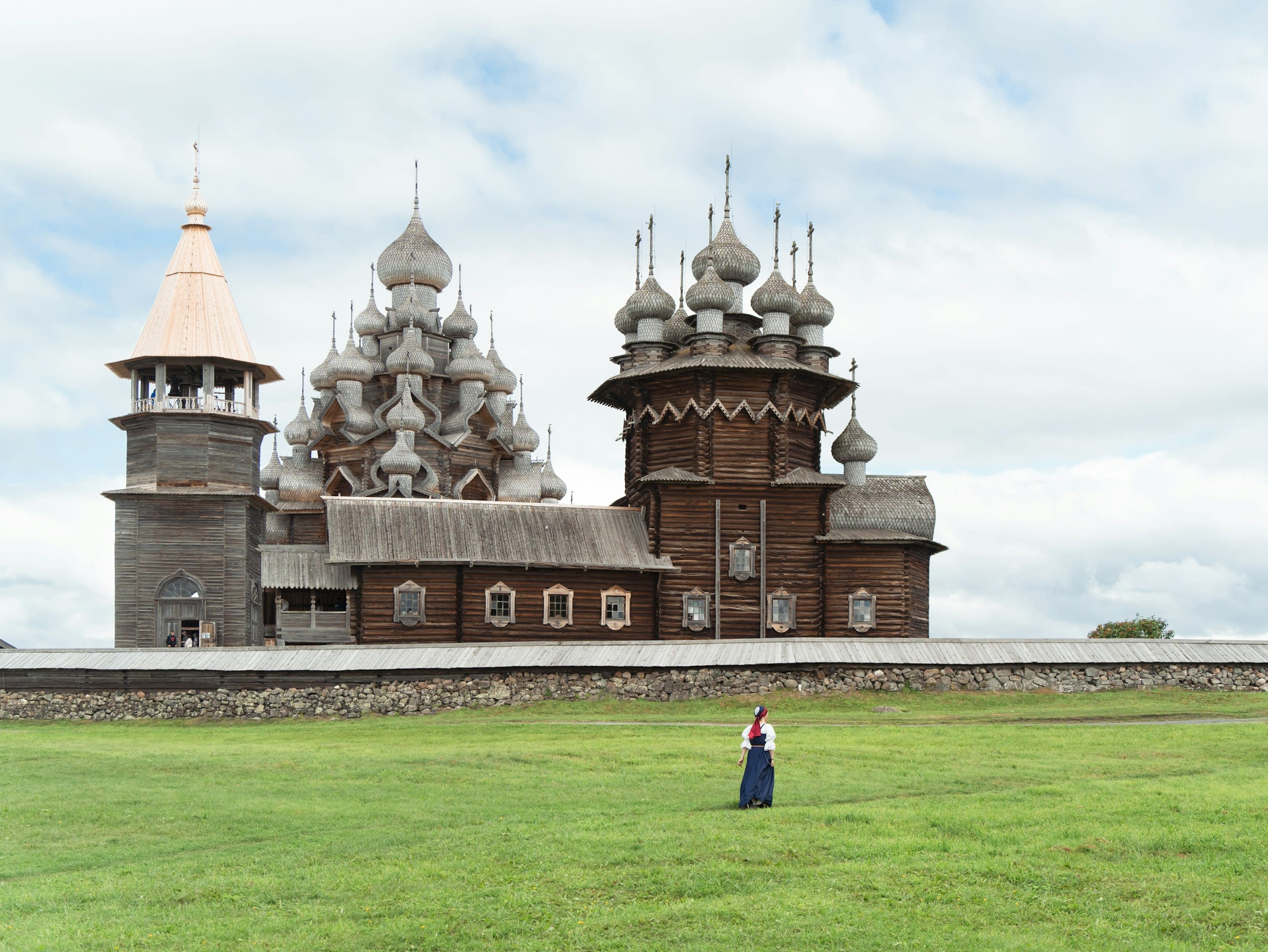
Kizhi Pogost, Kizhi Island
Kizhi, Republic of Karelia, Russia
Kizhi island is a open-air museum of sacred significance. Approximate coordinates: 62.06735, 35.22384. Attributes: built, cultural. Tradition: Orthodox Christianity. Recognized as a UNESCO World Heritage Site. Kizhi (Russian: Ки́жи, IPA: [ˈkʲiʐɨ]; Karelian: Kiži) is an island near the geometrical center of Lake Onega in the Republic of Karelia (Medvezhyegorsky District), Russia. It is elongated from north to south and is about 6 kilometres (3.7 mi) long, 1 kilometre (0.62 mi) wide and is about 68 kilometres (42 mi) away from the capital of Karelia, Petrozavodsk. Settlements and churches on the island were known from at least the 15th century. The population was rural, but was forced by the government to assist development of the ore mining and iron plants in the area that resulted in a major Kizhi Uprising in 1769–1771. Most villages had disappeared from the island by the 1950s and now only a small rural settlement remains. In the 18th century, two major churches and a bell tower were built on the island, which are now known as Kizhi Pogost. In the 1950s, dozens of historical wooden buildings were moved to the island from various parts of Karelia for preservation purposes. Nowadays, the entire island and the nearby area form a national open-air museum with more than 80 historical wooden structures. The most famous is the Kizhi Pogost, which is a UNESCO World Heritage site. Located in Великогубское сельское поселение, Карелия, Russia.
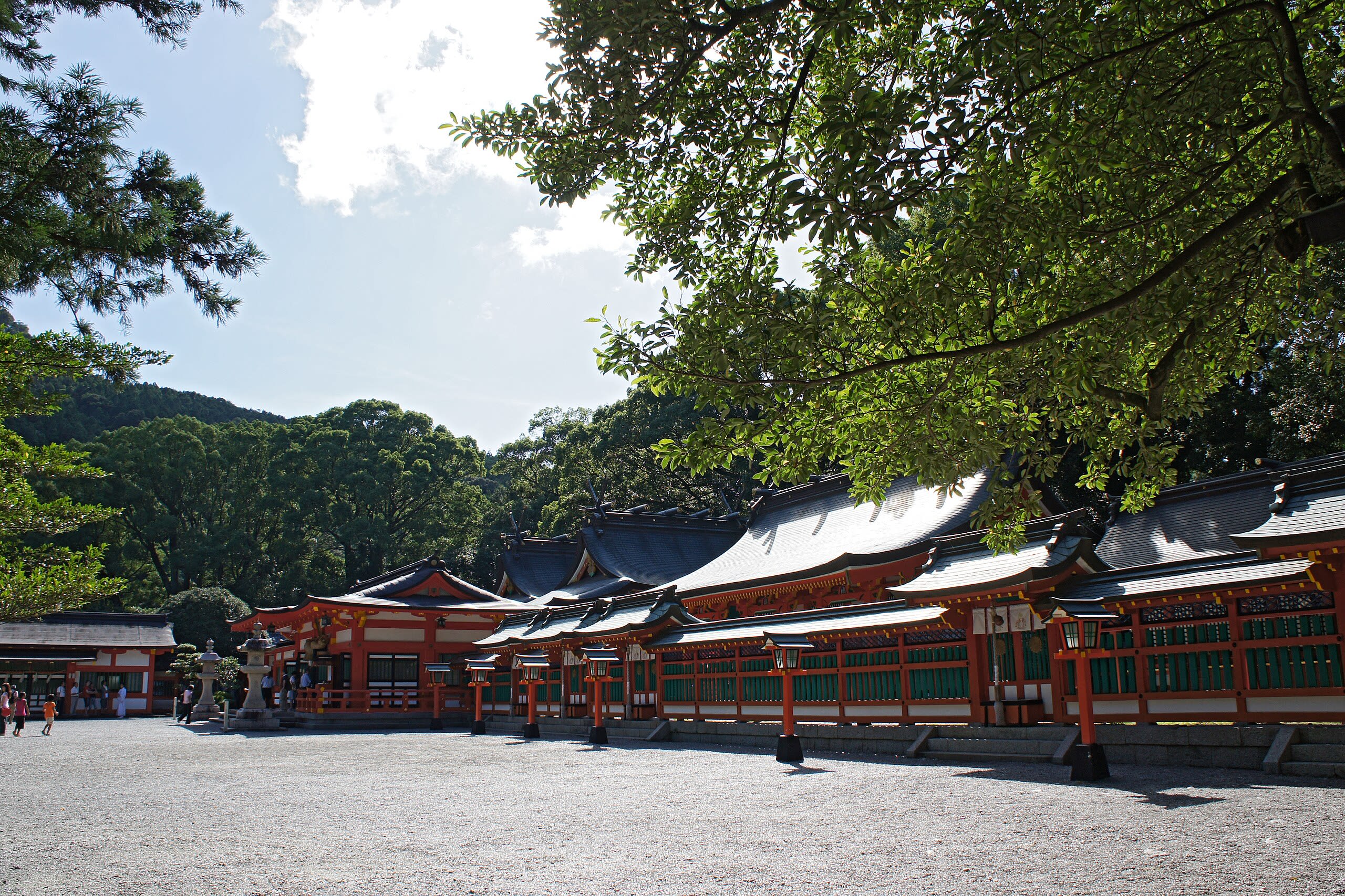
Kumano Hayatama Taisha
Shingū, Wakayama Prefecture, Japan
Kumano Hayatama Taisha is a shrine of sacred significance. Approximate coordinates: 33.73180, 135.98364. Attributes: built, cultural, pilgrimage, ceremonial. Tradition: Shinto. Recognized as a UNESCO World Heritage Site. Kumano Hayatama Taisha (熊野速玉大社) is a Shinto shrine located in Shingu, Wakayama Prefecture, on the shores of the Kumanogawa in the Kii Peninsula of Japan. It is included as part of the Kumano Sanzan in the UNESCO World Heritage site Sacred Sites and Pilgrimage Routes in the Kii Mountain Range . The three Kumano Sanzan shrines are the Sōhonsha ( head shrines ) of all Kumano shrines, lie at between 20 and 40 km of distance one from the other and are connected by the pilgrimage route known as Kumano Sankeimichi (熊野参詣道). Located in 新宮市, Japan.
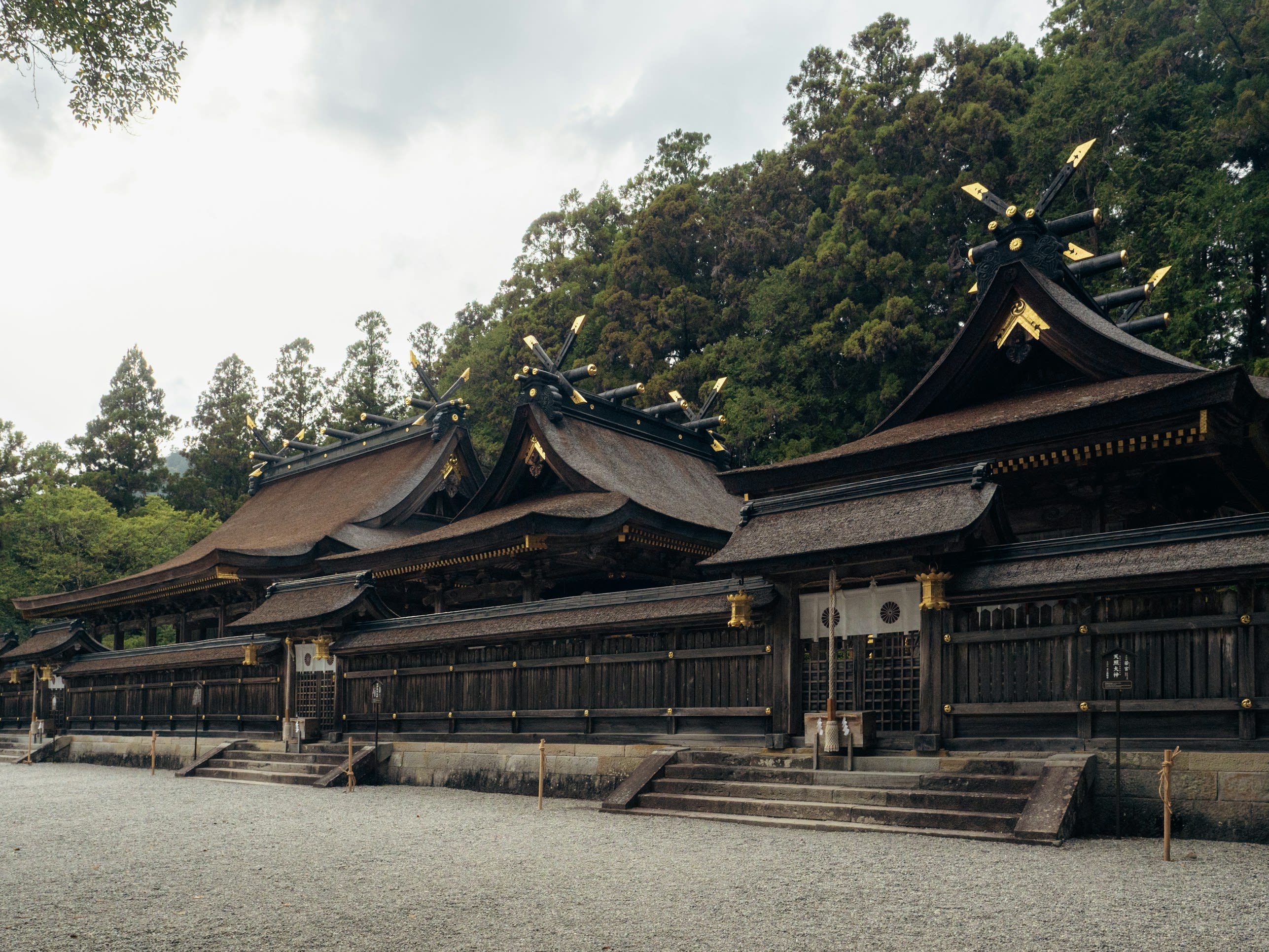
Kumano Hongū Taisha
Tanabe, Wakayama Prefecture, Japan
Kumano Hongū Taisha is a shrine of sacred significance. Approximate coordinates: 33.84064, 135.77364. Attributes: built, cultural, pilgrimage, ceremonial. Tradition: Shinto. Associated figure: Kumano Gongen. Recognized as a UNESCO World Heritage Site. Kumano Hongū Taisha (熊野本宮大社) is a Shinto shrine located in the jurisdiction of Tanabe, Wakayama, deep in the rugged mountains of the southeast Kii Peninsula of Japan. It is included as part of the Kumano Sanzan in the World Heritage Site Sacred Sites and Pilgrimage Routes in the Kii Mountain Range . The main deity enshrined is Kumano Gongen (熊野権現). All of the ancient Kumano Kodō routes lead to the Grand Shrine. It was originally located at present Ōyunohara (大斎原), on a sandbank at the confluence of the Kumano River and Otonashi River. In 1889, it was partially destroyed in a flood and the remaining shrine buildings were relocated at its present site in 1891. Of the original five main pavilions only three were rebuilt. Four deities were moved there and the other eight are still enshrined there in two stone monuments. In 2000, the largest torii shrine gate in the world (33.9 meters tall and 42 meters wide) was erected at the entrance to the Oyunohara sandbank. It is an official gateway that designates the entrance to a sacred area. It signifies the division of the secular and the spiritual worlds. This torii is called Otorii (o means great ) and is made of steel weighing 172 tons, which took about six months to make and another six months to assemble. Located in 田辺市, Japan.
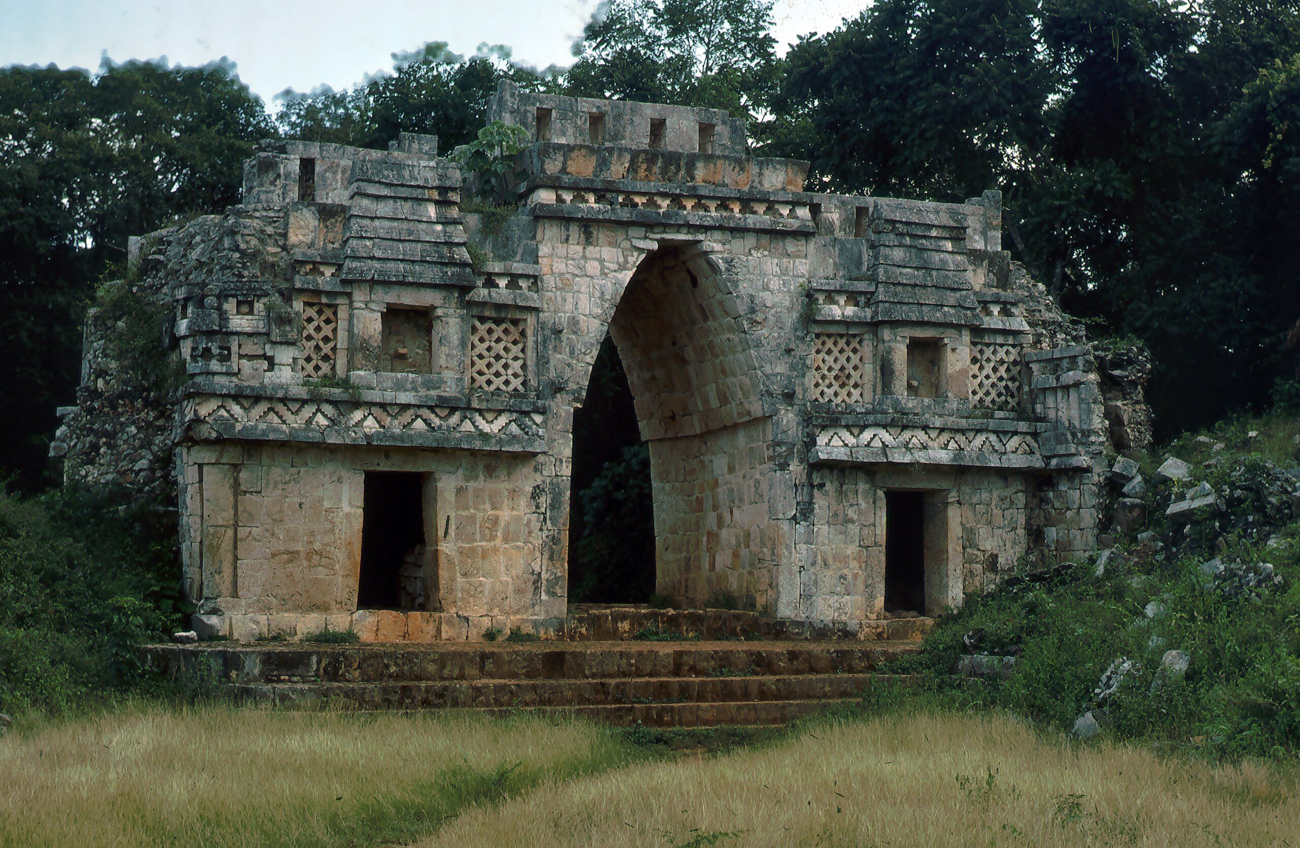
Labna
Santa Elena, Yucatán, Mexico
Labna is a mesoamerican archaeological site of sacred significance. Approximate coordinates: 20.17352, -89.57849. Attributes: built, cultural, archaeological, ceremonial. Tradition: Maya civilization. Recognized as a UNESCO World Heritage Site. Labna (or Labná in Spanish orthography) is a Mesoamerican archaeological site and ceremonial center of the pre-Columbian Maya civilization, located in the Puuc Hills region of the Yucatán Peninsula. It is situated to the south of the large Maya site of Uxmal, in the southwest of the present-day state of Yucatán, Mexico. Labna, Sayil and Kabah were incorporated with Uxmal as a UNESCO World Heritage Site in 1996. Located in Yucatán, Mexico.
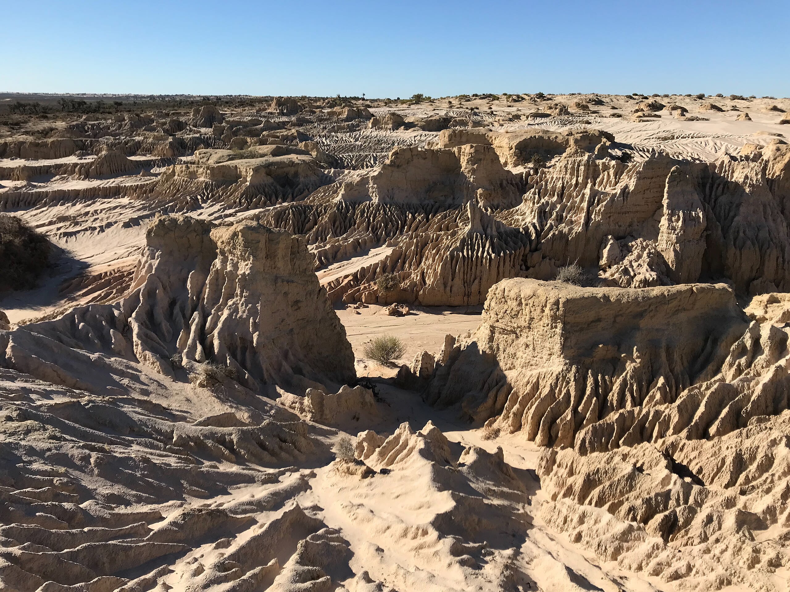
Lake Mungo
Willandra Lakes, New South Wales, Australia
Lake Mungo is a lake of sacred significance. Approximate coordinates: -33.72337, 143.05664. Attributes: natural, cultural, archaeological, ceremonial. Tradition: Indigenous Australian. Recognized as a UNESCO World Heritage Site. Lake Mungo is a dry lake located in New South Wales, Australia. It is about 760 km (472 miles) due west of Sydney and 90 km (56 miles) north-east of Mildura. The lake is the central feature of Mungo National Park, and is one of seventeen lakes in the World Heritage listed Willandra Lakes Region. Many important archaeological findings have been made at the lake, most significantly the discovery of the remains of Mungo Man, the oldest human remains found in Australia, Mungo Woman, the oldest human remains in the world to be ritually cremated and as the location of the Lake Mungo geomagnetic excursion, the first convincing evidence that Geomagnetic excursions are a geomagnetic phenomenon rather than sedimentological. Located in New South Wales, Australia.
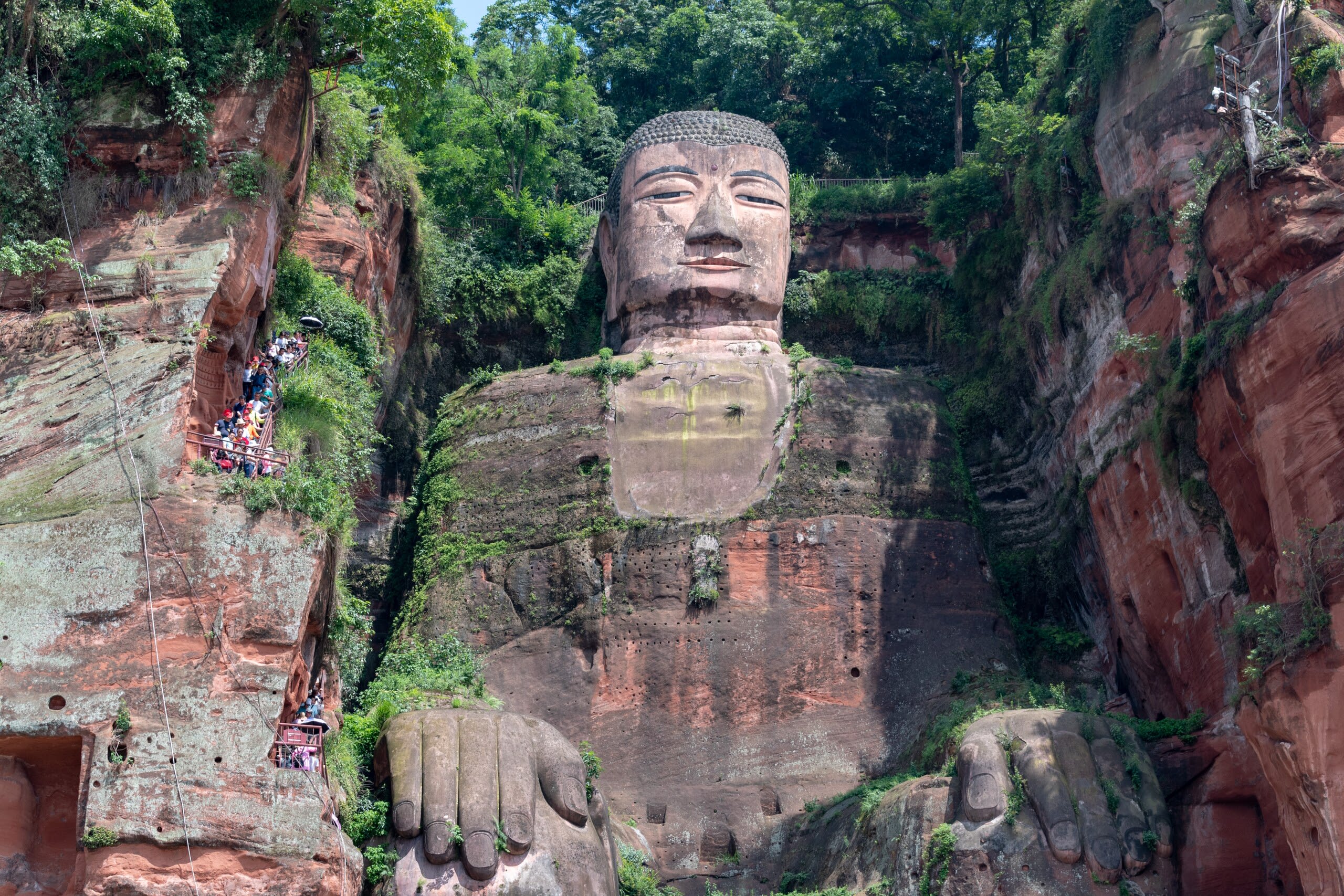
Leshan Giant Buddha
Leshan, Sichuan, China
For ninety years, three generations of craftsmen carved Maitreya Buddha into the cliffs where three rivers meet at Leshan. The monk Haitong believed a colossal image of the future Buddha could calm the treacherous currents that had claimed countless lives. He gouged out his own eyes to prove his sincerity. When the Buddha was completed in 803 CE, the waters did grow safer. Locals still call him Buddha Grandpa, their guardian watching over the city.
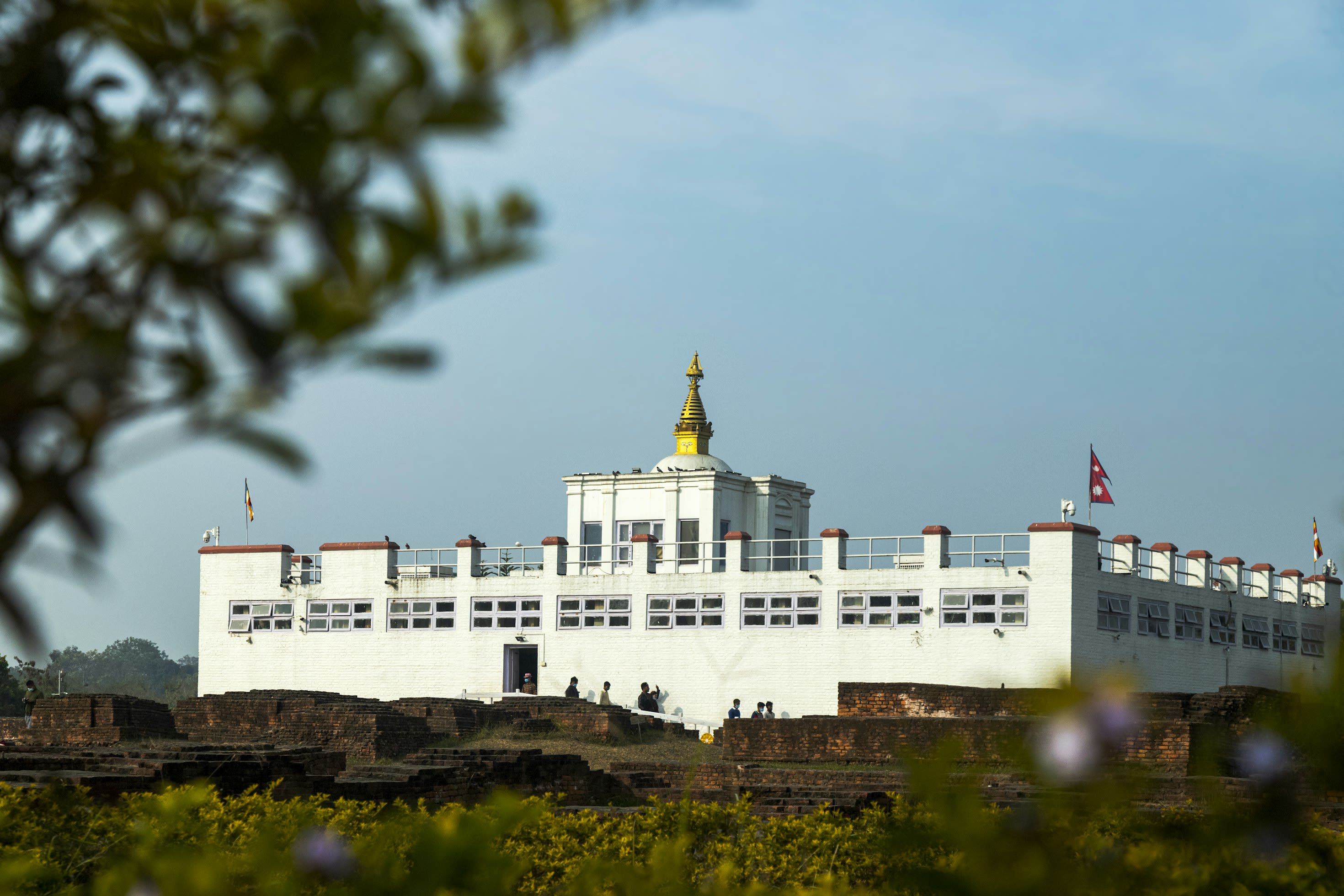
Lumbini
Parsa, Lumbini Province, Nepal
Lumbini is a pilgrimage site of sacred significance. Approximate coordinates: 27.48619, 83.27645. Attributes: built, cultural, archaeological, pilgrimage. Tradition: Buddhism. Associated figure: Buddha. Mythological context: Birthplace of Buddha. Recognized as a UNESCO World Heritage Site. Lumbinī (Lumbini, pronounced [ˈlumbini] , the lovely ) is a Buddhist pilgrimage site in the Rupandehi District of Lumbini Province in Nepal. According to the sacred texts of the Buddhist Commentaries, Maya Devi gave birth to Siddhartha Gautama in Lumbini in c. 624 BCE. Siddhartha Gautama achieved Enlightenment, and became Shakyamuni Buddha who founded Buddhism. He later passed into parinirvana at the age of 80 years, in c.544 BCE. Lumbini is one of four most sacred pilgrimage sites pivotal in the life of the Buddha. Lumbini has a number of old temples, including the Mayadevi Temple, and several new temples, funded by Buddhist organisations from various countries. Most of the temples have already been completed and some are still under construction. Many monuments, monasteries, stupas, a museum, and the Lumbini International Research Institute are also near to the holy site. The Puskarini, or Holy Pond, is where Mayadevi, the Buddha s mother, is believed to have taken the ritual bath prior to his birth and where the Buddha also had his first bath. At other sites near Lumbini, earlier Buddhas were born, then achieved ultimate Enlightenment and finally relinquished their earthly forms. Lumbini was made a World Heritage Site by UNESCO in 1997. Located in लुम्बिनी प्रदेश, नेपाल.
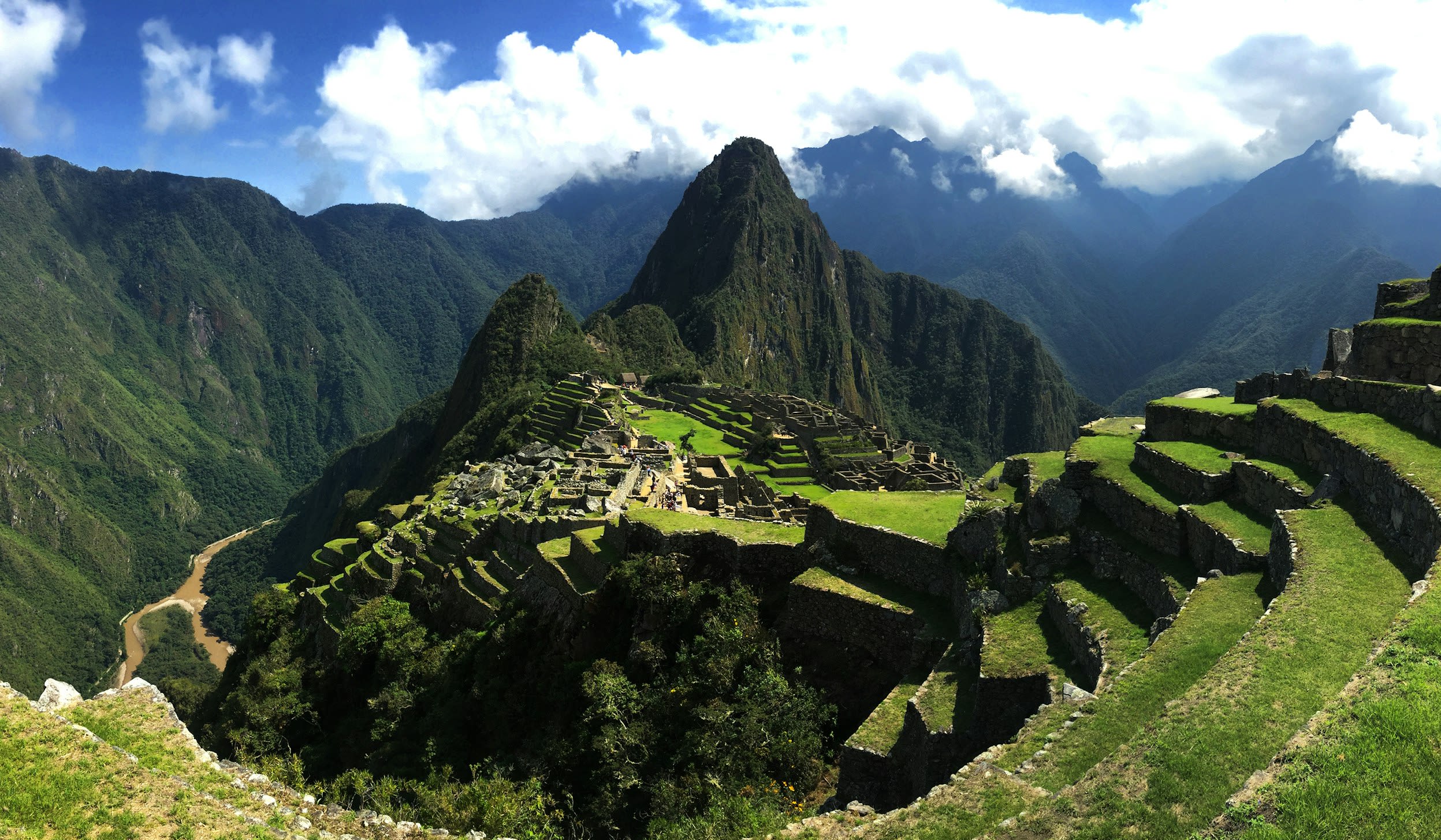
Machu Picchu
Machupicchu, Cusco, Peru
Machu Picchu is a inca citadel of sacred significance. Approximate coordinates: -13.16390, -72.54616. Attributes: built, cultural, archaeological. Tradition: Inca. Associated figure: Inca Emperor Pachacuti. Recognized as a UNESCO World Heritage Site. Machu Picchu is a 15th-century Inca citadel located in the Eastern Cordillera of southern Peru on a mountain ridge at 2,430 meters (7,970 ft). Often referred to as the Lost City of the Incas , it is the most familiar icon of the Inca Empire. It is located in the Machupicchu District within the Urubamba Province above the Sacred Valley, which is 80 kilometers (50 mi) northwest of the city of Cusco. The Urubamba River flows past it, cutting through the Cordillera and creating a canyon with a subtropical mountain climate. The Inca civilization had no written language and following the first encounter by the Spanish soldier Baltasar Ocampo, no Europeans are recorded to have visited the site from the late 16th century until the 19th century. As far as historical knowledge extends, there are no existing written records detailing the site during its period of active use. The leading theory is that Machu Picchu was a private city for Incan royalty. The names of the buildings, their supposed uses, and their inhabitants, are the product of modern archaeologists based on physical evidence, including tombs at the site. Machu Picchu was built in the classical Inca style, with polished dry-stone walls. Its three primary structures are the Temple of the Sun, the Temple of the Three Windows, and the Intihuatana. From 1929 to 1971, Machu Picchu underwent extensive restoration and conservation work, including structural stabilization and artifact excavation, driven by government initiatives and research expeditions. Most recent archaeologists believe that Machu Picchu was constructed as an estate for the Inca emperor Pachacuti (1438–1472). The Inca built the estate around 1450 but abandoned it a century later, at the time of the Spanish conquest. According to the new AMS radiocarbon dating, it was occupied from c. 1420–1532. Historical research published in 2022 claims that the site was probably called Huayna Picchu by the Inca people themselves, as it exists on the smaller peak of the same name. Machu Picchu was declared a Peruvian Historic Sanctuary in 1982 and a UNESCO World Heritage Site in 1983. In 2007, Machu Picchu was voted one of the New Seven Wonders of the World in a worldwide internet poll. Located in Machupicchu, Cusco, Peru.
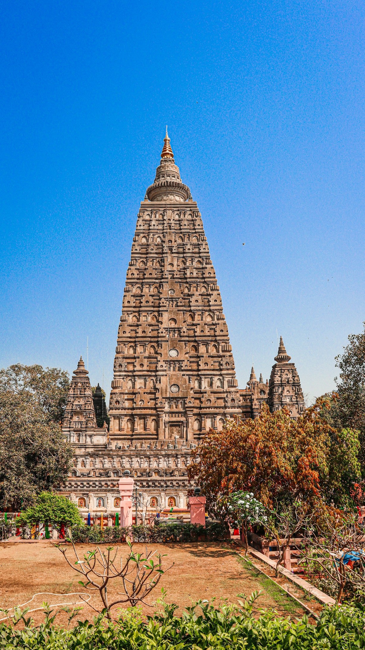
Mahabodhi Temple and Bodhi Tree, Bodh Gaya, Bihar
Bodh Gaya, Bihar, India
Mahabodhi Temple and Bodhi Tree, Bodh Gaya, Bihar is a temple and tree of sacred significance. Approximate coordinates: 24.69592, 84.99142. Attributes: built, natural, cultural, pilgrimage. Tradition: Buddhism. Associated figure: Buddha. Mythological context: Buddha's Enlightenment. Recognized as a UNESCO World Heritage Site. Located in Bihar, India.
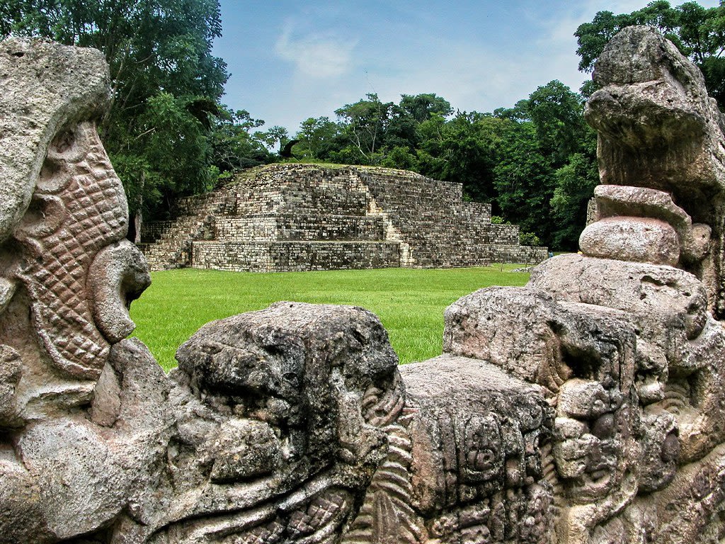
Maya Site of Copan
Copán Ruinas, Copán, Honduras
Copan is a archaeological site of sacred significance. Approximate coordinates: 14.83726, -89.14149. Attributes: built, cultural, archaeological, ceremonial. Tradition: Maya. Recognized as a UNESCO World Heritage Site. Located in Copán Ruinas, Copán, Honduras.
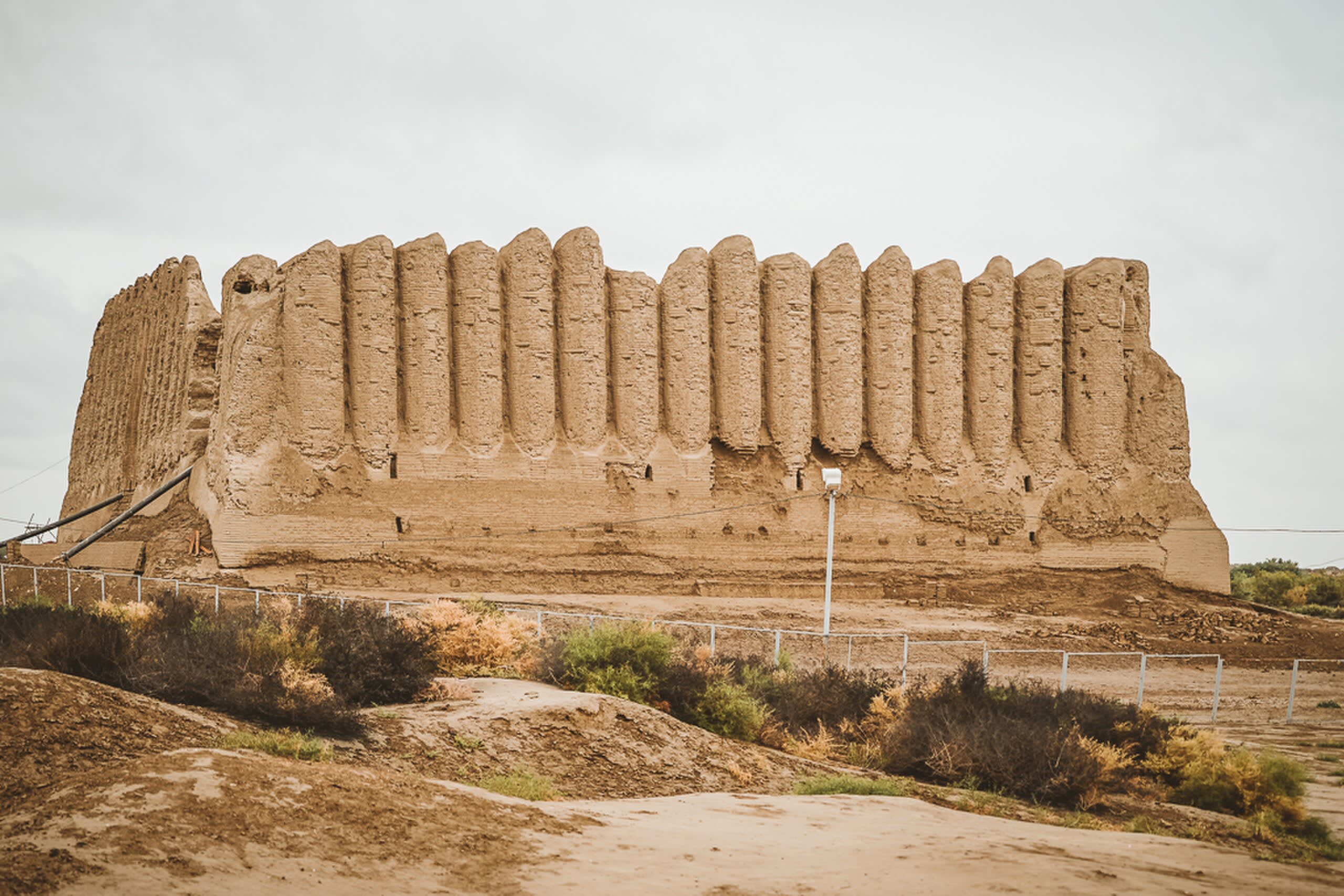
Merv Oasis
Mary, Mary Region, Turkmenistan
Hoja Ýusup Hemedany, Merv is a mausoleum of sacred significance. Approximate coordinates: 37.67867, 62.17064. Attributes: built, cultural, archaeological, pilgrimage. Tradition: Islamic. Associated figure: Hoja Ýusup Hemedany. Recognized as a UNESCO World Heritage Site. Located in Baýramaly etraby, Türkmenistan.
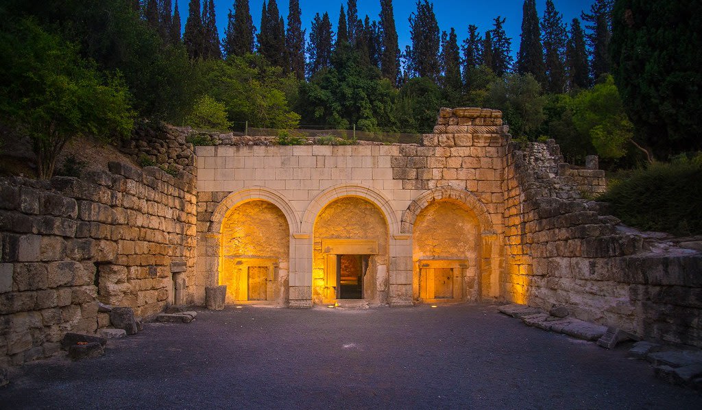
Necropolis of Bet Shearim
Emek Izrael Regional Council, North District, Israel
Bet Shearim is a catacombs of sacred significance. Approximate coordinates: 32.70326, 35.12758. Attributes: built, cultural, archaeological. Recognized as a UNESCO World Heritage Site. Located in קריית טבעון, מחוז חיפה, ישראל.
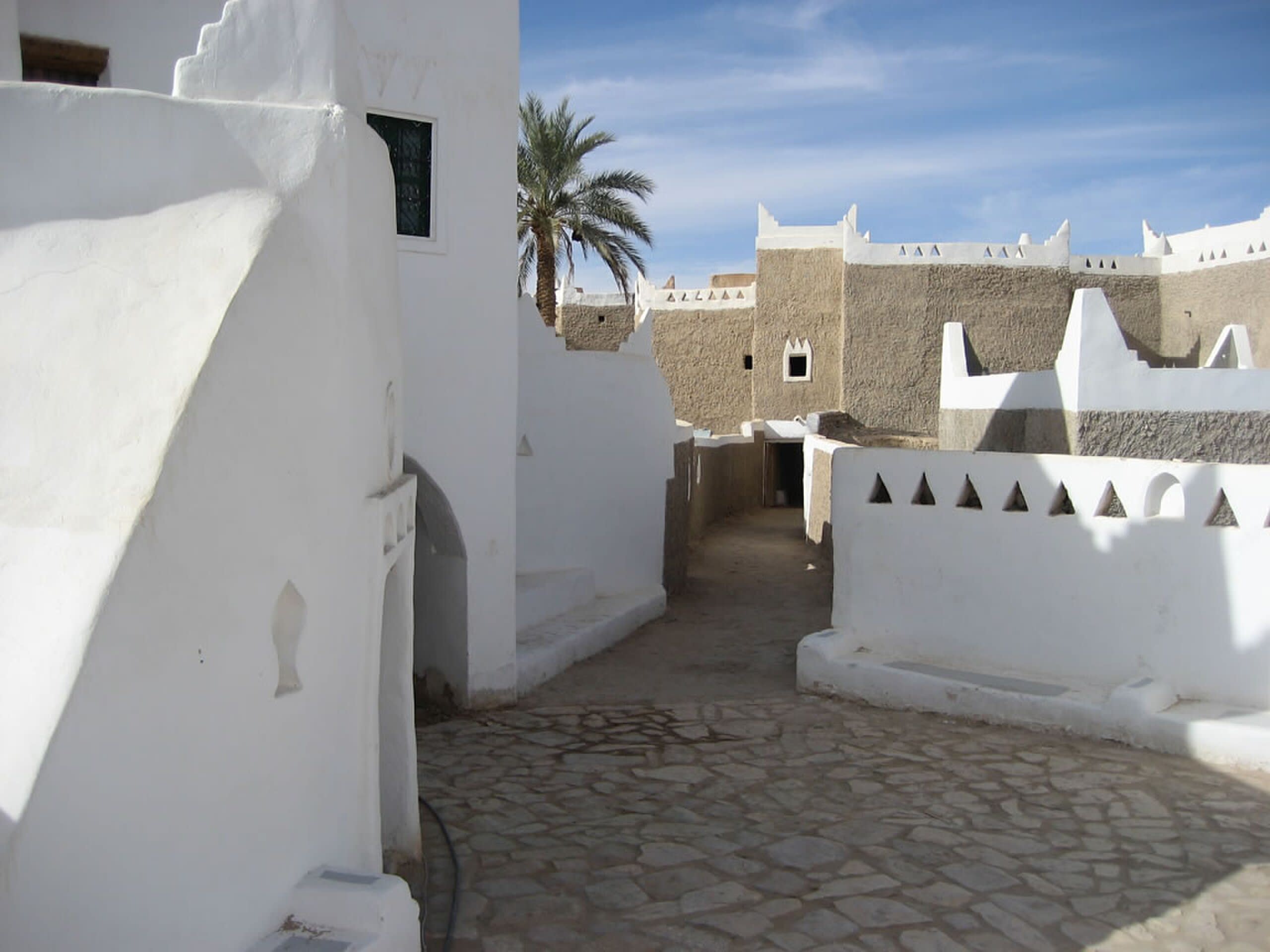
Old Town of Ghadames, Libya
Ghadames, Nalut, Libya
Ghadames, Libya is a ancient city of sacred significance. Approximate coordinates: 30.13236, 9.49724. Attributes: built, cultural, archaeological. Recognized as a UNESCO World Heritage Site. Located in غدامس, نالوت, ليبيا.
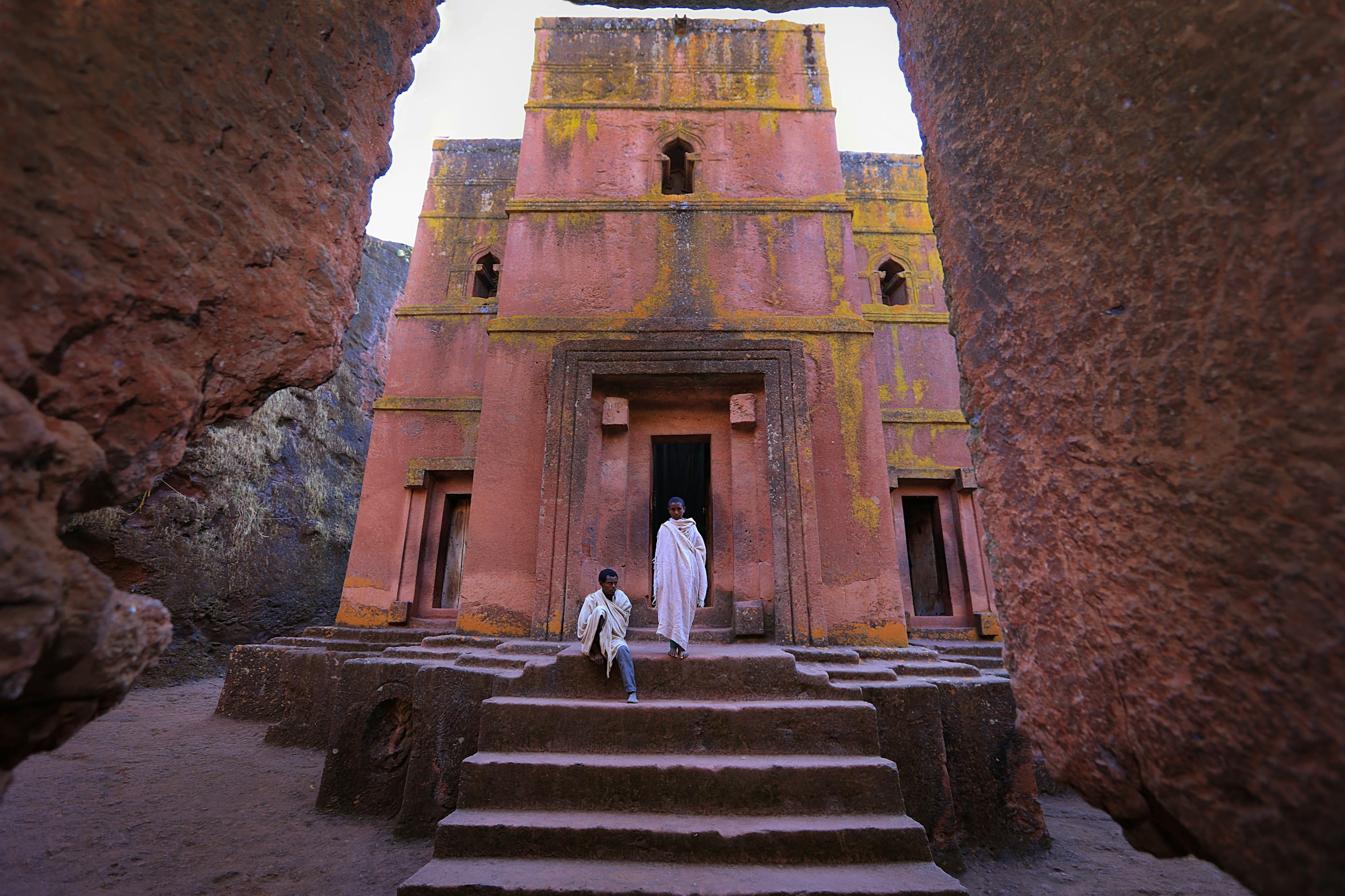
Rock-Hewn Churches, Lalibela
ላሊበላ / Lalibela, Amhara Region, Ethiopia
Lalibela is a church of sacred significance. Approximate coordinates: 12.04469, 39.04266. Attributes: built, cultural, archaeological, pilgrimage, ceremonial. Tradition: Christianity. Associated figure: St. Michael. Mythological context: Representation of Jerusalem. Recognized as a UNESCO World Heritage Site. Lalibela (Amharic: ላሊበላ, romanized: Lalibäla) is a town in the Amhara Region of Ethiopia. Located in the Lasta district and North Wollo Zone, it is a tourist site for its famous rock-cut monolithic churches designed in contrast to the earlier monolithic churches in Ethiopia. The whole of Lalibela is a large and important site for the antiquity, medieval, and post-medieval civilization of Ethiopia. To Christians, Lalibela is one of Ethiopia s holiest cities, and a center of pilgrimage. Ethiopia was one of the earliest nations to adopt Christianity in the first half of the 4th century, and its historical roots date to the time of the Apostles. The churches themselves date from the 7th to 13th centuries, and are traditionally dated to the reign of the Zagwe (Agaw) king Gebre Meskel Lalibela (r. c. 1181–1221). The layout and names of the major buildings in Lalibela are widely accepted, especially by local clergy, to be a symbolic representation of Jerusalem. This has led some experts to date the current church construction to the years following the capture of Jerusalem in 1187 by the Muslim leader Saladin. Lalibela is roughly 2,500 metres (8,200 ft) above sea level. It is the main town in Lasta, which was formerly part of the Bugna district. The rock-hewn churches were declared a World Heritage Site in 1978. Located in አማራ ክልል Amhara أمحرة, ኢትዮጵያ إثيوبيا.
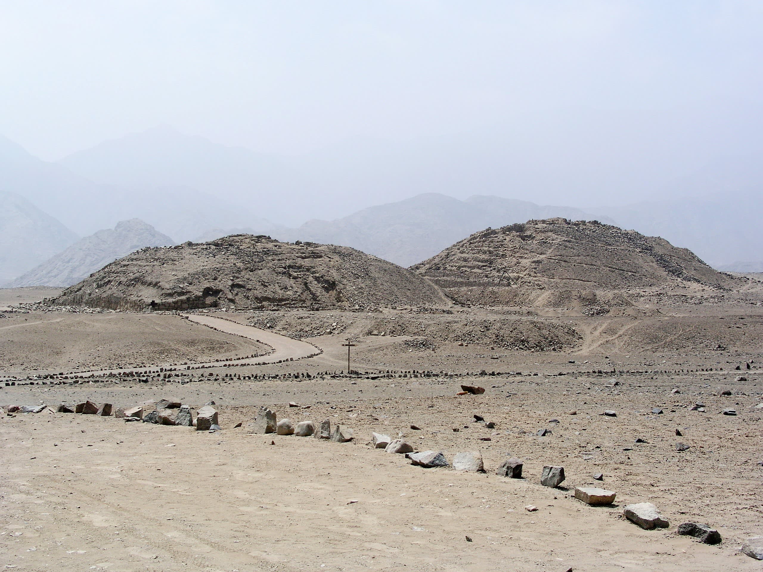
Sacred City of Caral-Supe
Supe, Lima, Peru
Caral is a ancient city of sacred significance. Approximate coordinates: -10.89275, -77.52111. Attributes: built, cultural, archaeological, ceremonial. Tradition: Pre-Hispanic. Recognized as a UNESCO World Heritage Site. The Sacred City of Caral-Supe, or simply Caral, is an archaeological site in Peru where the remains of the main city of the Caral civilization are found. It is located in the Supe valley of Peru, near the current town of Caral, 182 kilometers north of Lima, 23 km from the coast and 350 metres above sea level. It is attributed an antiquity of 5,000 years and it is considered the oldest city in the Americas and one of the oldest in the world. No other site has been found with such a diversity of monumental buildings or different ceremonial and administrative functions in the Americas as early as Caral. It has been declared a Humanity Cultural Heritage site by UNESCO. The Caral culture developed between 3000 and 1800 B.C (Late Archaic and Lower Formative periods). In America, it is the oldest of the pre-Hispanic civilizations, developing 1,500 years earlier than the Olmec civilization, the first Mesoamerican complex society. Closely related to the city of Caral was an early fishing city, Áspero or El Áspero, located on the coast near the mouth of the Supe River. There, remains of human sacrifices (two children and a newborn) have been found. In 2016, the remains were found of a woman, who presumably belonged to the local elite of 4,500 years ago. Located in Supe, Lima, Peru.
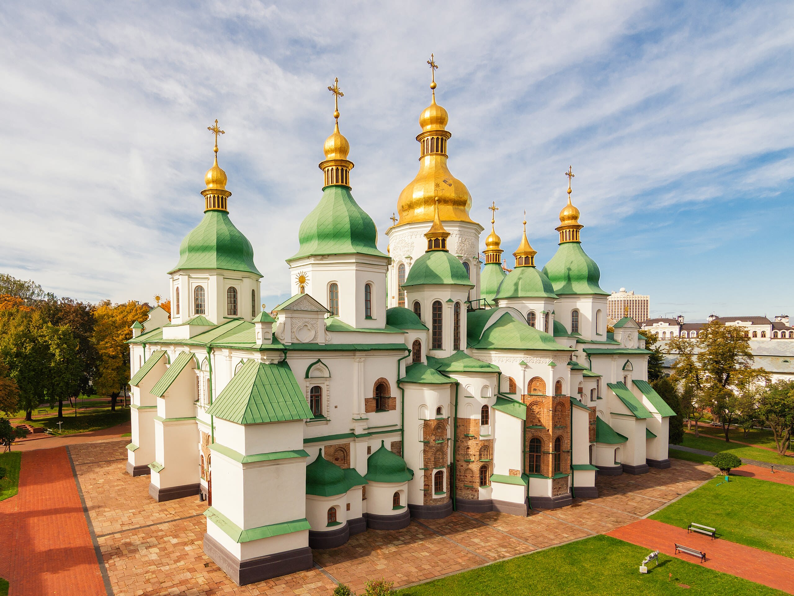
Saint-Sophia Cathedral, Kiev
Kyiv, Kyiv, Ukraine
Kiev is a monastery of sacred significance. Approximate coordinates: 50.43464, 30.55726. Attributes: built, cultural, pilgrimage. Tradition: Christianity. Recognized as a UNESCO World Heritage Site. Located in Київ, Україна.
Sanctuary in Kalwaria Zebrzydowska
Kalwaria Zebrzydowska, Lesser Poland, Poland
Kalwaria Zebrzydowska is a basilica and monastery of sacred significance. Approximate coordinates: 49.86021, 19.67158. Attributes: built, cultural, pilgrimage. Tradition: Christianity. Recognized as a UNESCO World Heritage Site. Kalwaria Zebrzydowska (Polish pronunciation: [kalˈvarja zɛbʐɨˈdɔfska]) is a town in southern Poland with 4,429 inhabitants (2007 estimate). As of 1999, it is situated in Lesser Poland or Małopolska (in Polish). Previously, the town was administered within the Voivodeship of Bielsko-Biała (1975–1998). Located in Kalwaria Zebrzydowska, województwo małopolskie, Poland.
Sanctuary of Bom Jesus do Congonhas
Congonhas, Minas Gerais, Brazil
Congonhas, Santuário do Bom Jesus de Matosinhos is a church of sacred significance. Approximate coordinates: -20.50811, -43.86070. Attributes: built, cultural, pilgrimage. Tradition: Christianity. Associated figure: Bom Jesus de Matosinhos. Recognized as a UNESCO World Heritage Site. Located in Congonhas, Minas Gerais, Brazil.
Seven Saints of Marrakesh
Marrakesh, Marrakech-Safi, Morocco
Marrakesh is a city of sacred significance. Approximate coordinates: 31.62367, -7.99360. Attributes: built, cultural, pilgrimage. Tradition: Islamic. Associated figure: Seven saints of Marrakesh. Recognized as a UNESCO World Heritage Site. Marrakesh or Marrakech (; Arabic: مراكش, romanized: murrākuš, pronounced [murraːkuʃ]) is the fourth-largest city in Morocco. It is one of the four imperial cities of Morocco and is the capital of the Marrakesh–Safi region. The city lies west of the foothills of the Atlas Mountains. The city was founded circa 1070 by Abu Bakr ibn Umar as the capital of the Almoravid dynasty. The Almoravids established the first major structures in the city and shaped its layout for centuries to come. The red walls of the city, built by Ali ibn Yusuf in 1122–1123, and various buildings constructed in red sandstone afterwards, have given the city the nickname of the Red City or Ochre City . Marrakesh grew rapidly and established itself as a cultural, religious, and trading center for the Maghreb. After a period of decline, Marrakesh regained its status in the early 16th century as the capital of the Saadian dynasty, with sultans Abdallah al-Ghalib and Ahmad al-Mansur embellishing the city with an array of sumptuous monuments. Beginning in the 17th century, the city became popular among Sufi pilgrims for its seven patron saints who are buried here. In 1912, the French Protectorate in Morocco was established and T hami El Glaoui became Pasha of Marrakesh and generally held this position until the independence of Morocco and the reestablishment of the monarchy in 1956. Marrakesh comprises an old fortified city packed with vendors and their stalls. This medina quarter is a UNESCO World Heritage Site and contains the Jemaa el-Fnaa square, a large number of souks (markets), the Kutubiyya Mosque, and many other historic and cultural sites. The city serves as a major economic center and tourist destination. Real estate and hotel development in Marrakesh have grown dramatically in the 21st century. Marrakesh is particularly popular with the French, and numerous French celebrities own property in the city. Marrakesh is served by Ménara International Airport and by Marrakesh railway station, which connects the city to Casablanca and northern Morocco. Marrakesh has several universities and schools, including Cadi Ayyad University. A number of Moroccan football clubs are here, including Najm de Marrakech, KAC Marrakech, Mouloudia de Marrakech and Chez Ali Club de Marrakech. The Marrakesh Street Circuit hosts the World Touring Car Championship, Auto GP and FIA Formula Two Championship races. Located in Marrakech ⵎⵕⵕⴰⴽⵯⵛ مراكش, Marrakech-Safi ⵎⵕⵕⴰⴽⵛ-ⴰⵙⴼⵉ مراكش-أسفي, Maroc ⵍⵎⵖⵔⵉⴱ المغرب.
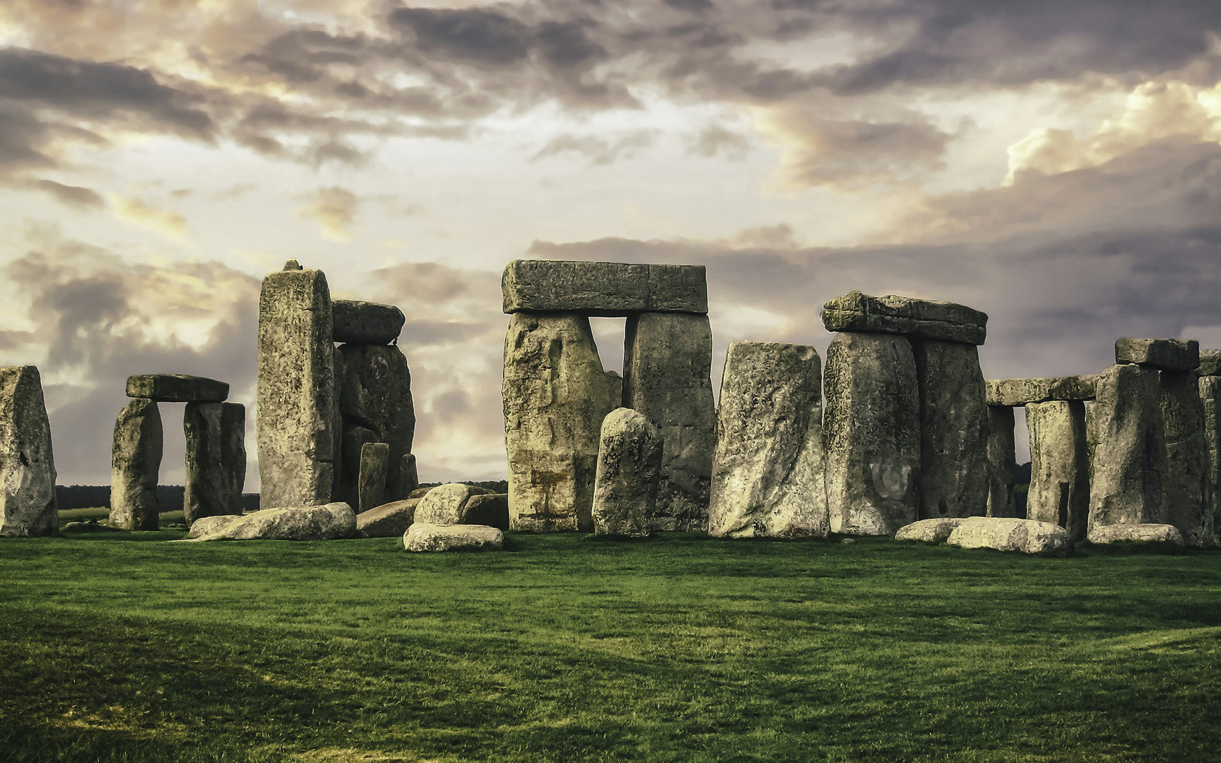
Stonehenge
West Amesbury, England, United Kingdom
Stonehenge is a site of sacred significance. Approximate coordinates: 51.17888, -1.82621. Stonehenge is a prehistoric megalithic structure on Salisbury Plain in Wiltshire, England, two miles (3 km) west of Amesbury. It consists of an outer ring of vertical sarsen standing stones, each around 13 feet (4.0 m) high, seven feet (2.1 m) wide, and weighing around 25 tons, topped by connecting horizontal lintel stones, held in place with mortise and tenon joints, a feature unique among contemporary monuments. Inside is a ring of smaller bluestones. Inside these are free-standing trilithons, two bulkier vertical sarsens joined by one lintel. The whole monument, now ruinous, is aligned towards the sunrise on the summer solstice and sunset on the winter solstice. The stones are set within earthworks in the middle of the densest complex of Neolithic and Bronze Age monuments in England, including several hundred tumuli (burial mounds). Stonehenge was constructed in several phases beginning about 3100 BC and continuing until about 1600 BC. The famous circle of large sarsen stones were placed between 2600 BC and 2400 BC. The surrounding circular earth bank and ditch, which constitute the earliest phase of the monument, have been dated to about 3100 BC. Radiocarbon dating suggests that the bluestones were given their current positions between 2400 and 2200 BC, although they may have been at the site as early as 3000 BC. One of the most famous landmarks in the United Kingdom, Stonehenge is regarded as a British cultural icon. It has been a legally protected scheduled monument since the Ancient Monuments Protection Act 1882 was passed. The site and its surroundings were added to UNESCO s list of World Heritage Sites in 1986. Stonehenge is owned by the Crown and managed by English Heritage; the surrounding land is owned by the National Trust. Stonehenge could have been a burial ground from its earliest beginnings. Deposits containing human bone date from as early as 3000 BC, when the ditch and bank were first dug, and continued for at least another 500 years. Located in England, United Kingdom.

Swayambhunath, Kathmandu
Kathmandu, Bagmati Province, Nepal
Swayambhunath, Kathmandu is a site of sacred significance. Approximate coordinates: 27.71495, 85.29034. Located in काठमाडौँ महानगरपालिका, बागमती प्रदेश, नेपाल.
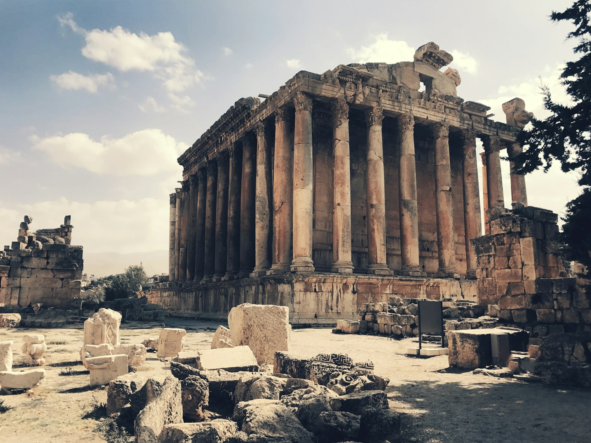
The acropolis of Baalbek
Baalbek, Baalbek-Hermel Governorate, Lebanon
Baalbek is a ancient city of sacred significance. Approximate coordinates: 34.00670, 36.20549. Attributes: built, cultural, archaeological. Tradition: Roman; also recognized in Islam, Christianity contexts. Associated figure: Bacchus, Jupiter. Mythological context: Roman Mythology. Recognized as a UNESCO World Heritage Site. Baalbek (; Arabic: بَعْلَبَكّ, romanized: Baʿlabakk; Syriac: ܒܥܠܒܟ) is a city located east of the Litani River in Lebanon s Beqaa Valley, about 67 km (42 mi) northeast of Beirut. It is the capital of Baalbek-Hermel Governorate. In 1998, the city had a population of 82,608. Most of the population consists of Shia Muslims, followed by Sunni Muslims and Christians; in 2017, there was also a large presence of Syrian refugees. Baalbek has a history that dates back at least 11,000 years, encompassing significant periods such as Prehistoric, Canaanite, Hellenistic, and Roman eras. After Alexander the Great conquered the city in 334 BCE, he renamed it Heliopolis (Ἡλιούπολις, Greek for Sun City ). The city flourished under Roman rule. However, it underwent transformations during the Christianization period and the subsequent rise of Islam following the Arab conquest in the 7th century. In later periods, the city was sacked by the Mongols and faced a series of earthquakes, resulting in a decline in importance during the Ottoman and modern periods. In the modern era, Baalbek enjoys economic advantages as a sought-after tourist destination. It is known for the ruins of the Roman temple complex, which includes the Temple of Bacchus and the Temple of Jupiter, and was inscribed in 1984 as a UNESCO World Heritage site. Other tourist attractions are the Great Umayyad Mosque, the Baalbek International Festival, the mausoleum of Sit Khawla, and a Roman quarry site named Hajar al-Hibla. Baalbek s tourism sector has encountered challenges due to conflicts in Lebanon, particularly the 1975–1990 civil war, the ongoing Syrian civil war since 2011, and the Israel–Hezbollah conflict (2023–present). Baalbek is considered to be part of Hezbollah group s heartland and is known to be their political stronghold. During the Israeli occupation of Southern Lebanon (1982–2000), the group managed to overpower the Lebanese army in Baalbek and gain control of the city. The settlement was subsequently used as a base to recruit and train men for attacks against Israeli forces. Hezbollah continues to hold significant political influence and popular support in Baalbek. In the 2022 Lebanese general election the Amal-Hezbollah list won 9 out of 10 seats in the Baalbek-Hermel Governorate. Israel has conducted numerous airstrikes and raids against military and civilian targets in the Baalbek area in the past decades. For instance, in 2006 during the Operation Sharp and Smooth, Israeli commandos raided a hospital and bombed multiple houses, killing two Hezbollah fighters and at least eleven civilians. In 2024, during the Israel–Hezbollah conflict, Israel sent forced displacement calls for the entire city. Shortly after, Israeli airstrikes killed 19 people, including 8 women. Located in بعلبك, محافظة بعلبك الهرمل, لبنان.
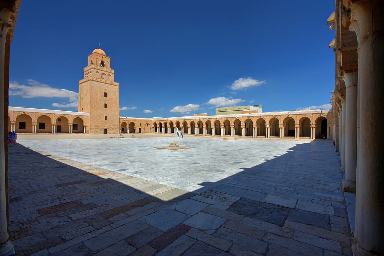
The Great Mosque of Kairouan
Kairouan, Kairouan, Tunisia
Kairouan is a mosque of sacred significance. Approximate coordinates: 35.68138, 10.10415. Attributes: built, cultural, pilgrimage. Tradition: Islamic. Associated figure: Sidi Sahbi. Recognized as a UNESCO World Heritage Site. Kairouan (UK: , US: ), also spelled El Qayrawān or Kairwan (Arabic: ٱلْقَيْرَوَان, romanized: al-Qayrawān [æl qɑjrɑˈwæːn] , Tunisian Arabic: Qeirwān [qɪrˈwɛːn] ), is the capital of the Kairouan Governorate in Tunisia and a UNESCO World Heritage Site. The city was founded by the Umayyads around 670, in the period of Caliph Mu awiya (reigned 661–680); this is when it became an important centre for Sunni Islamic scholarship and Quranic learning, attracting Muslims from various parts of the world. The Mosque of Uqba is situated in the city. Located in ولاية القيروان, تونس.
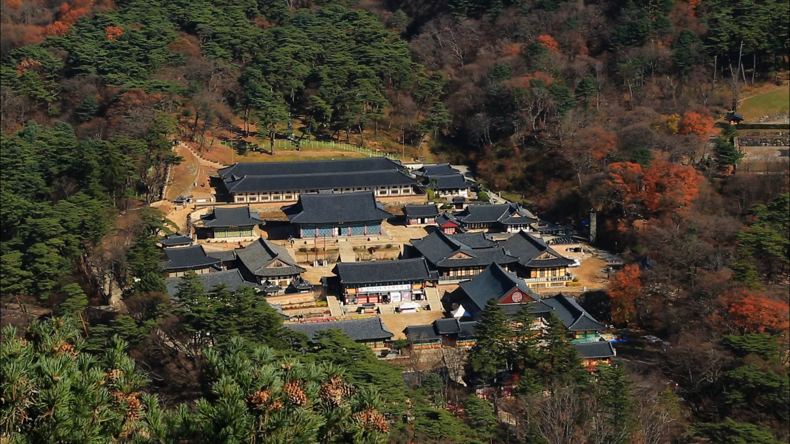
The Temple of Haeinsa, Gaya-san
Hapcheon, South Gyeongsang, South Korea
Gaya-san is a temple of sacred significance. Approximate coordinates: 35.79495, 128.08535. Attributes: built, cultural, pilgrimage. Tradition: Buddhism. Recognized as a UNESCO World Heritage Site. Located in 합천군, 대한민국.
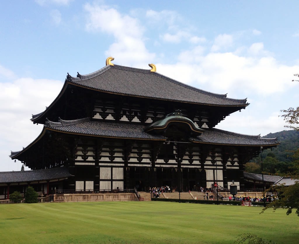
Todaiji
Nara, Nara Prefecture, Japan
In 752 CE, Emperor Shōmu consecrated a bronze Buddha of unprecedented scale—15 meters tall, cast from nearly all the copper in Japan—to bring peace to a nation wracked by plague and disaster. Today, Tōdai-ji's Great Buddha sits within one of the world's largest wooden buildings, visited by millions who come to stand before the cosmic Buddha Vairocana. Sacred deer wander the grounds as divine messengers. In March, the Omizutori ceremony draws sacred water in fire-lit rituals unchanged since 752 CE.
Toji
Kyoto, Kyoto Prefecture, Japan
For over 1,200 years, Tō-ji has been the beating heart of Shingon Buddhism—the esoteric tradition that Kūkai brought from China in the 9th century. The 57-meter five-story pagoda, Japan's tallest wooden structure, has become a symbol of Kyoto itself. Inside the Lecture Hall, 21 Buddhist statues form a three-dimensional mandala—the universe as understood in esoteric Buddhism made physical and walkable. On the 21st of each month, the Kobo-san market honors Kūkai with over 1,000 stalls.
Wat Xieng Thong, Luang Prabang
Luang Prabang, Luang Prabang, Laos
Luang Prabang is a city of sacred significance. Approximate coordinates: 19.89556, 102.14148. Attributes: built, cultural, ceremonial. Tradition: Buddhism. Associated figure: Buddha. Recognized as a UNESCO World Heritage Site. Luang Prabang (Lao: ຫຼວງພະບາງ, pronounced [lǔaŋ pʰāʔ.bàːŋ]), historically known as Xieng Thong (ຊຽງທອງ) and alternatively spelled Luang Phabang or Louangphabang, is the capital of Luang Prabang Province in north-central Laos. Its name, meaning “Royal Buddha Image,” derives from the Phra Bang, a statue symbolizing Lao sovereignty. Designated a UNESCO World Heritage Site in 1995, the city is recognized for blending traditional Lao architecture, European colonial buildings, and over 30 Buddhist temples. The protected area encompasses 33 of its 58 villages, where daily rituals like the morning alms-giving ceremony persist. Located in ຫຼວງພະບາງ, ຫລວງພະບາງ, ປະເທດລາວ.