Country guide
United States
134 sacred sites across 36 regions.
Traditions present in United States
Prominent site types
Arizona
14 sites
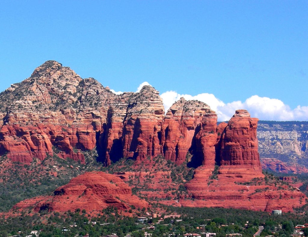
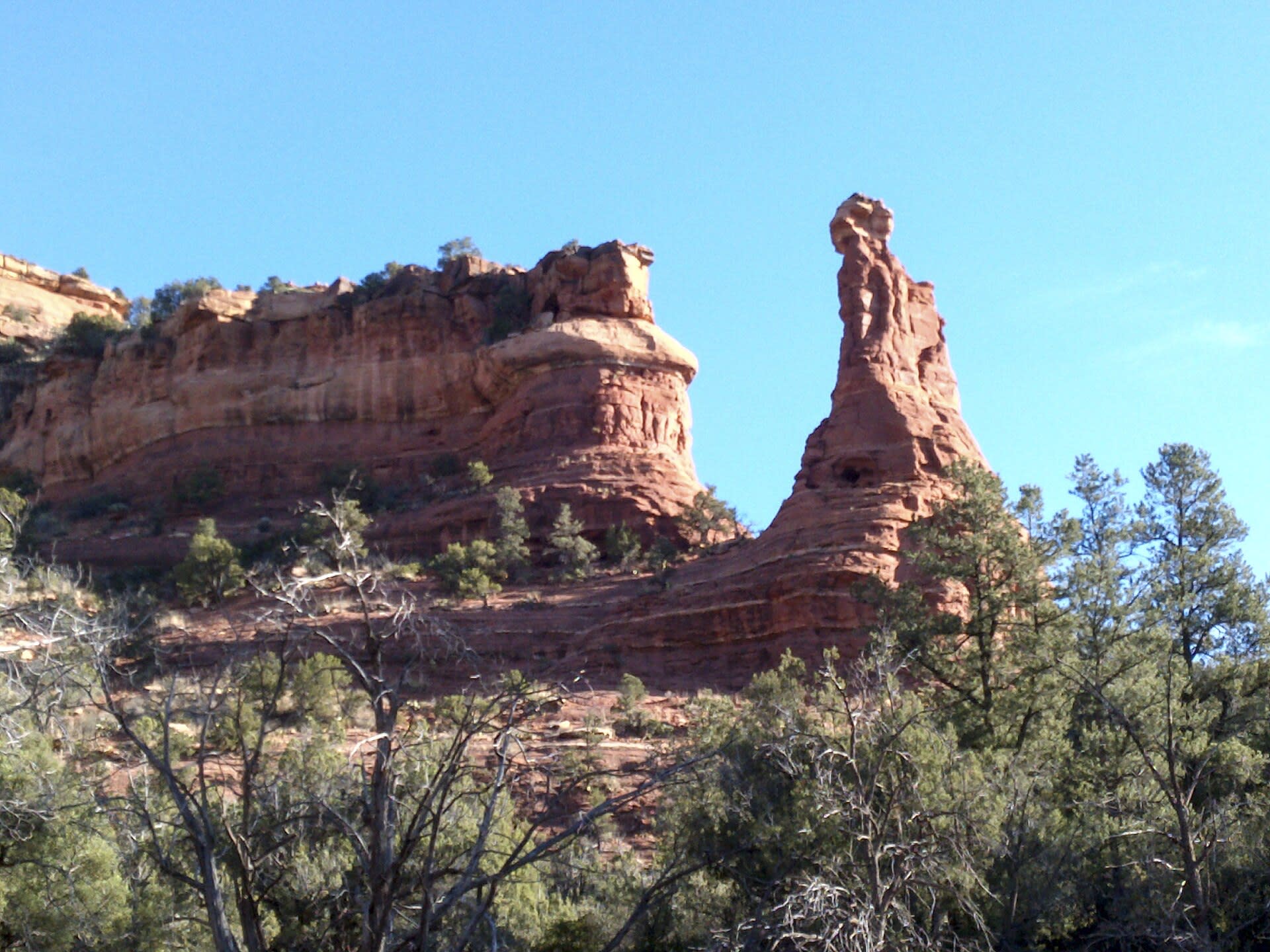
Airport Mesa, Sedona
Sedona, Arizona, United States
Perched above Sedona with 360-degree views of the red rock landscape, Airport Mesa offers the most accessible encounter with vortex energy. The masculine, upflow quality here supports clarity, motivation, and the kind of expanded perspective that comes from seeing far. Sunrise and sunset transform this overlook into something numinous.
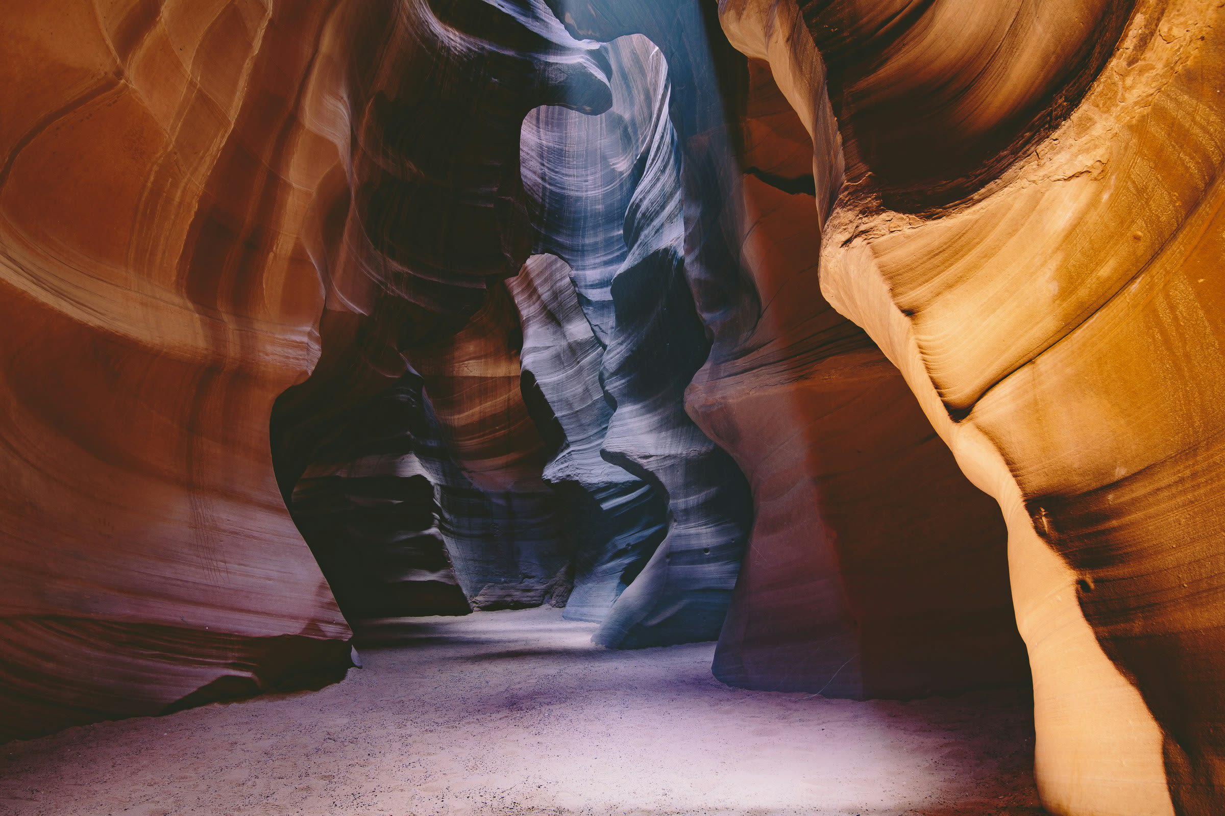
Antelope Canyon
Page, Arizona, United States
Deep within Navajo land, narrow sandstone passages open into chambers of flowing stone and cascading light. The Navajo call this place Tse bighanilini, where water runs through rocks, and understand it as a meeting point between physical and spiritual worlds. Visitors descend into darkness and emerge changed, having walked through what many describe as Earth itself made visible.
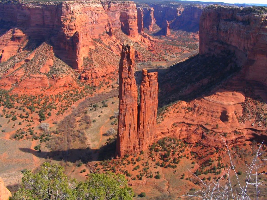
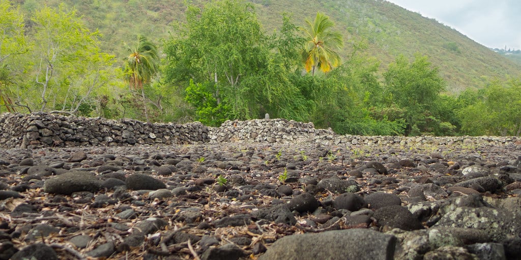
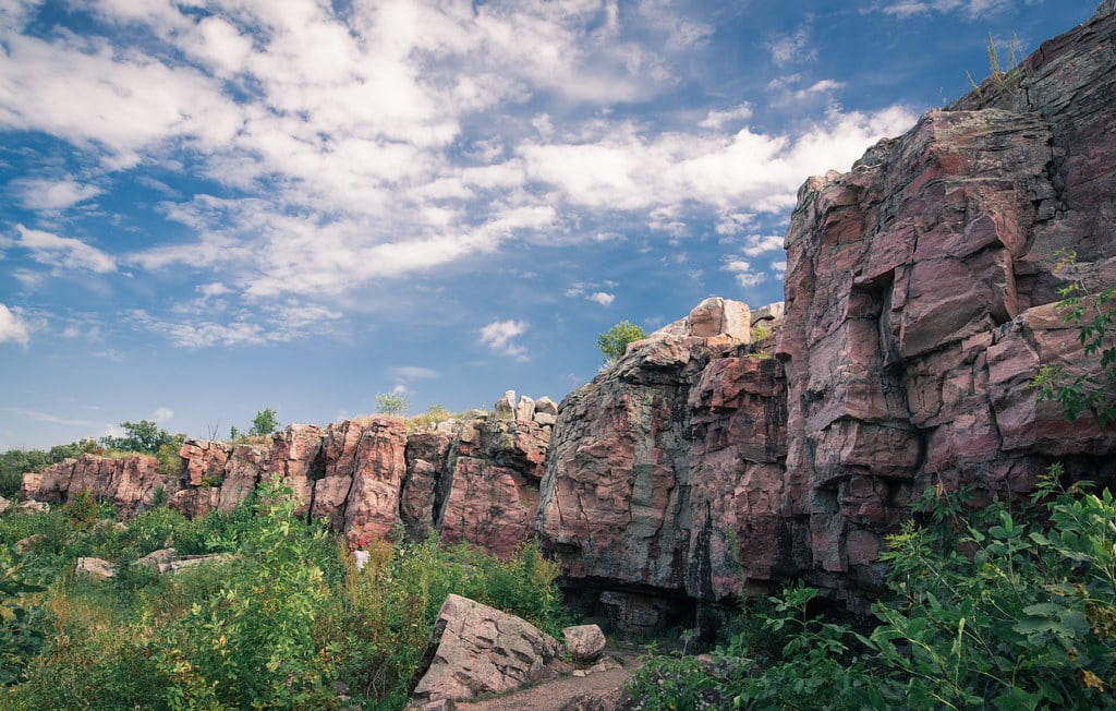
Canyon de Chelly, Arizona
Chinle Agency, Arizona, United States
Canyon de Chelly, Arizona is a canyon of sacred significance. Approximate coordinates: 36.13361, -109.46944. Attributes: natural, cultural, archaeological. Tradition: Navajo. Located in Chinle Agency, Arizona, United States.
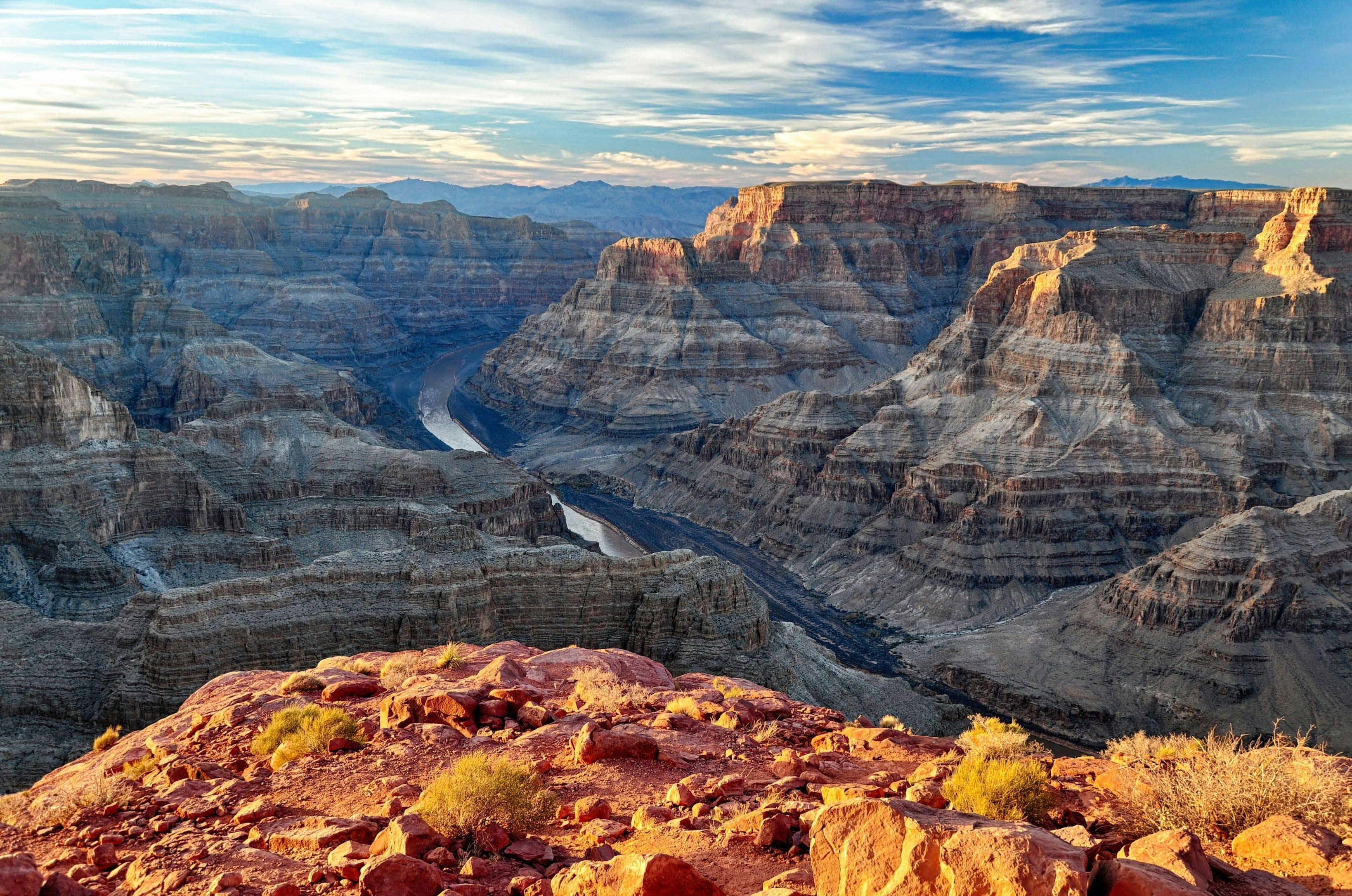
Grand Canyon National Park
Grand Canyon Village, Arizona, United States
For at least 12,000 years, humans have stood at the edge of this chasm and felt something shift. Eleven Native American tribes hold the Grand Canyon as ancestral homeland and place of emergence, where humanity climbed from the underworld into this world. The Hopi locate their Sipapuni here. The Zuni trace their origin to Ribbon Falls. Visitors consistently report that looking into this mile-deep wound in the earth produces not just awe but encounter, as though the canyon were looking back.
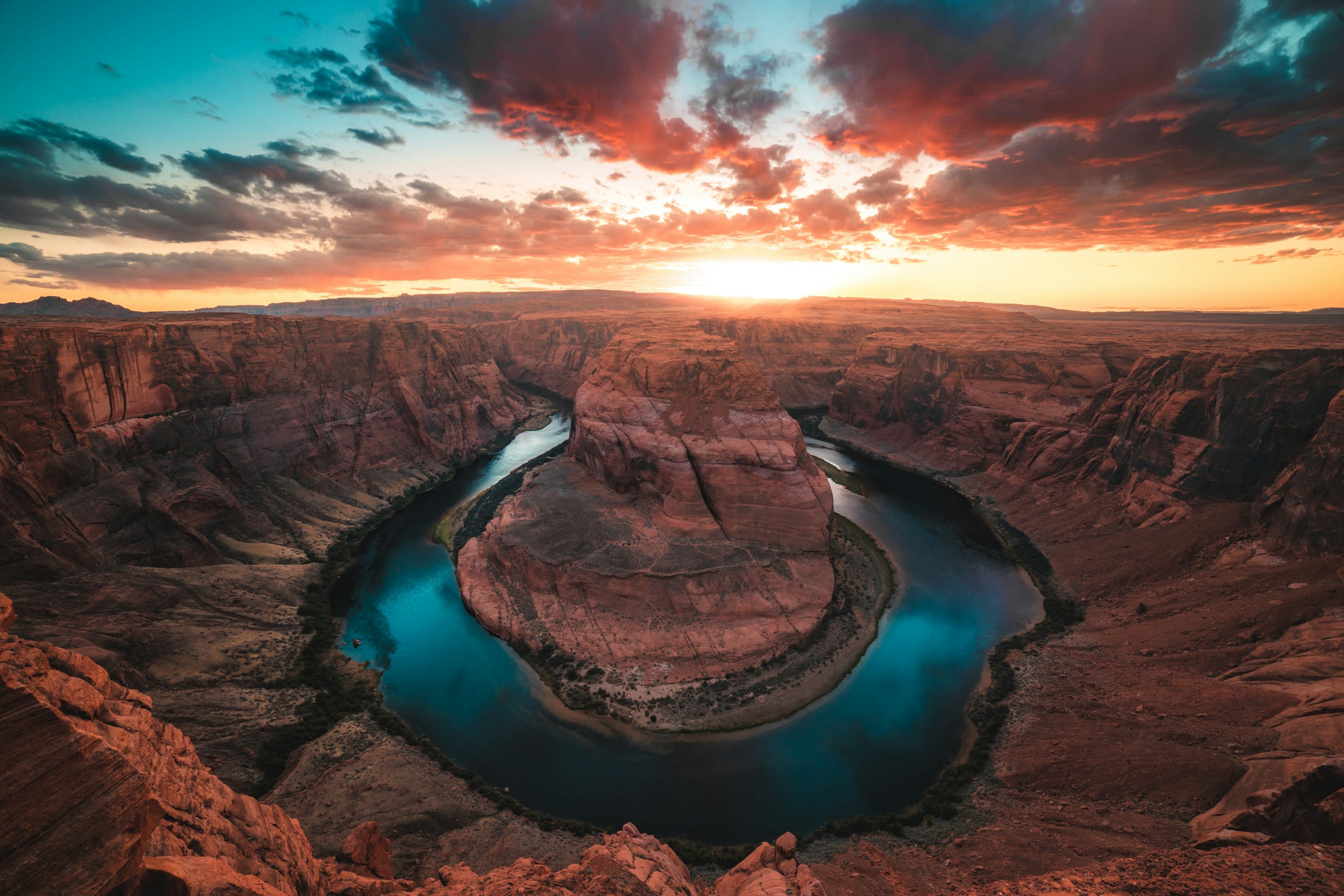
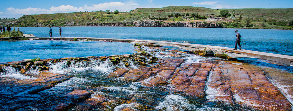
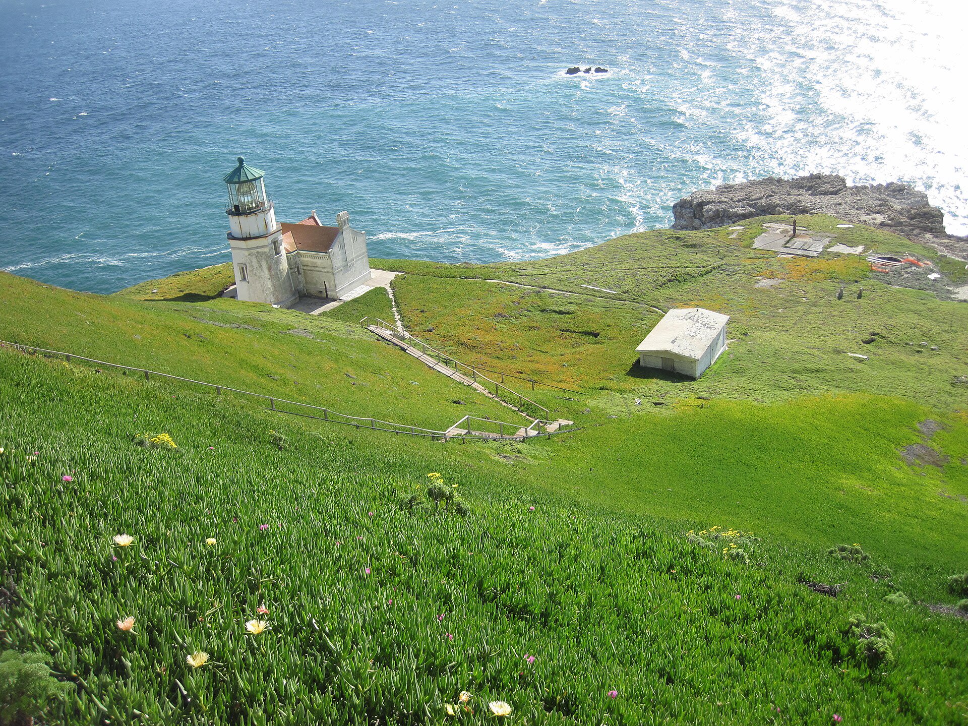
Horseshoe Bend
Page, Arizona, United States
A thousand feet below the overlook, the Colorado River completes its patient arc through Navajo Sandstone, forming the near-perfect horseshoe that has drawn both indigenous peoples and modern seekers to this edge. For the Navajo and Hopi, this land holds ancestral significance, part of a sacred landscape where water and stone speak of forces older than human memory. Standing here, the scale of geological time becomes visceral.
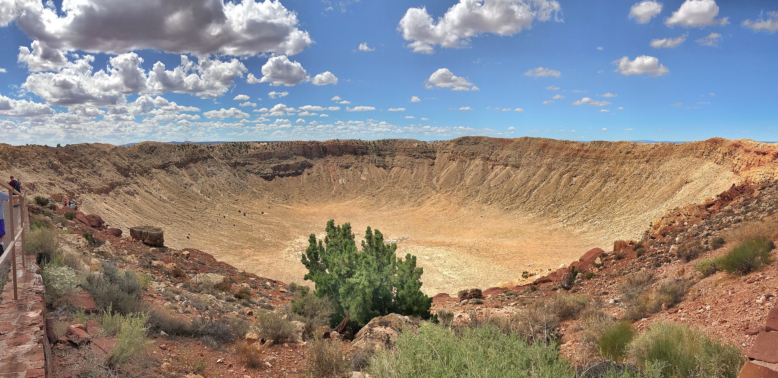
Meteor Crater, Arizona
Coconino County, Arizona, United States
Meteor Crater, Arizona is a site of sacred significance. Approximate coordinates: 35.03070, -111.02337. Located in Arizona, United States.
Mount Graham, Arizona
Safford, Arizona, United States
Mount Graham, Arizona is a site of sacred significance. Approximate coordinates: 32.70198, -109.87144. Located in Arizona, United States.
Mt. Baboquivari, Arizona
Tucson, Arizona, United States
Mt. Baboquivari, Arizona is a site of sacred significance. Approximate coordinates: 31.79147, -111.57566. Located in Arizona, United States.
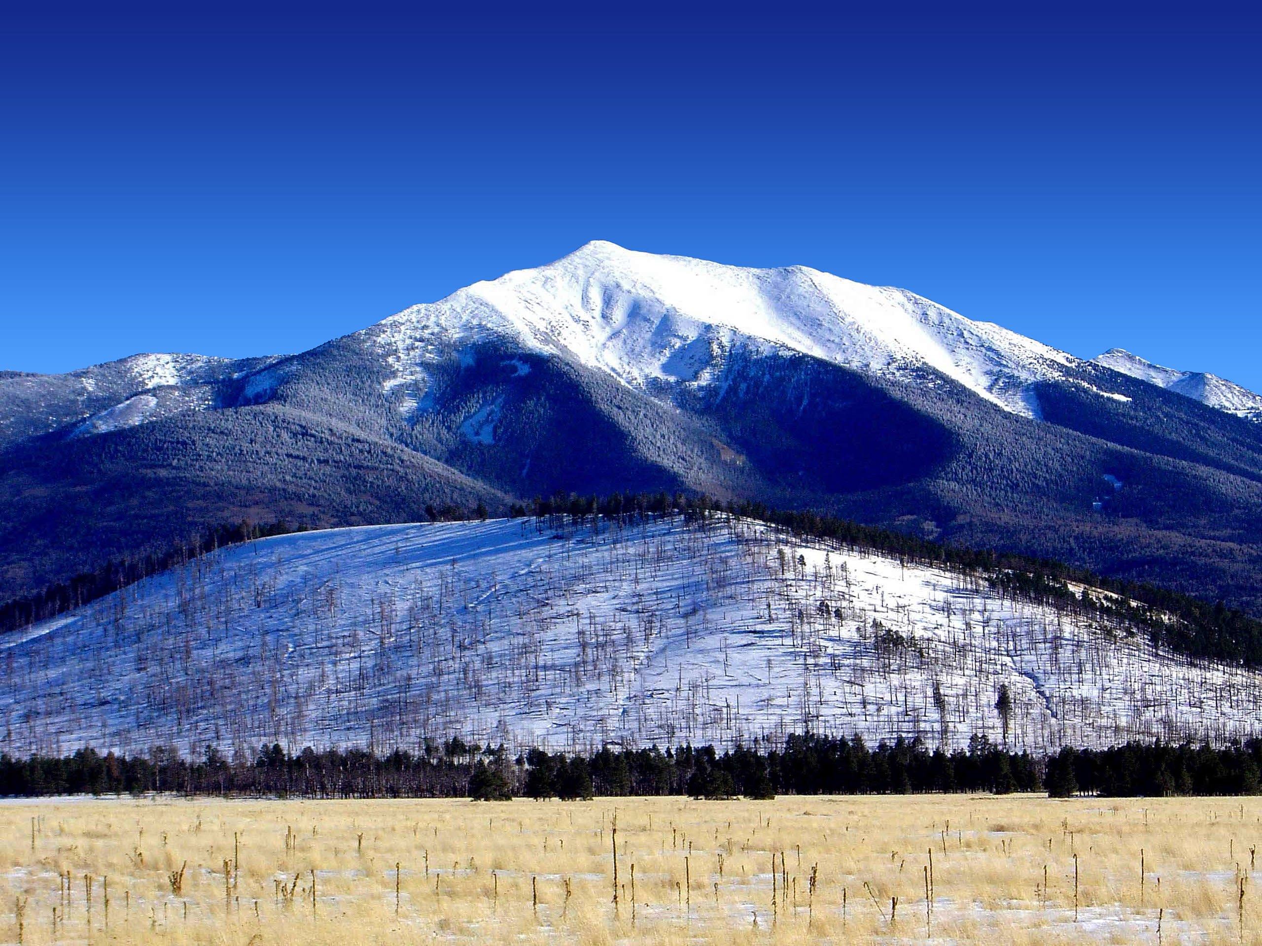
Mt. Humphreys, Arizona
Flagstaff, Arizona, United States
Mt. Humphreys, Arizona is a site of sacred significance. Approximate coordinates: 35.34607, -111.67834. Located in Arizona, United States.
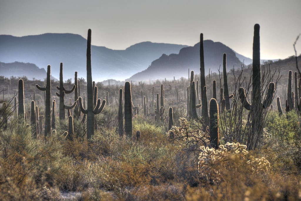
Organ Pipe Cactus National Monument, Arizona
Ajo, Arizona, United States
Organ Pipe Cactus National Monument, Arizona is a site of sacred significance. Approximate coordinates: 32.08926, -112.90546. Located in Arizona, United States.
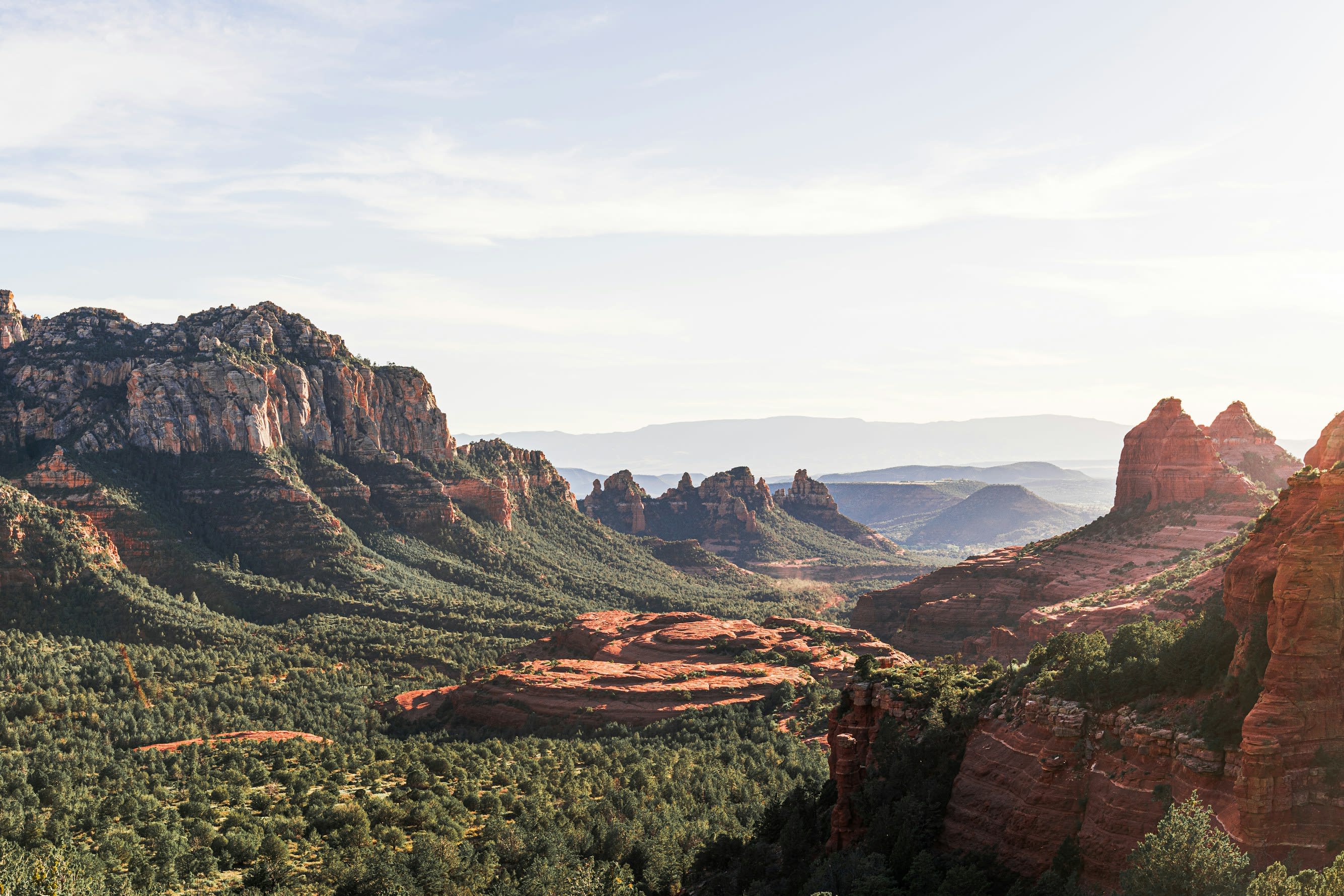
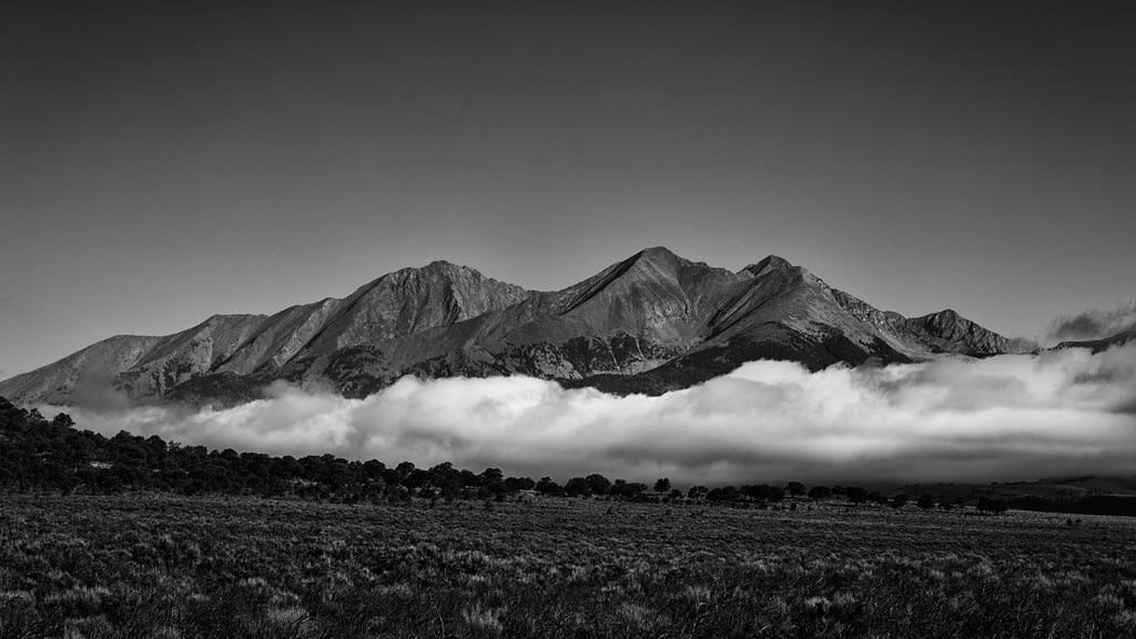
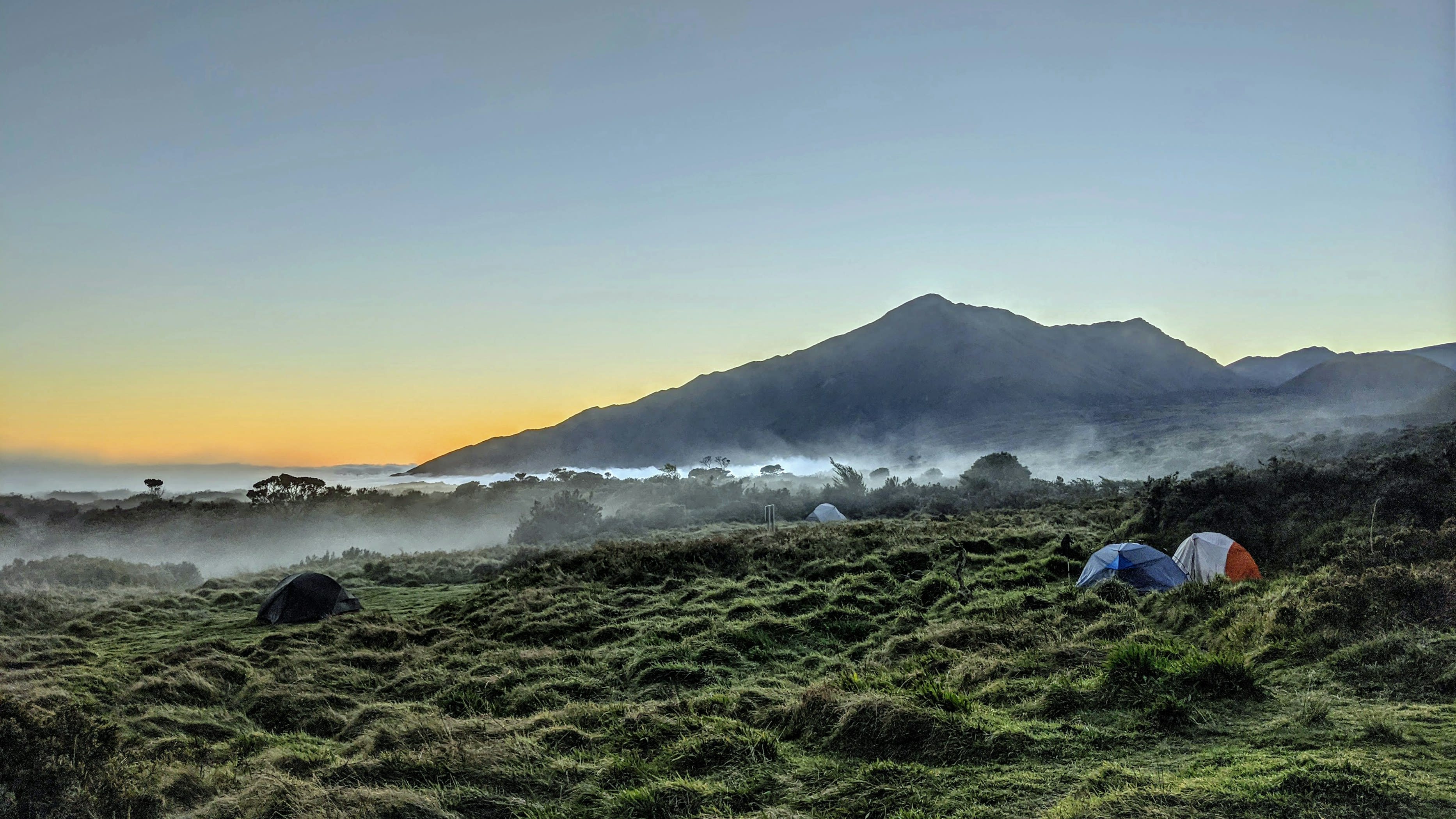
Sedona, Arizona
Sedona, Arizona, United States
Sedona, Arizona is a site of sacred significance. Approximate coordinates: 34.88613, -111.80722. Sedona ( si-DOH-nə) is a city that straddles the county line between Coconino and Yavapai counties in the northern Verde Valley region of the U.S. state of Arizona. As of the 2010 census, its population was 10,031. The city is within the Coconino National Forest. Sedona s main attraction is its array of red sandstone formations. The formations appear to glow in brilliant orange and red when illuminated by the rising or setting sun. The red rocks form a popular backdrop for many activities, ranging from spiritual pursuits to the hundreds of hiking and mountain biking trails. Sedona was named after Sedona Schnebly whose husband, Theodore Carlton Schnebly, was the city s first postmaster. She was celebrated for her hospitality and industriousness. Her mother, Amanda Miller, claimed to have made the name up because it sounded pretty . Located in Arizona, United States.
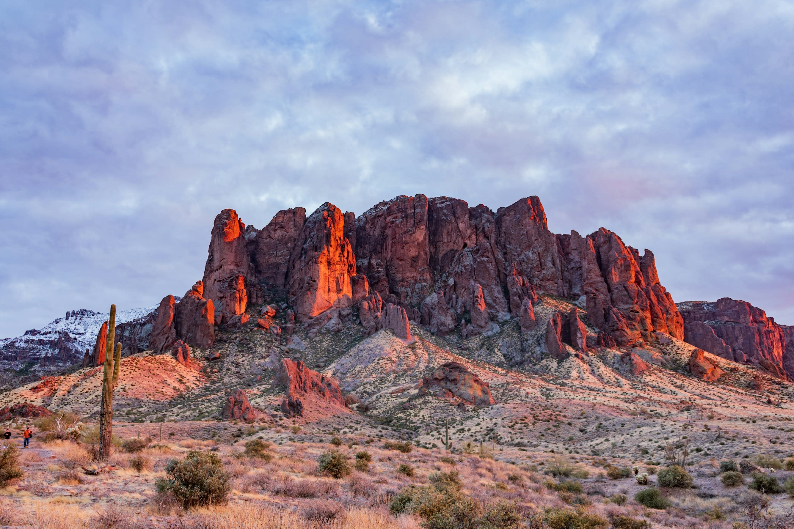
Superstition Mountains, Arizona
Apache Junction, Arizona, United States
Superstition Mountains, Arizona is a site of sacred significance. Approximate coordinates: 33.42879, -111.41776. Located in Arizona, United States.
Vortex at Boynton Canyon, Sedona
Sedona, Arizona, United States
Boynton Canyon holds the creation story of the Yavapai-Apache people, who understand this as the literal birthplace of their nation. The 80-foot Kachina Woman spire stands sentinel at the canyon's entrance, marking ground so sacred that tribal members gather here still for sunrise blessing ceremonies. For New Age seekers, this represents Sedona's most powerful balanced vortex. For the Yavapai-Apache, it is home.
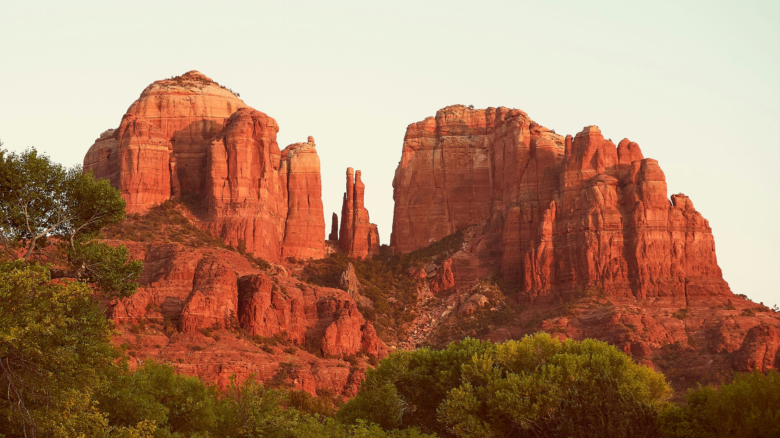
Vortex at Cathedral Rock, Sedona
Sedona, Arizona, United States
Cathedral Rock rises from the Sedona landscape like hands raised in prayer, its twin spires reflected in the waters of Oak Creek below. Known as the deepest magnetic vortex in Sedona, this formation carries feminine energy—receptive, nurturing, drawing seekers inward toward emotional release and gentle self-discovery. Where the creek flows closest to the rock, something softens.
California
10 sites
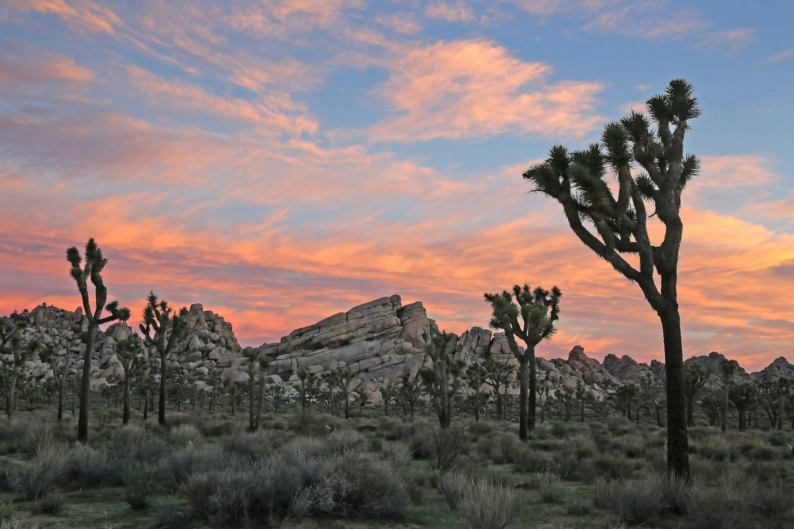
Joshua Tree National Park, California
Joshua Tree, California, United States
Joshua Tree, California is a natural of sacred significance. Approximate coordinates: 33.87342, -115.90099. Attributes: natural, cultural. Tradition: Native American. Joshua Tree is a census-designated place (CDP) in San Bernardino County, California, United States. The population was 7,414 at the 2010 census. At approximately 2,700 feet (820 meters) above sea level, Joshua Tree and its surrounding communities are located in the High Desert of California. The center of the business district in Joshua Tree is on California State Route 62. Located in California, United States.
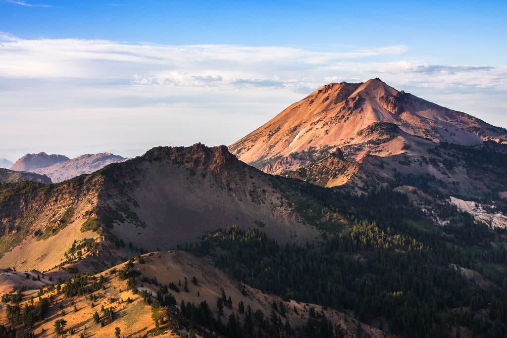
Lassen Peak, California
Mineral, California, United States
Lassen Peak, California is a mountain of sacred significance. Approximate coordinates: 40.48887, -121.50484. Attributes: natural. Located in California, United States.
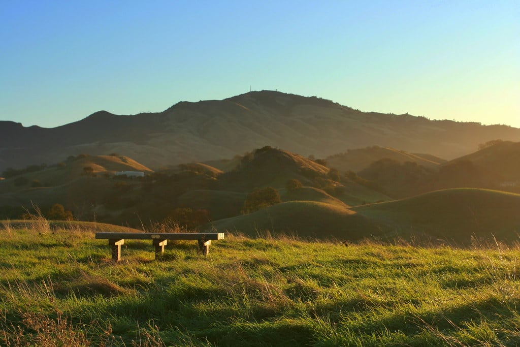
Mount Diablo, California
Contra Costa County, California, United States
Mount Diablo, California is a site of sacred significance. Approximate coordinates: 37.88163, -121.91408. Located in California, United States.
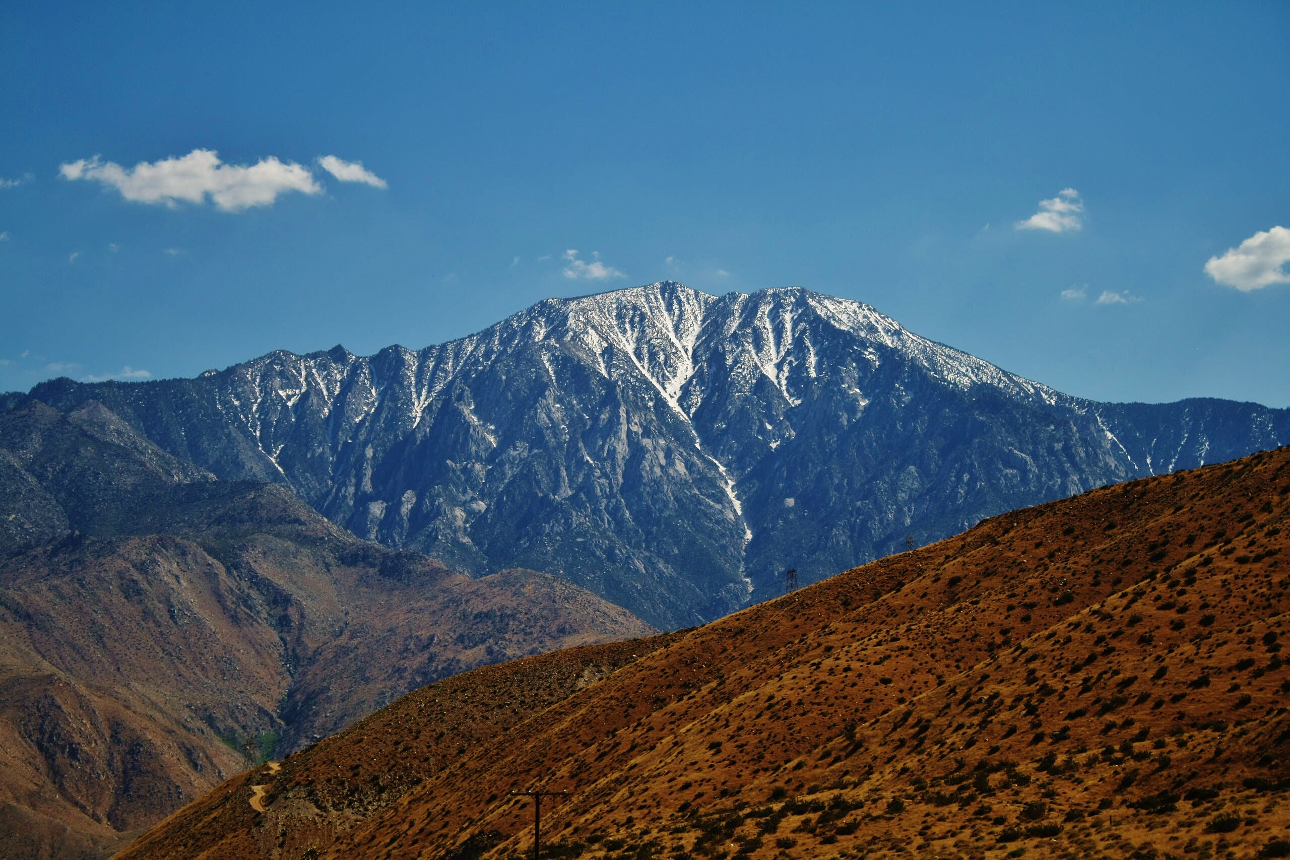
Mount San Jacinto, California
Riverside County, California, United States
Mount San Jacinto, California is a site of sacred significance. Approximate coordinates: 33.81448, -116.67918. Located in California, United States.
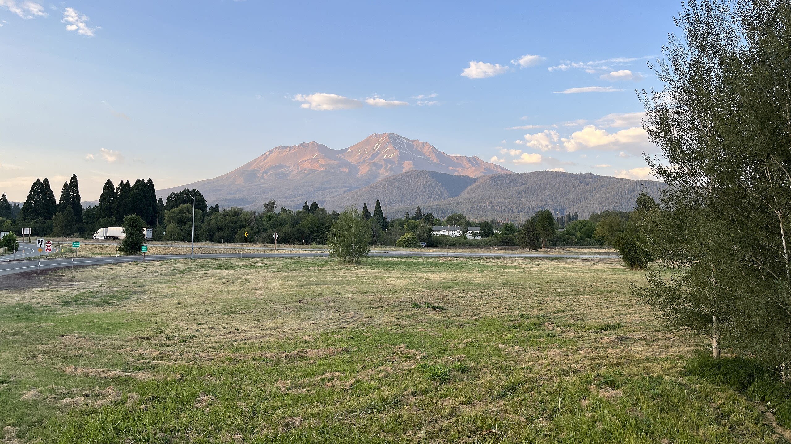
Mount Shasta
Siskiyou County, California, United States
Mount Shasta, California is a site of sacred significance. Approximate coordinates: 41.40990, -122.19486. Mount Shasta (also known as Mount Shasta City) is a city in Siskiyou County, California, United States, at about 3,600 feet (1,100 m) above sea level on the flanks of Mount Shasta, a prominent northern California landmark. The city is less than 9 miles (14 km) southwest of the summit of its namesake volcano. Its population is 3,223 as of the 2020 census, down from 3,394 from the 2010 census. Located in California, United States.
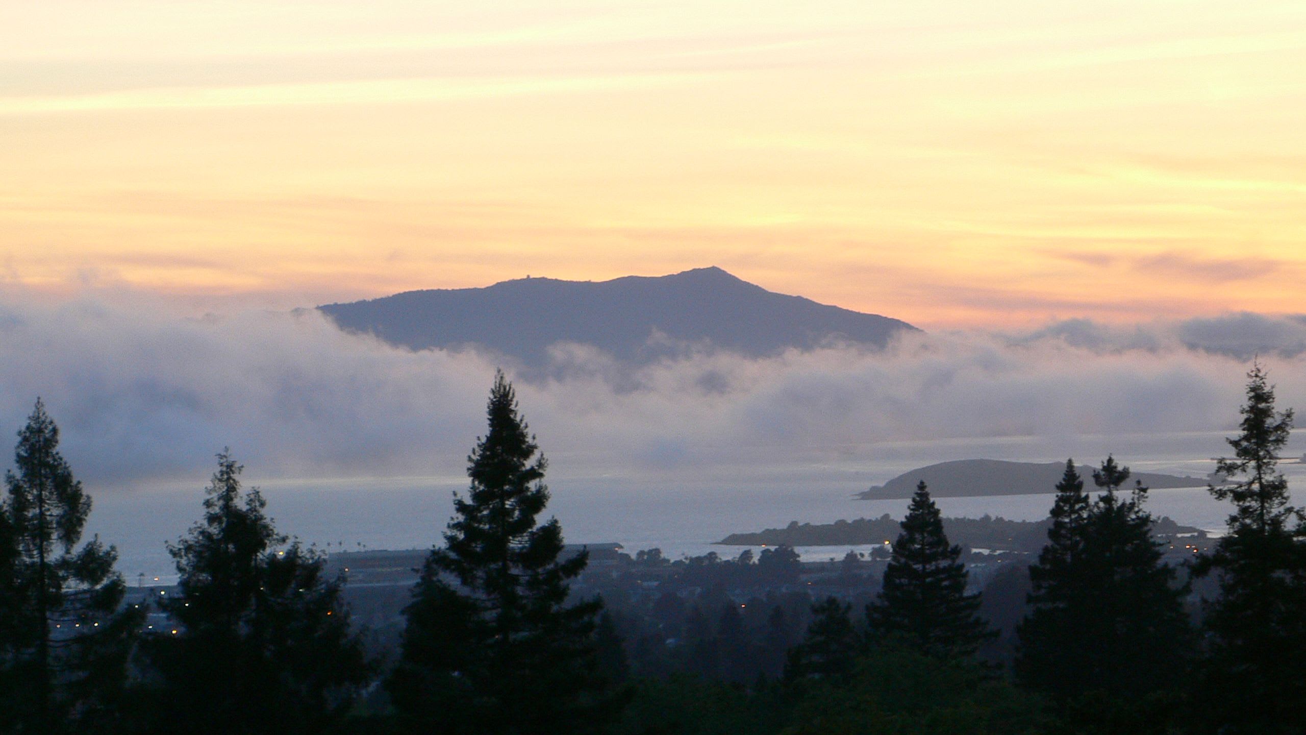
Mount Tamalpais
Marin County, California, United States
Mount Tamalpais, California is a site of sacred significance. Approximate coordinates: 37.92366, -122.59639. Located in California, United States.
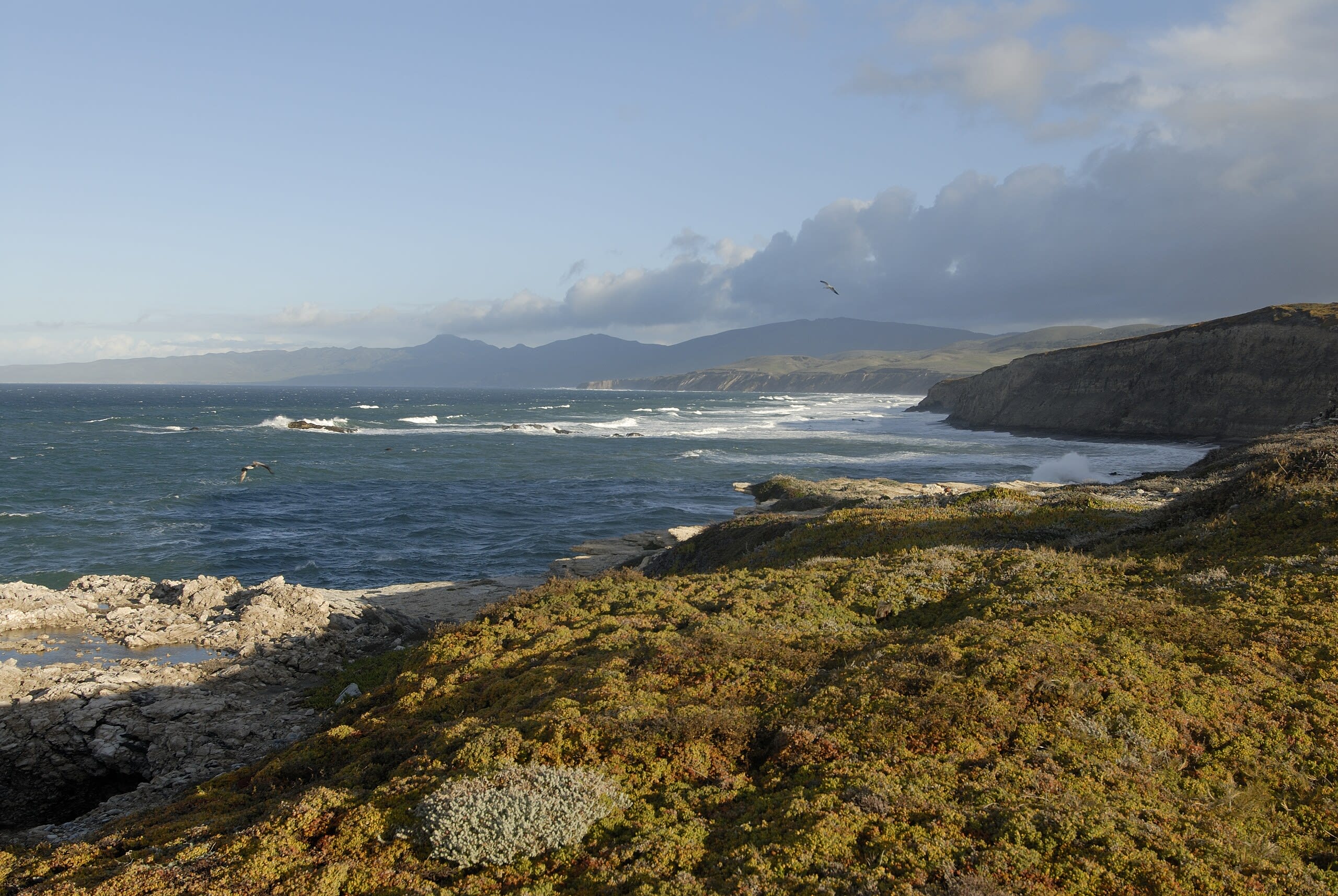
Point Conception, California
Santa Barbara County, California, United States
Point Conception, California is a site of sacred significance. Approximate coordinates: 34.44884, -120.47123. Located in California, United States.
Soldier Mountain, California
Redding, California, United States
Soldier Mountain, California is a site of sacred significance. Approximate coordinates: 41.07405, -121.56360. Located in California, United States.
Tecate Peak, California
Tecate, California, United States
Tecate Peak, California is a site of sacred significance. Approximate coordinates: 32.57939, -116.68886. Located in California, United States.
Tolay Lake
Sonoma County, California, United States
Charmstone Lake - Tolay Lake, California is a lake of sacred significance. Approximate coordinates: 38.20917, -122.51389. Attributes: natural, cultural. Located in California, United States.
Colorado
7 sites
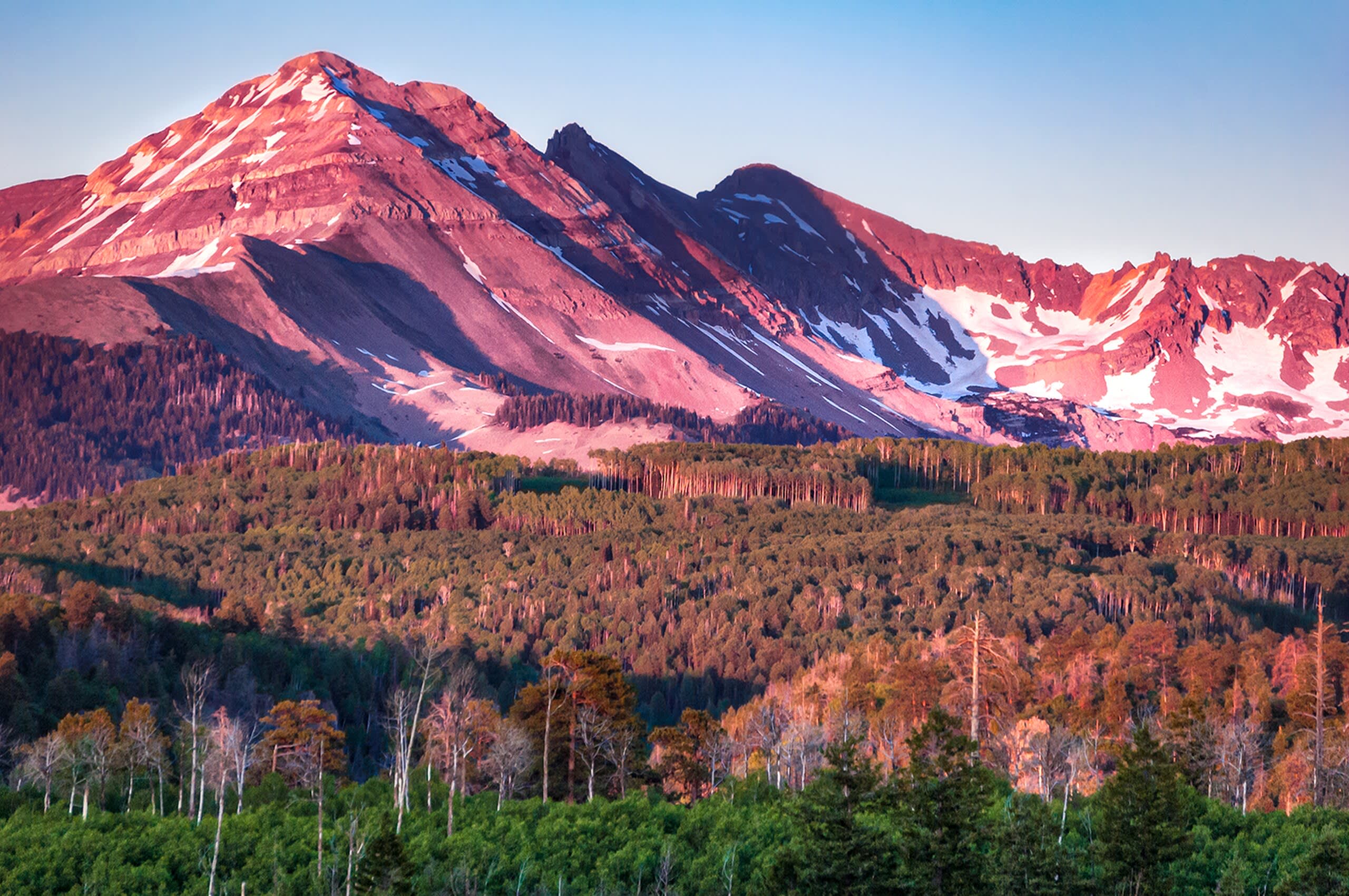
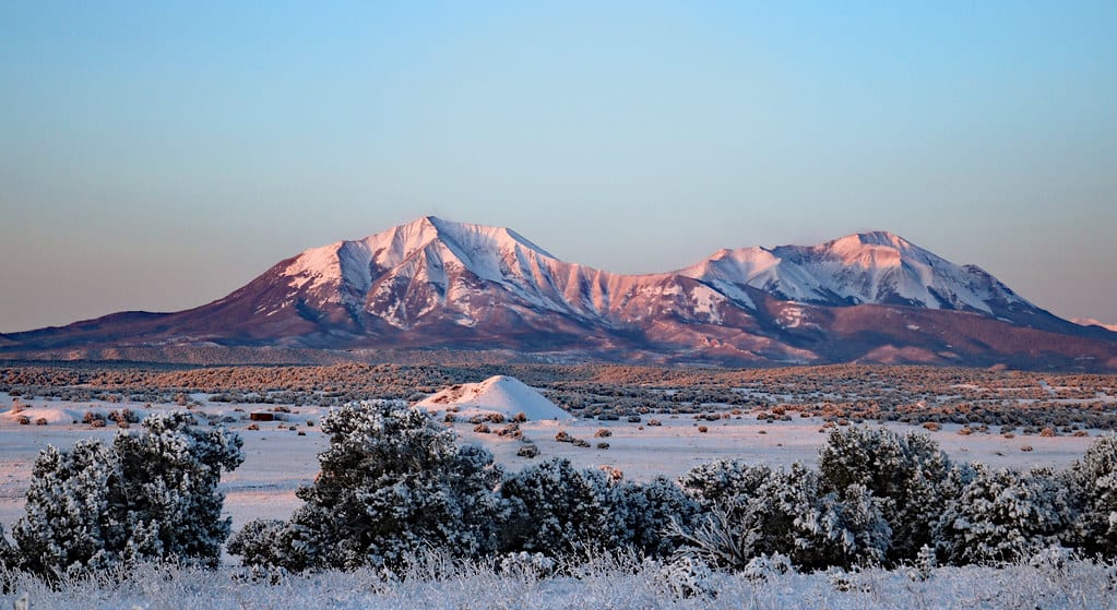
Blanca Peak, Colorado
Fort Garland, Colorado, United States
Blanca Peak, Colorado is a sacred mountain of sacred significance. Approximate coordinates: 37.57723, -105.48584. Attributes: natural, cultural. Tradition: Navajo. Mythological context: Navajo Sacred Mountain of the East. Located in Colorado, United States.
Crestone
Crestone, Colorado, United States
Crestone in Crestone, Colorado, United States.
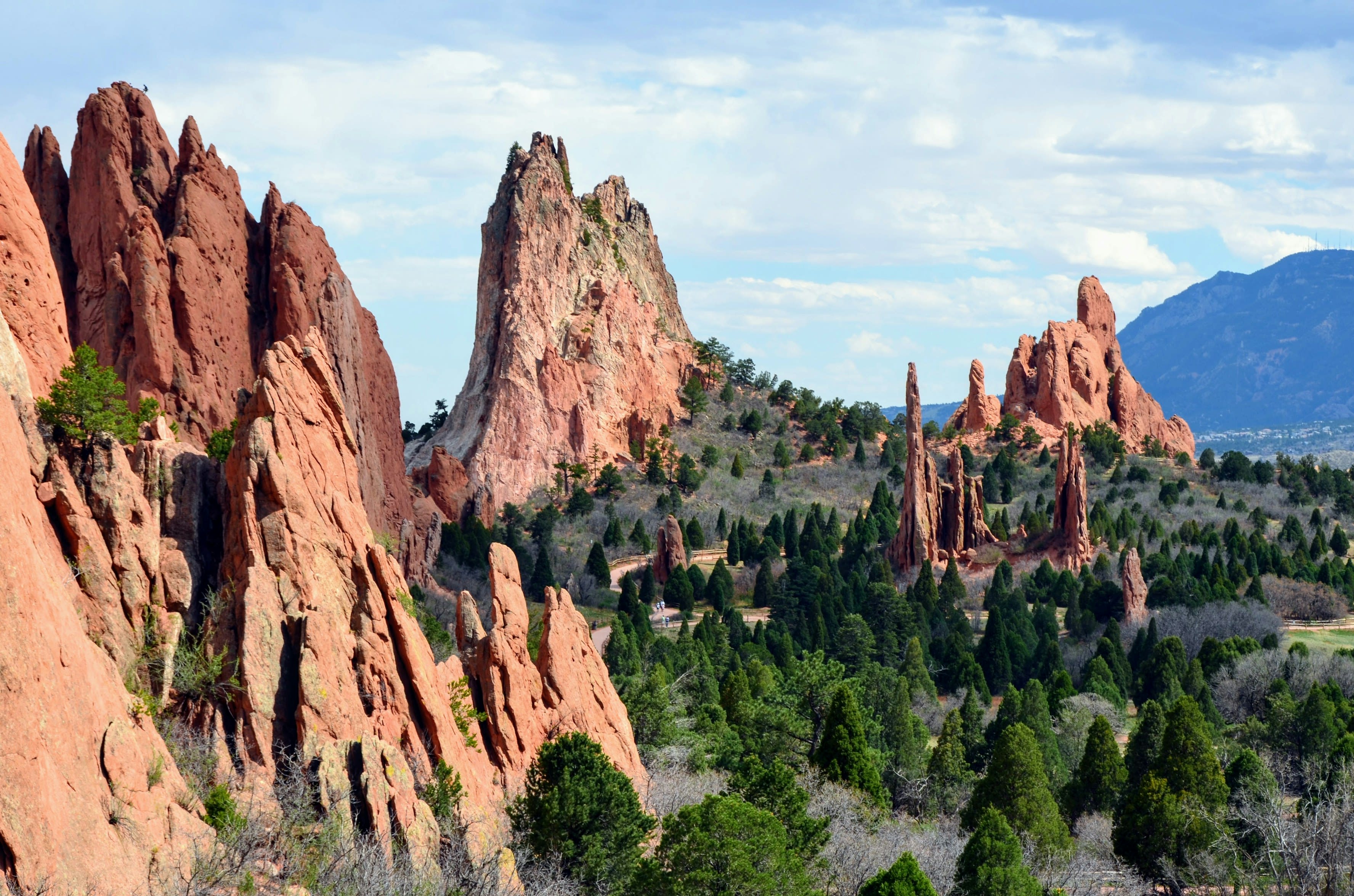
Garden of the Gods, Colorado
Colorado Springs, Colorado, United States
Garden of the Gods, Colorado is a natural sacred site of sacred significance. Approximate coordinates: 38.87319, -104.88630. Attributes: natural, cultural, ceremonial. Tradition: Native American. Mythological context: Native American mythology. Located in Colorado Springs, Colorado, United States.

Great Sand Dunes, Colorado
Mosca, Colorado, United States
Great Sand Dunes, Colorado is a natural of sacred significance. Approximate coordinates: 37.77397, -105.59647. Attributes: natural, cultural. Tradition: Native American. Located in Colorado, United States.
Island Lake, Colorado
Silverton, Colorado, United States
Island Lake, Colorado is a natural of sacred significance. Approximate coordinates: 37.82036, -107.80154. Attributes: natural, cultural. Tradition: Native American. Located in Colorado, United States.
Mt. Hesperus, Colorado
Mancos, Colorado, United States
Mt. Hesperus, Colorado is a site of sacred significance. Approximate coordinates: 37.44517, -108.08889. Located in Colorado, United States.
Spanish Peaks, Colorado
Walsenburg, Colorado, United States
Spanish Peaks, Colorado is a site of sacred significance. Approximate coordinates: 37.24509, -104.78725. Located in Colorado, United States.
Florida
3 sites
Crystal River Mounds, Florida
Crystal River, Florida, United States
Crystal River Mounds, Florida is a indian mounds of sacred significance. Approximate coordinates: 28.90811, -82.64328. Attributes: built, cultural, archaeological. Located in Florida, United States.
Lake Jackson Mounds, Tallahassee, Florida
Tallahassee, Florida, United States
Lake Jackson Mounds, Tallahassee, Florida is a mounds of sacred significance. Approximate coordinates: 30.50001, -84.31840. Attributes: built, cultural, archaeological. Located in Florida, United States.
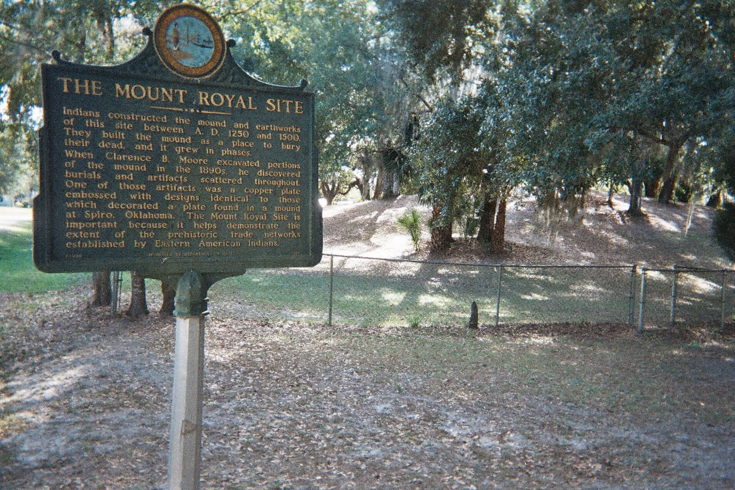
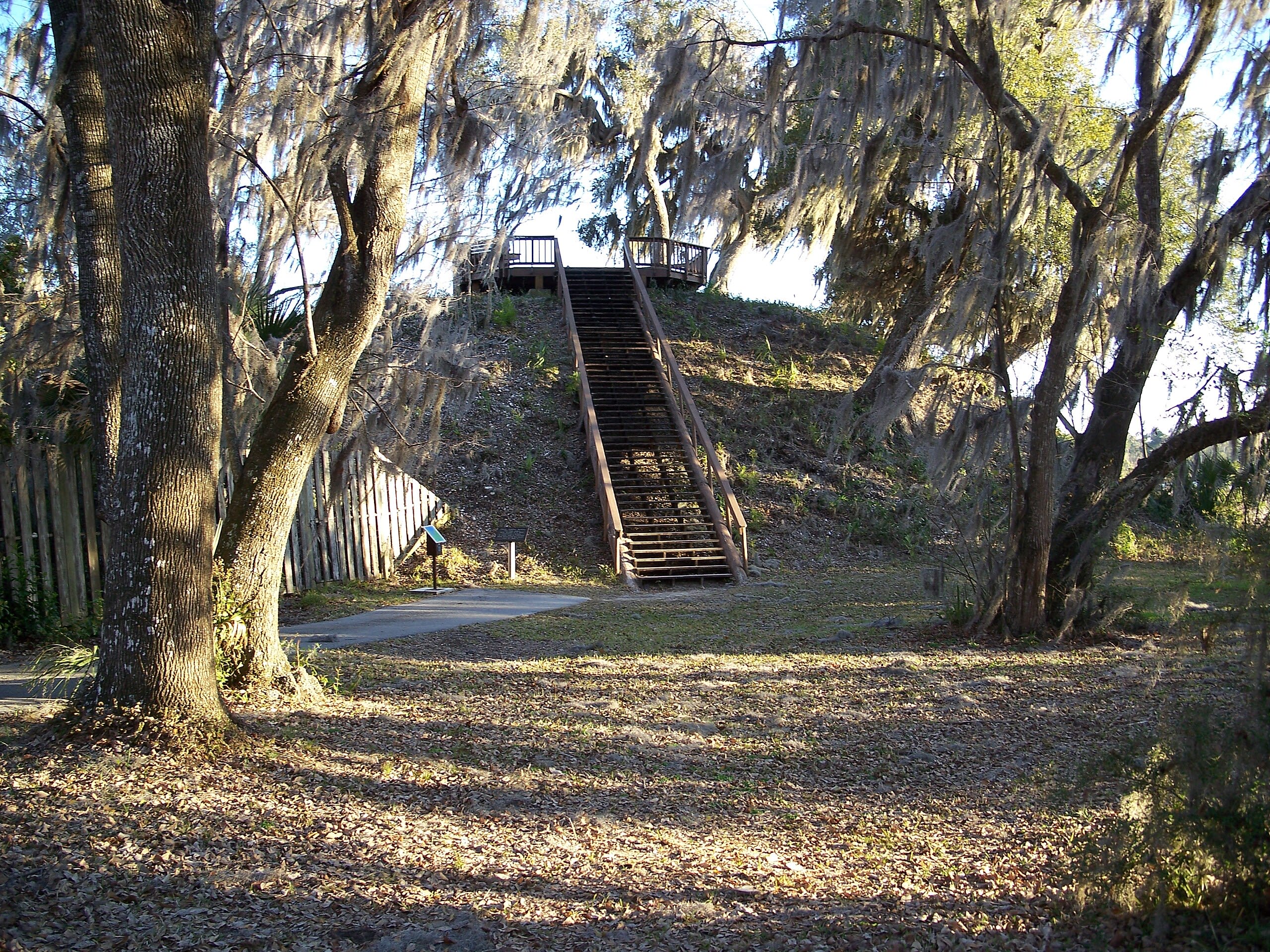
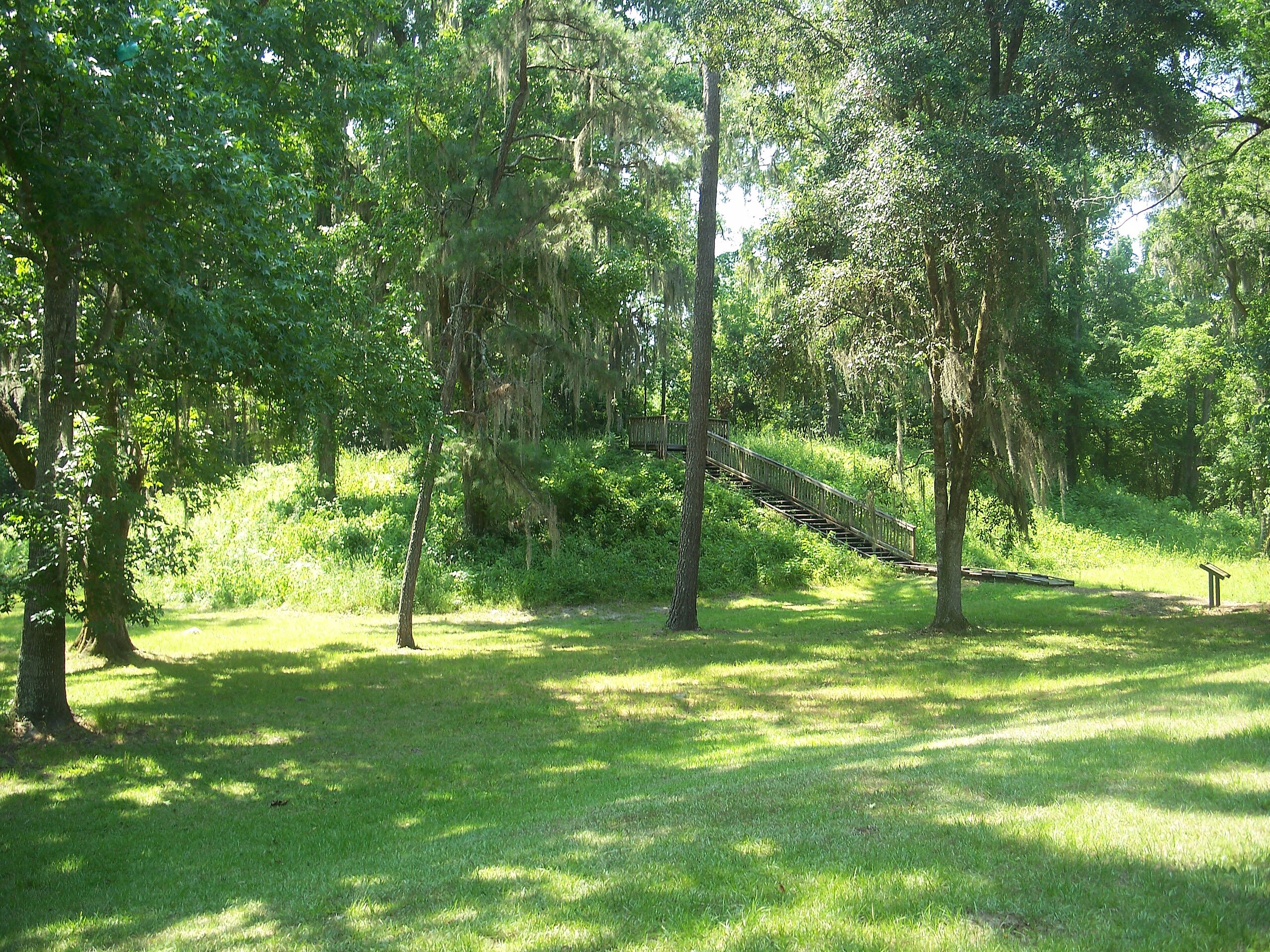
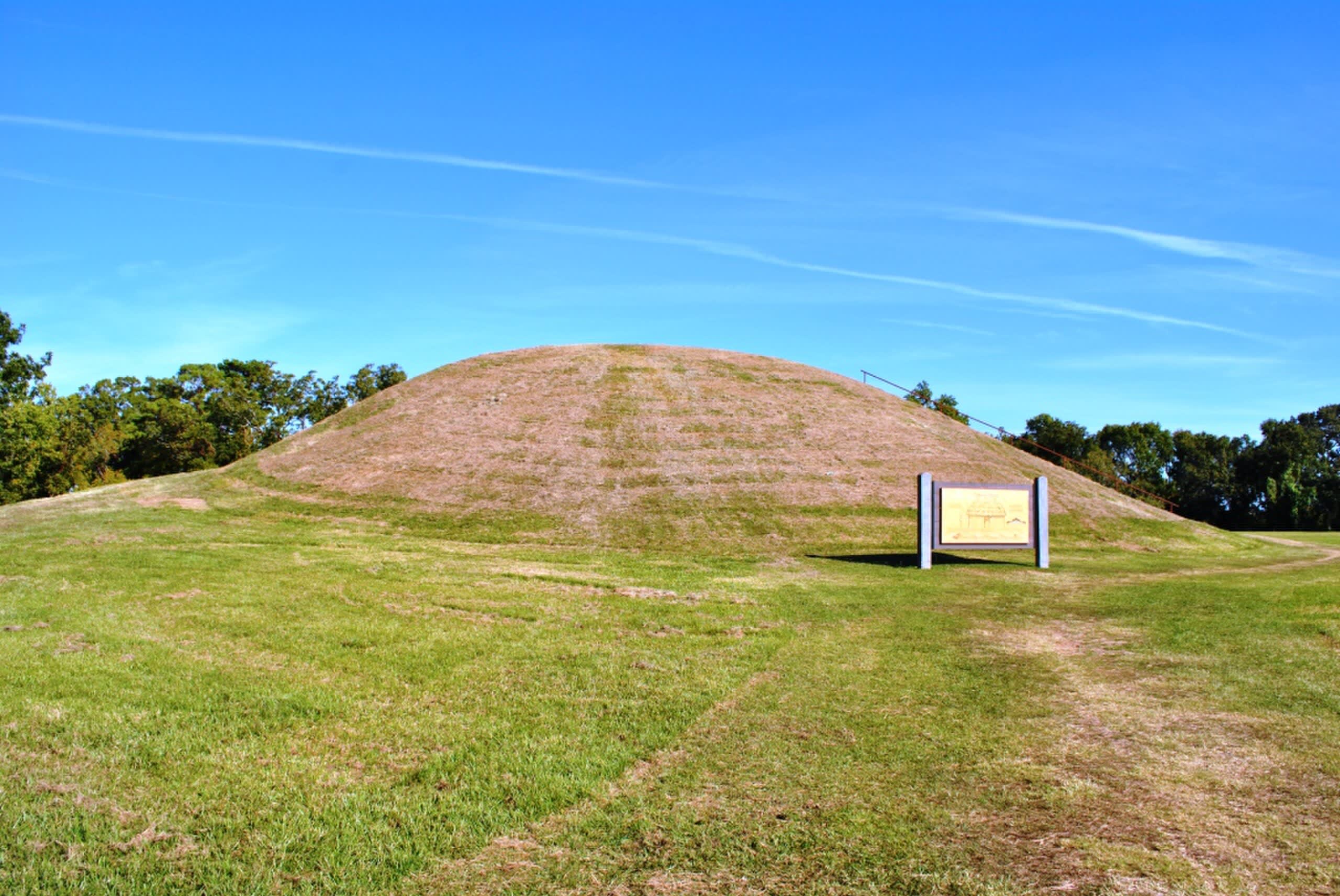
Mount Royal Mound, Florida
Welaka, Florida, United States
Mount Royal Mound, Florida is a site of sacred significance. Approximate coordinates: 29.43323, -81.65442. Located in Florida, United States.
Georgia
3 sites
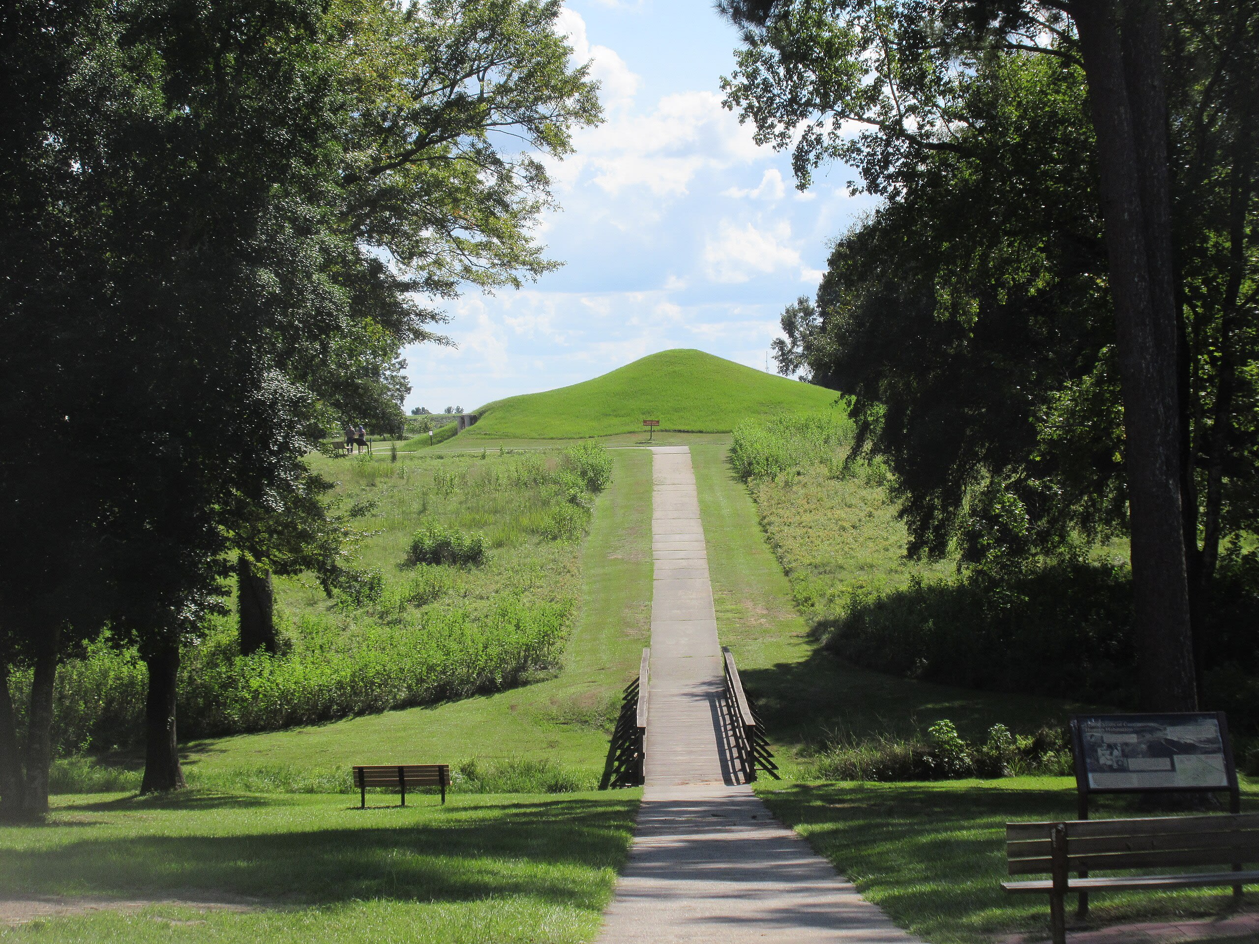
Etowah mounds, Georgia
Cartersville, Georgia, United States
Etowah mounds, Georgia is a mound of sacred significance. Approximate coordinates: 34.12617, -84.80677. Attributes: built, cultural, archaeological, ceremonial. Tradition: Native American. Located in Georgia, United States.
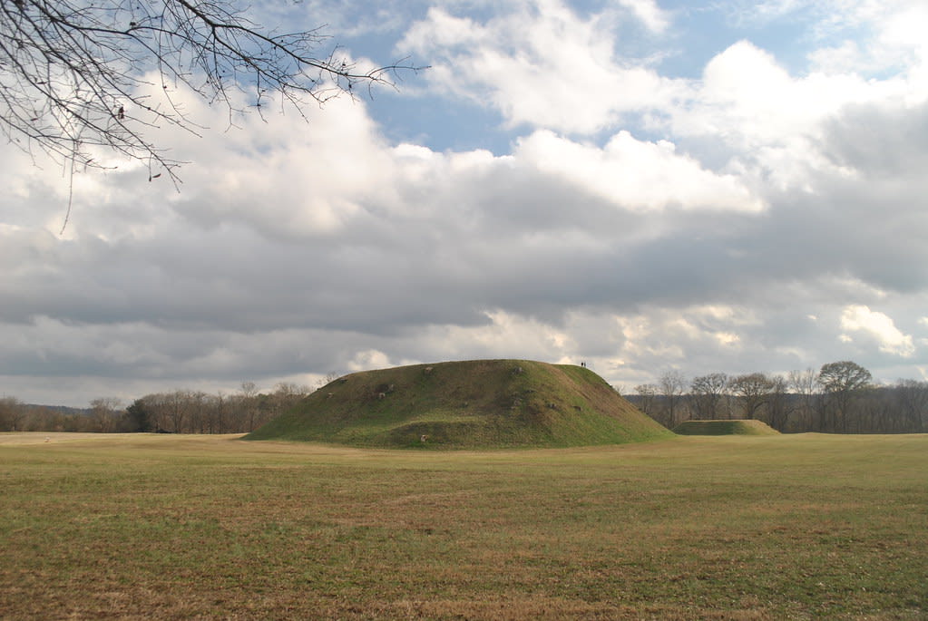
Ocmulgee Mounds, Georgia
Macon, Georgia, United States
Ocmulgee Mounds, Georgia is a site of sacred significance. Approximate coordinates: 32.84105, -83.60507. Located in Macon, Georgia, United States.
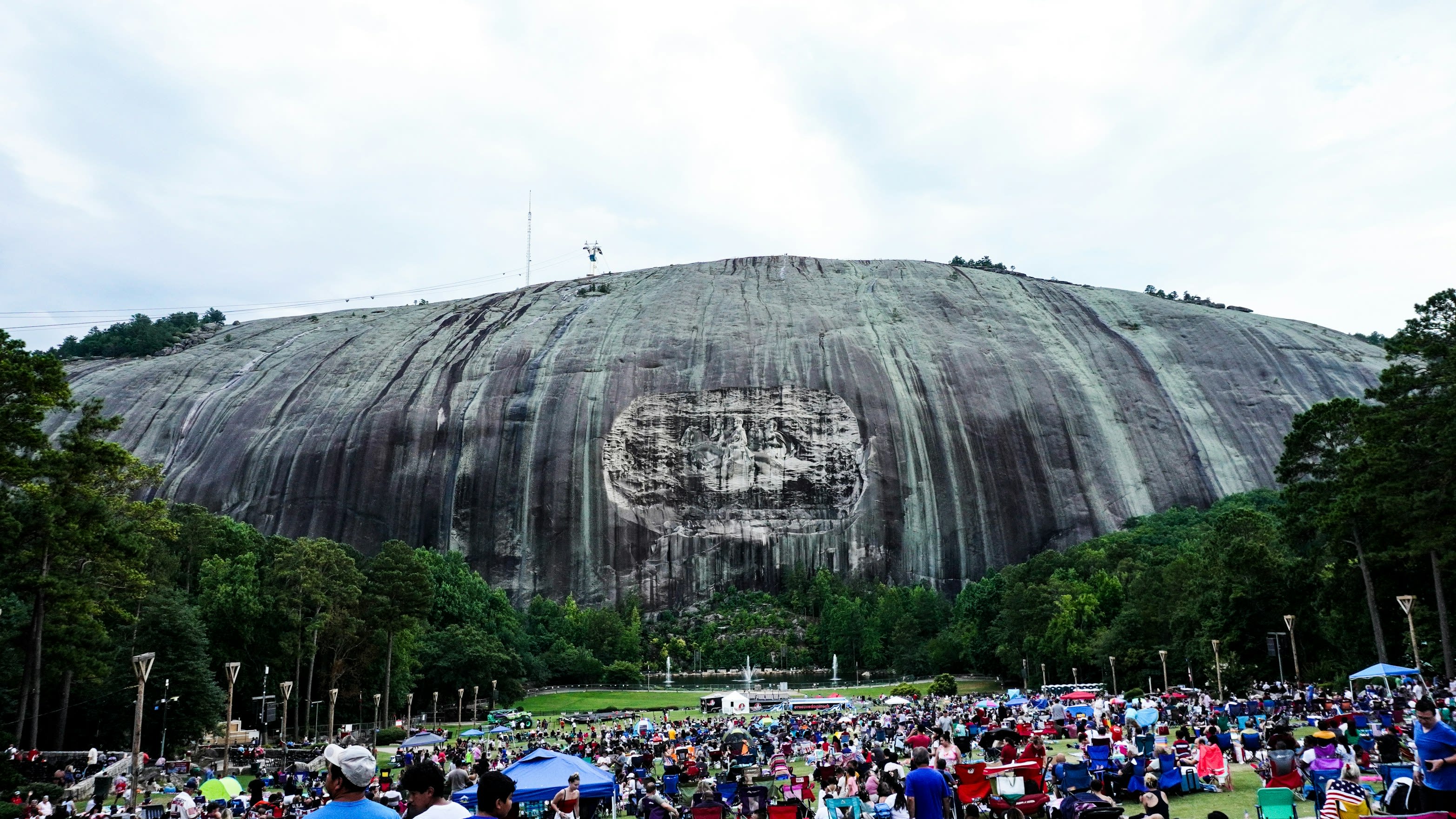
Stone Mountain, Georgia
Stone Mountain, Georgia, United States
Stone Mountain, Georgia is a site of sacred significance. Approximate coordinates: 33.80656, -84.14806. Stone Mountain is a city in DeKalb County, Georgia, United States. The population was 6,703 according in 2020. Stone Mountain is in the eastern part of DeKalb County and is a suburb of Atlanta that encompasses nearly 1.7 square miles. It lies near and touches the western base of the geological formation of the same name. Locals often call the city Stone Mountain Village to distinguish it from the larger unincorporated area traditionally considered Stone Mountain and Stone Mountain Park. Located in Georgia, United States.
Hawaii
15 sites
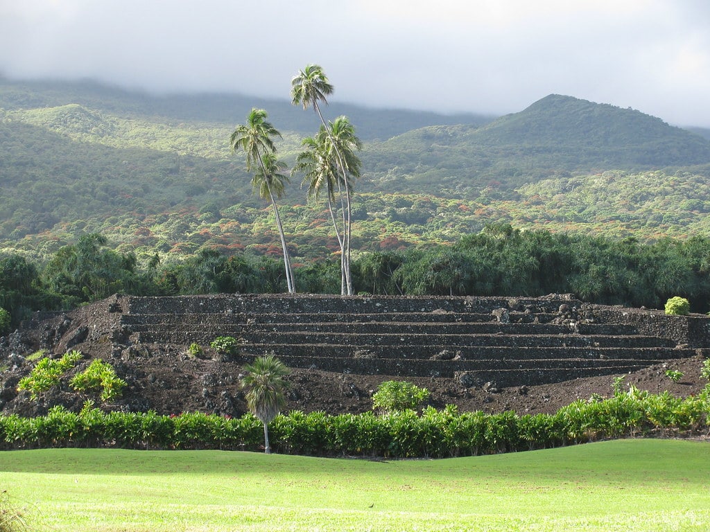
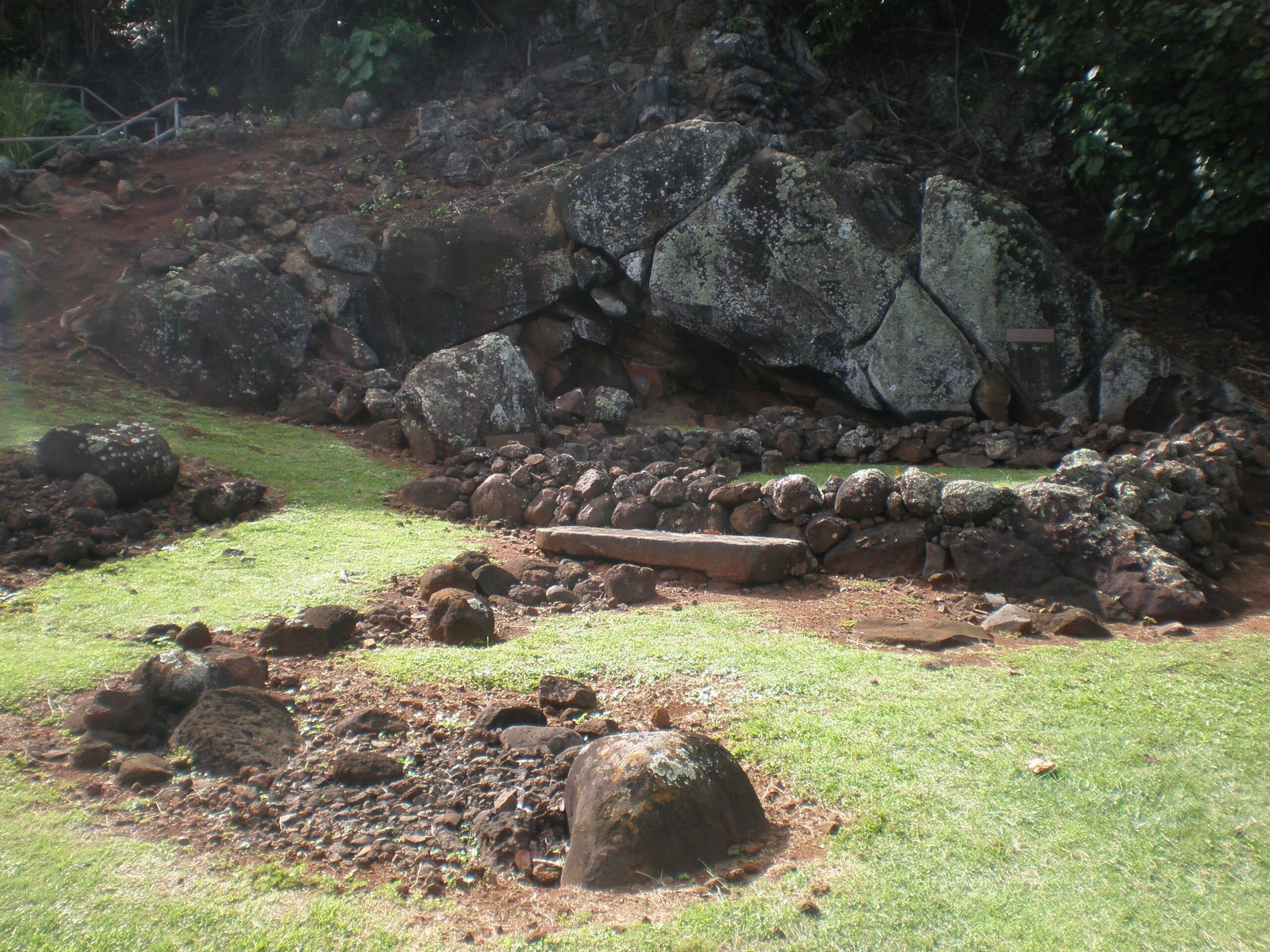
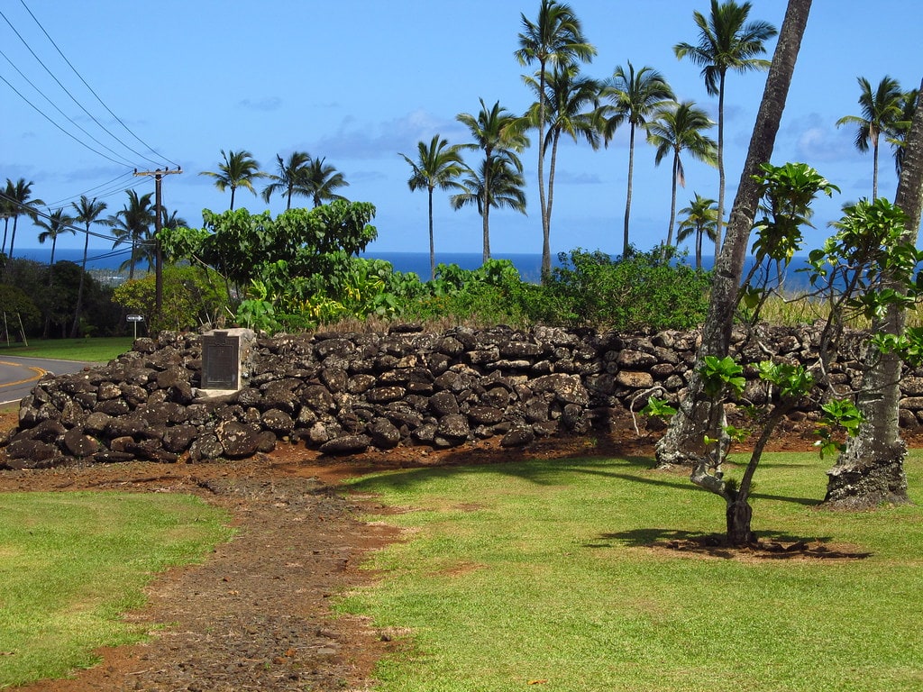
Hikiau Heiau, Hawaii
Captain Cook, Hawaii, United States
Hikiau Heiau, Hawaii is a heiau of sacred significance. Approximate coordinates: 19.47558, -155.91927. Attributes: built, cultural, archaeological, ceremonial. Tradition: Hawaiian. Located in Hawaii, United States.
Hikinaakala Heiau, Kauai
Kapaa, Hawaii, United States
Hikinaakala Heiau, Kauai is a heiau of sacred significance. Approximate coordinates: 22.04238, -159.33554. Attributes: built, cultural, archaeological, ceremonial. Tradition: Hawaiian. Located in Hawaii, United States.
Iao Valley State Park, Maui
Wailuku, Hawaii, United States
Iao Valley State Park, Maui is a natural of sacred significance. Approximate coordinates: 20.88088, -156.54518. Attributes: natural, cultural. Located in Hawaii, United States.
Keahiakawelo (Garden of the Gods), Hawaii
Lanai City, Hawaii, United States
Keahiakawelo (Garden of the Gods), Hawaii is a natural of sacred significance. Approximate coordinates: 20.87899, -156.99657. Attributes: natural, cultural. Tradition: Hawaiian. Associated figure: Kawelo. Mythological context: Hawaiian mythology. Located in Hawaii, United States.
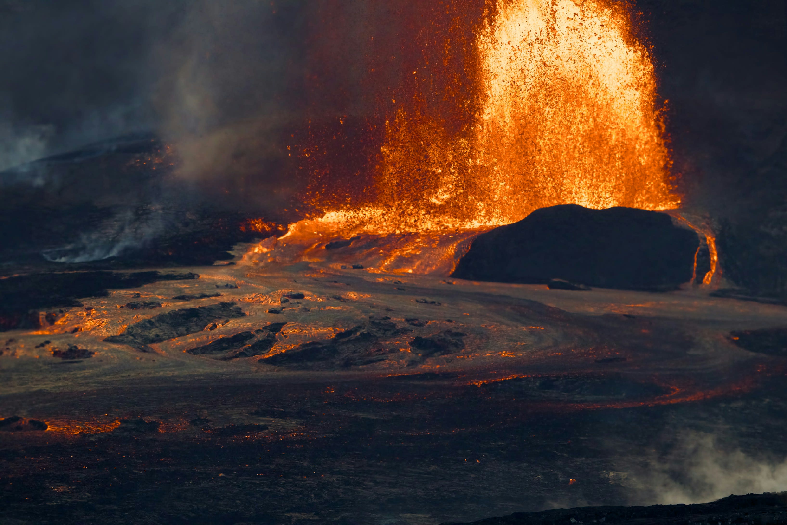
Kilauea
Volcano, Hawaii, United States
Mt. Kilauea is a site of sacred significance. Approximate coordinates: 19.42046, -155.28728. Located in Hawaii, United States.
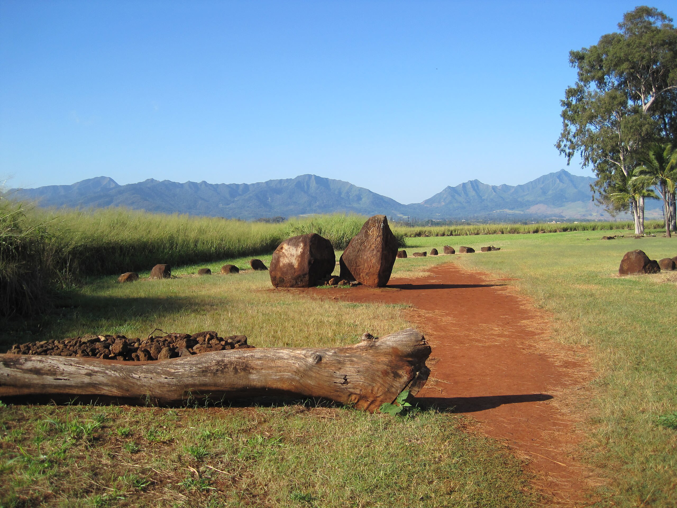
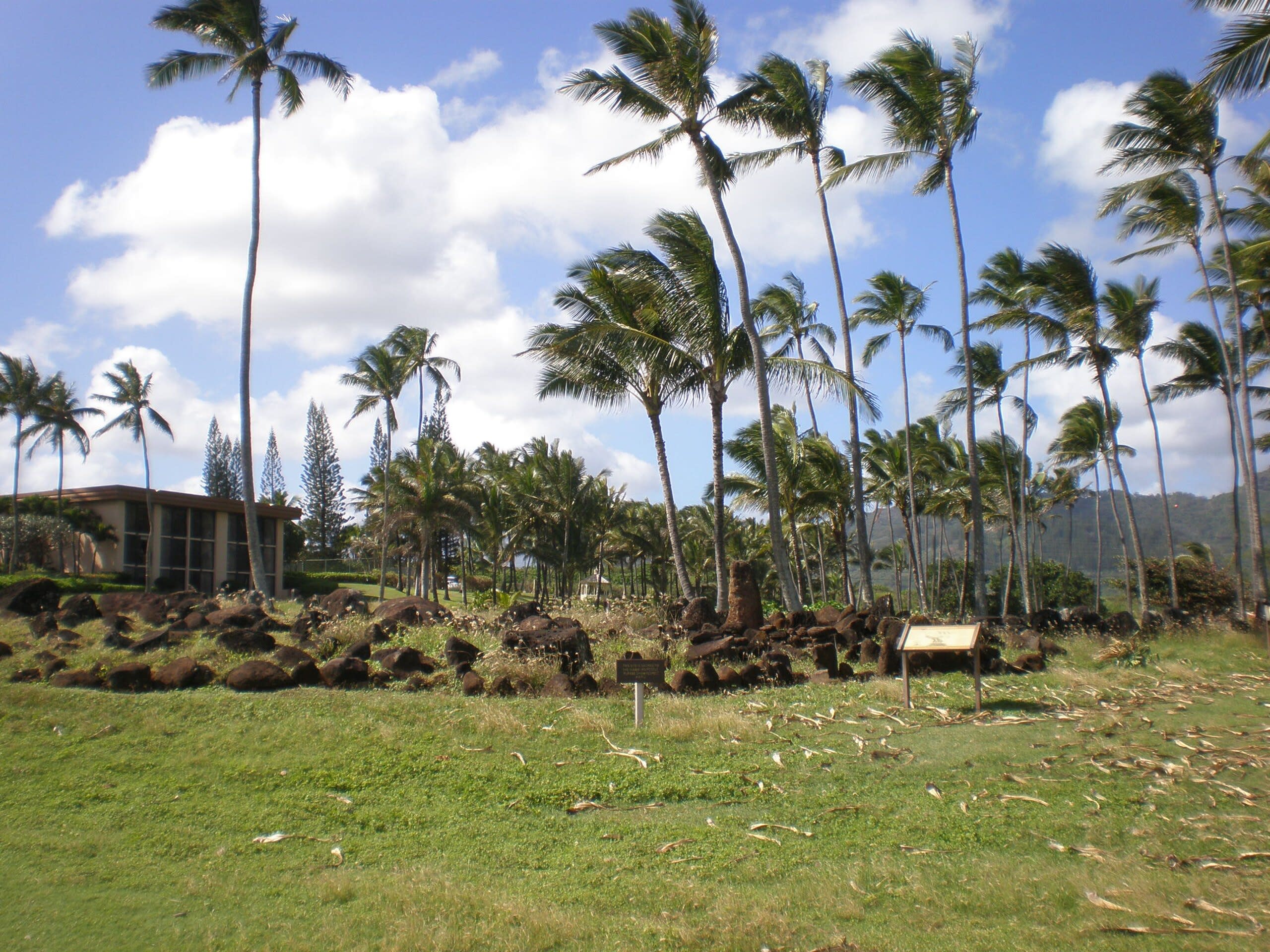
Kukaniloko Birthstones, Hawaii
Wahiawa, Hawaii, United States
Kukaniloko Birthstones, Hawaii is a birth site of sacred significance. Approximate coordinates: 21.50476, -158.03639. Attributes: natural, cultural, archaeological, ceremonial. Tradition: Hawaiian. Located in Waipahu, Hawaii, United States.
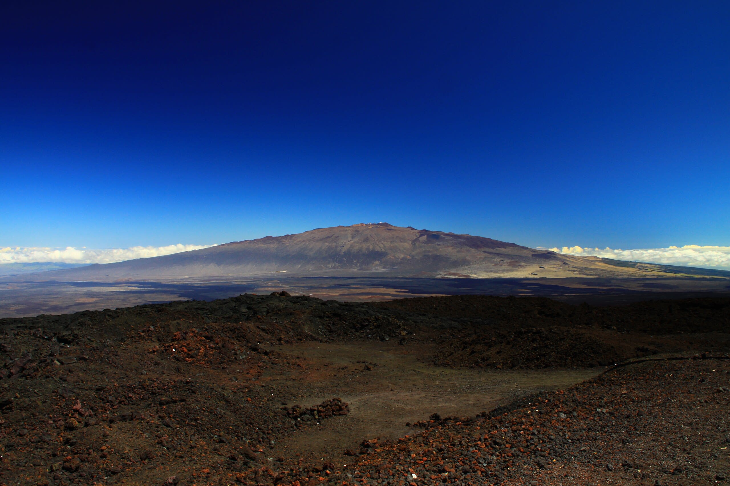
Mauna Kea, Hawaii
Hilo, Hawaii, United States
Mauna Kea, Hawaii is a mountain of sacred significance. Approximate coordinates: 19.82905, -155.47268. Attributes: natural, cultural. Located in Hawaii, United States.
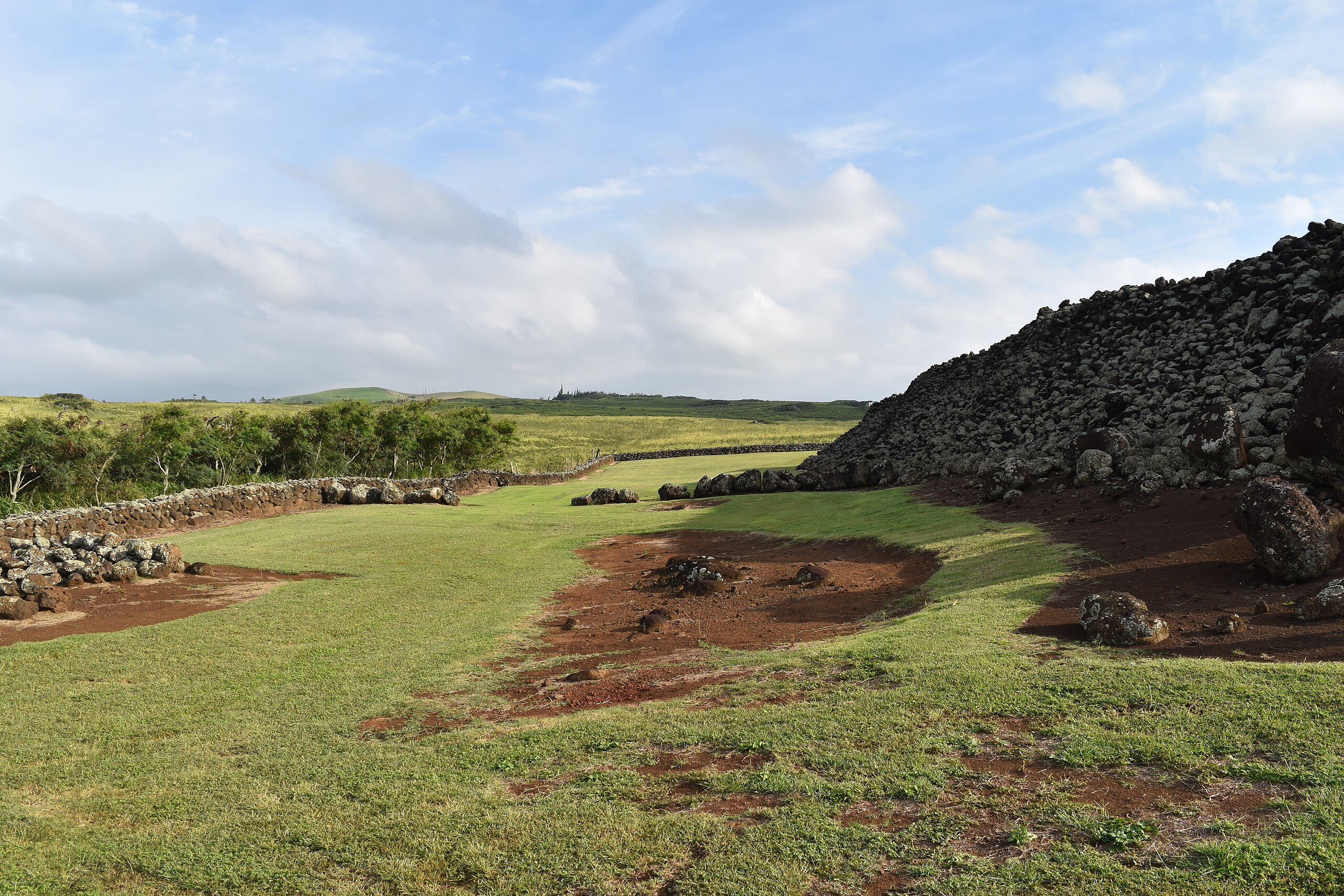
Mo'okini Heiau
Hawi, Hawaii, United States
Mo' okini Luakini Heiau is a site of sacred significance. Approximate coordinates: 21.30311, -157.74949. Located in Honolulu, Hawaii, United States.
Mt. Haleakala, Maui
Kula, Hawaii, United States
Mt. Haleakala, Maui is a site of sacred significance. Approximate coordinates: 20.70956, -156.24876. Located in Hawaii, United States.
Piilanihale Heiau temple, Maui
Hana, Hawaii, United States
Piilanihale Heiau temple, Maui is a site of sacred significance. Approximate coordinates: 20.80508, -156.03875. Located in Hawaii, United States.
Pohaku Ho'ohanau, Kauai
Kapaa, Hawaii, United States
Pohaku Ho'ohanau, Kauai is a site of sacred significance. Approximate coordinates: 22.04927, -159.33926. Located in Hawaii, United States.
Poli'ahu Heiau, Kauai
Kapaa, Hawaii, United States
Poli'ahu Heiau, Kauai is a site of sacred significance. Approximate coordinates: 22.04647, -159.35503. Located in Hawaii, United States.
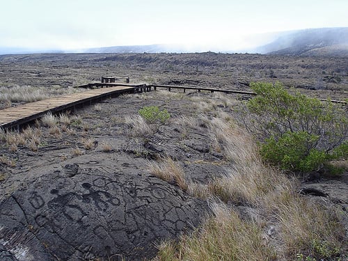
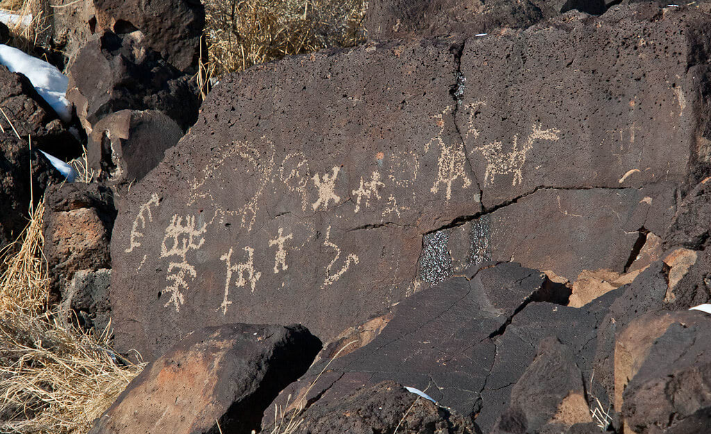
Puu Loa Petroglyphs, Hawaii
Volcano, Hawaii, United States
Puu Loa Petroglyphs, Hawaii is a site of sacred significance. Approximate coordinates: 19.29271, -155.12205. Located in Hawaii, United States.
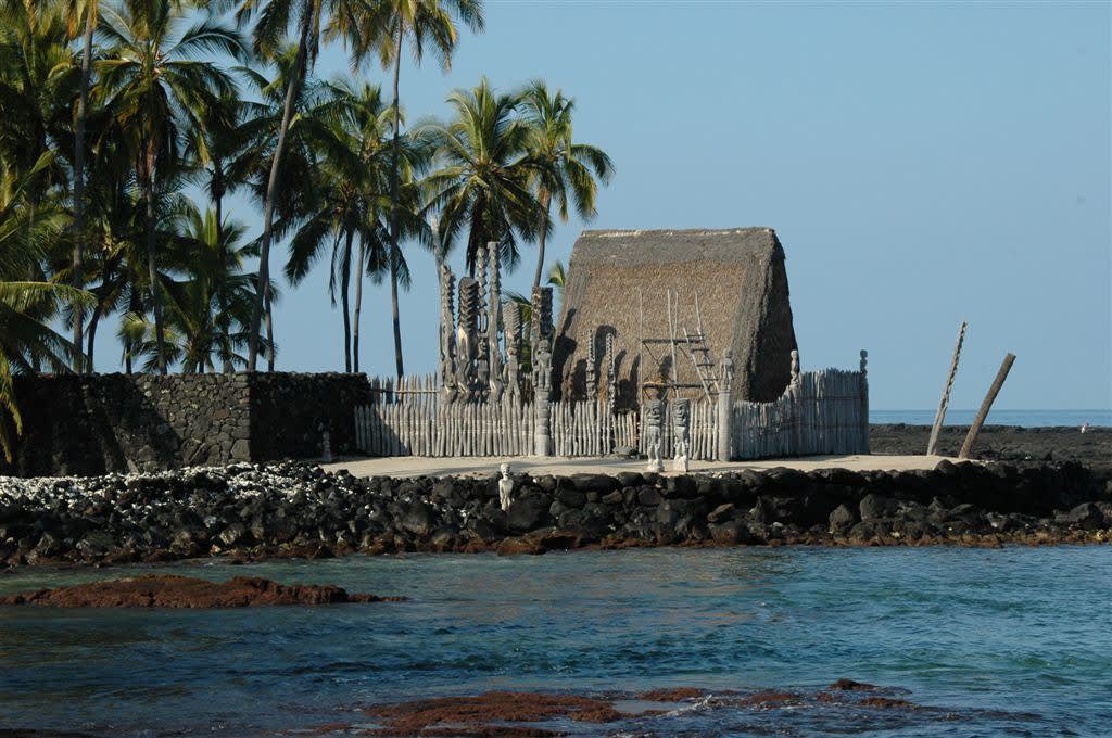
Puuhonua o Honaunau National Historical Park, Hawaii
Honaunau, Hawaii, United States
Puuhonua o Honaunau National Historical Park, Hawaii is a site of sacred significance. Approximate coordinates: 19.42154, -155.91053. Located in Hawaii, United States.
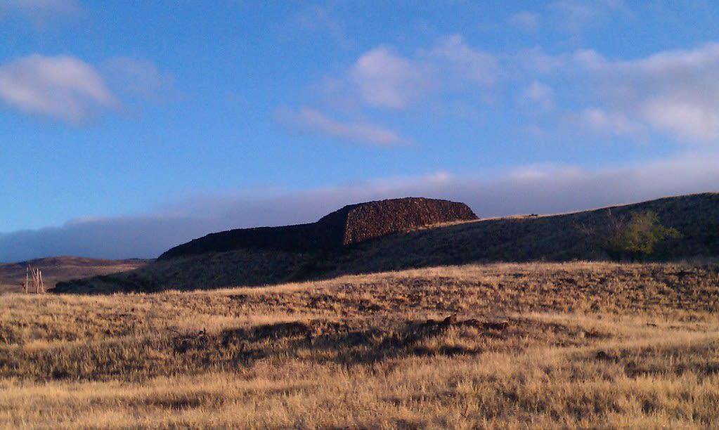
Puukohola Heiau National Historic Site, Hawaii
Kawaihae, Hawaii, United States
Puukohola Heiau National Historic Site, Hawaii is a site of sacred significance. Approximate coordinates: 20.02562, -155.82178. Located in Hawaii, United States.
Illinois
3 sites
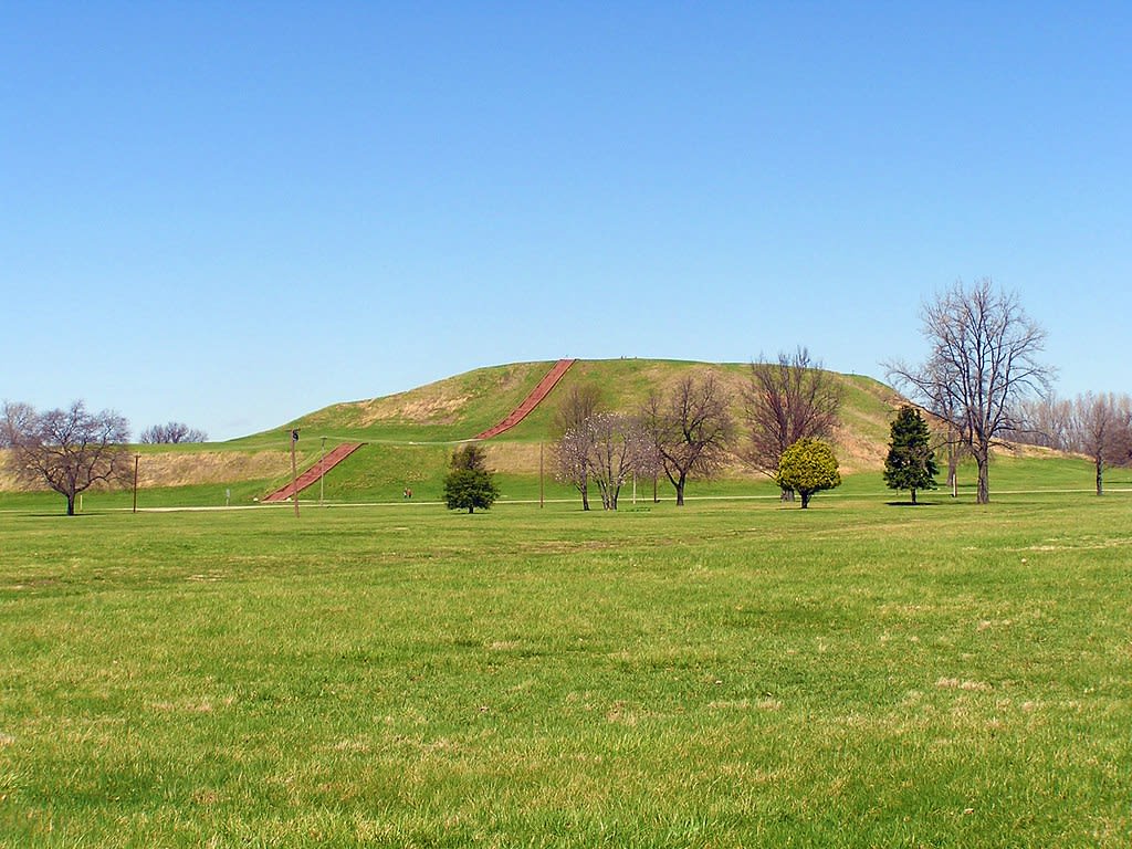
Cahokia Mounds, Collinsville, Illinois
Collinsville, Illinois, United States
Cahokia Mounds, Collinsville, Illinois is a mound of sacred significance. Approximate coordinates: 38.65506, -90.06182. Attributes: built, cultural, archaeological. Tradition: Native American. Recognized as a UNESCO World Heritage Site. Located in Collinsville, Illinois, United States.
Kincaid Mounds, Brookport, Illinois
Brookport, Illinois, United States
Kincaid Mounds, Brookport, Illinois is a mounds of sacred significance. Approximate coordinates: 37.08035, -88.49167. Attributes: built, cultural, archaeological. Tradition: Native American. Located in Illinois, United States.

National Shrine of Our Lady of the Snows, Belleville, Illinois
Belleville, Illinois, United States
National Shrine of Our Lady of the Snows, Belleville, Illinois is a site of sacred significance. Approximate coordinates: 38.56130, -90.09212. Located in Illinois, United States.
Indiana
2 sites
Angel Mounds, Evansville, Indiana
Evansville, Indiana, United States
Angel Mounds, Evansville, Indiana is a site of sacred significance. Approximate coordinates: 37.94519, -87.45189. Located in Indiana, United States.
Mounds State Park, Indiana
Anderson, Indiana, United States
Mounds State Park, Indiana is a site of sacred significance. Approximate coordinates: 40.10056, -85.61974. Located in Indiana, United States.
Iowa
1 sites
Louisiana
2 sites
Marksville mounds
Marksville, Louisiana, United States
Marksville mounds is a mound of sacred significance. Approximate coordinates: 31.12343, -92.04761. Attributes: built, cultural, archaeological. Tradition: Native American. Located in Louisiana, United States.
Poverty Point Mounds, Louisiana
West Carroll Parish, Louisiana, United States
Poverty Point Mounds, Louisiana is a site of sacred significance. Approximate coordinates: 32.63616, -91.40326. Located in Louisiana, United States.
Maine
1 sites
Maryland
1 sites
Michigan
3 sites
National Shrine of the Cross in the Woods, Indian River, Michigan
Indian River, Michigan, United States
National Shrine of the Cross in the Woods, Indian River, Michigan is a site of sacred significance. Approximate coordinates: 45.39744, -84.63131. Located in Tuscarora Township, Michigan, United States.
Norton Mound Group
Grand Rapids, Michigan, United States
Hopewell Indian Mounds, Grand Rapids, Michigan is a mound of sacred significance. Approximate coordinates: 42.93455, -85.72884. Attributes: built, cultural, archaeological. Tradition: Native American. Located in Wyoming, Michigan, United States.
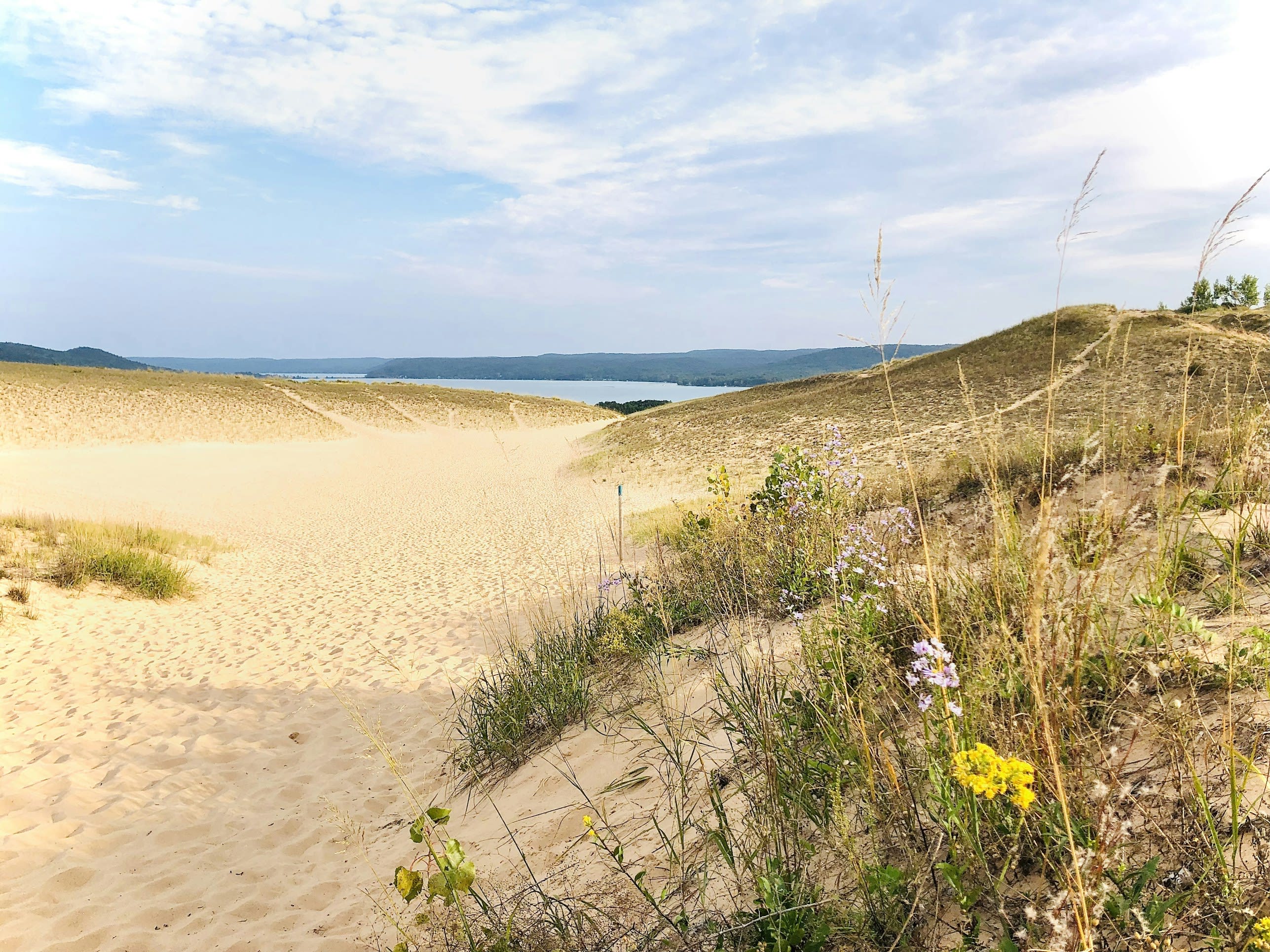
Sleeping Bear Dunes, Michigan
Empire, Michigan, United States
Sleeping Bear Dunes, Michigan is a site of sacred significance. Approximate coordinates: 44.87340, -86.04666. Located in Glen Arbor Township, Michigan, United States.
Minnesota
2 sites
Jeffers Petroglyphs, Comfrey, Minnesota
Comfrey, Minnesota, United States
Jeffers Petroglyphs, Comfrey, Minnesota is a archaeology site of sacred significance. Approximate coordinates: 44.09053, -95.05800. Attributes: natural, cultural, archaeological. Located in Minnesota, United States.
Pipestone National Monument, Minnesota
Pipestone, Minnesota, United States
Pipestone National Park, Minnesota is a site of sacred significance. Approximate coordinates: 44.01365, -96.32475. Located in Minnesota, United States.
Mississippi
1 sites
Missouri
1 sites
Montana
4 sites
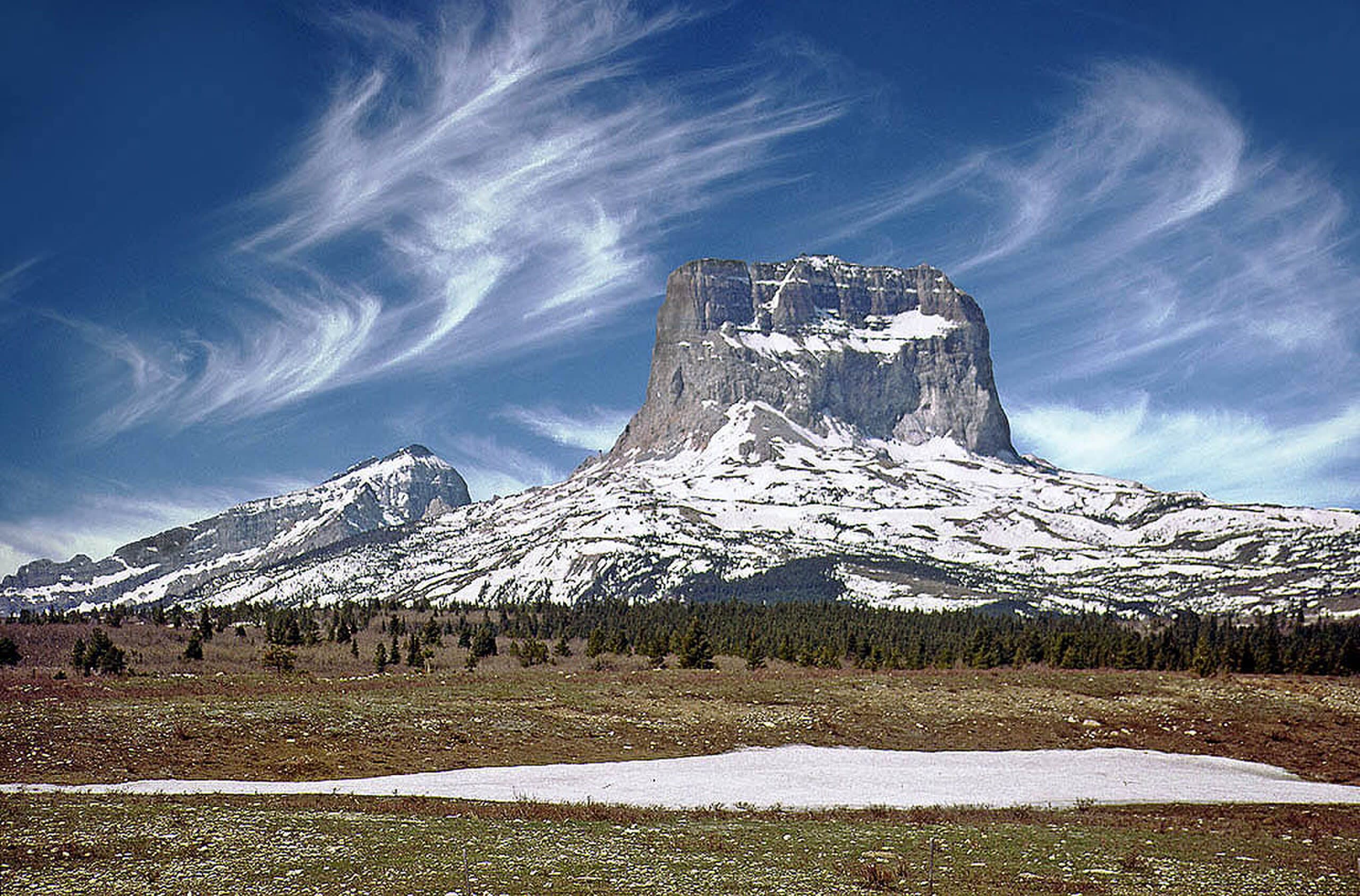
Chief Mountain (Ninaistakis), Glacier County, Montana
Babb, Montana, United States
Chief Mountain (Ninaistakis), Glacier County, Montana is a mountain of sacred significance. Approximate coordinates: 48.93276, -113.60927. Attributes: natural, cultural, ceremonial. Tradition: Nitsitapii. Mythological context: Nitsitapii mythology. Located in Montana, United States.
Giant Springs, Great Falls, Montana
Great Falls, Montana, United States
Giant Springs, Great Falls, Montana is a spring of sacred significance. Approximate coordinates: 47.53496, -111.22858. Attributes: natural, cultural. Tradition: Blackfeet Indian. Located in Montana, United States.
Sweet Grass Hills, Montana
Whitlash, Montana, United States
Sweet Grass Hills, Montana is a site of sacred significance. Approximate coordinates: 48.84845, -111.37802. Located in Montana, United States.
Two Medicine Lake, Montana
East Glacier Park, Montana, United States
Two Medicine Lake, Montana is a site of sacred significance. Approximate coordinates: 48.47669, -113.38681. Located in Montana, United States.
Nebraska
1 sites
Nevada
2 sites
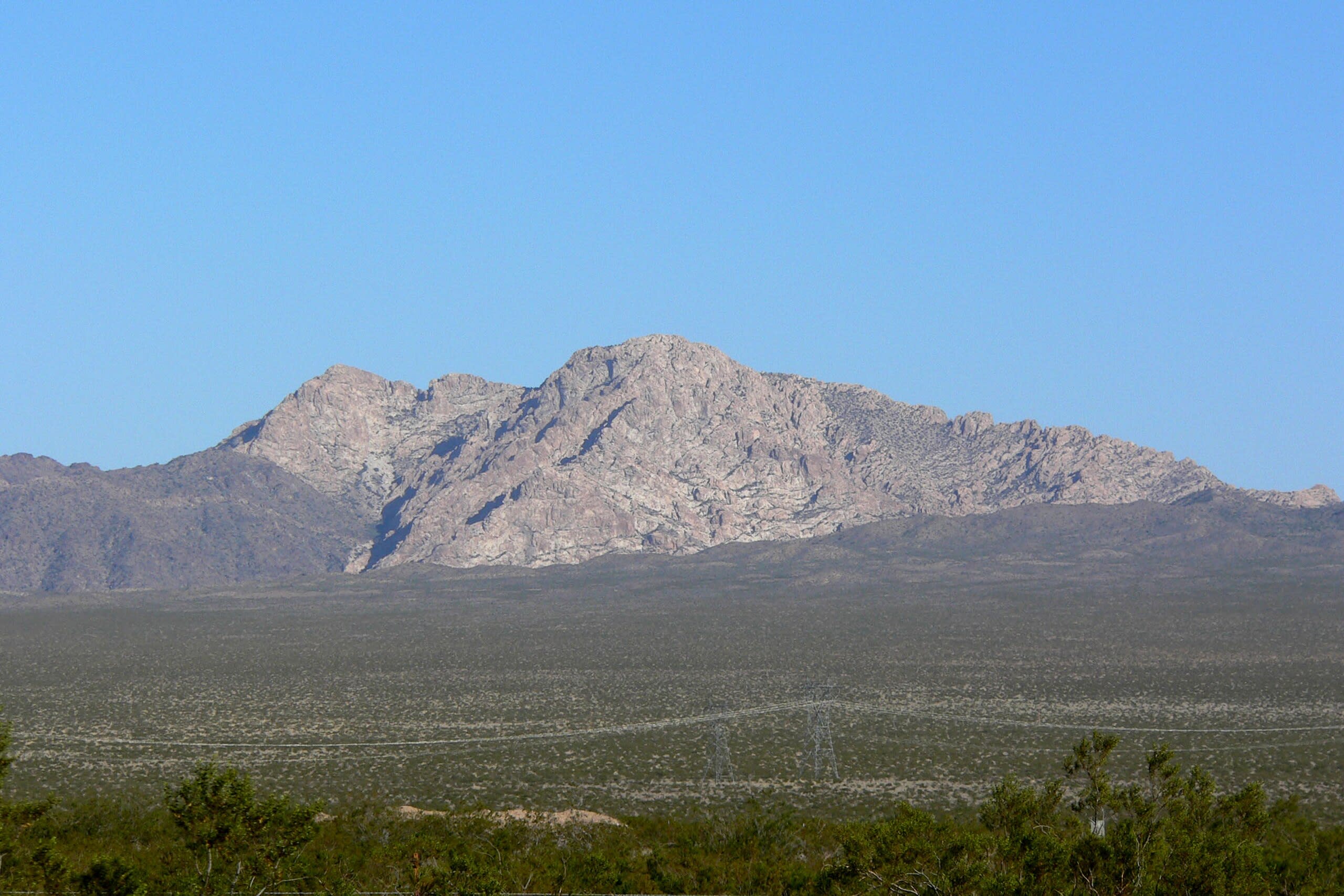
Newberry Mountains, Nevada
Laughlin, Nevada, United States
Newberry Mountains, Nevada is a site of sacred significance. Approximate coordinates: 35.18805, -114.70275. Located in Nevada, United States.
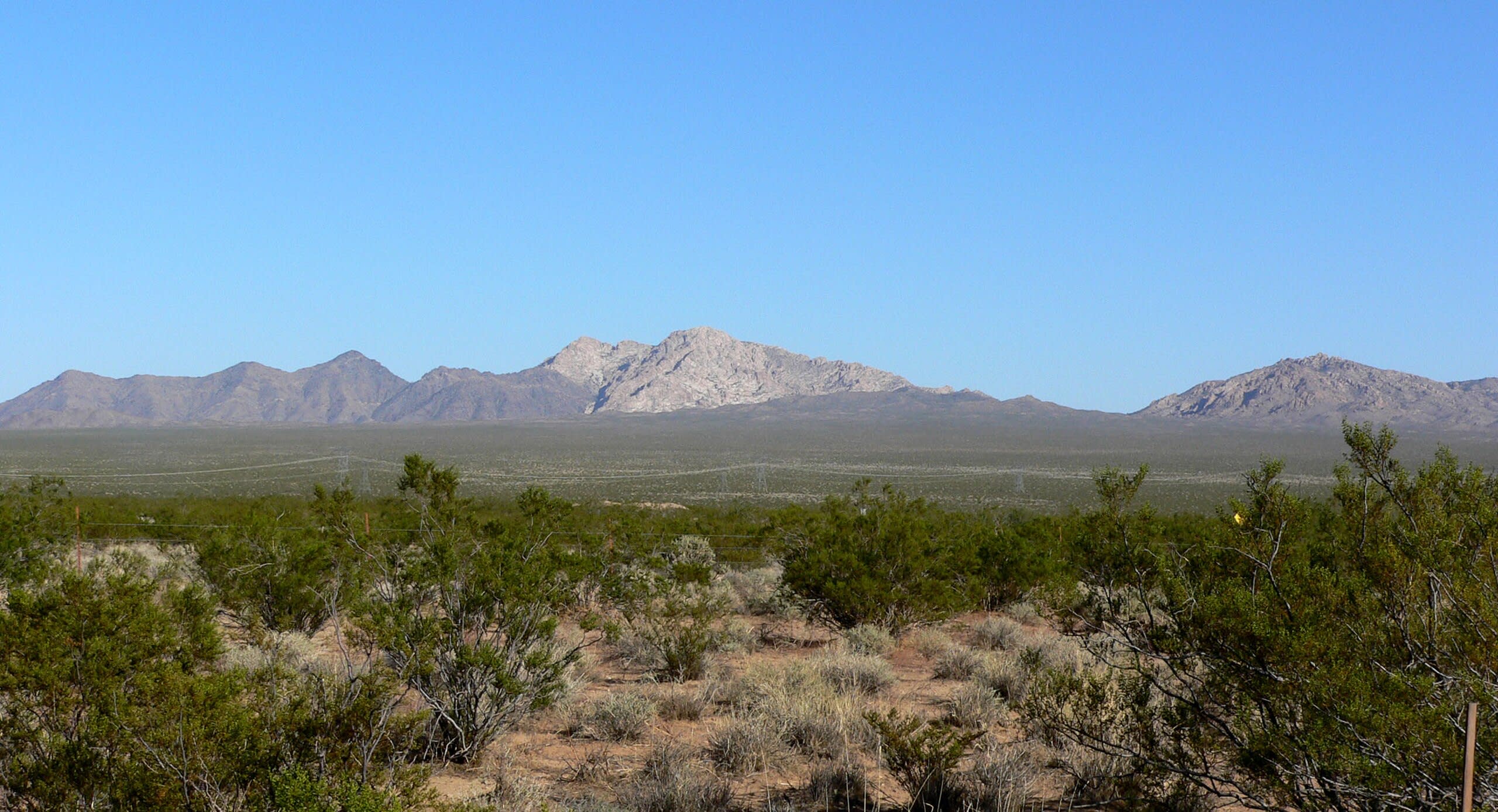
Spirit Mountain, Nevada
Laughlin, Nevada, United States
Spirit Mountain, Nevada is a site of sacred significance. Approximate coordinates: 35.27500, -114.72386. Located in Nevada, United States.
New Hampshire
2 sites
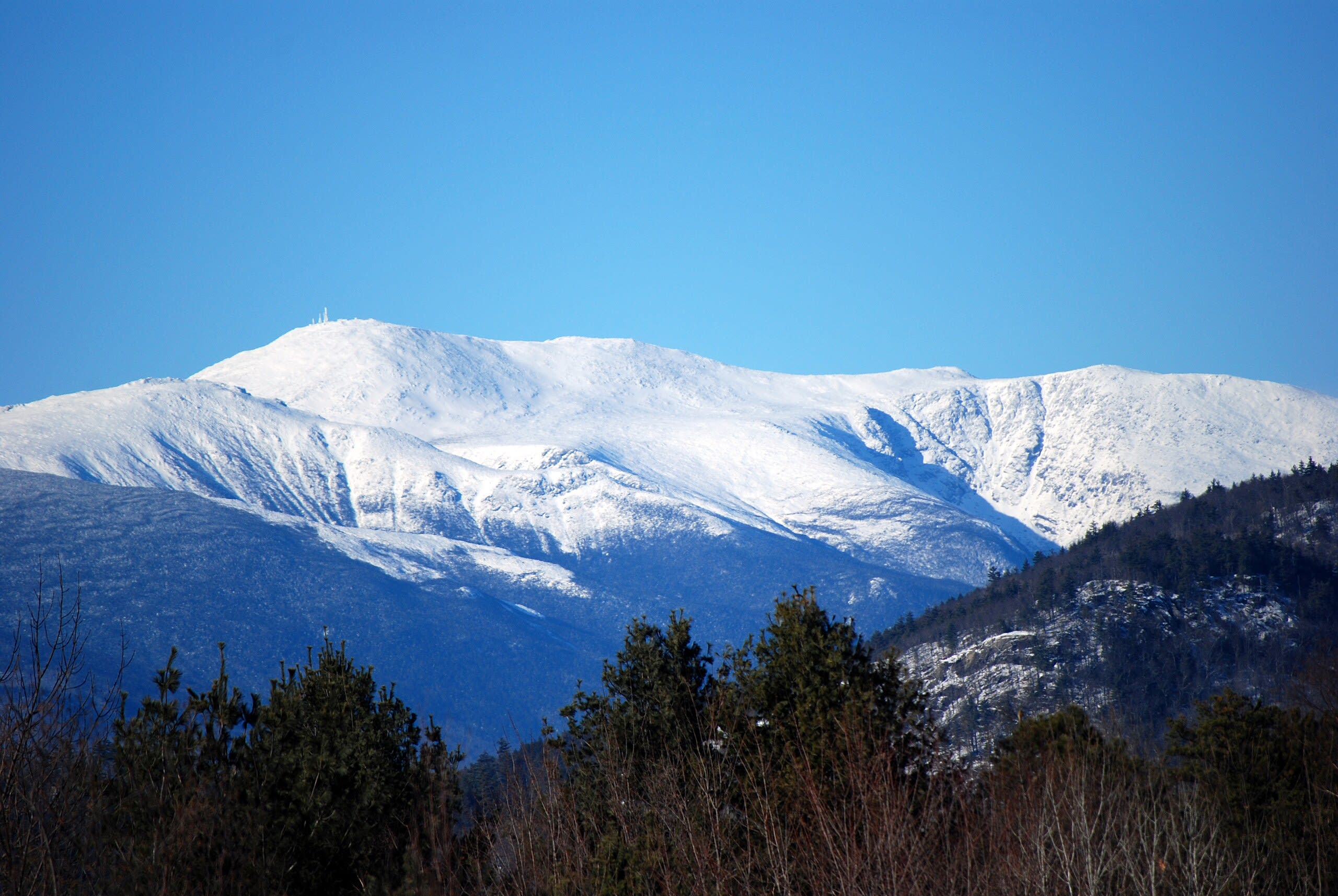
Mt. Washington, New Hampshire
Gorham, New Hampshire, United States
Mt. Washington, New Hampshire is a site of sacred significance. Approximate coordinates: 44.27059, -71.30327. Located in New Hampshire, United States.
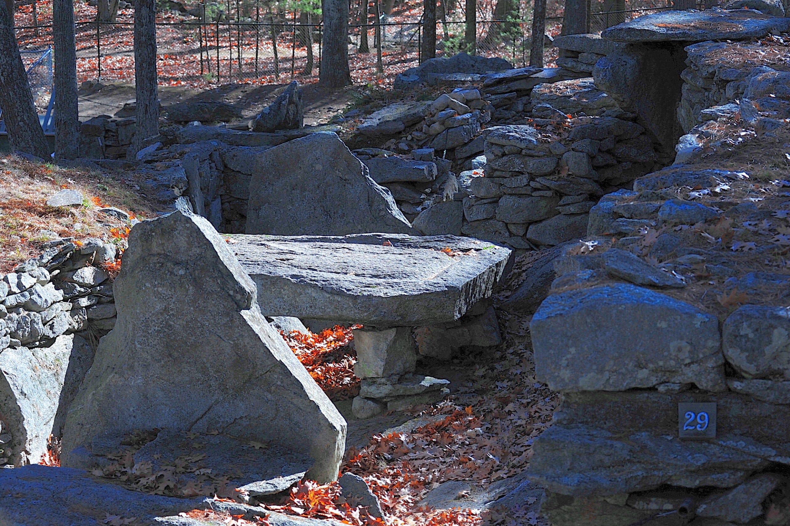
Mystery Hill, New Hampshire (America’s Stonehenge)
Salem, New Hampshire, United States
Mystery Hill, New Hampshire (America’s Stonehenge) is a site of sacred significance. Approximate coordinates: 42.84282, -71.20723. Located in Salem, New Hampshire, United States.
New Mexico
19 sites
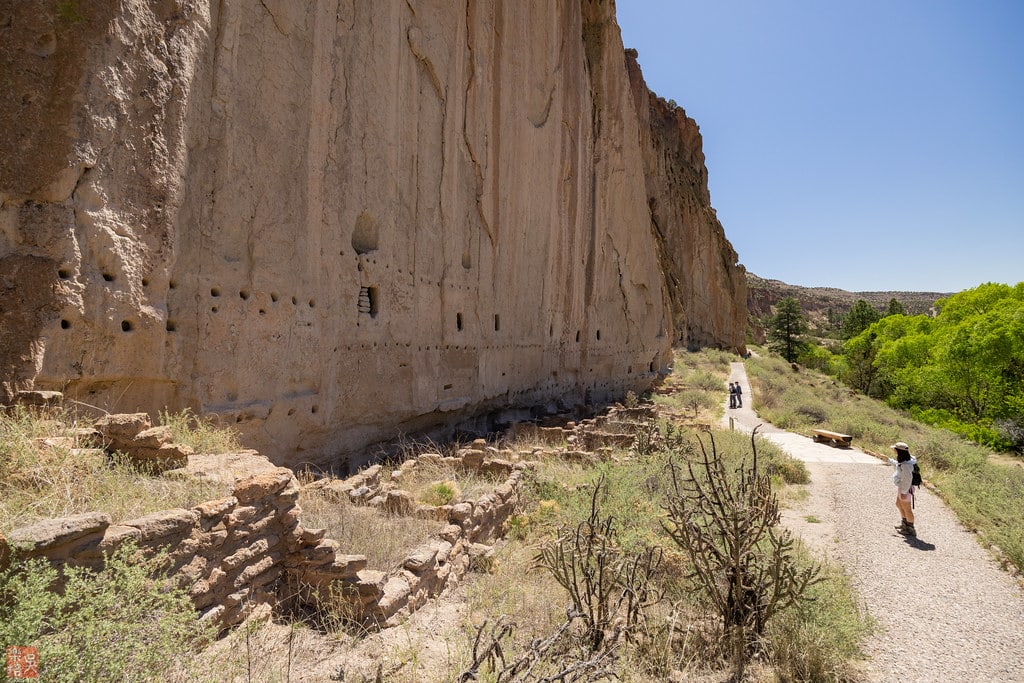
Bandelier National Monument
Sandoval County, New Mexico, United States
Bandelier National Monument is a national monument of sacred significance. Approximate coordinates: 35.76467, -106.32283. Attributes: built, natural, cultural, archaeological. Tradition: Ancestral Puebloans. Bandelier National Monument is a 33,677-acre (136 km2) United States National Monument near Los Alamos in Sandoval and Los Alamos counties, New Mexico. The monument preserves the homes and territory of the Ancestral Puebloans of a later era in the Southwest. Most of the pueblo structures date to two eras, dating between AD 1150 and 1600. The monument is 50 square miles (130 km2) of the Pajarito Plateau, on the slopes of the Jemez volcanic field in the Jemez Mountains. Over 70% of the monument is wilderness, with over one mile of elevation change, from about 5,000 feet (1,500 m) along the Rio Grande to over 10,000 feet (3,000 m) at the peak of Cerro Grande on the rim of the Valles Caldera, providing for a wide range of life zones and wildlife habitats. 3 miles (5 km) of road and more than 70 miles (110 km) of hiking trails are built. The monument protects Ancestral Pueblo archeological sites, a diverse and scenic landscape, and the country s largest National Park Service Civilian Conservation Corps National Landmark District. Two-thirds of the park, 23,267 acres (9,416 ha), is designated as the Bandelier Wilderness Area. Motorized travel and permanent structures are forbidden in the Wilderness. Bandelier was designated by President Woodrow Wilson as a national monument on February 11, 1916, and named for Adolph Bandelier, a Swiss-American anthropologist, who researched the cultures of the area and supported preservation of the sites. The park infrastructure was developed in the 1930s by crews of the Civilian Conservation Corps and is a National Historic Landmark for its well-preserved architecture. The National Park Service cooperates with surrounding Pueblos, other federal agencies, and state agencies to manage the park. Located in New Mexico, United States.

Blue Lake, New Mexico
Taos County, New Mexico, United States
Blue Lake, New Mexico is a natural of sacred significance. Approximate coordinates: 36.53835, -105.39107. Attributes: natural, cultural, pilgrimage, ceremonial. Tradition: Native American. Located in New Mexico, United States.
Capitan Mountains, New Mexico
Lincoln County, New Mexico, United States
Capitan Mountains, New Mexico is a mountain of sacred significance. Approximate coordinates: 33.60675, -105.36360. Attributes: natural, cultural. Tradition: Mescalero Apache. Located in New Mexico, United States.
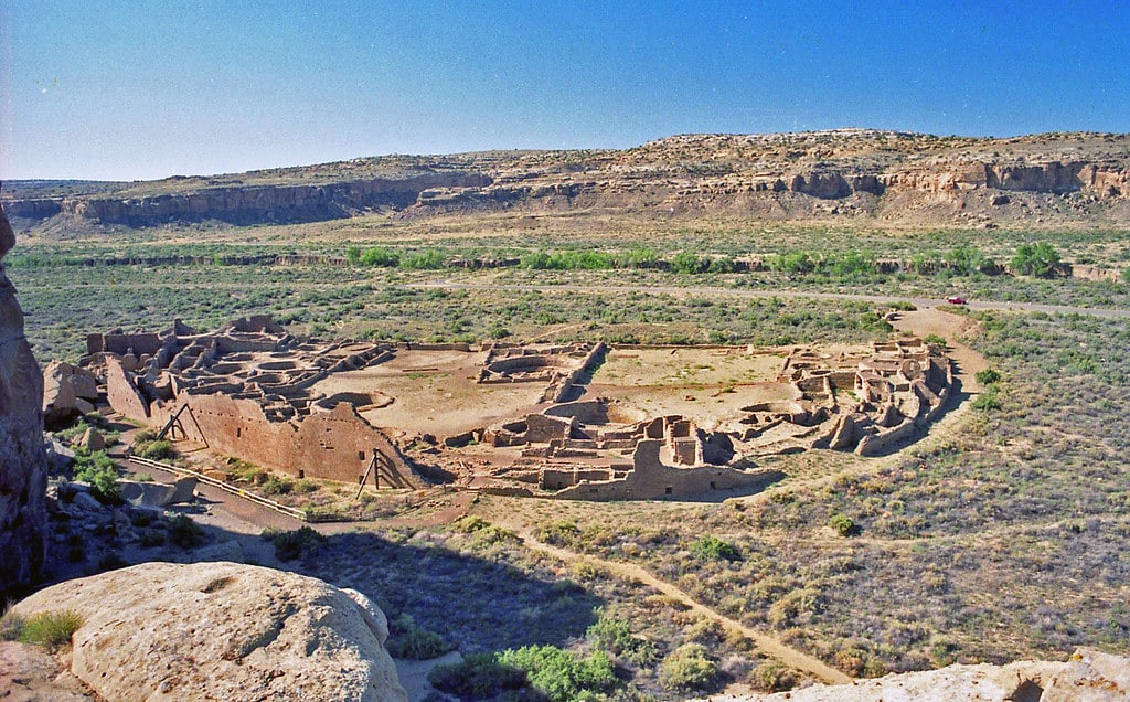
Chaco Canyon, New Mexico
San Juan County, New Mexico, United States
Chaco Canyon, New Mexico is a historical park of sacred significance. Approximate coordinates: 36.05909, -107.95784. Attributes: built, cultural, archaeological, ceremonial. Tradition: Anasazi Indian. Recognized as a UNESCO World Heritage Site. Located in New Mexico, United States.

Chicoma Mountain, New Mexico
Rio Arriba County, New Mexico, United States
Chicoma Mountain, New Mexico is a mountain of sacred significance. Approximate coordinates: 36.00797, -106.38422. Attributes: natural, cultural. Tradition: Pueblo Indians. Located in New Mexico, United States.

Gobernador knob, New Mexico
Rio Arriba County, New Mexico, United States
Gobernador knob, New Mexico is a sacred mountain of sacred significance. Approximate coordinates: 36.78226, -107.59333. Attributes: natural, cultural, ceremonial. Tradition: Navajo. Mythological context: Navajo Mythology. Located in New Mexico, United States.
Hosta Butte, New Mexico
Eastern Navajo Agency, New Mexico, United States
Hosta Butte, New Mexico is a sacred mountain of sacred significance. Approximate coordinates: 35.58777, -108.19387. Attributes: natural, cultural. Located in Eastern Navajo Agency / Tʼiistsʼóóz Ńdeeshgizh Bił Hahoodzo biyiʼdi, New Mexico, United States.

Huerfano Mountain, New Mexico
San Juan County, New Mexico, United States
Huerfano Mountain, New Mexico is a sacred mountain of sacred significance. Approximate coordinates: 36.42639, -107.84446. Attributes: natural, cultural. Tradition: Navaho. Located in Eastern Navajo Agency / Tʼiistsʼóóz Ńdeeshgizh Bił Hahoodzo biyiʼdi, New Mexico, United States.

Mt. Conjilon, New Mexico
Rio Arriba County, New Mexico, United States
Mt. Conjilon, New Mexico is a site of sacred significance. Approximate coordinates: 36.56835, -106.35170. Located in New Mexico, United States.
Mt. Salinas, New Mexico
Sierra County, New Mexico, United States
Mt. Salinas, New Mexico is a site of sacred significance. Approximate coordinates: 33.29830, -106.53215. Located in New Mexico, United States.
Mt. San Augustin, New Mexico
Doña Ana County, New Mexico, United States
Mt. San Augustin, New Mexico is a site of sacred significance. Approximate coordinates: 32.43870, -106.56277. Located in New Mexico, United States.
Mt. Taylor, New Mexico
Cibola County, New Mexico, United States
Mt. Taylor, New Mexico is a site of sacred significance. Approximate coordinates: 35.23866, -107.60815. Located in New Mexico, United States.
Petroglyphs National Monument
Albuquerque, New Mexico, United States
Petroglyphs National Monument is a site of sacred significance. Approximate coordinates: 35.13872, -106.71089. Located in Albuquerque, New Mexico, United States.

Sanctuary of Chimayo, New Mexico
Santa Fe County, New Mexico, United States
Sanctuary of Chimayo, New Mexico is a site of sacred significance. Approximate coordinates: 35.98920, -105.93173. Located in New Mexico, United States.
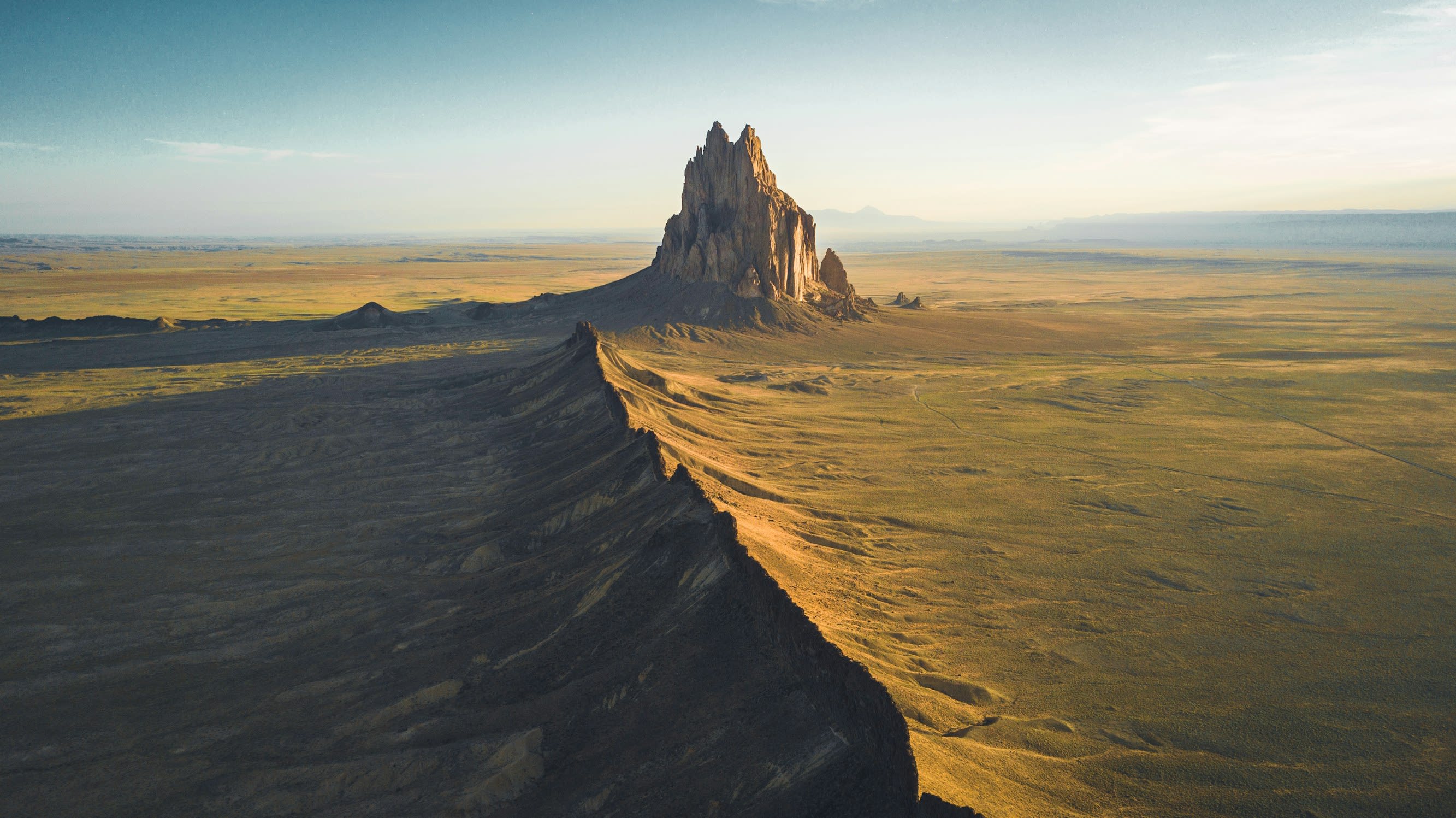
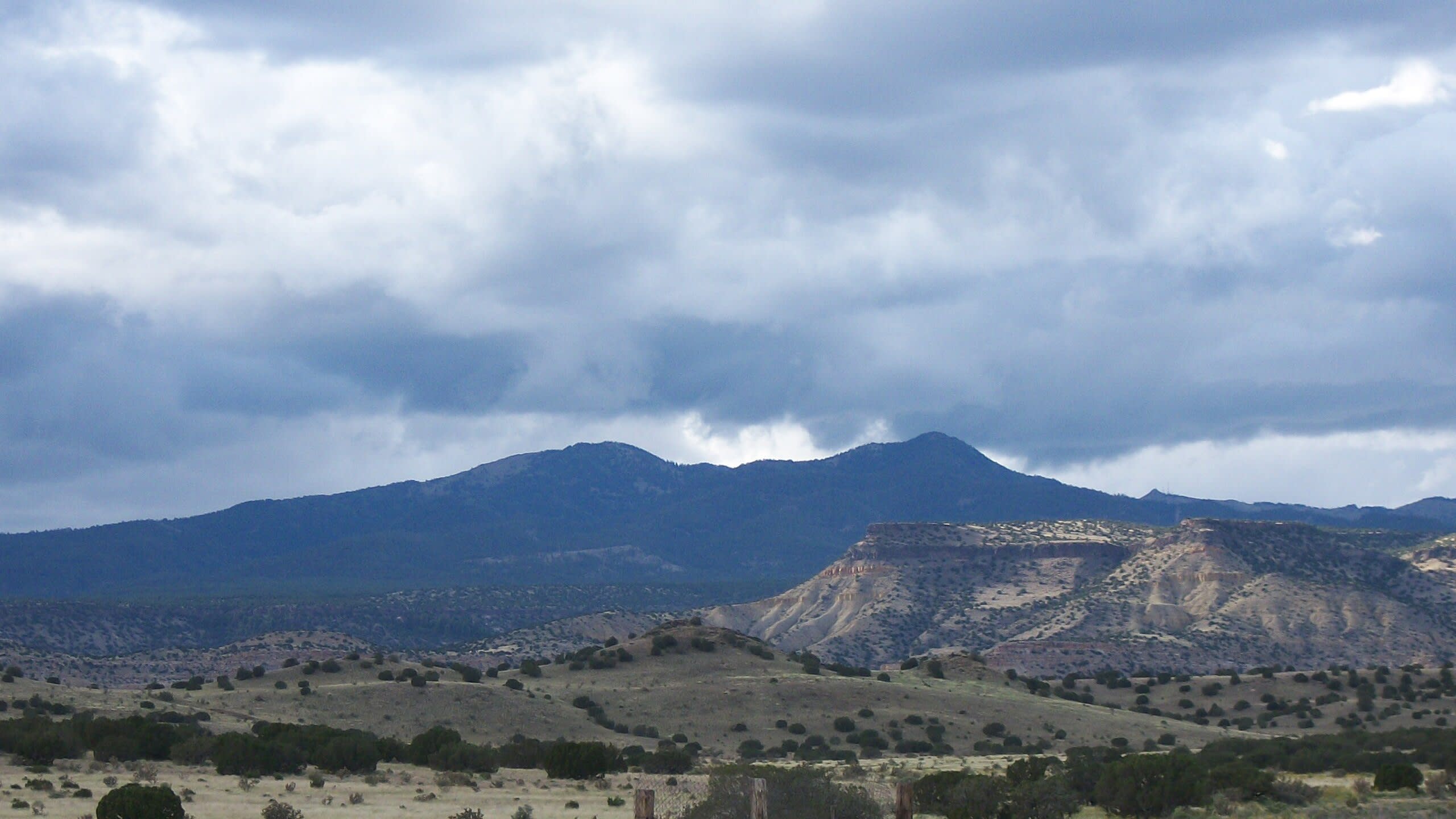
Shiprock, New Mexico
Shiprock, New Mexico, United States
Shiprock, New Mexico is a site of sacred significance. Approximate coordinates: 36.68769, -108.83812. Shiprock (Navajo: Naatʼáanii Nééz) is an unincorporated community on the Navajo reservation in San Juan County, New Mexico, United States. The population was 7,718 people in the 2020 census. For statistical purposes, the United States Census Bureau has defined Shiprock as a census-designated place (CDP). It is part of the Farmington Metropolitan Statistical Area. Shiprock is named after the nearby Shiprock rock formation. Since 1903, the town has been called Naat’áanii Nééz (meaning “tall leader” in the Navajo language) after the San Juan Indian Agency superintendent William T. Shelton who settled Shiprock for the United States government. Diné College is a local four-year college (formerly Navajo Community College), a tribally controlled community college with seven other campuses across the Navajo Nation. It is the site of a Chapter House for the Navajo, a Bureau of Indian Affairs agency and the Northern Navajo Medical Center (an Indian Health Service hospital). The town is a key road junction for truck traffic and tourists visiting the Four Corners, Mesa Verde, Shiprock and the Grand Canyon. It lies at the intersection of U.S. Route 64 and U.S. Route 491 (formerly U.S. Route 666). The annual Northern Navajo Fair is held every October. Since 1984, the community has hosted the Shiprock Marathon and Relay. Located in Shiprock Agency / Naatʼáanii Nééz Bił Hahoodzo biyiʼdi, Arizona, United States.
Truchas Peak, New Mexico
Mora County, New Mexico, United States
Truchas Peak, New Mexico is a site of sacred significance. Approximate coordinates: 35.96269, -105.64502. Located in New Mexico, United States.
Ute Mountain, New Mexico
Taos County, New Mexico, United States
Ute Mountain, New Mexico is a site of sacred significance. Approximate coordinates: 36.93748, -105.68393. Located in New Mexico, United States.
White Sands, New Mexico
Otero County, New Mexico, United States
White Sands, New Mexico is a site of sacred significance. Approximate coordinates: 32.77977, -106.33530. White Sands is a census-designated place (CDP) in Doña Ana County, New Mexico, United States. It consists of the main residential area on the White Sands Missile Range. As of the 2010 census the population of the CDP was 1,651. It is part of the Las Cruces Metropolitan Statistical Area. Located in New Mexico, United States.
Zuni Lake, New Mexico
Catron County, New Mexico, United States
Zuni Lake, New Mexico is a site of sacred significance. Approximate coordinates: 34.44826, -108.76808. Located in New Mexico, United States.
New York
5 sites
Balanced Rock
Town of North Salem, New York, United States
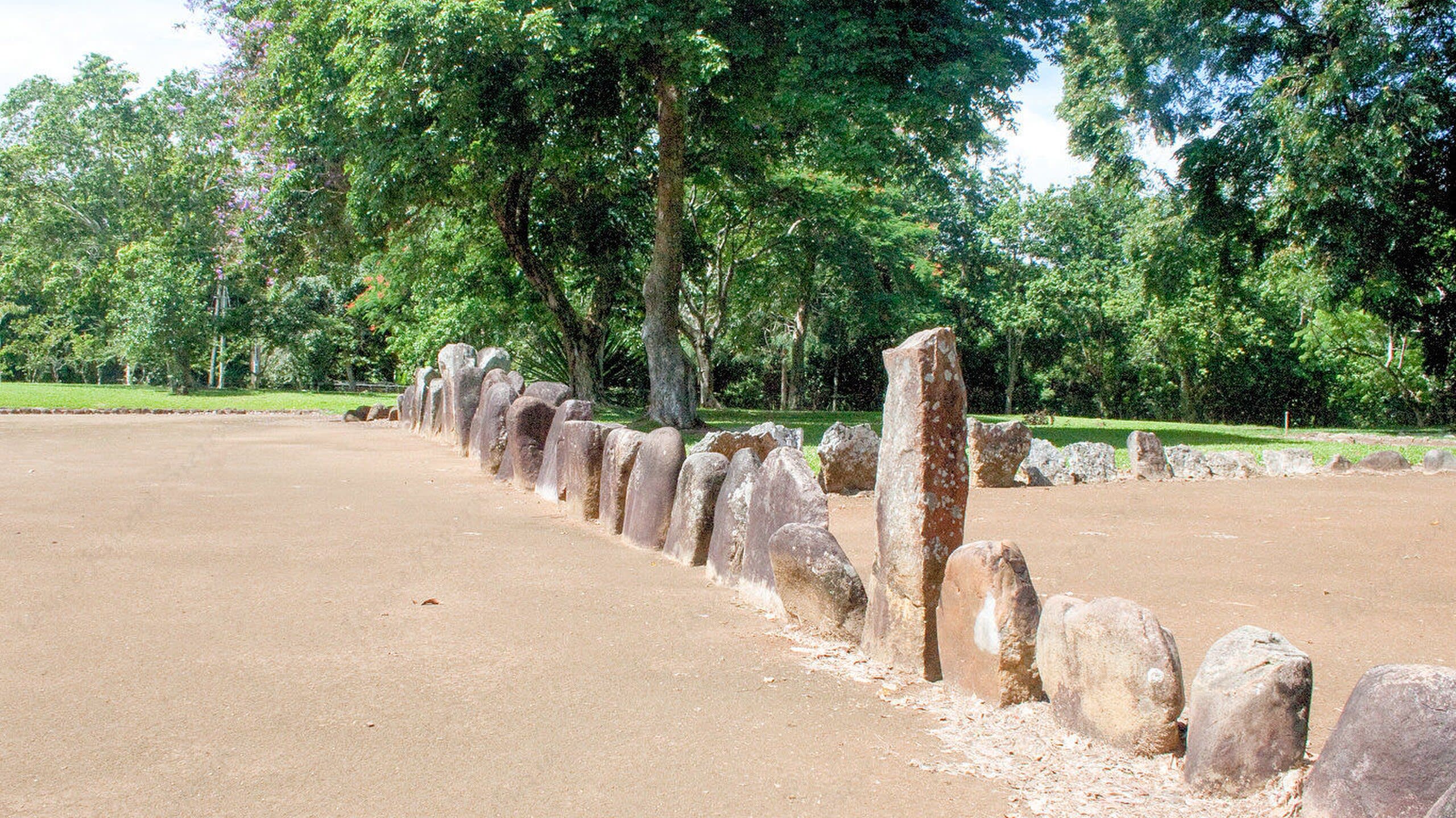
Balanced Rock is a rock formation of sacred significance. Approximate coordinates: 41.33404, -73.57153. Attributes: natural, cultural, ceremonial. Balanced Rock is one of the most popular features of Arches National Park, situated in Grand County, Utah, United States. Balanced Rock is located next to the park s main road, at about 9.2 miles (14.8 km) from the park entrance. It is one of only a few prominent features clearly visible from the road. The total height of Balanced Rock is 128 feet (39 m), with the balancing rock rising 55 feet (16.75 m) above the base. This rock is the largest of its kind in the park, weighing approximately 3,577 tons. Located in Town of North Salem, New York, United States.
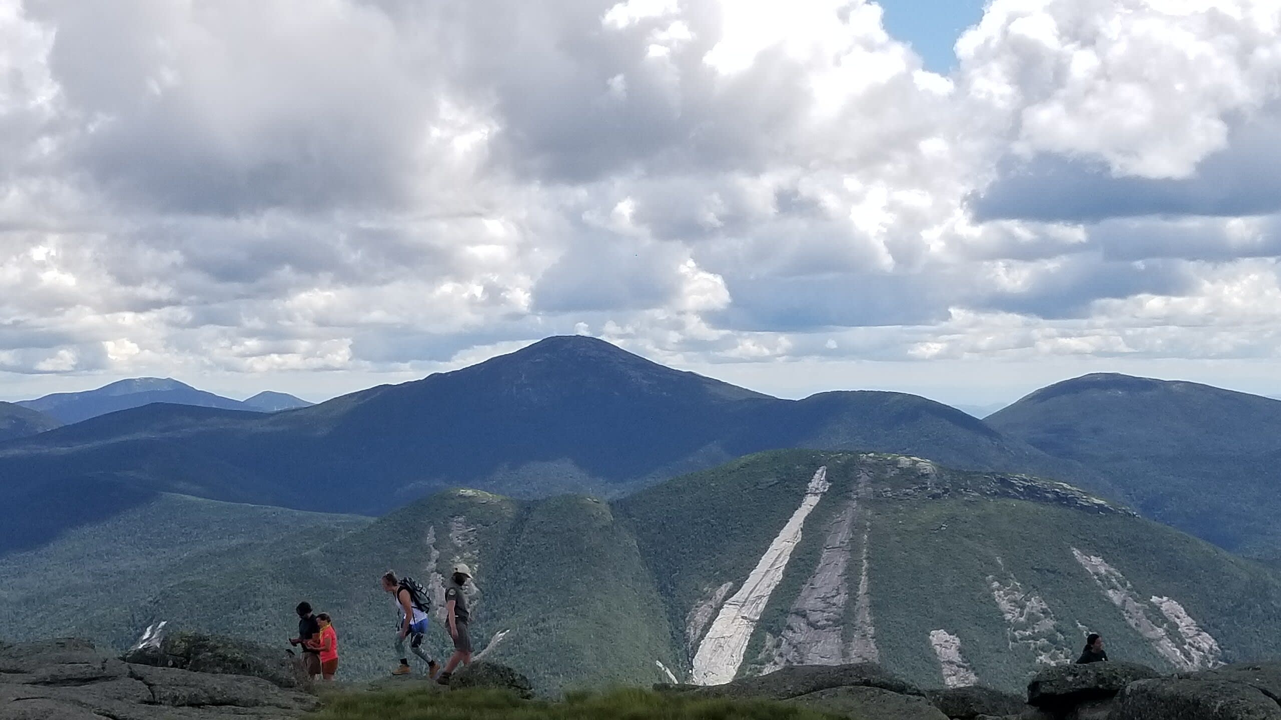
Mt. Marcy, New York
Town of Keene, New York, United States
Mt. Marcy, New York is a site of sacred significance. Approximate coordinates: 44.11255, -73.92348. Located in Town of Keene, New York, United States.
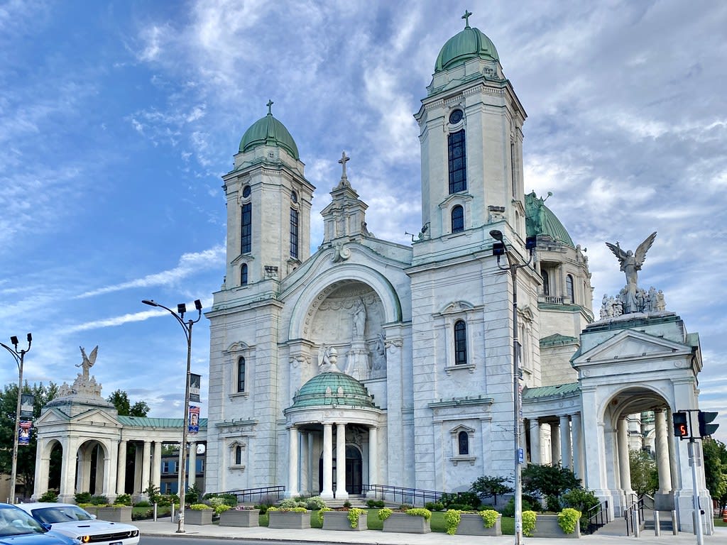
Our Lady of Victory Basilica, Lackawanna, New York
City of Lackawanna, New York, United States
Our Lady of Victory Basilica, Lackawanna, New York is a site of sacred significance. Approximate coordinates: 42.82521, -78.82361. Located in City of Lackawanna, New York, United States.
Shrine of Our Lady of the Island, Long Island, New York
Town of Brookhaven, New York, United States
Shrine of Our Lady of the Island, Long Island, New York is a site of sacred significance. Approximate coordinates: 40.84949, -72.75699. Located in Town of Brookhaven, New York, United States.
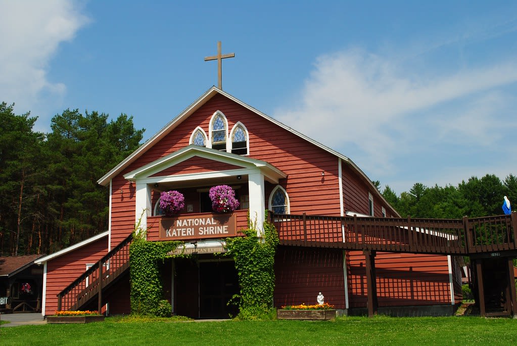
Shrine of Saint Kateri Tekakwitha, Fonda, New York
Village of Fonda, New York, United States
Shrine of Saint Kateri Tekakwitha, Fonda, New York is a site of sacred significance. Approximate coordinates: 42.95011, -74.39277. Located in Town of Mohawk, New York, United States.
North Carolina
2 sites
Mt. Richland-Balsam, North Carolina
Near Waynesville, North Carolina, United States
Mt. Richland-Balsam, North Carolina is a site of sacred significance. Approximate coordinates: 35.36732, -82.99041. Located in North Carolina, United States.
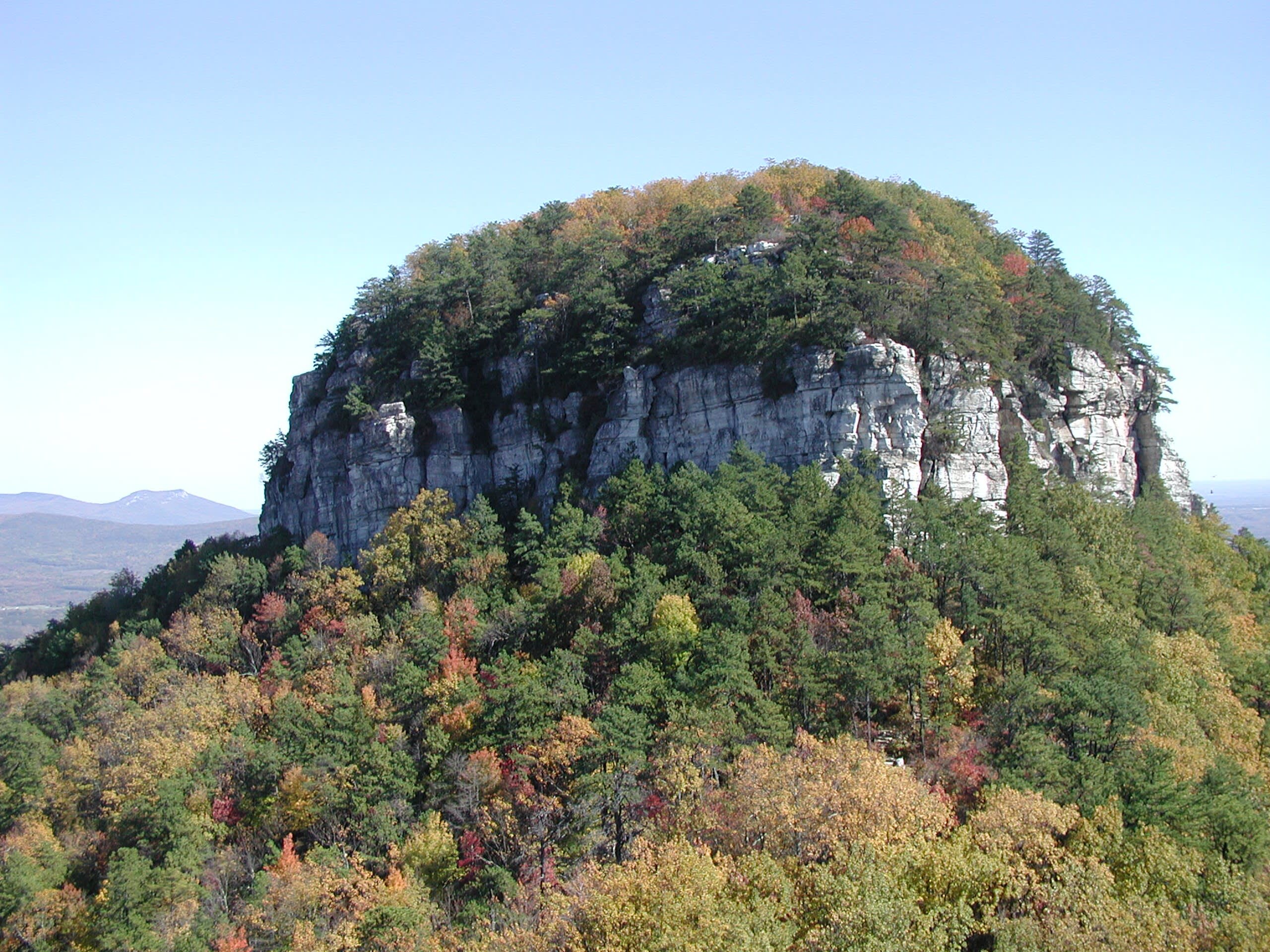
Pilot Mountain, North Carolina
Pinnacle, North Carolina, United States
Pilot Mountain, North Carolina is a site of sacred significance. Approximate coordinates: 36.34012, -80.47496. Located in North Carolina, United States.
Ohio
4 sites
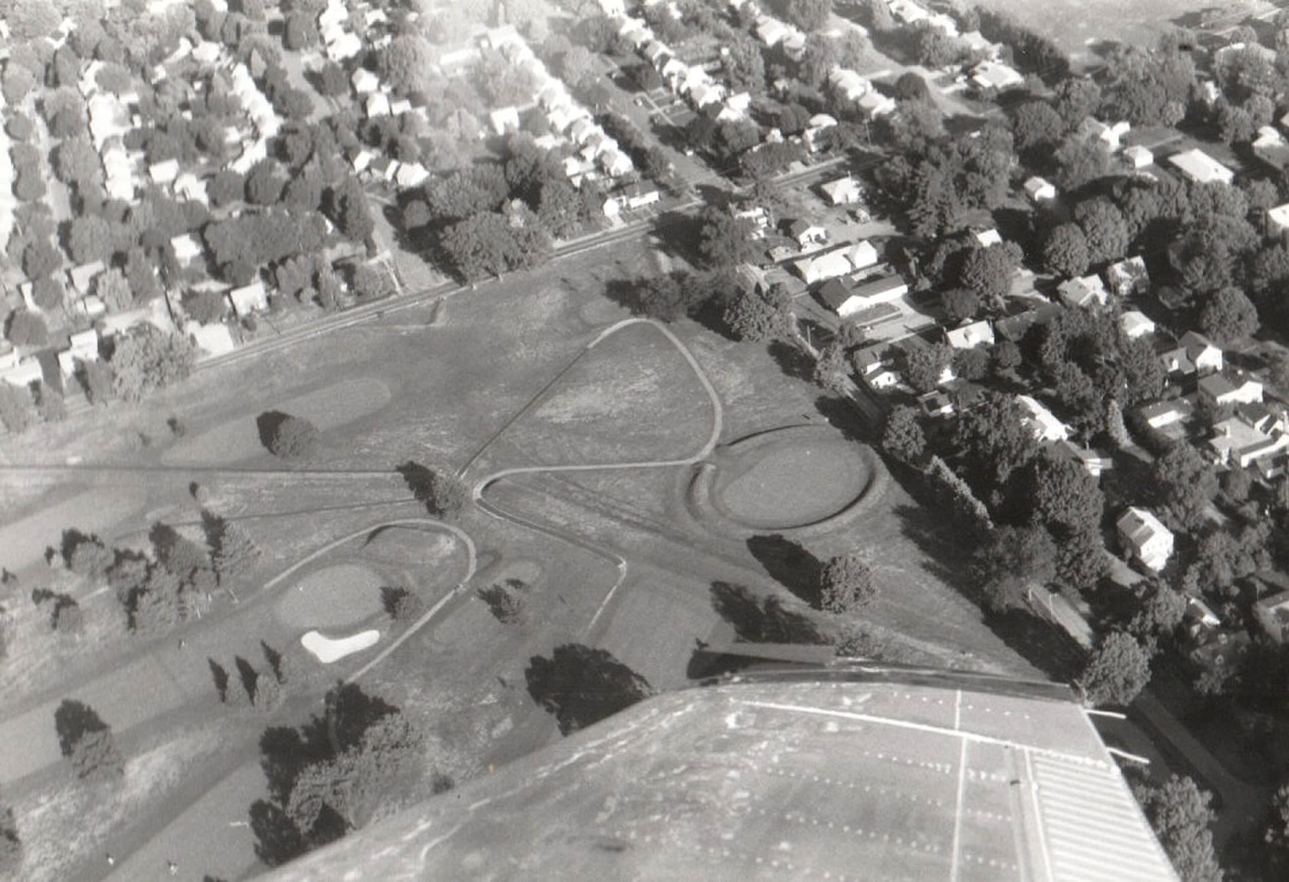
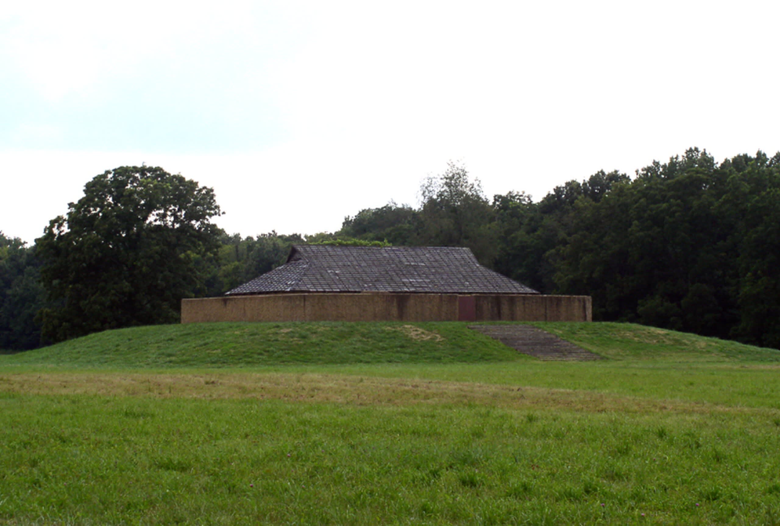
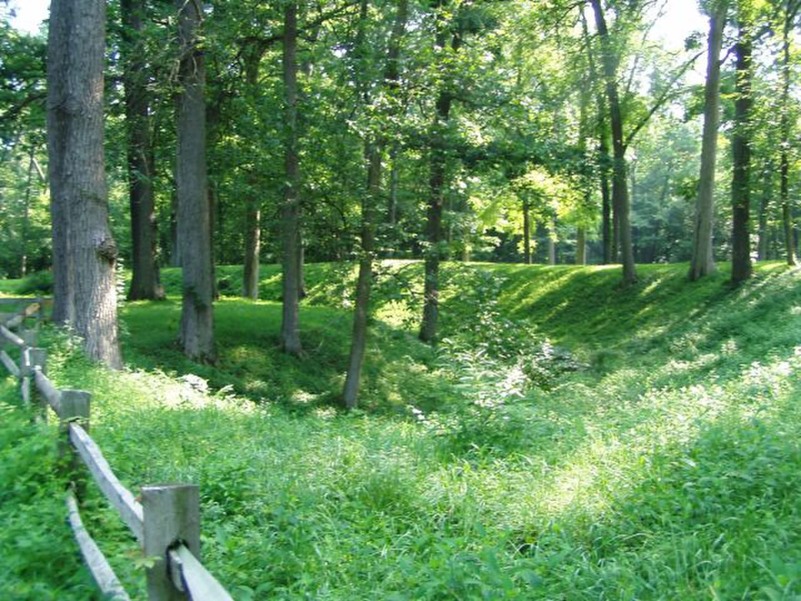
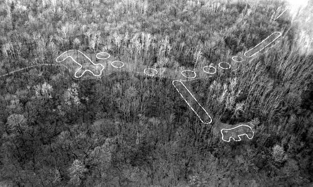
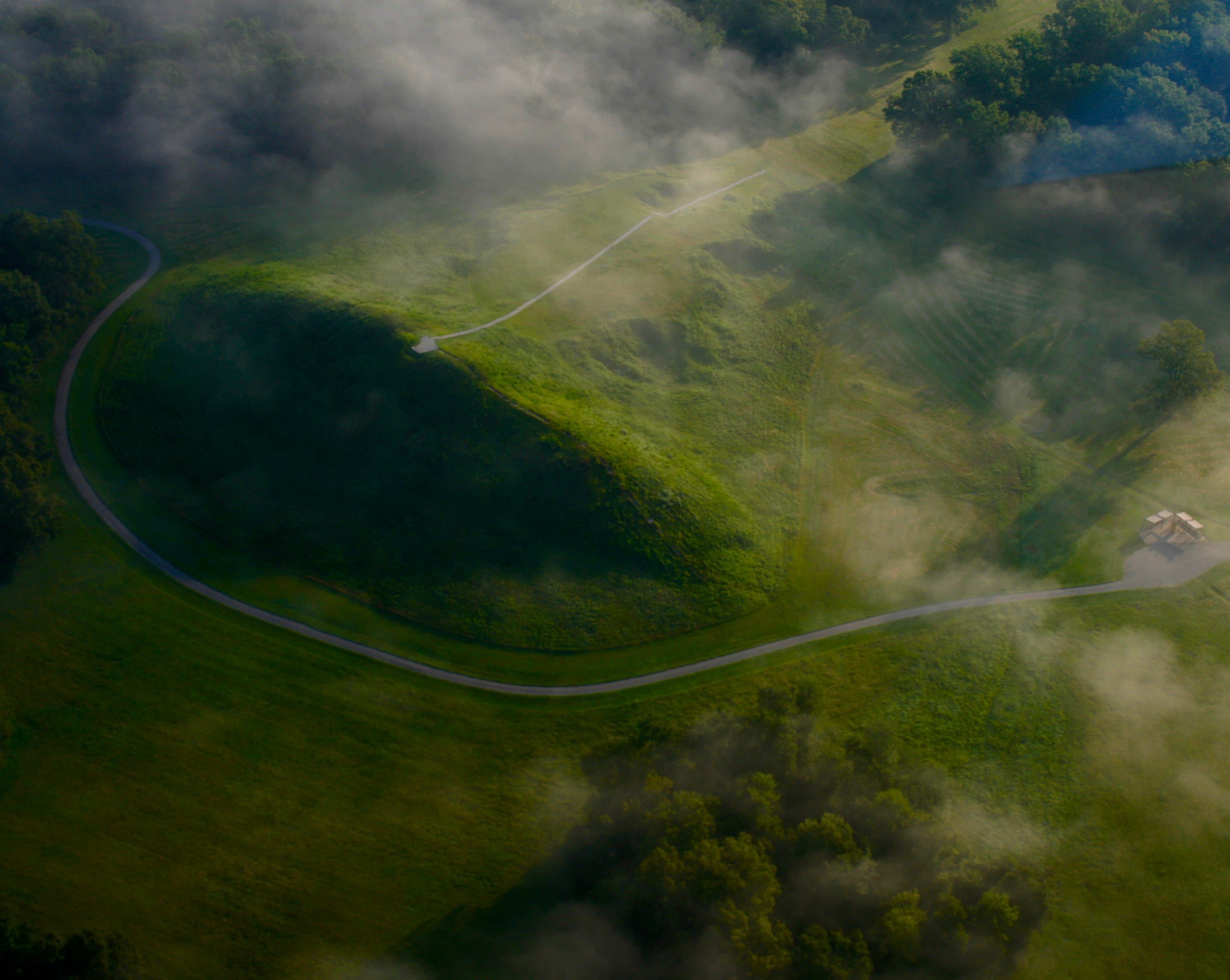
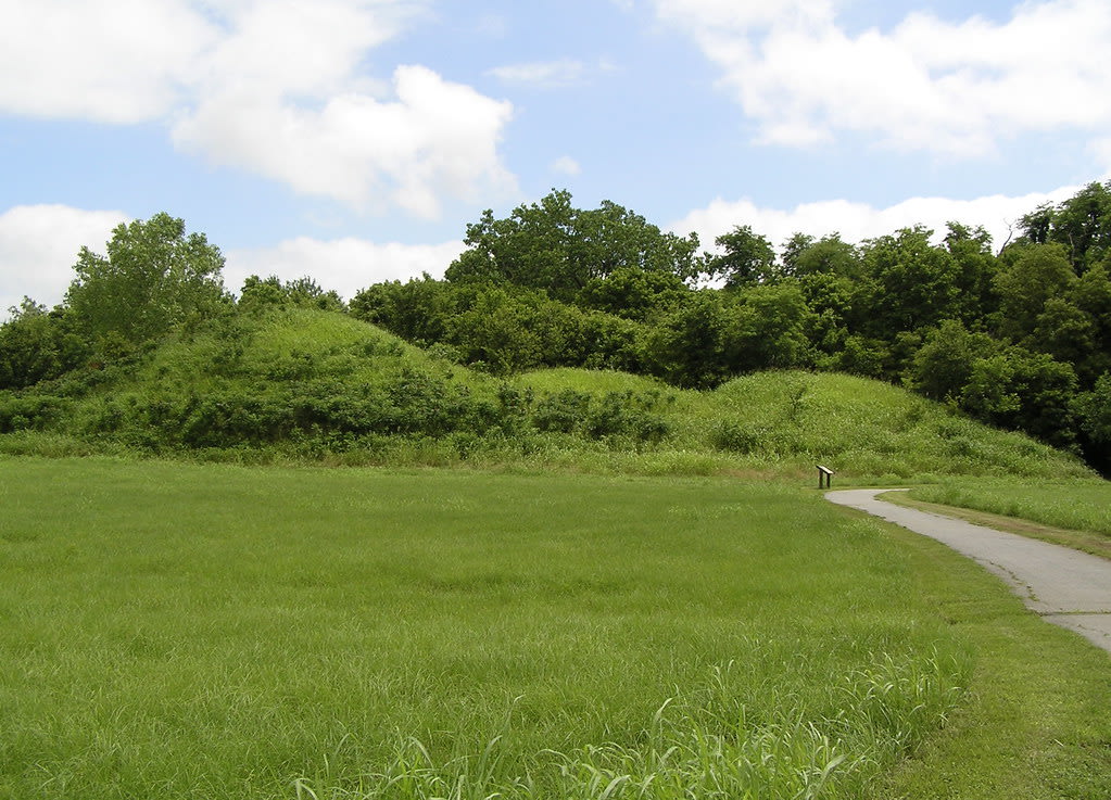
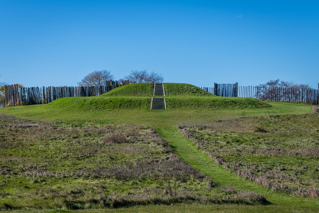
Hopewell Ceremonial Earthworks
Newark, Ohio, United States
The Hopewell Ceremonial Earthworks rise from Ohio's rolling landscape as monuments to a 2,000-year-old vision. Massive geometric enclosures—circles, octagons, squares—were built by dispersed communities who gathered to mark cosmic events and honor the dead. The Octagon aligns with the moon's 18.6-year cycle. The Great Circle spans thirty acres. In 2023, UNESCO recognized what Indigenous peoples have always known: this land was sacred, is sacred, will always be sacred.
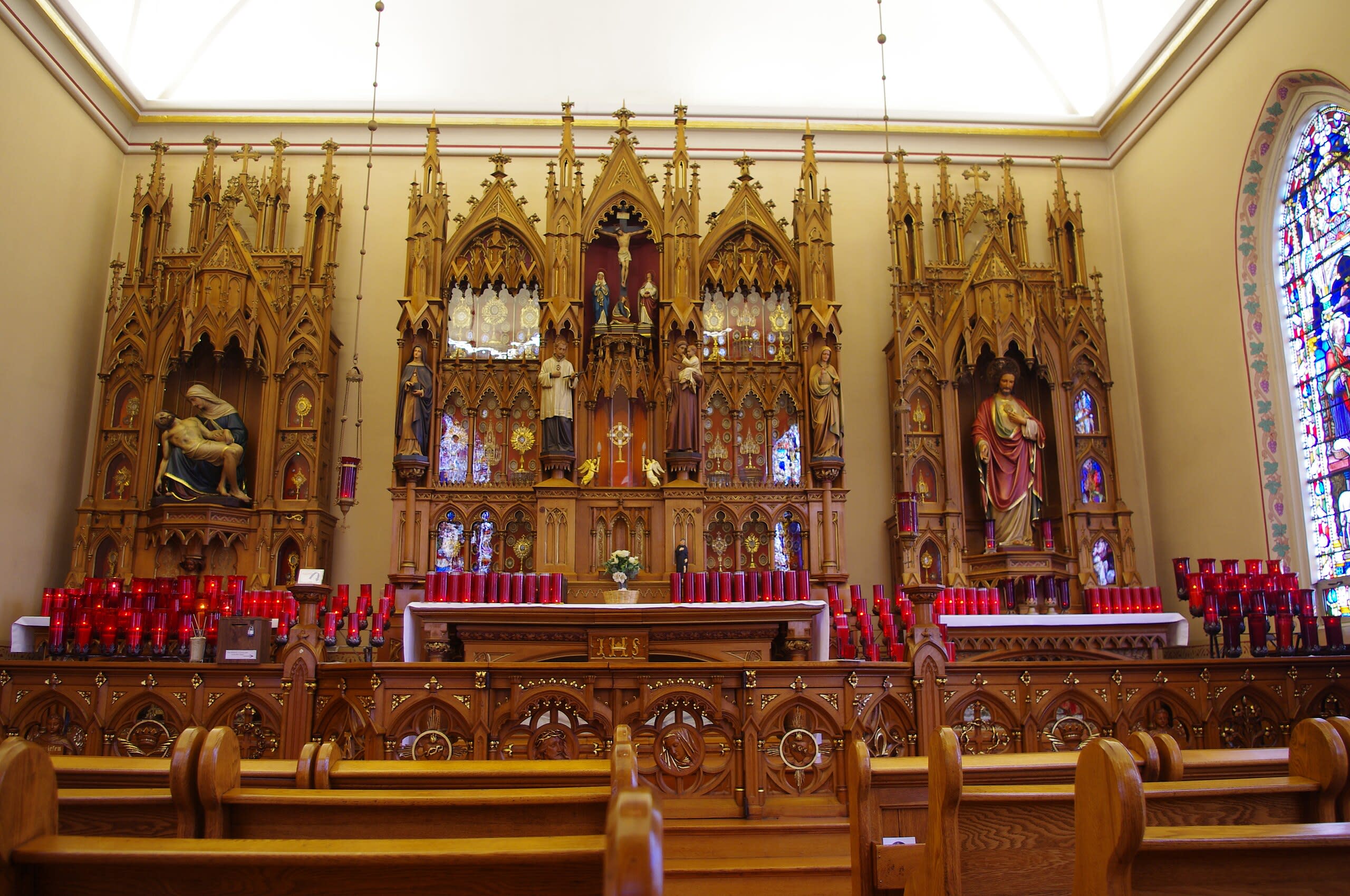
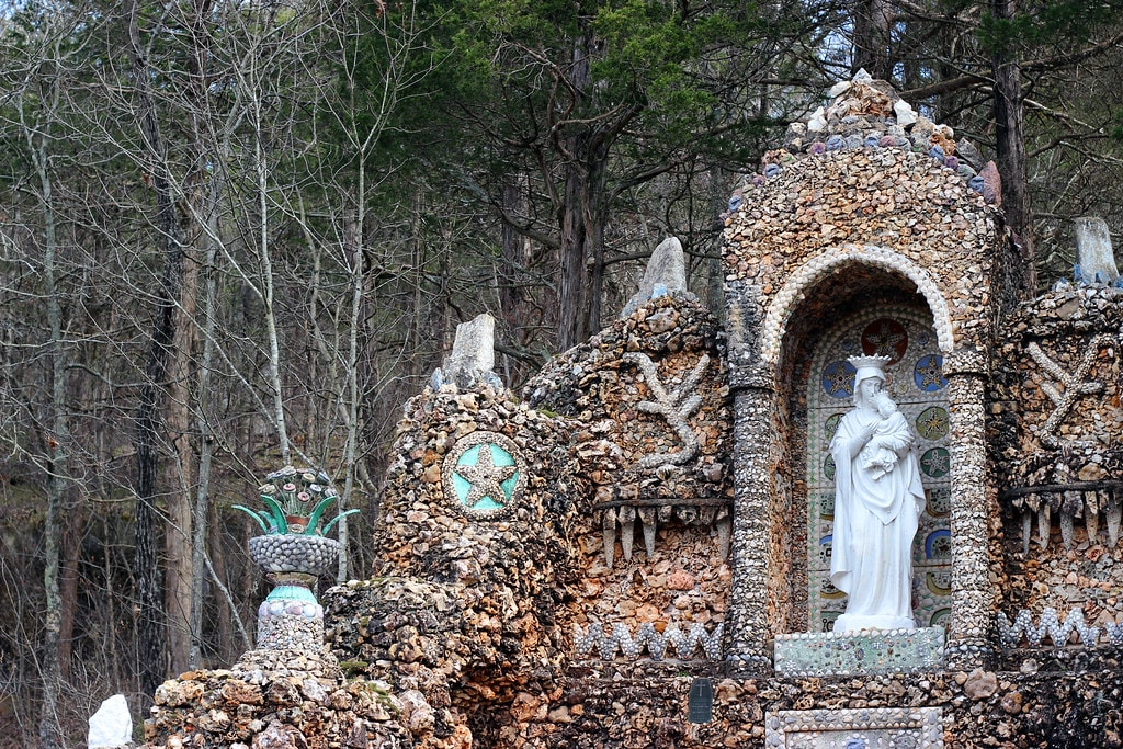
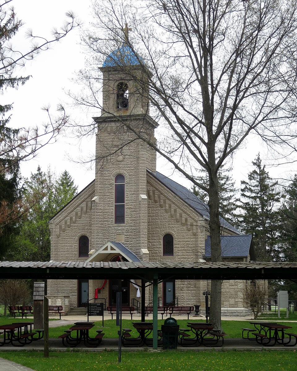
Maria Stein Shrine of the Holy Relics
Maria Stein, Ohio, United States
In rural western Ohio, surrounded by farmland and the steeples of over thirty cross-tipped churches, the Maria Stein Shrine of the Holy Relics holds one of the largest collections of authenticated sacred relics in the United States. More than 1,200 relics rest here, ninety-five percent authenticated by the Vatican as first-class, including five fragments of the True Cross and the wax-coated body of St. Victoria. An inscription above the Relic Chapel door reads: 'Enter devoutly, O Pilgrim, for no place is holier than this on the New Continent.'
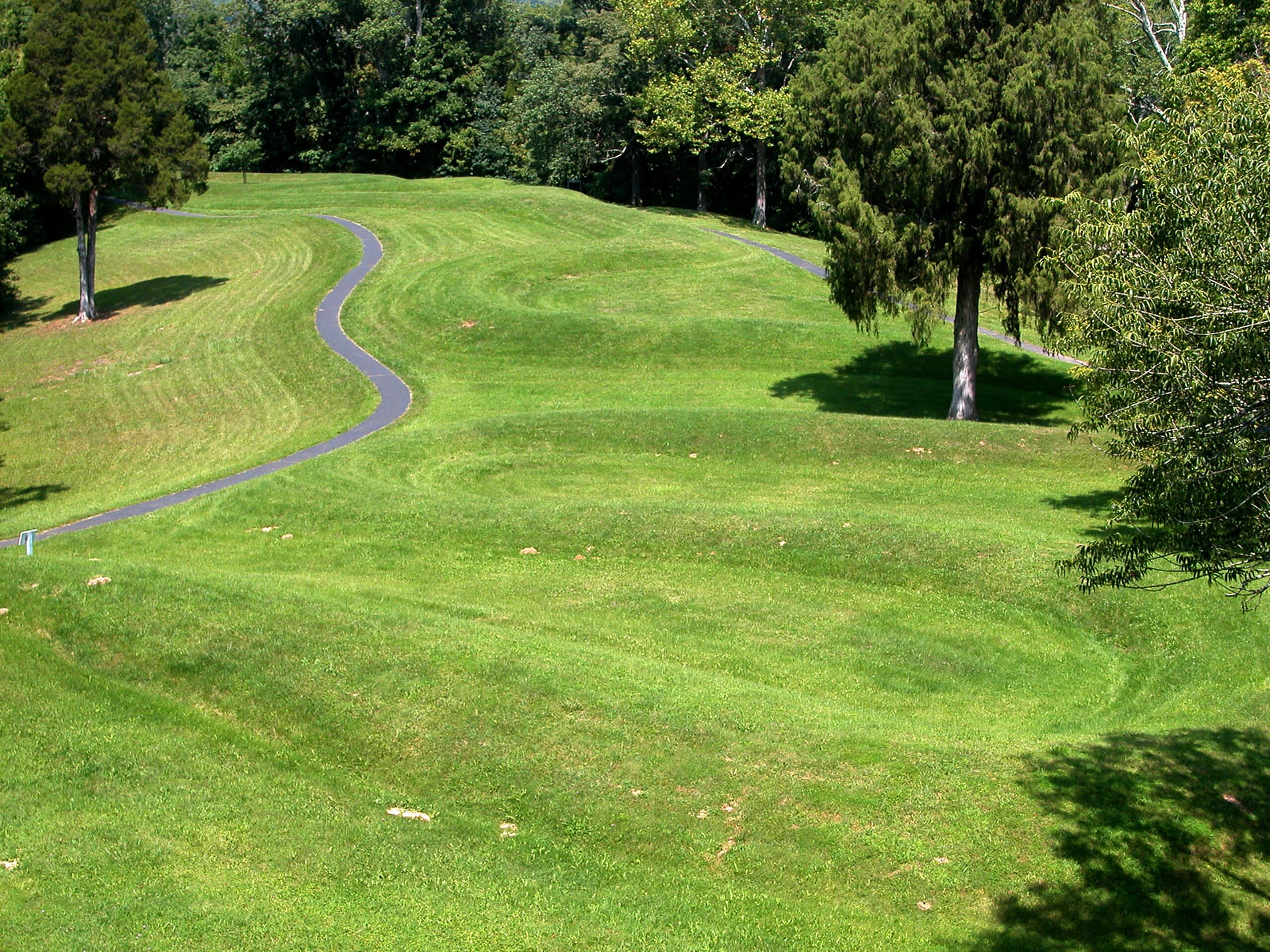
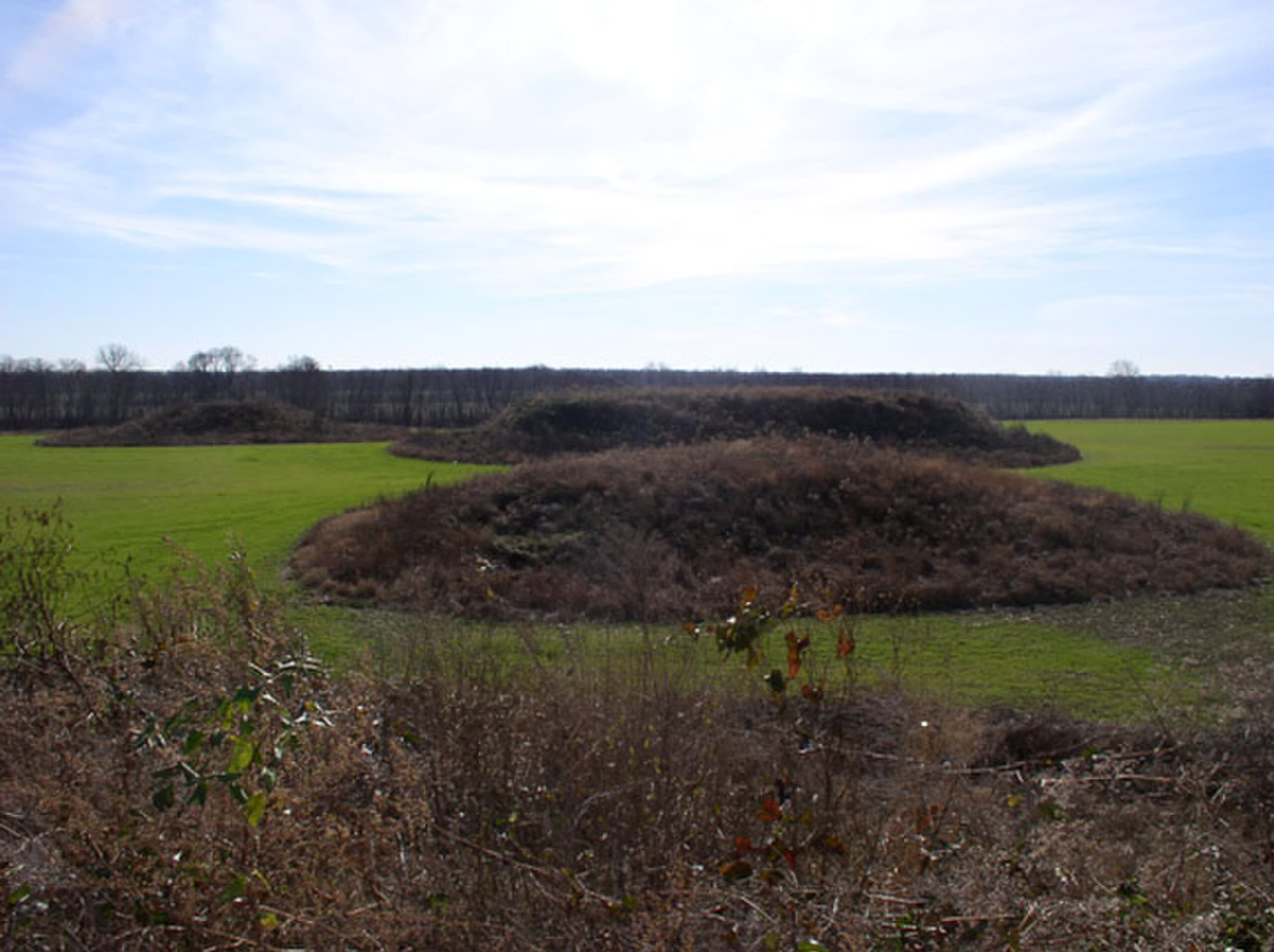
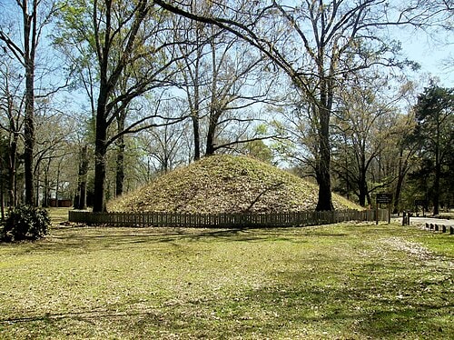
Serpent Mound, Peebles, Ohio
Bratton Township, Ohio, United States
Serpent Mound, Peebles, Ohio is a site of sacred significance. Approximate coordinates: 39.02524, -83.43020. Located in Bratton Township, Ohio, United States.
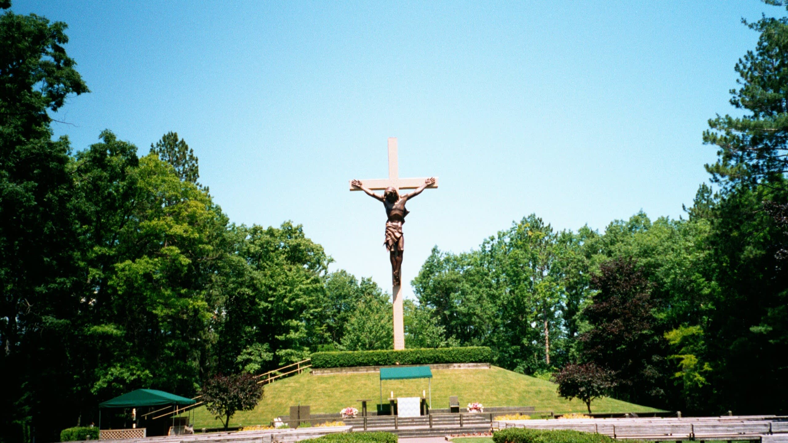
The Sorrowful Mother Shrine
Bellevue, Ohio, United States
The Sorrowful Mother Shrine, Bellevue, Ohio is a site of sacred significance. Approximate coordinates: 41.18400, -82.84234. Located in Thompson Township, Ohio, United States.
Oklahoma
2 sites
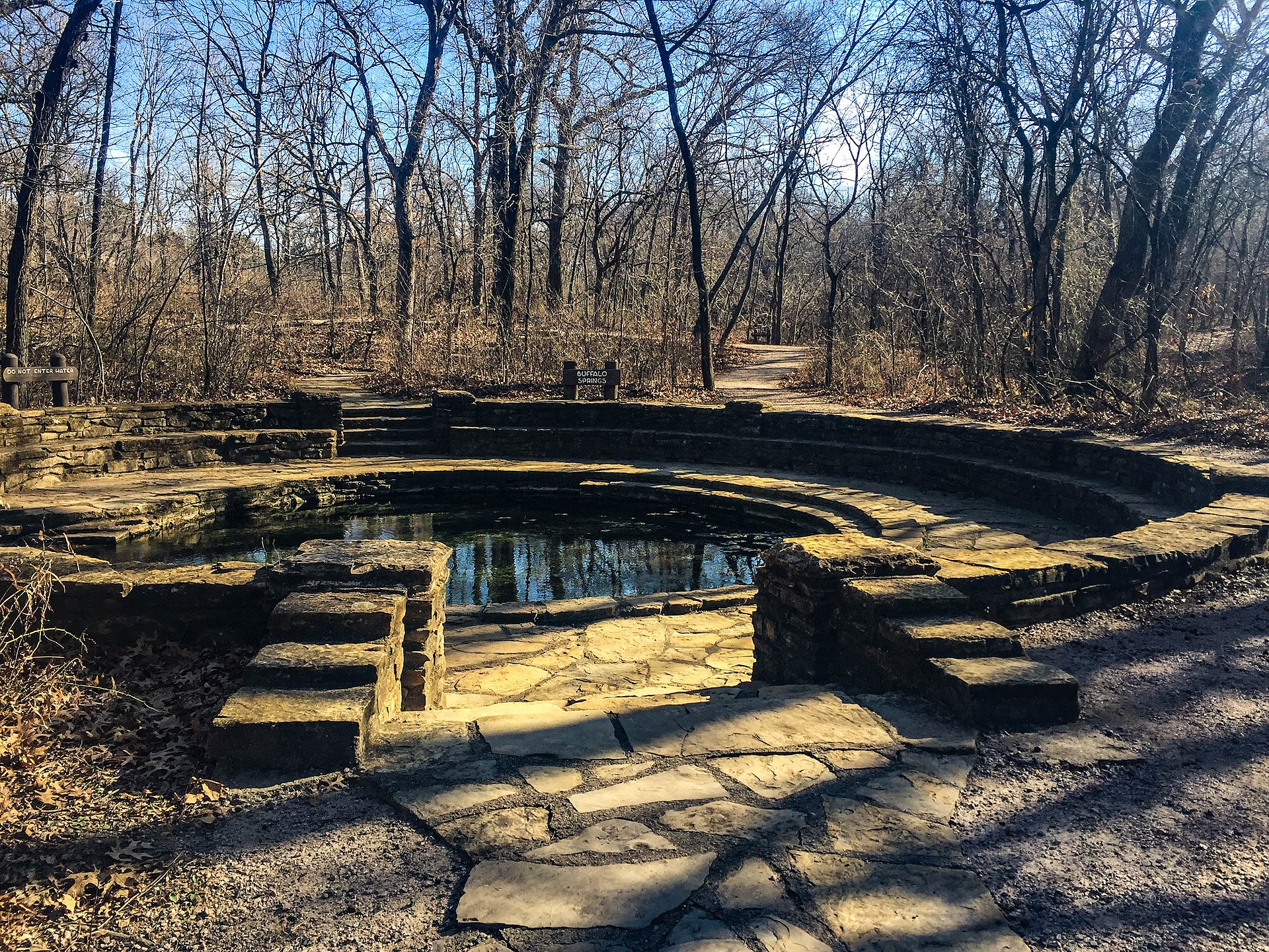
Antelope and Buffalo Springs (Chickasaw National Recreation Area)
Sulphur, Oklahoma, United States
Antelope and Buffalo Springs, Sulphur, Oklahoma is a spring of sacred significance. Approximate coordinates: 34.50265, -96.93928. Attributes: natural, cultural. Located in Oklahoma, United States.
Spiro Mounds State Park
Spiro, Oklahoma, United States
Spiro Mounds State Park is a site of sacred significance. Approximate coordinates: 35.31172, -94.56843. Located in Fort Coffee, Oklahoma, United States.
Oregon
4 sites
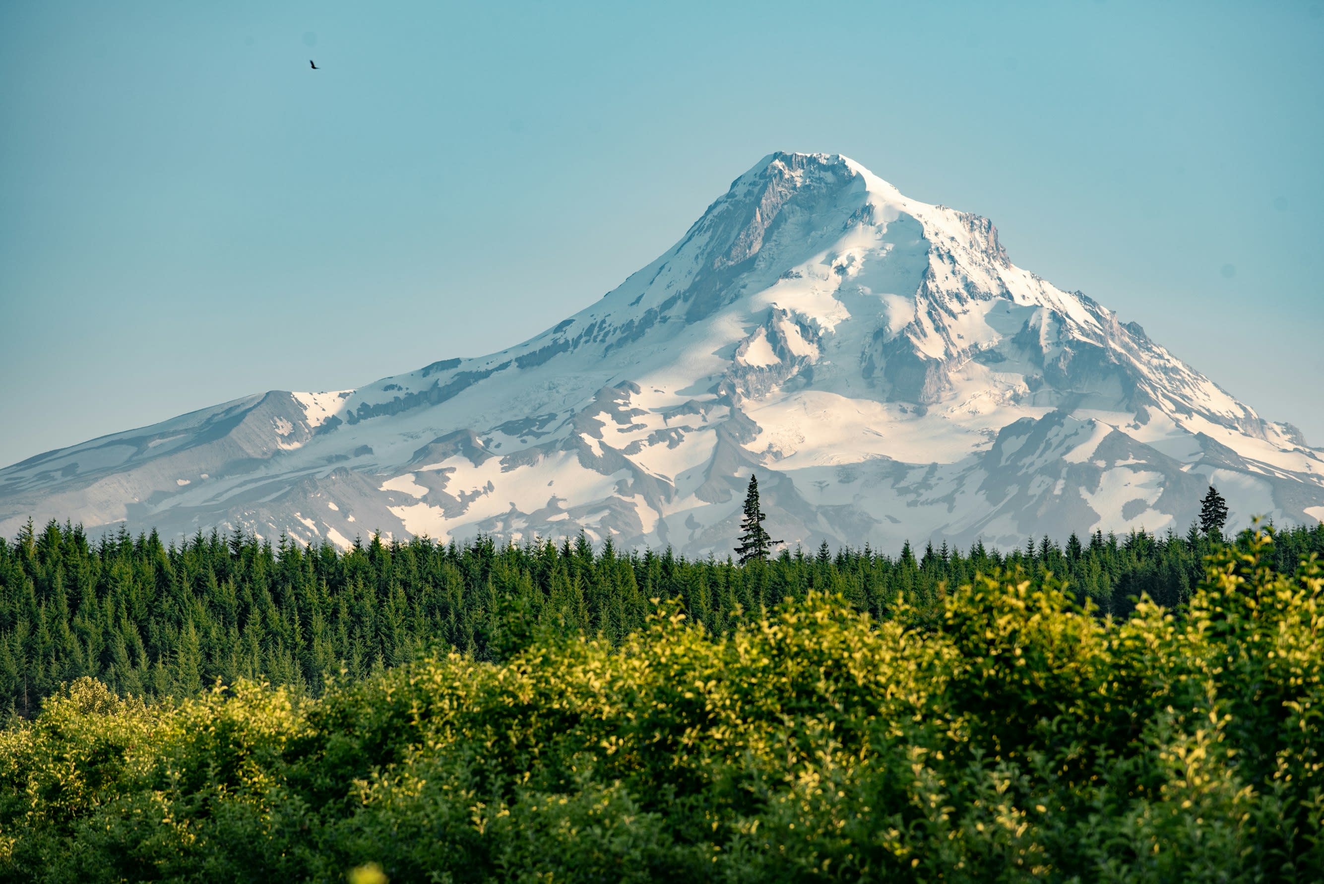
Mt. Hood, Oregon
Government Camp, Oregon, United States
Mt. Hood, Oregon is a site of sacred significance. Approximate coordinates: 45.37362, -121.69595. Located in Oregon, United States.
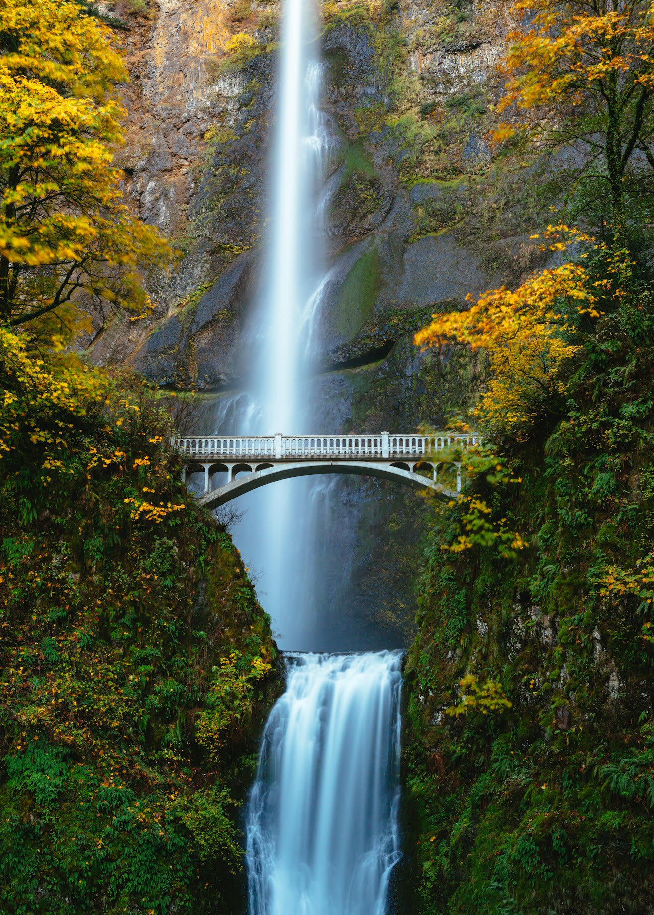
Multnomah Falls, Oregon
Corbett, Oregon, United States
Multnomah Falls, Oregon is a site of sacred significance. Approximate coordinates: 45.57616, -122.11578. Located in Oregon, United States.
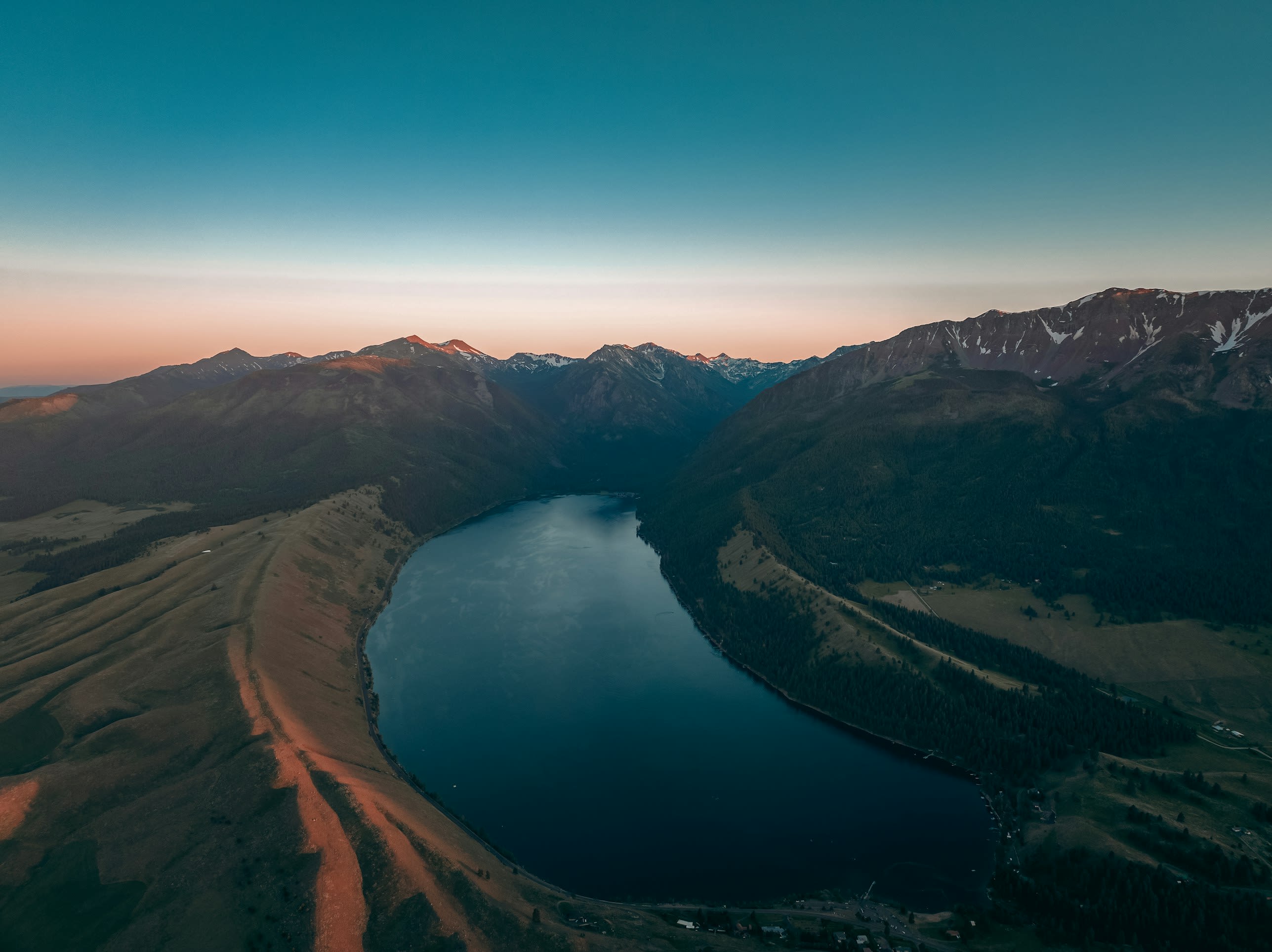
Wallowa Lake, Oregon
Joseph, Oregon, United States
Wallowa Lake, Oregon is a site of sacred significance. Approximate coordinates: 45.31256, -117.20695. Wallowa Lake is a census-designated place (CDP) and unincorporated community in Wallowa County, Oregon, United States. It is located on the south end of Wallowa Lake, and is a small community made up of vacation homes, lodging, restaurants, as well as other small businesses. Located in Oregon, United States.
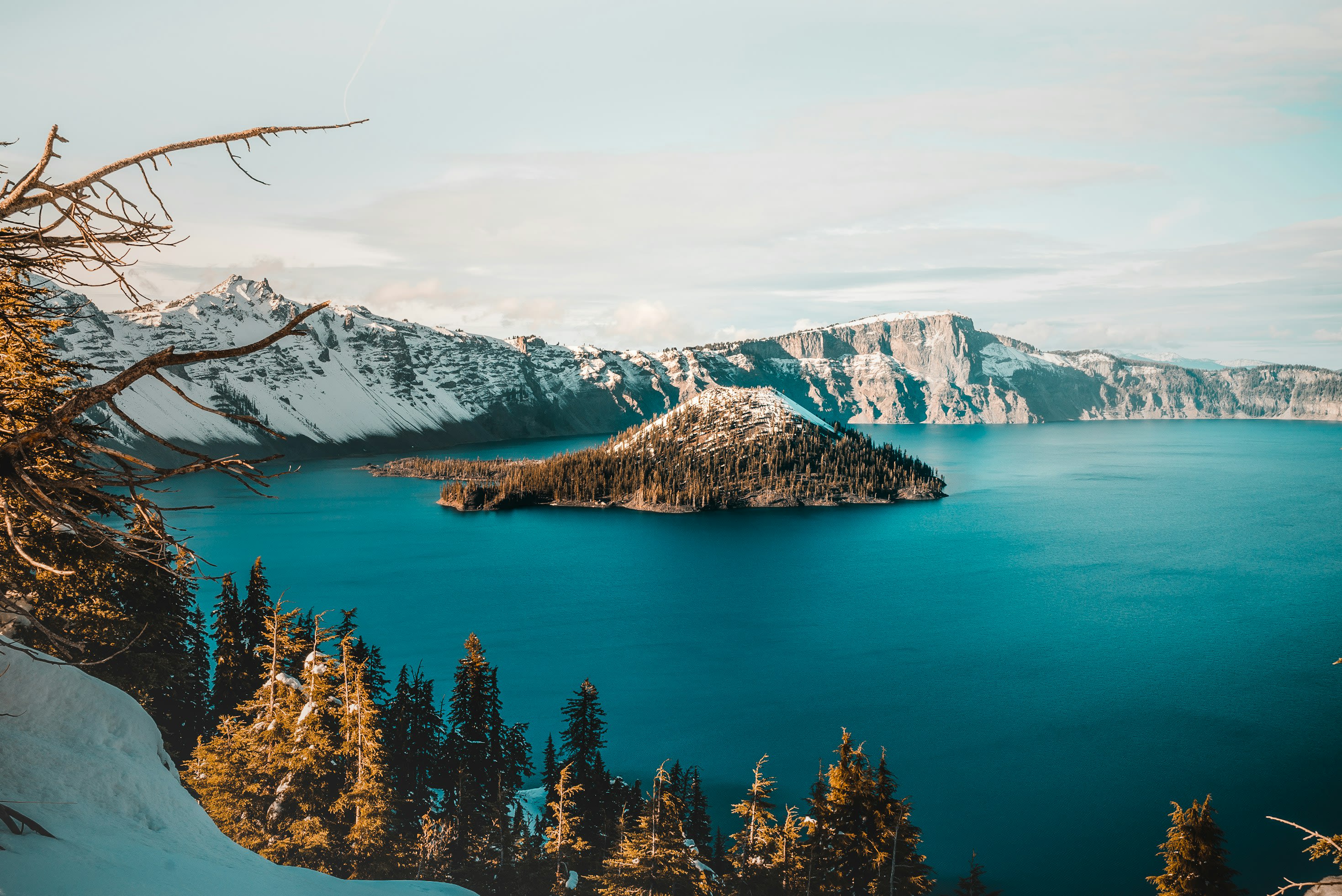
Wizard Island, Crater Lake, Oregon
Klamath County, Oregon, United States
Wizard Island, Crater Lake, Oregon is a site of sacred significance. Approximate coordinates: 42.94009, -122.14703. Located in Oregon, United States.
Pennsylvania
1 sites
Puerto Rico
1 sites
Santa Barbara County
1 sites
South Dakota
3 sites
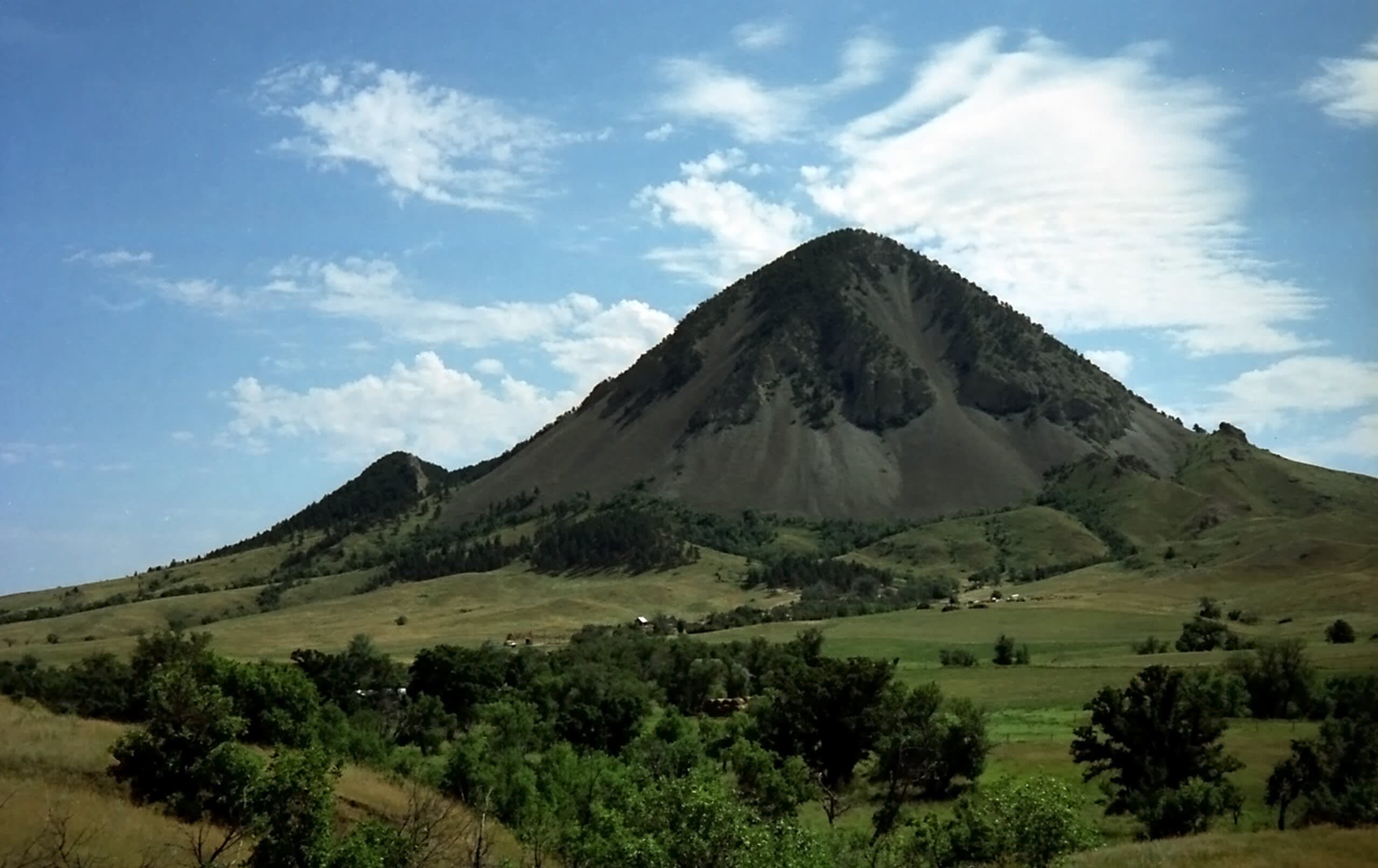
Bear Butte, South Dakota
Sturgis, South Dakota, United States
Bear Butte, South Dakota is a mountain of sacred significance. Approximate coordinates: 44.47446, -103.42323. Attributes: natural, cultural. Located in South Dakota, United States.
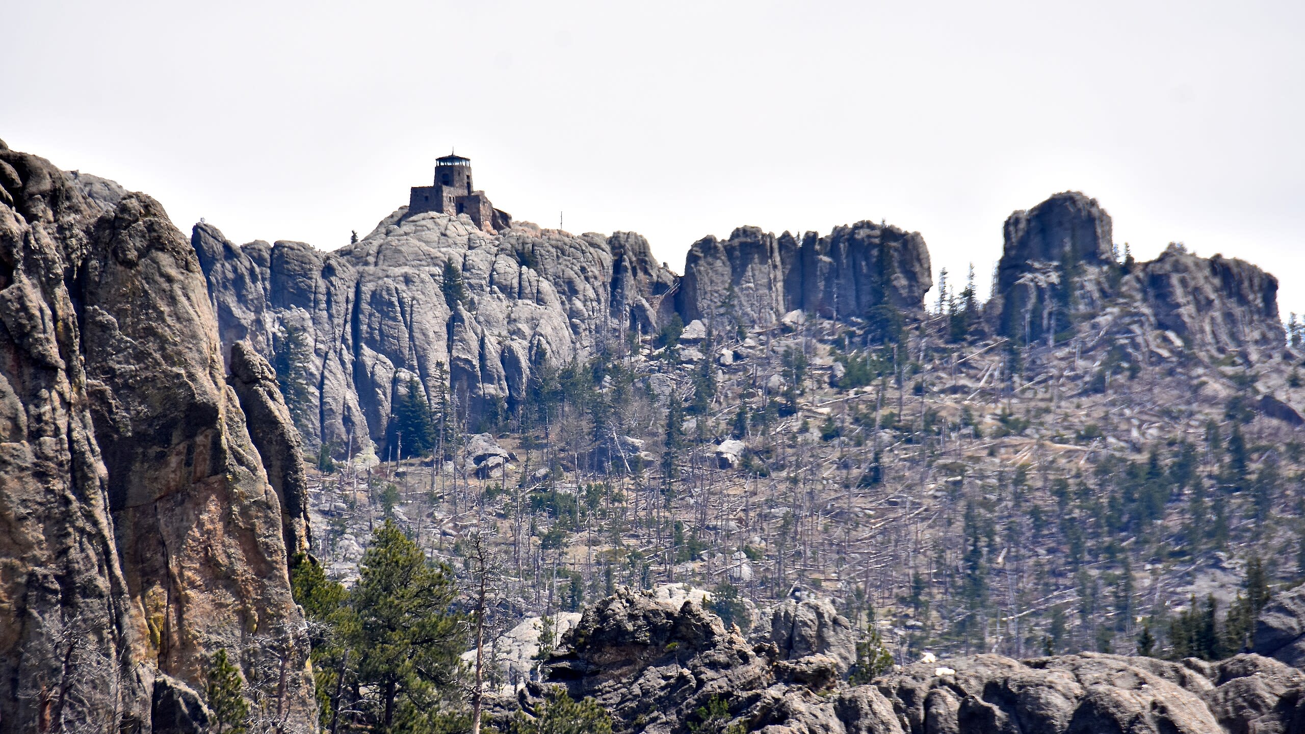
Black Elk Peak, South Dakota
Custer, South Dakota, United States
Harney Peak, South Dakota is a mountain of sacred significance. Approximate coordinates: 43.86647, -103.53181. Attributes: natural, cultural, ceremonial. Tradition: Sioux Native American. Associated figure: Black Elk. Mythological context: Black Elk's Great Vision. Located in South Dakota, United States.
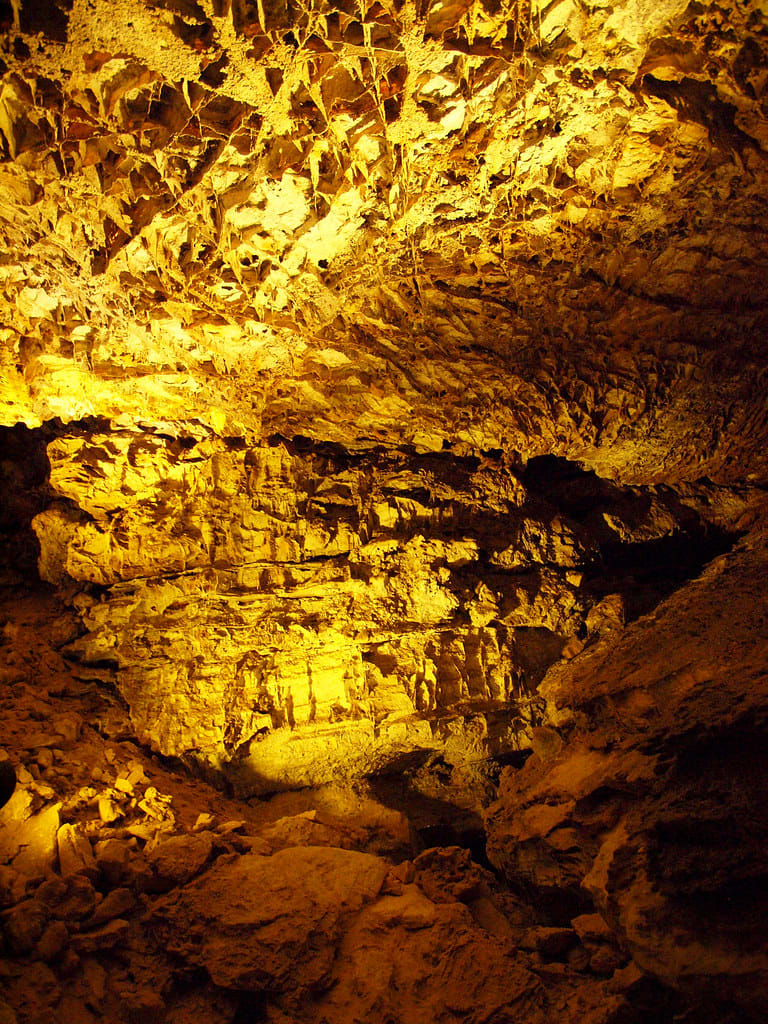
Wind Cave, South Dakota
Hot Springs, South Dakota, United States
Wind Cave, South Dakota is a site of sacred significance. Approximate coordinates: 43.58698, -103.44074. Located in South Dakota, United States.
Texas
3 sites
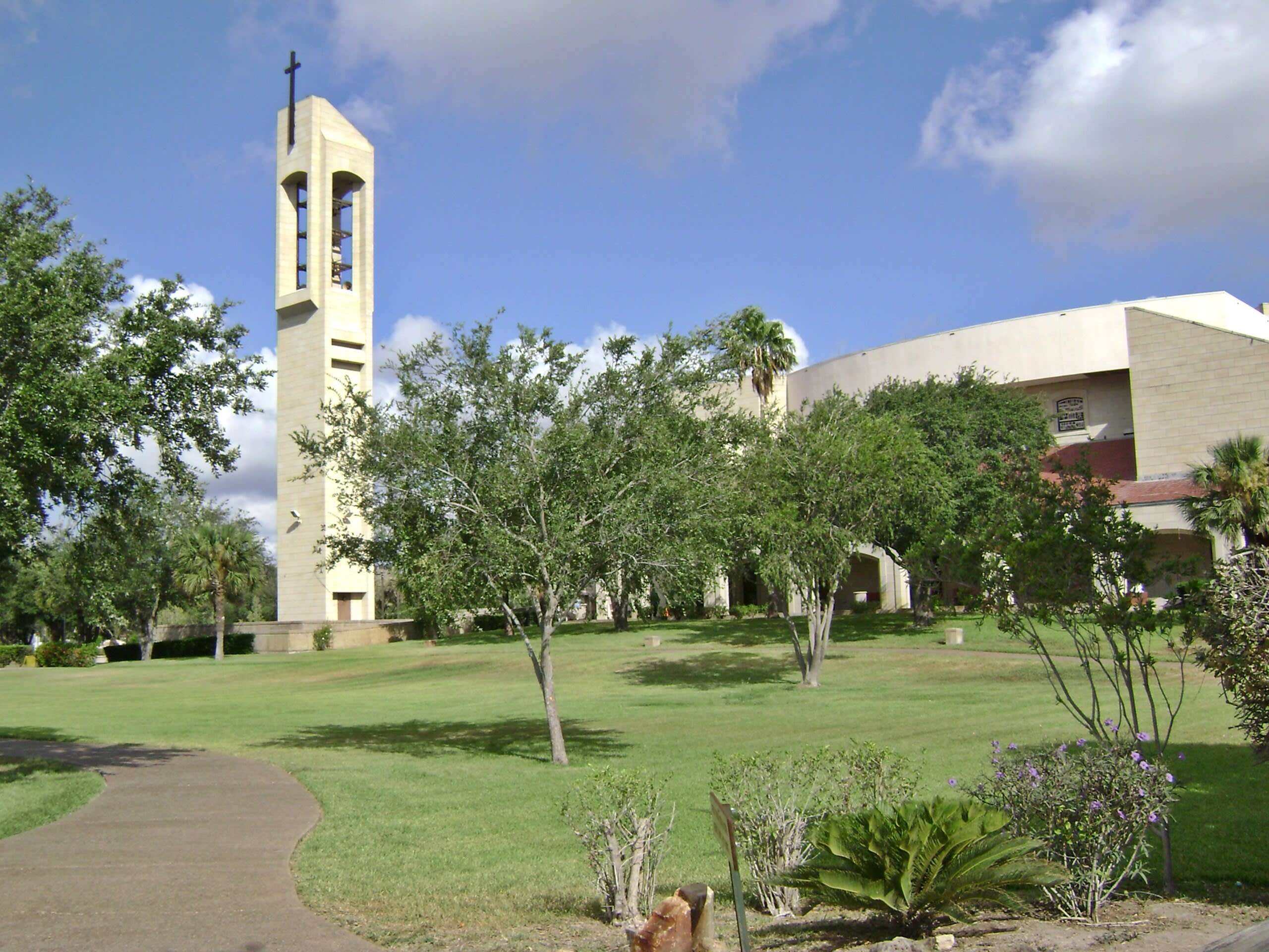
Basilica of Our Lady of San Juan del Valle, San Juan, Texas
San Juan, Texas, United States
Basilica of Our Lady of San Juan del Valle, San Juan, Texas is a basilica of sacred significance. Approximate coordinates: 26.19864, -98.15759. Attributes: built, cultural, pilgrimage. Tradition: Christianity. Associated figure: Our Lady of San Juan del Valle. Located in San Juan, Texas, United States.
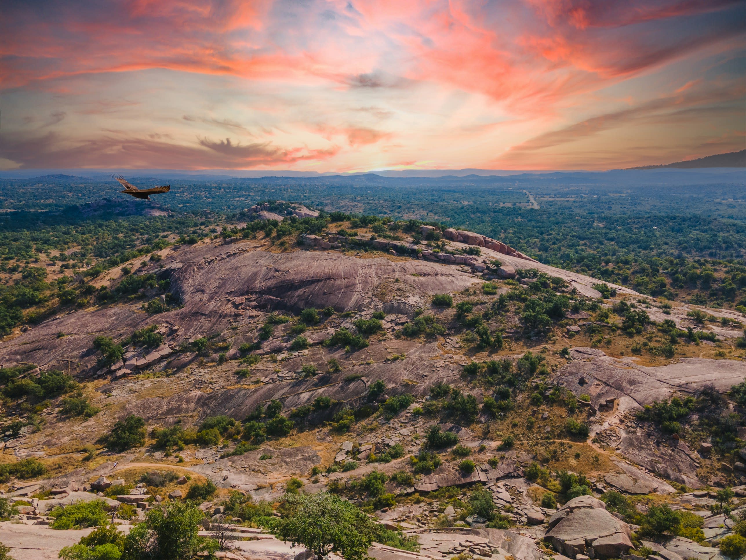
Enchanted Rock, Texas
Fredericksburg, Texas, United States
Enchanted Rock, Texas is a natural of sacred significance. Approximate coordinates: 30.50696, -98.81722. Attributes: natural, cultural. Tradition: Native American. Mythological context: Tonkawa, Apache and Comanche folklore. Located in Texas, United States.
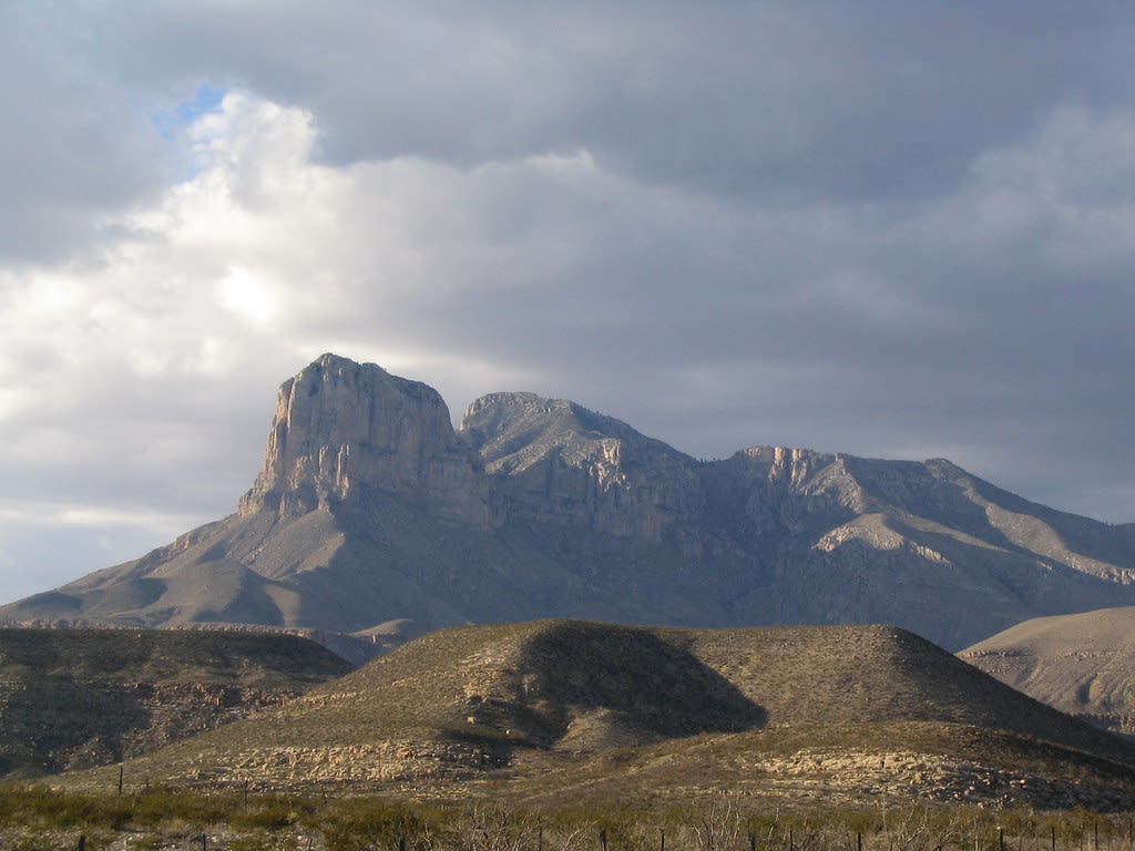
Guadalupe Peak, Texas
Salt Flat, Texas, United States
Guadalupe Peak, Texas is a sacred mountain of sacred significance. Approximate coordinates: 31.89123, -104.86050. Attributes: natural, cultural. Tradition: Mescalero Apache. Mythological context: Apache and European legends of gold caches. Located in Texas, United States.
Utah
3 sites
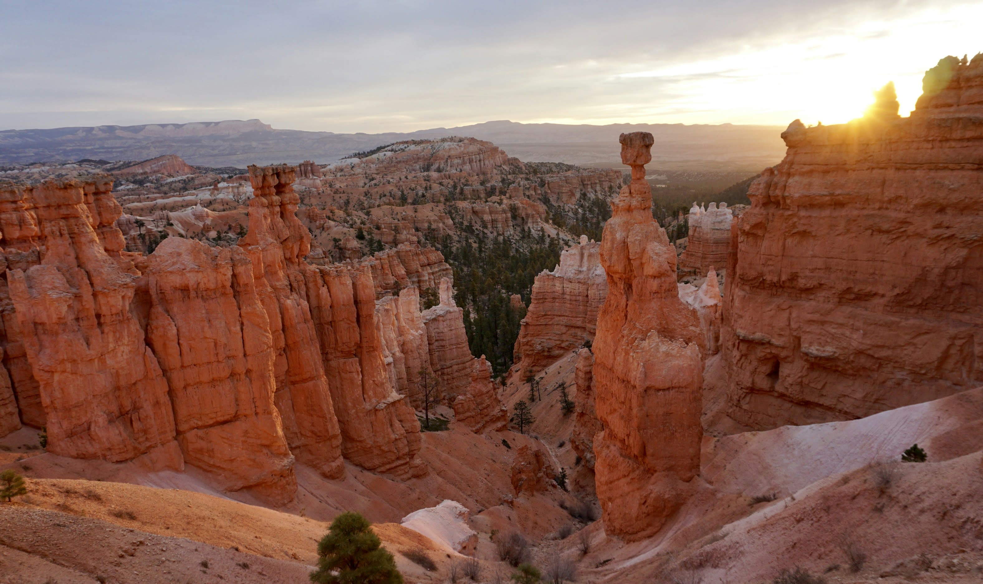
Bryce Canyon National Park
Bryce Canyon City, Utah, United States
At the edge of Utah's high plateau, thousands of stone spires rise from natural amphitheaters in formations found nowhere else on Earth. The Paiute call them the Legend People—ancient beings turned to stone by the Coyote spirit. The Hopi consider this place their heaven. At sunrise, the rocks glow with otherworldly light, and at night, seven thousand stars fill skies darker than almost anywhere in the continental United States.
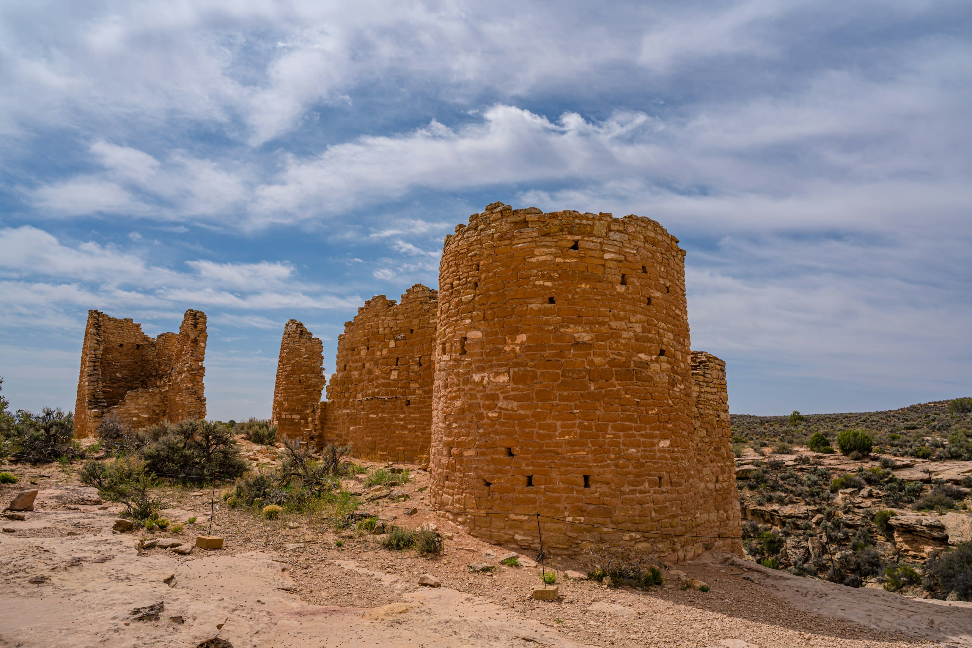
Hovenweep Ruins, Utah
Shiprock Agency, Utah, United States
Hovenweep Ruins, Utah is a ancient village of sacred significance. Approximate coordinates: 37.29928, -109.18420. Attributes: built, cultural, archaeological. Tradition: Ancient Puebloan. Located in Shiprock Agency / Naatʼáanii Nééz Bił Hahoodzo biyiʼdi, Arizona, United States.
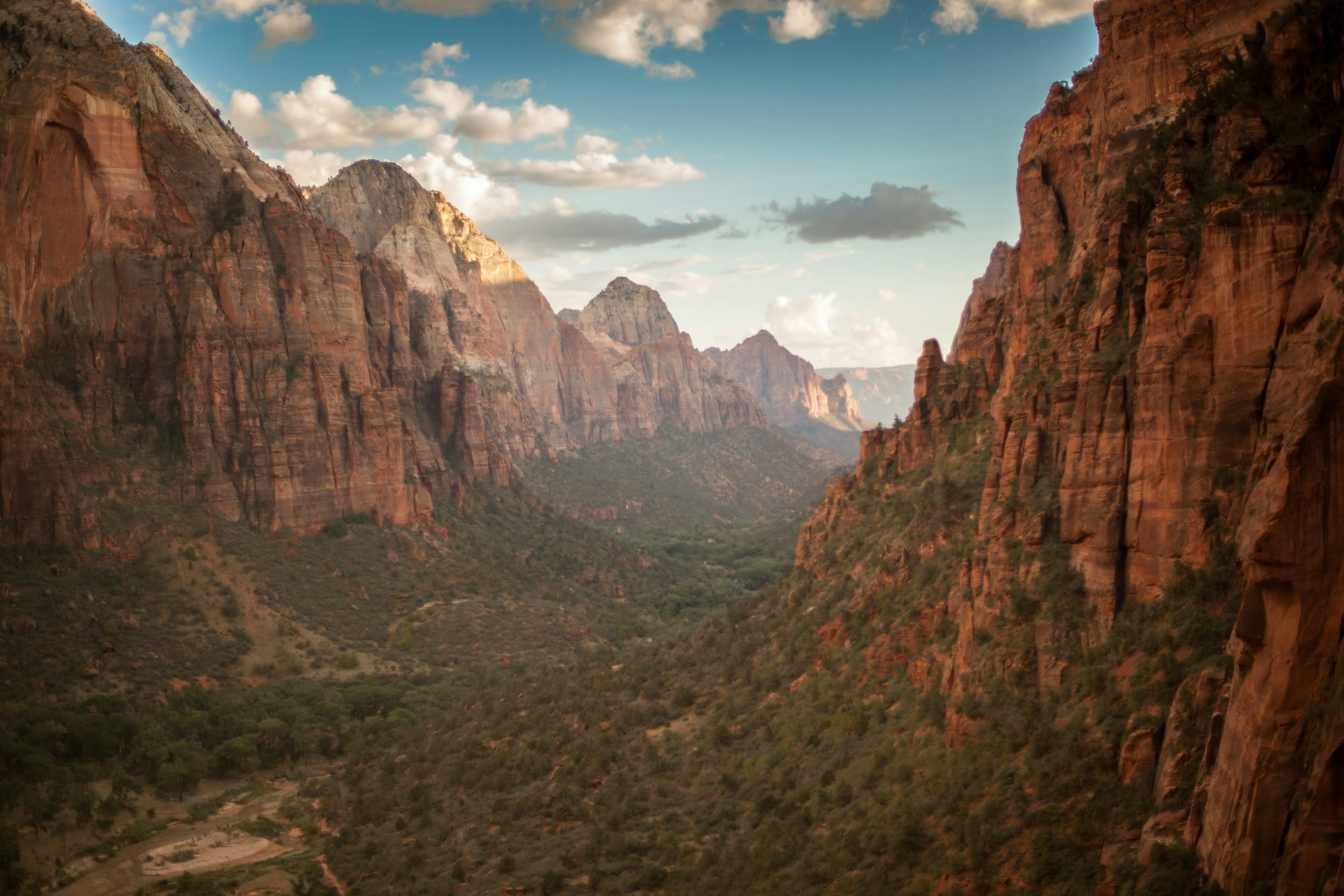
Zion National Park
Springdale, Utah, United States
For over eight centuries, the Southern Paiute have known these canyon walls as sacred homeland, a landscape alive with spiritual power they call Puha. Mormon settlers, overwhelmed by the vertical grandeur, named it after the biblical holy city. The same quality that moved both cultures persists today: something in these 3,000-foot cliffs and narrow corridors that makes the world feel thin, permeable, charged with presence.
Washington
4 sites
Mount Adams, Washington
Trout Lake, Washington, United States
Mount Adams, Washington is a site of sacred significance. Approximate coordinates: 46.20247, -121.49102. Located in Washington, United States.
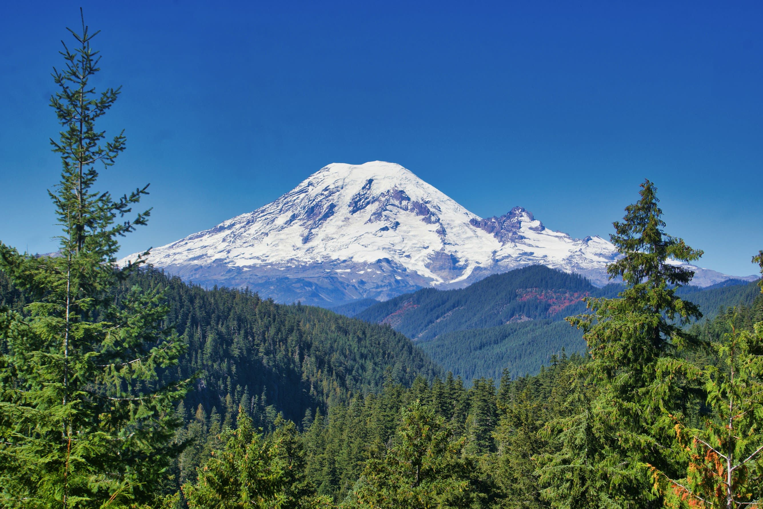
Mt. Rainier, Washington
Ashford, Washington, United States
Mt. Rainier, Washington is a site of sacred significance. Approximate coordinates: 46.85231, -121.76032. Located in Washington, United States.
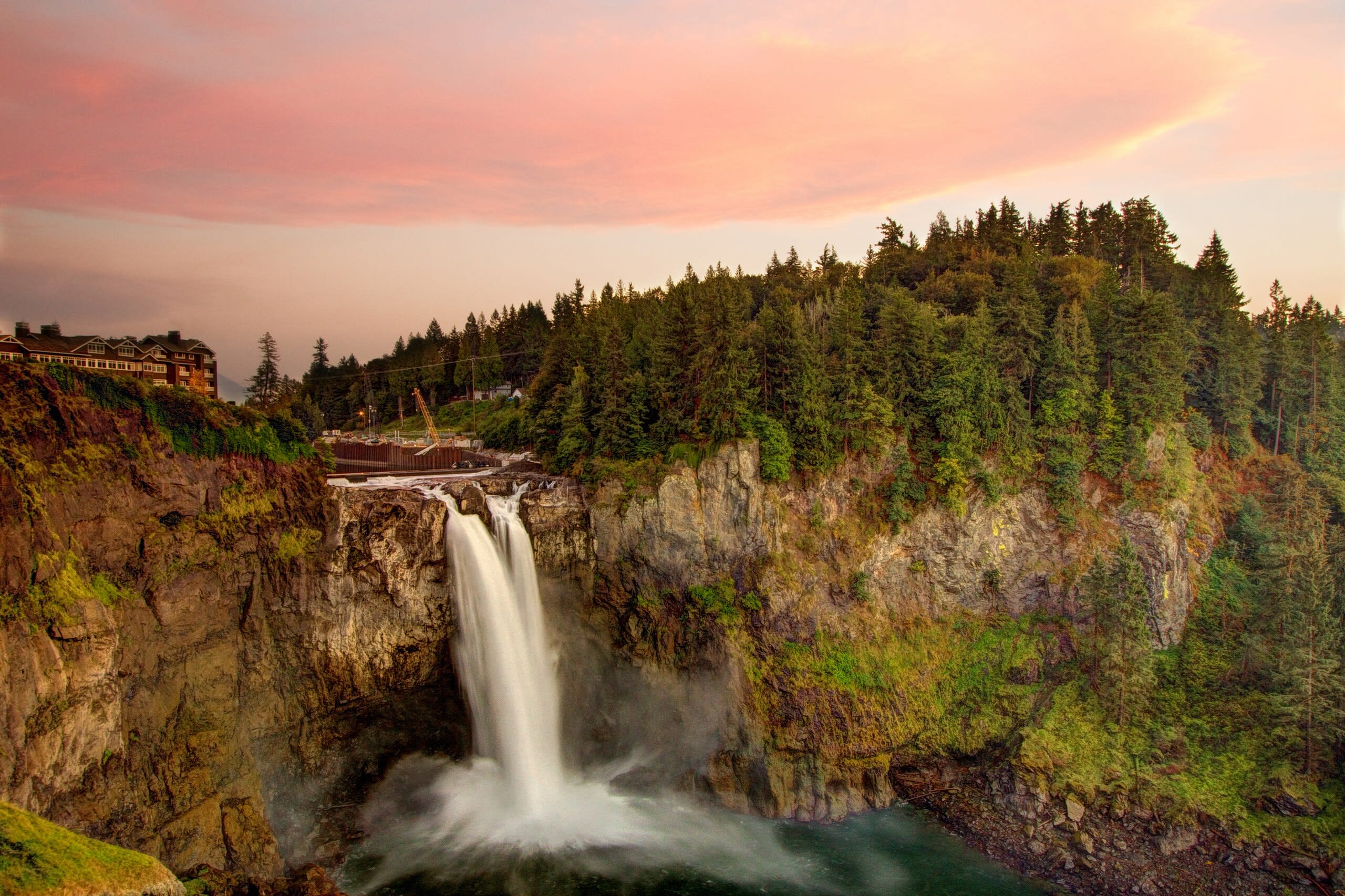
Snoqualmie Falls, Oregon
Snoqualmie, Washington, United States
Snoqualmie Falls, Oregon is a site of sacred significance. Approximate coordinates: 47.54186, -121.83729. Located in Snoqualmie, Washington, United States.
Tamanowas Rock Santuary, Washington
Port Townsend, Washington, United States
Tamanowas Rock Santuary, Washington is a site of sacred significance. Approximate coordinates: 48.02211, -122.79327. Located in Washington, United States.
West Virginia
1 sites
Wisconsin
1 sites
Wyoming
2 sites
Big Horn Medicine Wheel, Wyoming
Big Horn County, Wyoming, United States
Big Horn Medicine Wheel, Wyoming is a astronomical observation device of sacred significance. Approximate coordinates: 44.82587, -107.92153. Attributes: built, cultural, archaeological, ceremonial. Located in Wyoming, United States.
Inyan Kara Mountain, Wyoming
Sundance, Wyoming, United States
Inyan Kara Mountain, Wyoming is a mountain of sacred significance. Approximate coordinates: 44.21365, -104.34969. Attributes: natural, cultural, ceremonial. Tradition: Cheyenne and Sioux Lakota. Located in Wyoming, United States.