Mount Tamalpais
Where Coast Miwok sacred ground meets the Pacific horizon, wild nature rises above the urban world
Marin County, California, United States
At A Glance
- Coordinates
- 37.9237, -122.5964
- Suggested Duration
- A half-day permits a longer hike and unhurried time at the summit. This is sufficient to feel the mountain's qualities.
Pilgrim Tips
- Dress practically for variable conditions. Layers serve well—the summit may be twenty degrees cooler than the parking lot, and wind can make even moderate temperatures feel cold. Fog brings moisture; water-resistant outer layers prevent discomfort. Comfortable hiking shoes or boots suit most trails. For the Verna Dunshee Trail, which is paved, regular walking shoes suffice. Sun protection matters on exposed sections.
- The mountain offers spectacular photographic opportunities at every scale, from sweeping vistas to intimate details of bark and wildflower. Sunrise and sunset provide exceptional light. Fog creates moody conditions that reward patience. The Mountain Theater and East Peak Visitor Center are popular subjects. No restrictions apply beyond common courtesy to other visitors.
- Respect the mountain's active sacredness to the Coast Miwok and their descendants. The 'Sleeping Maiden' legend may be charming but attributing it to Indigenous tradition perpetuates a falsehood. If you're drawn to Indigenous understandings, seek out what the Coast Miwok actually taught rather than Victorian inventions. The mountain creates its own weather. Fog and wind can transform conditions rapidly. What begins as a warm sunny day may become cold and obscured within an hour. Prepare accordingly. Weekends, especially in good weather, bring crowds. If solitude matters to your practice, visit midweek or early morning.
Overview
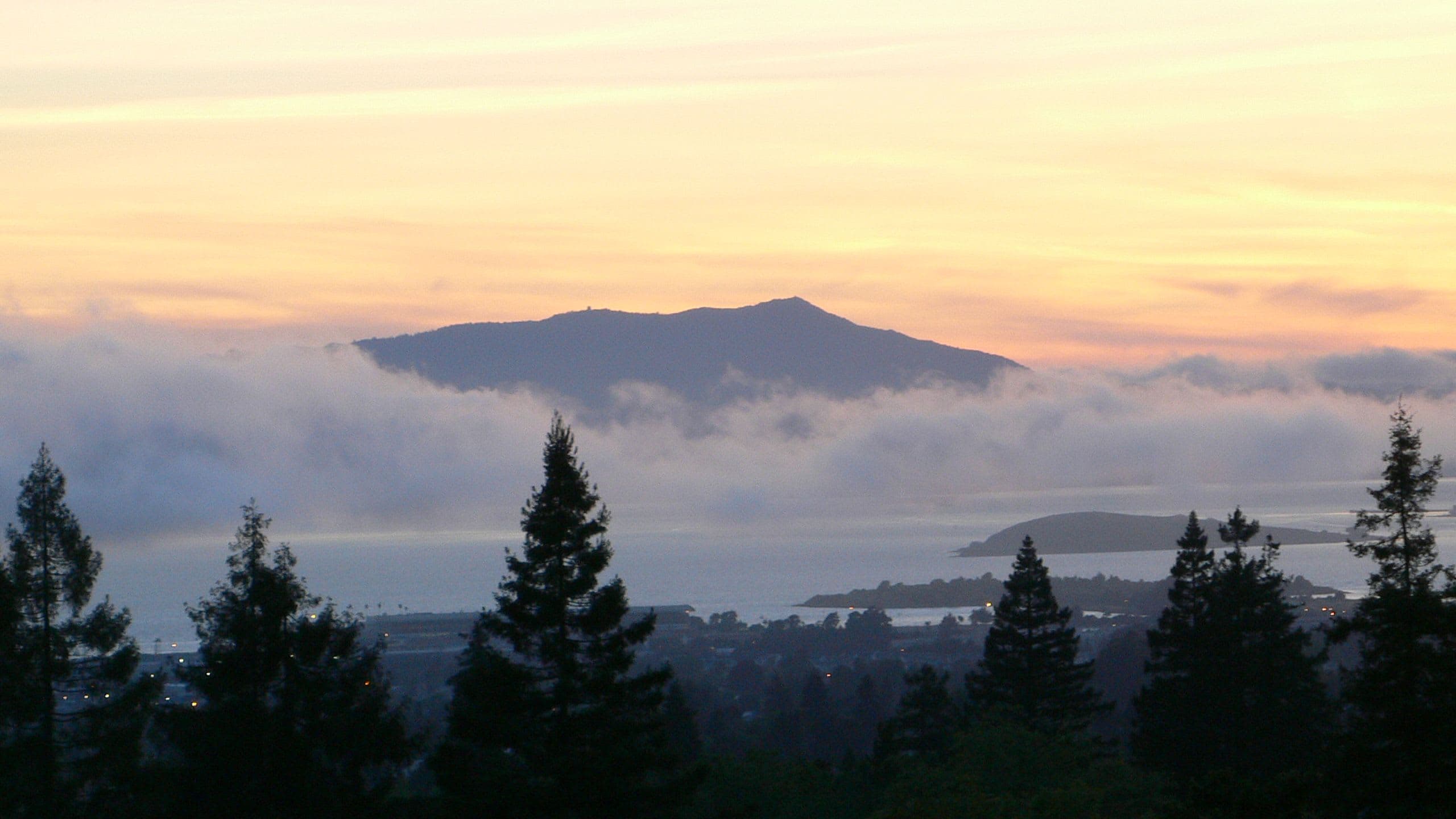
Mount Tamalpais rises 2,571 feet above San Francisco Bay, a mountain sacred to the Coast Miwok for thousands of years and recognized by the Lakota as the 'Holy Right Eye of the Great Turtle.' From its summit, the city's towers appear distant and small, while fog flows through redwood canyons and the Pacific stretches toward infinity. The mountain remains what it has always been—a threshold between worlds.
Fifteen miles north of the Golden Gate, Mount Tamalpais rises from the Pacific Coast like a promise. The Coast Miwok named it támal pájiṣ—'west hill'—and for thousands of years they lived in its shadow, gathering acorns beneath its oaks, trading obsidian along its ridges, and holding the summit as sacred ground where, according to some accounts, a powerful spirit dwelt and mortals should not tread.
Today the mountain draws hundreds of thousands of visitors each year. Some come for the trails that wind through redwood groves and across chaparral slopes. Others come to watch sunset paint the fog gold, or to find themselves momentarily outside the reach of modern life. From East Peak, the entire Bay Area spreads below—San Francisco's skyline, the bridges spanning dark water, the hills rolling east toward Mount Diablo. Yet standing there, surrounded by stone and sky and wind, the human world feels less absolute than it does in the valleys below.
The Lakota recognized this place from far away. In their cosmology, North America rests on the back of a Great Turtle, and Mount Tamalpais is its Holy Right Eye—Mount Diablo the left eye, San Francisco Bay the mouth, Florida the distant tail. This continental recognition speaks to what visitors still sense: that some places hold significance that exceeds their physical dimensions. Mount Tamalpais is such a place. It offers not escape from the world but perspective on it—the long view that ancient peoples sought and that seekers still find when they climb above the fog.
Context And Lineage
Human presence at Mount Tamalpais extends back thousands of years with the Coast Miwok. European settlement began in the mid-nineteenth century. The scenic railway, state park, and Mountain Play established the mountain as a recreational and cultural destination. Contemporary Indigenous communities maintain connection to ancestral lands.
The Coast Miwok account holds that a powerful spirit—sometimes described as an evil witch—dwelled at the summit of Mount Tamalpais, and therefore the peak was not to be climbed. Some historians suggest this taboo may have served the additional purpose of discouraging European settlers from sacred ground. Whether strategic or purely spiritual, the prohibition marked the summit as a threshold not casually crossed.
A different story circulated widely for decades: the 'Sleeping Maiden' legend, in which a Miwok maiden named Tamalpa lies eternally atop the mountain after a tragic love affair, her reclining form visible in the mountain's profile. This story appears in countless guidebooks and local lore. It is, however, not an Indigenous tradition. The legend was invented by European settlers in the 1870s and popularized by playwright Dan Totheroh's 1921 Mountain Play. Despite persistent belief, no Miwok origin has ever been documented. As artist Tom Killion observed, 'You just don't find that kind of anthropomorphizing of places' in actual Miwok tradition. The correction matters: honoring Indigenous sacred geography requires distinguishing authentic tradition from colonial invention.
The Lakota understanding places the mountain within continental scope. To them, North America is the back of a Great Turtle, and Mount Tamalpais is its Holy Right Eye—a place of vision and perception within a landscape-sized sacred body. This recognition came from far away, testifying to the mountain's significance beyond local boundaries.
The mountain has hosted continuous human engagement for thousands of years. Coast Miwok habitation preceded European contact by millennia. Spanish missionaries arrived in the late eighteenth century; American settlers followed in the mid-nineteenth. The scenic railway era (1896-1930) established tourism. The Mountain Play Association has maintained outdoor theater since 1913. Mount Tamalpais State Park was established in 1930; the CCC built the stone amphitheater in the 1930s. Mountain biking was invented here in the 1970s. The Federated Indians of Graton Rancheria, federally recognized in 2000, represents Coast Miwok and Southern Pomo peoples who maintain ancestral connection to the land.
William Kent
Sidney B. Cushing
Dan Totheroh
Why This Place Is Sacred
Mount Tamalpais has functioned as sacred ground for thousands of years. The Coast Miwok held it as a place of spiritual power, and accounts suggest they kept the summit inviolate. The Lakota recognized it within a continental sacred geography as the 'Holy Right Eye of the Great Turtle.' Contemporary visitors report experiences of expansion and clarity, the sense that ordinary concerns fall away when one stands above the fog with the Pacific horizon before them.
What makes a place thin? The Celtic tradition speaks of locations where the boundary between worlds grows permeable, where ordinary consciousness softens and something larger becomes accessible. Mount Tamalpais exhibits these qualities without requiring any particular belief system to perceive them.
The mountain rises dramatically from the surrounding landscape. Unlike peaks that sit among other peaks, Tamalpais stands alone between bay and ocean, visible from miles in every direction. This physical prominence has made it a landmark for as long as humans have inhabited the region. The Coast Miwok oriented their world around it. The summit taboo—whether based on fear of a spirit dwelling there or strategic discouragement of European encroachment—marked it as qualitatively different from ordinary terrain.
The Lakota understanding places the mountain within a vast sacred anatomy spanning the continent. To call Tamalpais the 'Holy Right Eye' is to recognize both its luminous quality and its role in cosmic vision. Eyes perceive; this place offers perception. Eyes see across distances; from this summit, the view encompasses nearly the entire Bay Area and beyond to the Farallon Islands.
Contemporary visitors often describe what might be called the Tamalpais effect: the experience of ascending from fog-shrouded valleys into brilliant sunlight, of walking trails where each turn reveals a new vista, of sitting at East Peak as the world stretches away in all directions. These experiences don't require spiritual vocabulary to register. The mountain offers what it has always offered—altitude, perspective, the chance to stand temporarily outside the human project and observe it from a distance.
The fog itself contributes to the thin place quality. Summer brings reliable marine layers that pool in valleys while peaks remain clear. To climb from grey to gold, from obscurity to illumination, enacts a transformation that needs no interpretation. Many visitors time their trips to coincide with fog inversions, watching the white sea flow through the Golden Gate while they stand in sunlight. The visual drama reflects an inner shift—the sense of having risen above something, of having gained vantage.
For the Coast Miwok, the mountain was integral to sacred geography. The summit taboo indicates it was not a place of casual use but rather a boundary marking transition between human and spirit realms. Traditional practices at the mountain are not well documented, but the Miwok lived on and around it for thousands of years, their seasonal rounds bringing them into continuous relationship with its slopes, groves, and ridges.
The mountain's sacred function has evolved while its essential quality persists. European settlers arrived in the mid-nineteenth century, bringing with them cattle ranching and logging. By the 1880s, the Mount Tamalpais Scenic Railway carried visitors to the summit, inaugurating tourism that continues today. The Mountain Play began in 1913, creating an annual ritual of outdoor theater that draws thousands. The 1967 Fantasy Fair—considered the first outdoor rock festival—added another ceremonial layer. Mount Tamalpais State Park, established in 1930, now protects 6,300 acres. The Federated Indians of Graton Rancheria, representing Coast Miwok descendants, maintains connection to ancestral lands. What was sacred remains sacred, even as the forms of engagement transform.
Traditions And Practice
Traditional Coast Miwok practices at the mountain are not well documented in public sources. Contemporary practices center on hiking as contemplative activity, attendance at the Mountain Play, and visits timed to experience fog inversions or exceptional views. The mountain accommodates seekers of many kinds without prescribing specific practices.
Specific Coast Miwok rituals at Mount Tamalpais remain largely undocumented in available sources. The people lived on and around the mountain for thousands of years, hunting deer, gathering acorns beneath the oaks, collecting shellfish along nearby shores, trading with neighboring tribes. The mountain was not separate from daily life but integrated into the seasonal round that structured Miwok existence. The summit taboo indicates that certain boundaries were maintained—that the mountain held zones of varying accessibility and sacredness. What ceremonies may have occurred, at what locations, with what purposes, has not been recorded in sources available to the general public.
The Mountain Play, held each May and June since 1913, is the mountain's most distinctive contemporary ceremony. Thousands gather at the Cushing Memorial Amphitheatre—4,000 stone seats carved into the mountainside—for musicals performed beneath open sky. The experience combines hiking (or shuttle bus), picnicking, and theater in ways that feel ritualistic even when the content is secular.
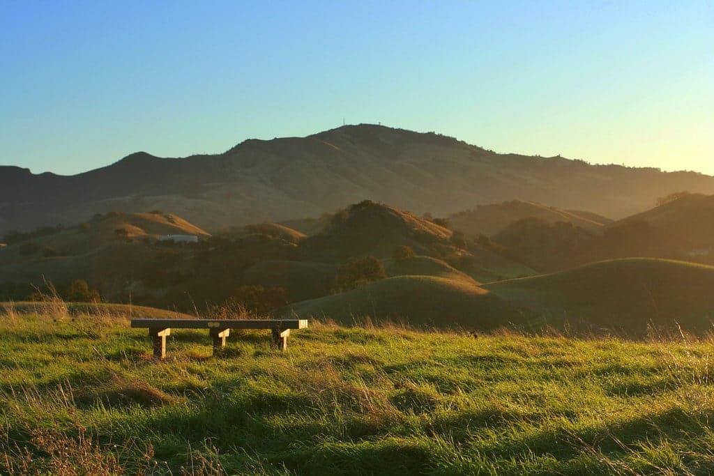
Many visitors treat hiking itself as practice. The trails invite walking meditation, the rhythm of footfall and breath aligning with the gradual revelation of views. Some come specifically for sunrise or sunset at East Peak, timing arrivals to witness the light show. Others visit repeatedly throughout the year, tracking the mountain's seasonal changes—wildflowers in spring, golden grasses in summer, clear skies in fall, green renewal after winter rains.
The 1967 Fantasy Fair introduced another ceremonial form: large gatherings in natural settings for music and community. Though the festival didn't continue, it established a template that influenced outdoor concert culture broadly.
Walk one of the longer trails, giving yourself time to transition from daily rhythm into mountain rhythm. The Steep Ravine Trail offers redwood immersion; the Matt Davis Trail provides ocean views. At the summit, find a spot to sit without agenda. Let the view wash over you rather than trying to name or document everything. If fog is present below, watch how it moves—there's a contemplative practice in observing transformation.
If you can attend the Mountain Play, do so. The experience of outdoor theater in that setting—stone seats, mountain air, fading daylight—offers something unavailable elsewhere.
Consider visiting at different times and seasons. The mountain reveals different faces in morning and afternoon, fog and clarity, spring green and autumn gold. Multiple visits deepen relationship.
Coast Miwok sacred geography
ActiveThe Coast Miwok inhabited the lands around Mount Tamalpais for thousands of years before European contact. The mountain—támal pájiṣ, 'west hill'—held central place in their sacred geography. According to some accounts, the summit was taboo, home to a powerful spirit mortals should not approach. Whether this prohibition reflected spiritual belief, practical wisdom, or strategy to protect sacred ground from settlers, it marked the peak as qualitatively different from ordinary terrain.
Traditional practices are not well documented in public sources. The Coast Miwok lived on and around the mountain, their seasonal rounds integrating hunting, gathering, fishing, and ceremony with the rhythms of the land. The Federated Indians of Graton Rancheria, the federally recognized tribe of Coast Miwok and Southern Pomo peoples, maintains connection to ancestral lands including this mountain.
Lakota sacred geography
ActiveIn Lakota cosmology, North America is the back of a Great Turtle. Mount Tamalpais is the 'Holy Right Eye of the Great Turtle'—Mount Diablo to the east is the left eye, San Francisco Bay is the mouth, and Florida is the tail. This continental-scale sacred geography recognizes Tamalpais as a place of vision and perception within a landscape-sized spiritual body.
Recognition of the mountain within broader sacred geography. The Lakota acknowledgment reflects inter-tribal awareness of spiritually significant places beyond any single people's territory.
Contemporary spiritual seeking
ActiveMount Tamalpais draws visitors seeking spiritual experience, nature connection, and contemplative practice from many backgrounds. The mountain's accessibility from San Francisco, its natural beauty, and its cultural associations attract hikers, meditators, artists, and seekers of various kinds.
Hiking as spiritual practice. Meditation and contemplation at summit viewpoints. Timing visits to witness sunrise, sunset, or fog inversions. Attendance at Mountain Play performances. Repeated visits to deepen relationship with the land.
Experience And Perspectives
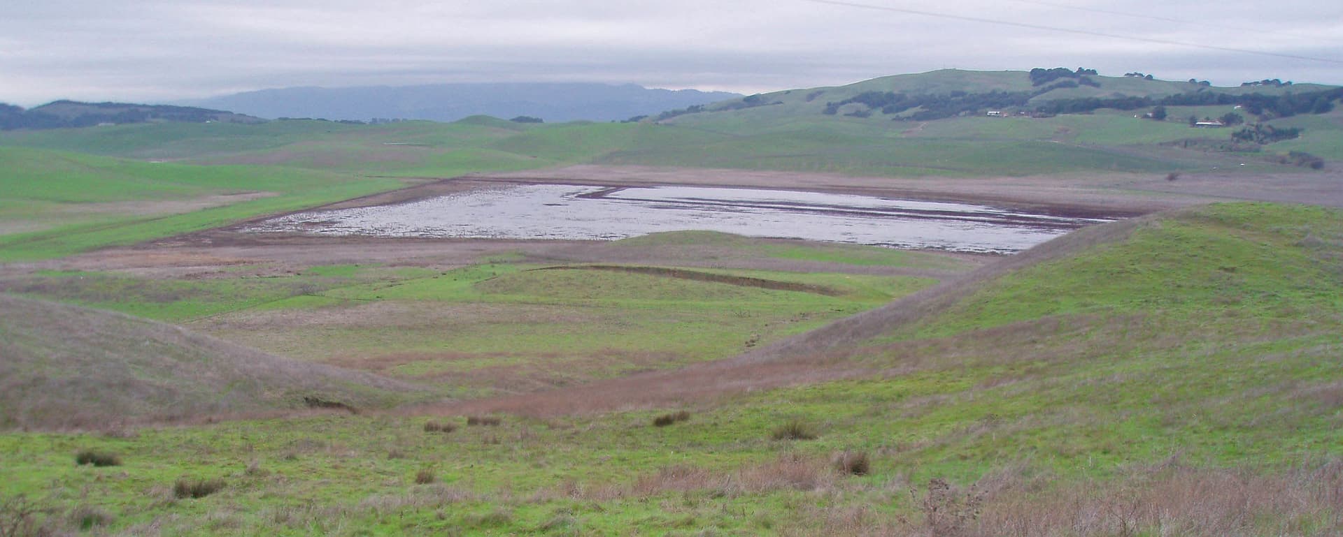
Visitors to Mount Tamalpais commonly report experiences of expanded perspective, physical invigoration, and the distinctive pleasure of wildness close to urban civilization. The mountain's varied ecosystems—redwood groves, oak woodlands, chaparral slopes, grasslands—provide diverse sensory environments. The summit views encompass an entire metropolitan region while feeling utterly removed from it.
The experience of Mount Tamalpais begins before arrival. Driving across the Golden Gate Bridge, the mountain appears to the north, its profile familiar yet somehow always surprising in its scale. The approach through Mill Valley trades highway for winding roads, urban density for forest canopy. By the time you reach Pantoll Station or East Peak, you've already undergone transition.
The trails offer different qualities depending on the route. The Steep Ravine Trail descends through redwood forest, the air cool and fragrant, light filtering through high canopy. The Matt Davis Trail traverses open slopes with ocean views. The Dipsea—oldest trail race in America—connects Mill Valley to Stinson Beach across the mountain's western flanks. Each path provides its own character, but all share the quality of drawing attention outward: to the texture of bark, the call of Steller's jays, the sudden appearance of deer browsing in morning light.
At East Peak, the experience intensifies. The Verna Dunshee Trail circles the summit, offering 360-degree views accessible to those who cannot hike steeper routes. On clear days, the vista extends to the Farallon Islands in one direction and the Sierra Nevada in another. The bridges are visible, the city's towers, the shipping lanes crossing the bay. Yet what strikes most visitors is not the human elements but the enormity of what surrounds them—water and mountains, sky and horizon, the whole apparatus of the natural world carrying on regardless of human activity.
The fog creates its own experiences. Summer mornings often begin obscured, the bay invisible, sound muffled. Then the ascent through grey into sudden brightness—the fog below now a white ocean, the sun warm on skin, the sense of having emerged into another realm entirely. These fog inversions are Tamalpais specialties, phenomena visitors plan trips around. To watch the Golden Gate appear as the marine layer retreats, to see San Francisco's towers pierce the white like islands rising from the sea, is to witness transformation on a landscape scale.
Many visitors report what might be called renewed perspective. The problems that loomed large at sea level seem smaller from above. The pace of daily life, visible in ant-like cars on distant highways, appears more clearly as something constructed rather than necessary. The mountain doesn't preach these realizations—it simply offers altitude, and altitude does its work.
Approach Mount Tamalpais as you would approach any elder—with respect, without demands. The mountain will offer what it offers; your task is to be present enough to receive it. Come prepared for variable weather; fog and wind are part of the experience, not obstacles to it. Leave time for stillness as well as walking. The views reward patience, revealing different qualities in morning light, afternoon haze, or the gold of sunset. If you seek transformation, be open to surprise—the mountain may offer something other than what you expected, and that difference may be precisely what you need.
Mount Tamalpais holds different meanings for different communities. The Coast Miwok understand it as ancestral sacred ground. The Lakota recognize it within continental cosmology. Scholars study its ecological and cultural history. Contemporary seekers find their own significance. These perspectives need not be reconciled; the mountain is large enough to hold them all.
Academic understanding recognizes Mount Tamalpais as land sacred to the Coast Miwok and as a landscape of significant ecological and recreational value. Scholars have documented that the 'Sleeping Maiden' legend is a Victorian invention rather than Indigenous tradition, though this correction has not yet reached popular consciousness. The mountain's cultural history includes pioneering conservation efforts, the development of hiking culture in the Bay Area, the scenic railway era, and the invention of mountain biking in the 1970s. Ecological research tracks the intersection of ecosystems—redwood forest, oak woodland, chaparral, grassland—that gives the mountain its biodiversity.
For the Coast Miwok and their descendants in the Federated Indians of Graton Rancheria, Mount Tamalpais remains sacred. The mountain's name—támal pájiṣ, 'west hill'—preserves their language. Indigenous perspectives emphasize the mountain's ongoing sacredness rather than merely historical significance. The land was sacred, is sacred, will be sacred. Contemporary Coast Miwok navigate the complexities of ancestral connection to land now administered as public recreation space, maintaining relationship while not controlling access.
Some contemporary spiritual seekers describe Mount Tamalpais as an energy center or vortex, though it lacks the recognition that places like Mount Shasta or Sedona have achieved in esoteric circles. The mountain attracts practitioners of nature-based spirituality, walking meditation, and contemplative hiking. The 'Sleeping Maiden' image, though manufactured rather than traditional, has taken on symbolic meaning for some visitors who find power in the notion of a feminine presence in the landscape—though understanding its actual origin seems important to honest engagement.
Much about the mountain's deeper history remains unclear. The full extent of traditional Coast Miwok ceremonial practice at Tamalpais is not documented in available sources. The original meaning of the summit taboo—whether the 'witch' was literal belief, metaphor, or strategic discouragement—has not been definitively established. How the mountain functioned within pre-contact Indigenous cosmology and inter-tribal networks can only be partially reconstructed. These gaps remind visitors that some knowledge lives outside texts, preserved in ways not accessible to casual inquiry.
Visit Planning
Mount Tamalpais is located in Marin County, California, approximately 15 miles north of San Francisco across the Golden Gate Bridge. The park is accessible year-round during daylight hours. Fall offers the clearest weather; summer brings fog. A half-day allows for meaningful hiking; multiple visits reward with varied experiences.
Steep Ravine Environmental Cabins offer rustic oceanfront lodging on the mountain's western slope (reserve through ReserveCalifornia; extremely popular). Pantoll Campground provides walk-in sites. The adjacent towns of Mill Valley, Sausalito, and San Rafael offer hotels, inns, and vacation rentals. San Francisco provides full urban accommodation options.
Mount Tamalpais is a public state park with standard regulations. Practical hiking attire is appropriate. Photography is welcome. The land itself asks for respect—stay on trails, pack out everything, leave no trace.
Visiting Mount Tamalpais requires no special credentials or preparation beyond basic outdoor readiness. The park operates on the leave-no-trace principle that governs wilderness spaces broadly. What you carry in, you carry out. The trails you walk should look no different for your passage.
The mountain's significance to the Coast Miwok suggests an additional layer of respect. Walking here means walking on land that remains sacred to living peoples. Acknowledgment need not be dramatic—simply holding awareness that you're a guest in a place with long memory and ongoing meaning.
The views invite photography, and the park welcomes it. Respect other visitors' experiences; avoid blocking trails for extended shoots. Drones are prohibited.
Dogs are welcome but restricted to specific areas—paved roads, the Old Stage Fire Road, the Verna Dunshee Trail, and developed areas. Bikes may use fire roads only. Fires are prohibited except in designated areas. The park's ecosystems have evolved with periodic fire but not the kind that escapes control.
Dress practically for variable conditions. Layers serve well—the summit may be twenty degrees cooler than the parking lot, and wind can make even moderate temperatures feel cold. Fog brings moisture; water-resistant outer layers prevent discomfort. Comfortable hiking shoes or boots suit most trails. For the Verna Dunshee Trail, which is paved, regular walking shoes suffice. Sun protection matters on exposed sections.
The mountain offers spectacular photographic opportunities at every scale, from sweeping vistas to intimate details of bark and wildflower. Sunrise and sunset provide exceptional light. Fog creates moody conditions that reward patience. The Mountain Theater and East Peak Visitor Center are popular subjects. No restrictions apply beyond common courtesy to other visitors.
Leaving objects at the mountain is not a traditional practice and is not appropriate in a state park context. The appropriate offering is attention—noticing what the mountain presents, receiving what it gives. If you wish to mark your visit, do so internally.
Park hours run from 7am to sunset. Parking fees apply at East Peak, Pantoll, and Bootjack; free parking is available elsewhere. Dogs are restricted to specific areas. Bikes may use fire roads only. Camping is available at designated sites with reservations. No fires except in designated areas. No hunting.
Sacred Cluster
Nearby sacred places create the location cluster described in the growth plan. This block is intentionally crawlable and links into the wider regional graph.