Site type guide
Natural
Crawlable taxonomy page generated from the current site detail schema and used in the internal linking graph.
Countries to explore next
Traditions represented here
19 sites
Browse this type across countries, traditions, and sacred landscapes.
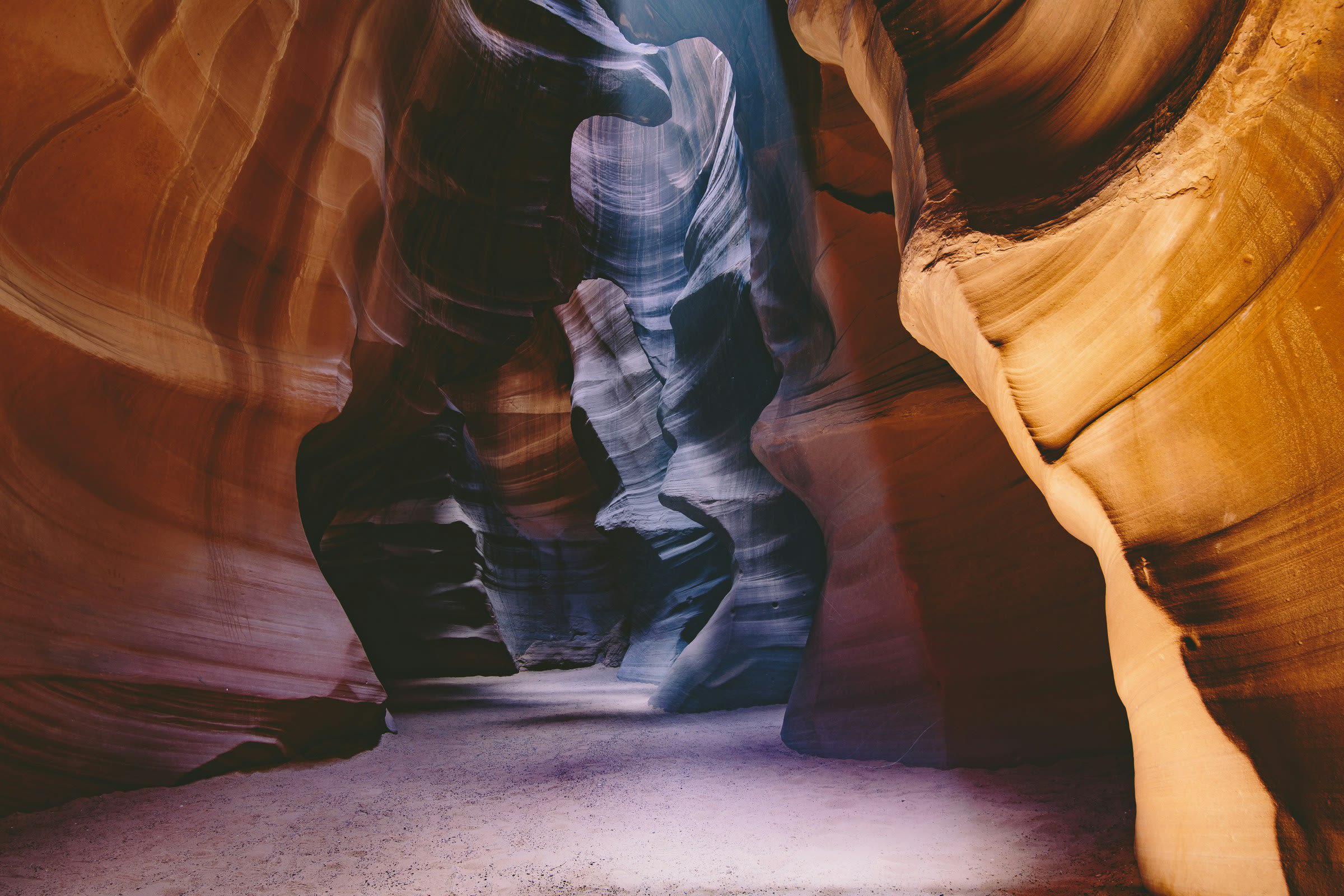
Antelope Canyon
Page, Arizona, United States
Deep within Navajo land, narrow sandstone passages open into chambers of flowing stone and cascading light. The Navajo call this place Tse bighanilini, where water runs through rocks, and understand it as a meeting point between physical and spiritual worlds. Visitors descend into darkness and emerge changed, having walked through what many describe as Earth itself made visible.

Blue Lake, New Mexico
Taos County, New Mexico, United States
Blue Lake, New Mexico is a natural of sacred significance. Approximate coordinates: 36.53835, -105.39107. Attributes: natural, cultural, pilgrimage, ceremonial. Tradition: Native American. Located in New Mexico, United States.
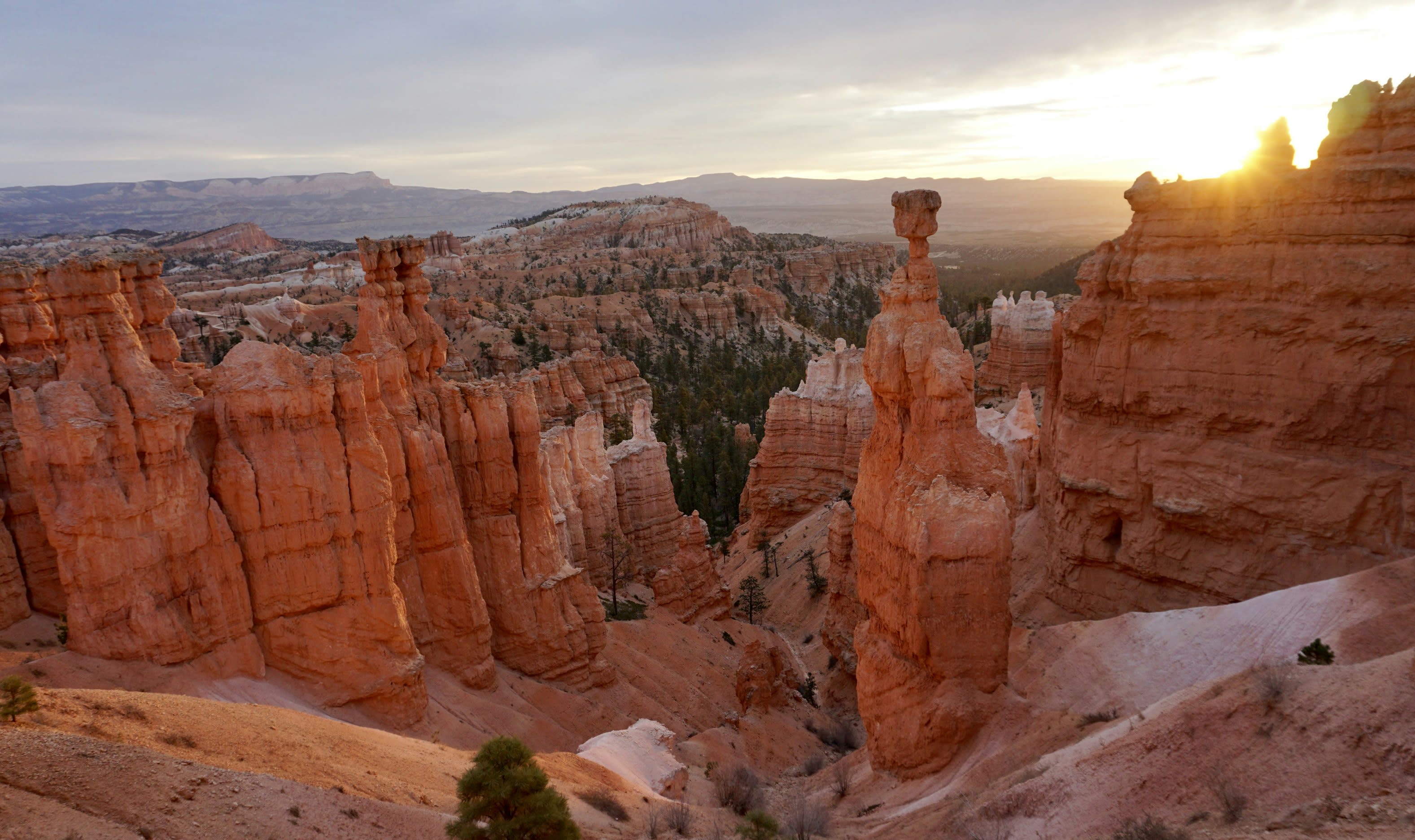
Bryce Canyon National Park
Bryce Canyon City, Utah, United States
At the edge of Utah's high plateau, thousands of stone spires rise from natural amphitheaters in formations found nowhere else on Earth. The Paiute call them the Legend People—ancient beings turned to stone by the Coyote spirit. The Hopi consider this place their heaven. At sunrise, the rocks glow with otherworldly light, and at night, seven thousand stars fill skies darker than almost anywhere in the continental United States.

Cormorant Island
Alert Bay, British Columbia, Canada
Cormorant Island is a natural of sacred significance. Approximate coordinates: 50.58001, -126.91973. Attributes: natural. Cormorant Island is a 10 ha island lying in Bismarck Strait 1 km south of Anvers Island, 4 km (2.5 mi) east-south-east of Bonaparte Point, in the Palmer Archipelago of Antarctica. It lies some 5 km to the south-east of the United States Palmer Station in Arthur Harbour on Anvers Island. It was shown on an Argentine government chart of 1954, but not named. It was named by the United Kingdom Antarctic Place-names Committee (UK-APC) in 1958 because of the large number of cormorants (shags) seen there. Located in Alert Bay, British Columbia, Canada.
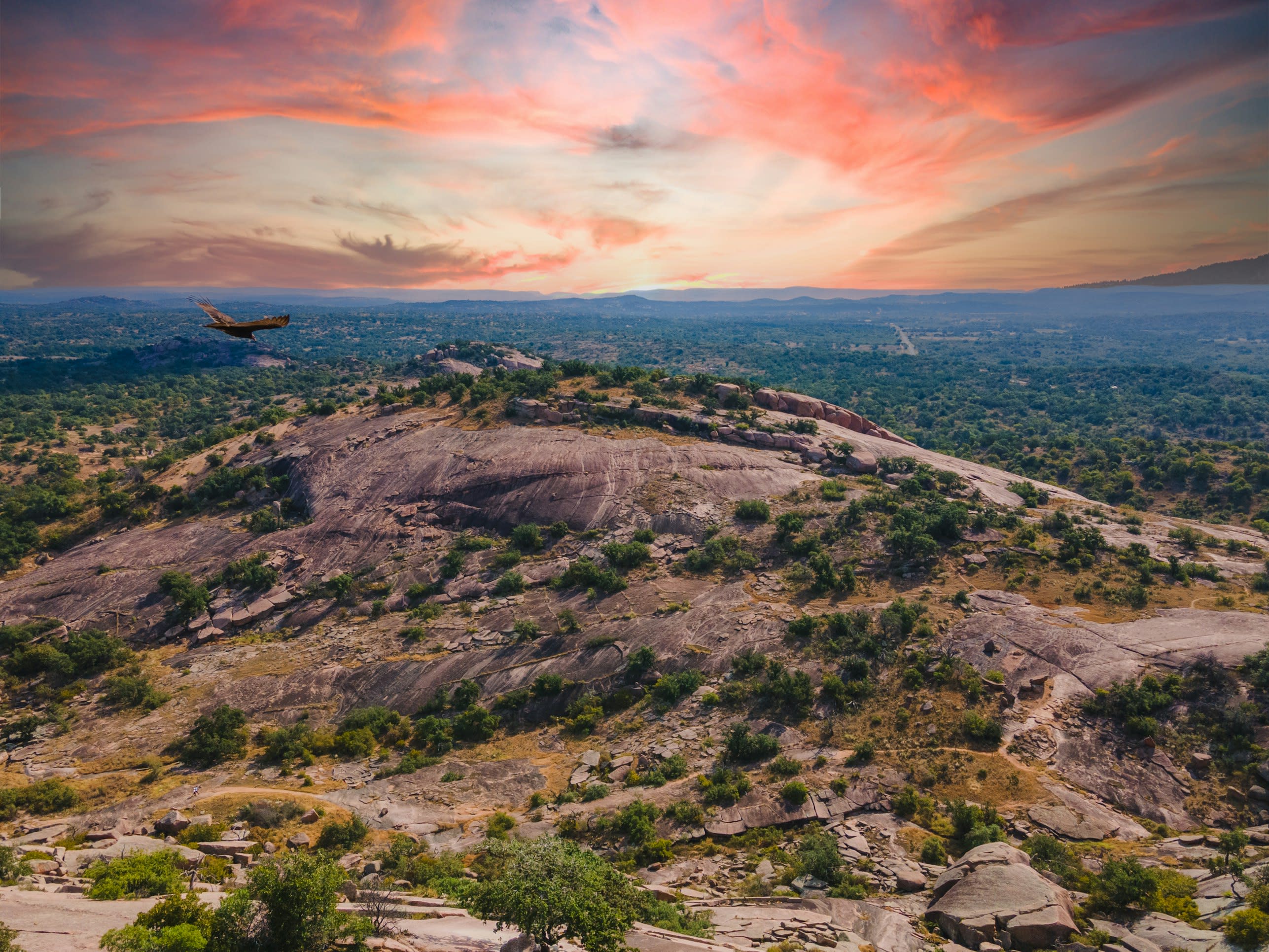
Enchanted Rock, Texas
Fredericksburg, Texas, United States
Enchanted Rock, Texas is a natural of sacred significance. Approximate coordinates: 30.50696, -98.81722. Attributes: natural, cultural. Tradition: Native American. Mythological context: Tonkawa, Apache and Comanche folklore. Located in Texas, United States.
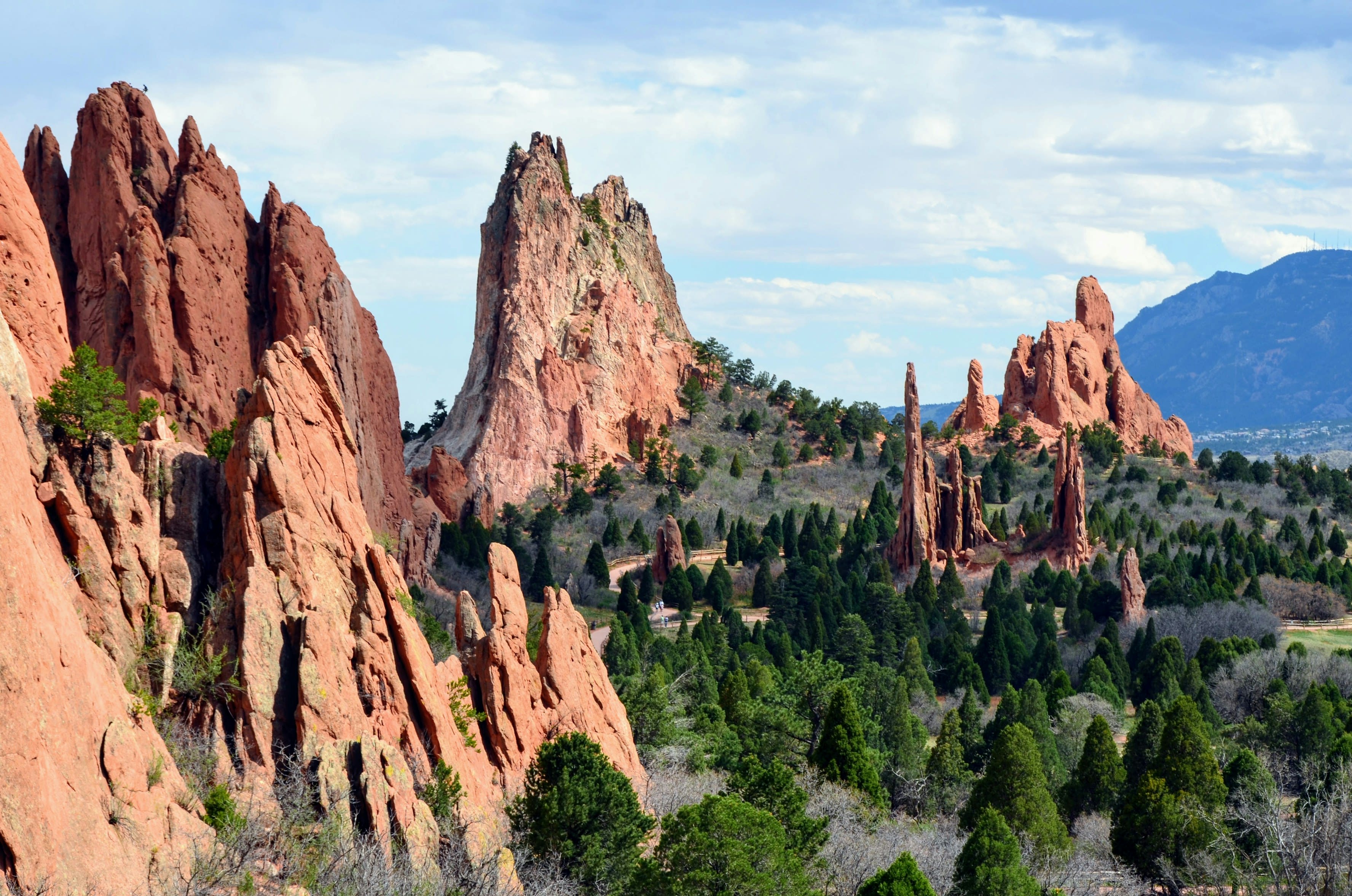
Garden of the Gods, Colorado
Colorado Springs, Colorado, United States
Garden of the Gods, Colorado is a natural sacred site of sacred significance. Approximate coordinates: 38.87319, -104.88630. Attributes: natural, cultural, ceremonial. Tradition: Native American. Mythological context: Native American mythology. Located in Colorado Springs, Colorado, United States.
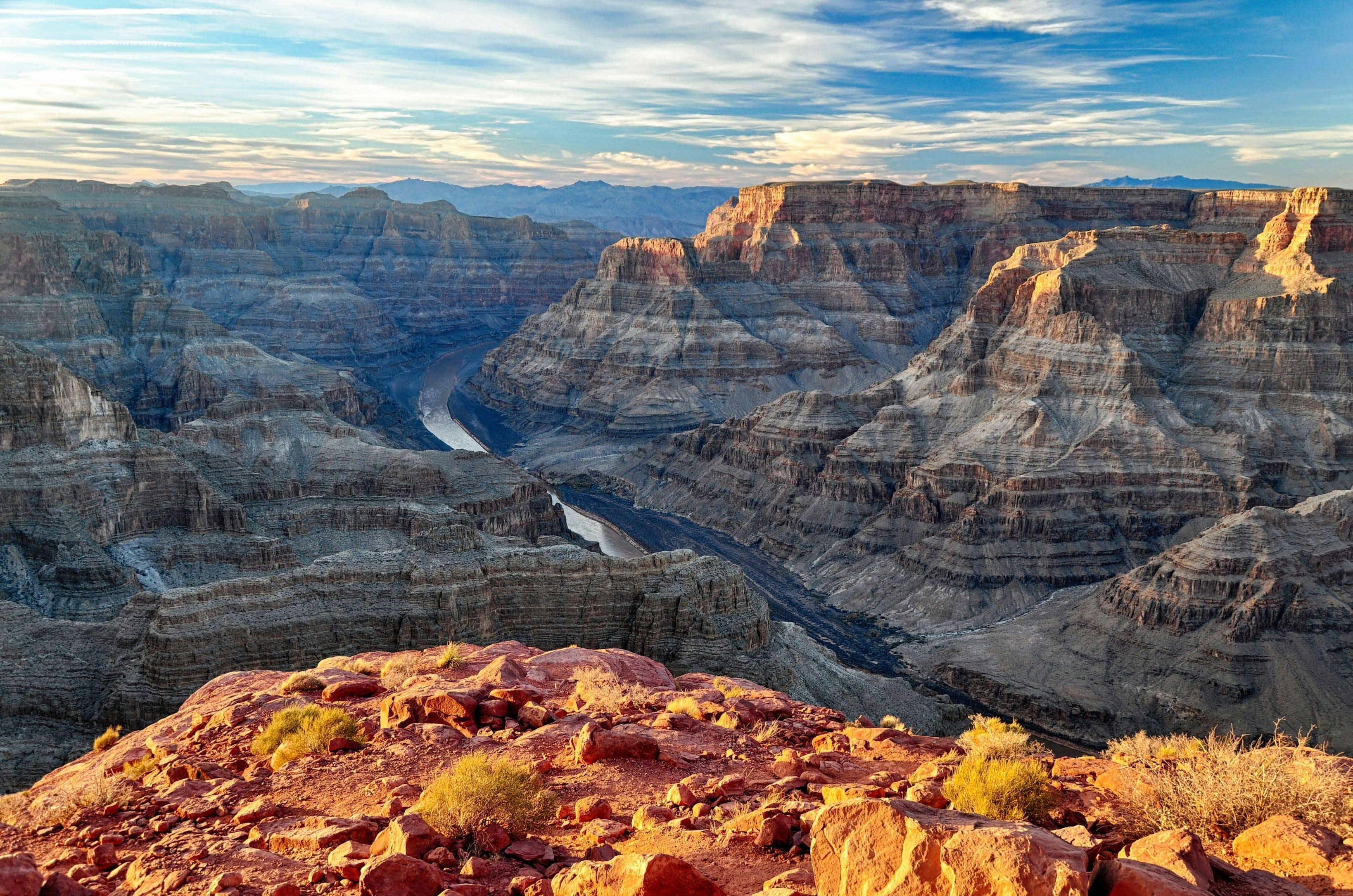
Grand Canyon National Park
Grand Canyon Village, Arizona, United States
For at least 12,000 years, humans have stood at the edge of this chasm and felt something shift. Eleven Native American tribes hold the Grand Canyon as ancestral homeland and place of emergence, where humanity climbed from the underworld into this world. The Hopi locate their Sipapuni here. The Zuni trace their origin to Ribbon Falls. Visitors consistently report that looking into this mile-deep wound in the earth produces not just awe but encounter, as though the canyon were looking back.
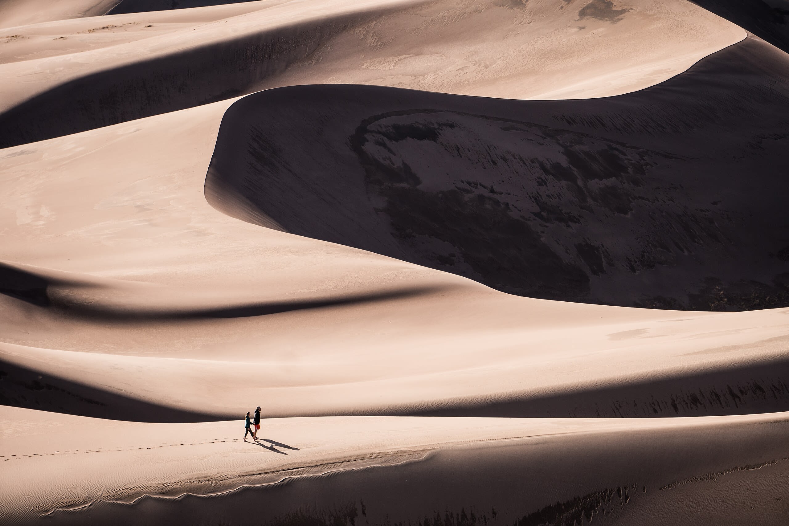
Great Sand Dunes, Colorado
Mosca, Colorado, United States
Great Sand Dunes, Colorado is a natural of sacred significance. Approximate coordinates: 37.77397, -105.59647. Attributes: natural, cultural. Tradition: Native American. Located in Colorado, United States.
Great Sandhills
Sceptre, Saskatchewan, Canada
Great Sandhills is a natural of sacred significance. Approximate coordinates: 50.85993, -109.26221. Attributes: natural. Located in Sceptre, Saskatchewan, Canada.
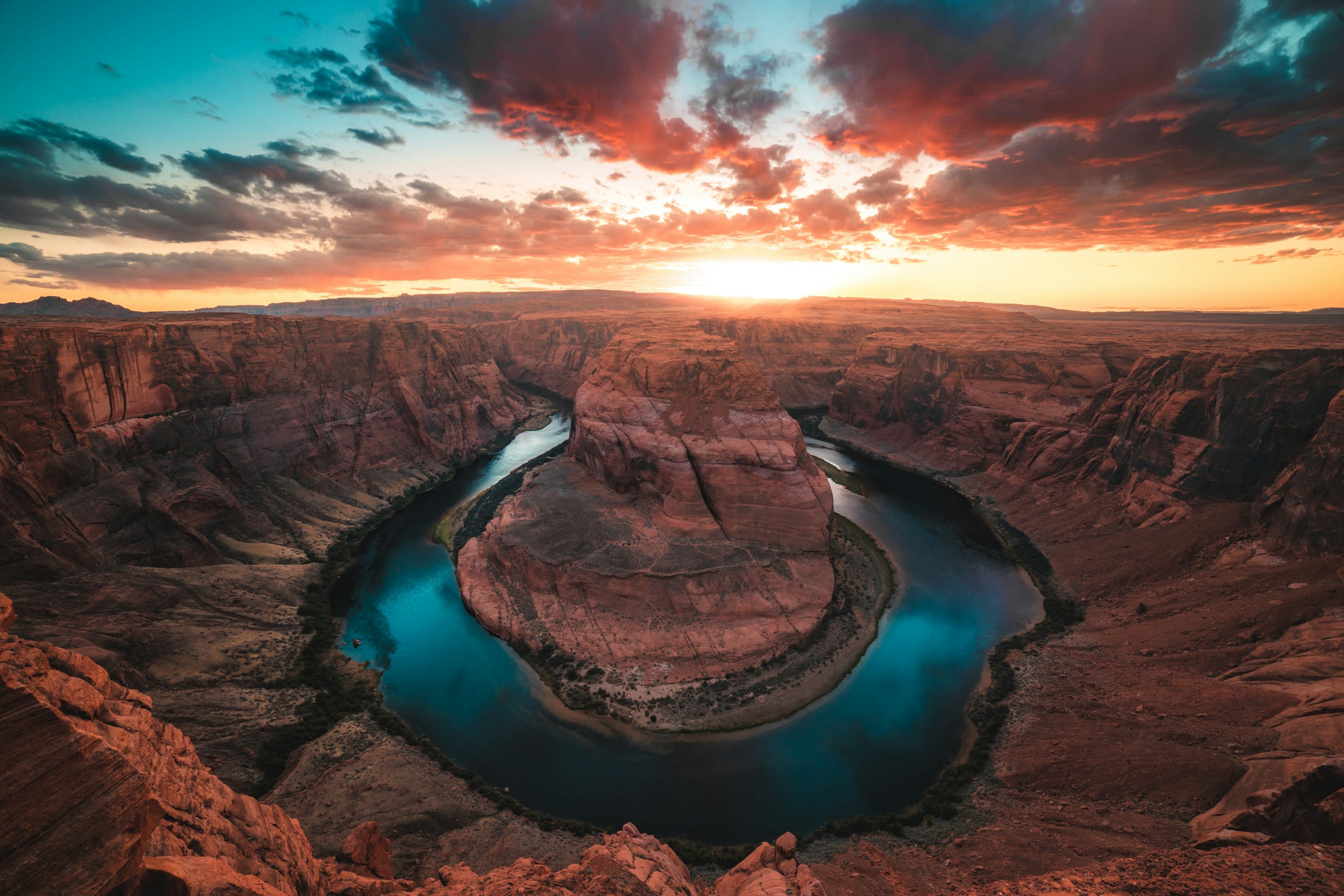
Horseshoe Bend
Page, Arizona, United States
A thousand feet below the overlook, the Colorado River completes its patient arc through Navajo Sandstone, forming the near-perfect horseshoe that has drawn both indigenous peoples and modern seekers to this edge. For the Navajo and Hopi, this land holds ancestral significance, part of a sacred landscape where water and stone speak of forces older than human memory. Standing here, the scale of geological time becomes visceral.
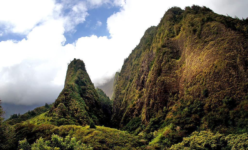
Iao Valley State Park, Maui
Wailuku, Hawaii, United States
Iao Valley State Park, Maui is a natural of sacred significance. Approximate coordinates: 20.88088, -156.54518. Attributes: natural, cultural. Located in Hawaii, United States.
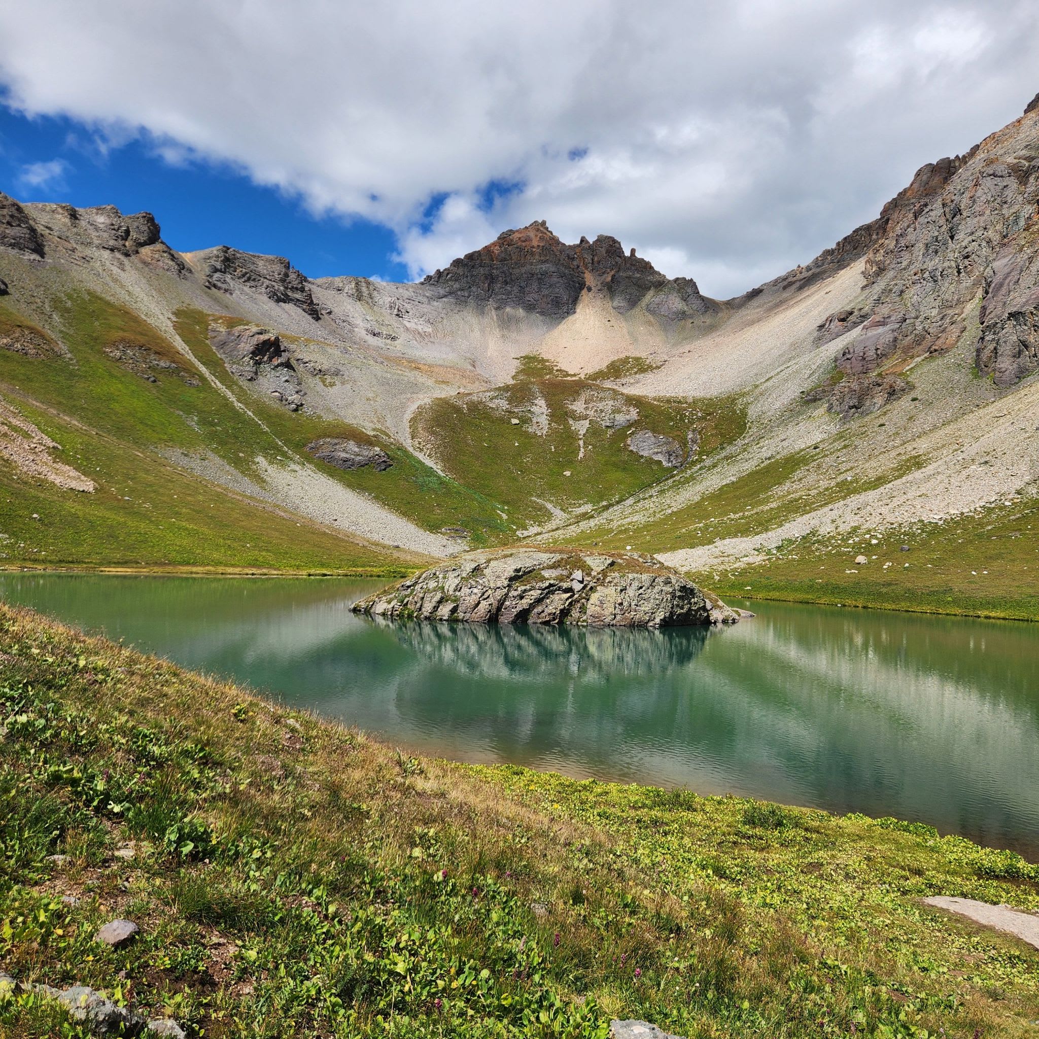
Island Lake, Colorado
Silverton, Colorado, United States
Island Lake, Colorado is a natural of sacred significance. Approximate coordinates: 37.82036, -107.80154. Attributes: natural, cultural. Tradition: Native American. Located in Colorado, United States.
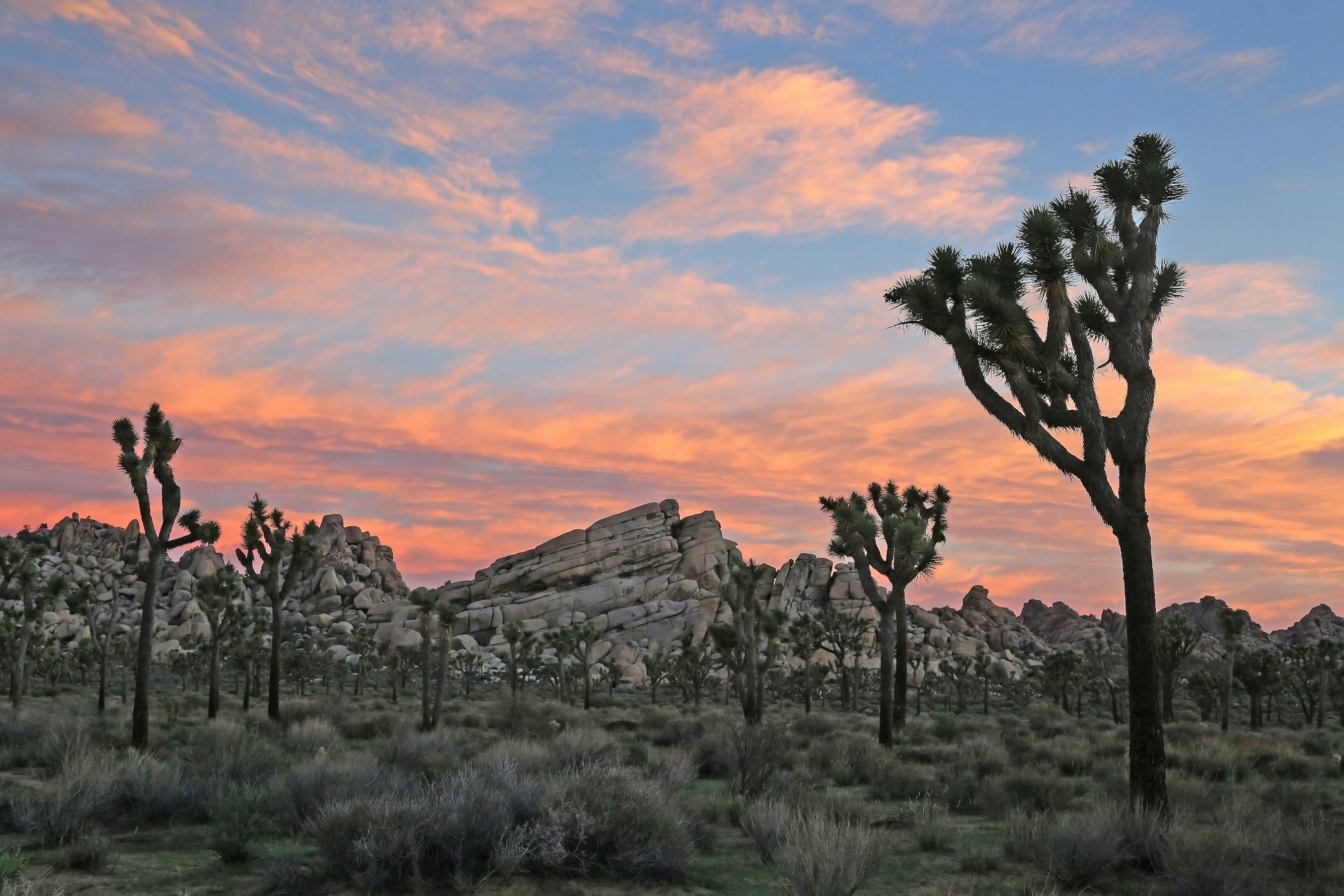
Joshua Tree National Park, California
Joshua Tree, California, United States
Joshua Tree, California is a natural of sacred significance. Approximate coordinates: 33.87342, -115.90099. Attributes: natural, cultural. Tradition: Native American. Joshua Tree is a census-designated place (CDP) in San Bernardino County, California, United States. The population was 7,414 at the 2010 census. At approximately 2,700 feet (820 meters) above sea level, Joshua Tree and its surrounding communities are located in the High Desert of California. The center of the business district in Joshua Tree is on California State Route 62. Located in California, United States.
Keahiakawelo (Garden of the Gods), Hawaii
Lanai City, Hawaii, United States
Keahiakawelo (Garden of the Gods), Hawaii is a natural of sacred significance. Approximate coordinates: 20.87899, -156.99657. Attributes: natural, cultural. Tradition: Hawaiian. Associated figure: Kawelo. Mythological context: Hawaiian mythology. Located in Hawaii, United States.
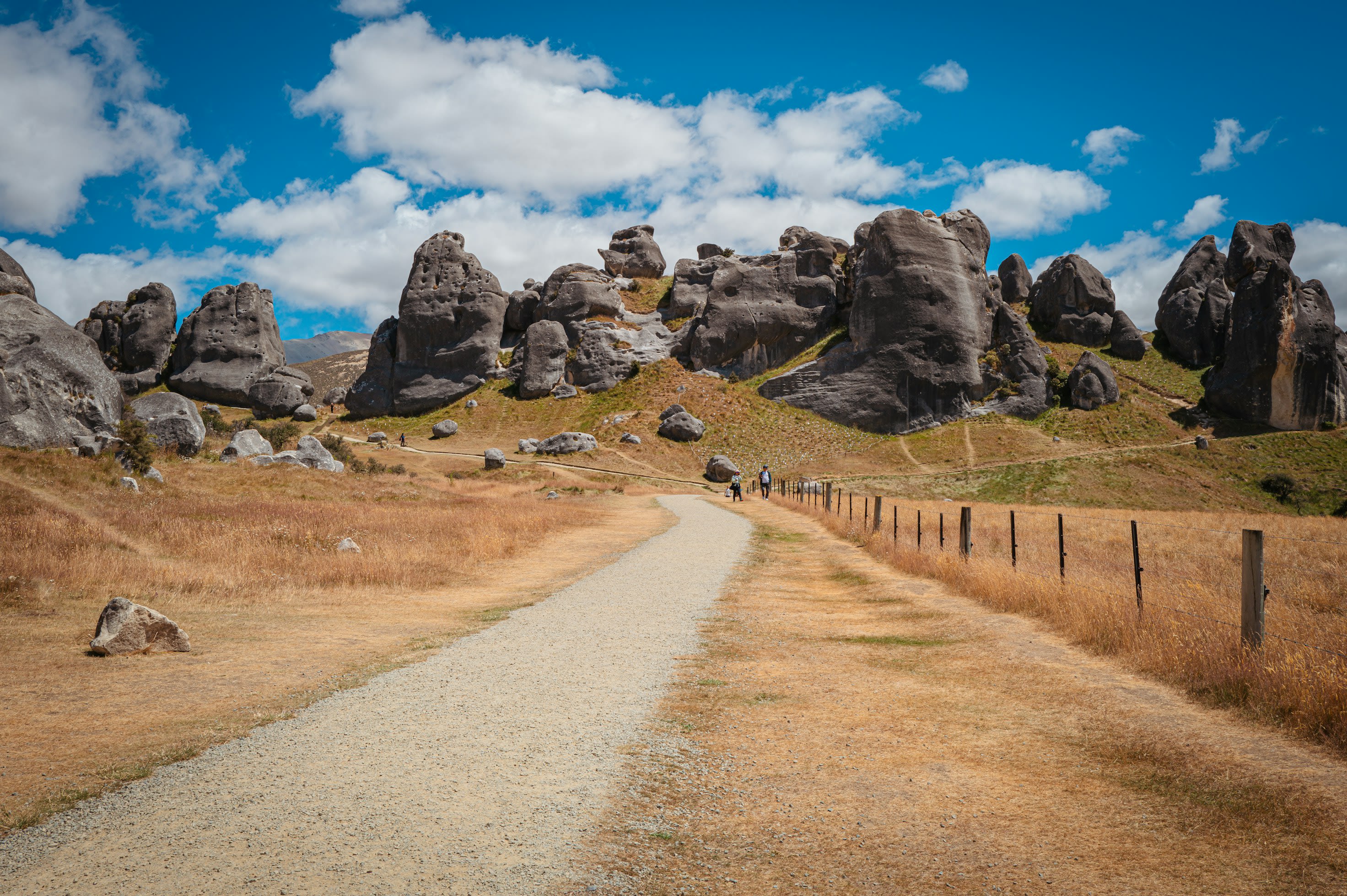
Kura Tawhiti - Castle Hill
Castle Hill, Canterbury, New Zealand
Kura Tawhiti - Castle Hill is a natural of sacred significance. Approximate coordinates: -43.22956, 171.71623. Attributes: natural, cultural. Located in Selwyn District, New Zealand / Aotearoa.
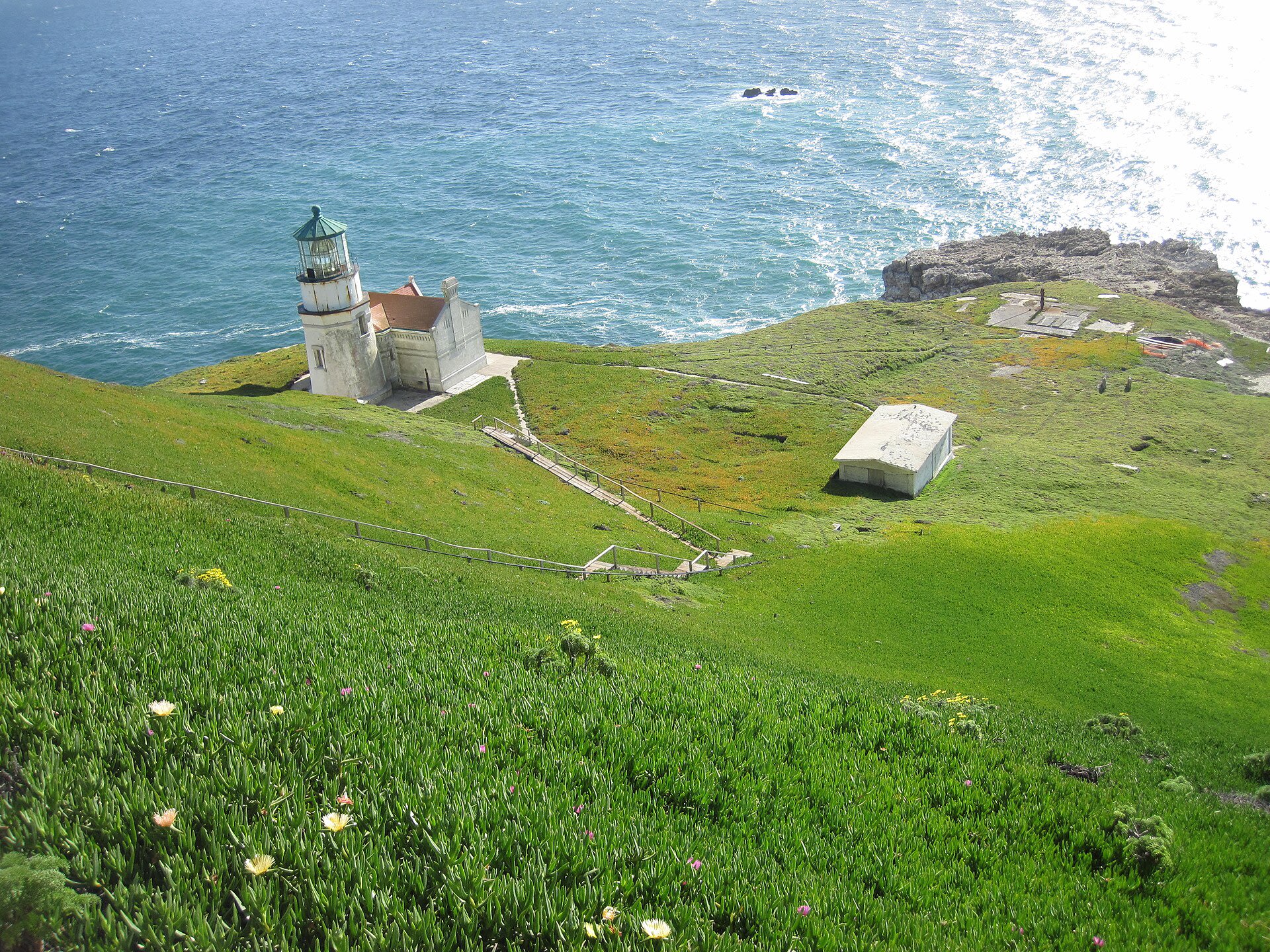
Point Conception
Santa Barbara County, United States
Point Conception in None, Santa Barbara County, United States.
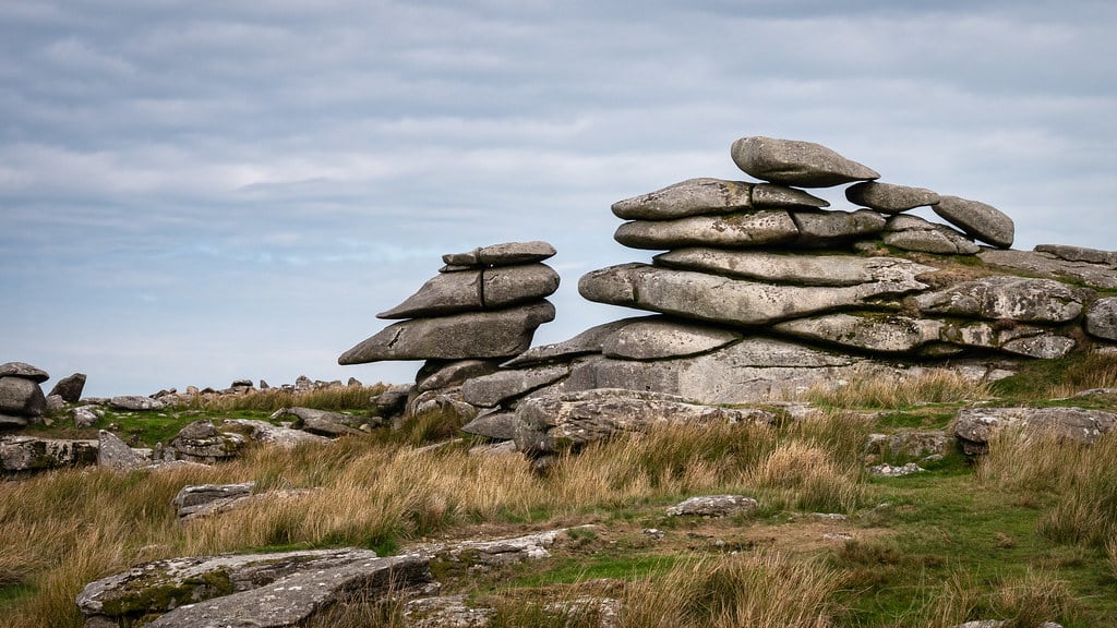
The Cheesewring
Henwood, England, United Kingdom
The Cheesewring is a site of sacred significance. Approximate coordinates: 50.52537, -4.45930. The Cheesewring (Cornish: Keuswask) is a granite tor in Cornwall, England, situated on the eastern flank of Bodmin Moor on Stowe s Hill in the parish of Linkinhorne approximately one mile northwest of the village of Minions and four miles (6 km) north of Liskeard. It is a natural geological formation, a rock outcrop of granite slabs formed by weathering. The name derives from the resemblance of the piled slabs to a stack of cheeses in a traditional cider press. Wilkie Collins described the Cheesewring in 1861 in his book Rambles Beyond Railways: If a man dreams of a great pile of stones in a nightmare, he would dream of such a pile as the Cheesewring. All the heaviest and largest of the seven thick slabs of which it is composed are at the top; all the lightest and smallest at the bottom. It rises perpendicularly to a height of thirty-two feet, without lateral support of any kind. The fifth and sixth rocks are of immense size and thickness, and overhang fearfully all round the four lower rocks which support them. All are perfectly irregular; the projections of one do not fit into the interstices of another; they are heaped up loosely in their extraordinary top-heavy form on slanting ground, half way down a steep hill. Located adjacent to the Cheesewring Quarry (which supplied the granite cladding for the structure of Tower Bridge, London) and surrounded by other granite formations, this landmark was threatened with destruction in the late nineteenth century by the proximity of blasting operations, but was saved as a result of local activism. Located in England, United Kingdom.
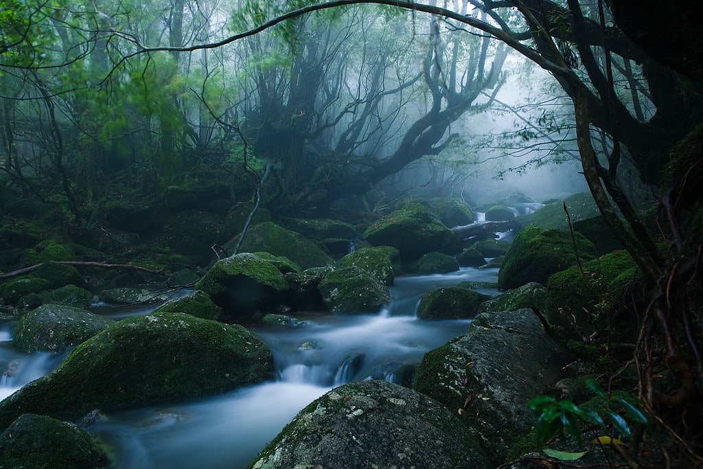
Yakushima Island
Yakushima, Kagoshima Prefecture, Japan
Yakushima Island in Yakushima, Kagoshima Prefecture, Japan.
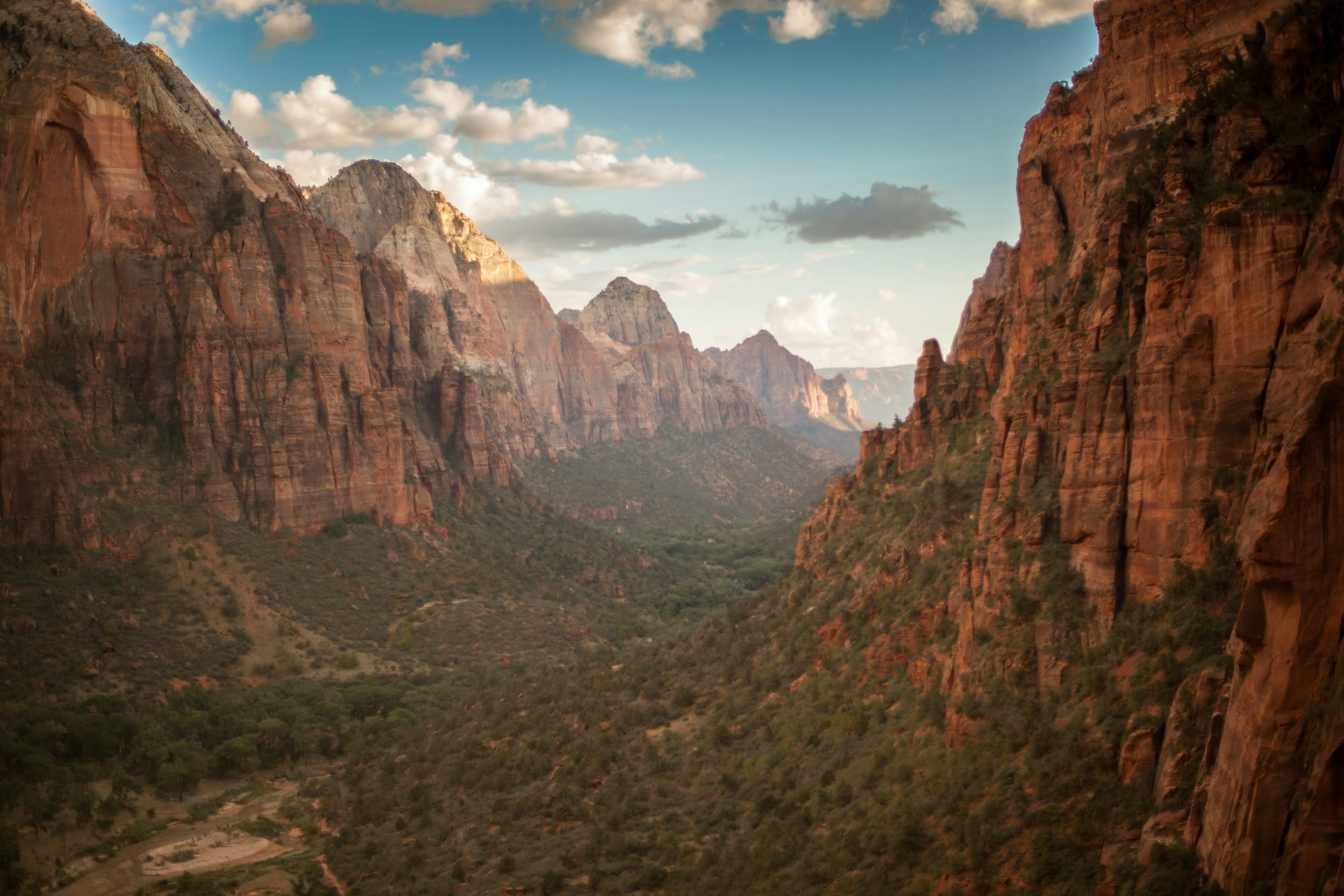
Zion National Park
Springdale, Utah, United States
For over eight centuries, the Southern Paiute have known these canyon walls as sacred homeland, a landscape alive with spiritual power they call Puha. Mormon settlers, overwhelmed by the vertical grandeur, named it after the biblical holy city. The same quality that moved both cultures persists today: something in these 3,000-foot cliffs and narrow corridors that makes the world feel thin, permeable, charged with presence.