Country guide
Japan
102 sacred sites across 37 regions.
Traditions present in Japan
Prominent site types
Aichi Prefecture
1 sites
Akita Prefecture
1 sites
Aomori Prefecture
6 sites
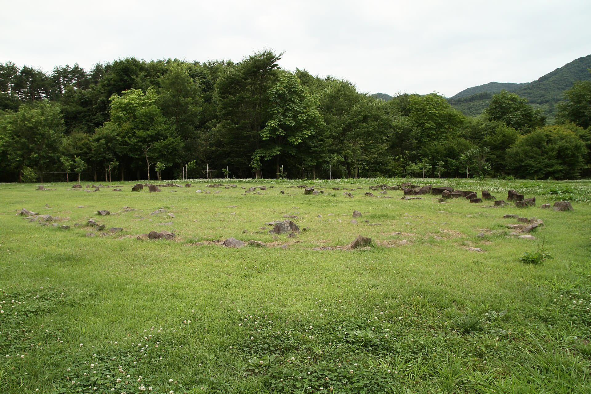
Komakino Stone Circle
Aomori, Aomori Prefecture, Japan
Four thousand years ago, Jomon communities leveled a hilltop and arranged nearly three thousand stones in a configuration so distinctive that archaeologists named it the 'Komakino style'—a vertical arrangement with flanking flat stones found at no other site in Japan. More than a hundred burial pits lie beneath the circles, marking this ridge as a threshold between worlds where the living gathered to honor their dead.

Mt. Iwaki
Hirosaki, Aomori Prefecture, Japan
Mt. Iwaki is a site of sacred significance. Approximate coordinates: 40.65611, 140.30278. Located in 弘前市, Japan.
Ōmori Katsuyama Stone Circle
Hirosaki, Aomori Prefecture, Japan
Three thousand years ago, the Jomon people positioned this stone circle with extraordinary precision: on the shortest day of the year, the setting sun descends directly behind the summit of Mount Iwaki. This alignment was no accident. The ellipse of 77 stone assemblages, the large ceremonial dwelling on the exact axis between circle and mountain, the 250 mysterious disc-shaped stones—all speak to a community that understood their place within a cosmos shaped by sacred peak and turning sun.
Osore-zan Boto-ji
Mutsu, Aomori Prefecture, Japan
Mt. Osore is a site of sacred significance. Approximate coordinates: 41.32706, 141.09026. Located in むつ市, Japan.
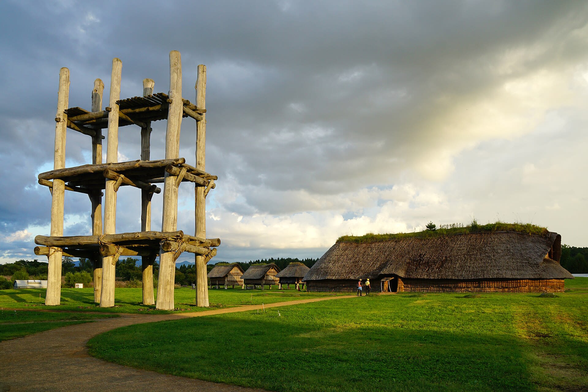
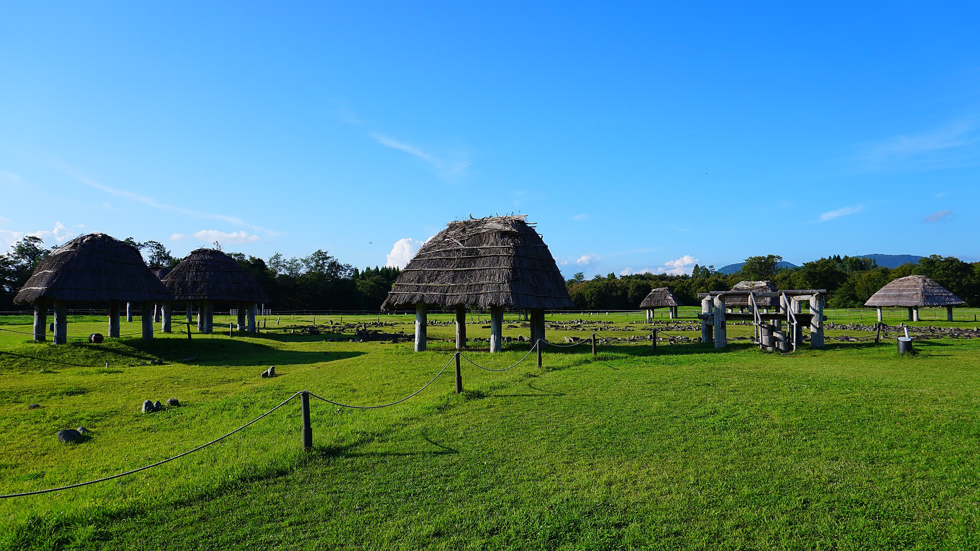
Sannai-Maruyama Site
Aomori, Aomori Prefecture, Japan
For seventeen centuries, the Jomon people lived at Sannai-Maruyama, cultivating chestnuts, trading jade across hundreds of kilometers, and building structures that still challenge our assumptions about prehistoric societies. The reconstructed six-pillar building towers 15 meters over the 42-hectare site, its purpose debated but its scale undeniable. Aligned burial rows and planned settlement layout reveal a community that understood sacred geography. This is not merely archaeology; this is encounter with 80 generations of human continuity.

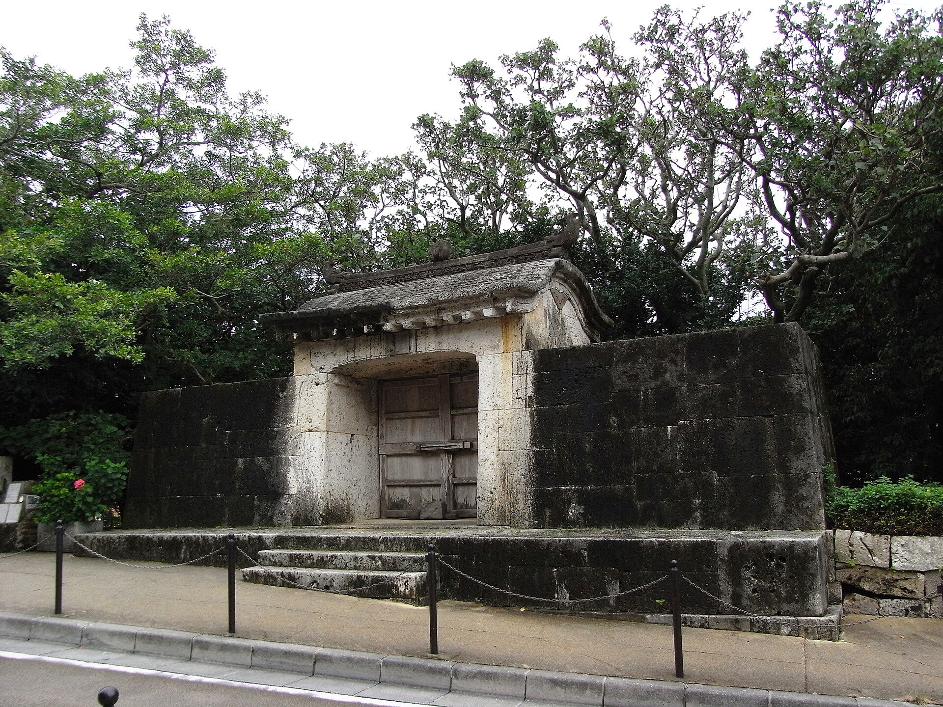
Tomb of Christ, Shingo, Japan
Shingo, Aomori Prefecture, Japan
Tomb of Christ, Shingo, Japan is a site of sacred significance. Approximate coordinates: 40.45405, 141.14869. Located in 新郷村, 三戸郡, Japan.
Chiba Prefecture
1 sites
Ehime Prefecture
2 sites
Ishiteji Temple, Matsuyama
Matsuyama, Ehime Prefecture, Japan
Ishiteji Temple, Matsuyama is a temple of sacred significance. Approximate coordinates: 33.84790, 132.79647. Attributes: built, cultural, pilgrimage. Tradition: Buddhism. Associated figure: Kūkai. Located in 松山市, Japan.

Mt. Ishizuchi
Saijo, Ehime Prefecture, Japan
Mt. Ishizuchi is a site of sacred significance. Approximate coordinates: 33.77192, 133.11193. Located in 西条市, Japan.
Fukui Prefecture
1 sites
Fukuoka Prefecture
1 sites

Fukushima Prefecture
1 sites

Hiroshima Prefecture
1 sites

Hokkaido
1 sites

Hokkaidō
2 sites
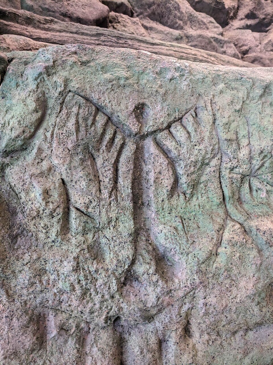
Fugoppe Cave
Yoichi, Hokkaidō, Japan
Carved into the walls of a small sea-facing cave near Yoichi, approximately 800 petroglyphs have puzzled scholars since their discovery in 1950. The images—human figures with wings or horns, boats, fish, marine creatures—date to roughly 2,000 years ago, created by a people whose identity remains unknown. The 'winged man' figures have become iconic in Hokkaido. This is one of only two petroglyph caves in all of Japan, preserving evidence of a spiritual tradition that appeared briefly and then vanished.
Washinoki Stone Circle
Mori, Hokkaidō, Japan
Beneath a highway tunnel in southwestern Hokkaido lies Japan's largest stone circle, a 4,000-year-old Jomon burial site that was nearly destroyed by modern construction. Discovered in 2003, the Washinoki Stone Circle contains 602 carefully arranged stones in a double-ring formation, with outer stones aligned on their long axes and inner stones pointing toward the center. The volcanic ash that buried it for centuries preserved evidence of sophisticated ritual architecture.
Hyogo Prefecture
2 sites
Ishi-no-Hoden, Himeji
Takasago, Hyogo Prefecture, Japan
Ishi-no-Hoden, Himeji is a megalith of sacred significance. Approximate coordinates: 34.78258, 134.79509. Attributes: natural, cultural, archaeological. Located in 高砂市, Japan.
Izanagi Shinto Shrine, Awaji Island
Awaji, Hyogo Prefecture, Japan
Izanagi Shinto Shrine, Awaji Island is a shrine of sacred significance. Approximate coordinates: 34.46005, 134.85250. Attributes: built, cultural, pilgrimage, ceremonial. Tradition: Shinto. Associated figure: Izanagi. Mythological context: Japanese mythology. Located in 淡路市, Japan.
Ibaraki Prefecture
1 sites
Ishikawa Prefecture
1 sites

Iwate Prefecture
2 sites
Goshono Site
Ichinohe, Iwate Prefecture, Japan
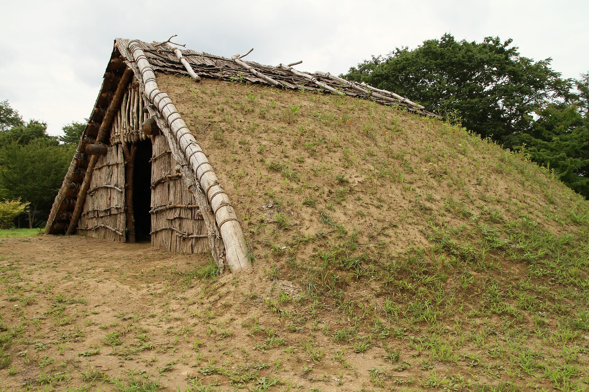
For forty generations, Jomon communities gathered at this river terrace to tend their dead and feed their fires. The earthen mounds along the settlement's southern edge hold evidence of repeated ceremonies: burned animal bones, charred nuts, clay figurines—offerings made across eight centuries. At the center of the village, two stone-outlined burial grounds marked where the living gathered to honor ancestors. Today, reconstructed earthen-roof dwellings bring the settlement back to life.
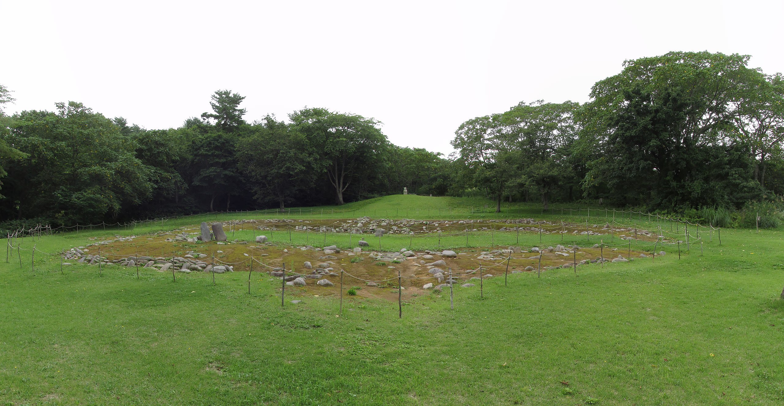
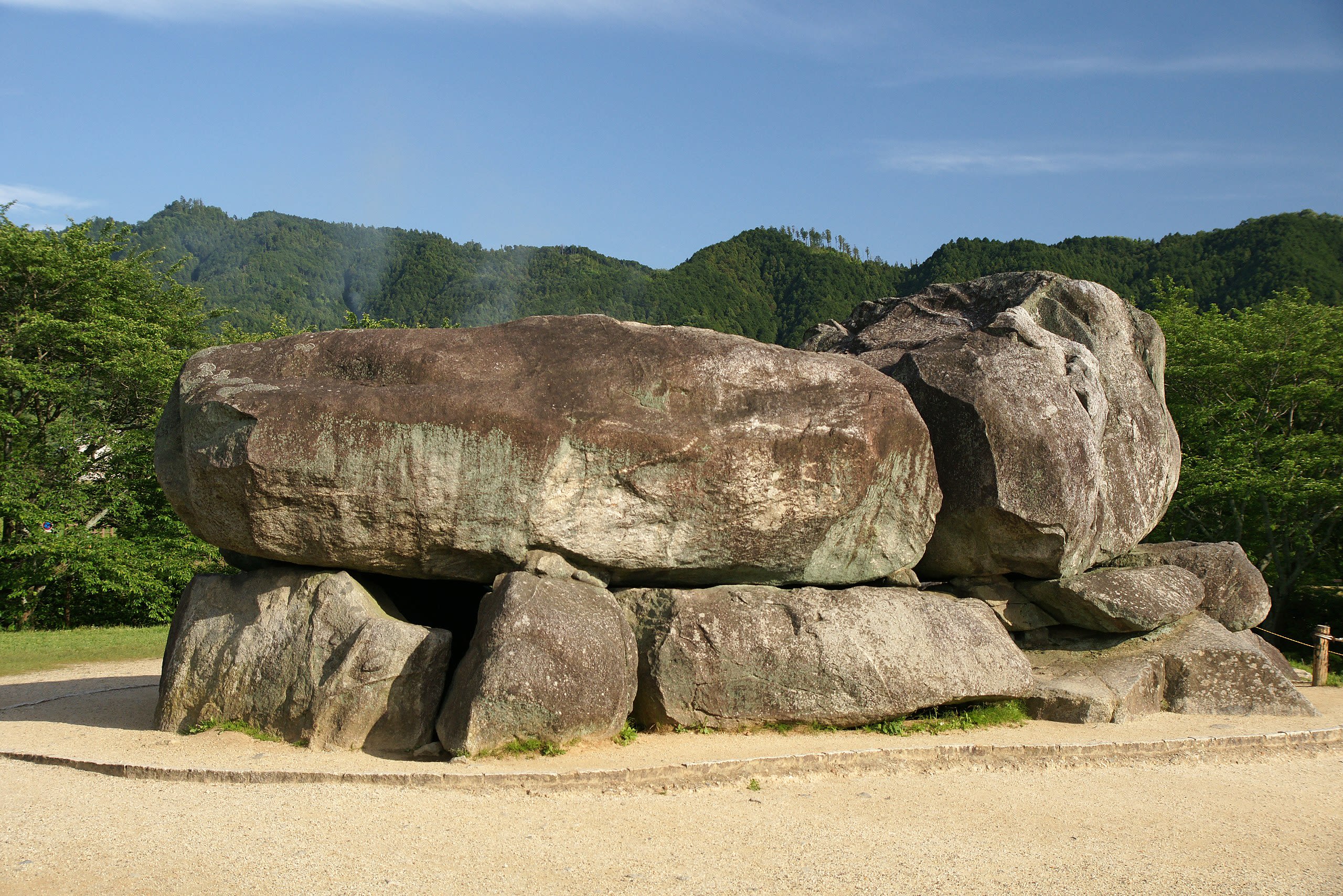
Yubunezawa Stone Circle
Takizawa, Iwate Prefecture, Japan
Four thousand years ago, Jomon peoples of northern Japan established this ground exclusively for the dead and for ceremony. No homes stood here, no everyday debris accumulated—only the careful placement of nine hundred stones over ancestral graves. The vernal equinox sunset aligns with Mount Yachiyama on the horizon, suggesting that spring's return was marked in this place where the boundary between living and dead grew thin.
Kagawa Prefecture
3 sites
Kotohira shrine, Kotohira, Japan
Kotohira, Kagawa Prefecture, Japan
Kotohira shrine, Kotohira, Japan is a shinto shrine of sacred significance. Approximate coordinates: 34.18400, 133.80954. Attributes: built, cultural, pilgrimage, ceremonial. Tradition: Shinto. Associated figure: Konpira. Mythological context: Shinto. Located in 琴平町, 仲多度郡, Japan.
Motoyamaji Temple, Motoyama
Mitoyo, Kagawa Prefecture, Japan
Motoyamaji Temple, Motoyama is a site of sacred significance. Approximate coordinates: 34.13975, 133.69411. Located in 三豊市, Japan.

Yakuriji Temple, Yakuri
Takamatsu, Kagawa Prefecture, Japan
Yakuriji Temple, Yakuri is a site of sacred significance. Approximate coordinates: 34.35969, 134.13985. Located in 高松市, Japan.
Kagoshima Prefecture
3 sites

Kirishima Shrine
Kirishima, Kagoshima Prefecture, Japan
Mt. Kirishima is a site of sacred significance. Approximate coordinates: 31.91706, 130.88004. Located in 霧島市, Japan.

Mt. Kaimon
Ibusuki, Kagoshima Prefecture, Japan
Mt. Kaimon is a site of sacred significance. Approximate coordinates: 31.18083, 130.52583. Located in 指宿市, Japan.
Yakushima Island
Yakushima, Kagoshima Prefecture, Japan
Yakushima Island in Yakushima, Kagoshima Prefecture, Japan.
Kochi Prefecture
1 sites
Kumamoto Prefecture
1 sites

Kyoto
1 sites
Kyoto Prefecture
10 sites

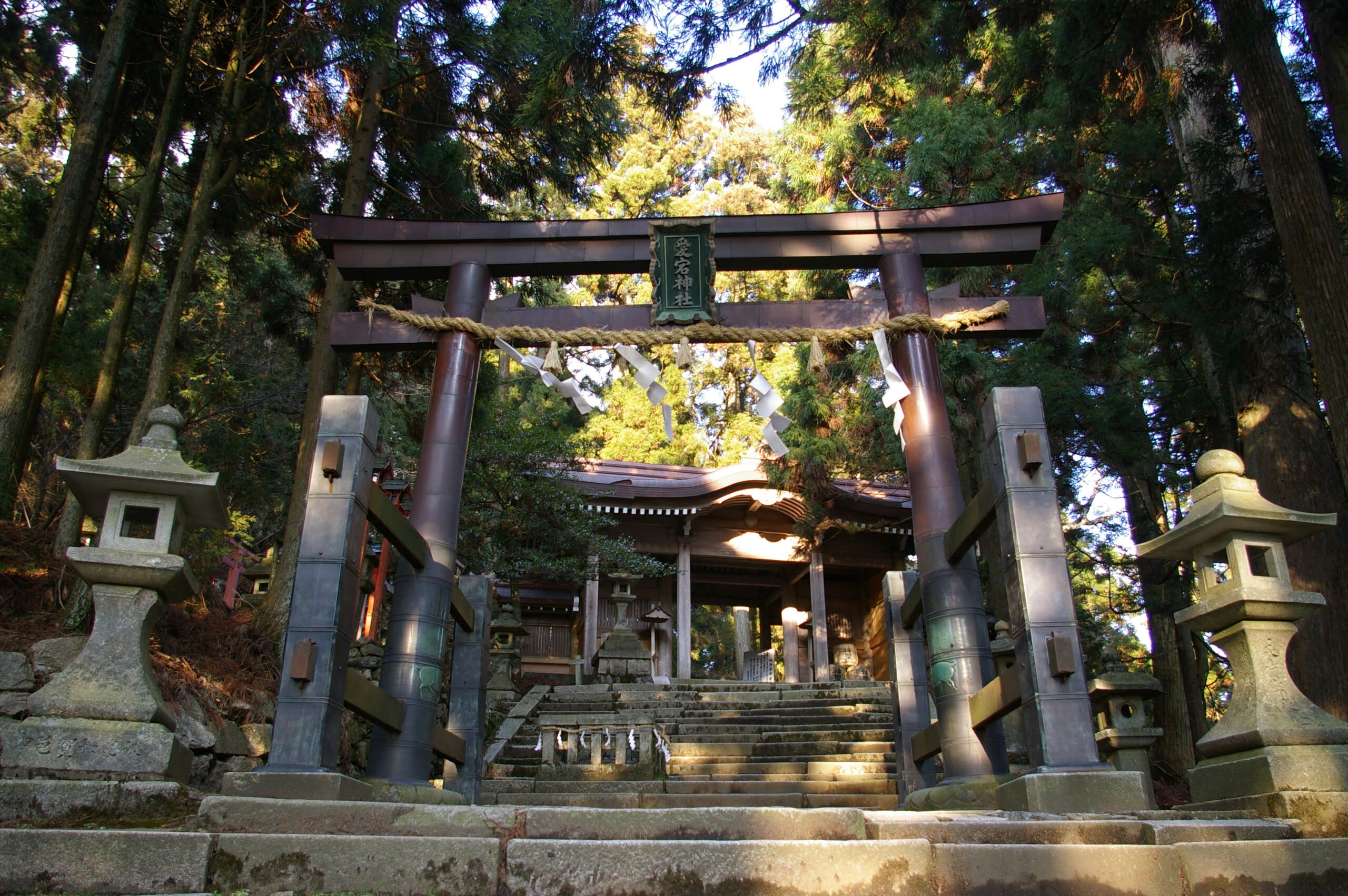
Atago Shrine (Atago Jinja)
Kyoto, Kyoto Prefecture, Japan
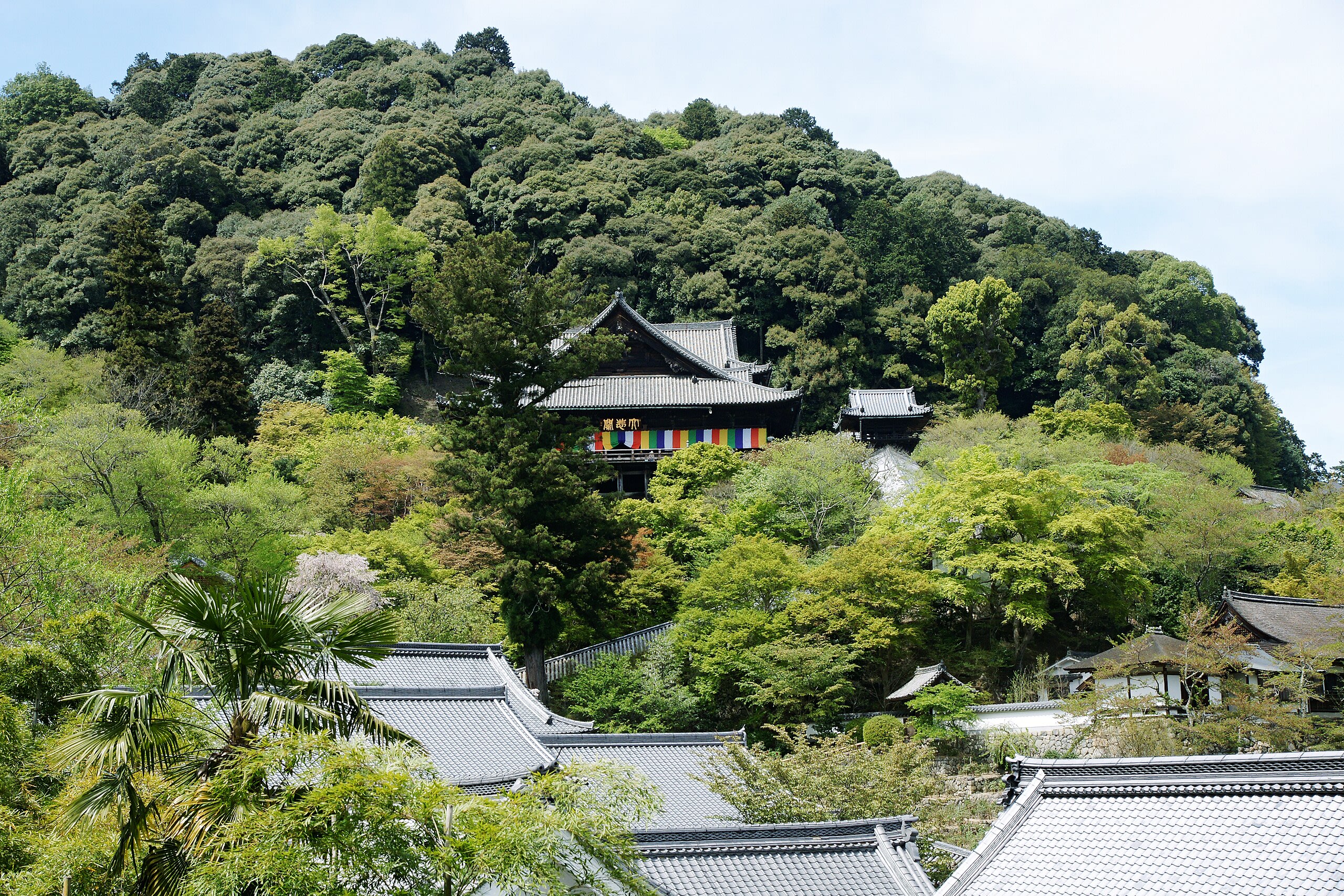
Atago Shrine crowns Mount Atago at 924 meters, the highest point surrounding Kyoto. As head shrine of approximately 900 Atago shrines across Japan, it anchors the nation's network of fire prevention worship. Here, the fire god Kagutsuchi is honored not as destroyer but as guardian. The demanding climb to reach the shrine transforms pilgrims before they receive the mountain's protective blessing.

Atago Shrine (Atago Jinja)
Kyoto, Kyoto Prefecture, Japan
Atago Shrine crowns Mount Atago at 924 meters, the highest point surrounding Kyoto. As head shrine of approximately 900 Atago shrines across Japan, it anchors the nation's network of fire prevention worship. Here, the fire god Kagutsuchi is honored not as destroyer but as guardian. The demanding climb to reach the shrine transforms pilgrims before they receive the mountain's protective blessing.
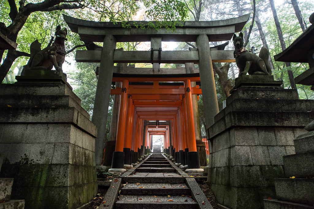
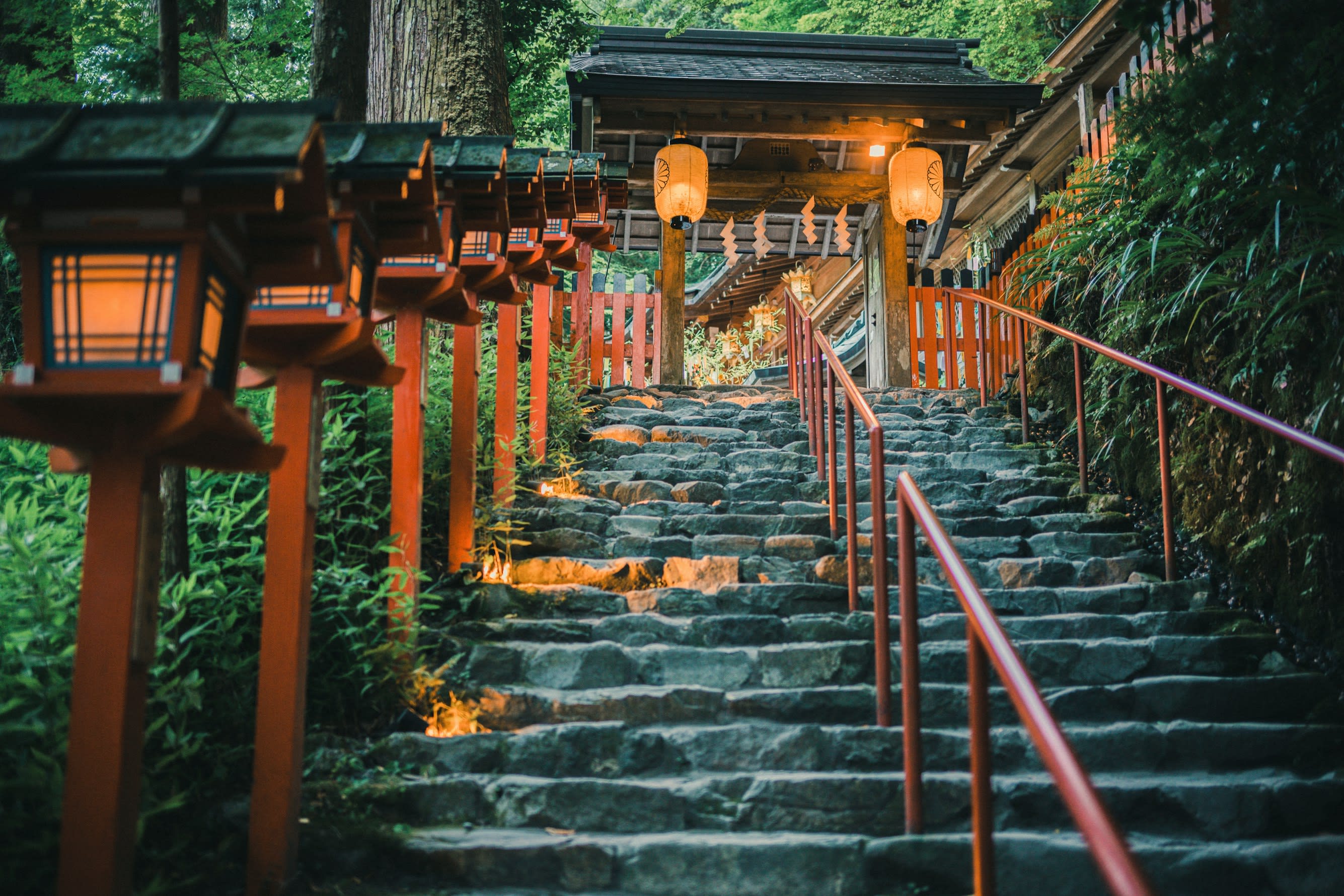
Fushimi Inari-taisha
Kyoto, Kyoto Prefecture, Japan
Since 711 CE, pilgrims have climbed sacred Mount Inari through tunnels of vermilion torii gates—each one donated by someone whose prayers were answered, or who hoped they would be. As the head shrine of over 30,000 Inari shrines across Japan, Fushimi Inari-taisha stands at the center of worship for prosperity, abundant harvests, and worldly success. Fox messengers guard the paths. The mountain trail winds past countless smaller shrines where incense smoke rises and bells ring softly, ascending toward the summit where the deity dwells.
Kifune Shrine
Kyoto, Kyoto Prefecture, Japan
Kifune Shrine in Kyoto, Kyoto Prefecture, Japan.
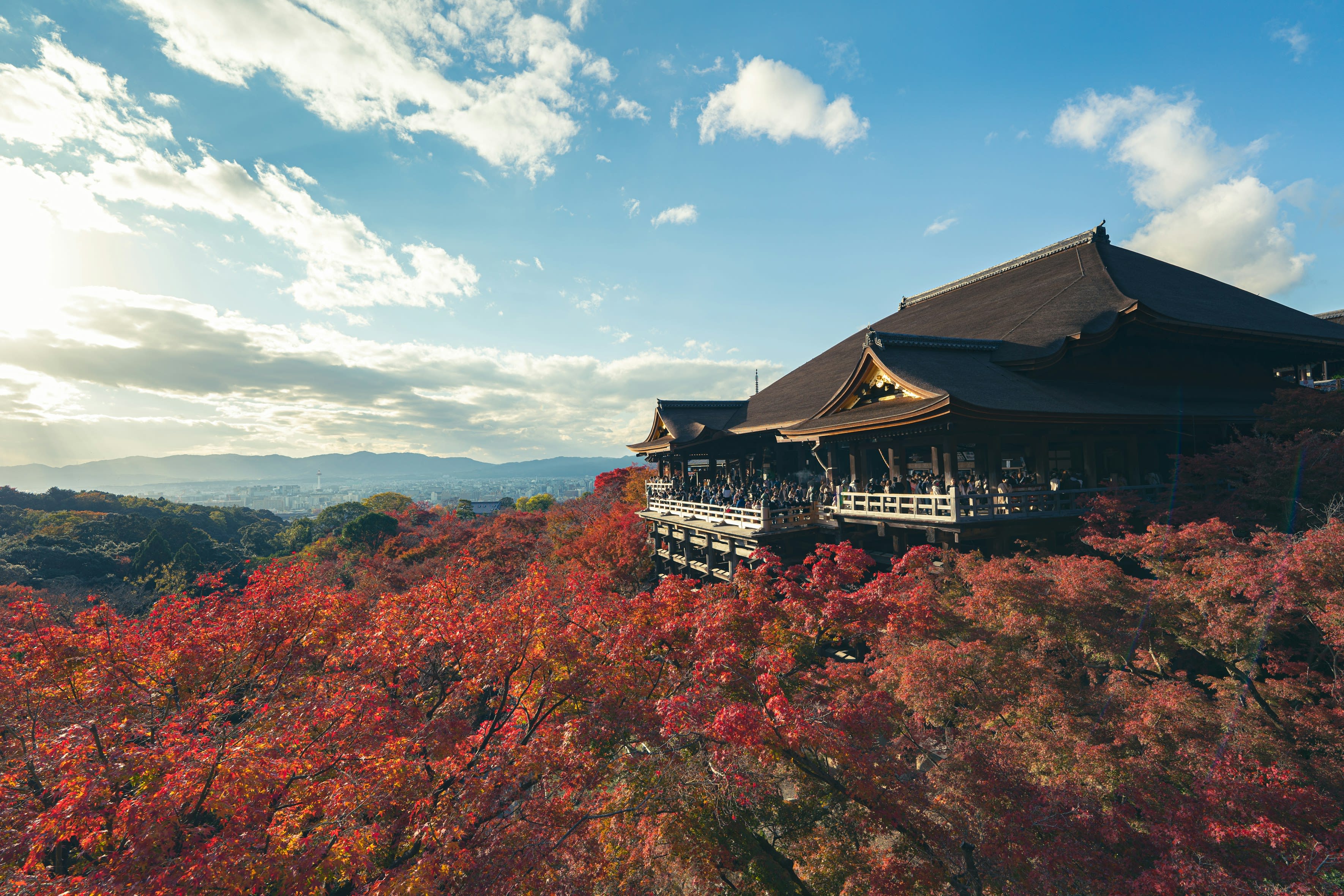
Kiyomizu-dera Temple
Kyoto, Kyoto Prefecture, Japan
On the forested slopes of Mount Otowa in eastern Kyoto, a vast wooden stage juts out over the valley—built without a single nail, supported by pillars of four-hundred-year-old zelkova, defying gravity and time. Kiyomizu-dera, the Temple of Pure Water, takes its name from the sacred spring that has flowed here since before Kyoto was a capital. For over 1,250 years, pilgrims have climbed this hillside to drink from its three streams and stand suspended between earth and heaven.

Kurama-dera Temple
Kyoto, Kyoto Prefecture, Japan
Kurama-dera Temple is a temple of sacred significance. Approximate coordinates: 35.11798, 135.77098. Attributes: built, cultural, pilgrimage. Tradition: Buddhism. Associated figure: Bishamonten. Mythological context: Japanese Buddhism. Located in 京都市, Japan.

Mt. Atago
Kyoto, Kyoto Prefecture, Japan
Mt. Atago is a site of sacred significance. Approximate coordinates: 31.30760, 130.92343. Located in 肝付町, 肝属郡, Japan.
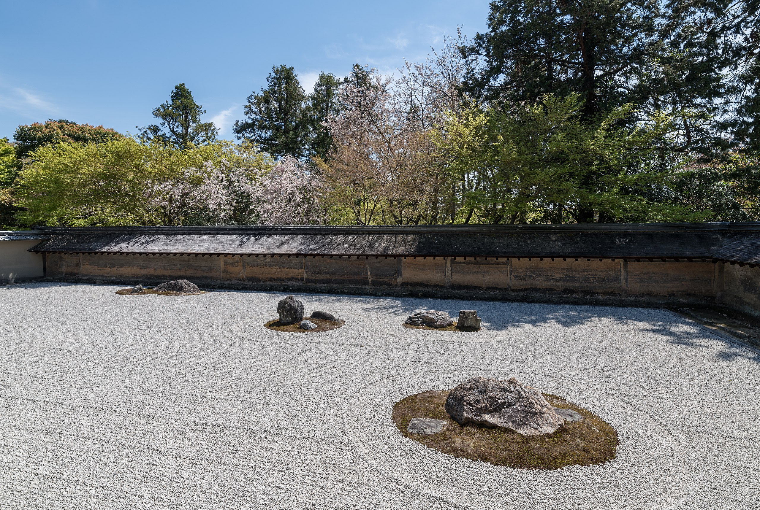
Ryoan-ji
Kyoto, Kyoto Prefecture, Japan
Ryoan-ji is a site of sacred significance. Approximate coordinates: 35.03449, 135.71826. Located in 京都市, Japan.
Toji
Kyoto, Kyoto Prefecture, Japan
For over 1,200 years, Tō-ji has been the beating heart of Shingon Buddhism—the esoteric tradition that Kūkai brought from China in the 9th century. The 57-meter five-story pagoda, Japan's tallest wooden structure, has become a symbol of Kyoto itself. Inside the Lecture Hall, 21 Buddhist statues form a three-dimensional mandala—the universe as understood in esoteric Buddhism made physical and walkable. On the 21st of each month, the Kobo-san market honors Kūkai with over 1,000 stalls.
Mie Prefecture
2 sites
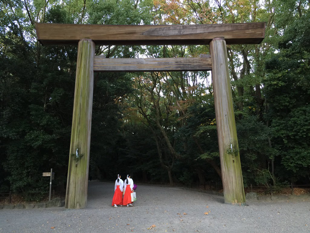
Ise
Ise, Mie Prefecture, Japan
Ise is a shrine of sacred significance. Approximate coordinates: 34.45501, 136.72579. Attributes: built, cultural, pilgrimage, ceremonial. Tradition: Shinto. Ise may refer to: Located in 伊勢市, Japan.
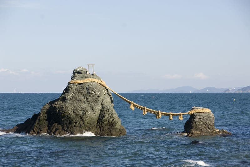
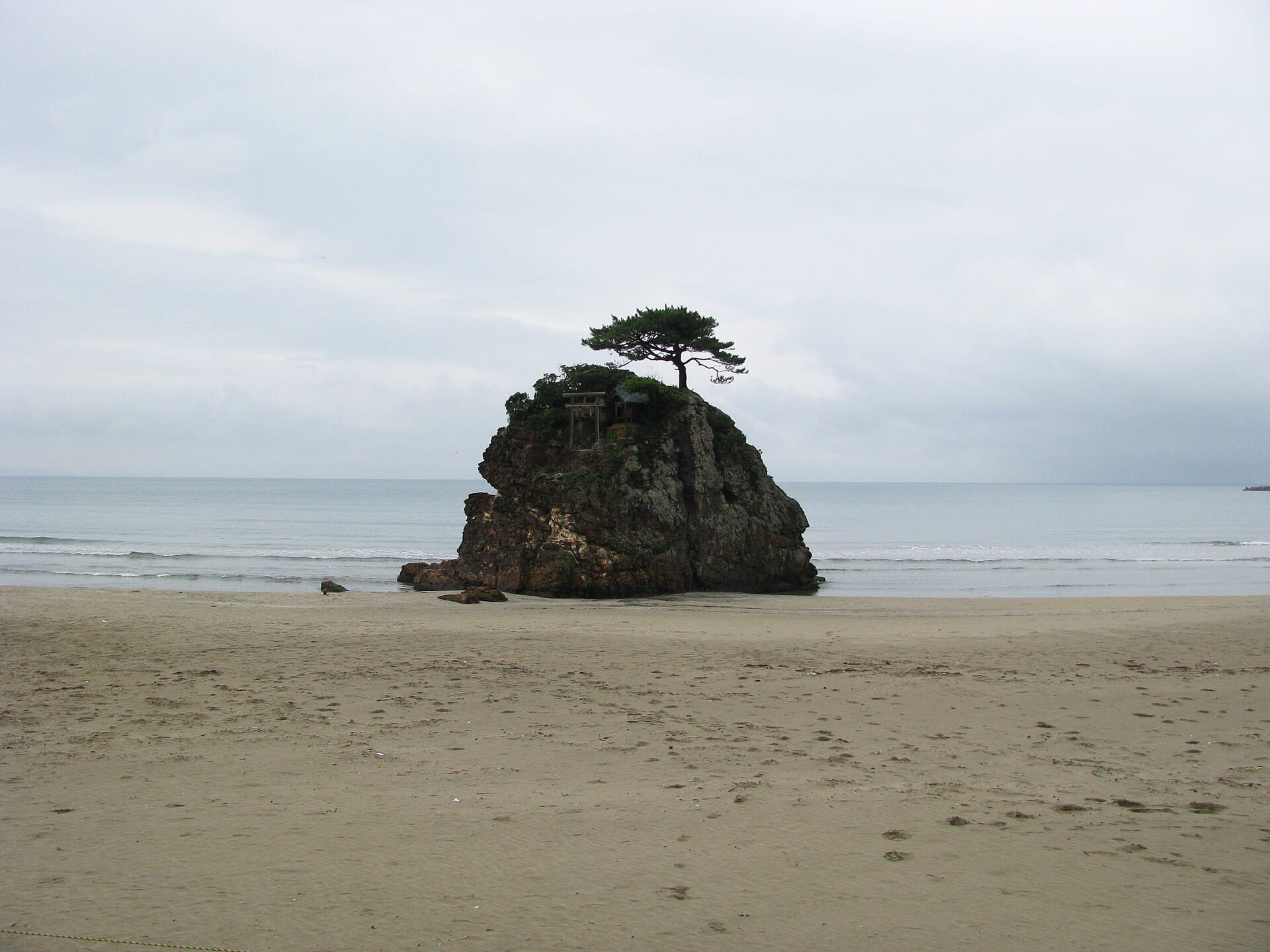
Meoto Iwa
Ise, Mie Prefecture, Japan
Two rocks rise from the sea at Futami, joined by a massive shimenawa rope weighing over one ton. The larger represents Izanagi, the smaller Izanami—the divine couple whose union created Japan according to Shinto myth. On summer solstice mornings, the rising sun appears between them directly over distant Mount Fuji, linking creator deities, sun goddess, and sacred mountain in a single luminous moment. This is where pilgrims have purified themselves before approaching Ise Grand Shrine for centuries.
Miyazaki Prefecture
2 sites
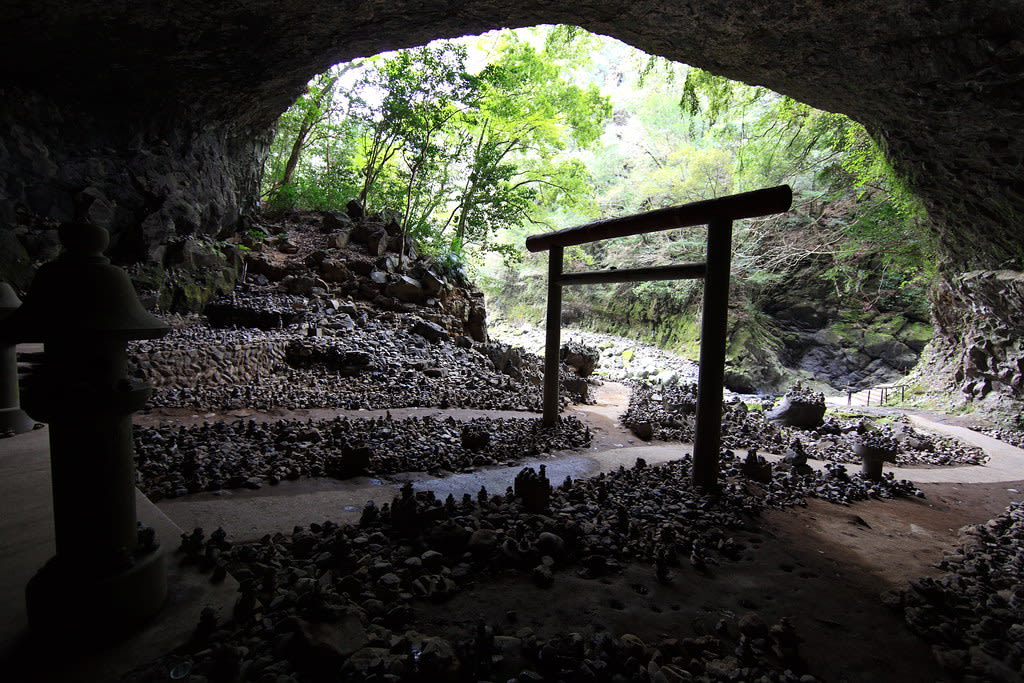
Amanoiwato Shrine
Takachiho, Miyazaki Prefecture, Japan
In a forested gorge in Kyushu's Takachiho region, pilgrims have gathered for centuries at the cave where Amaterasu, the sun goddess and ancestress of Japan's Imperial line, hid from the world. The darkness that fell when she withdrew—and the wild dance that drew her back—gave birth to kagura, the sacred performance tradition still enacted here through winter nights. Priests guide visitors to view the cave, while nearby, stone cairns rise by the thousands where eight million kami once gathered.
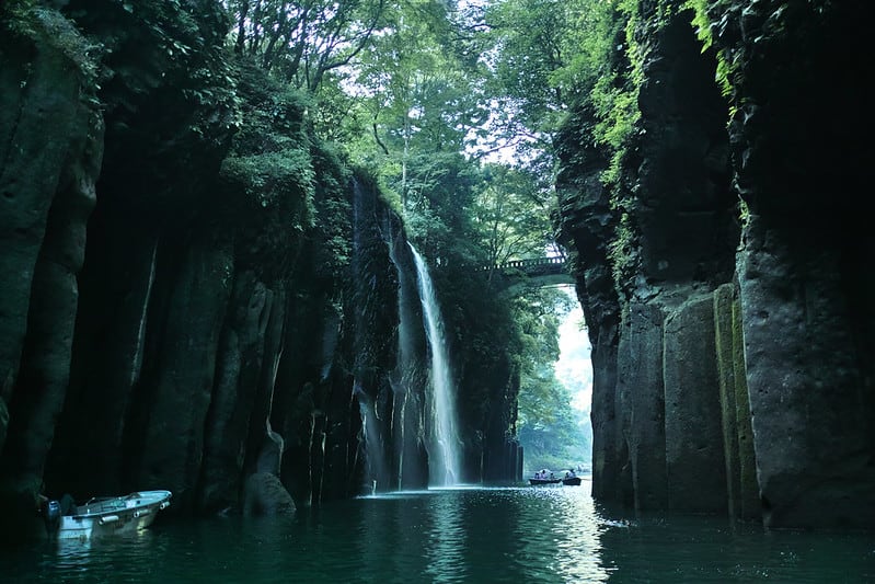
Takachiho Gorge
Takachiho, Miyazaki Prefecture, Japan
In this volcanic gorge where sheer basalt cliffs rise 80 meters above an emerald river, Japan's creation mythology takes physical form. Here the Sun Goddess Amaterasu hid herself in a cave, plunging all realms into darkness. Here the eight million kami gathered and danced to lure her out. Here her grandson Ninigi descended from heaven to establish divine rule on earth. The Manai Falls still pour where legend says heavenly water first touched the world.
Nagano Prefecture
5 sites
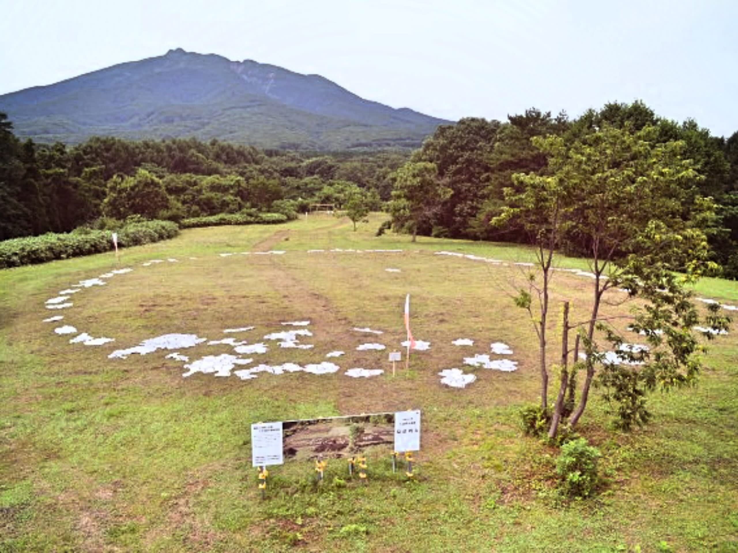
Akyū Ruins
Hara, Nagano Prefecture, Japan
Six thousand years ago, the Jomon people gathered here to tend sacred fires beneath the gaze of Mount Tateshina. At the heart of their ceremonial ground stood a single stone, deliberately aligned toward the mountain they venerated. Today the ruins lie buried beneath a highway, preserved for eternity—but above them, a quiet forest holds the memory of what once made this ridge a place where worlds could meet.

Mt. Asama
Komoro, Nagano Prefecture, Japan
Mt. Asama is a site of sacred significance. Approximate coordinates: 31.78518, 130.49296. Located in 薩摩川内市, Japan.
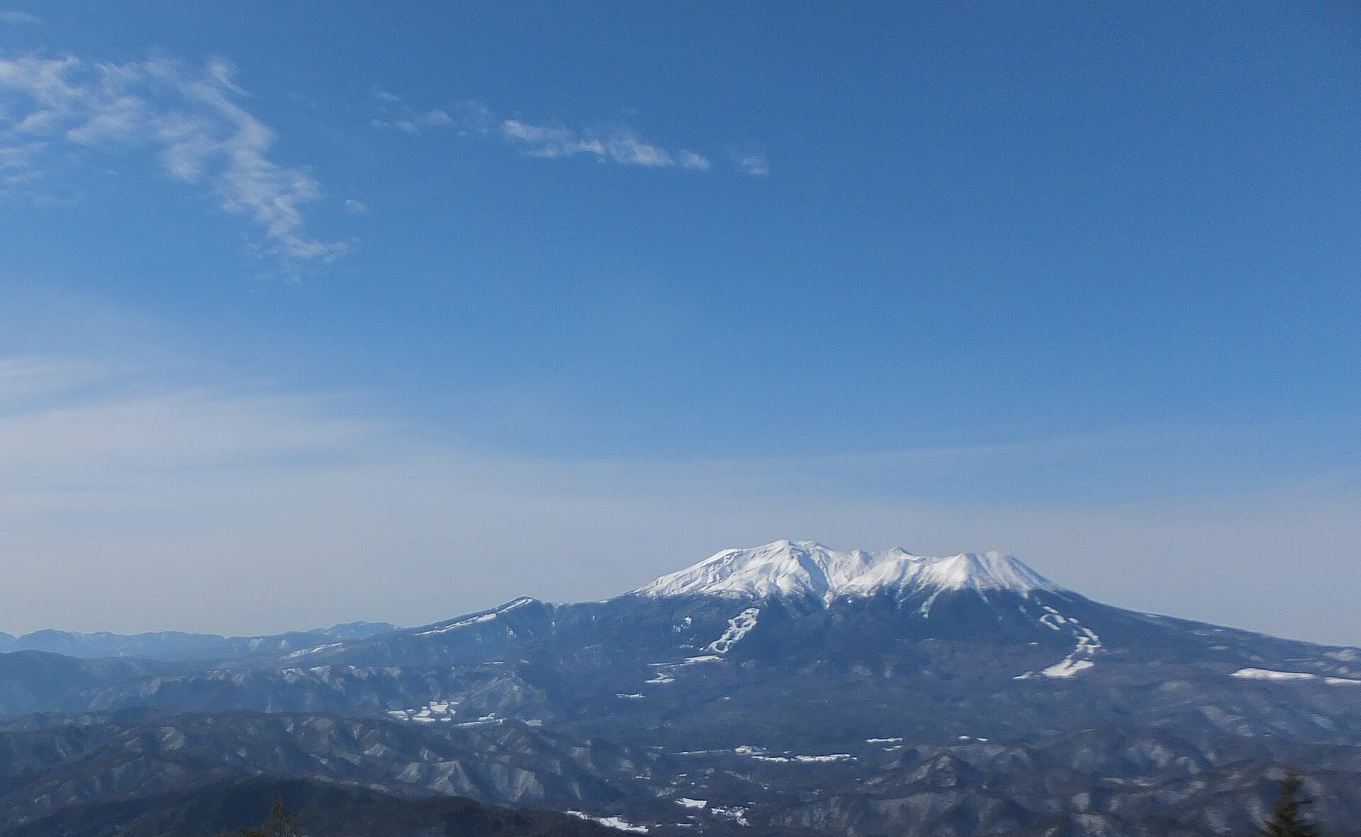
Mt. Ontake
Otaki, Nagano Prefecture, Japan
Mt. Ontaki is a site of sacred significance. Approximate coordinates: 35.89333, 137.47917. Located in 木曽町, 木曽郡, Japan.
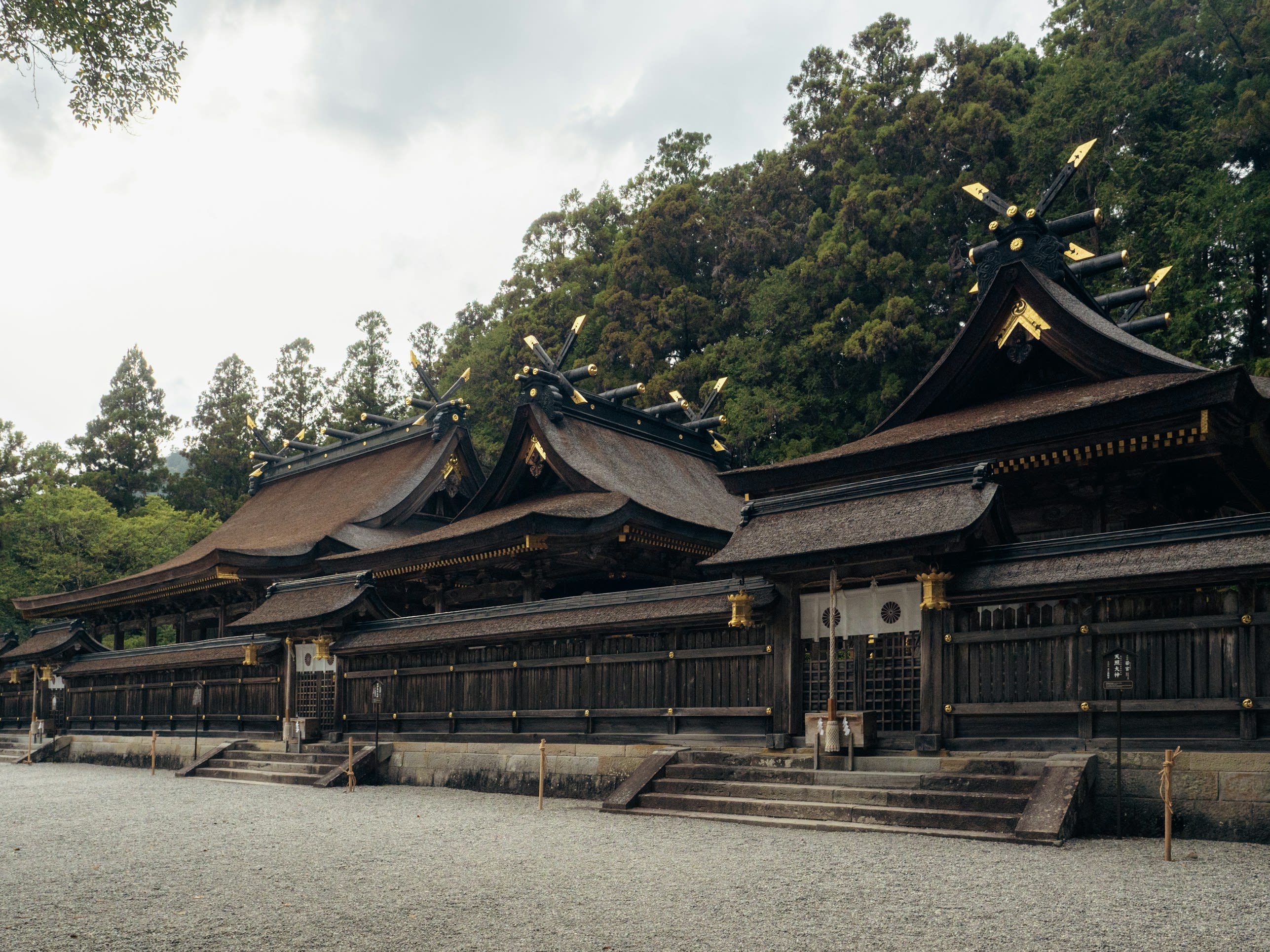
Suwa-taisha
Suwa, Nagano Prefecture, Japan
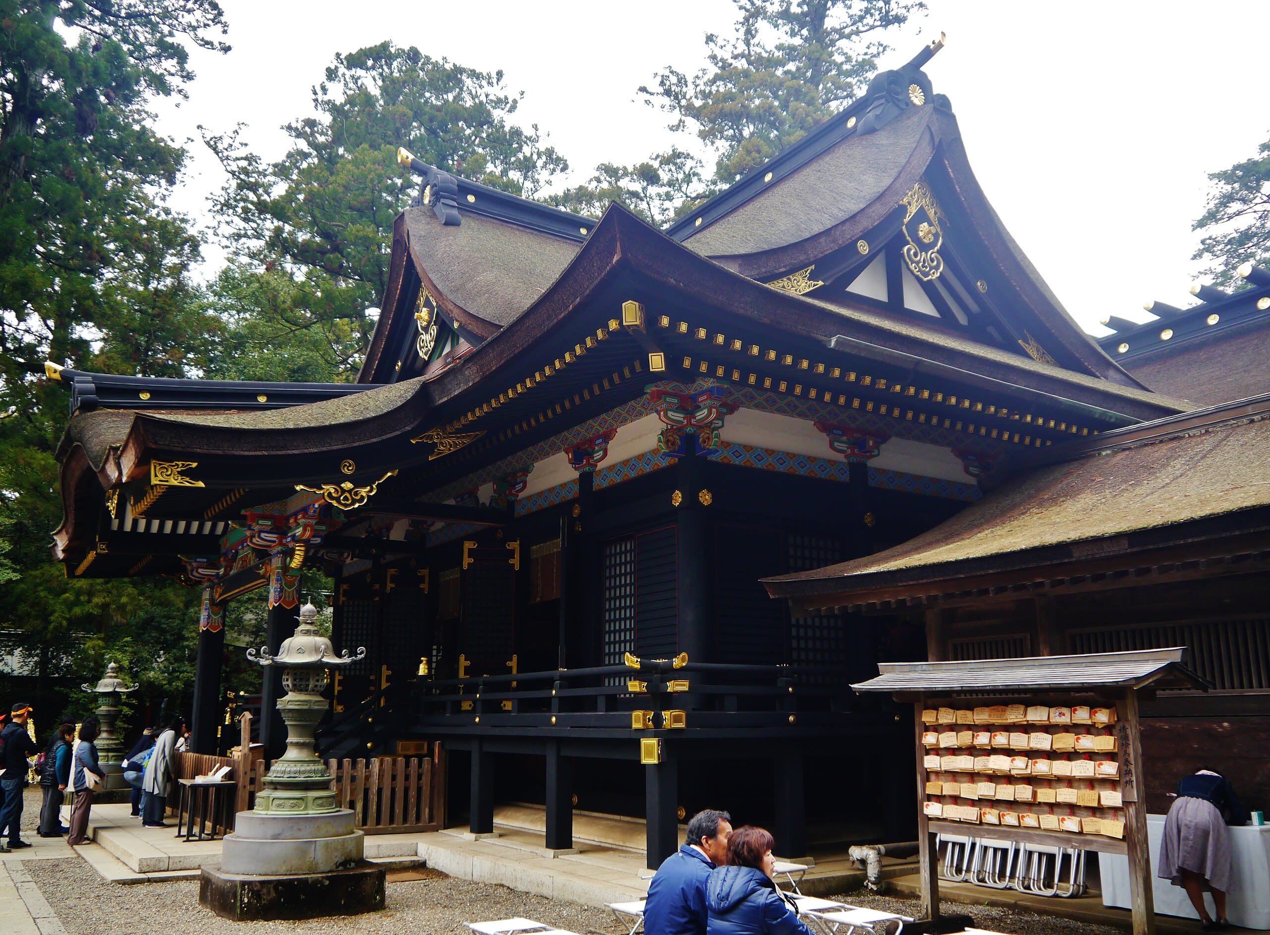
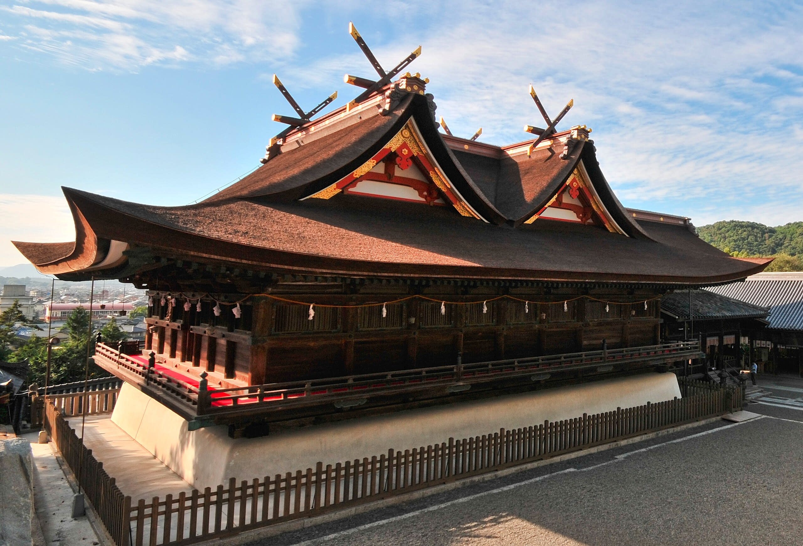
Suwa-taisha predates shrine architecture itself. Four shrines encircle Lake Suwa in Nagano Prefecture, but their sacred objects are not artifacts—they are Mount Moriya and ancient yew and cedar trees. This represents Shinto at its most primal: direct encounter with kami dwelling in landscape. Every six years, the Onbashira Festival renews this connection as communities drag massive sacred pillars from the mountains, a tradition documented for over 1,200 years. Head shrine of more than 10,000 affiliated Suwa shrines across Japan.
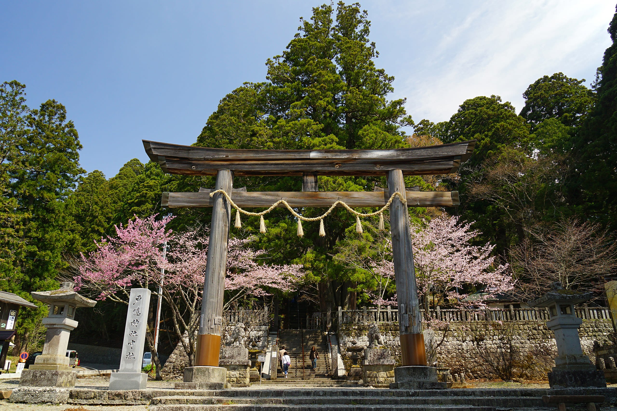
Togakushi Shrine
Nagano, Nagano Prefecture, Japan
Mount Togakushi is literally the 'Hidden Door'—the cave entrance that the god Tajikarao threw across the heavens after pulling the sun goddess Amaterasu from her hiding place. Five shrines scatter across this sacred mountain, each enshrining a deity who helped restore light to the world. The pilgrimage to Okusha, the most remote shrine, passes through an avenue of 400-year-old cedars that create a natural cathedral. Ninja once trained in these forested slopes. Today, the mountain draws pilgrims seeking the power of the gods who overcame cosmic darkness.
Nara Prefecture
12 sites
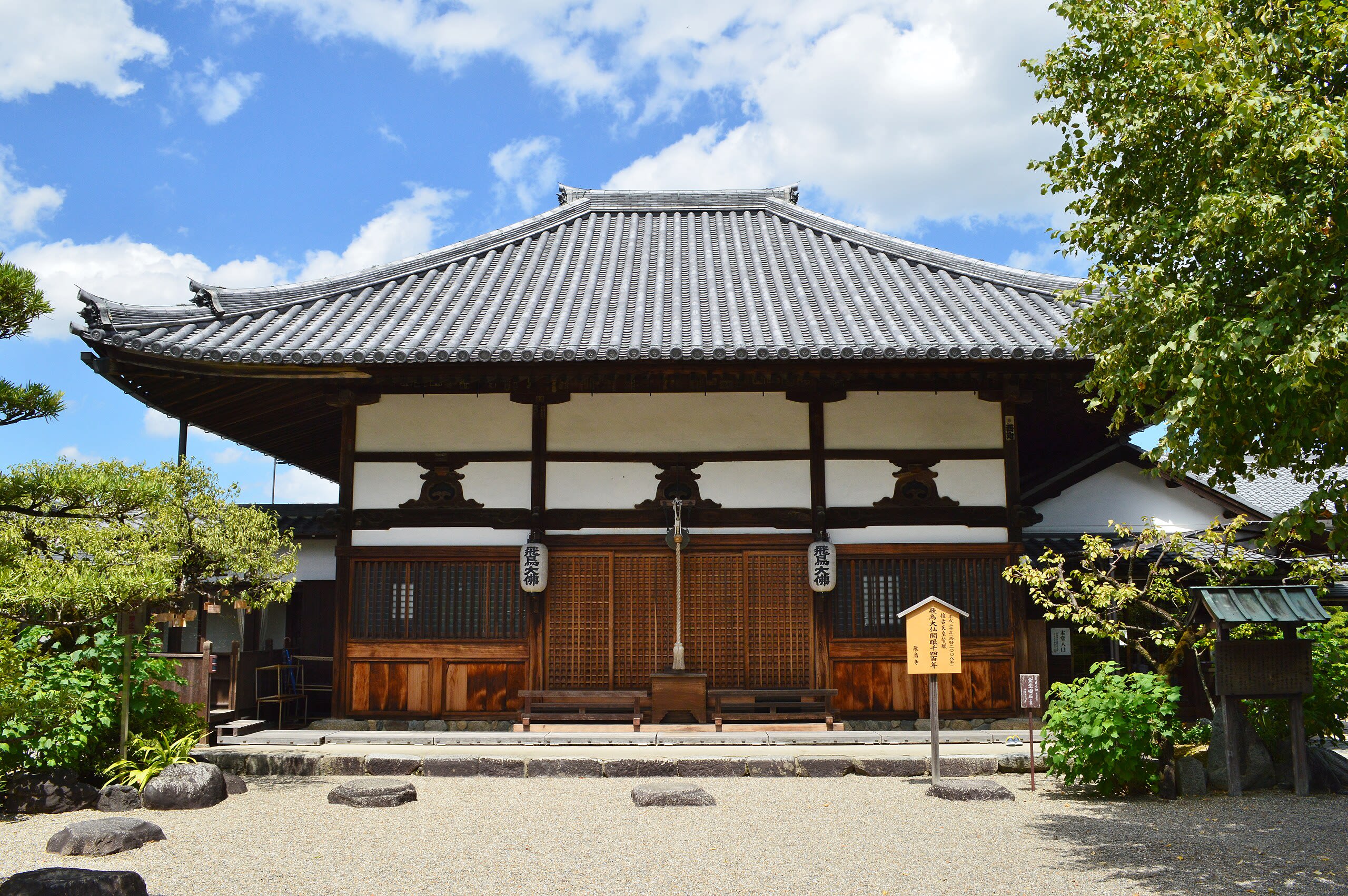
Asuka-dera
Asuka, Nara Prefecture, Japan
In a quiet valley surrounded by rice fields, Japan's oldest surviving Buddha statue has watched from the same location for over 1,400 years. Asuka-dera marks where Buddhism transformed from a foreign import to an established Japanese institution. When the Soga clan built this temple in 588 CE using Korean craftsmen, they created Japan's first full-scale Buddhist complex. The Great Buddha's face bears the scars of fire and time—half original bronze, half later repair—yet continues to receive devotees at the birthplace of institutional Buddhism in Japan.
Hase-dera Shingon Buddhist Temple, Sakurai
Sakurai, Nara Prefecture, Japan
Hase-dera Shingon Buddhist Temple, Sakurai is a buddhist temple of sacred significance. Approximate coordinates: 34.53589, 135.90679. Attributes: built, cultural, pilgrimage, ceremonial. Tradition: Shingon Buddhism. Located in 桜井市, Japan.
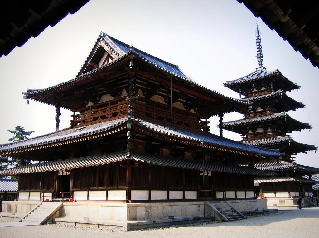
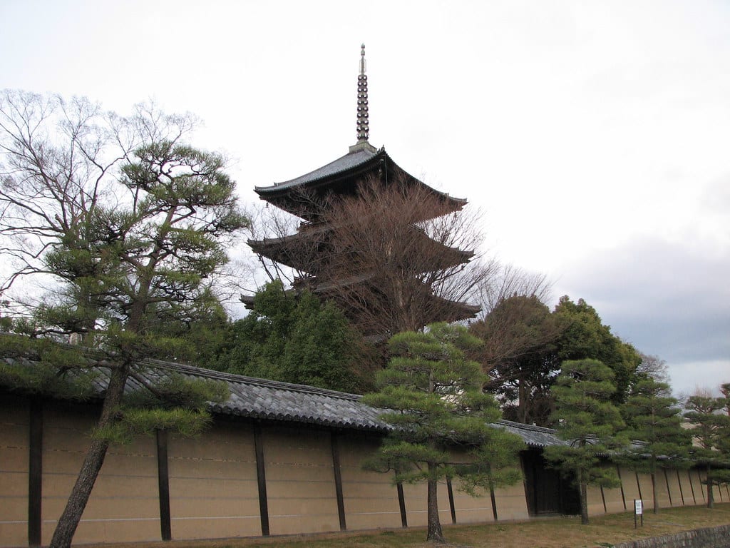
Horyuji
Ikaruga, Nara Prefecture, Japan
The pagoda and main hall of Hōryū-ji have stood for over 1,300 years—the oldest surviving wooden structures on earth. Founded by Prince Shōtoku in 607 CE to fulfill his father's dying wish, the temple became Japan's first UNESCO World Heritage Site and remains a living repository of Buddhist practice. Within its halls and treasure houses, over 180 National Treasures preserve the artistic flowering of early Japanese Buddhism. In the octagonal Yumedono, a hidden Buddha awaits those who visit during its brief seasonal openings.
Ishibutai Kofun, Asuka
Asuka, Nara Prefecture, Japan
Ishibutai Kofun, Asuka is a tumulus of sacred significance. Approximate coordinates: 34.46685, 135.82615. Attributes: built, cultural, archaeological. Tradition: Shinto. Located in 明日香村, 高市郡, Japan.
Masuda Iwafune, Asuka
Kashihara, Nara Prefecture, Japan
Masuda Iwafune, Asuka is a monolith of sacred significance. Approximate coordinates: 34.47058, 135.78867. Attributes: built, cultural, archaeological. Located in 橿原市, Japan.
Mount Miwa
Sakurai, Nara Prefecture, Japan
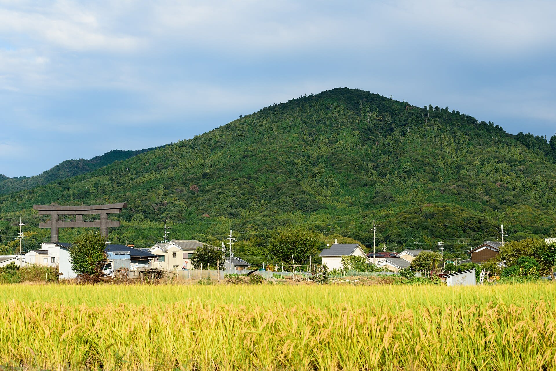
Mount Miwa does not house a deity. The mountain is the deity. This 467-meter peak in the Nara Basin represents the oldest stratum of Japanese spirituality, a form of worship so ancient it predates shrine buildings entirely. At Omiwa Shrine, there is no main hall because none is needed. Worshippers pray through a distinctive three-part torii gate directly toward the sacred peak, whose forests have never been logged throughout recorded history.

Mt. Katsuragi
Gose, Nara Prefecture, Japan
Mt. Katsuragi is a site of sacred significance. Approximate coordinates: 34.45520, 135.68287. Located in 千早赤阪村, 南河内郡, Japan.

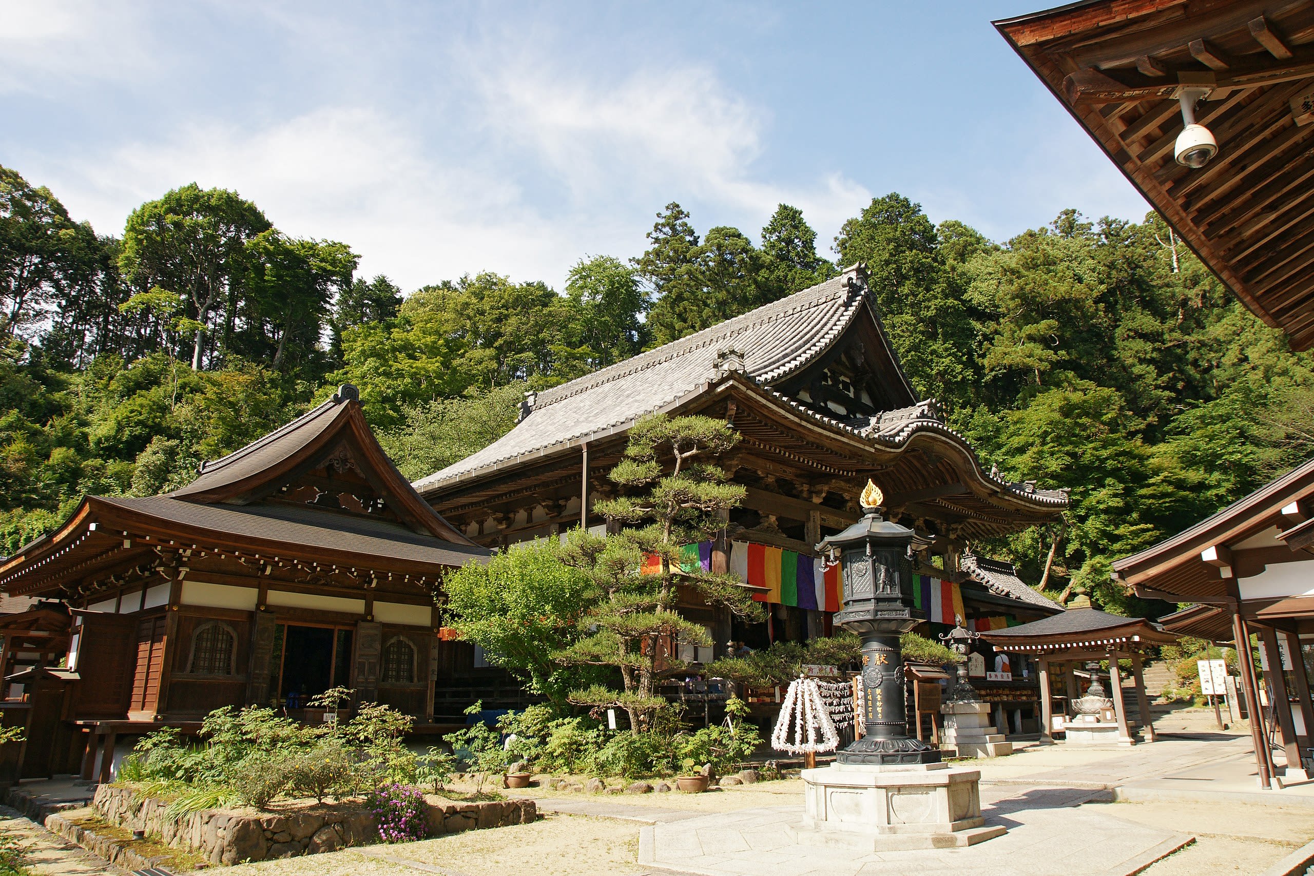
Mt. Omine (Mount Sanjō)
Tenkawa, Nara Prefecture, Japan
Mt. Omine/Mt. Sanjogatake is a site of sacred significance. Approximate coordinates: 34.25238, 135.94094. Located in 天川村, 吉野郡, Japan.
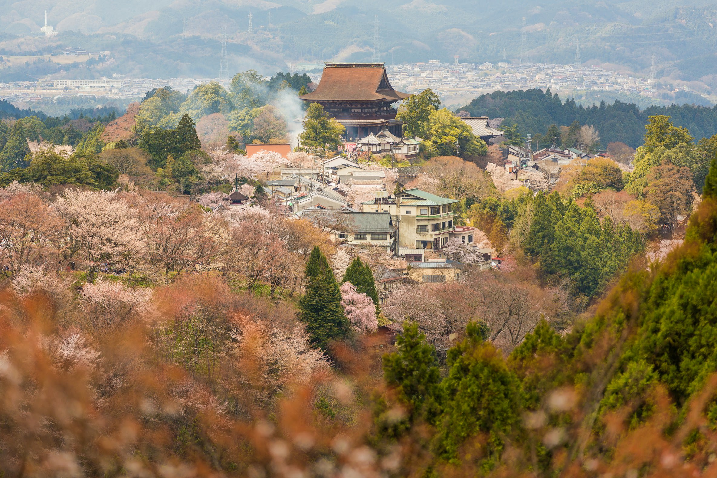
Mt. Yoshino
Yoshino, Nara Prefecture, Japan
Mt. Yoshino is a site of sacred significance. Approximate coordinates: 34.36040, 135.86697. Located in 吉野町, 吉野郡, Japan.
Okadera Buddhist Temple, Asuka
Asuka, Nara Prefecture, Japan
Okadera Buddhist Temple, Asuka is a site of sacred significance. Approximate coordinates: 34.47178, 135.82826. Located in 明日香村, 高市郡, Japan.
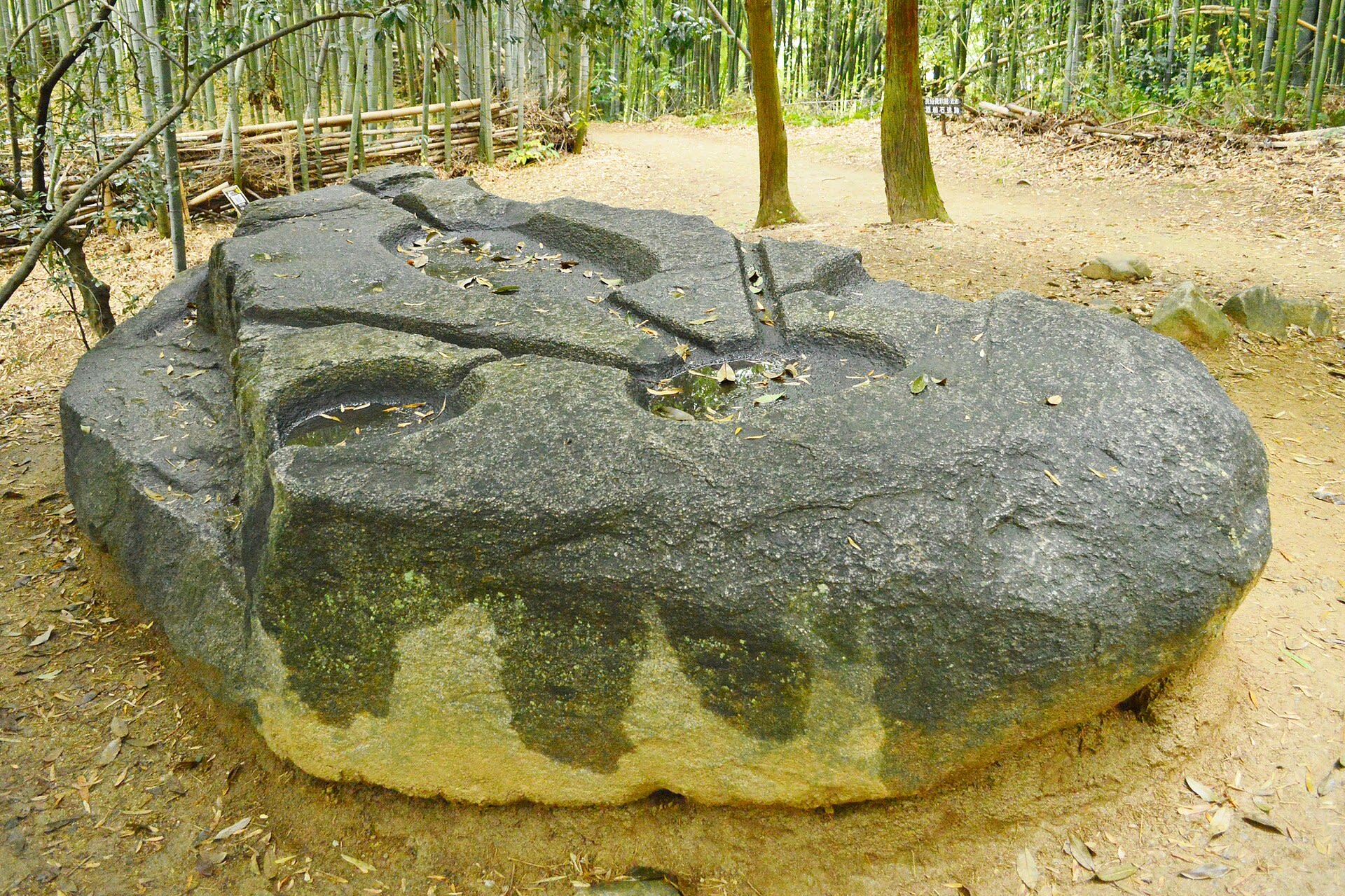
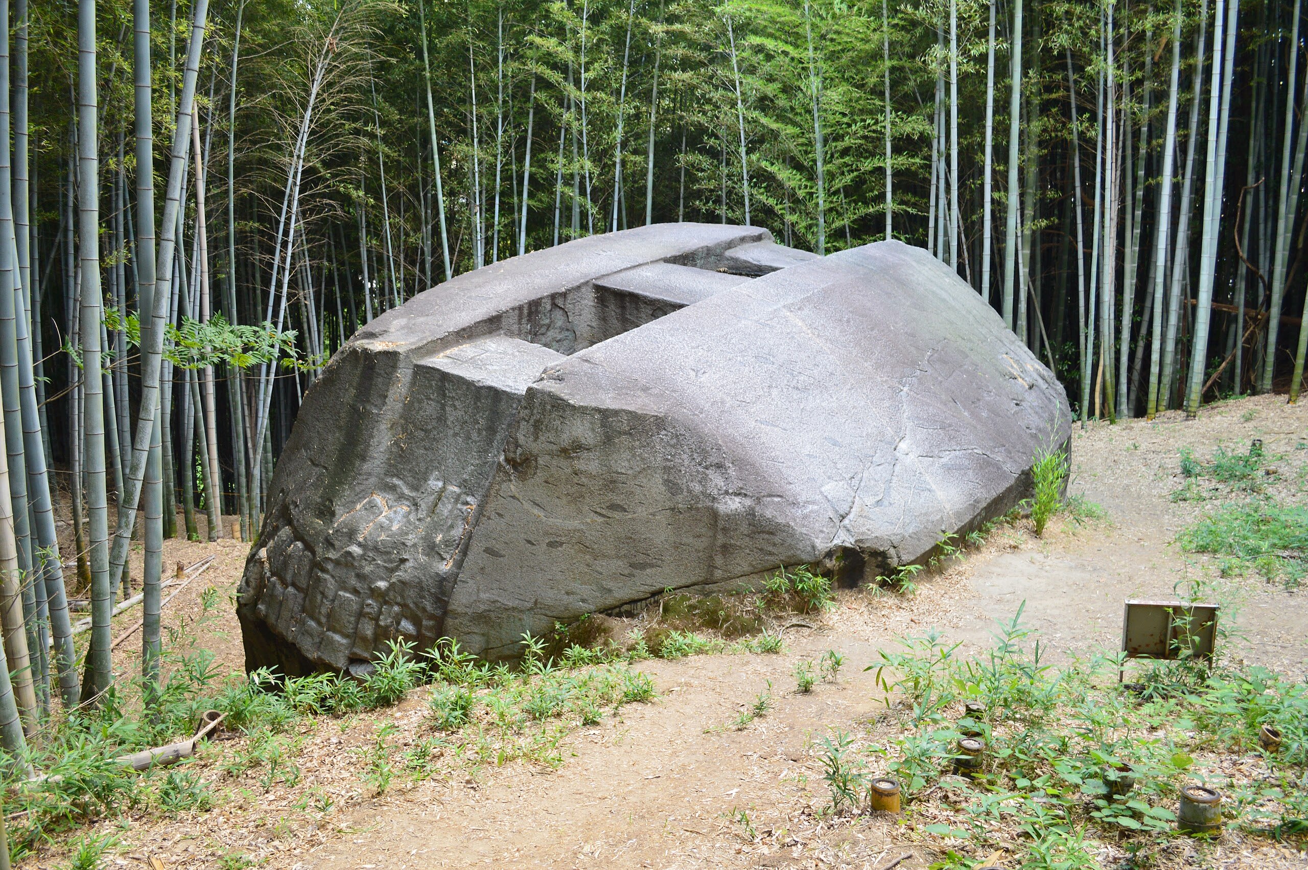
Sakafuneishi Site
Asuka, Nara Prefecture, Japan
In the hills of Asuka, Japan's ancient capital, water once flowed through a turtle-shaped stone basin in ceremonies conducted for Empress Saimei nearly fourteen centuries ago. The purpose of these water rituals remains debated—purification, harvest blessing, rain-making—but their sophistication is undeniable. Above the turtle monument, the enigmatic Sakafuneishi stone has puzzled scholars for generations, its carved channels and basins defying definitive interpretation.
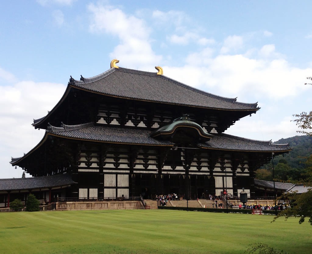
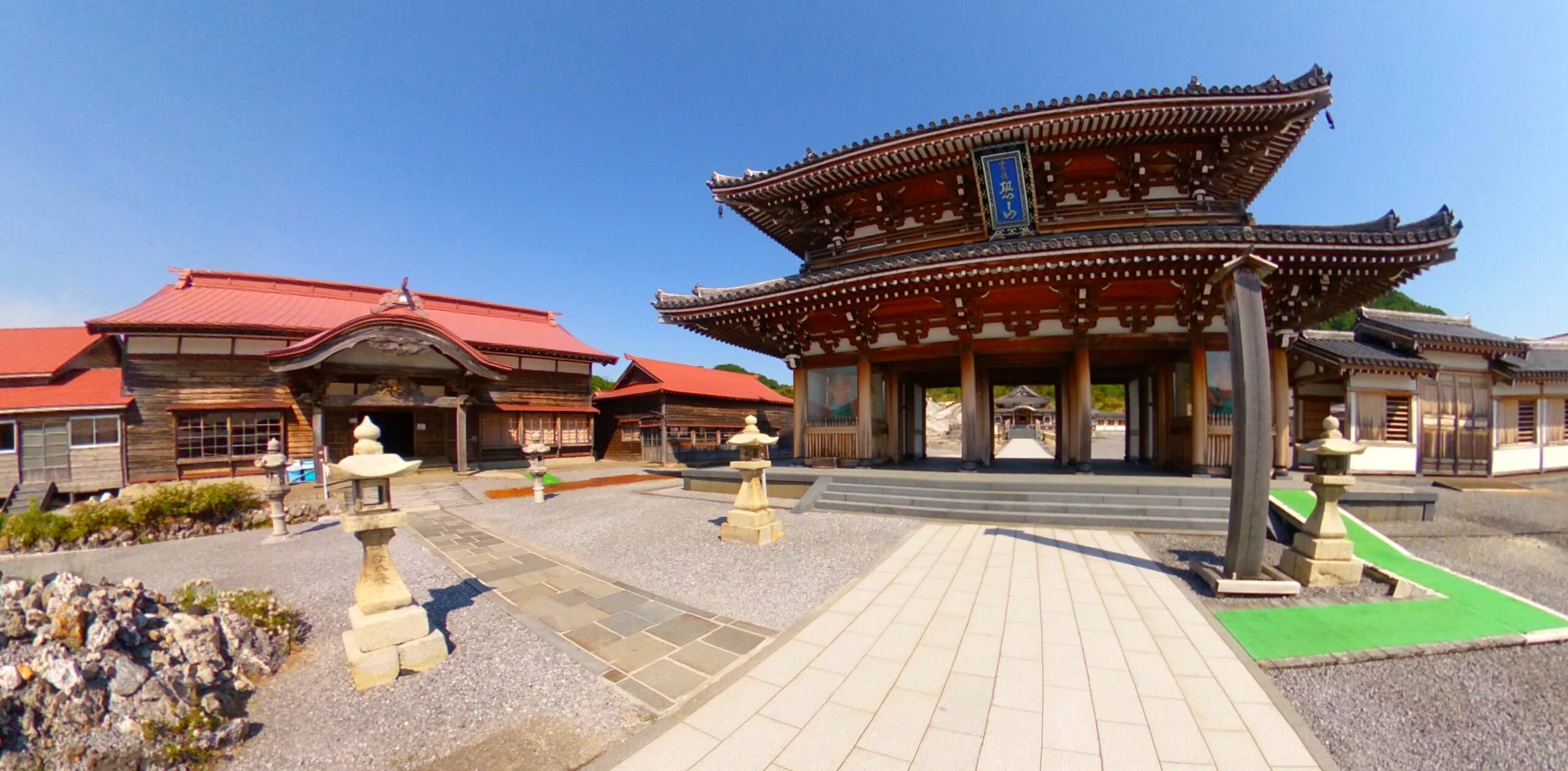
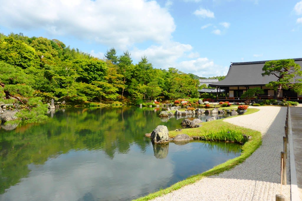
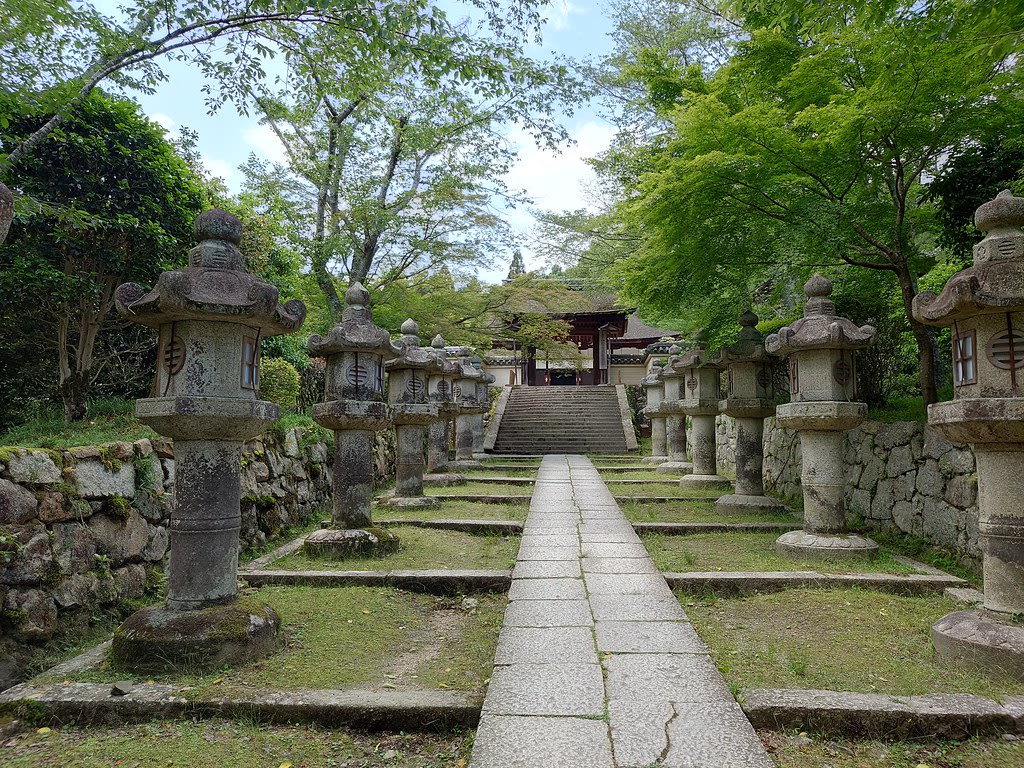
Todaiji
Nara, Nara Prefecture, Japan
In 752 CE, Emperor Shōmu consecrated a bronze Buddha of unprecedented scale—15 meters tall, cast from nearly all the copper in Japan—to bring peace to a nation wracked by plague and disaster. Today, Tōdai-ji's Great Buddha sits within one of the world's largest wooden buildings, visited by millions who come to stand before the cosmic Buddha Vairocana. Sacred deer wander the grounds as divine messengers. In March, the Omizutori ceremony draws sacred water in fire-lit rituals unchanged since 752 CE.
Oita Prefecture
2 sites
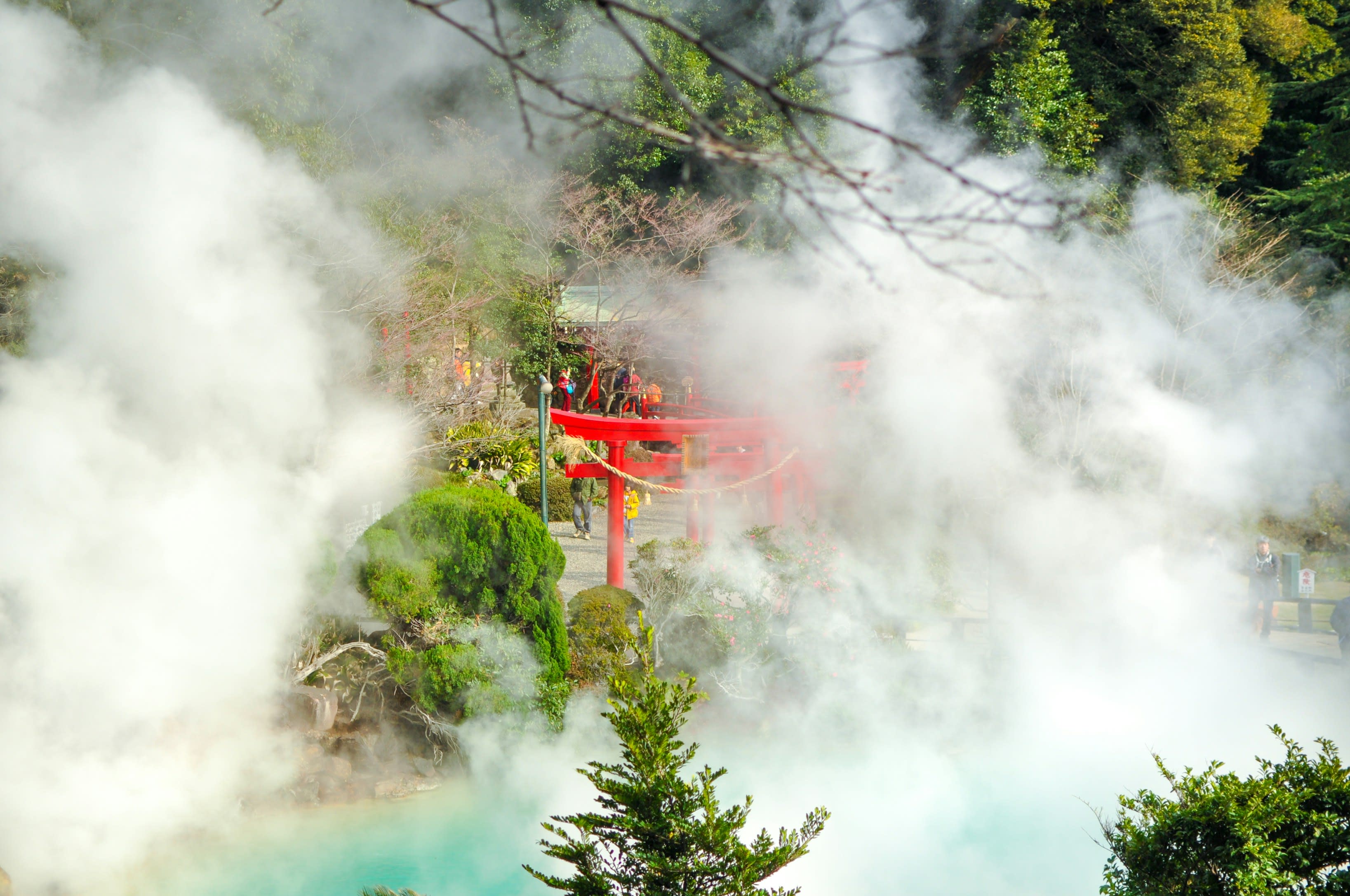
Beppu
Beppu, Oita Prefecture, Japan
Beppu is a hot springs of sacred significance. Approximate coordinates: 33.28458, 131.49128. Attributes: natural, cultural. Beppu (別府市, Beppu-shi) is a city in Ōita Prefecture on the island of Kyushu, Japan. As of November 30, 2023, the city had a population of 113,045 in 62,702 households, and a population density of 900 persons per km2. The total area of the city is 125.34 km2 (48.39 sq mi). Beppu is famous for its hot springs. In 2024, Beppu celebrated its centenary as a city. Located in 別府市, Japan.
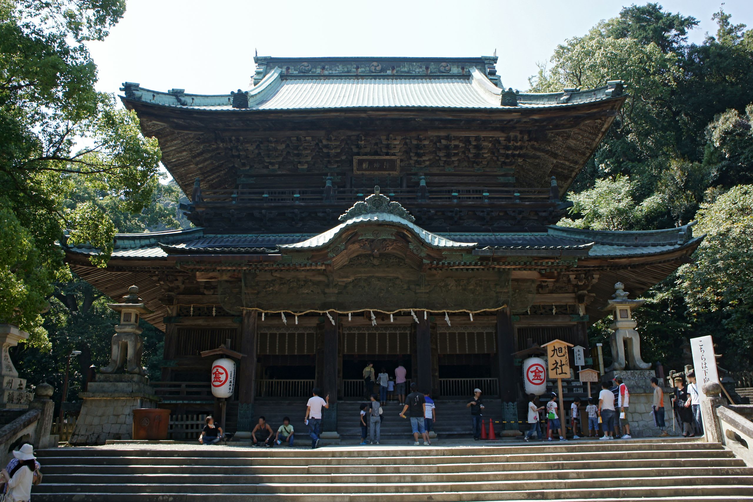
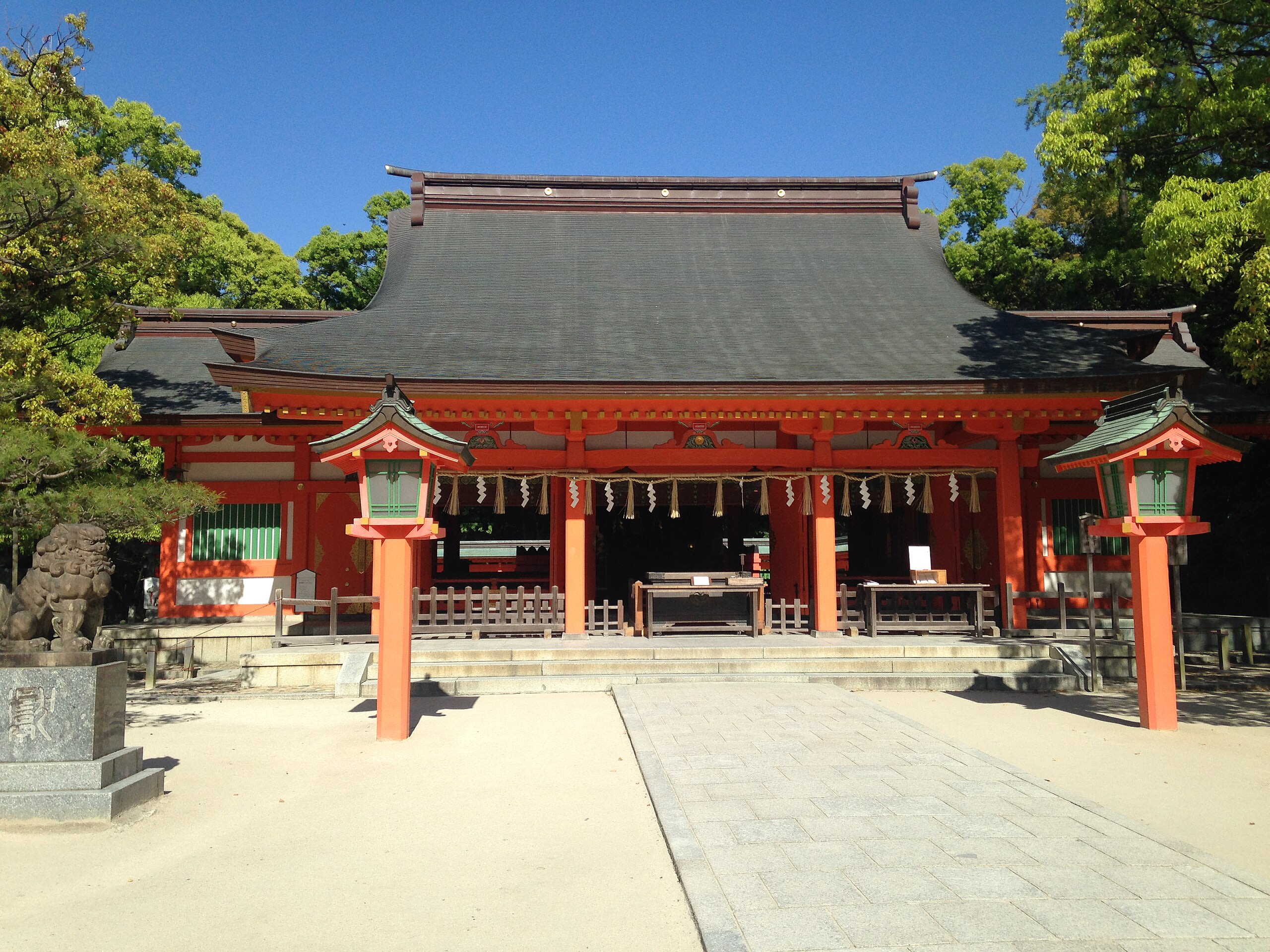
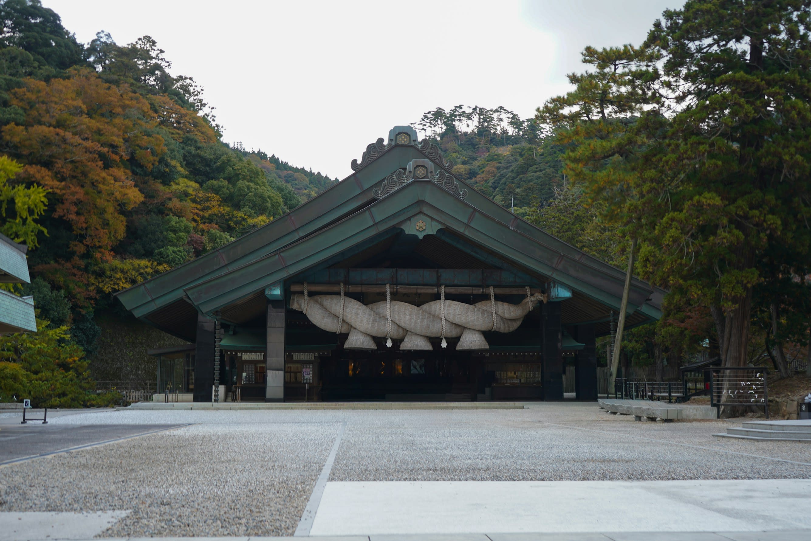
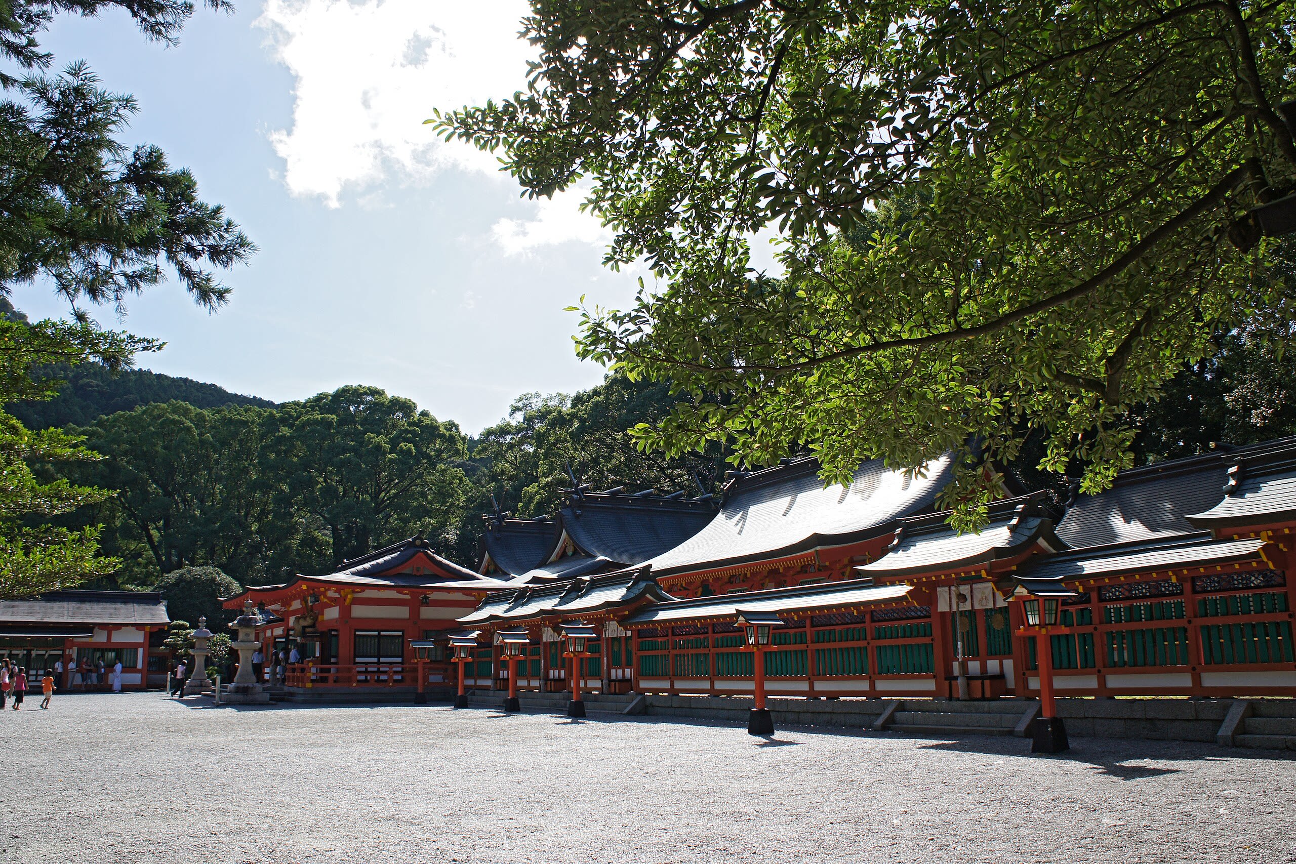
Usa Jingu
Usa, Oita Prefecture, Japan
In 749 CE, when Emperor Shōmu consecrated the Great Buddha at Tōdai-ji, a deity traveled from Kyushu to Nara for the ceremony—the first time a Shinto god participated in Buddhist ritual. That deity was Hachiman, and his journey from Usa Jingū in the first-ever mikoshi procession established the template for over a thousand years of Shinto-Buddhist synthesis. Today, Usa Jingū leads over 40,000 affiliated Hachiman shrines, the largest shrine network dedicated to a single deity in Japan.
Okayama Prefecture
2 sites
Kibitsu Jinja Shinto Shrine, Okayama
Okayama, Okayama Prefecture, Japan
Kibitsu Jinja Shinto Shrine, Okayama is a shinto shrine of sacred significance. Approximate coordinates: 34.67073, 133.85060. Attributes: built, cultural, ceremonial. Tradition: Shinto. Located in 岡山市, Japan.

Yuga Shinto Shrine, Kurashiki
Kurashiki, Okayama Prefecture, Japan
Yuga Shinto Shrine, Kurashiki is a site of sacred significance. Approximate coordinates: 34.50594, 133.85101. Located in 倉敷市, Japan.
Okinawa Prefecture
1 sites
Osaka Prefecture
1 sites
Saitama Prefecture
1 sites
Shiga Prefecture
3 sites
Enryaku-ji temple and Mt. Hiei
Otsu, Shiga Prefecture, Japan
Mt. Hiei is a site of sacred significance. Approximate coordinates: 35.06890, 135.83033. Located in 京都市, Japan.

Hiyoshi Taisha
Otsu, Shiga Prefecture, Japan
At the foot of sacred Mount Hiei, Hiyoshi Taisha has served as spiritual guardian for over two thousand years. The shrine protects against evil from the northeast—the demon gate direction in East Asian cosmology—and leads a network of 3,800 affiliated shrines across Japan. Monkeys, considered divine messengers since ancient times, appear throughout the complex as protectors. In April, the Sanno Festival reenacts divine marriage and birth with mikoshi processions that have continued for nearly a millennium.
Mii-dera
Otsu, Shiga Prefecture, Japan
Mii-dera has earned its nickname—the Phoenix Temple—through seven destructions and seven risings. The sacred spring that gave the temple its name (Temple of Three Wells) provided the first bath water for three emperors in the 7th century. Today, visitors can still hear the ancient water bubbling within the Akaiya Well House. The temple serves as the head of Tendai Buddhism's Jimon sect and Temple 14 on the Saigoku Kannon Pilgrimage. Its evening bell, ranked among the Eight Views of Ōmi, has echoed across Lake Biwa for over a millennium.
Shimane Prefecture
2 sites
Inasa Beach
Izumo, Shimane Prefecture, Japan
In Japanese mythology, a god descended from heaven at this beach, thrust his sword into the sand, and demanded that the ruler of the earthly realm cede power to the sun goddess's descendants. The negotiation that followed shaped Japan's spiritual cosmos. Today, the eight million kami of Japan are believed to arrive at this same shore each autumn to convene their divine council at nearby Izumo Taisha. The rock called Bentenjima marks where worlds still meet.
Izumo Taisha (Izumo Grand Shrine)
Izumo, Shimane Prefecture, Japan
Izumo Taisha (Izumo Grand Shrine) in Izumo, Shimane Prefecture, Japan.
Shizuoka Prefecture
1 sites

Tochigi Prefecture
14 sites

Futarasan Shrine (Nikkō Futarasan Jinja)
Nikko, Tochigi Prefecture, Japan
Futarasan Shrine connects three sacred spaces in a vertical axis of worship: the main shrine at the base of Mount Nantai, the Chuguji by Lake Chuzenji, and the summit Okumiya. Founded by Shodo Shonin in 782 CE, it represents one of Japan's purest expressions of mountain worship, where the land itself is understood as divine. UNESCO recognizes it as part of a sacred landscape of outstanding universal value.
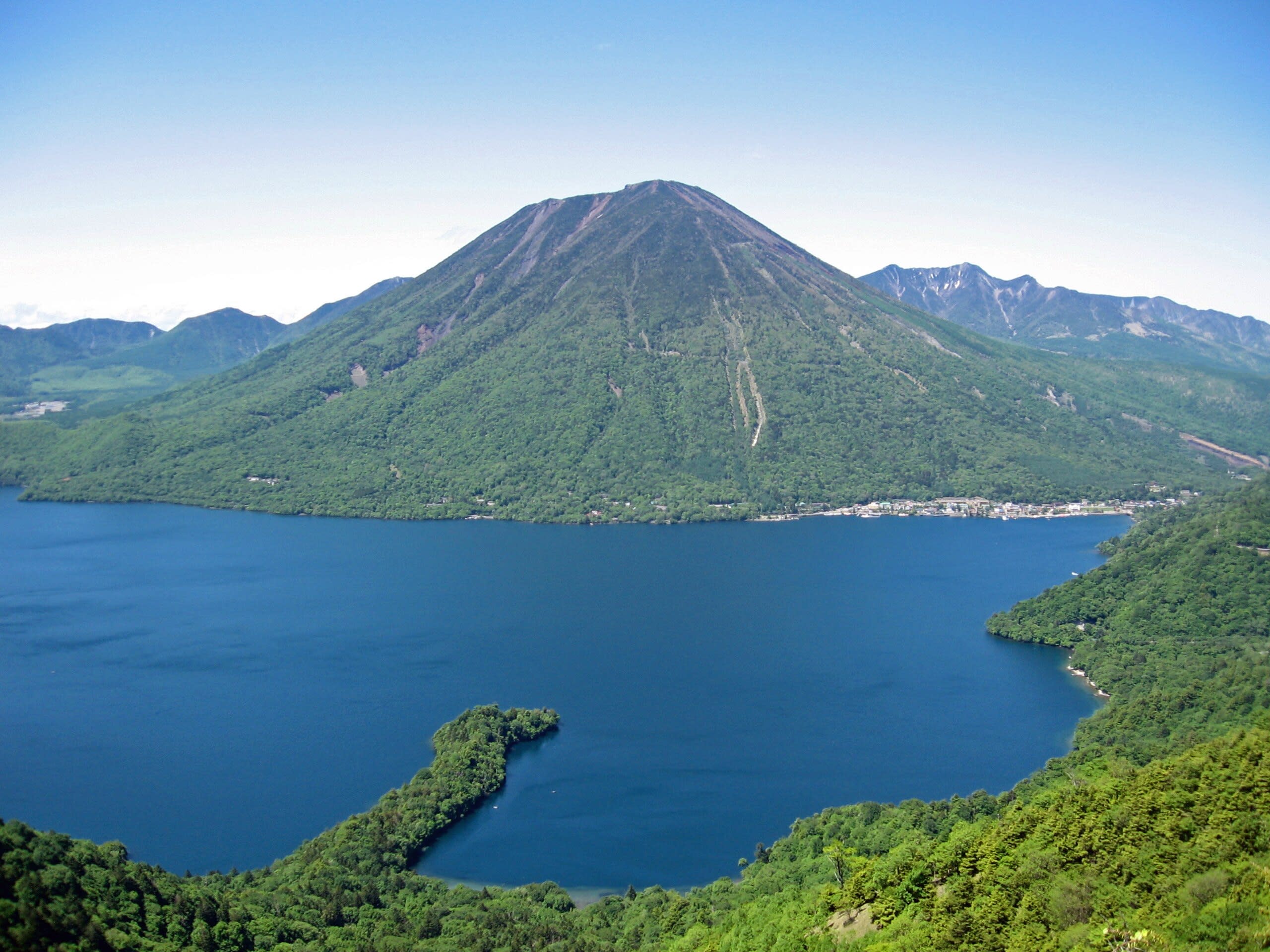
Mt. Nantai
Nikko, Tochigi Prefecture, Japan
Mt. Nantai is a site of sacred significance. Approximate coordinates: 36.76810, 139.48731. Located in 日光市, Japan.

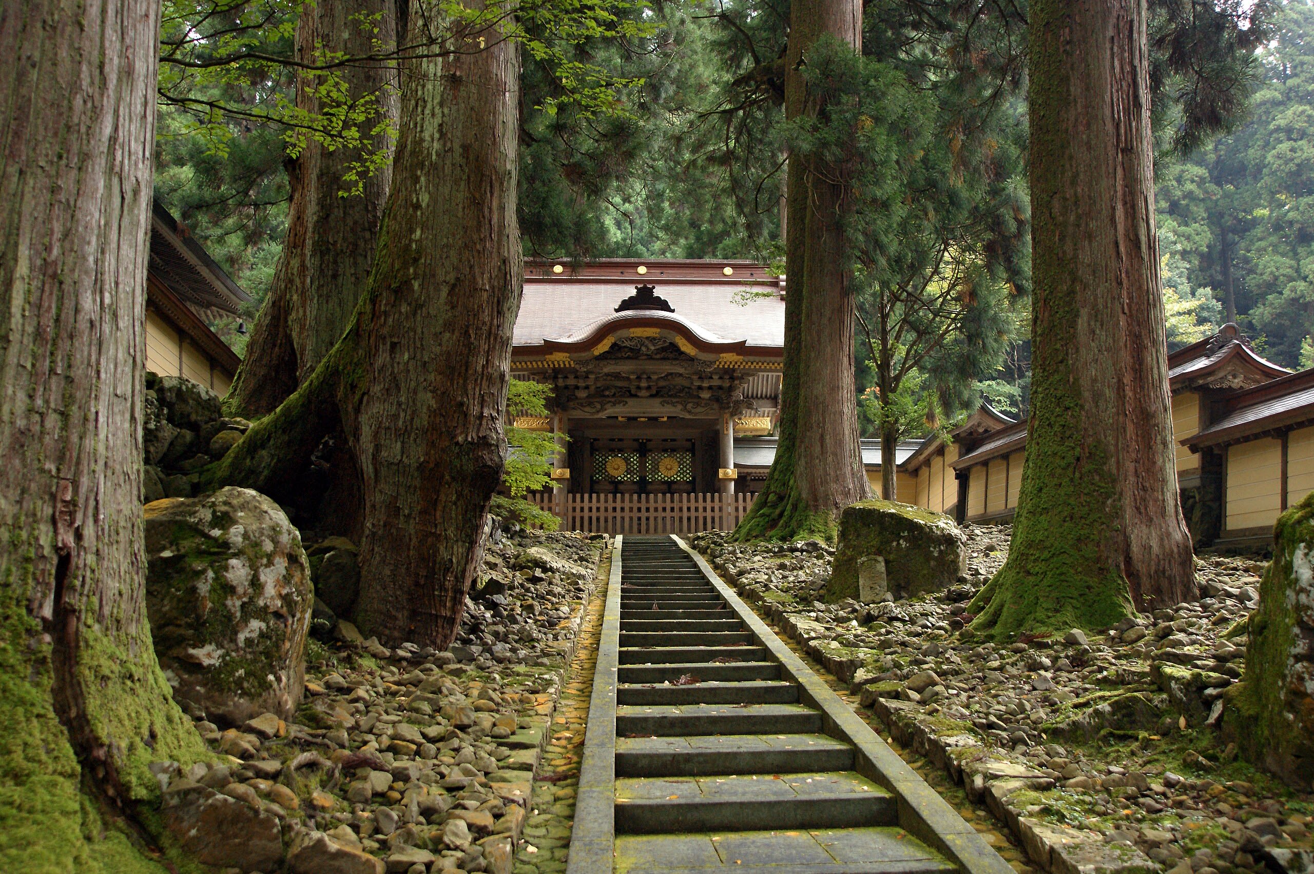
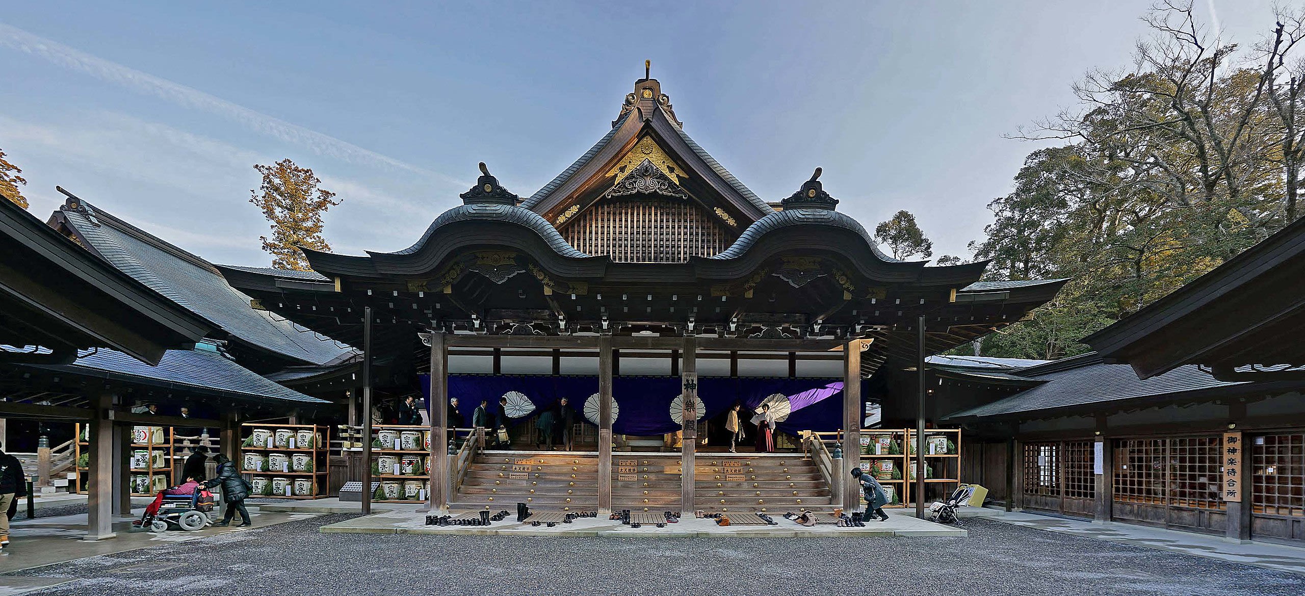
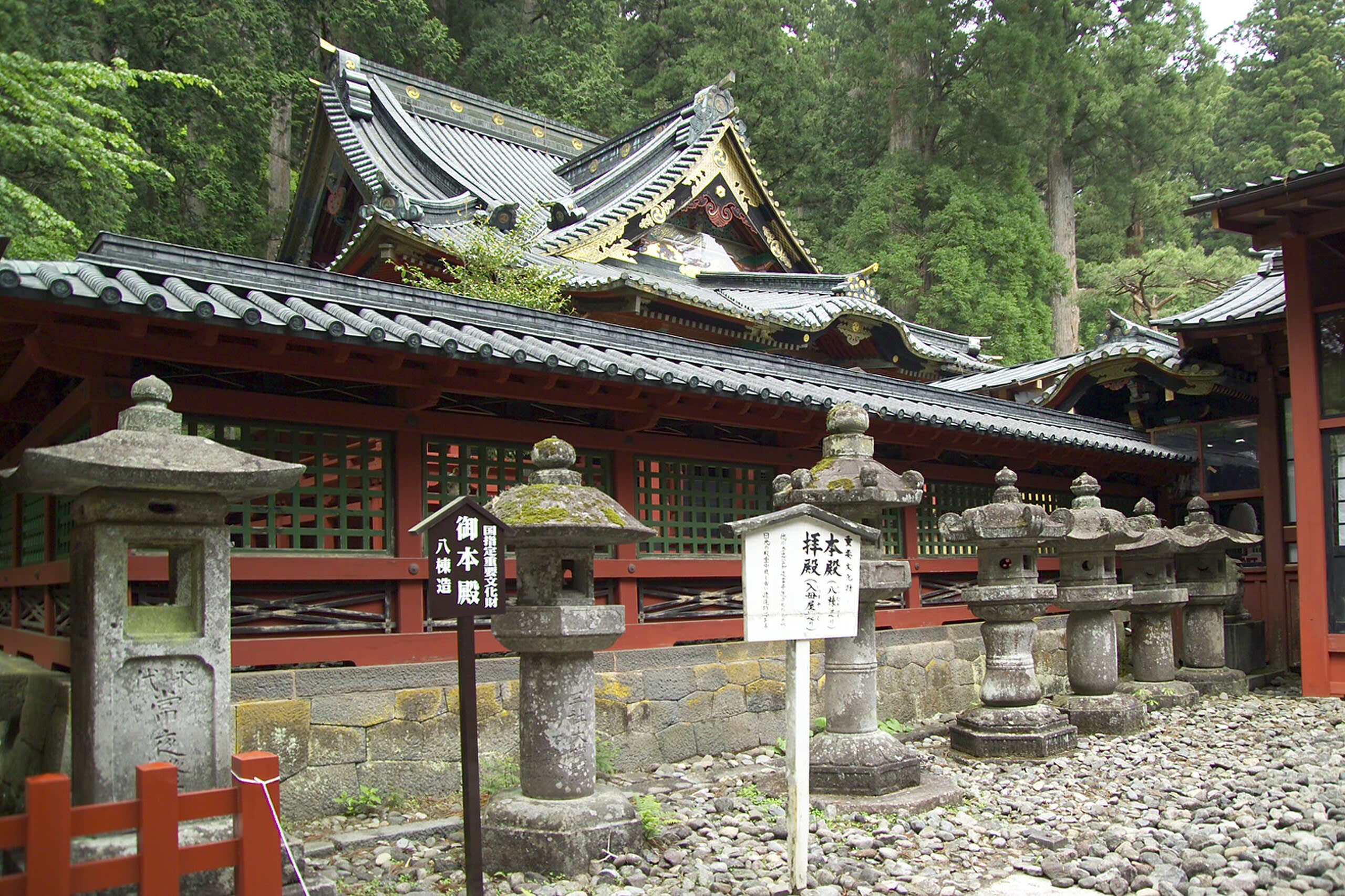
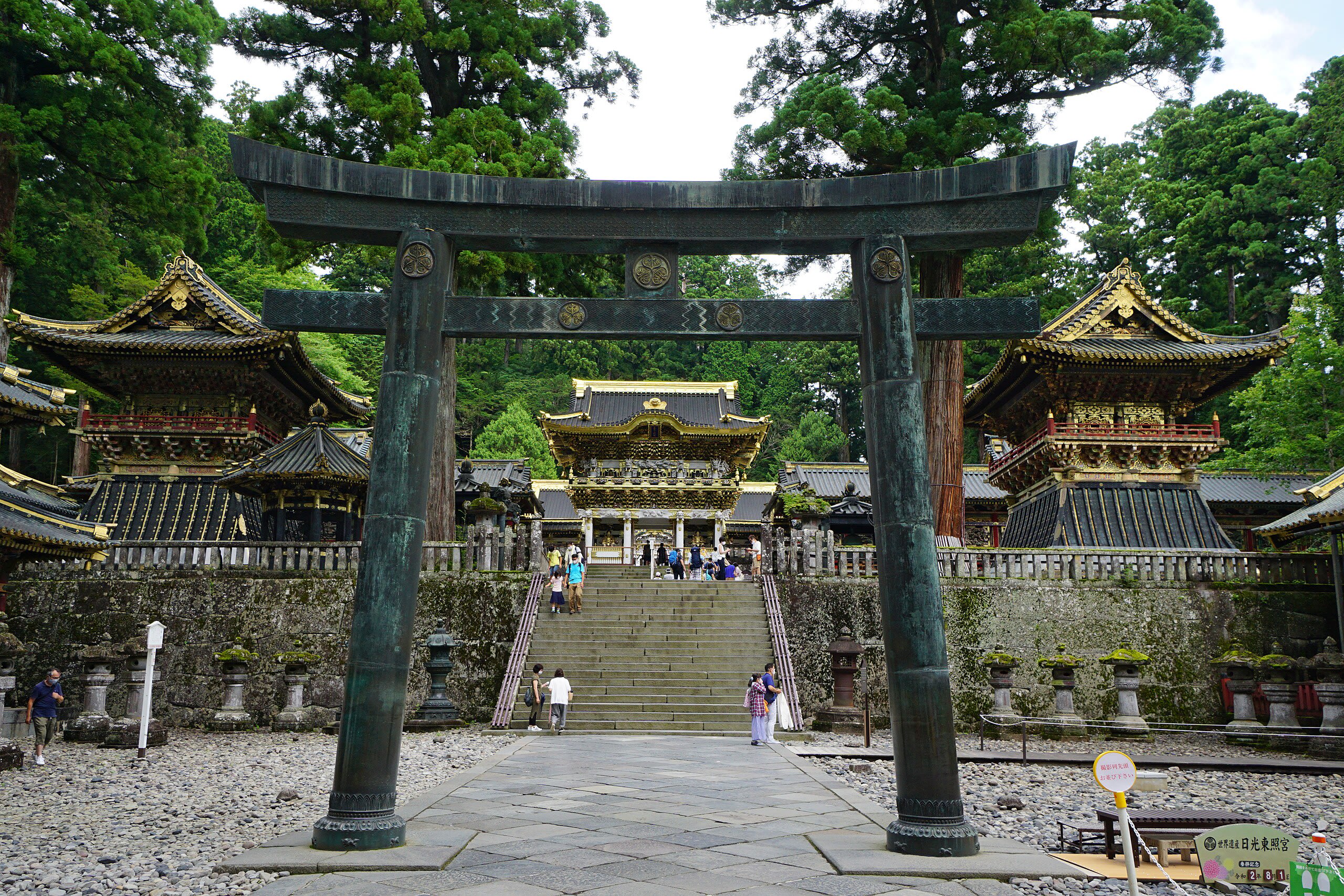
Nikkō Tōshō-gū
Nikko, Tochigi Prefecture, Japan
Nikko Toshogu is the mausoleum and shrine of Tokugawa Ieyasu, the warlord who unified Japan and founded a dynasty that ruled for 300 years of peace. After his death in 1616, Ieyasu was deified as a kami and enshrined in this complex of overwhelming beauty, built by 127,000 craftsmen with over 5,000 carvings. UNESCO recognizes it as 'an outstanding example of architectural and artistic genius.'

Rinnō-ji
Nikko, Tochigi Prefecture, Japan
Rinnoji Temple stands as the Buddhist heart of Nikko's sacred landscape, founded in 766 CE by Shodo Shonin. The Sanbutsudo, eastern Japan's largest wooden building, houses three massive gold-leafed Buddha statues representing the mountain kami of Nikko in Buddhist form. This profound synthesis of Shinto and Buddhist traditions has continued for over 1,250 years.
Tokyo
2 sites
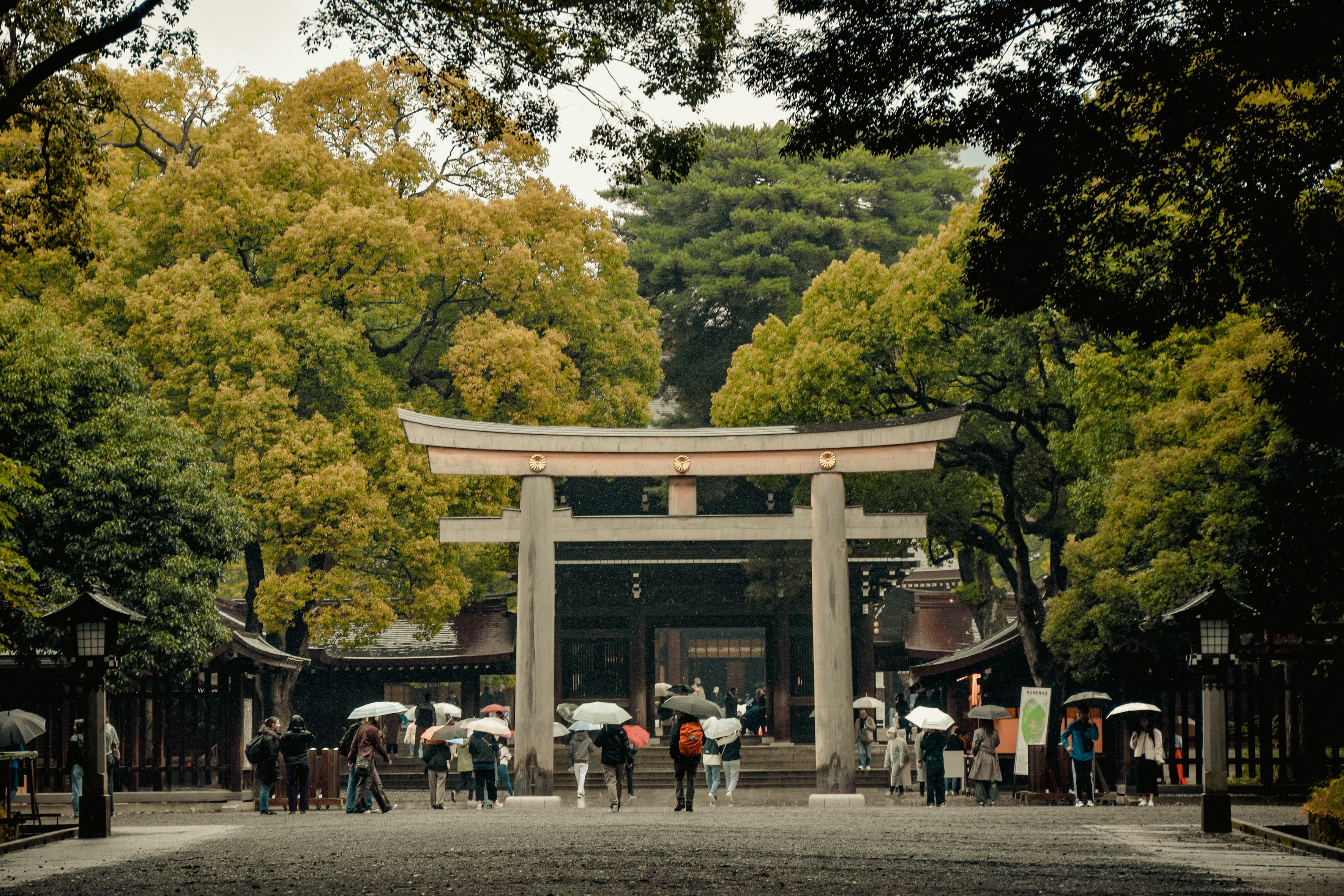
Meiji Shrine
Tokyo, Tokyo, Japan
Rising from the heart of Tokyo, Meiji Shrine offers one of the world's most dramatic sacred thresholds. Step through the massive torii gate and the city dissolves—replaced by a forest planted over a century ago by 110,000 volunteers. At its center, a shrine honors the spirits of Emperor Meiji and Empress Shoken, the imperial couple who shepherded Japan from isolation into modernity.
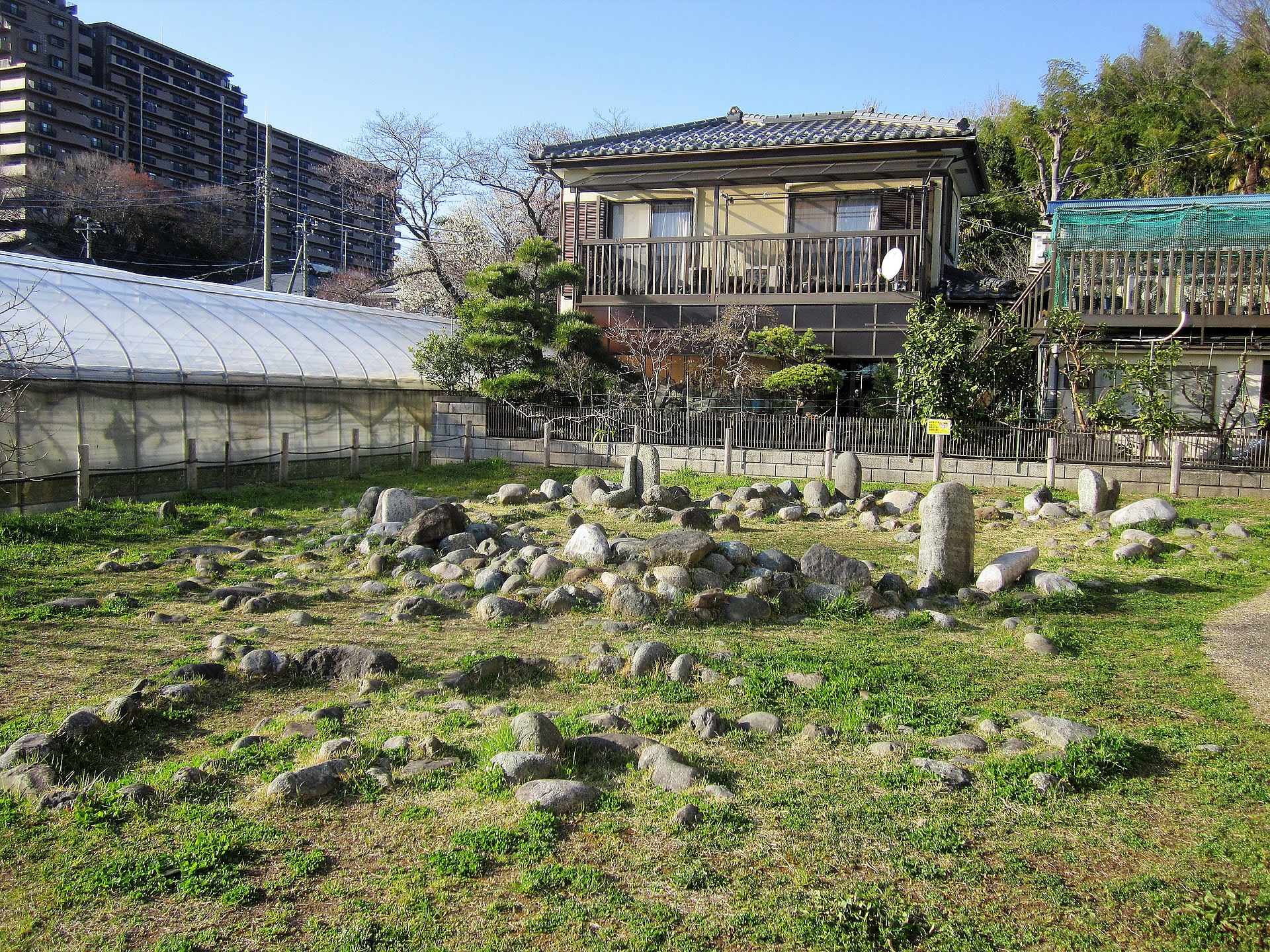
Tabata Stone Circle
Machida, Tokyo, Japan
Five minutes from a Tokyo train station, a ring of stones marks where Jomon peoples gathered three thousand years ago. They built their ceremonial circle directly over the graves of thirty ancestors, aligning it so the winter solstice sun would set precisely over Mount Hirugatake in the Tanzawa range. It remains the only Jomon period stone circle in the Tokyo metropolitan area—a quiet reminder that the sacred can persist beneath modern landscapes.
Wakayama Prefecture
6 sites
Hiro Shrine
Nachikatsuura, Wakayama Prefecture, Japan
At the base of Japan's tallest single-drop waterfall, Hirou Shrine offers something rare: direct worship of natural phenomenon. Here there is no temple building to pray before, only the 133-meter cascade itself serving as the divine body of the kami. This is nature worship in its purest form.

Kongobu-ji Temple (Mt. Koya)
Koya, Wakayama Prefecture, Japan
Mt. Koya is a site of sacred significance. Approximate coordinates: 34.18380, 135.60443. Located in 高野町, 伊都郡, Japan.
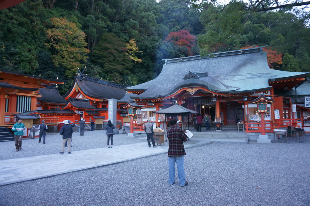
Kumano Hayatama Taisha
Shingū, Wakayama Prefecture, Japan
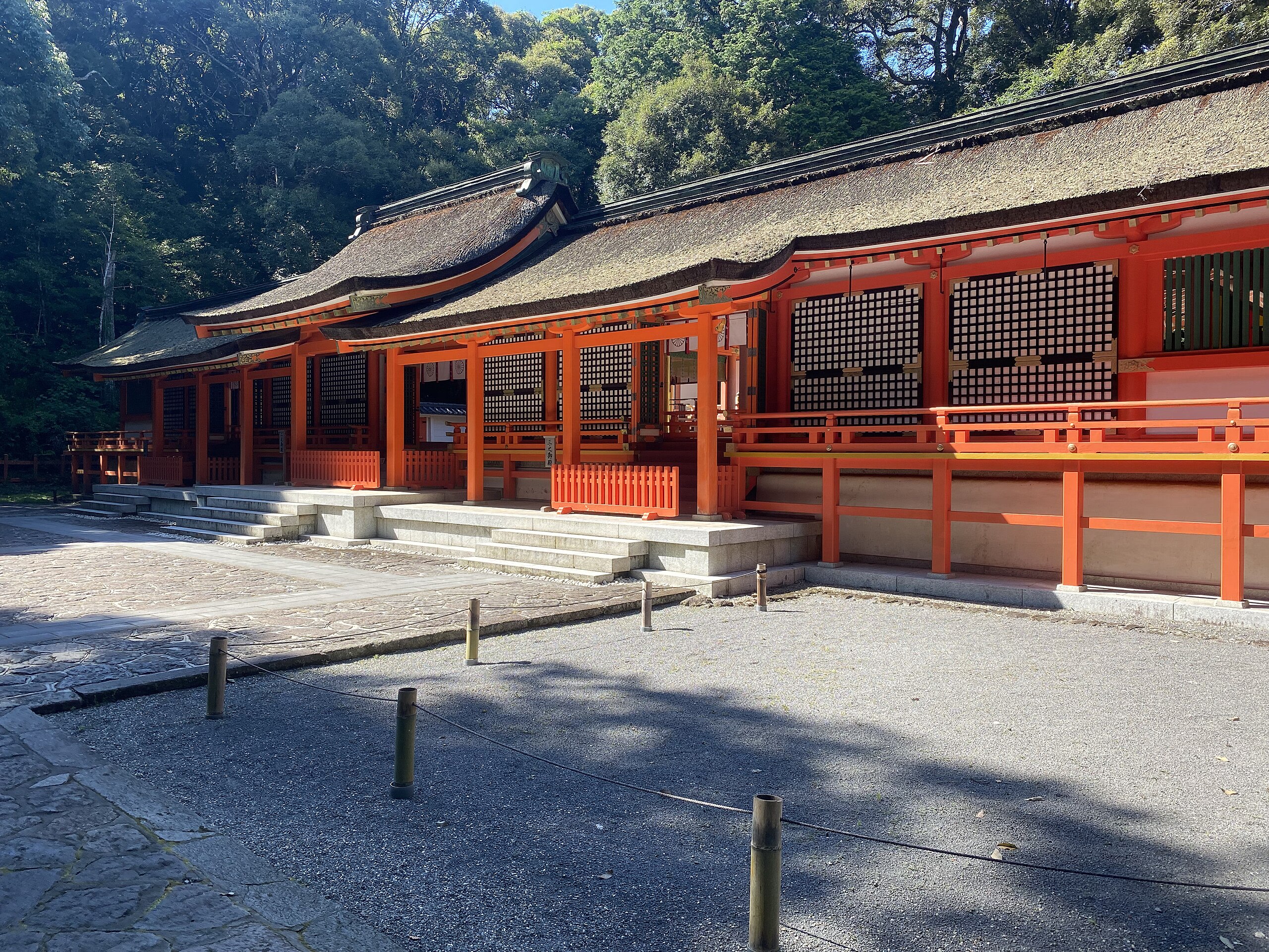
Kumano Hayatama Taisha is a shrine of sacred significance. Approximate coordinates: 33.73180, 135.98364. Attributes: built, cultural, pilgrimage, ceremonial. Tradition: Shinto. Recognized as a UNESCO World Heritage Site. Kumano Hayatama Taisha (熊野速玉大社) is a Shinto shrine located in Shingu, Wakayama Prefecture, on the shores of the Kumanogawa in the Kii Peninsula of Japan. It is included as part of the Kumano Sanzan in the UNESCO World Heritage site Sacred Sites and Pilgrimage Routes in the Kii Mountain Range . The three Kumano Sanzan shrines are the Sōhonsha ( head shrines ) of all Kumano shrines, lie at between 20 and 40 km of distance one from the other and are connected by the pilgrimage route known as Kumano Sankeimichi (熊野参詣道). Located in 新宮市, Japan.
Kumano Hongū Taisha
Tanabe, Wakayama Prefecture, Japan
Kumano Hongū Taisha is a shrine of sacred significance. Approximate coordinates: 33.84064, 135.77364. Attributes: built, cultural, pilgrimage, ceremonial. Tradition: Shinto. Associated figure: Kumano Gongen. Recognized as a UNESCO World Heritage Site. Kumano Hongū Taisha (熊野本宮大社) is a Shinto shrine located in the jurisdiction of Tanabe, Wakayama, deep in the rugged mountains of the southeast Kii Peninsula of Japan. It is included as part of the Kumano Sanzan in the World Heritage Site Sacred Sites and Pilgrimage Routes in the Kii Mountain Range . The main deity enshrined is Kumano Gongen (熊野権現). All of the ancient Kumano Kodō routes lead to the Grand Shrine. It was originally located at present Ōyunohara (大斎原), on a sandbank at the confluence of the Kumano River and Otonashi River. In 1889, it was partially destroyed in a flood and the remaining shrine buildings were relocated at its present site in 1891. Of the original five main pavilions only three were rebuilt. Four deities were moved there and the other eight are still enshrined there in two stone monuments. In 2000, the largest torii shrine gate in the world (33.9 meters tall and 42 meters wide) was erected at the entrance to the Oyunohara sandbank. It is an official gateway that designates the entrance to a sacred area. It signifies the division of the secular and the spiritual worlds. This torii is called Otorii (o means great ) and is made of steel weighing 172 tons, which took about six months to make and another six months to assemble. Located in 田辺市, Japan.
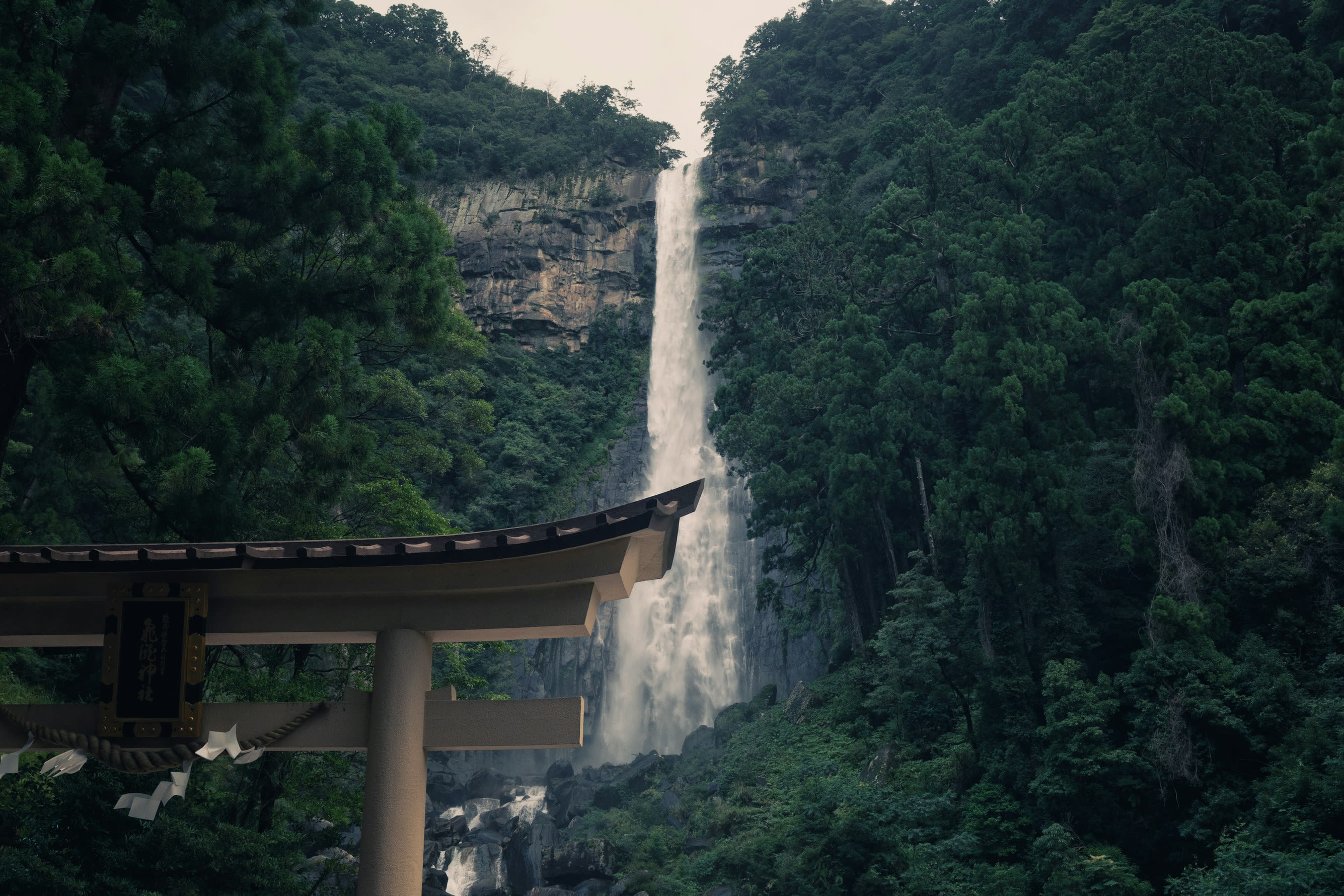
Kumano-Nachi Grand Shrine
Nachikatsuura, Wakayama Prefecture, Japan
One of the three great Kumano shrines, Kumano Nachi Taisha rises on Mt. Nachi above Japan's tallest waterfall. Here nature worship became formalized Shinto, drawing emperors from Kyoto who walked for weeks through mountain passes to seek blessings from the kami of these sacred heights.
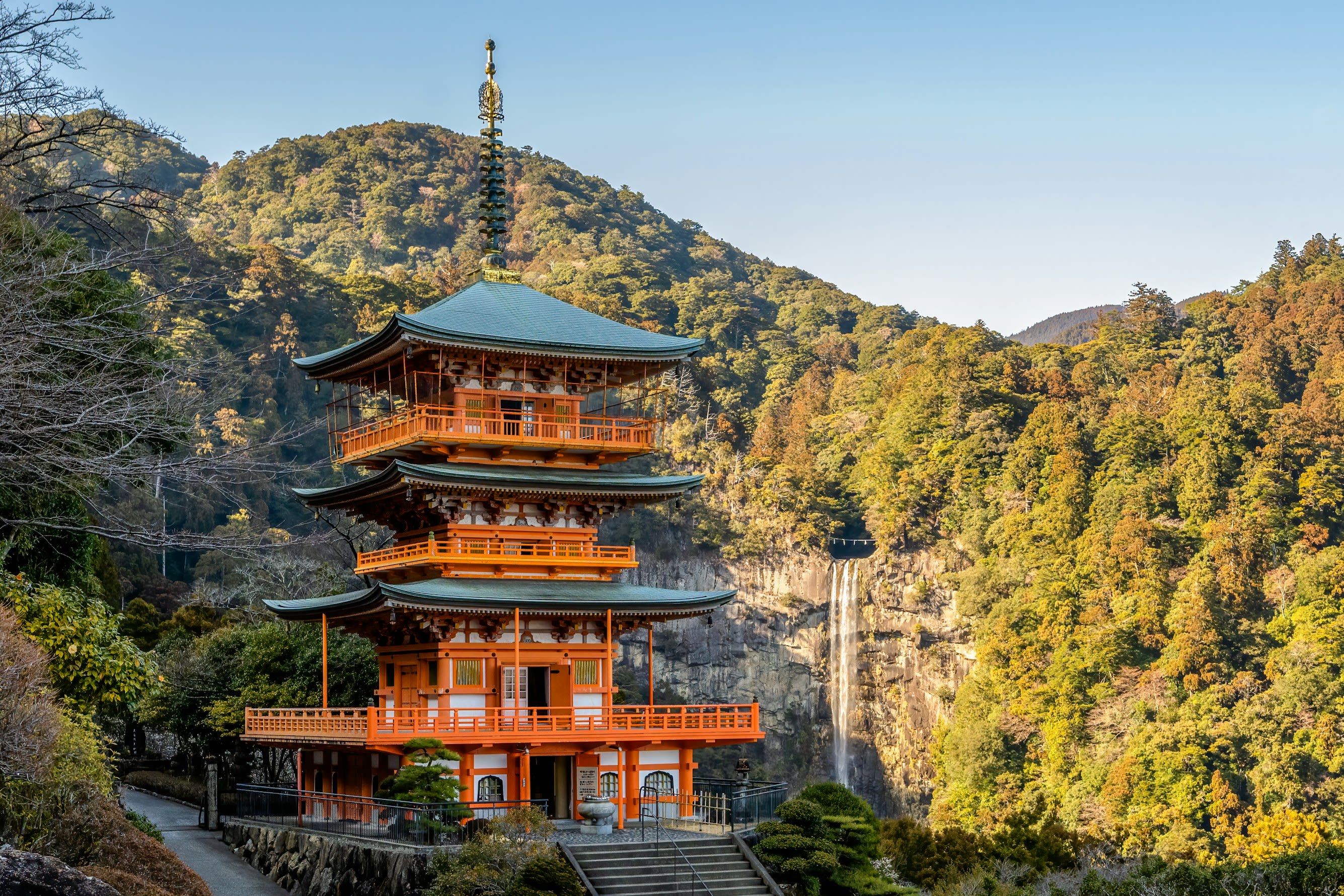
Seigantoji (Seiganto Temple)
Nachikatsuura, Wakayama Prefecture, Japan
High on Mt. Nachi in Wakayama Prefecture, the three-story vermillion pagoda of Seigantoji frames one of the most iconic views in Japan: the 133-meter Nachi Falls cascading behind it. This temple marks the beginning of the Saigoku Kannon Pilgrimage, drawing seekers for over a thousand years to where Buddhist devotion meets the raw power of falling water.
Yamagata Prefecture
3 sites

Dewa Shrine and Mt. Haguro
Tsuruoka, Yamagata Prefecture, Japan
Mt. Haguro is a site of sacred significance. Approximate coordinates: 38.70247, 139.98292. Located in 鶴岡市, Japan.
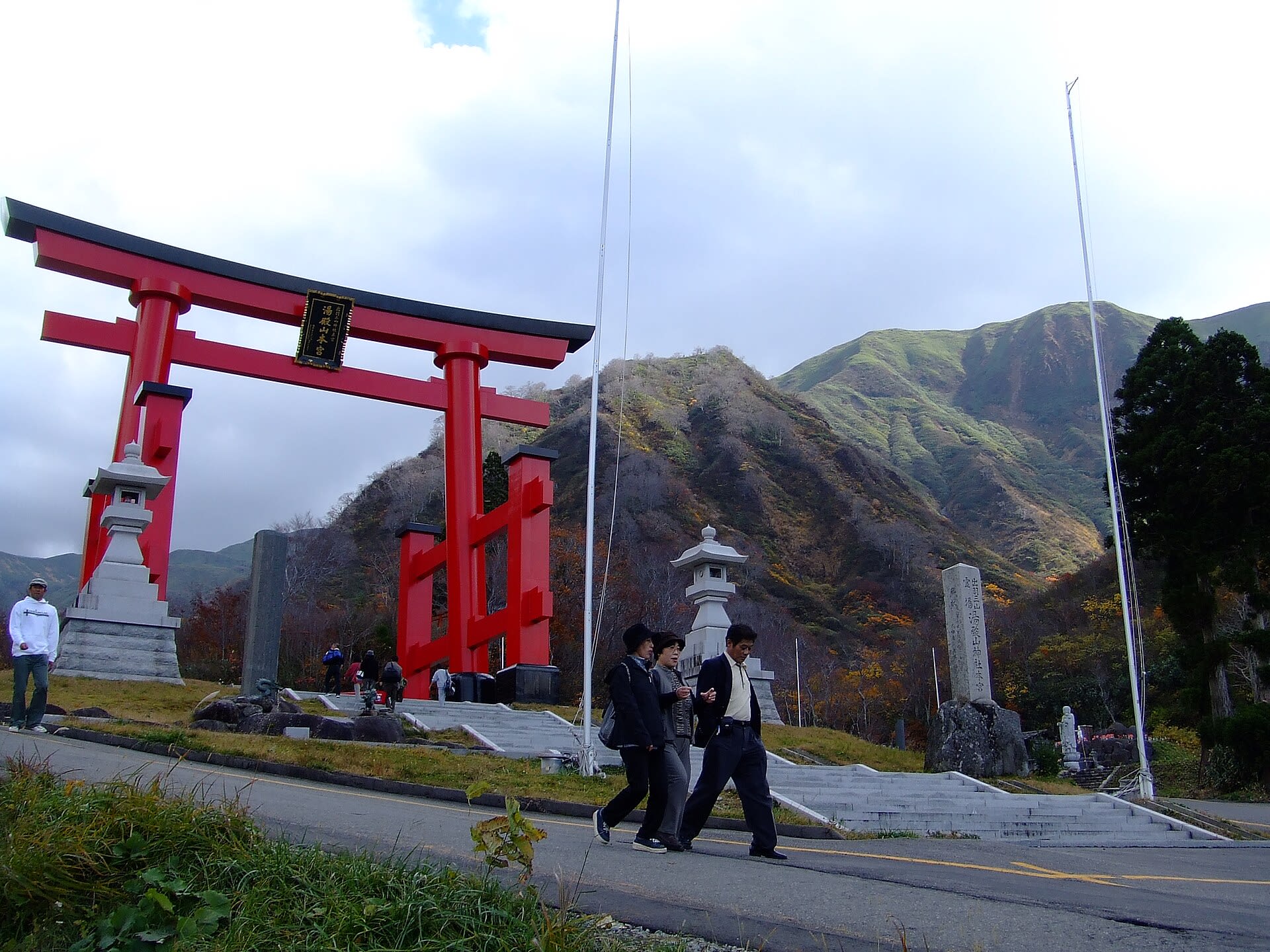
Mount Yudono
Tsuruoka, Yamagata Prefecture, Japan
At the culmination of the Dewa Sanzan pilgrimage, where seekers symbolically die and are reborn across three sacred mountains, Mount Yudono guards the final mystery. The shrine has no building because the sacred object needs no shelter: a massive rust-red rock from which hot spring water perpetually flows. What happens when barefoot pilgrims walk across this warm, wet stone is protected by a tradition of strict secrecy maintained for over a millennium: speak not, hear not.
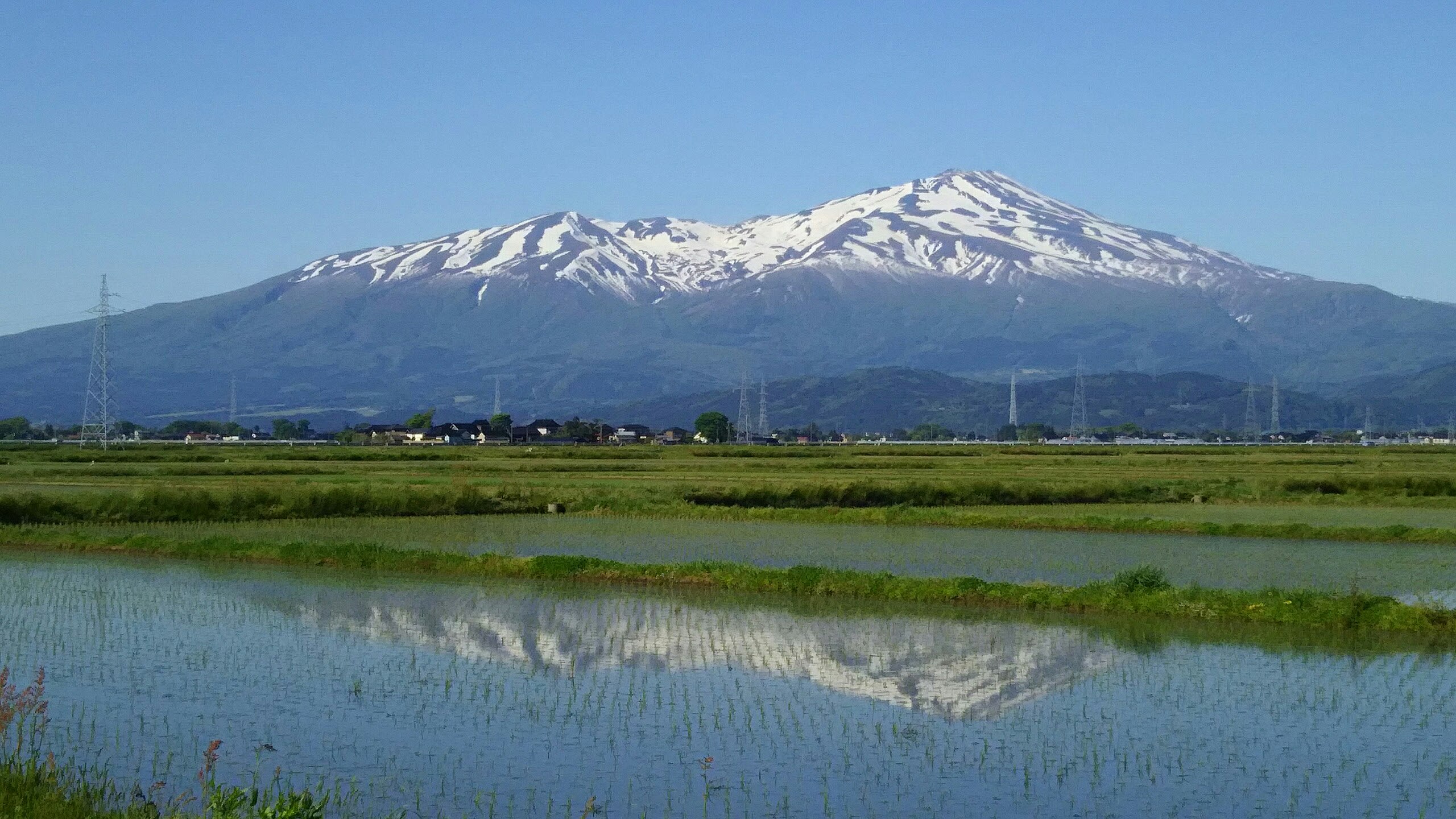
Mt. Chokai
Yuza, Yamagata Prefecture, Japan
Mt. Chokai is a site of sacred significance. Approximate coordinates: 39.09917, 140.05083. Located in 遊佐町, 飽海郡, Japan.