Country guide
China
46 sacred sites across 20 regions.
Traditions present in China
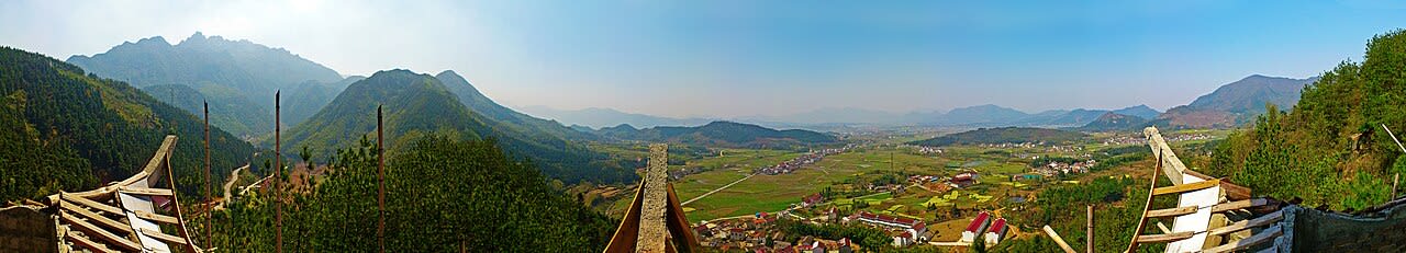
Anhui
3 sites
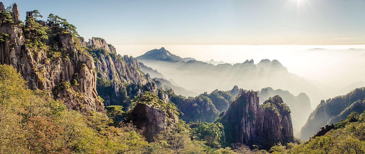
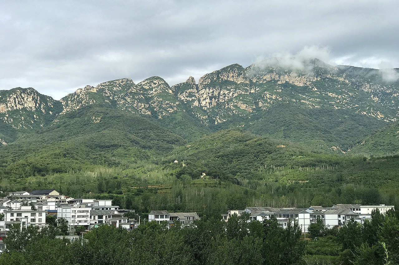
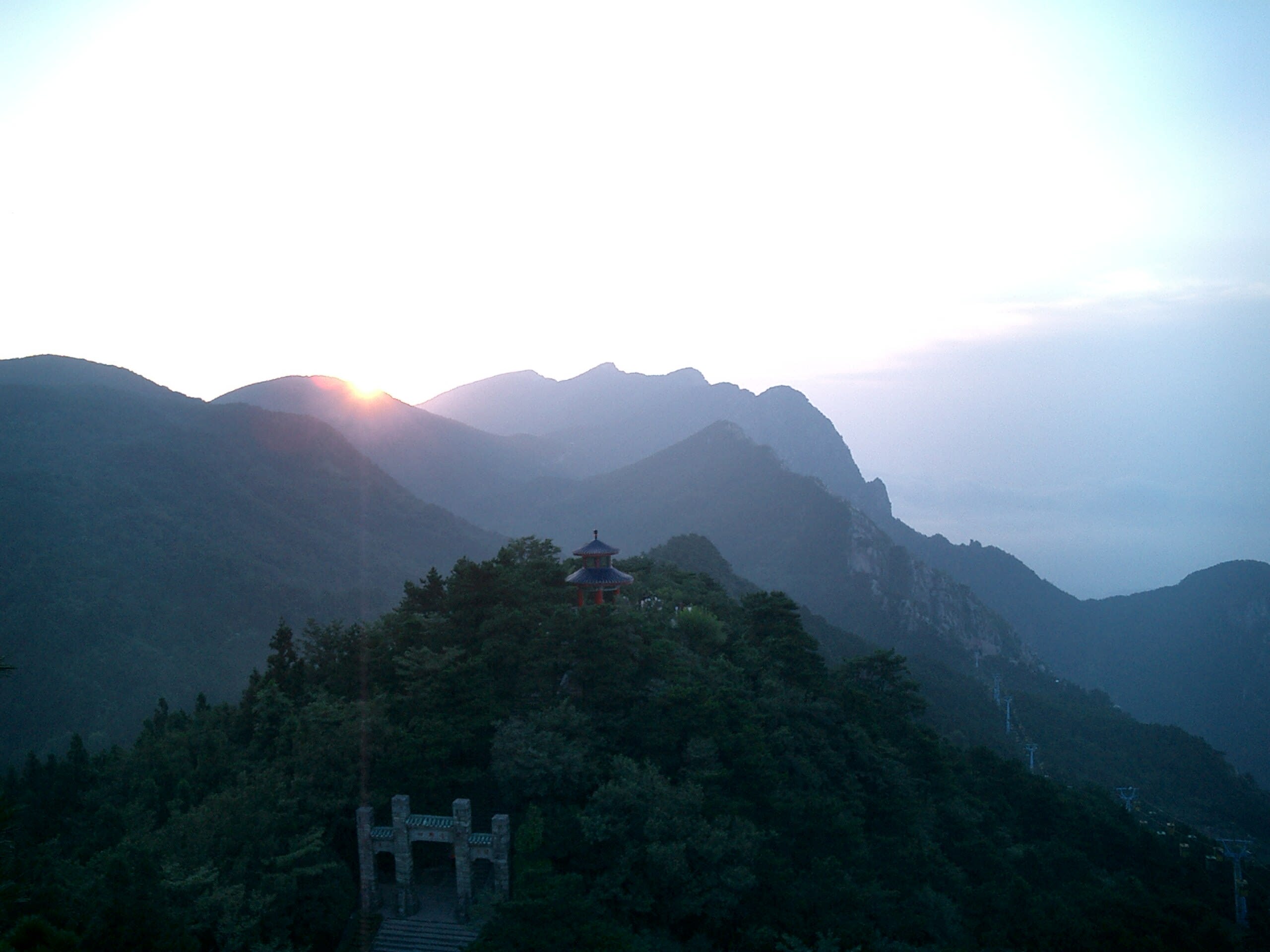
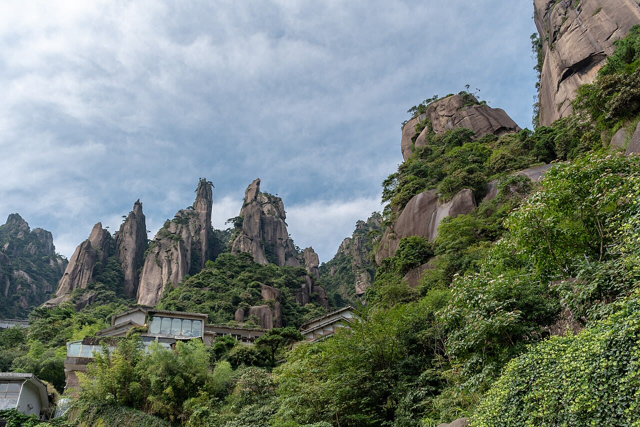
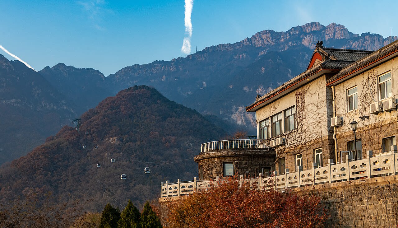
Mt. Huang Shan
Huangshan District, Anhui, China
Mt. Huang Shan is a site of sacred significance. Approximate coordinates: 30.13780, 118.16520. Located in 黄山区, 安徽省, China.
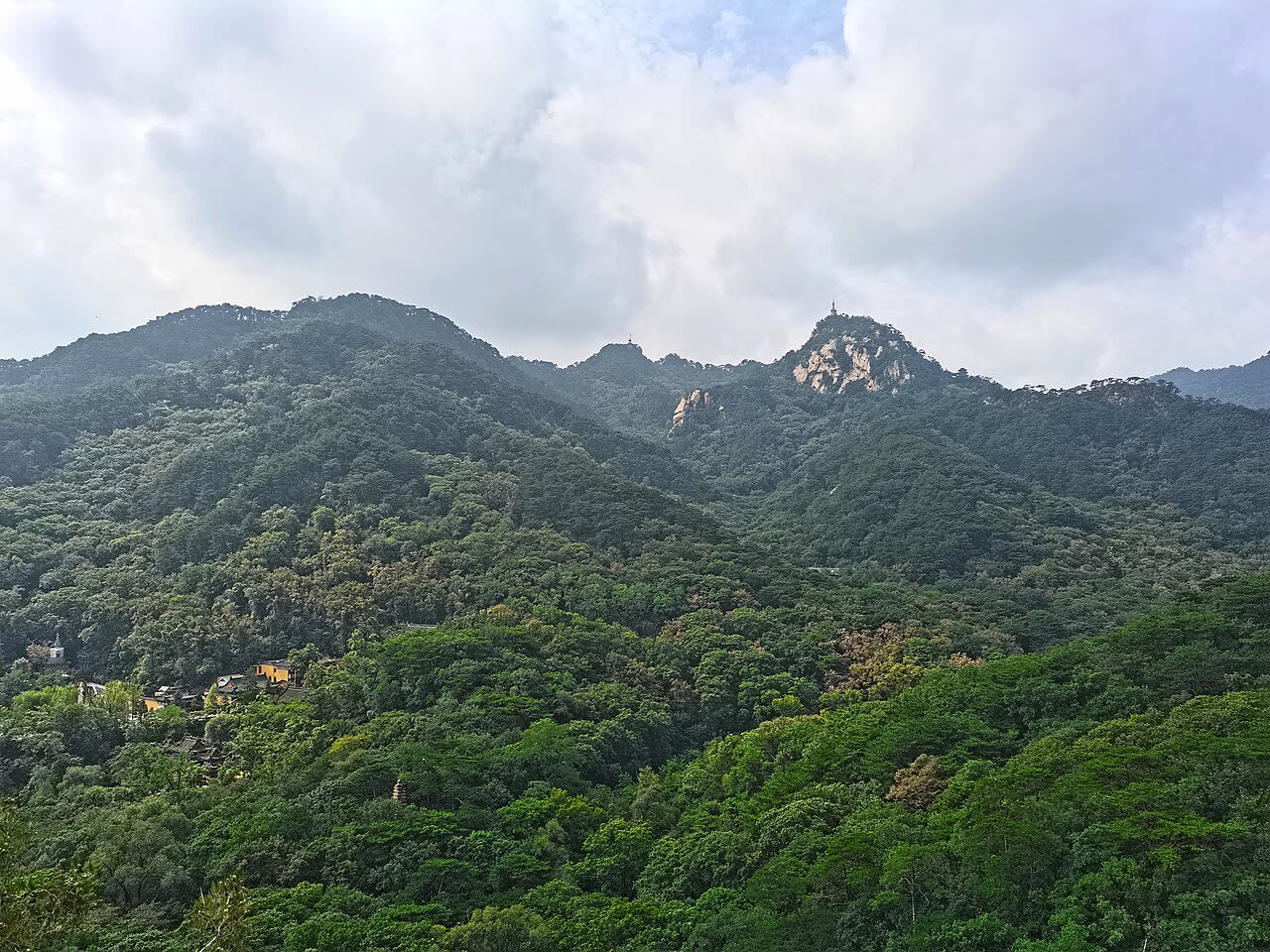
Mt. Jiuhua Shan
Chizhou, Anhui, China
Mt. Jiuhua Shan is a site of sacred significance. Approximate coordinates: 30.46393, 117.82442. Located in 池州市, 安徽省, China.
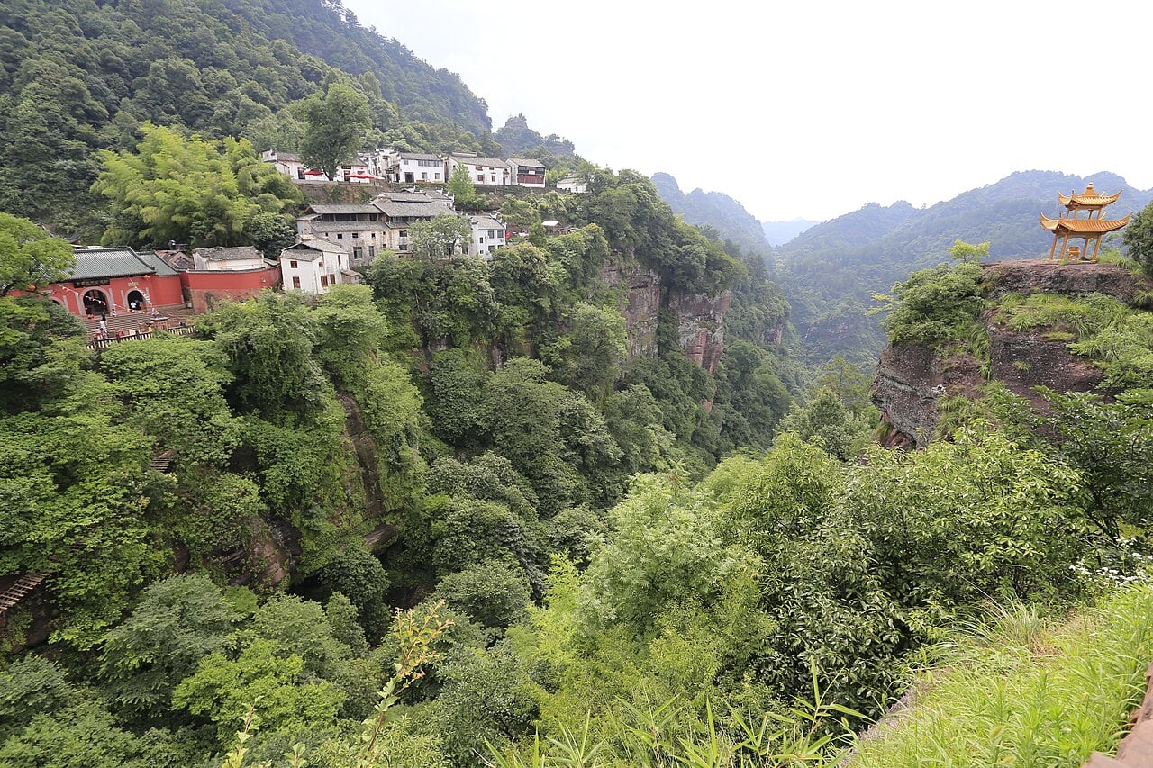
Mt. Qi Yun Shan
Huangshan, Anhui, China
Mt. Qi Yun Shan is a site of sacred significance. Approximate coordinates: 29.81715, 118.04219. Located in 黄山市, 安徽省, China.
Fujian
2 sites
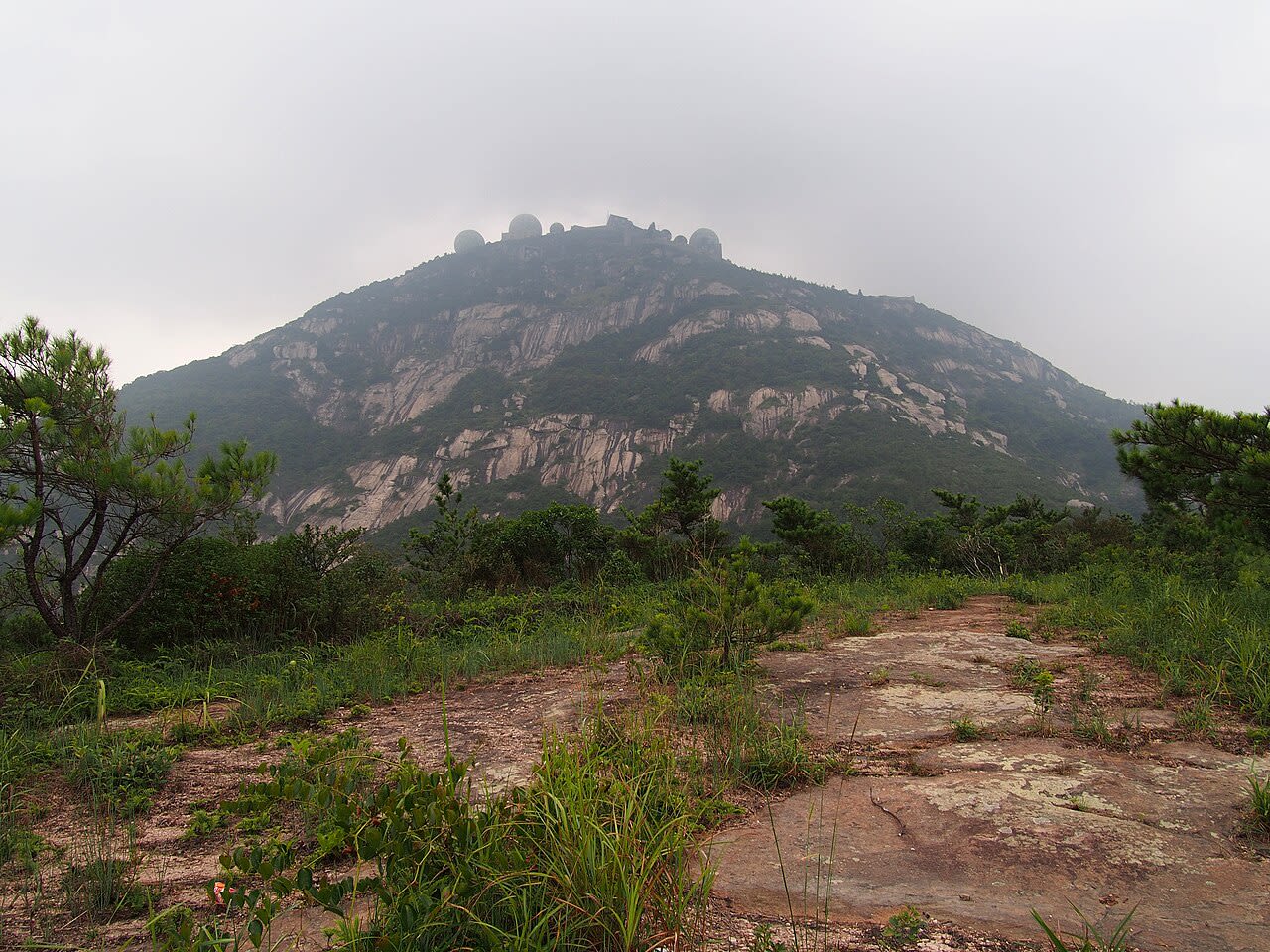
Mt. Gu Shan
Gushan, Fujian, China
Mt. Gu Shan is a site of sacred significance. Approximate coordinates: 26.05292, 119.37815. Located in 福州市, 福建省, China.
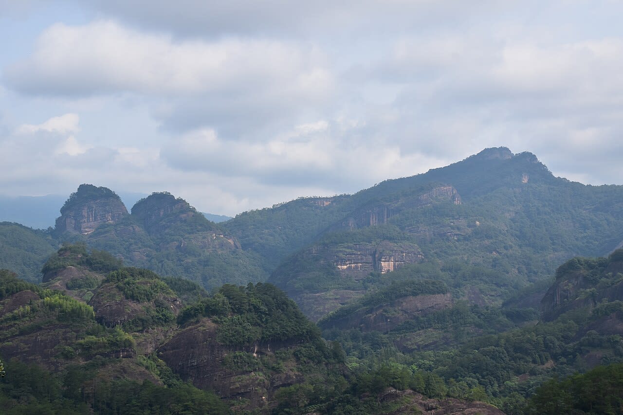
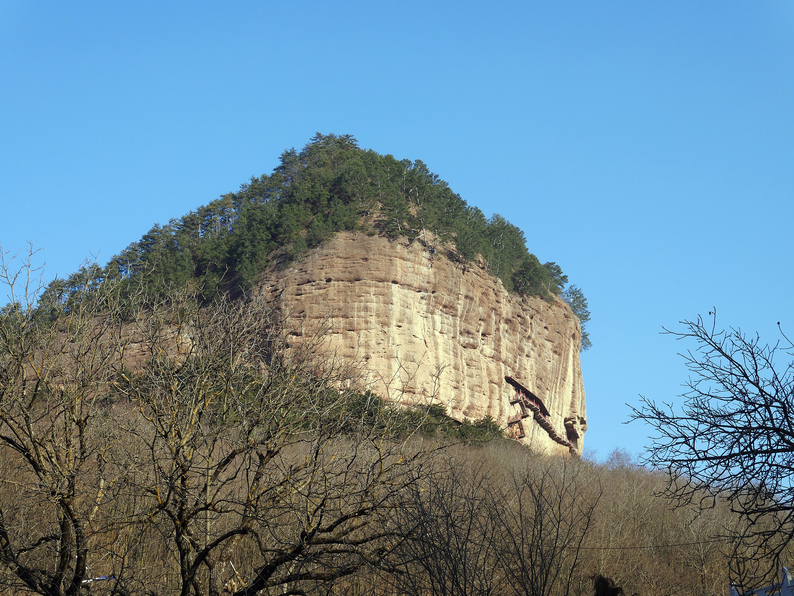
Mt. Wu Yi Shan
Wuyishan, Fujian, China
Mt. Wu Yi Shan is a site of sacred significance. Approximate coordinates: 27.71712, 117.68299. Located in 武夷山市, 福建省, China.
Gansu
1 sites
Guangdong Province
2 sites
Mt. Dinghushan
Dinghu District, Guangdong Province, China
Mt. Dinghushan is a site of sacred significance. Approximate coordinates: 23.16403, 112.54841. Located in 鼎湖区, 广东省, China.
Mt. Luo Fu Shan
Huizhou, Guangdong Province, China
Mt. Luo Fu Shan is a site of sacred significance. Approximate coordinates: 23.30024, 113.99913. Located in 惠州市, 广东省, China.
Guangxi
1 sites
Guizhou
2 sites
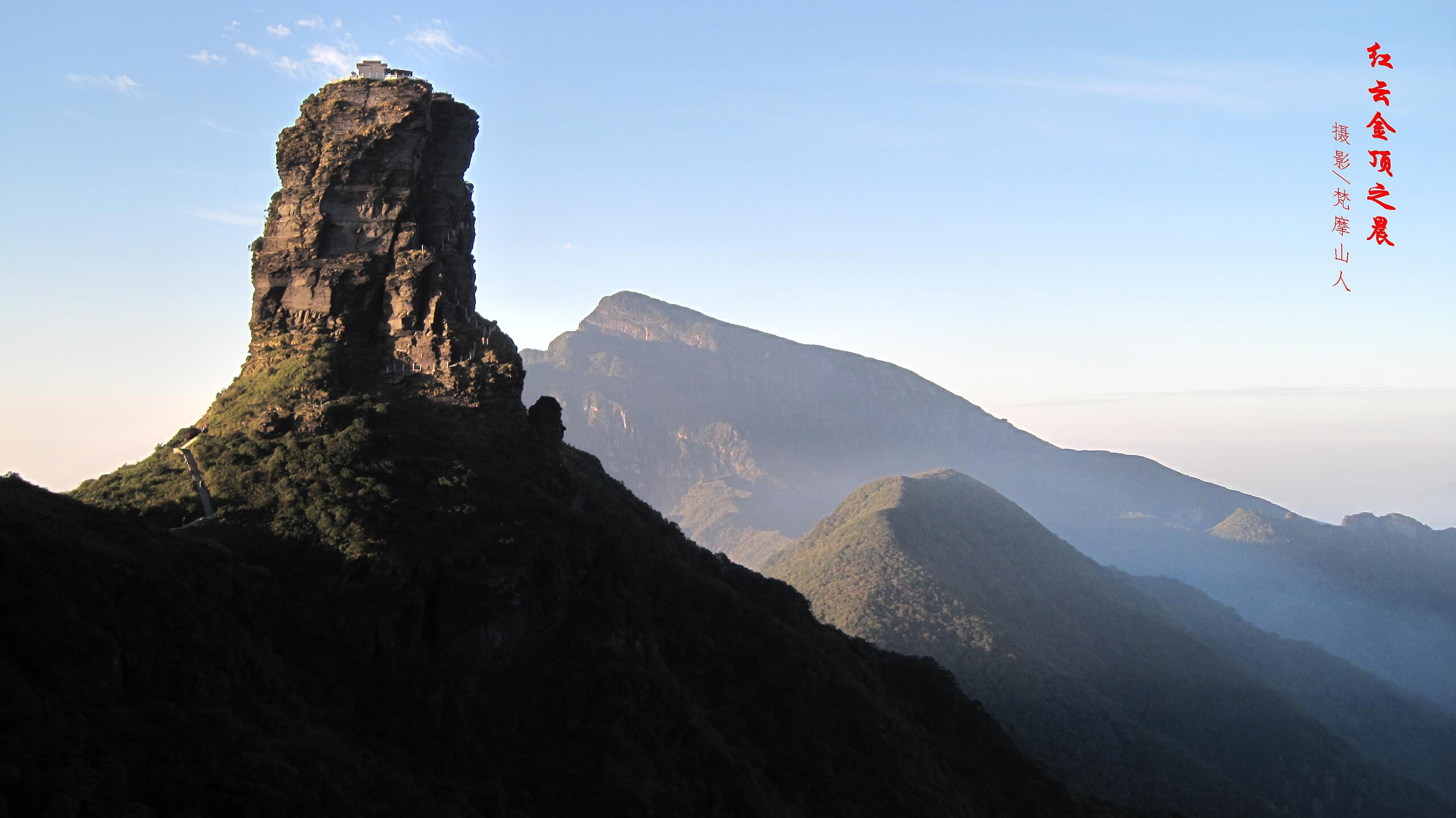
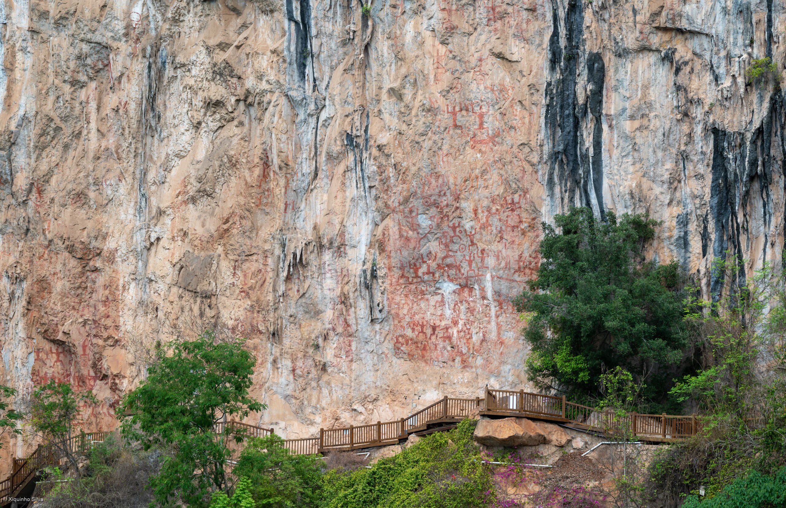
Fanjingshan mountain and temple, Tongren
Tongren, Guizhou, China
Fanjingshan mountain and temple, Tongren is a mountain and temple of sacred significance. Approximate coordinates: 27.92028, 108.69028. Attributes: built, natural, cultural, pilgrimage. Tradition: Buddhism. Associated figure: Buddha. Mythological context: Buddhist mythology. Recognized as a UNESCO World Heritage Site. Located in 贵州省, China.
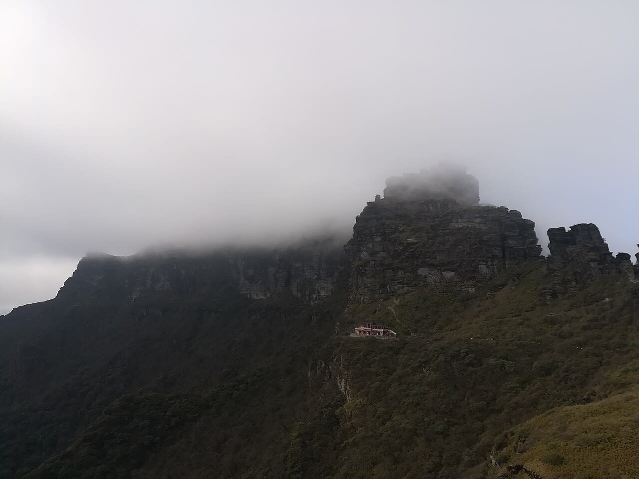
Mt. Fanjing, Guizhou, China
Yinjiang Tujia and Miao Autonomous County, Guizhou, China
Mt. Fanjing, Guizhou, China is a site of sacred significance. Approximate coordinates: 27.92028, 108.69028. Located in 贵州省, China.
Henan
2 sites
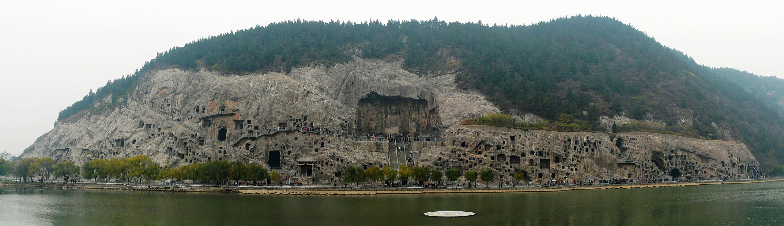
Longmen Grottoes
Luolong District, Henan, China
Longmen Grottoes is a site of sacred significance. Approximate coordinates: 34.55950, 112.46788. The Longmen Grottoes (simplified Chinese: 龙门石窟; traditional Chinese: 龍門石窟; pinyin: Lóngmén Shíkū; lit. Dragon s Gate Grottoes ) or Longmen Caves are some of the finest examples of Chinese Buddhist art. Housing tens of thousands of statues of Shakyamuni Buddha and his disciples, they are located 12 kilometres (7.5 mi) south of present-day Luoyang in Henan province, China. The images, many once painted, were carved as outside rock reliefs and inside artificial caves excavated from the limestone cliffs of the Xiangshan (香山) and Longmenshan, running east and west. The Yi River (Chinese: 伊河) flows northward between them and the area used to be called Yique (伊阙; The Gate of the Yi River ). The alternative name of Dragon s Gate Grottoes derives from the resemblance of the two hills that check the flow of the Yi River to the typical Chinese gate towers that once marked the entrance to Luoyang from the south. There are as many as 100,000 statues within the 2,345 caves, ranging from 1 inch (25 mm) to 57 feet (17 m) in height. The area also contains nearly 2,500 stelae and inscriptions, hence the name Forest of Ancient Stelae , as well as over sixty Buddhist pagodas. Situated in a scenic natural environment, the caves were dug from a 1 kilometre (0.62 mi) stretch of cliff running along both banks of the river. 30% date from the Northern Wei and 60% from the Tang dynasty, caves from other periods accounting for less than 10% of the total. Starting with the Northern Wei dynasty in 493 AD, patrons and donors included emperors, Wu Zetian, members of the royal family, other rich families, generals, and religious groups. In 2000 the site was added to the UNESCO World Heritage List as an outstanding manifestation of human artistic creativity, for its perfection of an art form, and for its encapsulation of the cultural sophistication of Tang China. Located in 洛龙区, 河南省, China.
Mt. Song Shan
Gongyi, Henan, China
Mt. Song Shan is a site of sacred significance. Approximate coordinates: 34.52084, 113.00357. Located in 郑州市, 河南省, China.
Hubei
1 sites
Hunan
1 sites
Jiangsu
1 sites
Jiangxi
2 sites
Lushan Mountain
Jiujiang, Jiangxi, China
Lushan Mountain is a mountain of sacred significance. Approximate coordinates: 29.57926, 115.99425. Attributes: natural. Located in 庐山市, 江西省, China.
Mt. San Qing Shan
Sanqing, Jiangxi, China
Mt. San Qing Shan is a site of sacred significance. Approximate coordinates: 28.90721, 118.06732. Located in 三清乡, 江西省, China.
Jilin
1 sites
Liaoning
1 sites
Qinghai
1 sites
Shaanxi
2 sites
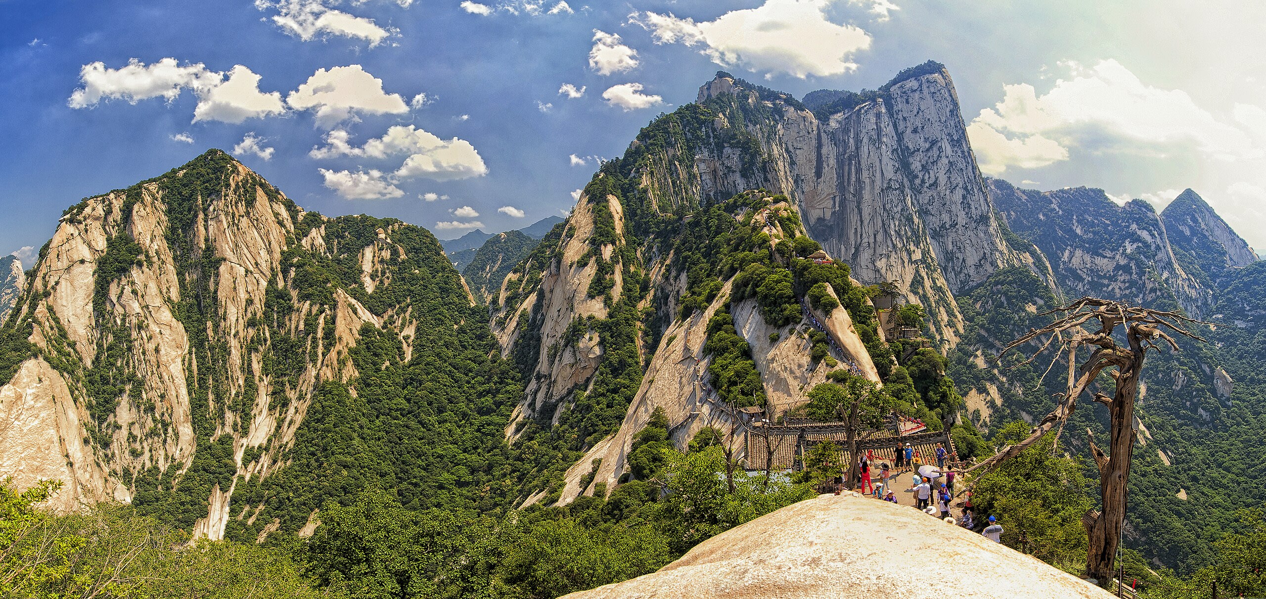
Mt. Hua Shan
Huayin City, Shaanxi, China
Mt. Hua Shan is a site of sacred significance. Approximate coordinates: 34.48499, 110.08222. Located in 华阴市, 陕西省, China.
Zhongnan-shan
Chang'an District, Shaanxi, China
Zhongnan-shan is a site of sacred significance. Approximate coordinates: 33.93333, 109.01667. Located in 长安区, 陕西省, China.
Shandong
2 sites
Mt. Lao Shan
Laoshan District, Shandong, China
Mt. Lao Shan is a site of sacred significance. Approximate coordinates: 36.10654, 120.47058. Located in 崂山区, 山东省, China.
Mt. Tai Shan
Taishan District, Shandong, China
Mt. Tai Shan is a site of sacred significance. Approximate coordinates: 36.25580, 117.10560. Located in 泰山区, 山东省, China.
Shanxi
3 sites
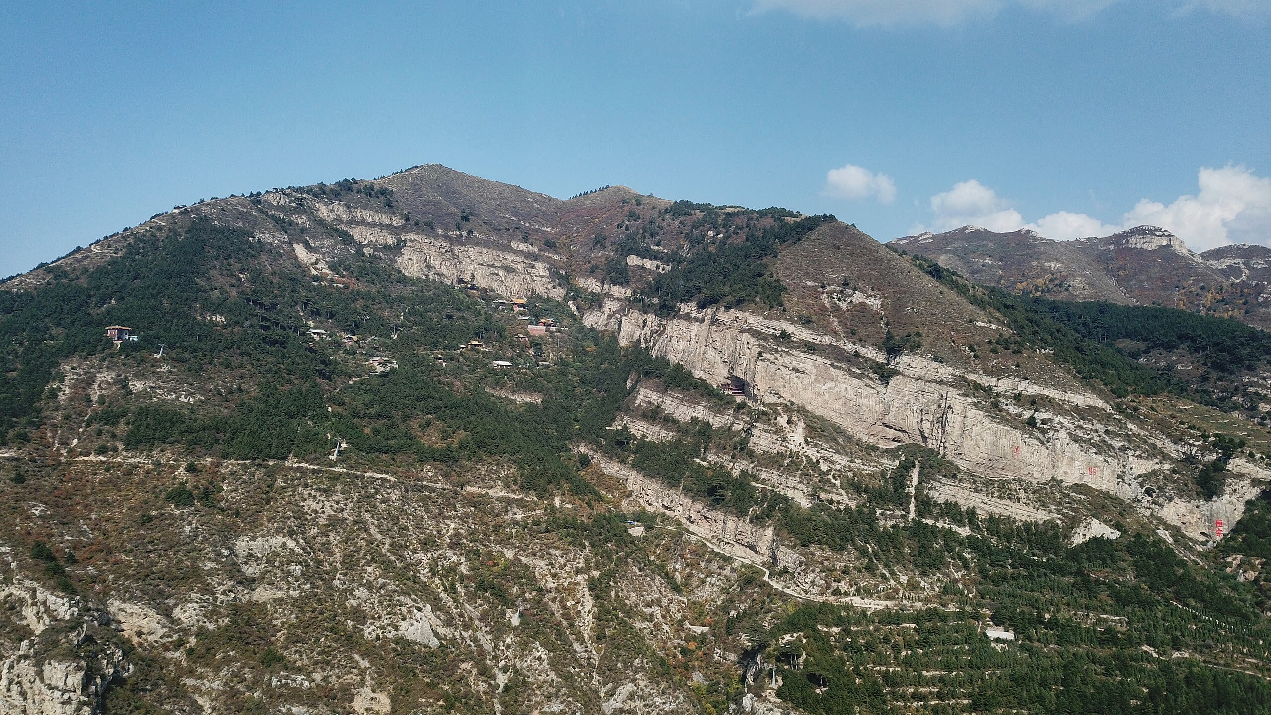
Beiyue Hengshan Mountain
Datong, Shanxi, China
Beiyue Hengshan Mountain is a mountain of sacred significance. Approximate coordinates: 39.65709, 113.72627. Attributes: natural, cultural, pilgrimage. Tradition: Taoism. Located in 浑源县, 山西省, China.
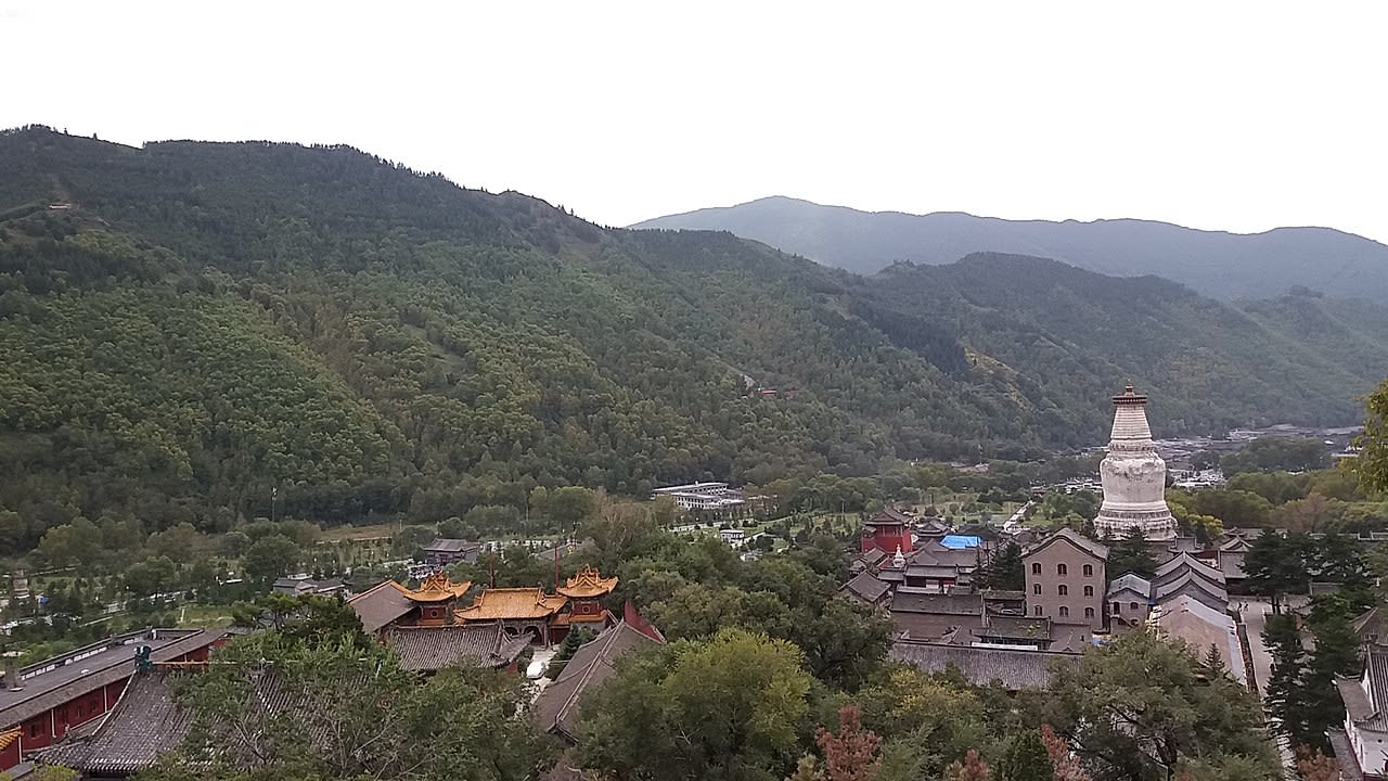
Mt. Wu Tai Shan
Taihuai, Shanxi, China
Mt. Wu Tai Shan is a site of sacred significance. Approximate coordinates: 39.02992, 113.56271. Located in 山西省, China.
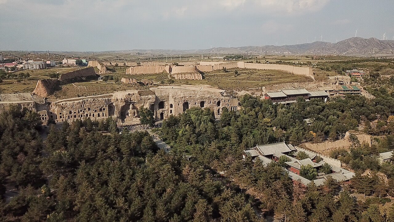
Yungang Grottoes
Datong, Shanxi, China
Yungang Grottoes is a site of sacred significance. Approximate coordinates: 40.11151, 113.13247. The Yungang Grottoes (Chinese: 云冈石窟; pinyin: Yúngāng shíkū), formerly the Wuzhoushan Grottoes (Chinese: 武州山 / 武周山; pinyin: Wǔzhōushān), are ancient Chinese Buddhist temple grottoes built during the Northern Wei dynasty near the city of Datong, then called Pingcheng, in the province of Shanxi. They are excellent examples of rock-cut architecture and one of the three most famous ancient Buddhist sculptural sites of China. The others are Longmen and Mogao. The site is located about 16 km west of the city of Datong, in the valley of the Shi Li river at the base of the Wuzhou Shan mountains. They are an outstanding example of the Chinese stone carvings from the 5th and 6th centuries. There are 53 major caves, along with 51,000 niches housing the same number of Buddha statues. Additionally, there are around 1,100 minor caves. A Ming dynasty-era fort is still located on top of the cliff housing the Yungang Grottoes. The grottoes were excavated in the south face of a sandstone cliff about 2,600 feet long and 30 to 60 feet high. In 2001, the Yungang Grottoes were made a UNESCO World Heritage Site. The Yungang Grottoes are considered by UNESCO to be a masterpiece of early Chinese Buddhist cave art... [and] ...represent the successful fusion of Buddhist religious symbolic art from south and central Asia with Chinese cultural traditions, starting in the 5th century CE under Imperial auspices. It is classified as a AAAAA scenic area by the China National Tourism Administration. Located in 大同市, 山西省, China.
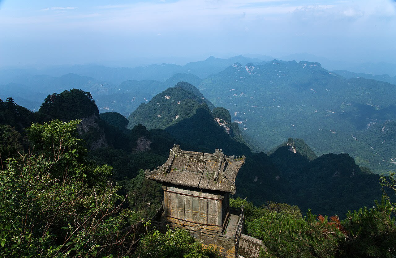
Sichuan
3 sites
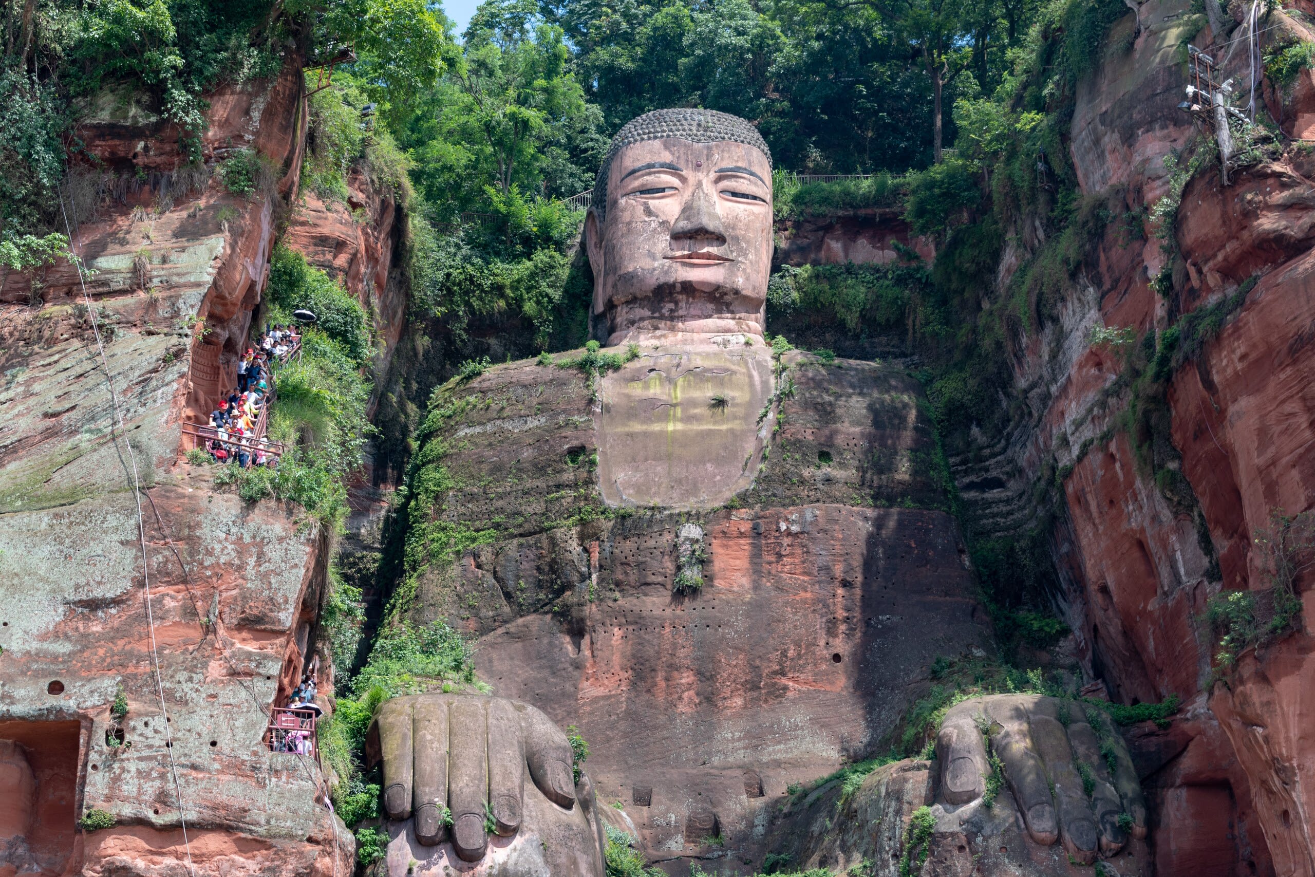
Leshan Giant Buddha
Leshan, Sichuan, China
For ninety years, three generations of craftsmen carved Maitreya Buddha into the cliffs where three rivers meet at Leshan. The monk Haitong believed a colossal image of the future Buddha could calm the treacherous currents that had claimed countless lives. He gouged out his own eyes to prove his sincerity. When the Buddha was completed in 803 CE, the waters did grow safer. Locals still call him Buddha Grandpa, their guardian watching over the city.
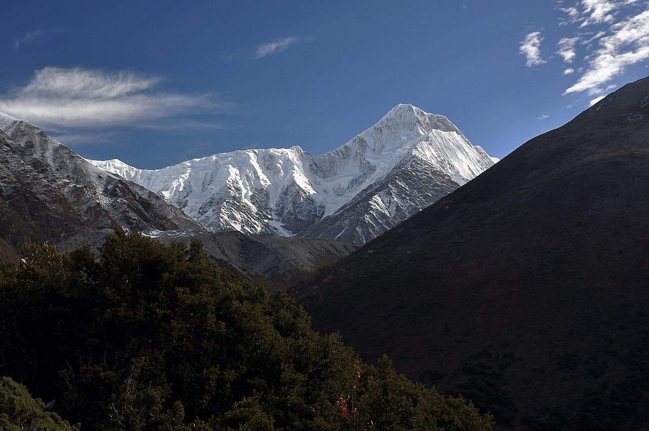
Mount Gongga
Kangding, Sichuan, China
Mount Gongga is a site of sacred significance. Approximate coordinates: 29.59500, 101.87667. Mount Gongga (simplified Chinese: 贡嘎山; traditional Chinese: 貢嘎山; pinyin: Gònggá Shān), also known as Minya Konka (Khams Tibetan: མི་ཉག་གངས་དཀར་རི་བོ་, Khams Tibetan pinyin: Mi nyâg Gong ga Riwo) and colloquially as The King of Sichuan Mountains , is the highest mountain in Sichuan province, China. It has an elevation of 7,509 m (24,636 ft) above sea level, as surveyed by the Ministry of Natural Resources in November 2023. This makes it the third highest peak in the world outside of the Himalaya/Karakoram range, after Tirich Mir and Kongur Tagh, and the easternmost and most isolated 7,000-metre (23,000 ft) peak in the world. It is situated in the Daxue Shan mountain range, between Dadu River and Yalong River, and is part of the Hengduan mountainous region. From it comes the Hailuogou glacier. The peak has large vertical relief over the deep nearby gorges. Located in 康定市 དར་མདོ་གྲོང་ཁྱེར།, 四川省, China.
Mt. Emei Shan
双水井, Sichuan, China
Mt. Emei Shan is a site of sacred significance. Approximate coordinates: 29.52463, 103.33715. Located in 四川省, China.
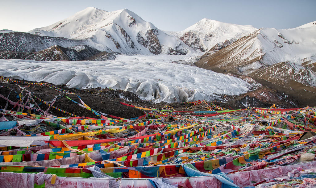
Tibet
13 sites
Drak Yerpa
Lhasa, Tibet, China
Drak Yerpa is a hermitage of sacred significance. Approximate coordinates: 29.74284, 91.28027. Attributes: natural, cultural, pilgrimage. Tradition: Buddhist. Associated figure: Milarepa. Mythological context: Buddhist mythology. Located in 拉萨市 ལྷ་ས་གྲོང་ཁྱེར།, 西藏自治区 བོད་རང་སྐྱོང་ལྗོངས།, China.
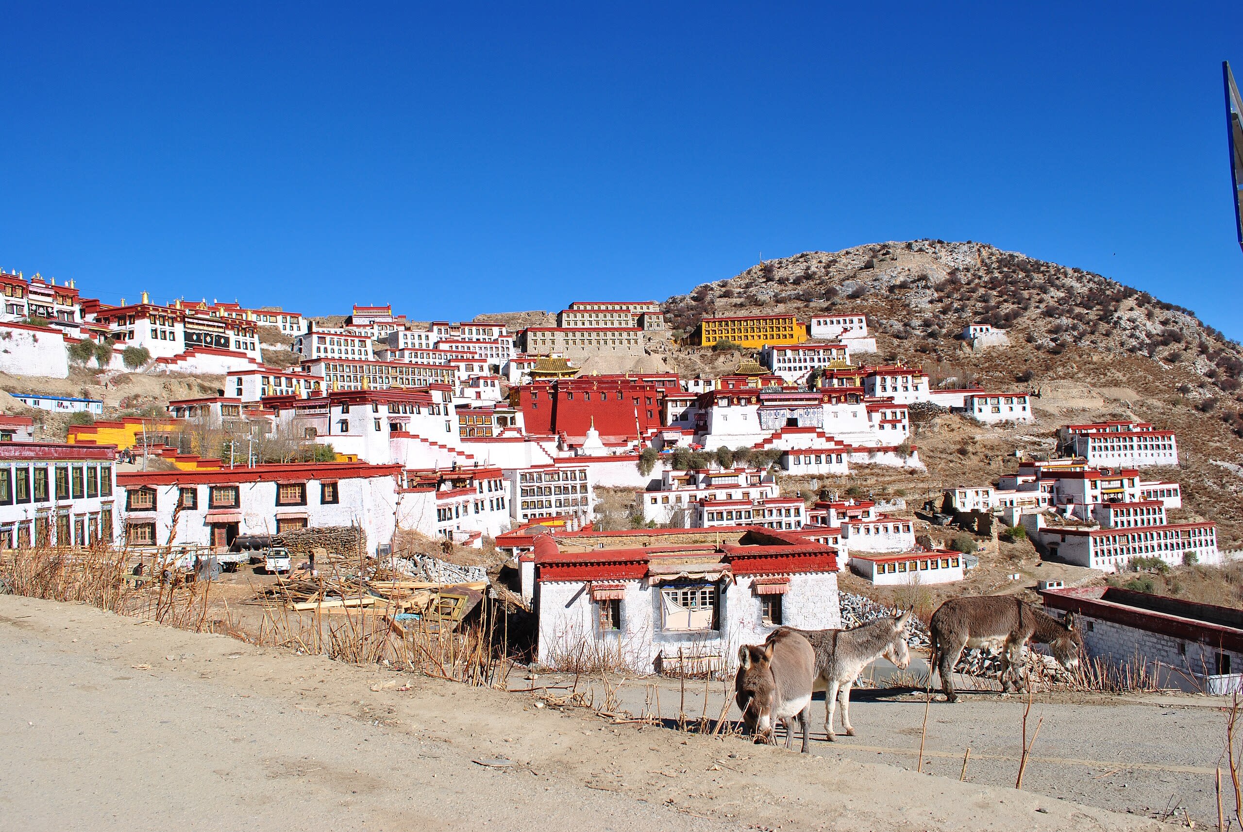
Ganden Monastery
Lhasa, Tibet, China
Ganden Monastery is a monastery of sacred significance. Approximate coordinates: 29.75866, 91.47620. Attributes: built, cultural, pilgrimage, ceremonial. Tradition: Buddhist. Associated figure: Je Tsongkhapa Lozang-dragpa. Ganden Monastery (also Gaden or Gandain) or Ganden Namgyeling or Monastery of Gahlden is one of the great three Gelug university monasteries located in Dagzê County, Lhasa, Tibet. The other two are Sera Monastery and Drepung Monastery. Ganden Monastery was founded in 1409 by Je Tsongkhapa Lozang-dragpa, founder of the Gelug order. The monastery was destroyed after 1959, but has since been partially rebuilt. Another monastery with the same name and tradition was established in Southern India in 1966 by Tibetan exiles. Located in 拉萨市 ལྷ་ས་གྲོང་ཁྱེར།, 西藏自治区 བོད་རང་སྐྱོང་ལྗོངས།, China.
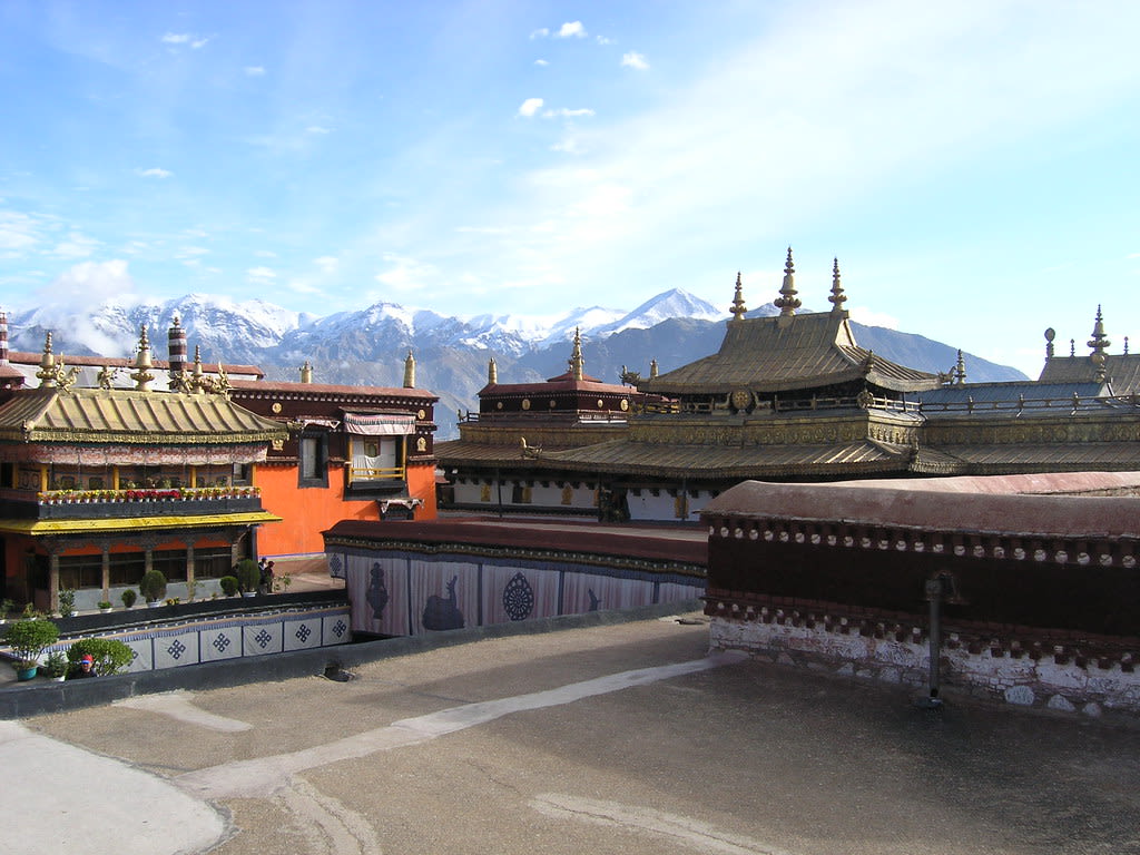
Jokhang Temple
Chengguan District, Tibet, China
Jokhang Temple is a temple of sacred significance. Approximate coordinates: 29.65025, 91.13382. Attributes: built, cultural, pilgrimage. Tradition: Tibetan Buddhism. Recognized as a UNESCO World Heritage Site. Located in 城关区 ཁྲིན་ཀོན་ཆུས།, 西藏自治区 བོད་རང་སྐྱོང་ལྗོངས།, China.
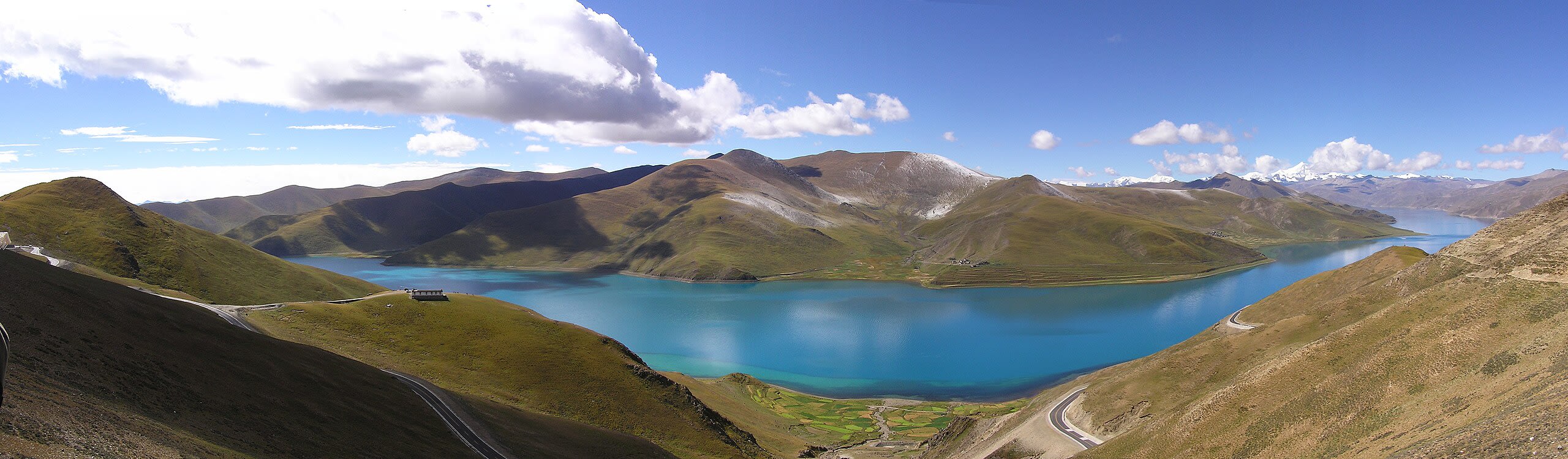
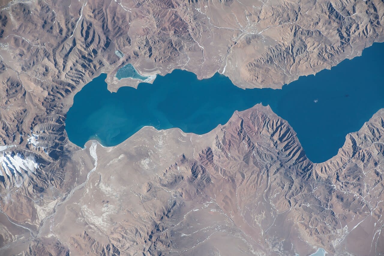
Lake Nam Tso
Baingoin County, Tibet, China
Lake Nam Tso is a lake of sacred significance. Approximate coordinates: 30.69461, 90.52734. Attributes: natural. Located in 班戈县 དཔལ་མགོན་རྫོང།, 西藏自治区 བོད་རང་སྐྱོང་ལྗོངས།, China.
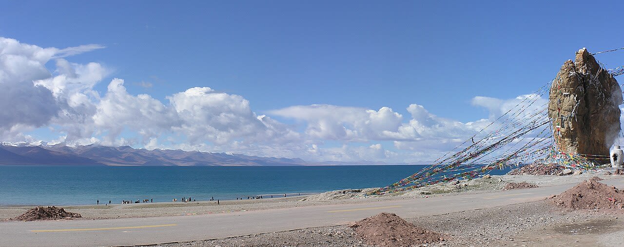
Lake Yamzho Yumco
Ngarzhag, Tibet, China
Lake Yamzho Yumco is a lake of sacred significance. Approximate coordinates: 29.00078, 90.66648. Attributes: natural. Located in 阿扎乡, 西藏自治区 བོད་རང་སྐྱོང་ལྗོངས།, China.

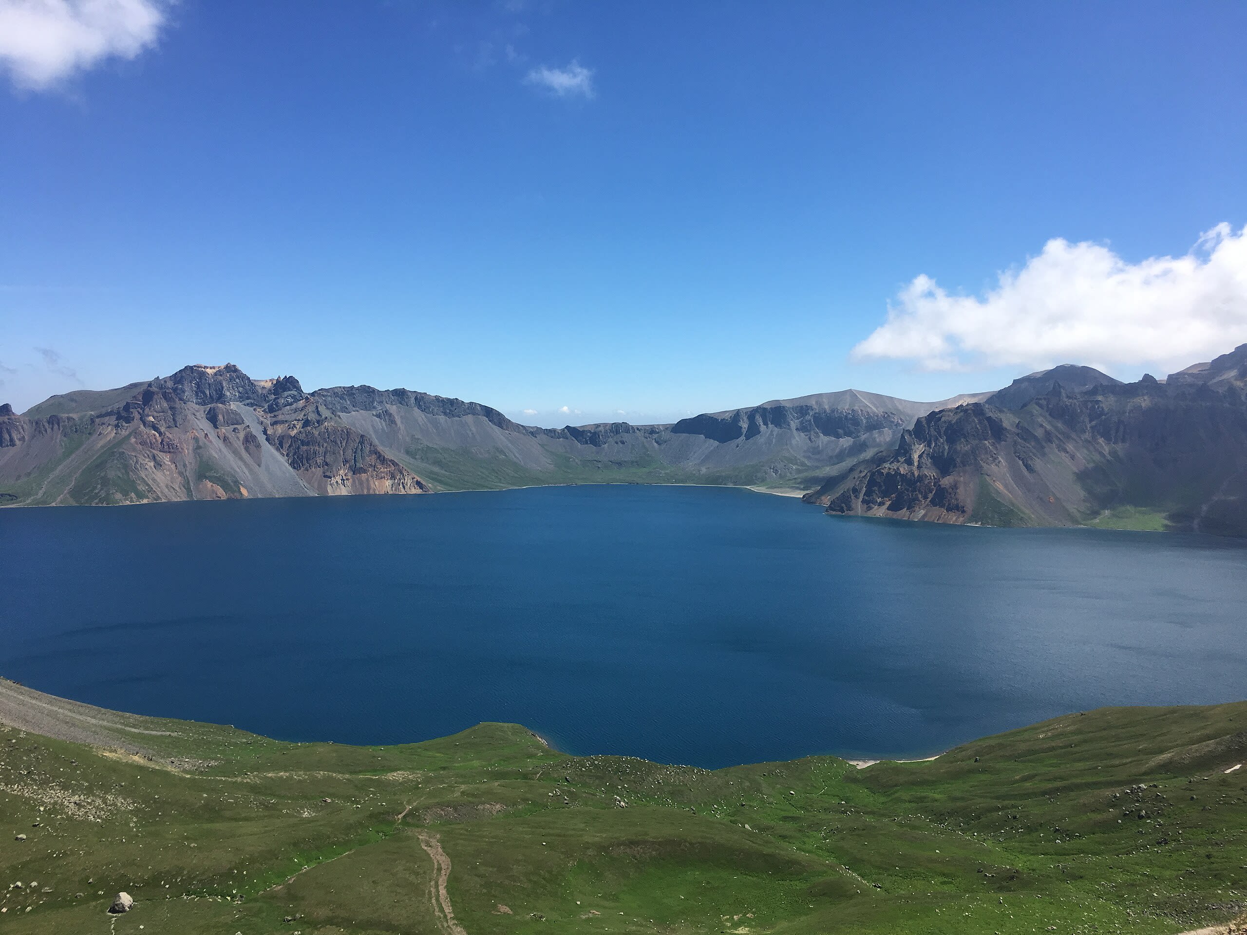
Mt. Kailash
Darchen, Tibet, China
Mt. Kailash is a site of sacred significance. Approximate coordinates: 31.06750, 81.31194. Located in 巴嘎镇, 西藏自治区 བོད་རང་སྐྱོང་ལྗོངས།, China.
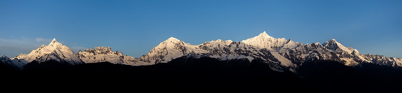
Mt. Meili Xue
Zogang County, Tibet, China
Mt. Meili Xue is a site of sacred significance. Approximate coordinates: 28.43987, 98.68452. Located in 左贡县 མཛོ་སྒང་རྫོང།, 西藏自治区 བོད་རང་སྐྱོང་ལྗོངས།, China.
Mt. Targo and Lake Dangra
Targo, Tibet, China
Mt. Targo and Lake Dangra is a site of sacred significance. Approximate coordinates: 30.99999, 86.63310. Located in 达果乡, 西藏自治区 བོད་རང་སྐྱོང་ལྗོངས།, China.
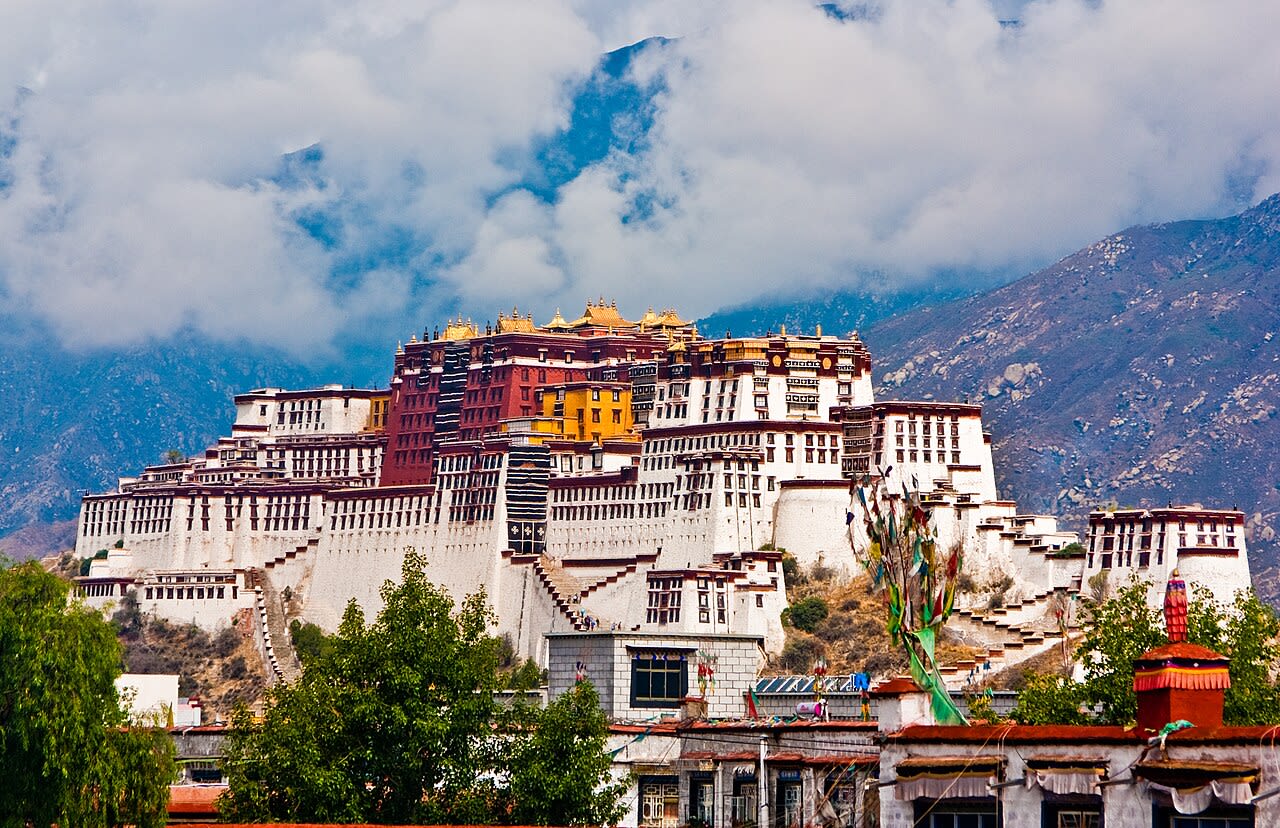
Potala Palace
Chengguan District, Tibet, China
Potala Palace is a site of sacred significance. Approximate coordinates: 29.65549, 91.11858. Potala Palace (Tibetan: པོ་ཏ་ལ་ཕོ་བྲང Chinese: 布达拉宫) is the name of a museum in Tibet Autonomous Region of China, previously a palace of the Tibetan sovereign, the Dalai Lama, in the dzong-style, in Lhasa, capital of Tibet. It was the winter palace of the Dalai Lamas from 1649. In 1959 the Tibetan government ceased inhabitation when the buildings were seized by the People s Republic of China. The palace is named after Mount Potalaka, which within Buddhist thought is the mythical abode of the bodhisattva Avalokiteśvara. The 5th Dalai Lama made decree for its construction in 1645 with advice of Konchog Chophel the Thirty-Fifth Ganden Tripa of the monastical tradition of Tsongkhapa. The Potala is on ruins of the White or Red Palace, built by decree of Songtsen Gampo in 637. Built at an altitude of 3,700metres, on the side of Ri Marpo ( Red Mountain ) in the centre of Lhasa Valley, the building measures 400m east-west and 350m north-south, with sloping stone walls averaging 3m thick, and 5m thick at the base, and with copper poured into the foundations to help proof it against earthquakes. The Potala is thirteen storeys of buildings which contain over 1,000 rooms, 10,000 shrines and about 200,000 statues. The building height is 119m on Marpo Ri, and more than 300m in total above the valley floor. Located in 城关区 ཁྲིན་ཀོན་ཆུས།, 西藏自治区 བོད་རང་སྐྱོང་ལྗོངས།, China.
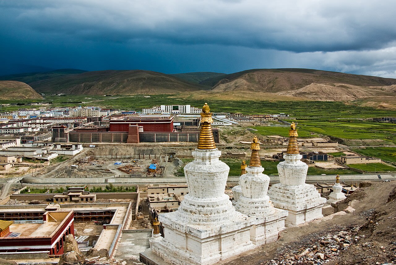
Sakya
Tashigang, Tibet, China
Sakya is a site of sacred significance. Approximate coordinates: 28.90512, 88.01821. The Sakya (Tibetan: ས་སྐྱ་, Wylie: sa skya, pale earth ) school is one of four major schools of Tibetan Buddhism, the others being the Nyingma, Kagyu, and Gelug. It is one of the Red Hat Orders along with the Nyingma and Kagyu. Located in 萨迦镇, 西藏自治区 བོད་རང་སྐྱོང་ལྗོངས།, China.
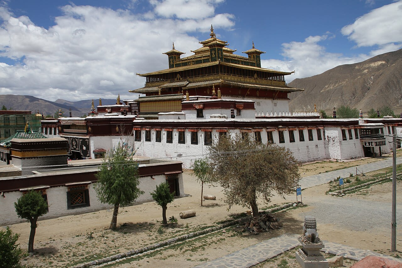
Samye
Samye, Tibet, China
Samye is a site of sacred significance. Approximate coordinates: 29.32395, 91.50388. Samye (Tibetan: བསམ་ཡས་, Wylie: bsam yas, Chinese: 桑耶寺), full name Samye Mighur Lhundrub Tsula Khang (Wylie: Bsam yas mi ’gyur lhun grub gtsug lag khang) and Shrine of Unchanging Spontaneous Presence, is the first Tibetan Buddhist and Nyingma monastery built in Tibet, during the reign of King Trisong Deutsen. Shantarakshita began construction around 763, and Tibetan Vajrayana founder Guru Padmasambhava tamed the local spirits for its completion in 779. The first Tibetan monks were ordained there. Samye was destroyed during the Cultural Revolution then rebuilt after 1988. Samye Monastery is located in the Chimpu valley (Mchims phu), south of Lhasa, next the Hapori mountain, in the Yarlung Valley. The site is in the present administrative region of Gra Nang or Drananga Lhoka. Located in 桑耶镇, 西藏自治区 བོད་རང་སྐྱོང་ལྗོངས།, China.
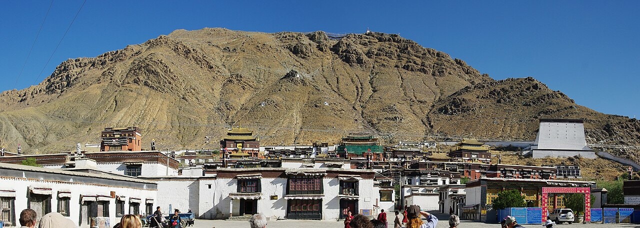
Tashilhunpo
城西街道, Tibet, China
Tashilhunpo is a site of sacred significance. Approximate coordinates: 29.26658, 88.87089. Located in 城西街道, 西藏自治区 བོད་རང་སྐྱོང་ལྗོངས།, China.
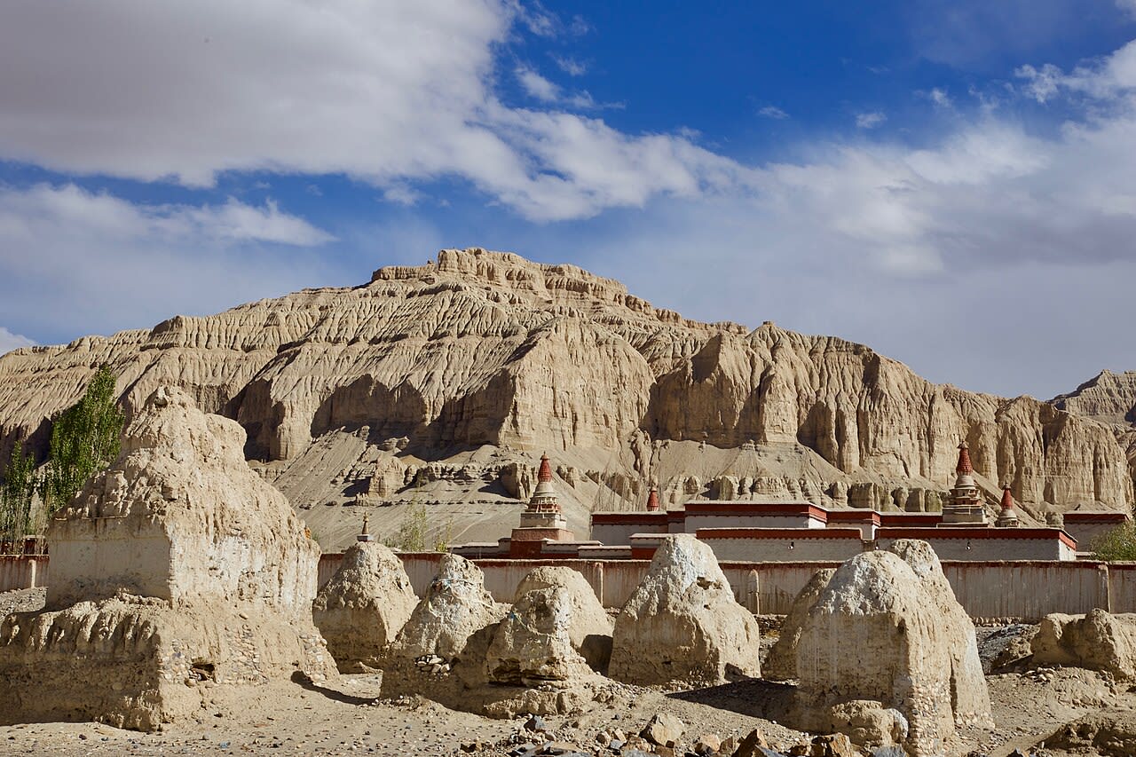
Toling
Tsamda County, Tibet, China
Toling is a site of sacred significance. Approximate coordinates: 31.48424, 79.79902. Located in 札达县 རྩ་མདའ་རྫོང་།, 西藏自治区 བོད་རང་སྐྱོང་ལྗོངས།, China.
Zhejiang
2 sites
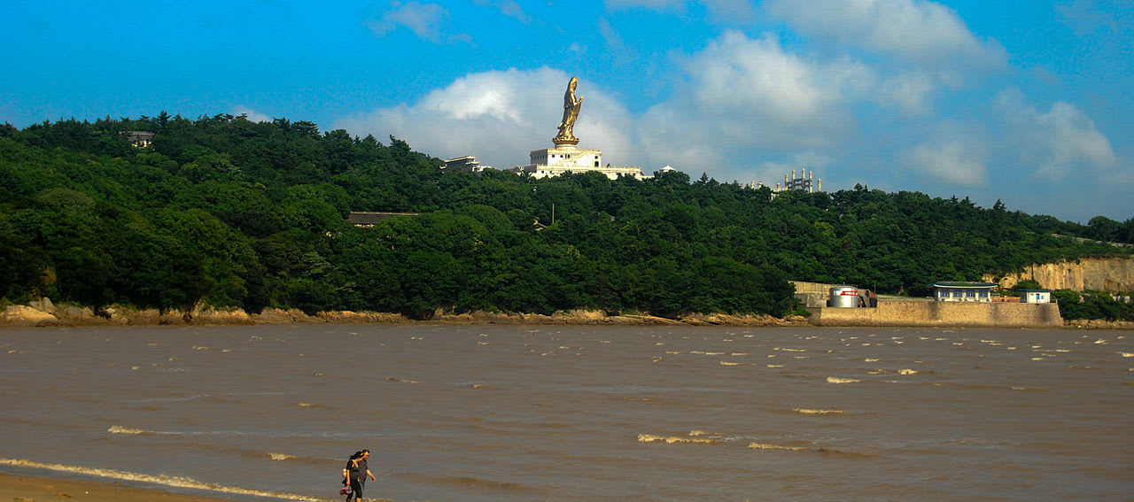
Mt. Pu Tuo Shan
Putuo District, Zhejiang, China
Mt. Pu Tuo Shan is a site of sacred significance. Approximate coordinates: 29.98494, 122.38594. Located in 普陀区, 浙江省, China.
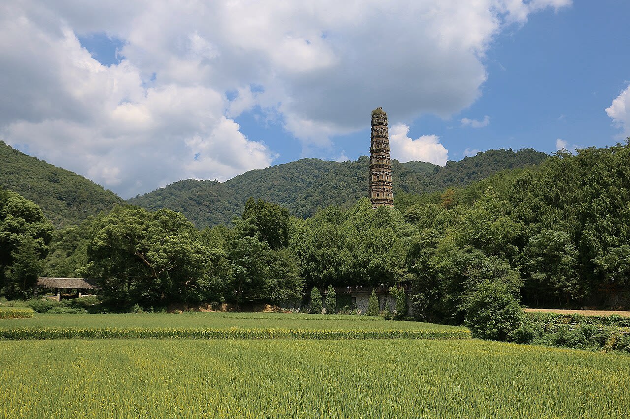
Mt. Tiantai Shan
Tiantai County, Zhejiang, China
Mt. Tiantai Shan is a site of sacred significance. Approximate coordinates: 29.15000, 121.04268. Located in 天台县, 浙江省, China.