Country guide
Peru
56 sacred sites across 11 regions.
Traditions present in Peru
Prominent site types
Ancash
2 sites
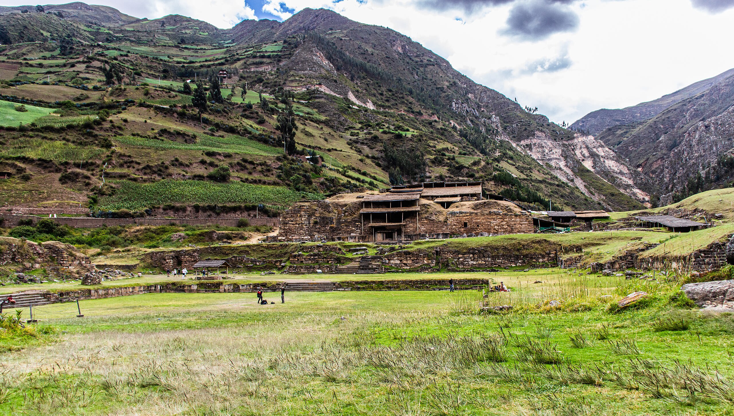
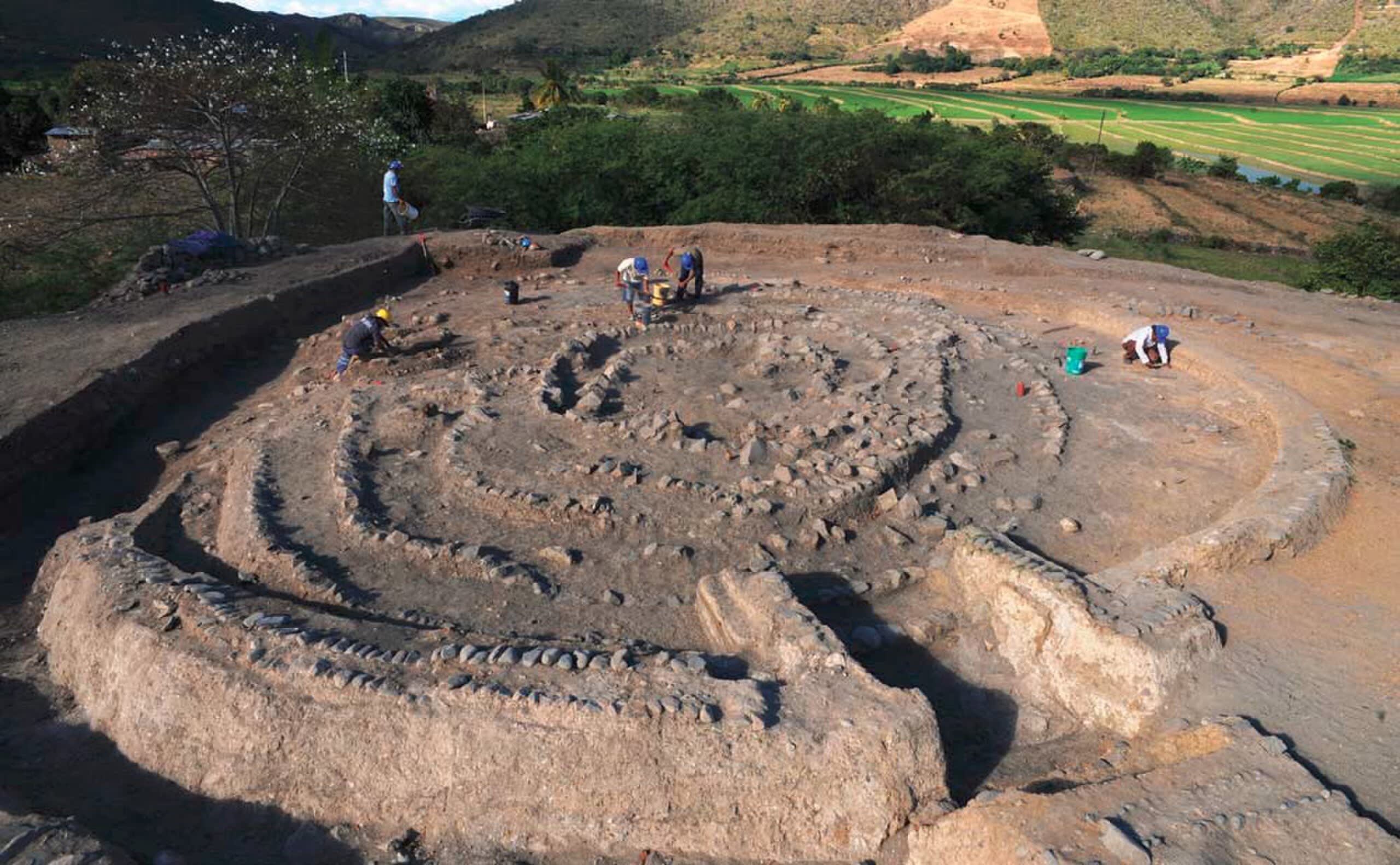
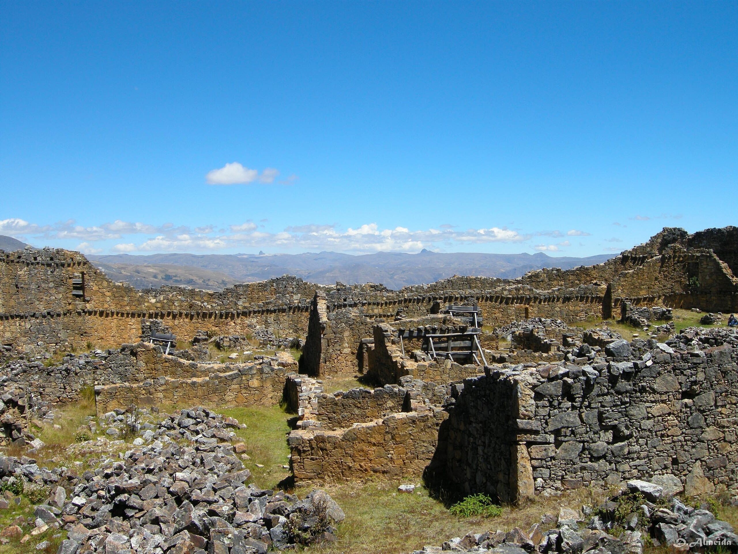
Chavín de Huántar
Chavín de Huantar, Ancash, Peru
Chavín de Huántar is a archaeological site of sacred significance. Approximate coordinates: -9.59367, -77.17734. Attributes: built, cultural, archaeological, ceremonial. Tradition: Chavín. Recognized as a UNESCO World Heritage Site. Chavín de Huántar is an archaeological site in Peru, containing ruins and artifacts constructed as early as 1200 BC, and occupied until around 400–500 BC by the Chavín, a major pre-Inca culture. The site is located in the Ancash Region, 434 kilometers (270 mi) north of Lima, at an elevation of 3,180 meters (10,430 ft), east of the Cordillera Blanca at the start of the Conchucos Valley. Chavín de Huántar has been designated as a UNESCO World Heritage Site. Some of the Chavín relics from this archaeological site are on display in the Museo de la Nación in Lima and the Museo Nacional de Chavín in Chavín itself. Occupation at Chavín de Huántar has been carbon-dated to at least 3000 BC, with ceremonial center activity occurring primarily toward the end of the second millennium, and through the middle of the first millennium BC. While the fairly large population was based on an agricultural economy, the city s location at the headwaters of the Marañón River, between the coast and the jungle, made it an ideal location for the dissemination and collection of both ideas and material goods. This archaeological site is a large ceremonial center that has revealed a great deal about the Chavín culture. Chavín de Huántar served as a gathering place for people of the region to come together and worship. The transformation of the center into a valley-dominating monument made it a pan-regional place of importance. People went to Chavín de Huántar as a center: to attend and participate in rituals, consult an oracle, or enter a cult. Findings at Chavín de Huántar indicate that social instability and upheaval began to occur between 500 and 300 BC, at the same time that the larger Chavín culture began to decline. Large ceremonial sites were abandoned, some unfinished, and were replaced by villages and agricultural land. At Chavín de Huántar, no later than 500 BC, a small village replaced the Circular Plaza. The plaza was occupied by a succession of cultural groups, and residents salvaged building stones and stone carvings to use in house walls. Multiple occupation floors indicate the village was continuously occupied through the 1940s. Located in Chavín de Huantar, Ancash, Peru.
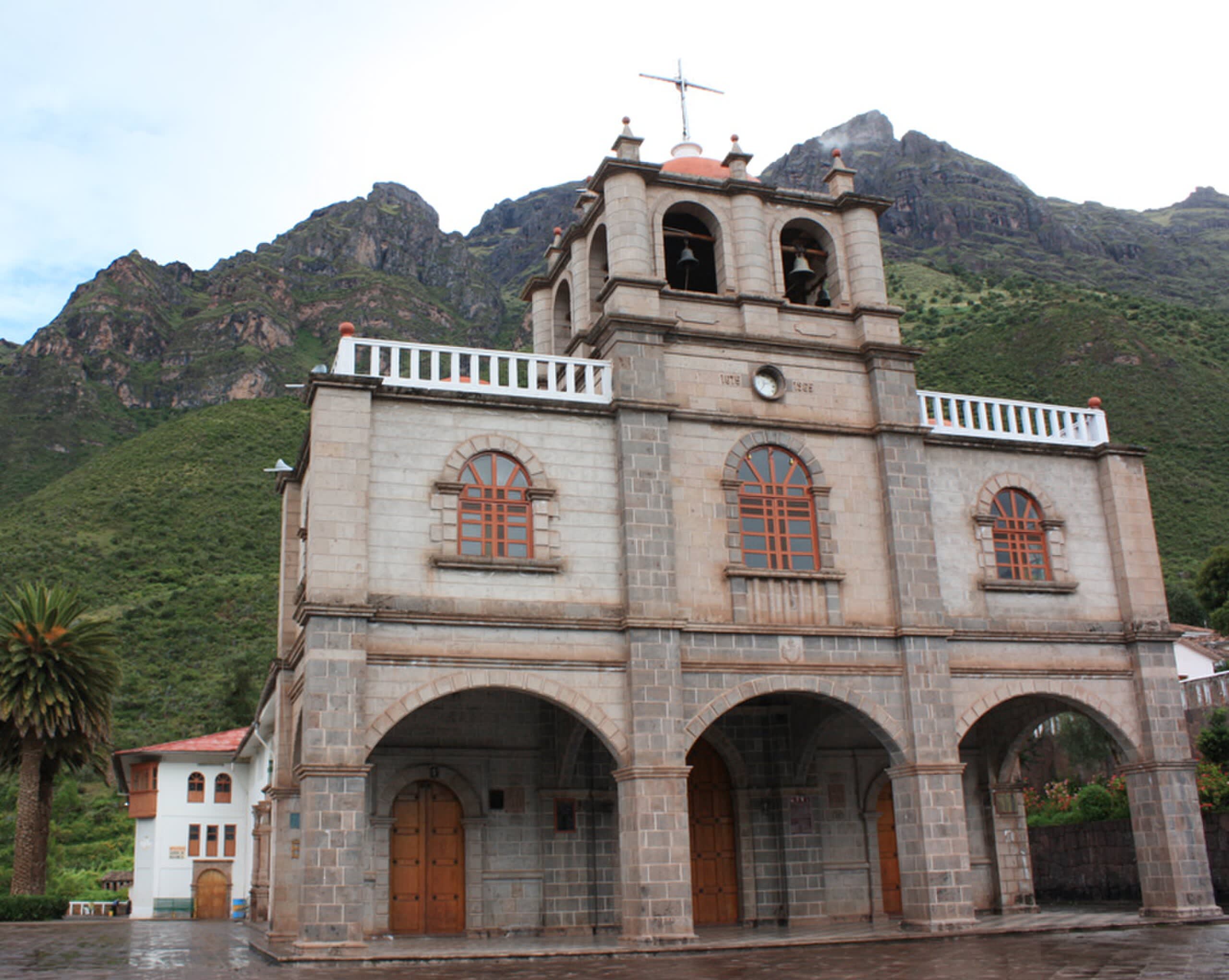
Sanctuary of Our Lady of the Assumption in Chacas
Chacas, Ancash, Peru
Santuario de Mama Ashu is a site of sacred significance. Approximate coordinates: -9.16262, -77.36604. Located in Chacas, Ancash, Peru.
Ayacucho
3 sites
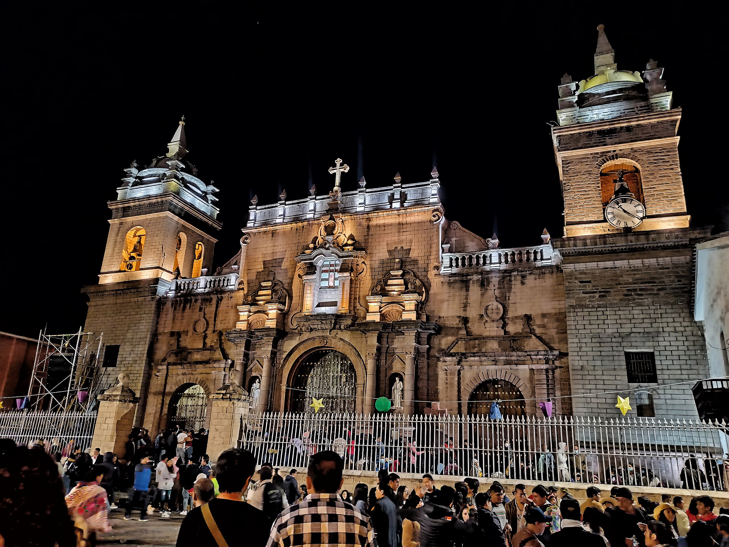
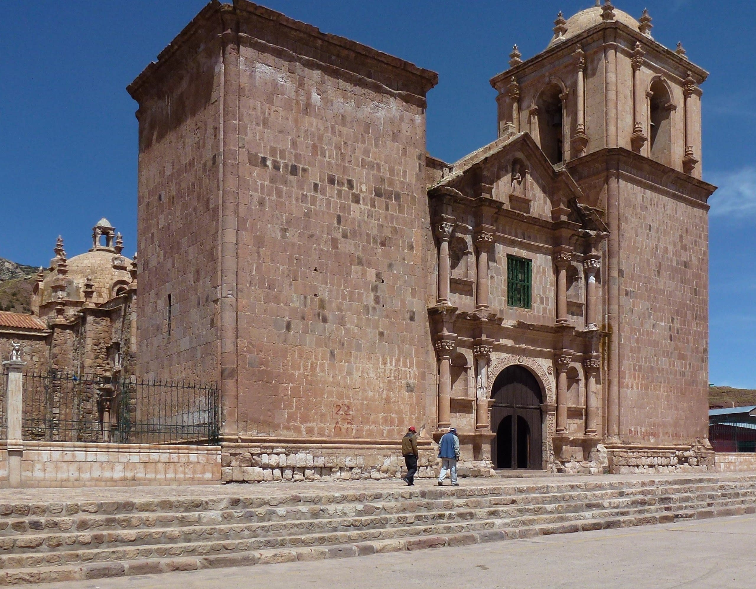
Ayacucho Cathedral
Ayacucho, Ayacucho, Peru
Ayacucho Cathedral is a cathedral of sacred significance. Approximate coordinates: -13.16063, -74.22521. Attributes: built, cultural, pilgrimage. Tradition: Christianity. Associated figure: St. Mary. Located in Ayacucho, Ayacucho, Peru.
El Ushnu
Vilcashuaman, Ayacucho, Peru
El Ushnu in Vilcashuaman, Ayacucho, Peru.

Templo del Sol y la Luna
Vilcashuaman, Ayacucho, Peru
Templo del Sol y la Luna in Vilcashuaman, Ayacucho, Peru.
Cajamarca
1 sites
Cusco
20 sites
Centro Arqueológico de Chinchero
Chinchero, Cusco, Peru
Centro Arqueológico de Chinchero in Chinchero, Cusco, Peru.
Centro Arqueológico Puka Pukara
Cusco, Cusco, Peru
Centro Arqueológico Puka Pukara in Cusco, Cusco, Peru.
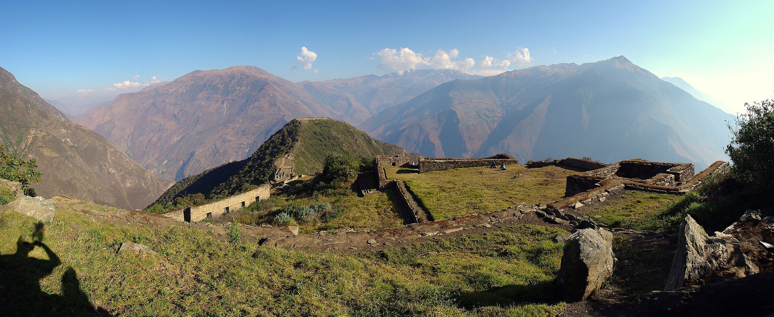
Choquequirao Archaeological Park, Peru
Santa Teresa, Cusco, Peru
Choquequirao Archaeological Park, Peru is a archaeological park of sacred significance. Approximate coordinates: -13.39501, -72.87222. Attributes: built, cultural, archaeological. Tradition: Inca. Located in Santa Teresa, Cusco, Peru.
Complejo Arqueológico Q'enqo
Cusco, Cusco, Peru
Complejo Arqueológico Q'enqo in Cusco, Cusco, Peru.
El Templo de los Monos
Cusco, Cusco, Peru
El Templo de los Monos in Cusco, Cusco, Peru.
Huaca Pachatosa
Cusco, Cusco, Peru
Huaca Pachatosa in Cusco, Cusco, Peru.
Huaca Sapantiana
Cusco, Cusco, Peru
Huaca Sapantiana in Cusco, Cusco, Peru.
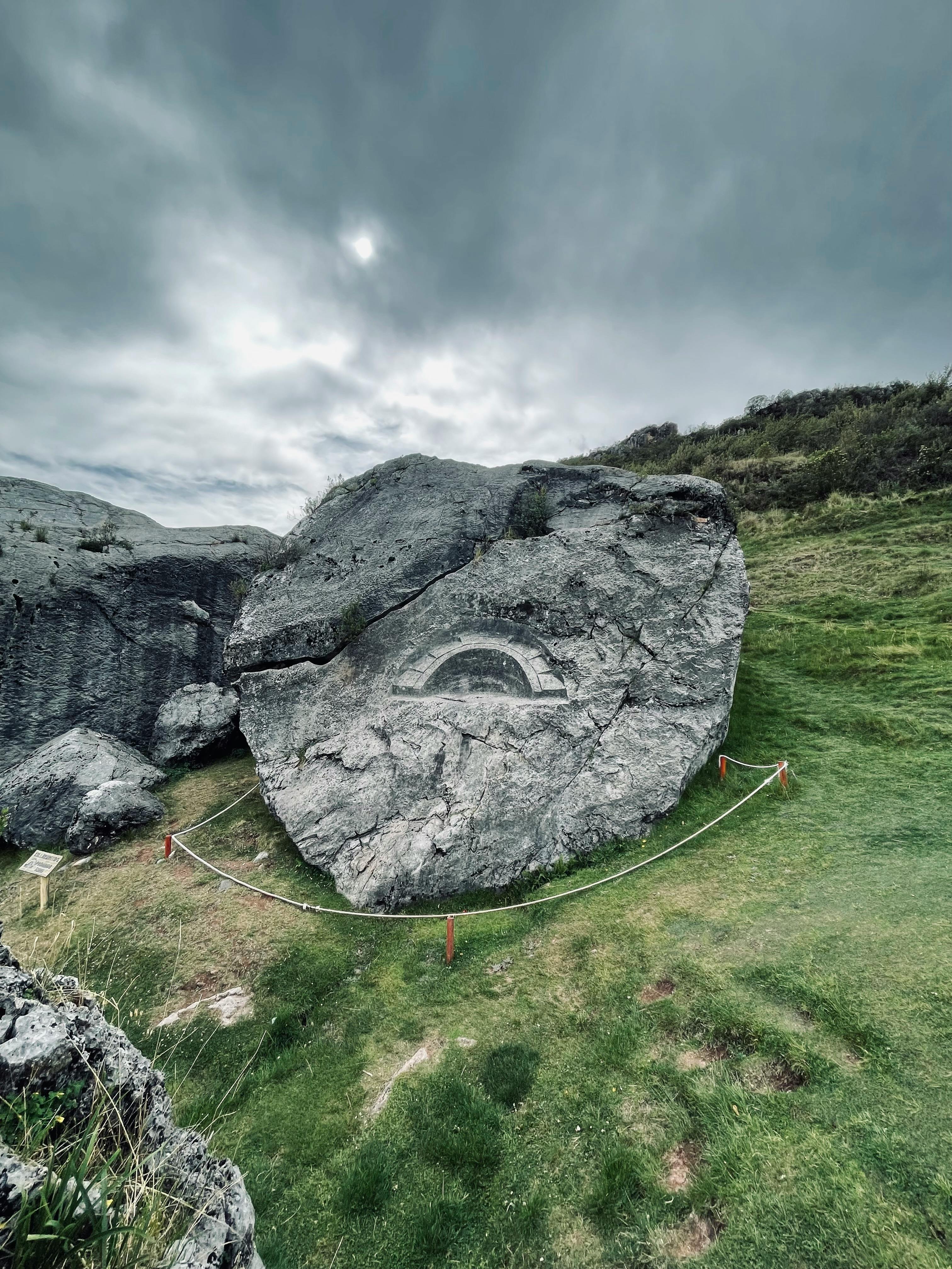
Killarumiyoq
Ancahuasi, Cusco, Peru
Killarumiyoq is a archaeological of sacred significance. Approximate coordinates: -13.44562, -72.31092. Attributes: built, cultural, archaeological, ceremonial. Associated figure: Moon Goddess. Located in Ancahuasi, Cusco, Peru.
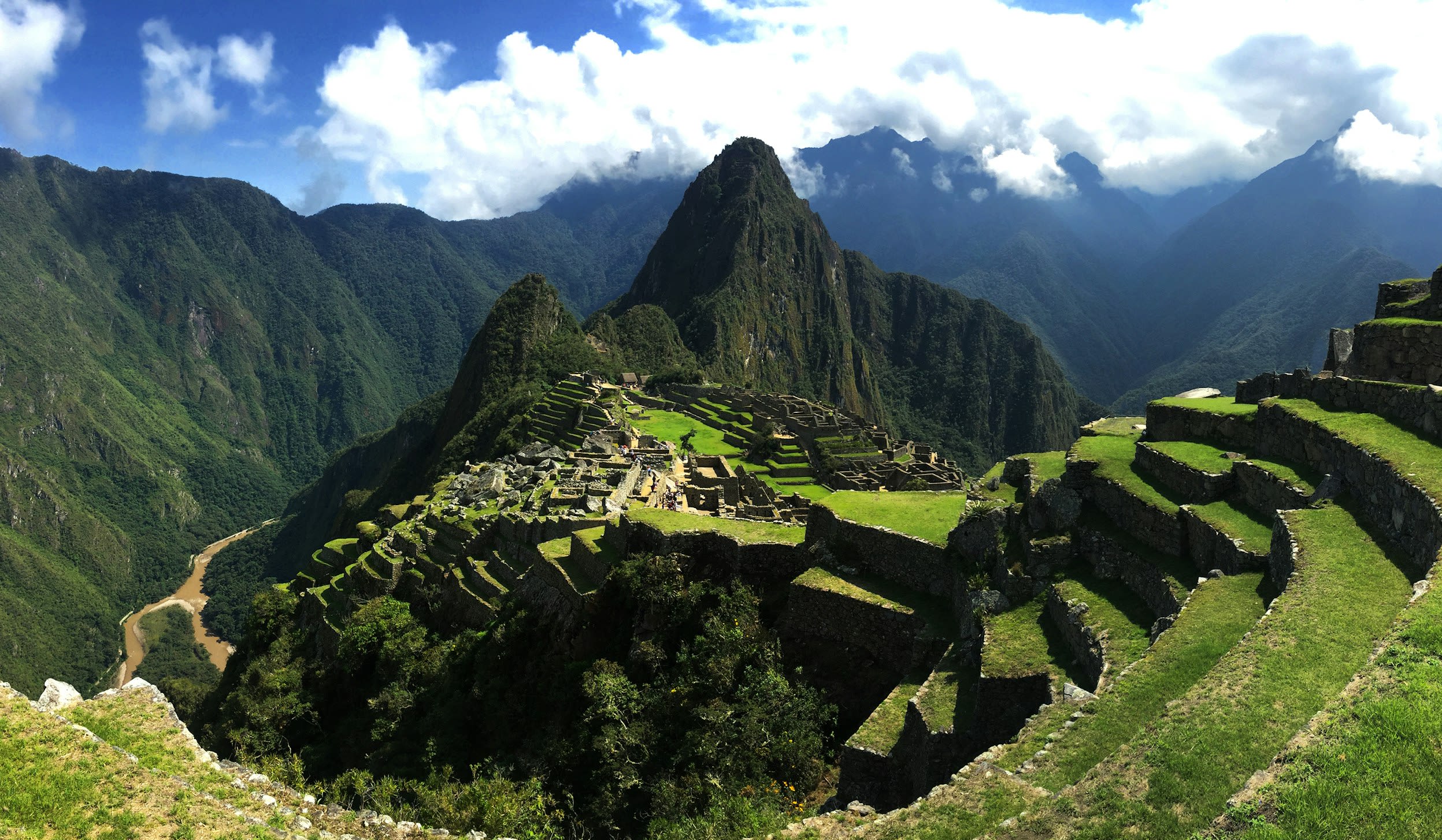
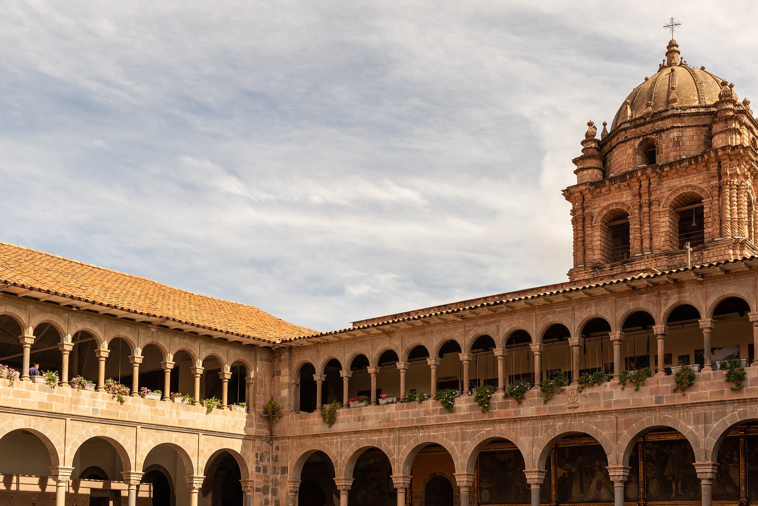
Machu Picchu
Machupicchu, Cusco, Peru
Machu Picchu is a inca citadel of sacred significance. Approximate coordinates: -13.16390, -72.54616. Attributes: built, cultural, archaeological. Tradition: Inca. Associated figure: Inca Emperor Pachacuti. Recognized as a UNESCO World Heritage Site. Machu Picchu is a 15th-century Inca citadel located in the Eastern Cordillera of southern Peru on a mountain ridge at 2,430 meters (7,970 ft). Often referred to as the Lost City of the Incas , it is the most familiar icon of the Inca Empire. It is located in the Machupicchu District within the Urubamba Province above the Sacred Valley, which is 80 kilometers (50 mi) northwest of the city of Cusco. The Urubamba River flows past it, cutting through the Cordillera and creating a canyon with a subtropical mountain climate. The Inca civilization had no written language and following the first encounter by the Spanish soldier Baltasar Ocampo, no Europeans are recorded to have visited the site from the late 16th century until the 19th century. As far as historical knowledge extends, there are no existing written records detailing the site during its period of active use. The leading theory is that Machu Picchu was a private city for Incan royalty. The names of the buildings, their supposed uses, and their inhabitants, are the product of modern archaeologists based on physical evidence, including tombs at the site. Machu Picchu was built in the classical Inca style, with polished dry-stone walls. Its three primary structures are the Temple of the Sun, the Temple of the Three Windows, and the Intihuatana. From 1929 to 1971, Machu Picchu underwent extensive restoration and conservation work, including structural stabilization and artifact excavation, driven by government initiatives and research expeditions. Most recent archaeologists believe that Machu Picchu was constructed as an estate for the Inca emperor Pachacuti (1438–1472). The Inca built the estate around 1450 but abandoned it a century later, at the time of the Spanish conquest. According to the new AMS radiocarbon dating, it was occupied from c. 1420–1532. Historical research published in 2022 claims that the site was probably called Huayna Picchu by the Inca people themselves, as it exists on the smaller peak of the same name. Machu Picchu was declared a Peruvian Historic Sanctuary in 1982 and a UNESCO World Heritage Site in 1983. In 2007, Machu Picchu was voted one of the New Seven Wonders of the World in a worldwide internet poll. Located in Machupicchu, Cusco, Peru.
Machuqolqa
Chinchero, Cusco, Peru
Machuqolqa in Chinchero, Cusco, Peru.
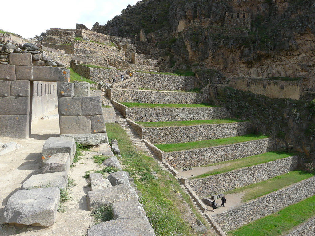
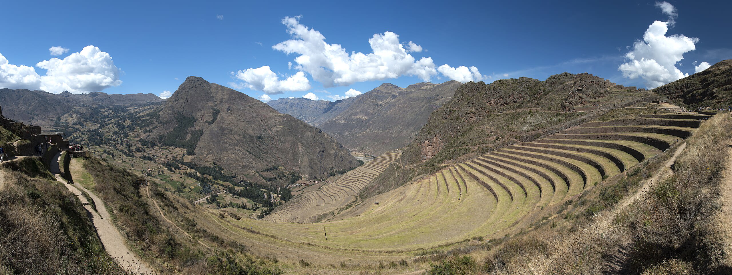
Ollantaytambo Archeological Site
Compone, Cusco, Peru
Ollantaytambo is a site of sacred significance. Approximate coordinates: -13.25668, -72.26590. Ollantaytambo (Quechua: Ullantaytampu) is a town and an Inca archaeological site in southern Peru some 72 km (45 mi) by road northwest of the city of Cusco. It is located at an altitude of 2,792 m (9,160 ft) above sea level in the district of Ollantaytambo, province of Urubamba, Cusco region. During the Inca Empire, Ollantaytambo in the Sacred Valley of the Incas was the royal estate of Emperor Pachacuti, after the mid-15th century.: 73 He built a town and a ceremonial center there. At the time of the Spanish conquest of Peru, it served as a stronghold for Manco Inca Yupanqui, leader of the Inca resistance. It is now an important tourist attraction on account of its Inca ruins and its location en route to a starting point for the four-day, three-night hike of the Inca Trail. Located in Ollantaytambo, Cusco, Peru.
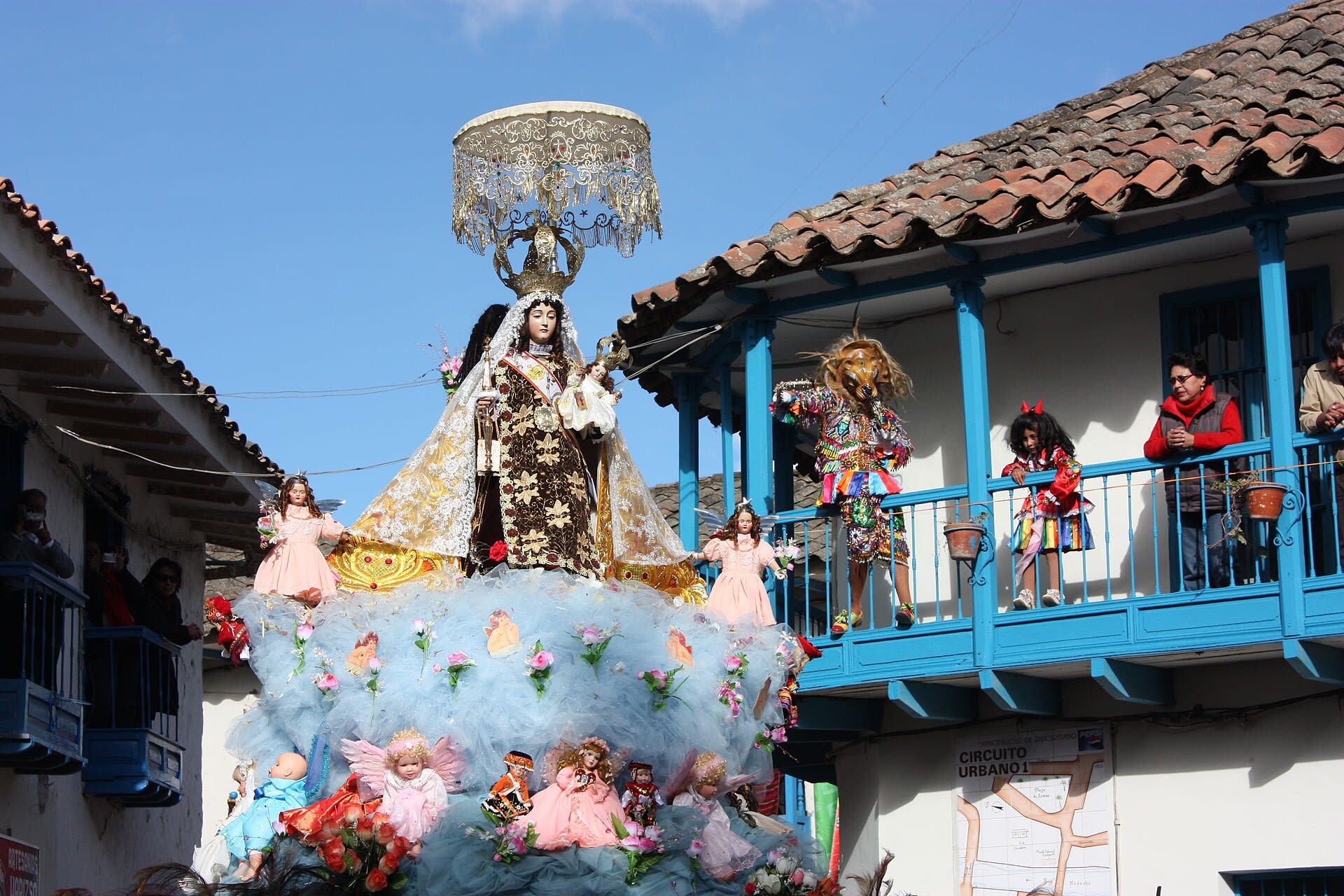
Paucartambo—Fiesta de la Virgen del Carmen
Paucartambo, Cusco, Peru
Paucartambo—Fiesta de la Virgen del Carmen in Paucartambo, Cusco, Peru.
Pisac Incan Archaeological Complex
Pisac, Cusco, Peru
Pisac is a site of sacred significance. Approximate coordinates: -13.40778, -71.84434. Located in Pisac, Cusco, Peru.
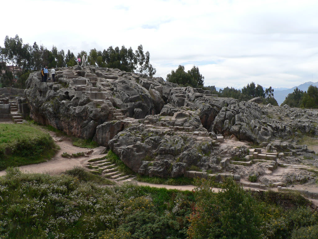
Q'enco Archeological Complex
Cuzco, Cusco, Peru
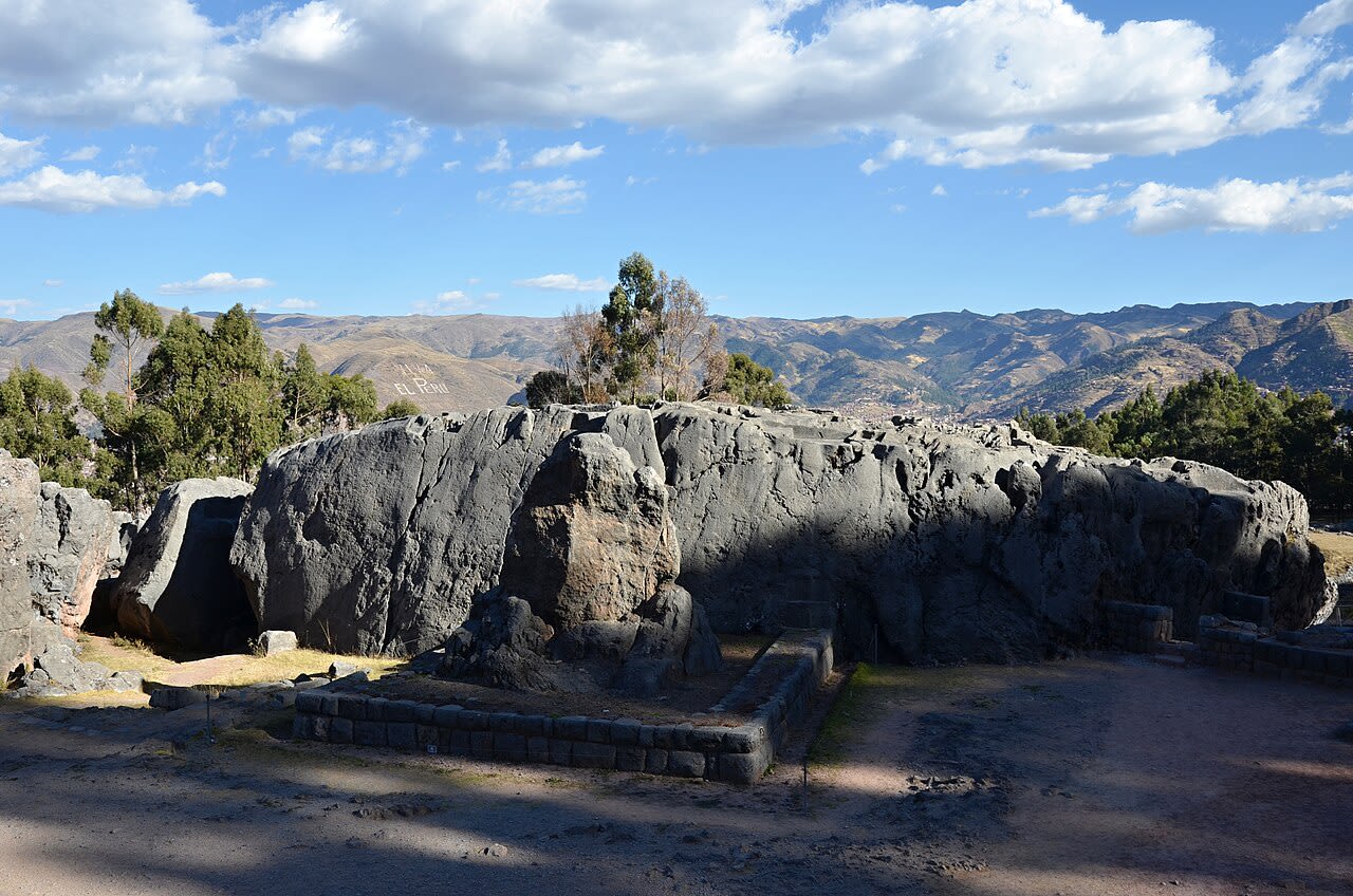
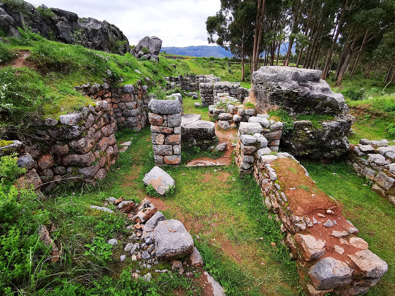
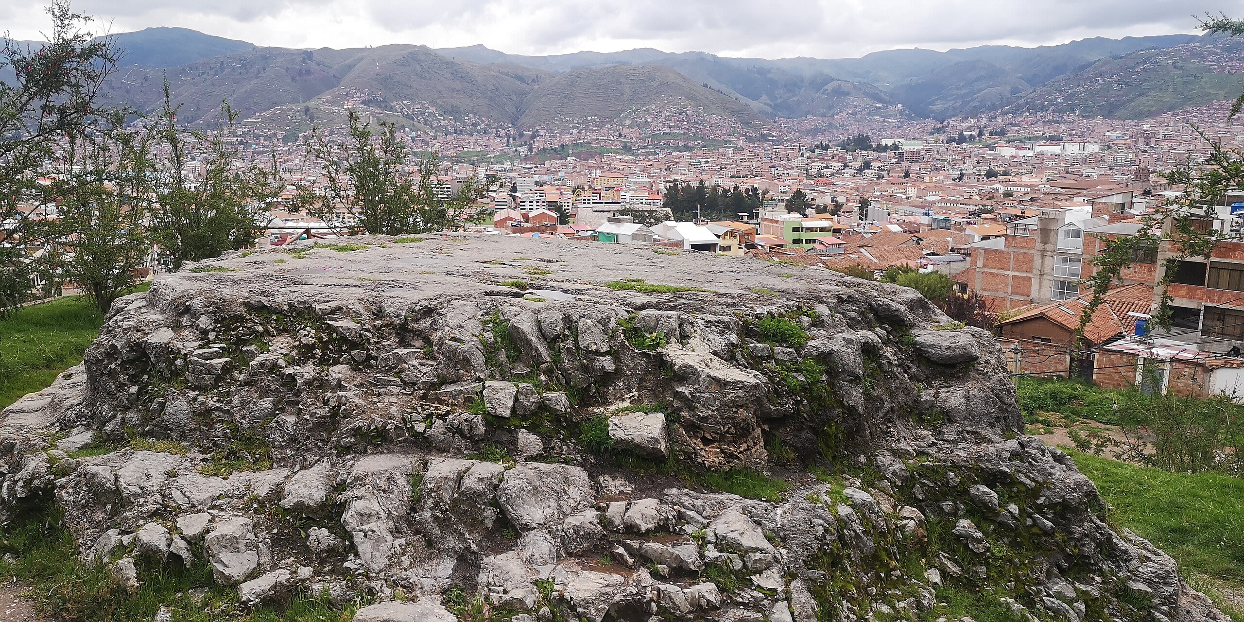
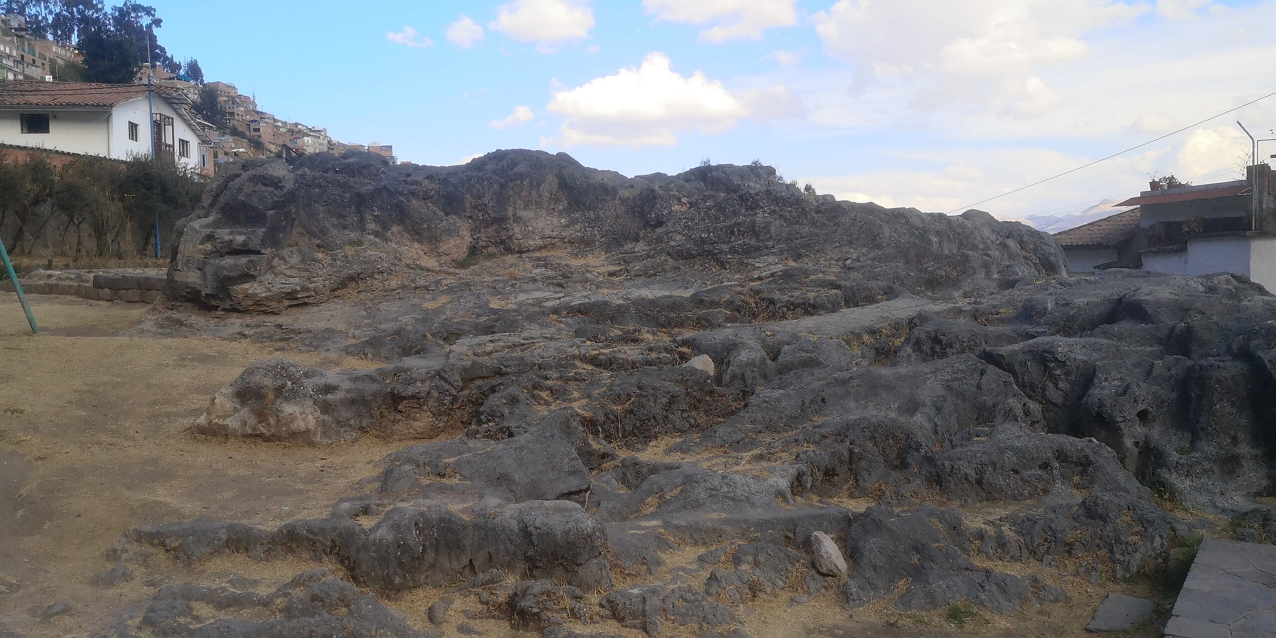
Qenko is a site of sacred significance. Approximate coordinates: -13.50883, -71.97047. Q enqo, Qenko, Kenko, or Quenco (all from Quechua for zig-zag ) is an archaeological site in the Sacred Valley of Peru located in the Cusco Region, Cusco Province, Cusco District, about 6 km north east of Cusco. The site was declared a Cultural Heritage (Patrimonio Cultural) of the Cusco Region by the National Institute of Culture. It is one of the largest huacas (holy places) in the Cusco Region. Many huacas were based on naturally occurring rock formations. It was believed to be a place where sacrifices and mummification took place. A tunnel runs inside the huaca with a large gutter on one side, leading to a room containing a ceremonial table with niches on either side. The discovery of many bones within the gutter leads experts to believe this room was the site of ritual sacrifices. One of the niches was used to place mummies while another contained a large silver plate which reflected the sun s rays into the room. Located in Distrito de Cusco, Cusco, Peru.
Sanctuary of Our Lord of Huanca
Qosqo Ayllu, Cusco, Peru
Santuario Senor de Huanca is a site of sacred significance. Approximate coordinates: -13.48705, -71.80277. Located in San Salvador, Cusco, Peru.
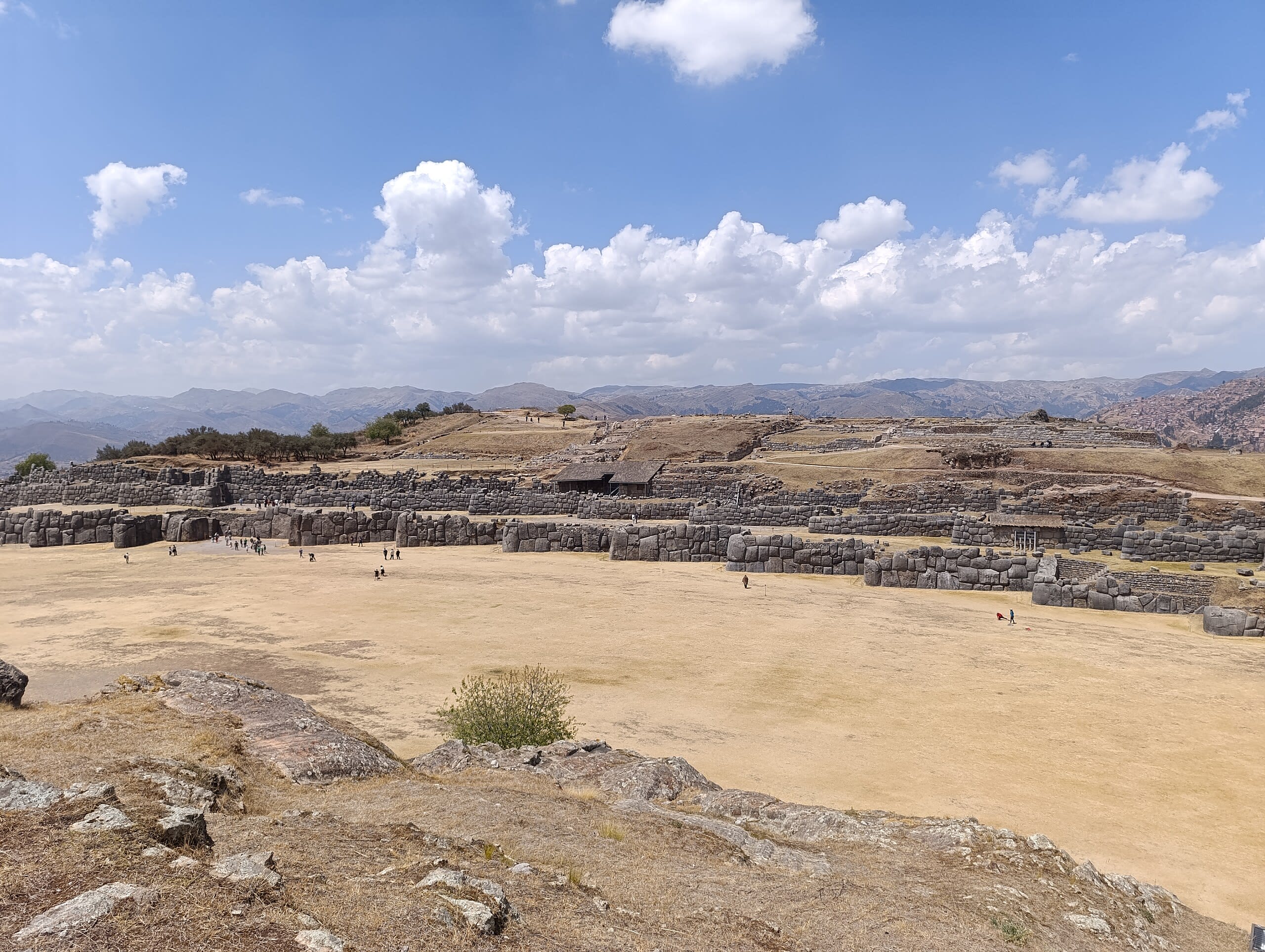
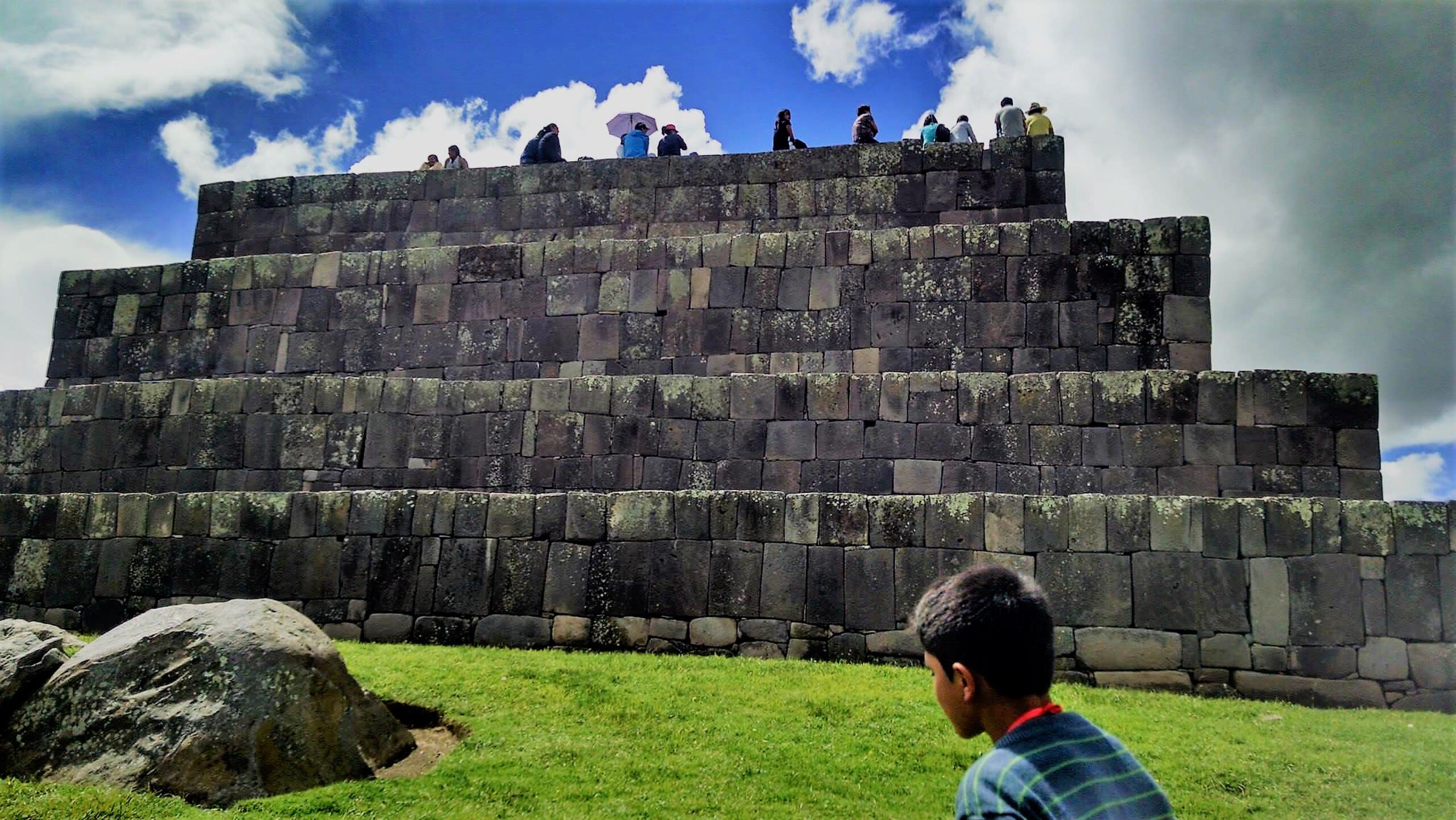
Saqsaywaman
Cuzco, Cusco, Peru
Saqsaywaman is a site of sacred significance. Approximate coordinates: -13.50986, -71.98169. Located in Distrito de Cusco, Cusco, Peru.
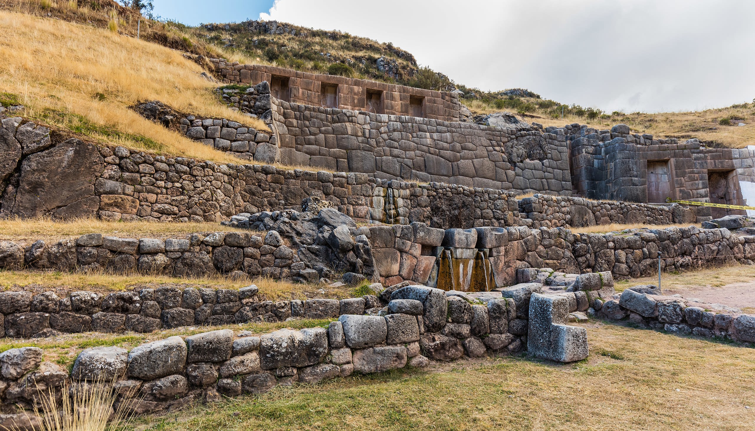
Tambomachay Archaeological Complex
Cuzco, Cusco, Peru
Tambomachay is a site of sacred significance. Approximate coordinates: -13.47999, -71.96639. Tambomachay (possibly from Quechua tampu inn, guest house, mach ay cave, or machay drunkenness, to get drunk or spindle with thread ) is an archaeological site associated with the Inca Empire, located near Cusco, Peru. An alternate Spanish name is El Baño del Inca ( the bath of the Inca ). It consists of a series of aqueducts, canals and waterfalls that run through the terraced rocks. It is situated near springs such as the one called Timpuc Puquiu, a boiling spring on the northern bank of the Timpuc River and the spring near Huaylla Cocha community. These natural springs were channeled through three waterfalls that still flow today. The function of the site is uncertain: it may have served as a military outpost guarding the approaches to Cusco, as a spa resort for the Incan political elite or imperial baths. It could have also served a religious function since sacred water fountains were found almost all of major Incan temple such as Pisac, Ollantaytambo, and Machu Picchu. There are sources that refer to Tambomachay as one of the nine ceques built along the Road of Antisuyu, describing it as an Incan house where sacrifices were also made. Located in Distrito de Cusco, Cusco, Peru.

Templo de la Luna
Cusco, Cusco, Peru
Templo de la Luna in Cusco, Cusco, Peru.
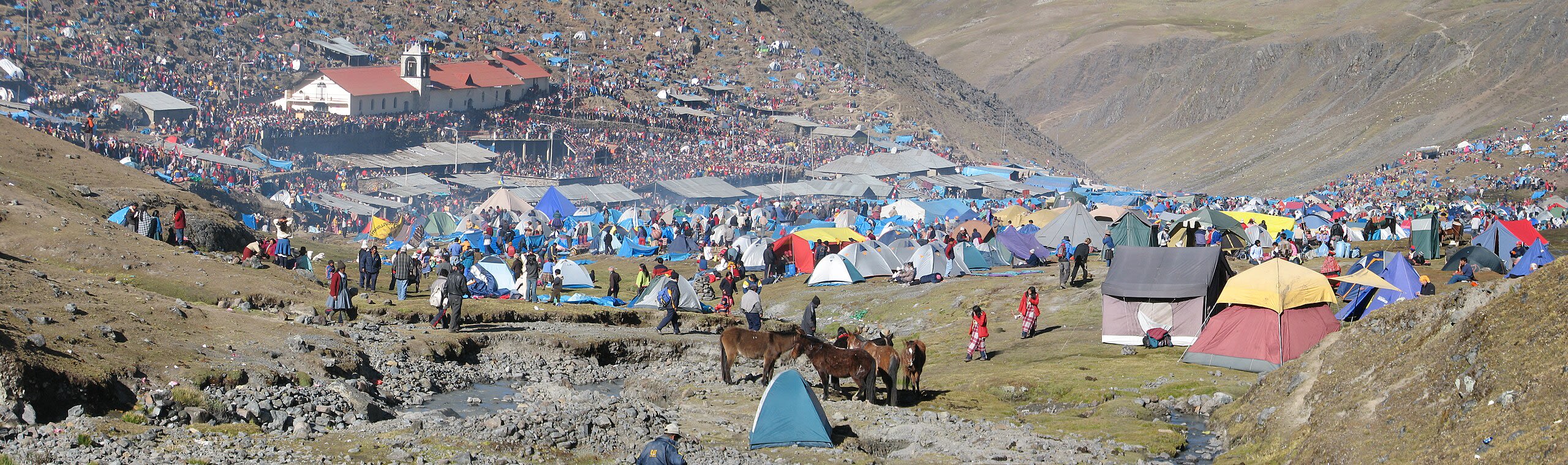
Valle de Sinakara—Quyllurit'i
Ocongate, Cusco, Peru
Valle de Sinakara—Quyllurit'i in Ocongate, Cusco, Peru.
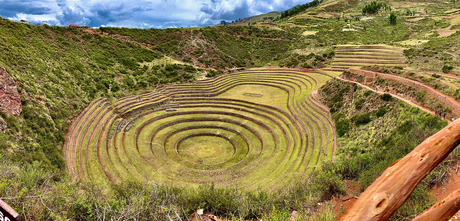
Zona Arqueologica Moray
Maras, Cusco, Peru
Zona Arqueologica Moray in Maras, Cusco, Peru.
Cusco Region
1 sites
Huancavelica
1 sites
Ica
17 sites
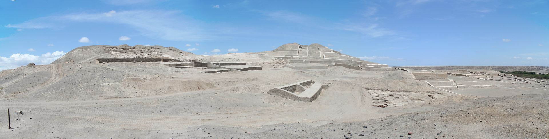
Cahuachi Nazca site
Nazca, Ica, Peru
Cahuachi Nazca site is a archaeological site of sacred significance. Approximate coordinates: -14.81886, -75.11811. Attributes: built, cultural, archaeological, ceremonial. Located in Nasca, Ica, Peru.
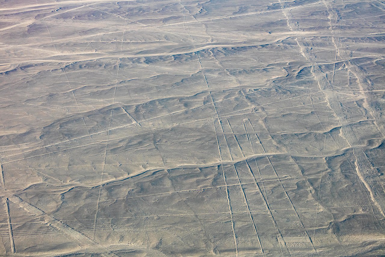
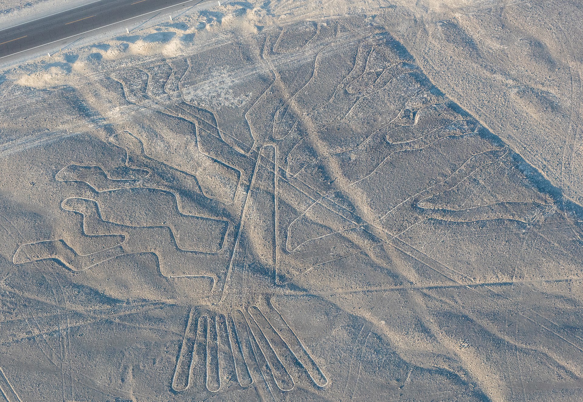
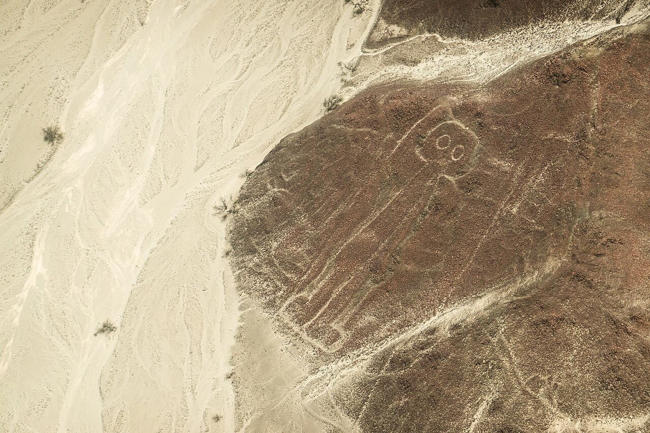
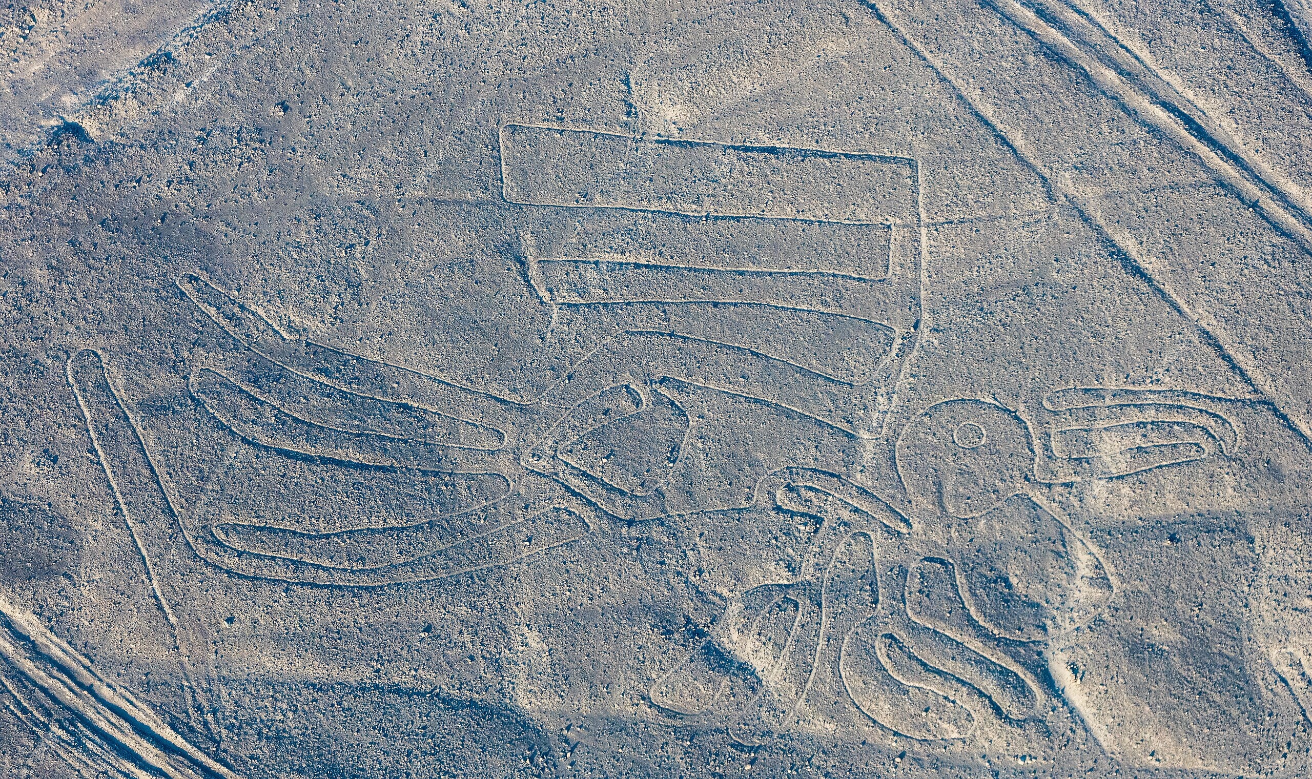
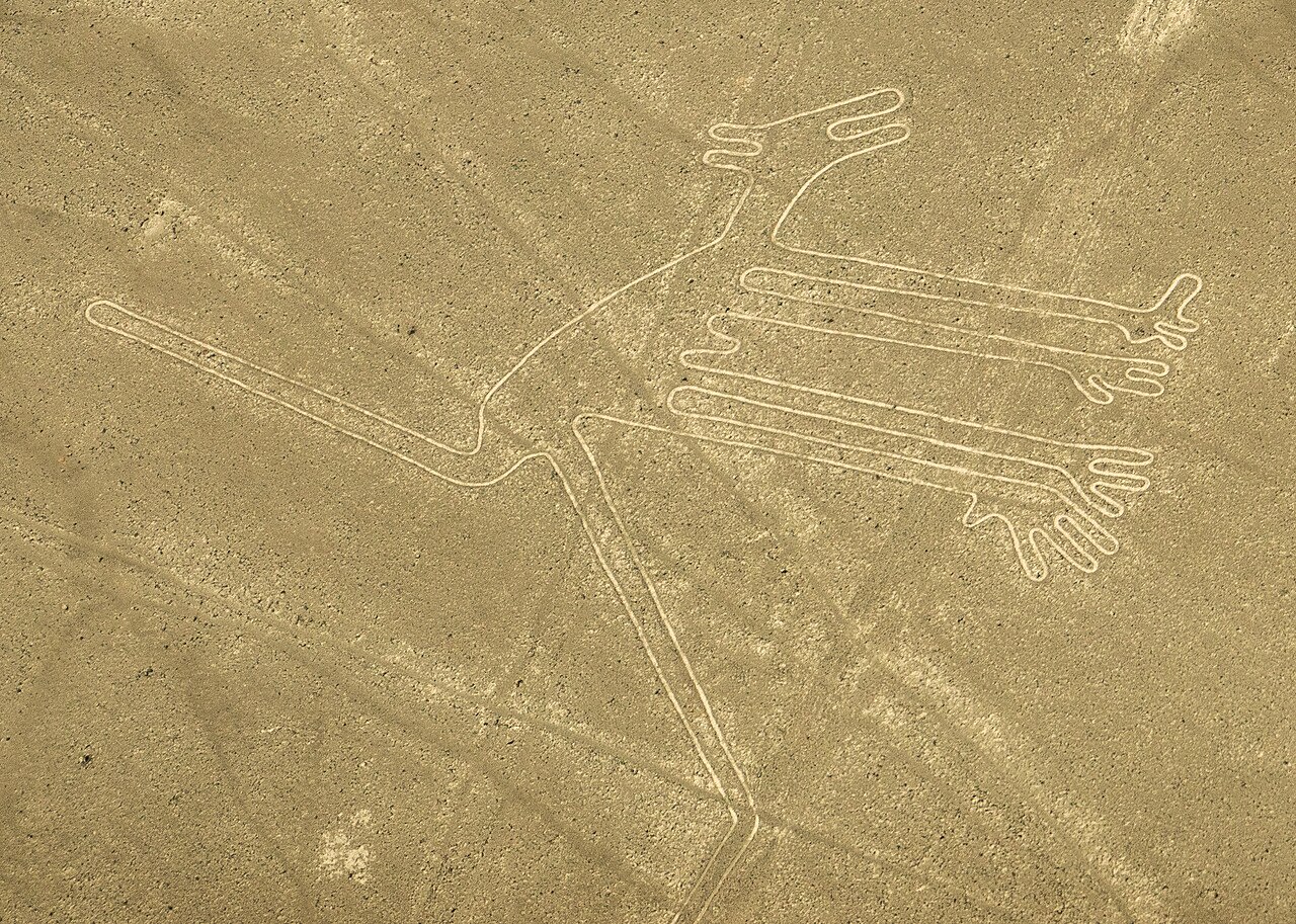
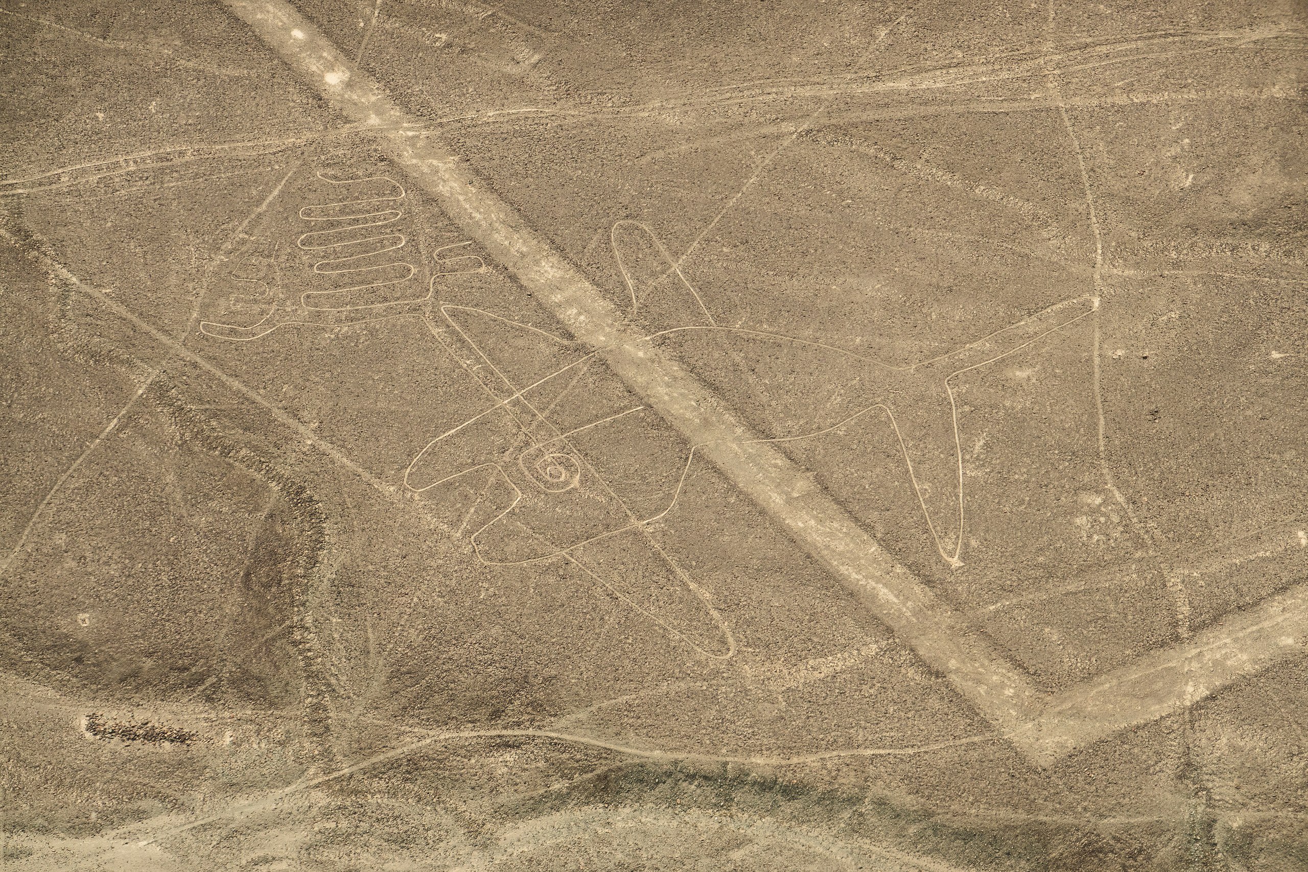
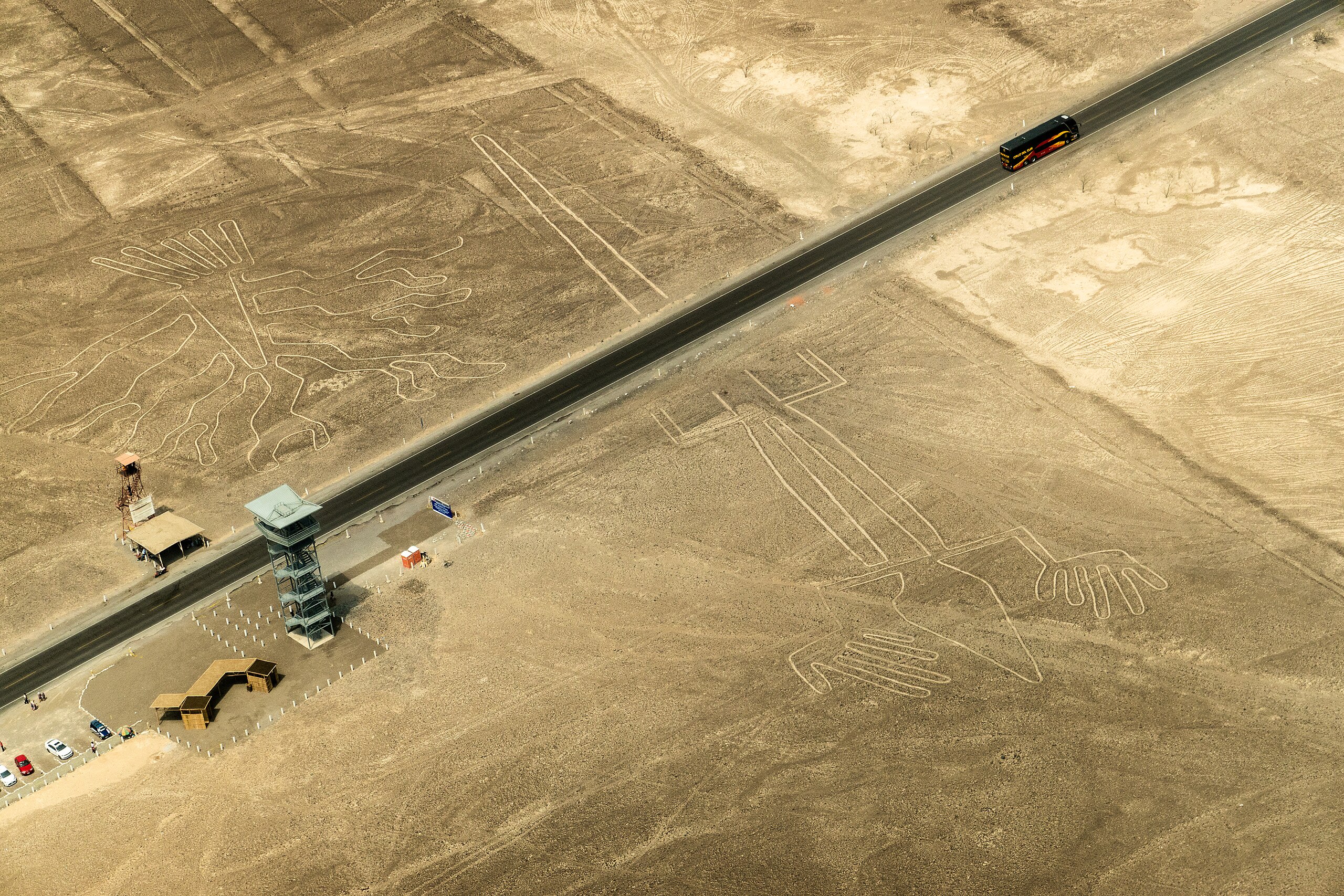
Líneas de Nazca
Nazca, Ica, Peru
Líneas de Nazca in Nazca, Ica, Peru.
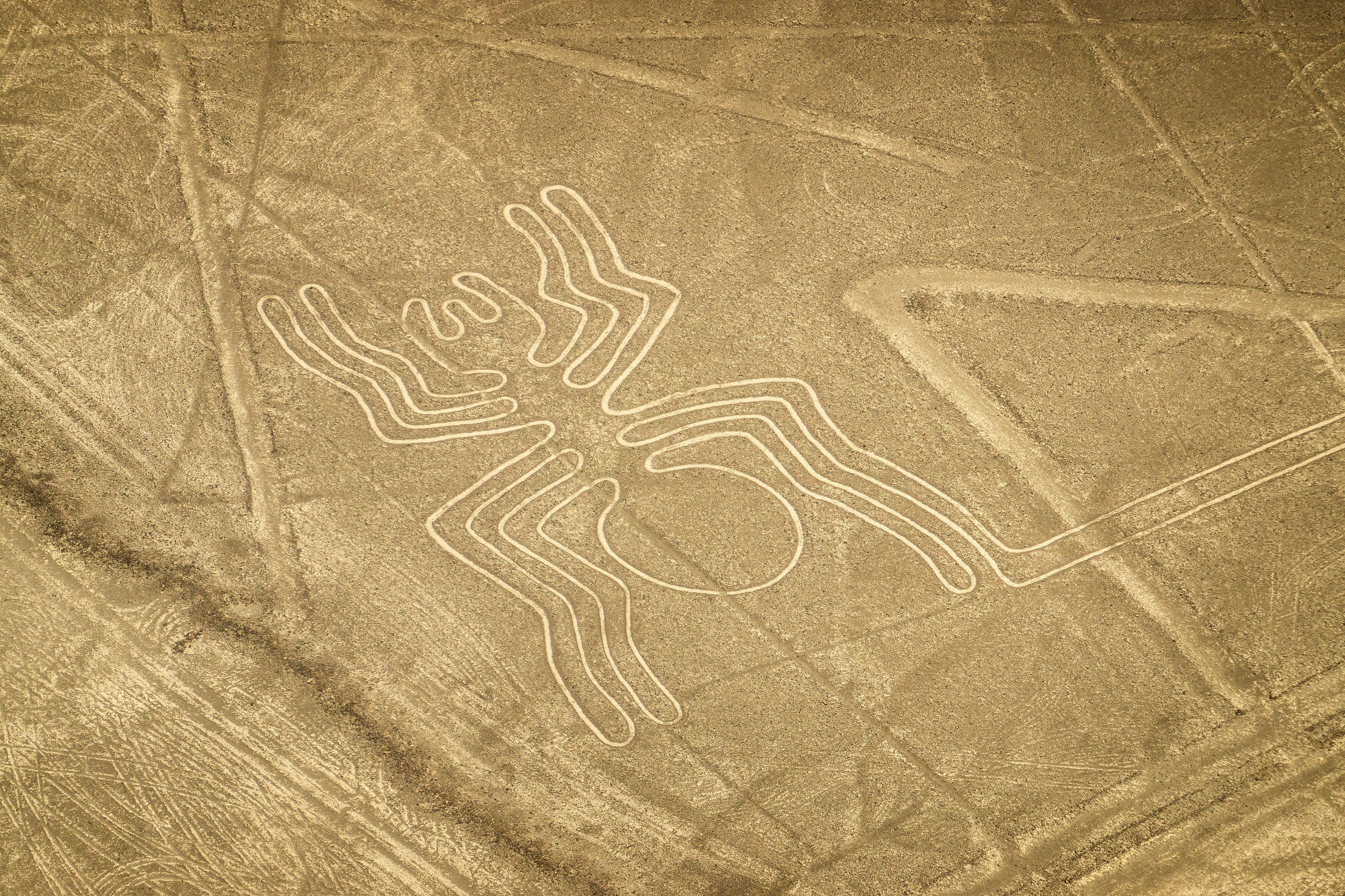
Nasca - El Araña
Nazca, Ica, Peru
Nasca - El Araña in Nazca, Ica, Peru.
Nasca - El Árbol
Nazca, Ica, Peru
Nasca - El Árbol in Nazca, Ica, Peru.
Nasca - El Astronauta
Nazca, Ica, Peru
Nasca - El Astronauta in Nazca, Ica, Peru.
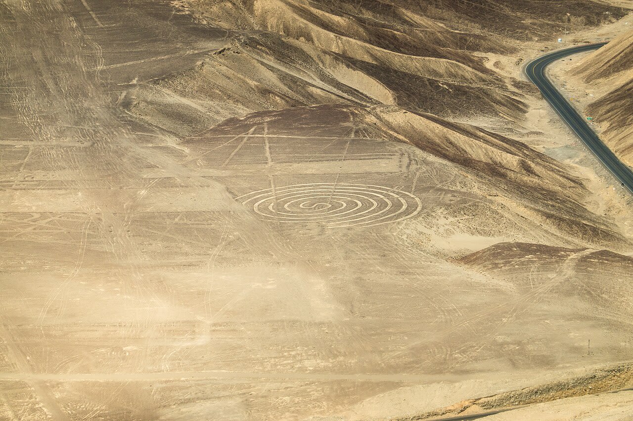
Nasca - El Caracol
Nazca, Ica, Peru
Nasca - El Caracol in Nazca, Ica, Peru.
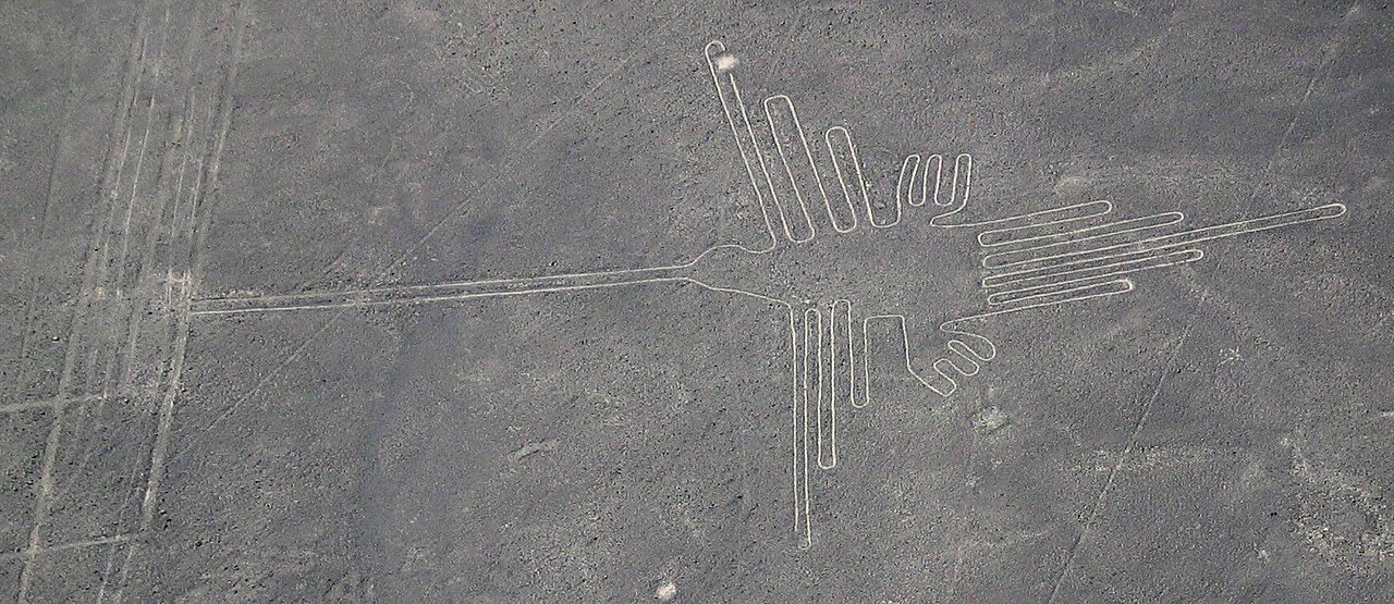
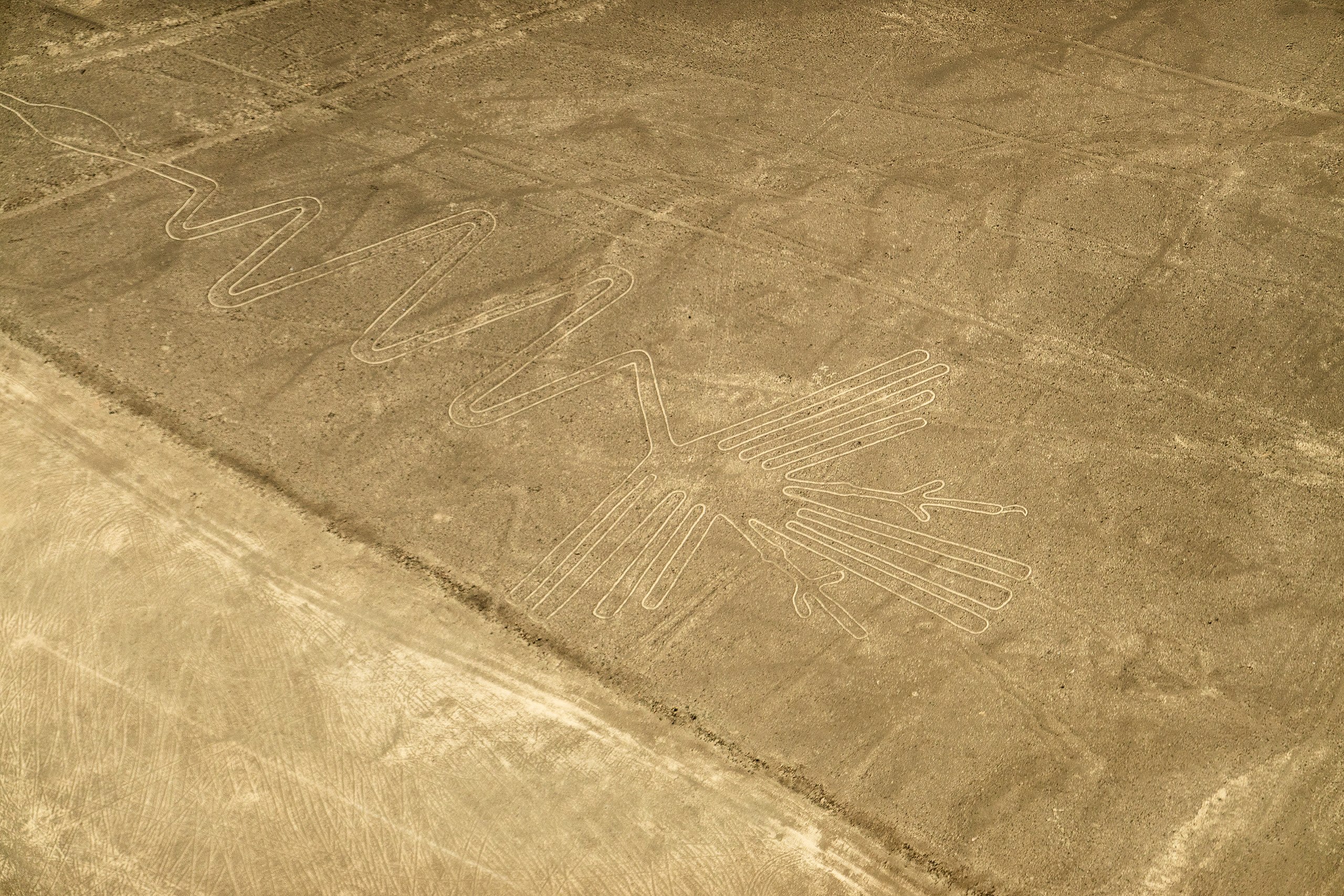
Nasca - El Colibrí
Nazca, Ica, Peru
Nasca - El Colibrí in Nazca, Ica, Peru.
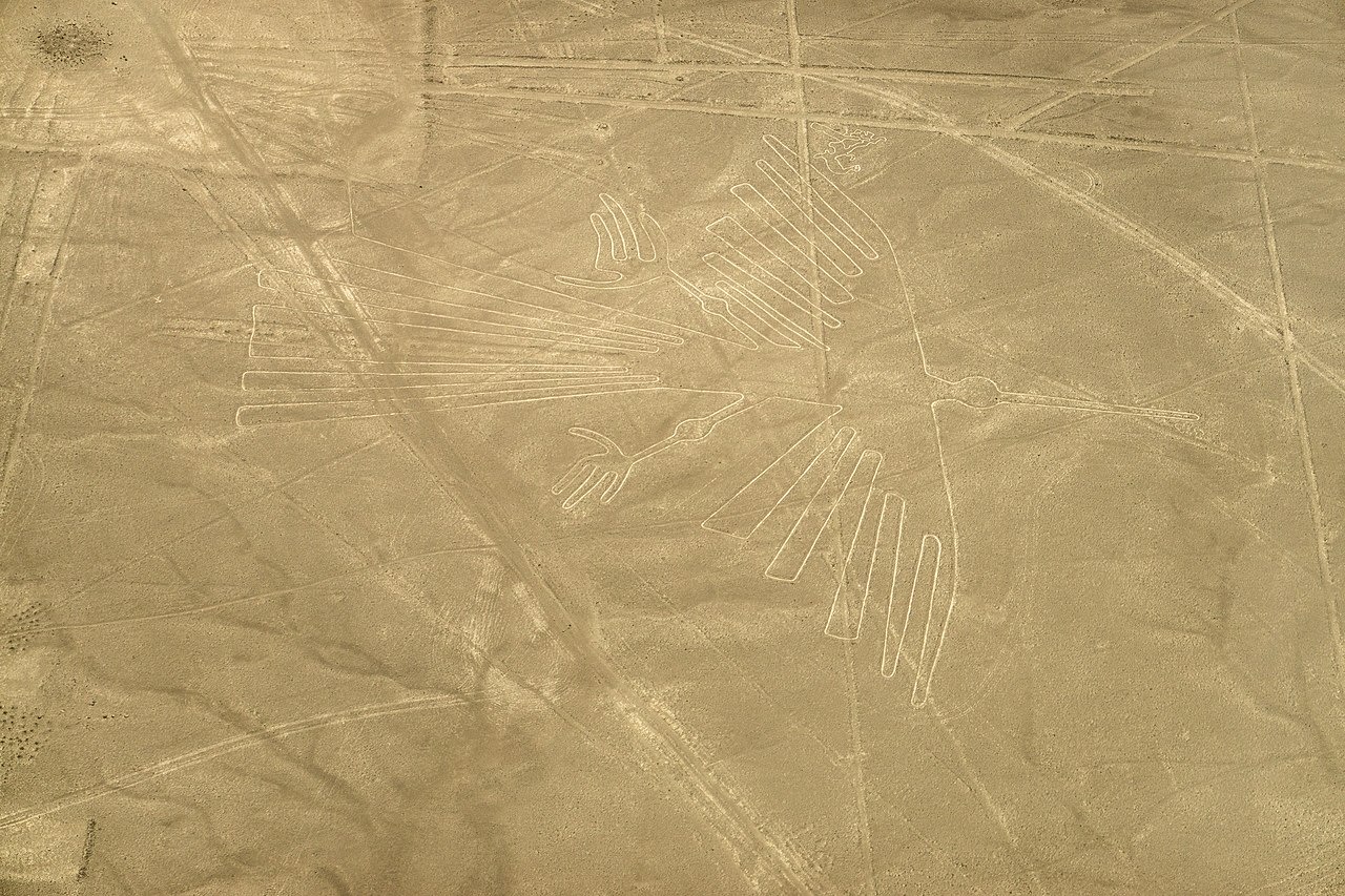
Nasca - El Cóndor
Nazca, Ica, Peru
Nasca - El Cóndor in Nazca, Ica, Peru.
Nasca - El Garza
Nazca, Ica, Peru
Nasca - El Garza in Nazca, Ica, Peru.

Nasca - El Loro
Nazca, Ica, Peru
Nasca - El Loro in Nazca, Ica, Peru.
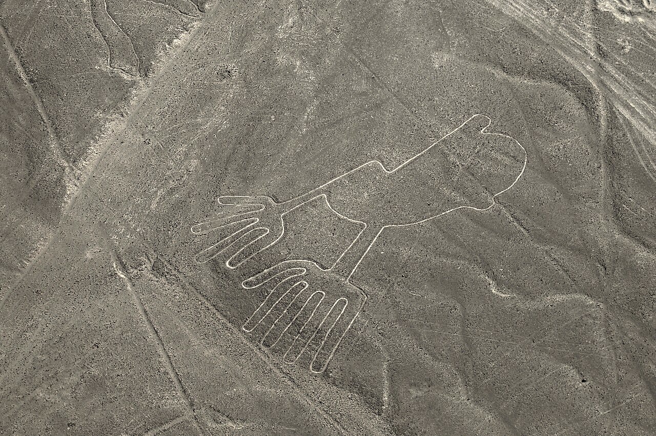
Nasca - El Manos
Nazca, Ica, Peru
Nasca - El Manos in Nazca, Ica, Peru.
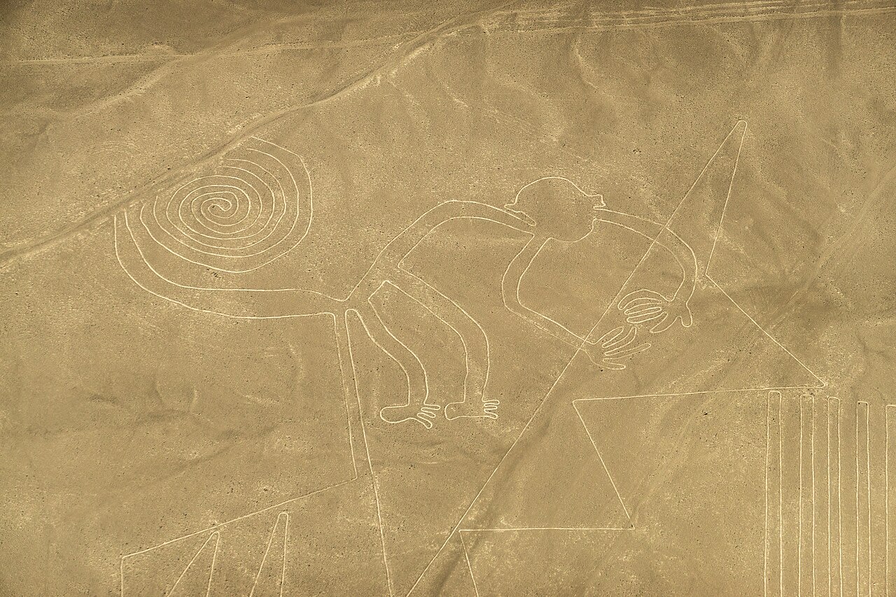
Nasca - El Mono
Nazca, Ica, Peru
Nasca - El Mono in Nazca, Ica, Peru.
Nasca - El Pelícano
Nazca, Ica, Peru
Nasca - El Pelícano in Nazca, Ica, Peru.
Nasca - El Perro
Nazca, Ica, Peru
Nasca - El Perro in Nazca, Ica, Peru.
Nasca - La Ballena
Nazca, Ica, Peru
Nasca - La Ballena in Nazca, Ica, Peru.
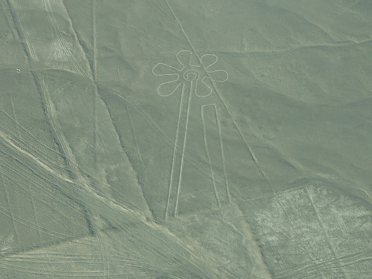
Nasca - La Flor
Nazca, Ica, Peru
Nasca - La Flor in Nazca, Ica, Peru.
Nasca - La Lagartija
Nazca, Ica, Peru
Nasca - La Lagartija in Nazca, Ica, Peru.
La Libertad
1 sites
Lima
2 sites
Archaeological Sanctuary of Pachacamac
Lurín, Lima, Peru
Pachacamac is a site of sacred significance. Approximate coordinates: -12.25983, -76.89948. Pachacámac (Quechua: Pachakamaq) is an archaeological site 40 kilometres (25 mi) southeast of Lima, Peru in the Valley of the Lurín River. The site was first settled around A.D. 200 and was named after the Earth Maker creator god Pacha Kamaq. The site flourished for about 1,300 years until the Spanish invaded. Pachacamac covers about 600 hectares (1480 acres) of land. Located in Lima, Peru.
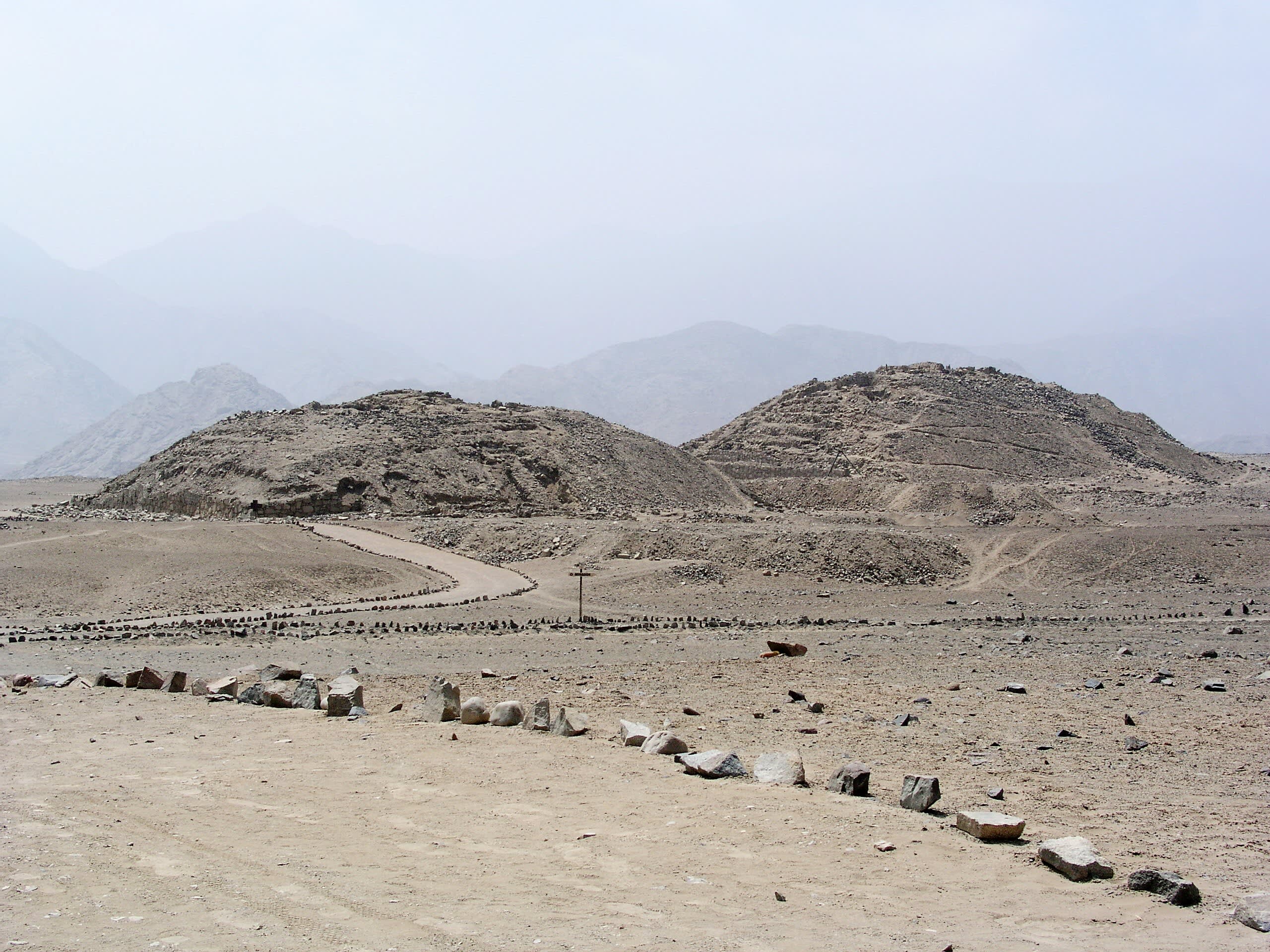
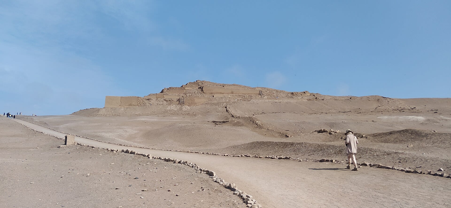
Sacred City of Caral-Supe
Supe, Lima, Peru
Caral is a ancient city of sacred significance. Approximate coordinates: -10.89275, -77.52111. Attributes: built, cultural, archaeological, ceremonial. Tradition: Pre-Hispanic. Recognized as a UNESCO World Heritage Site. The Sacred City of Caral-Supe, or simply Caral, is an archaeological site in Peru where the remains of the main city of the Caral civilization are found. It is located in the Supe valley of Peru, near the current town of Caral, 182 kilometers north of Lima, 23 km from the coast and 350 metres above sea level. It is attributed an antiquity of 5,000 years and it is considered the oldest city in the Americas and one of the oldest in the world. No other site has been found with such a diversity of monumental buildings or different ceremonial and administrative functions in the Americas as early as Caral. It has been declared a Humanity Cultural Heritage site by UNESCO. The Caral culture developed between 3000 and 1800 B.C (Late Archaic and Lower Formative periods). In America, it is the oldest of the pre-Hispanic civilizations, developing 1,500 years earlier than the Olmec civilization, the first Mesoamerican complex society. Closely related to the city of Caral was an early fishing city, Áspero or El Áspero, located on the coast near the mouth of the Supe River. There, remains of human sacrifices (two children and a newborn) have been found. In 2016, the remains were found of a woman, who presumably belonged to the local elite of 4,500 years ago. Located in Supe, Lima, Peru.
Piura
1 sites
Puno
7 sites
Amantani, Pachatata & Pachamama
Santa Rosa, Puno, Peru
Amantani, Pachatata & Pachamama is a island of sacred significance. Approximate coordinates: -15.66512, -69.71199. Attributes: natural, cultural. Located in Amantaní, Puno, Peru.
Aramu Muru
Ilave, Puno, Peru
Aramu Muru is a abandoned stone carving of sacred significance. Approximate coordinates: -16.17051, -69.54123. Attributes: built, cultural, archaeological, pilgrimage. Tradition: Incan. Mythological context: Incan. Aramu Muru is an abandoned stone carving in Peru, near Lake Titicaca, known as “Gate of the Gods”. It was discovered in the early 1990s and is believed to be an abandoned Incan construction project. The flat stone is approximately 23 ft (7.0 m) square, with a T-shaped niche measuring 6 feet and 6 inches (198 cm) tall carved into it. Aramu Muru is a popular tourist destination for paranormal pilgrimage. Legend has it that an Incan priest in possession of a golden disk, placed the disk in a small depression in the door (the door being the niche carved into the rock), and this caused the door to open. The golden disk supposedly dropped from the sky. Located in Ilave, Puno, Peru.
Chullpa Lagarto
Sillustani, Puno, Peru
Chullpa Lagarto in Sillustani, Puno, Peru.
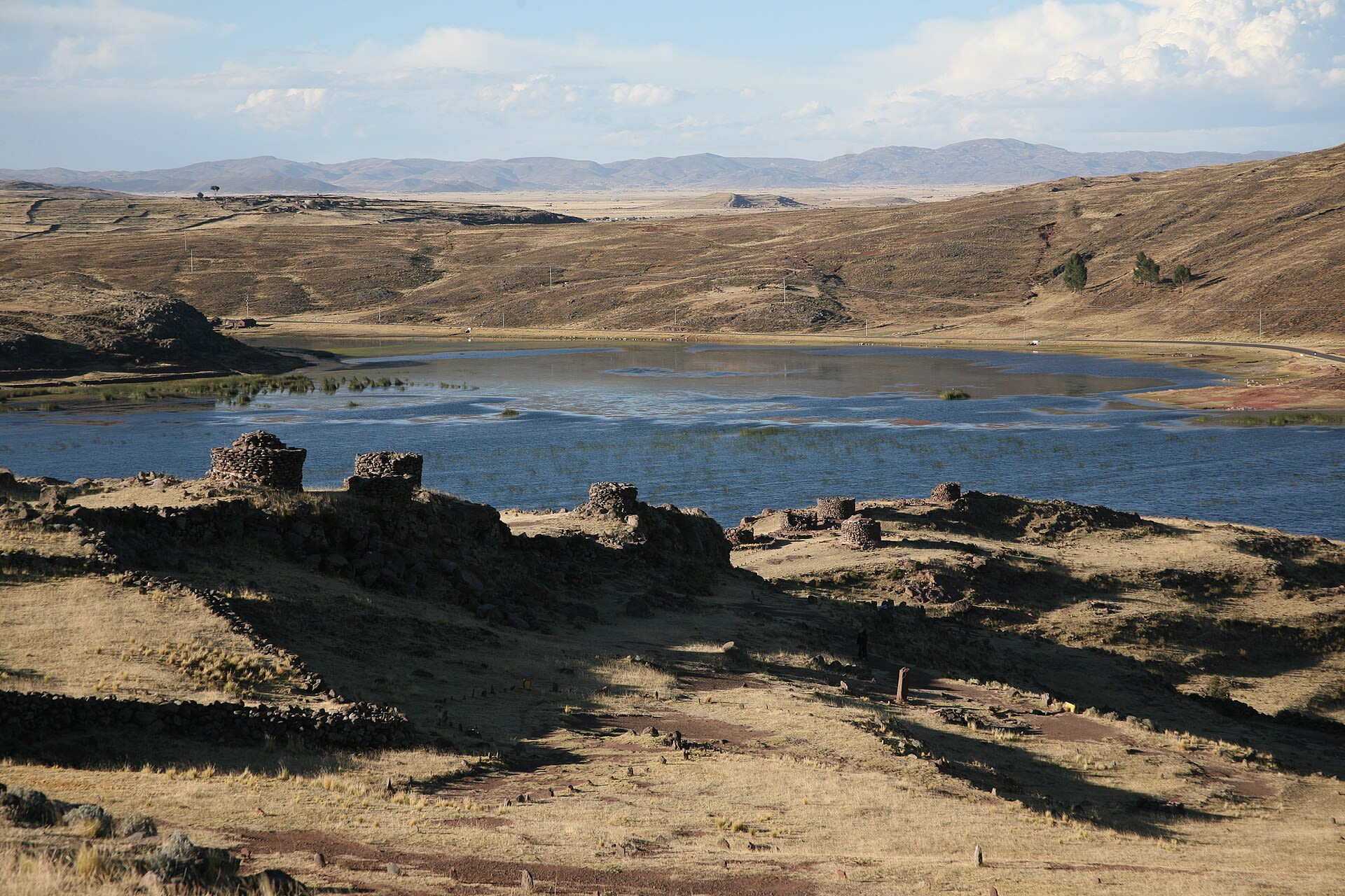
Chullpas Sillustani
Sillustani, Puno, Peru
Chullpas Sillustani in Sillustani, Puno, Peru.
Pukara, Templo Santa Isabel
Pukara, Puno, Peru
Pukara, Templo Santa Isabel is a site of sacred significance. Approximate coordinates: -15.04230, -70.36860. Located in Pucará, Puno, Peru.
Shrine of Our Lady of Candelaria
Puno, Puno, Peru
Puno, Santuario de La Virgen de La Candelaria is a site of sacred significance. Approximate coordinates: -15.83782, -70.02841. Located in Puno, Puno, Peru.
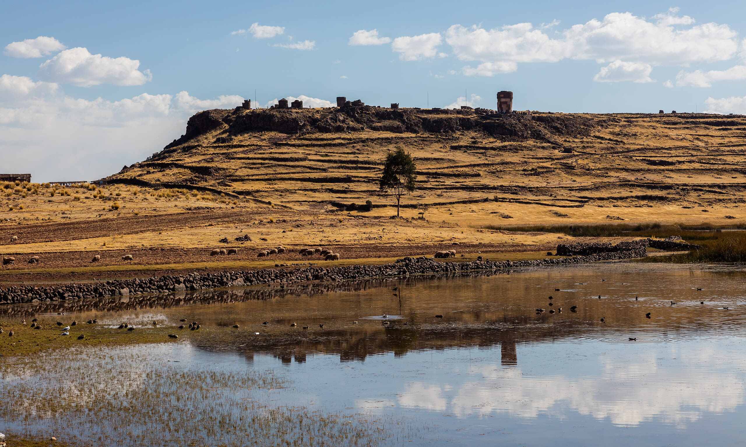
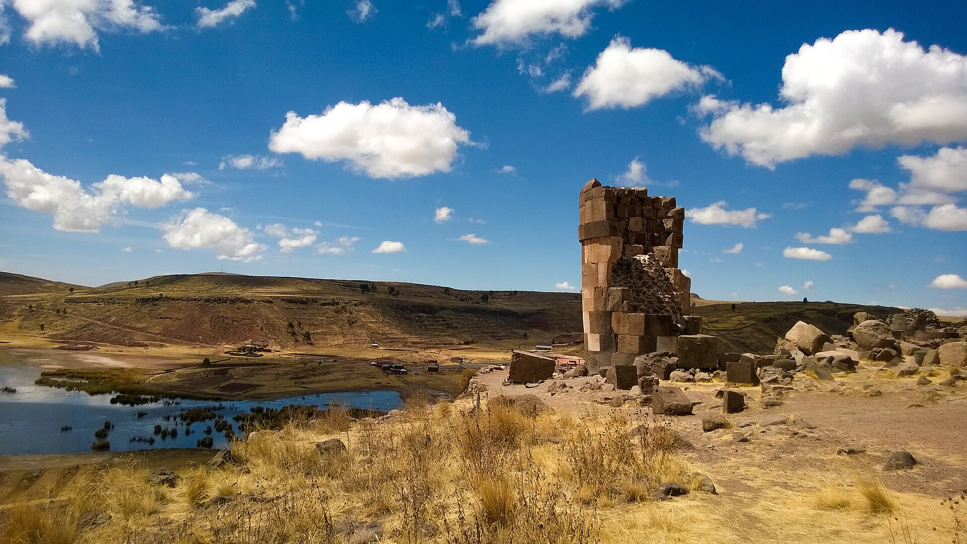
Sillustani
Atuncolla, Puno, Peru
Sillustani is a site of sacred significance. Approximate coordinates: -15.72141, -70.15898. Sillustani is a pre-Inca cemetery on the shores of Lake Umayo near Puno in Peru. The tombs, which are built above ground in tower-like structures called chullpas, are the vestiges of the Qulla people, most likely a Puquina-speaking people, conquered by the Inca Empire in the 15th century. The structures housed the remains of complete family groups, although they were probably limited to nobility. Many of the tombs have been dynamited by grave robbers, while others were left unfinished. Located in Atuncolla, Puno, Peru.