Country guide
Mexico
33 sacred sites across 15 regions.
Traditions present in Mexico
Prominent site types
Campeche
1 sites
Chiapas
3 sites
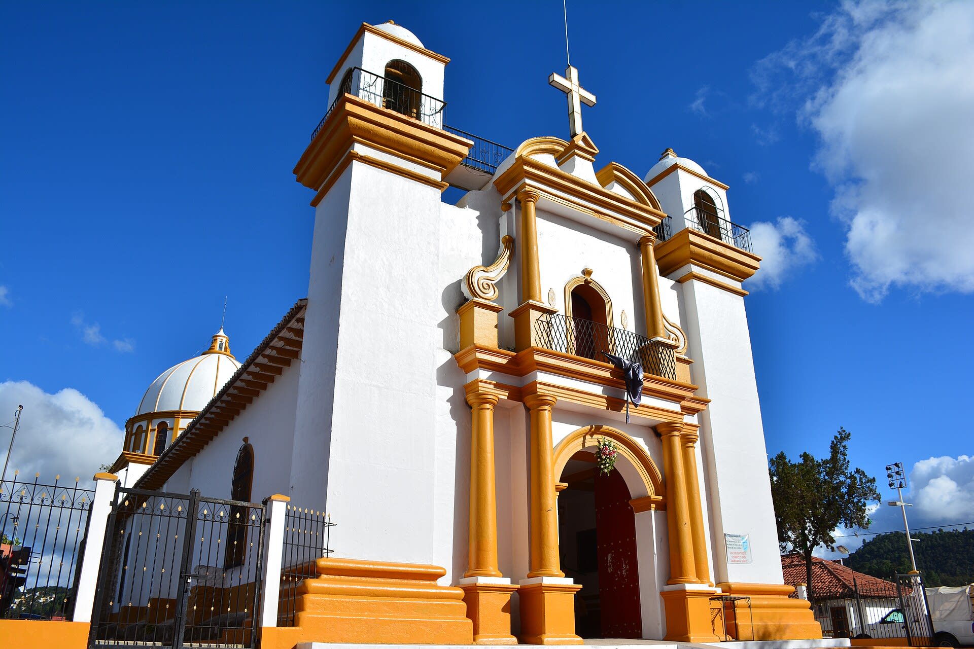
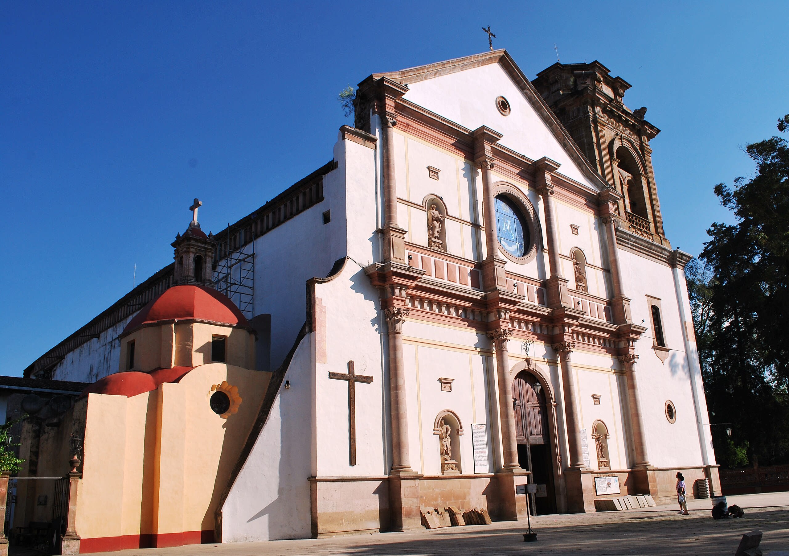
Church of Guadalupe, San Cristobal
San Cristóbal, Chiapas, Mexico
Church of Guadalupe, San Cristobal is a church of sacred significance. Approximate coordinates: 16.73776, -92.62578. Attributes: built, cultural, pilgrimage, ceremonial. Tradition: Christianity. Associated figure: Our Lady of Guadalupe. Located in San Cristóbal, Chiapas, Mexico.

Palenque
Palenque, Chiapas, Mexico
Palenque is a site of sacred significance. Approximate coordinates: 17.48429, -92.04672. Palenque (Spanish pronunciation: [pa leŋke]; Yucatec Maya: Bàakʼ [ɓaːkʼ]), also anciently known in the Itza Language as Lakamha ( big water or big waters ), was a Maya city-state in southern Mexico that perished in the 8th century. The Palenque ruins date from ca. 226 BC to ca. 799 AD. After its decline, it was overgrown by the jungle of cedar, mahogany, and sapodilla trees, but has since been excavated and restored. It is located near the Usumacinta River in the Mexican state of Chiapas, about 130 km (81 mi) south of Ciudad del Carmen, 150 meters (490 ft) above sea level. It is adjacent to the modern town of Palenque, Chiapas. It averages a humid 26 °C (79 °F) with roughly 2,160 millimeters (85 in) of rain a year. Palenque is a medium-sized site, smaller than Tikal, Chichen Itza, or Copán, but it contains some of the finest architecture, sculpture, roof comb and bas-relief carvings that the Mayas produced. Much of the history of Palenque has been reconstructed from reading the hieroglyphic inscriptions on the many monuments; historians now have a long sequence of the ruling dynasty of Palenque in the 5th century and extensive knowledge of the city-state s rivalry with other states such as Calakmul and Toniná. The most famous ruler of Palenque was Kʼinich Janaabʼ Pakal, or Pacal the Great, whose tomb has been found and excavated in the Temple of the Inscriptions. By 2005, the discovered area covered up to 2.5 km2 (0.97 sq mi), but it is estimated that less than 10% of the total area of the city is explored, leaving more than a thousand structures still covered by jungle. Palenque received 920,470 visitors in 2017. Located in Chiapas, Mexico.
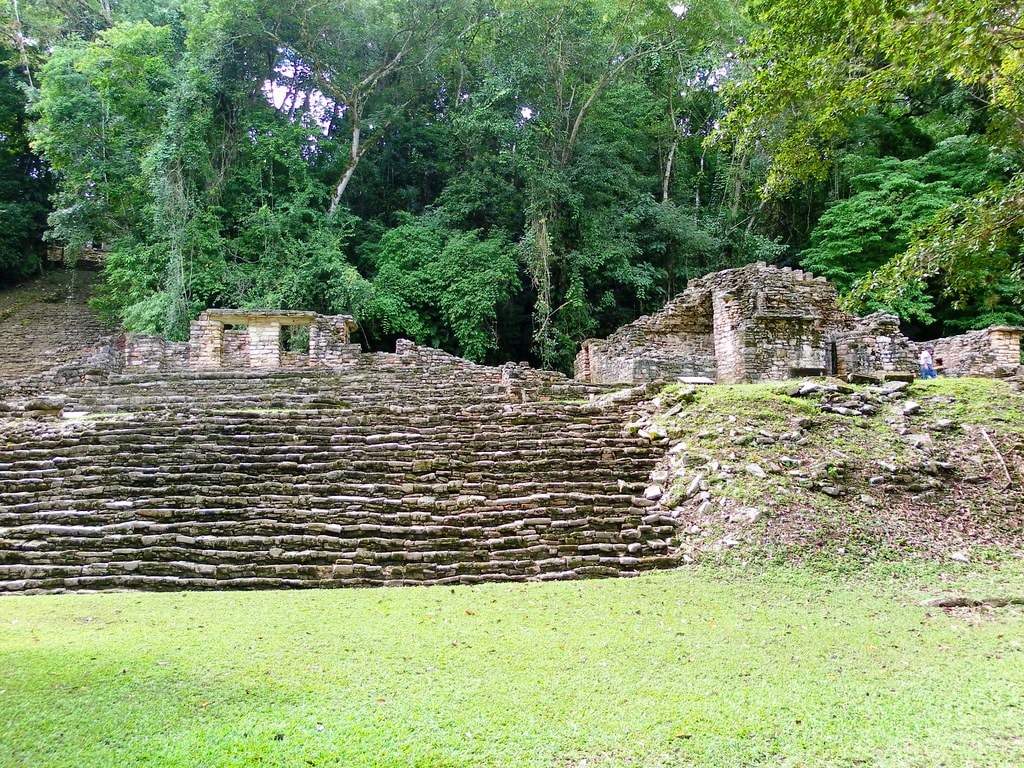
Yaxchilan Archaeological Zone
Ocosingo, Chiapas, Mexico
Yaxchilan is a site of sacred significance. Approximate coordinates: 16.90016, -90.96714. Yaxchilan (pronounced [ʝaʃtʃiˈlan]) is an ancient Maya city located on the bank of the Usumacinta River in the state of Chiapas, Mexico. In the Late Classic Period Yaxchilan was one of the most powerful Maya states along the course of the Usumacinta River, with Piedras Negras as its major rival. Architectural styles in subordinate sites in the Usumacinta region demonstrate clear differences that mark a clear boundary between the two kingdoms. Yaxchilan was a large center, important throughout the Classic era, and the dominant power of the Usumacinta River area. It dominated such smaller sites as Bonampak, and had a long rivalry with Piedras Negras and at least for a time with Tikal; it was a rival of Palenque, with which Yaxchilan warred in 654. The site is particularly known for its well-preserved sculptured stone lintels set above the doorways of the main structures. These lintels, together with the stelae erected before the major buildings, contain hieroglyphic texts describing the dynastic history of the city. Located in Chiapas, Mexico.
Guanajuato
1 sites
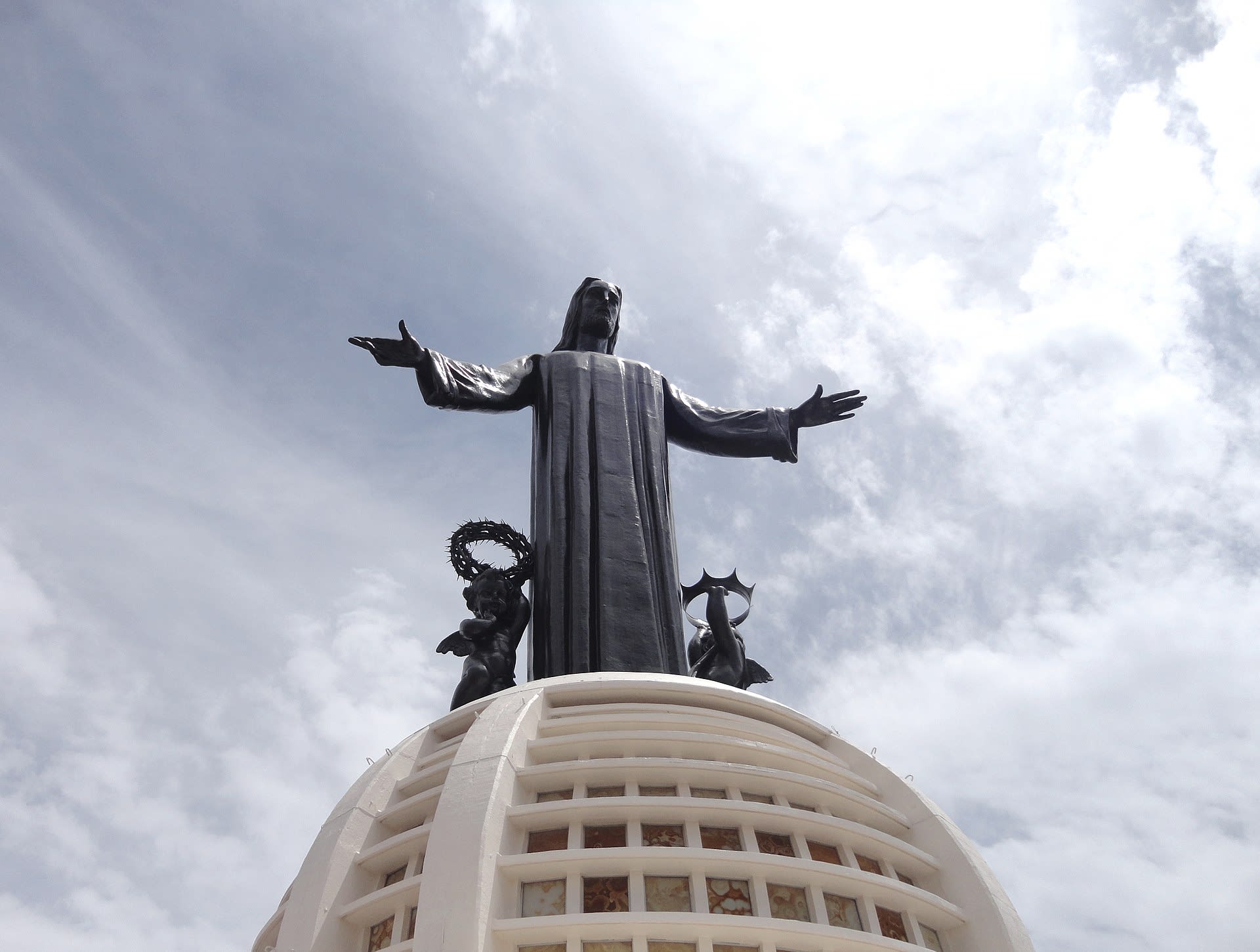
Jalisco
1 sites
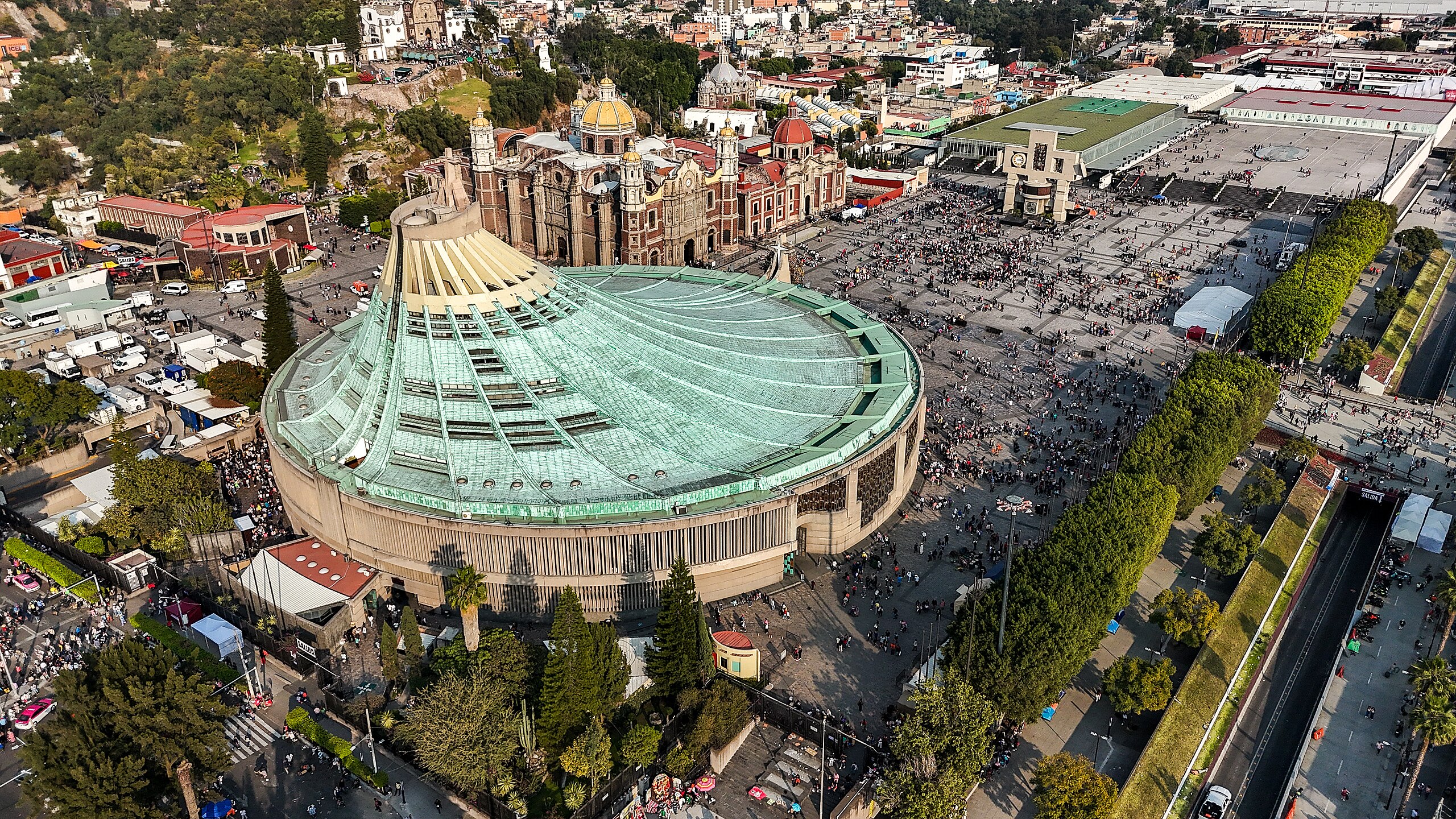
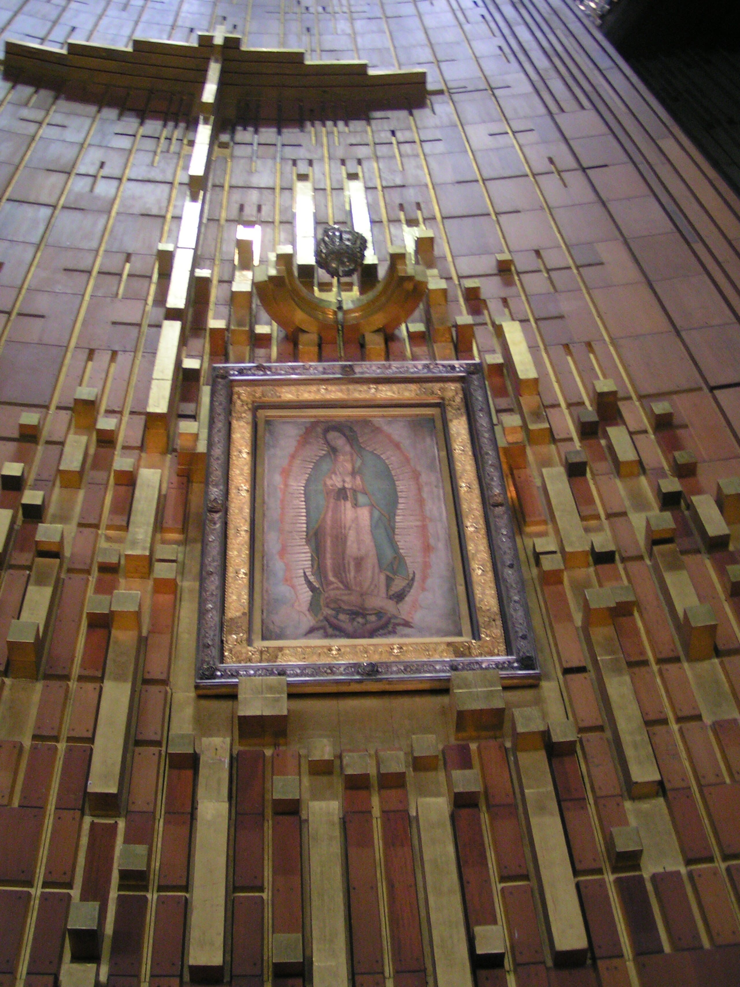
Mexico City
2 sites
Michoacán
1 sites
Morelos
1 sites
Oaxaca
2 sites
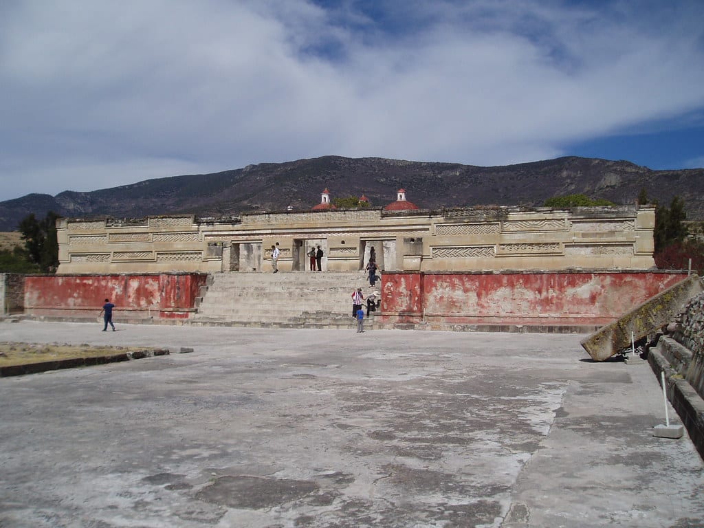
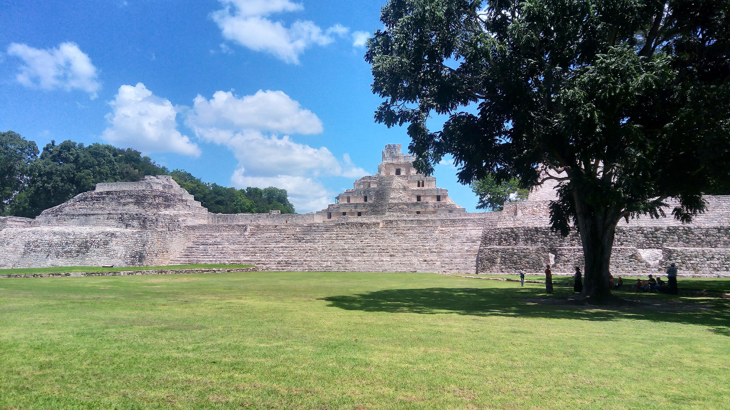
Mitla Archaeological Zone
San Pablo Villa de Mitla, Oaxaca, Mexico
Mitla is a site of sacred significance. Approximate coordinates: 16.92721, -96.35934. Mitla is the second-most important archeological site in the state of Oaxaca in Mexico, and the most important of the Zapotec culture. The site is located 44 km from the city of Oaxaca, in the upper end of the Tlacolula Valley, one of the three cold, high valleys that form the Central Valleys Region of the state. At an elevation of 4,855 ft (1,480 m), surrounded by the mountains of the Sierra Madre del Sur, the archeological site is within the modern municipality of San Pablo Villa de Mitla. It is 24 mi (38 km) southeast of Oaxaca city. While Monte Albán was the most important politically of the Zapotec centers, Mitla became the main religious one in a later period as the area became dominated by the Mixtec. The name Mitla is derived from the Nahuatl name Mictlán, meaning the place of the dead or underworld. Its Zapotec name is Lyobaa, which means “place of rest”. The name Mictlán was transliterated to Mitla. It was established as a sacred burial site by the Zapotec, but the architecture and designs also show the influence of the Mixtec, who had become prominent in the area during the peak of Mitla settlement. Mitla is unique among Mesoamerican sites because of its elaborate and intricate mosaic fretwork and geometric designs that cover tombs, panels, friezes, and even entire walls of the complex. These mosaics are made with small, finely cut and polished stone pieces that have been fitted together without the use of mortar. No other site in Mexico has this decorative work. Located in Oaxaca, Mexico.
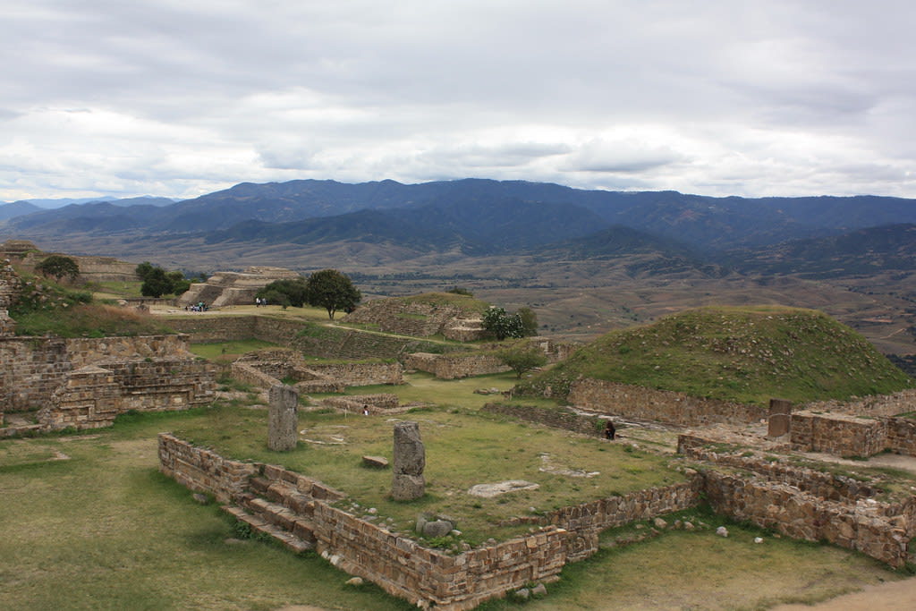
Monte Alban Archaeological Zone
Santa Cruz Xoxocotlán, Oaxaca, Mexico
Monte Alban is a site of sacred significance. Approximate coordinates: 17.04361, -96.76831. Located in Oaxaca, Mexico.
Puebla
1 sites
Quintana Roo
2 sites
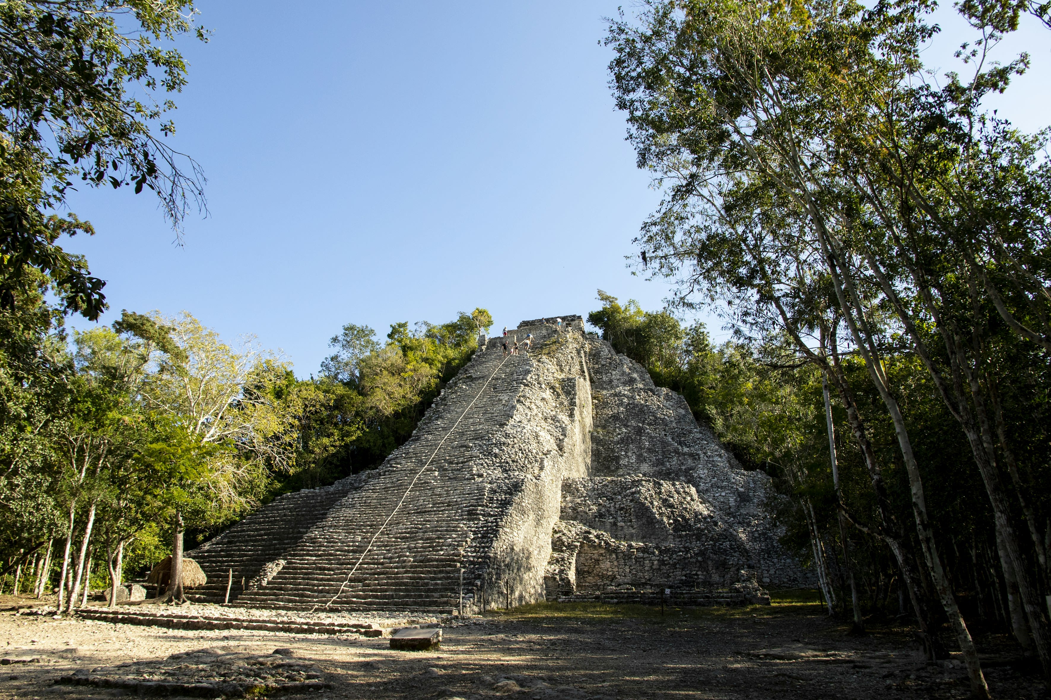
Coba
Cobá, Quintana Roo, Mexico
Coba is a ancient city of sacred significance. Approximate coordinates: 20.48668, -87.73836. Attributes: built, cultural, archaeological, ceremonial. Tradition: Maya. Mythological context: Mesoamerican. Coba (Spanish: Cobá) is an ancient Maya city on the Yucatán Peninsula, located in the Mexican state of Quintana Roo. The site is the nexus of the largest network of stone causeways of the ancient Maya world, and it contains many engraved and sculpted stelae that document ceremonial life and important events of the Late Classic Period (AD 600–900) of Mesoamerican civilization. The adjacent modern village bearing the same name, reported a population of 1,278 inhabitants in the 2010 Mexican federal census. The ruins of Coba lie 47 km (approx. 29 mi) northwest of Tulum, in the State of Quintana Roo, Mexico. The geographical coordinates of Coba Group (main entrance for tourist area of the archaeological site) are North 19° 29.6’ and West 87° 43.7’. The archaeological zone is reached by a two-kilometer branch from the asphalt road connecting Tulum with Nuevo Xcán (a community of Lázaro Cárdenas, another municipality of Quintana Roo) on the Valladolid to Cancún highway. Coba is located around two lagoons, Lake Coba and Lake Macanxoc. A series of elevated stone and plaster roads radiate from the central site to various smaller sites near and far. These are known by the Maya term sacbe (plural sacbeob) or white road. Some of these causeways go east, and the longest runs over 100 kilometres (62 mi) westward to the site of Yaxuna. The site contains a group of large temple pyramids known as the Nohoch Mul, the tallest of which, Ixmoja, is some 42 metres (138 ft) in height. Ixmoja is among the tallest pyramids on the Yucatán peninsula, exceeded by Calakmul at 45 metres (148 ft). Coba was estimated to have had some 50,000 inhabitants (and possibly significantly more) at its peak of civilization, and the built up area extends over some 80 km2. The site was occupied by a sizable agricultural population by the first century. The bulk of Coba s major construction seems to have been made in the middle and late Classic period, about 500 to 900 AD, with most of the dated hieroglyphic inscriptions from the 7th century (see Mesoamerican Long Count calendar). However, Coba remained an important site in the Post-Classic era and new temples were built and old ones kept in repair until at least the 14th century, possibly as late as the arrival of the Spanish. Cobá lies in the tropics, subject to alternating wet and dry seasons which, on average, differ somewhat from those in the rest of the northern peninsula, where the rainy season generally runs from June through October and the dry season from November through May. At Cobá, rain can occur in almost any time of the year, but there is a short dry period in February and March, and a concentration of rain from September through November. Located in Tulum, Quintana Roo, Mexico.
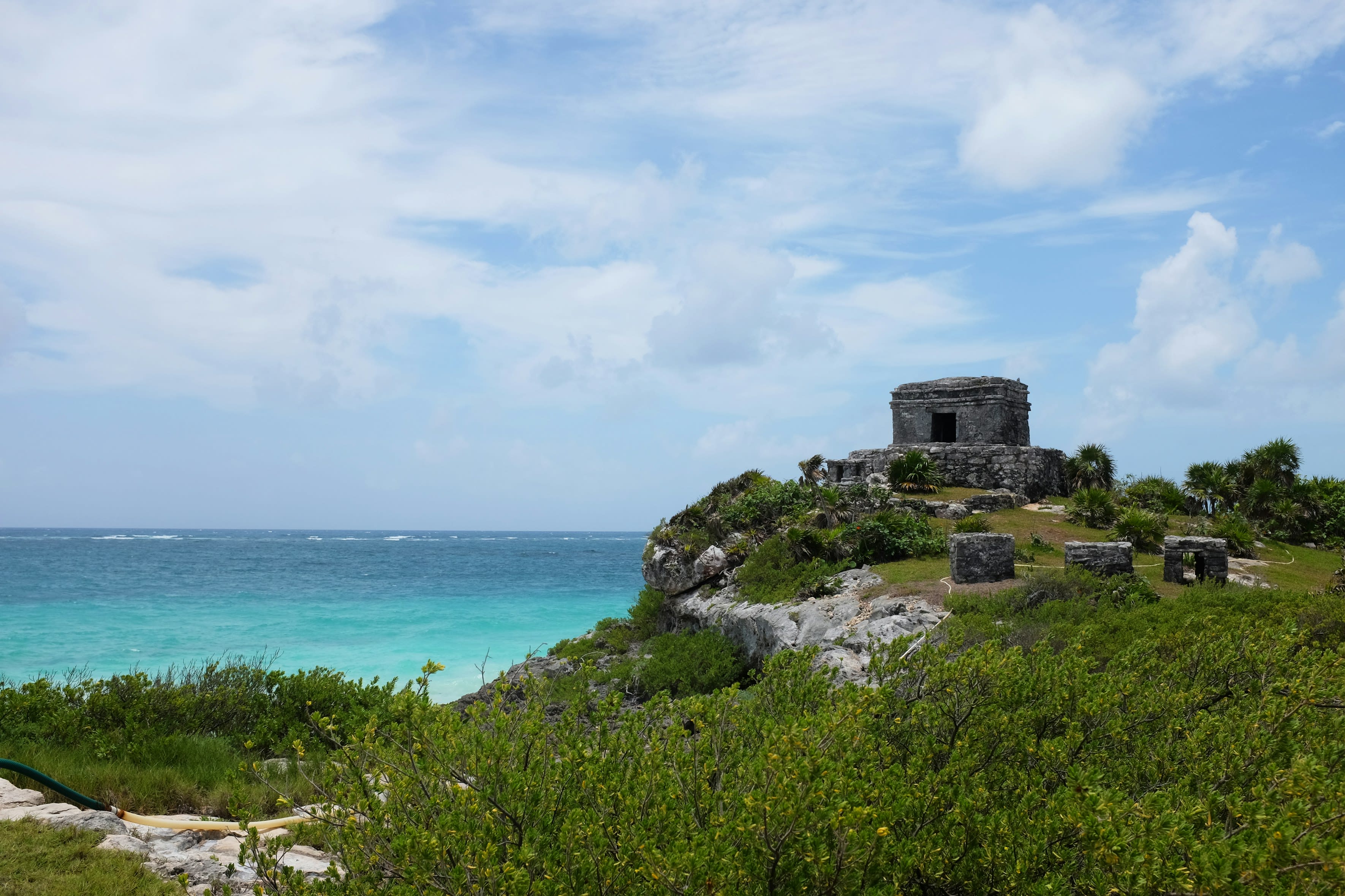
Tulum
Tulum, Quintana Roo, Mexico
Tulum is a site of sacred significance. Approximate coordinates: 20.21493, -87.43083. Tulum (Spanish pronunciation: [tuˈlun], Yucatec Maya: Tulu um) is the site of a pre-Columbian Mayan walled city which served as a major port for Coba, in the Mexican state of Quintana Roo. The ruins are situated on 12-meter-tall (39 ft) cliffs along the east coast of the Yucatán Peninsula on the Caribbean Sea. Tulum was one of the last cities built and inhabited by the Maya and achieved its greatest prominence between the 13th and 15th centuries. Maya continued to occupy Tulum for about 70 years after the Spanish began occupying Mexico, but the city was abandoned by the end of the 16th century. Tulum is one of the best-preserved coastal Maya sites, and today it is a popular site for tourists. Located in Tulum, Quintana Roo, Mexico.
State of Mexico
8 sites
Basilica of Our Lady of Remedies, Naucalpan de Juarez
Naucalpan de Juárez, State of Mexico, Mexico
Basilica of Our Lady of Remedies, Naucalpan de Juarez is a site of sacred significance. Approximate coordinates: 19.47222, -99.25127. Located in Ciudad Satélite, Estado de México, Mexico.
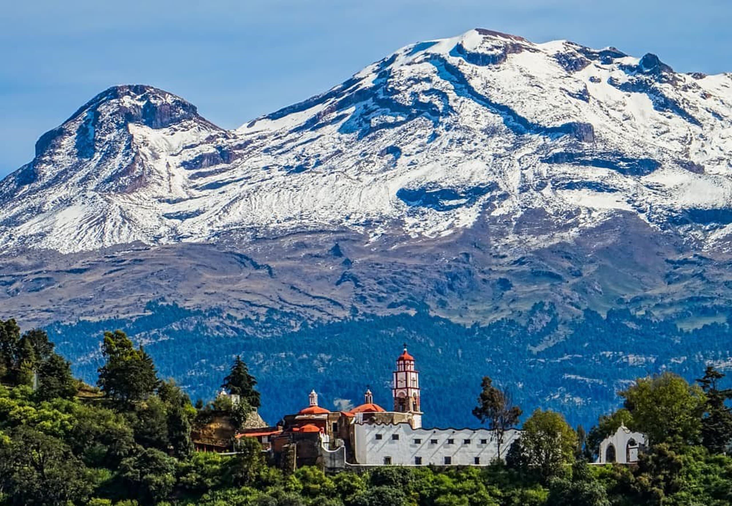
Mt. Iztaccihuatl
Tlalmanalco, State of Mexico, Mexico
Mt. Iztaccihuatl is a site of sacred significance. Approximate coordinates: 19.21521, -98.64967. Located in Estado de México, Mexico.
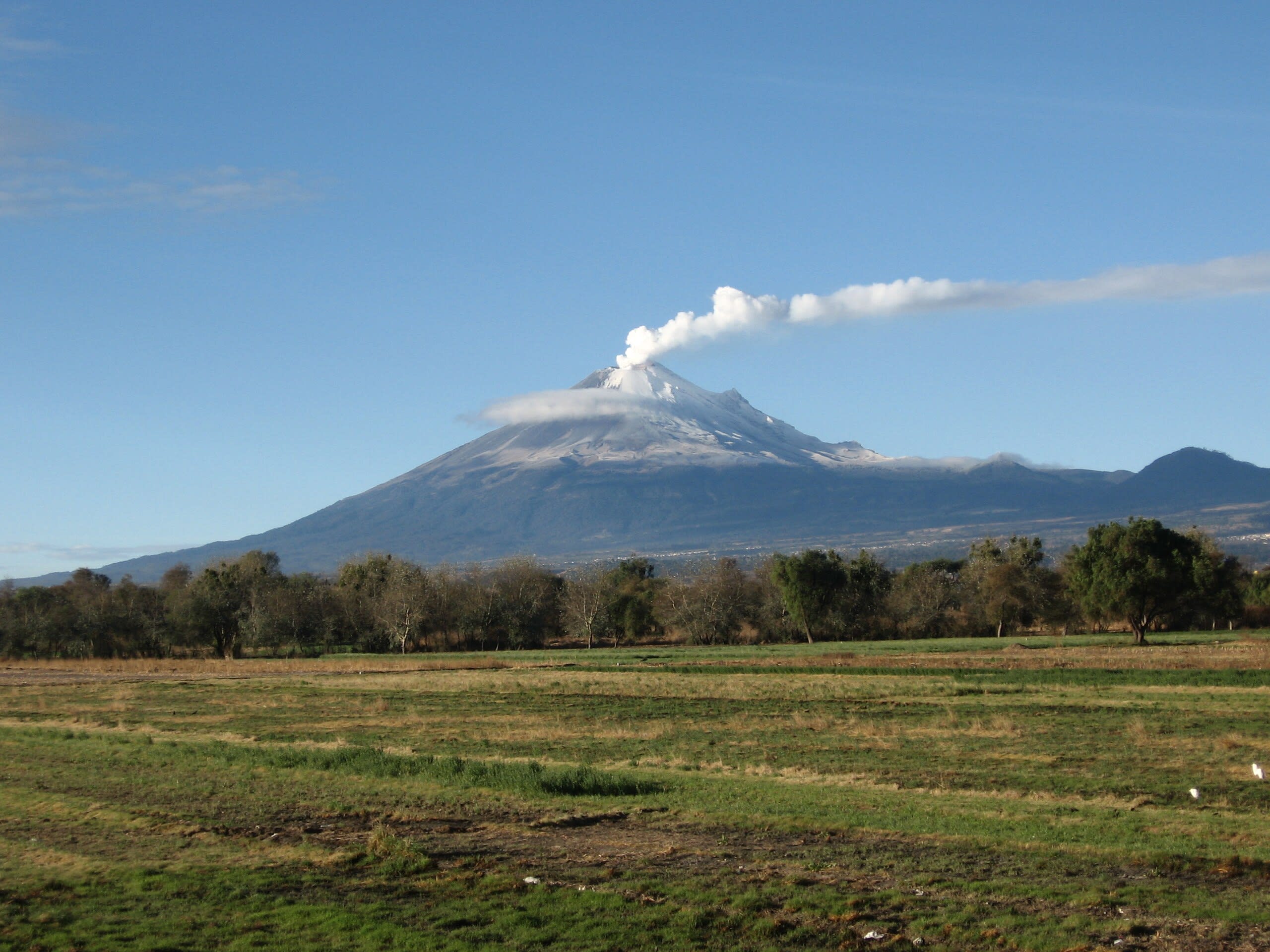
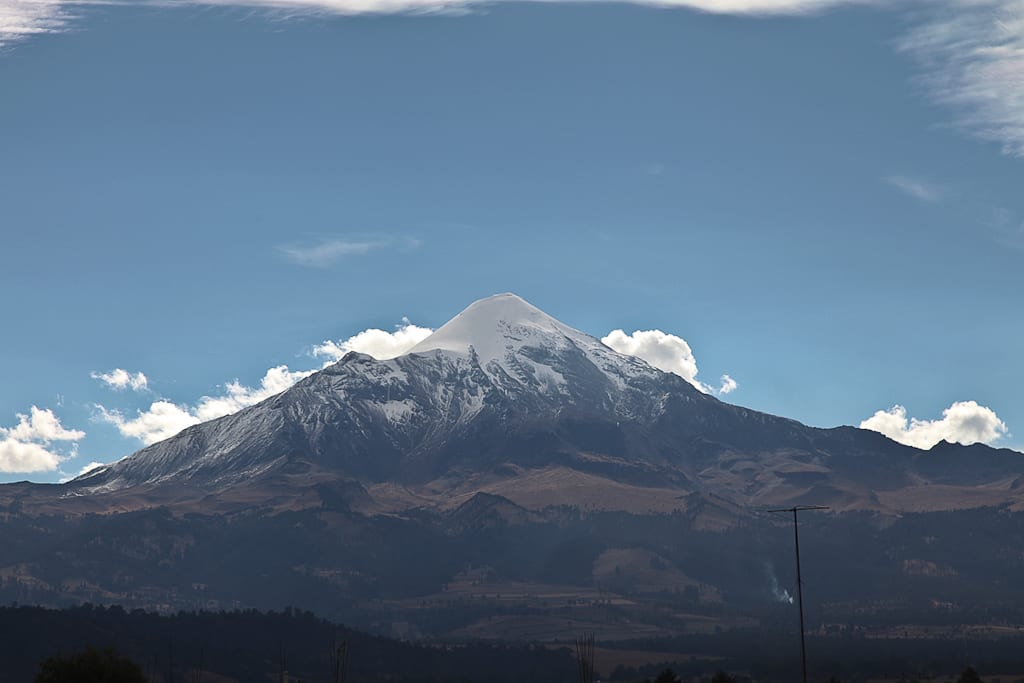
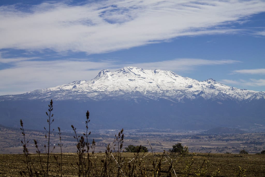
Mt. Popocatepetl
Atlautla, State of Mexico, Mexico
Mt. Popocatepetl is a site of sacred significance. Approximate coordinates: 19.02242, -98.62790. Located in Estado de México, Mexico.
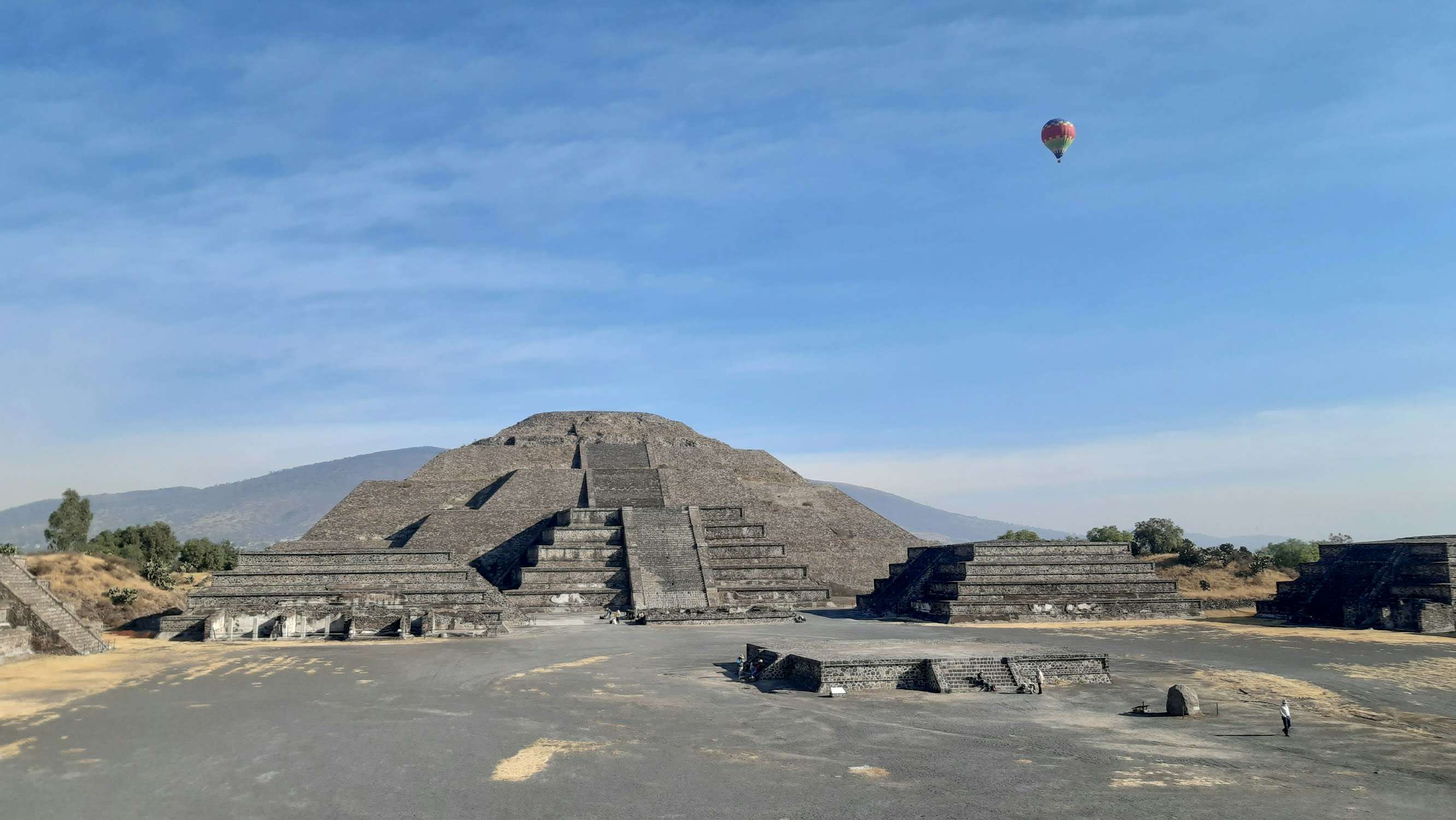
Pyramid of the Moon, Teotihuacán
San Juan Teotihuacan, State of Mexico, Mexico
Pyramid of the Moon, Teotihuacán in San Juan Teotihuacan, State of Mexico, Mexico.
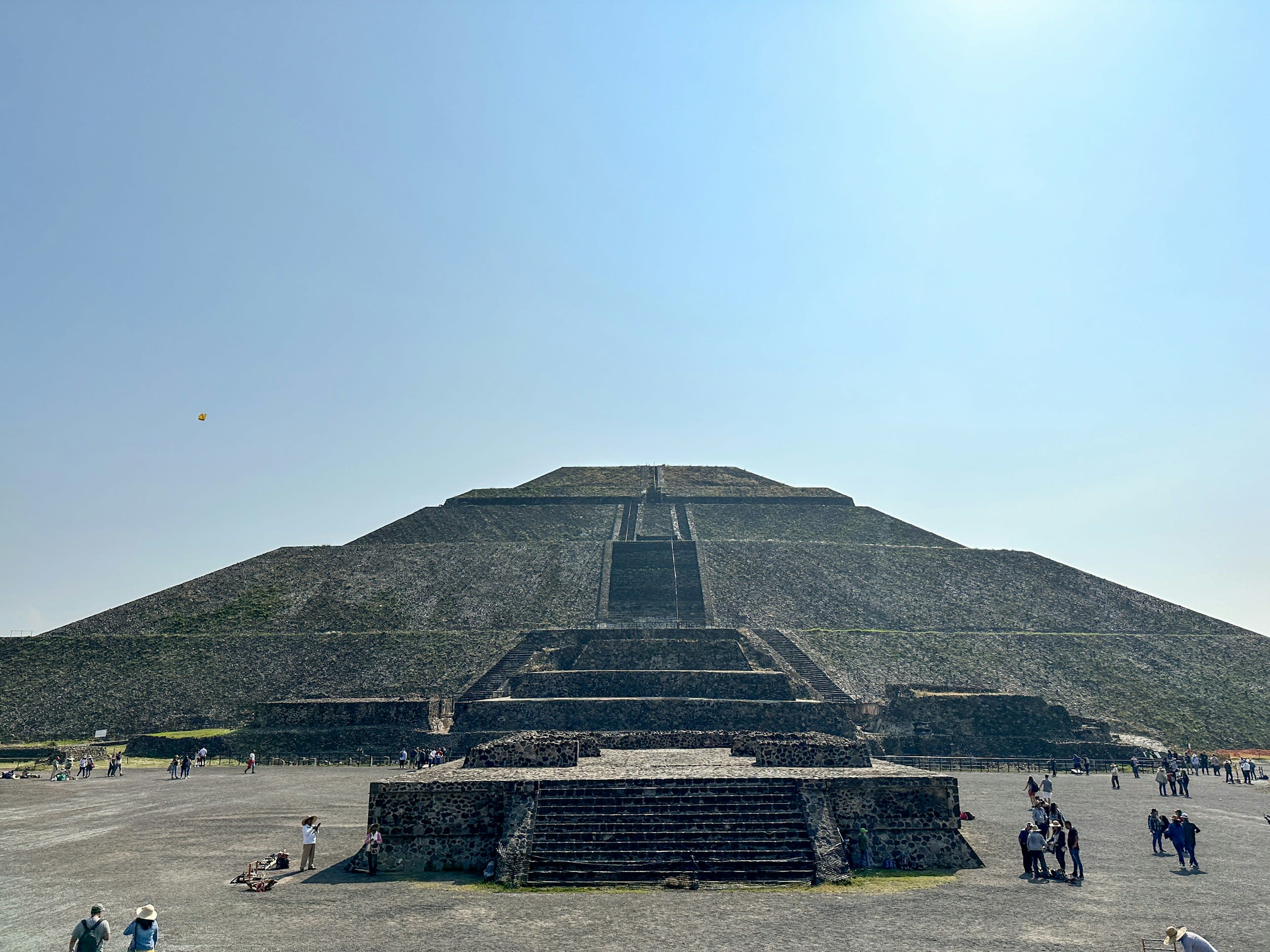
Pyramid of the Sun, Teotihuacán
San Juan Teotihuacan, State of Mexico, Mexico
Pyramid of the Sun, Teotihuacán in San Juan Teotihuacan, State of Mexico, Mexico.
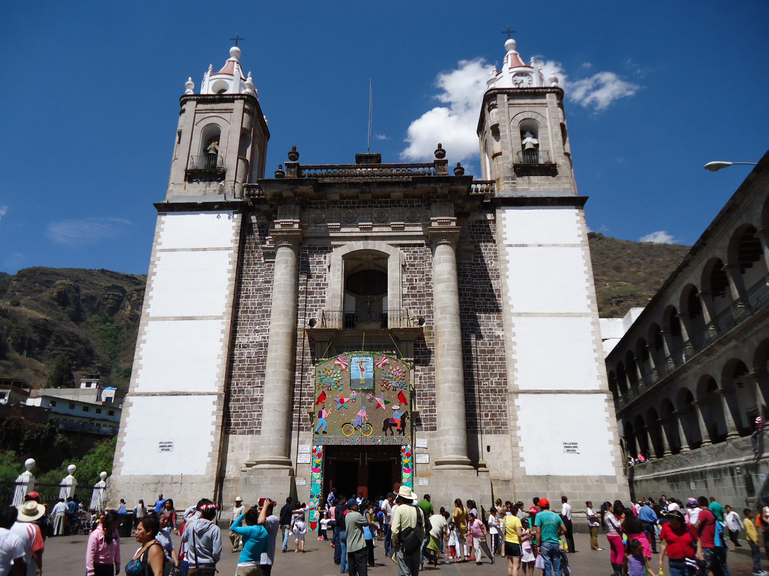
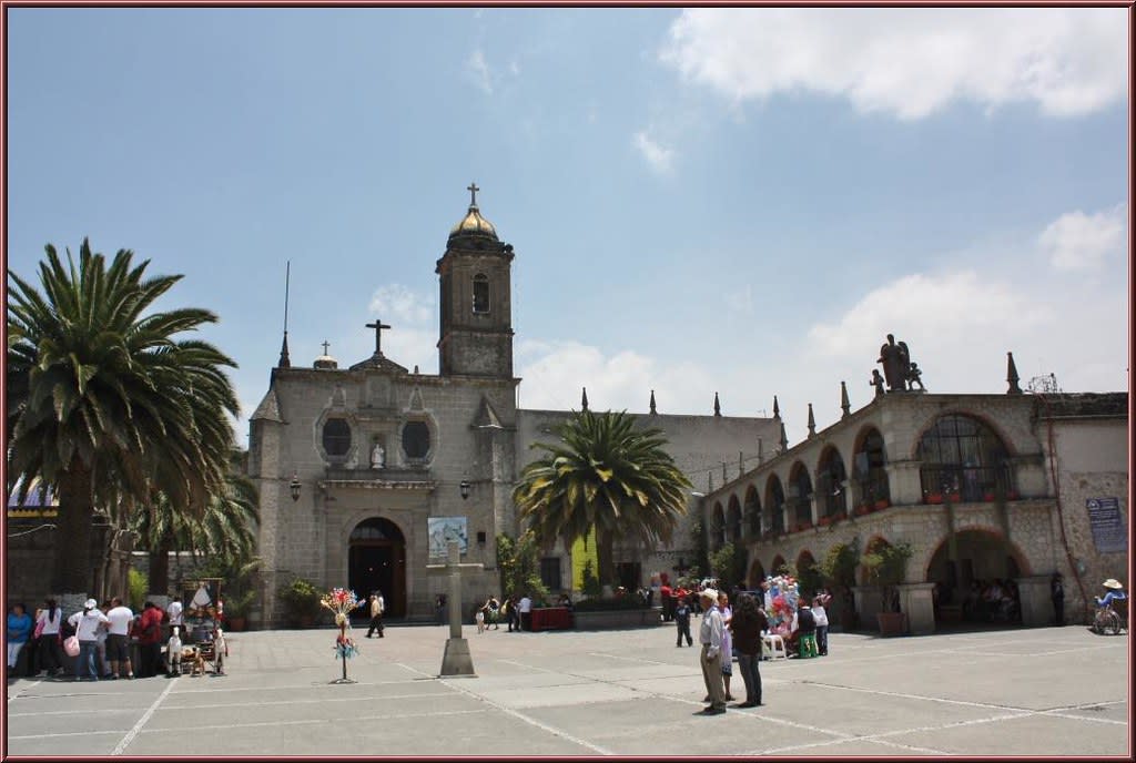
Sanctuary of the Lord of Chalma
Chalma, State of Mexico, Mexico
Chalma is a church of sacred significance. Approximate coordinates: 18.93287, -99.43444. Attributes: built, cultural, pilgrimage. Tradition: Christianity. Associated figure: El Senor de Chalma. Mythological context: Aztec. Chalma may refer to: Located in Estado de México, Mexico.
Sanctuary of the Lord of Sacromonte
Amecameca, State of Mexico, Mexico
Sanctuary of Señor del Sacromonte, Amecameca is a site of sacred significance. Approximate coordinates: 19.12628, -98.77393. Located in Estado de México, Mexico.
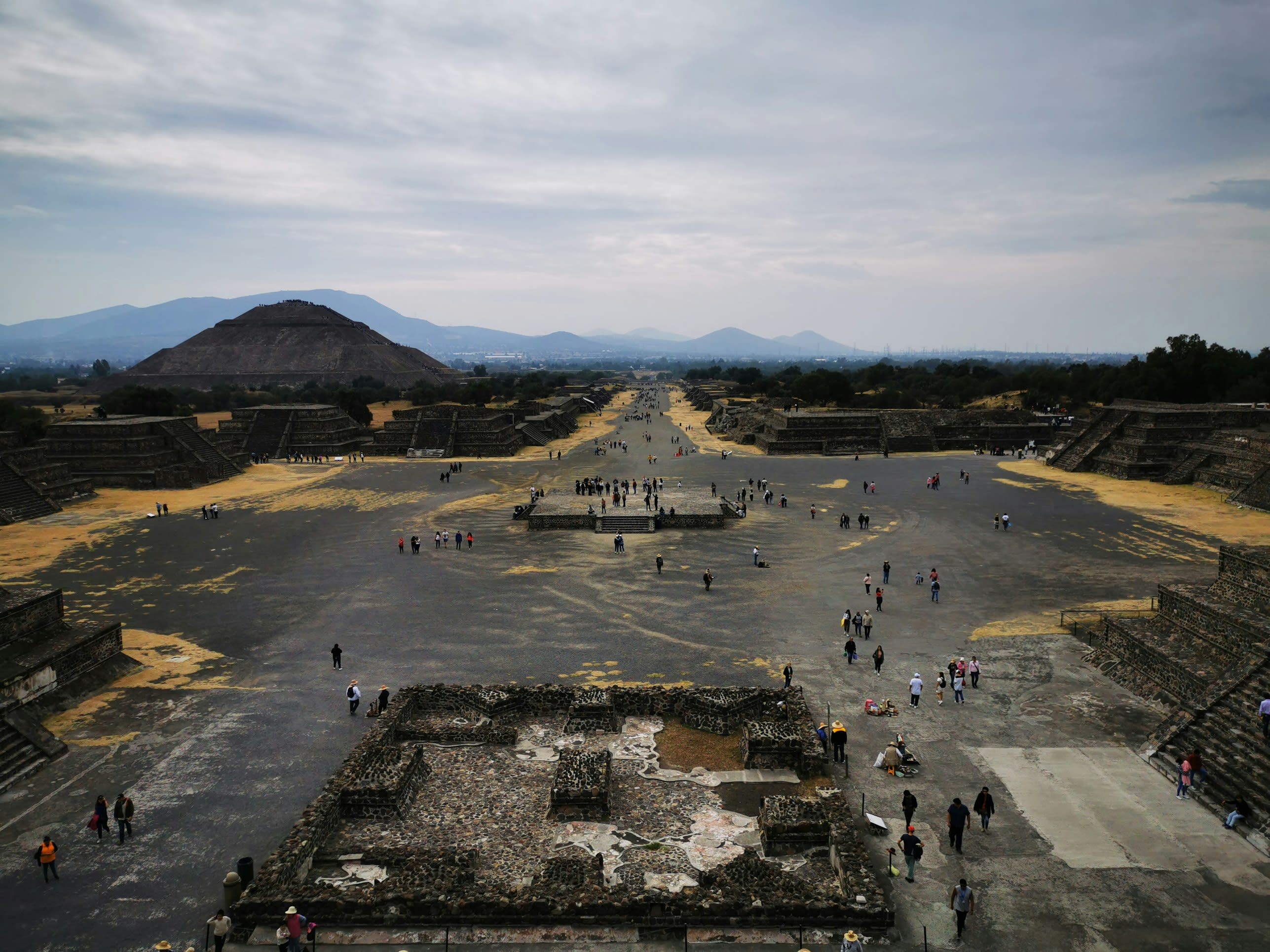
Teotihuacan
Teotihuacán, State of Mexico, Mexico
Teotihuacan is a site of sacred significance. Approximate coordinates: 19.69318, -98.84711. Teotihuacan (; Spanish: Teotihuacán, Spanish pronunciation: [teotiwa kan] ; ) is an ancient Mesoamerican city located in a sub-valley of the Valley of Mexico, which is located in the State of Mexico, 40 kilometers (25 mi) northeast of modern-day Mexico City. Teotihuacan is known today as the site of many of the most architecturally significant Mesoamerican pyramids built in the pre-Columbian Americas, namely the Pyramid of the Sun and the Pyramid of the Moon. Although close to Mexico City, Teotihuacan was not a Mexica (i.e. Aztec) city, and it predates the Aztec Empire by many centuries. At its zenith, perhaps in the first half of the first millennium (1 CE to 500 CE), Teotihuacan was the largest city in the Americas, with a population of at least 25,000, but has been estimated at 125,000 or more, making it at least the sixth-largest city in the world during its epoch. The city covered eight square miles (21 km2) and 80 to 90 percent of the total population of the valley resided in Teotihuacan. Apart from the pyramids, Teotihuacan is also anthropologically significant for its complex, multi-family residential compounds, the Avenue of the Dead, and its vibrant, well-preserved murals. Additionally, Teotihuacan exported fine obsidian tools found throughout Mesoamerica. The city is thought to have been established around 100 BCE, with major monuments continuously under construction until about 250 CE. The city may have lasted until sometime between the 7th and 8th centuries CE, but its major monuments were sacked and systematically burned around 550 CE. Its collapse might be related to the extreme weather events of 535–536. Teotihuacan began as a religious center in the Mexican Plateau around the first century CE. It became the largest and most populated center in the pre-Columbian Americas. Teotihuacan was home to multi-floor apartment compounds built to accommodate the large population. The term Teotihuacan (or Teotihuacano) is also used to refer to the whole civilization and cultural complex associated with the site. Although it is a subject of debate whether Teotihuacan was the center of a state empire, its influence throughout Mesoamerica is well documented. Evidence of Teotihuacano presence is found at numerous sites in Veracruz and the Maya region. The later Aztecs saw these magnificent ruins and claimed a common ancestry with the Teotihuacanos, modifying and adopting aspects of their culture. The ethnicity of the inhabitants of Teotihuacan is the subject of debate. Possible candidates are the Nahua, Otomi, or Totonac ethnic groups. Other scholars have suggested that Teotihuacan was multi-ethnic, due to the discovery of cultural aspects connected to the Maya as well as Oto-Pamean people. It is clear that many different cultural groups lived in Teotihuacan during the height of its power, with migrants coming from all over, but especially from Oaxaca and the Gulf Coast. After the collapse of Teotihuacan, central Mexico was dominated by more regional powers, notably Xochicalco and Tula. The city and the archeological site are located in what is now the San Juan Teotihuacán municipality in the State of México, approximately 40 kilometers (25 mi) northeast of Mexico City. The site covers a total surface area of 83 square kilometers (32 sq mi) and was designated a UNESCO World Heritage Site in 1987. It was the second most-visited archeological site in Mexico in 2024, receiving 1,313,321 visitors. Located in Estado de México, Mexico.
Veracruz
2 sites
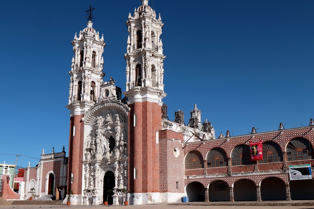
Basilica of Our Lady of Ocotlan
Otatitlán, Veracruz, Mexico
Nuestra Senora de Ocotlan, Tlaxcala is a site of sacred significance. Approximate coordinates: 18.17700, -96.03310. Located in Veracruz, Mexico.
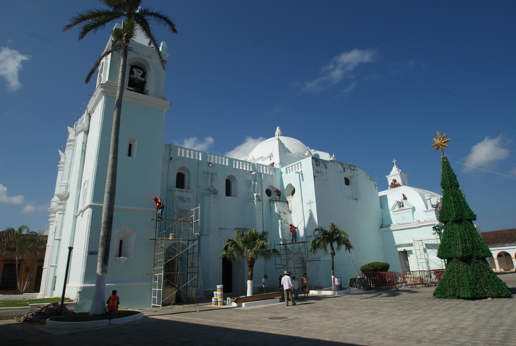
Sanctuary of the Virgin of Candelaria in Tlacotalpan
Tlacotalpan, Veracruz, Mexico
Virgen de la Candelaria, Tlacotalpan is a site of sacred significance. Approximate coordinates: 18.61240, -95.66086. Located in Veracruz, Mexico.
Yucatan
1 sites
Yucatán
6 sites
Chichen Itza
Pisté, Yucatán, Mexico
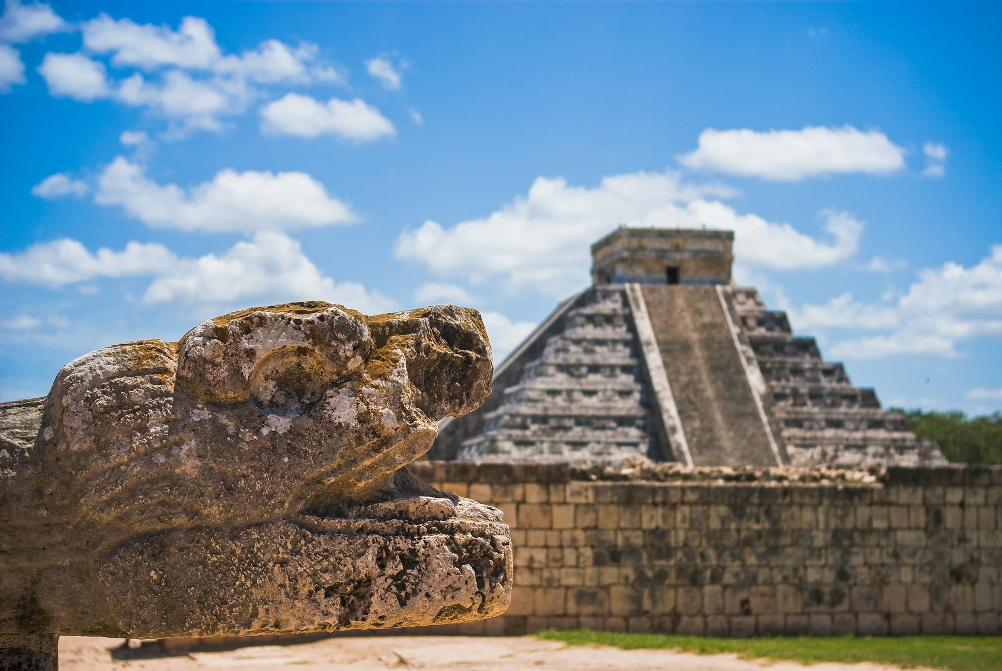
Chichen Itza is a pre-columbian city of sacred significance. Approximate coordinates: 20.68322, -88.57075. Attributes: built, cultural, archaeological, pilgrimage, ceremonial. Tradition: Maya. Mythological context: Mesoamerican. Recognized as a UNESCO World Heritage Site. Chichén Itzá (often spelled Chichen Itza in English and traditional Yucatec Maya) was a large pre-Columbian city built by the Maya people of the Terminal Classic period. The archeological site is located in Tinúm Municipality, Yucatán State, Mexico. Chichén Itzá was a major focal point in the Northern Maya Lowlands from the Late Classic (c. AD 600–900) through the Terminal Classic (c. AD 800–900) and into the early portion of the Postclassic period (c. AD 900–1200). The site exhibits a multitude of architectural styles, reminiscent of styles seen in central Mexico and of the Puuc and Chenes styles of the Northern Maya lowlands. The presence of central Mexican styles was once thought to have been representative of direct migration or even conquest from central Mexico, but most contemporary interpretations view the presence of these non-Maya styles more as the result of cultural diffusion. Chichén Itzá was one of the largest Maya cities and it was likely to have been one of the mythical great cities, or Tollans, referred to in later Mesoamerican literature. The city may have had the most diverse population in the Maya world, a factor that could have contributed to the variety of architectural styles at the site. The ruins of Chichén Itzá are federal property, and the site s stewardship is maintained by Mexico s Instituto Nacional de Antropología e Historia (National Institute of Anthropology and History). The land under the monuments had been privately owned until 29 March 2010, when it was purchased by the state of Yucatán. Chichén Itzá is one of the most visited archeological sites in Mexico with over 2.6 million tourists in 2017. Located in Yucatán, Mexico.
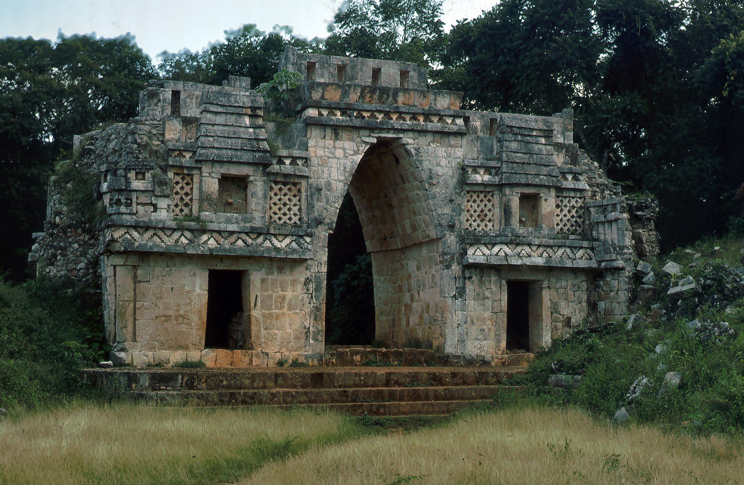
Kabah Archaeological Zone
Santa Elena, Yucatán, Mexico
Kabah is a maya civilization city of sacred significance. Approximate coordinates: 20.24996, -89.65050. Attributes: built, cultural, archaeological, ceremonial. Tradition: Maya. Kabah may refer to: Kabah (Maya site), a Maya civilization city in Yucatán, Mexico Kaaba, the holy building in Mecca, Saudi Arabia Kabah (band), a Mexican pop music group Located in Yucatán, Mexico.
Labna
Santa Elena, Yucatán, Mexico
Labna is a mesoamerican archaeological site of sacred significance. Approximate coordinates: 20.17352, -89.57849. Attributes: built, cultural, archaeological, ceremonial. Tradition: Maya civilization. Recognized as a UNESCO World Heritage Site. Labna (or Labná in Spanish orthography) is a Mesoamerican archaeological site and ceremonial center of the pre-Columbian Maya civilization, located in the Puuc Hills region of the Yucatán Peninsula. It is situated to the south of the large Maya site of Uxmal, in the southwest of the present-day state of Yucatán, Mexico. Labna, Sayil and Kabah were incorporated with Uxmal as a UNESCO World Heritage Site in 1996. Located in Yucatán, Mexico.
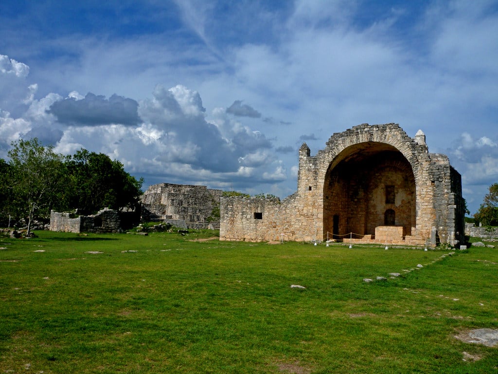
Museum of the Mayan Village at Dzibilchaltun
Mérida, Yucatán, Mexico
Dzibilchaltun is a archaeological site of sacred significance. Approximate coordinates: 21.09427, -89.59642. Attributes: built, cultural, archaeological. Tradition: Maya. Dzibilchaltún (Yucatec Maya: Ts íibil Cháaltun, [d̥z̥ʼiː˧˥biɭ tɕʰɒːl˦˥tuŋ]) is a Maya archaeological site in the Mexican state of Yucatán, approximately 10 miles (16 km) north of the state capital of Mérida. The original name for the site may have been Ch iy Chan Ti Ho. Located in Mérida, Yucatán, Mexico.
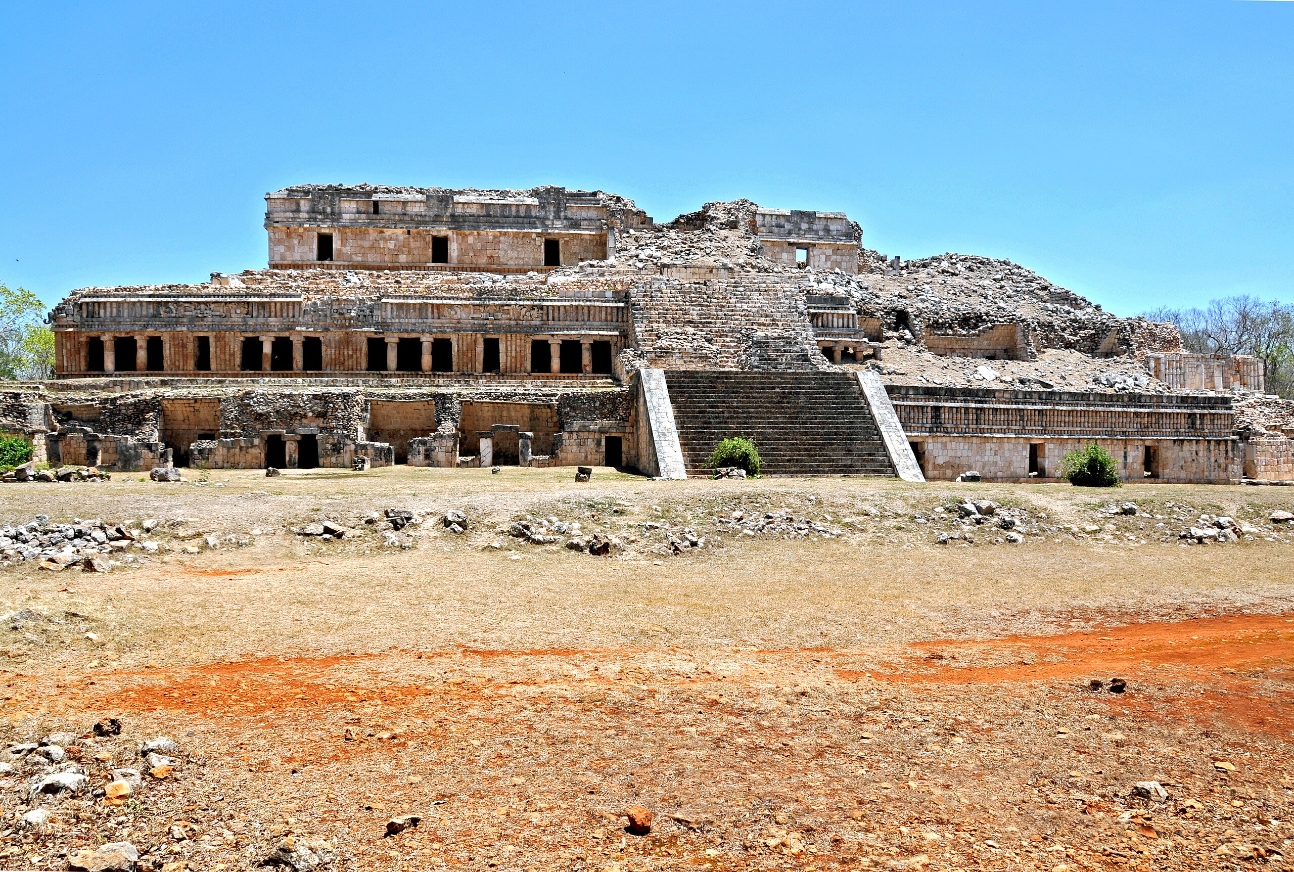
Sayil Archaeological Zone
Santa Elena, Yucatán, Mexico
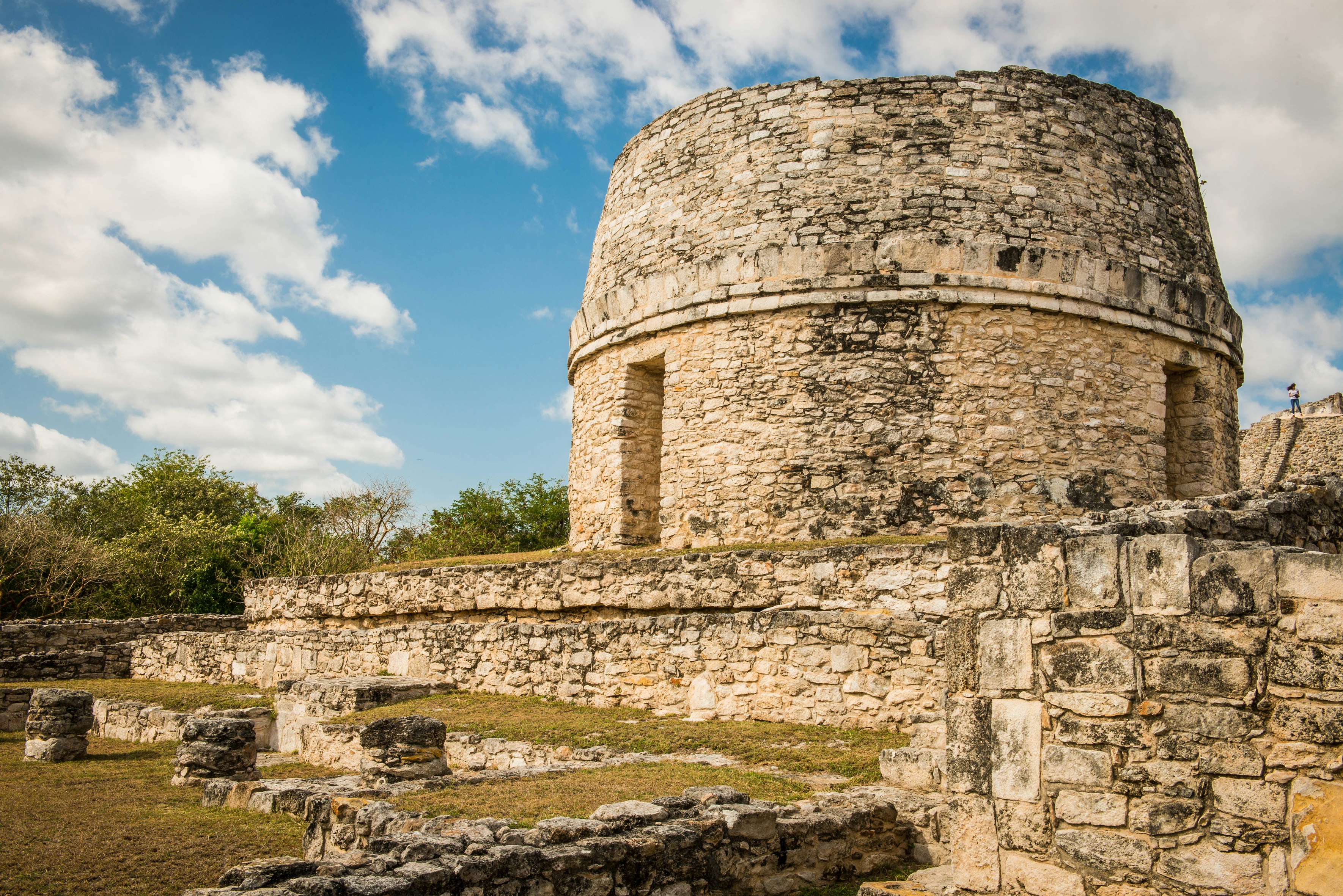
Sayil is a site of sacred significance. Approximate coordinates: 20.17457, -89.65187. Sayil was a pre-Columbian city built by the Maya people of the Terminal Classic period. It is located in the Mexican state of Yucatán, in the southwest of the state, south of Uxmal. Sayil, Kabah and Labna were incorporated together with Uxmal as a UNESCO World Heritage Site in 1996. Sayil flourished principally, albeit briefly, in the Terminal Classic period. The city reached its greatest extent c. 900 and had a population of 10,000 with an additional 5,000–7,000 living in the surrounding area. A number of badly damaged monuments suggest that Sayil was governed by a local royal dynasty, with wealth among lineages based, at least in part, upon control of the best agricultural lands. The ruins of Sayil include a prominent example of monumental Puuc style architecture, the partially ruined Grand Palace of Sayil. Located in Yucatán, Mexico.

Uxmal
Santa Elena, Yucatán, Mexico
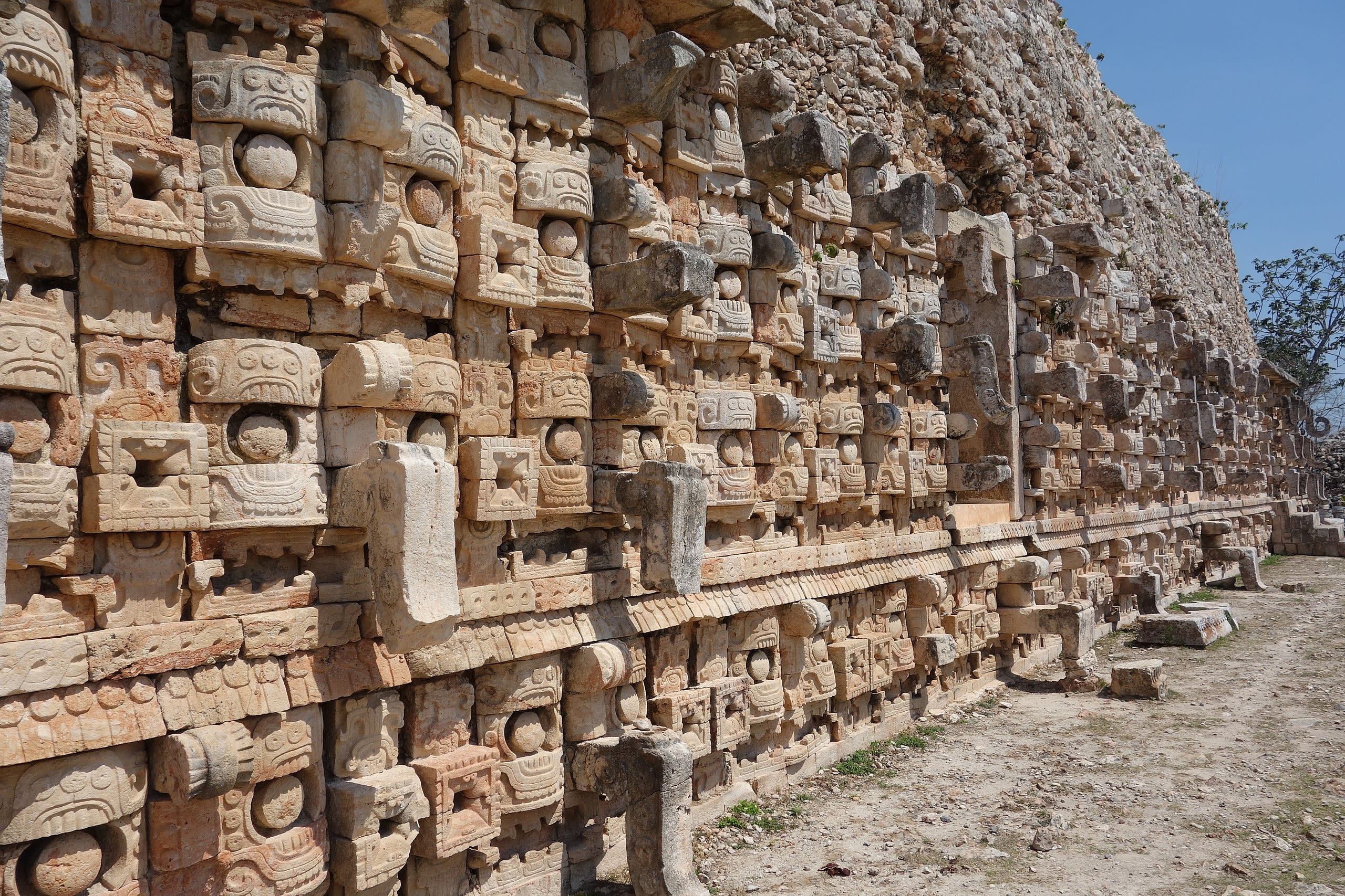
Uxmal is a site of sacred significance. Approximate coordinates: 20.36040, -89.77203. Uxmal (Yucatec Maya: Óoxmáal [óˑʃmáˑl]) is an ancient Maya city of the classical period located in present-day Mexico. It is considered one of the most important archaeological sites of Maya culture, along with Palenque, Chichen Itza and Calakmul in Mexico, Caracol and Xunantunich in Belize, and Tikal in Guatemala. It is located in the Puuc region of the western Yucatán Peninsula, and is considered one of the Maya cities most representative of the region s dominant architectural style. It was designated a UNESCO World Heritage Site along with the nearby ruins of Kabah, Sayil and Labna. Uxmal is located 62 km south of Mérida, capital of Yucatán state in Mexico. Its buildings are noted for their size and decoration. Ancient roads called sacbes connect the buildings, and also were built to other cities in the area such as Chichén Itzá in modern-day Mexico, Caracol and Xunantunich in modern-day Belize, and Tikal in modern-day Guatemala. Its buildings are typical of the Puuc style, with smooth low walls that open on ornate friezes based on representations of typical Maya huts. These are represented by columns (representing the reeds used for the walls of the huts) and trapezoidal shapes (representing the thatched roofs). Entwined snakes and, in many cases two-headed snakes are used for masks of the rain god, Chaac; its big noses represent the rays of the storms. Feathered serpents with open fangs are shown leaving from the same human beings. Also seen in some cities are the influences of the Nahua peoples, who followed the cult of Quetzalcoatl and Tlaloc. These were integrated with the original elements of the Puuc tradition. The buildings take advantage of the terrain to gain height and acquire important volumes, including the Pyramid of the Magician, with five levels, and the Governor s Palace, which covers an area of more than 1,200 m2 (12,917 sq ft). Located in Yucatán, Mexico.
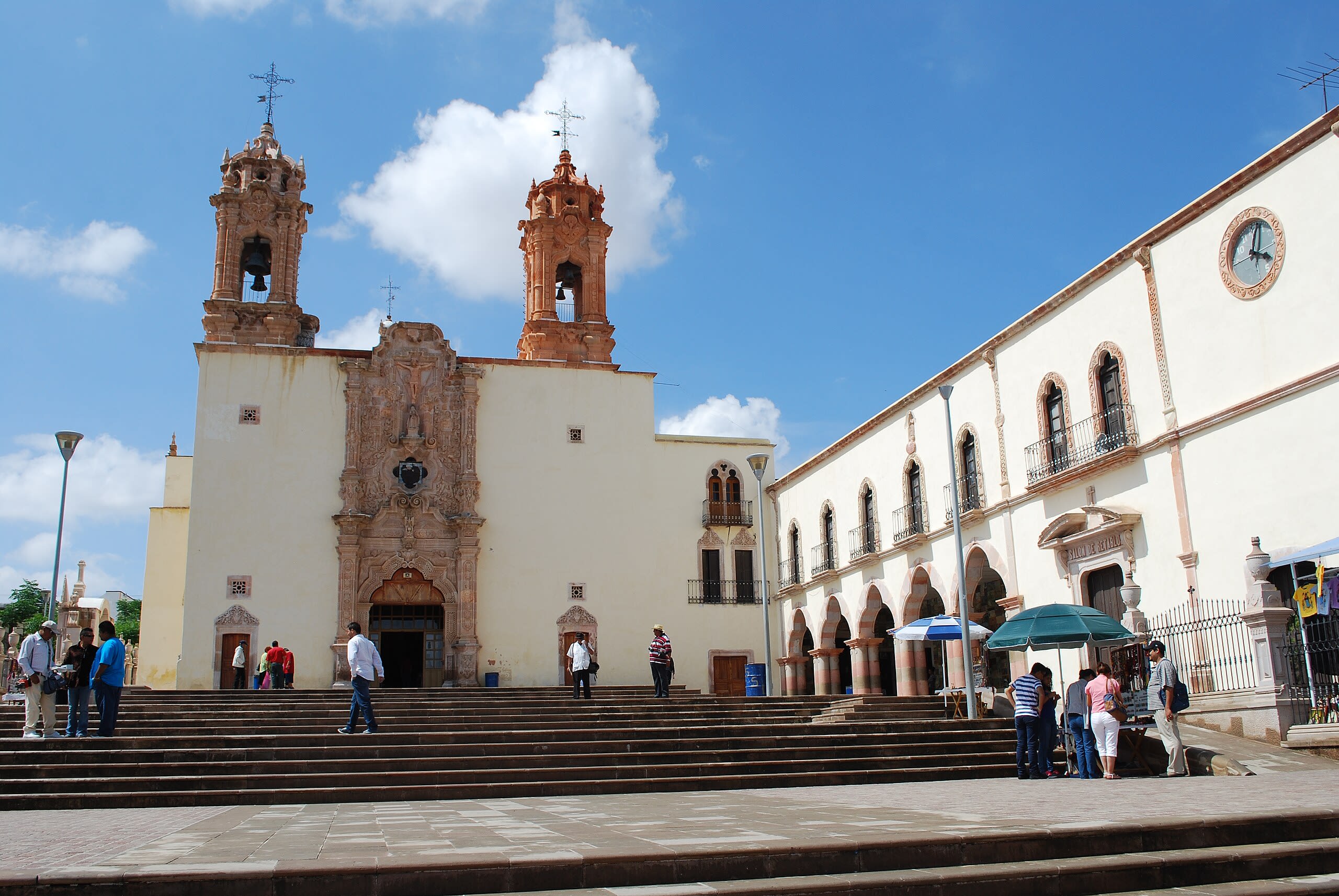
Zacatecas
1 sites