Tradition guide
Maya
9 sacred sites available through this shared spiritual lineage.
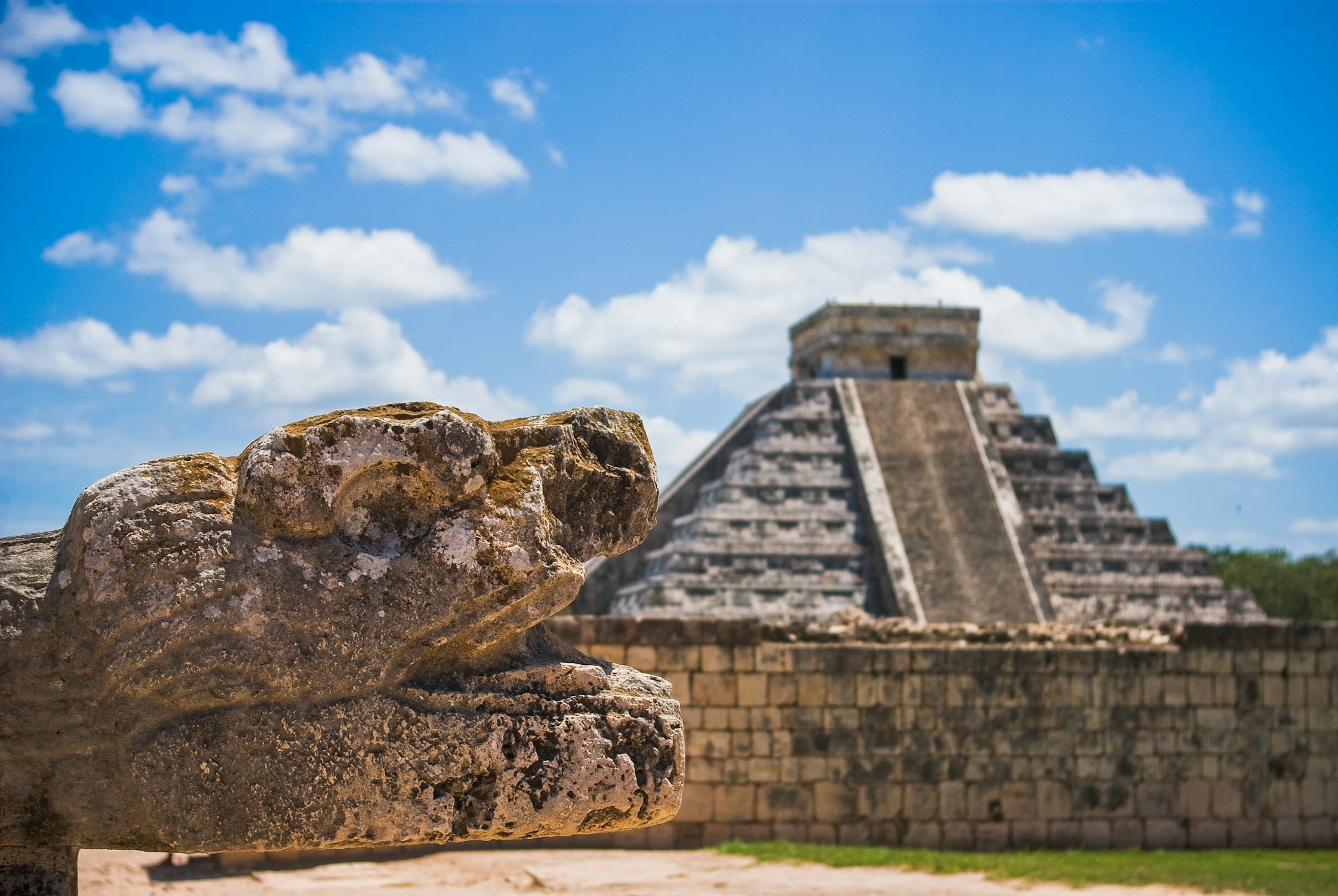
Chichen Itza
Pisté, Yucatán, Mexico
Chichen Itza is a pre-columbian city of sacred significance. Approximate coordinates: 20.68322, -88.57075. Attributes: built, cultural, archaeological, pilgrimage, ceremonial. Tradition: Maya. Mythological context: Mesoamerican. Recognized as a UNESCO World Heritage Site. Chichén Itzá (often spelled Chichen Itza in English and traditional Yucatec Maya) was a large pre-Columbian city built by the Maya people of the Terminal Classic period. The archeological site is located in Tinúm Municipality, Yucatán State, Mexico. Chichén Itzá was a major focal point in the Northern Maya Lowlands from the Late Classic (c. AD 600–900) through the Terminal Classic (c. AD 800–900) and into the early portion of the Postclassic period (c. AD 900–1200). The site exhibits a multitude of architectural styles, reminiscent of styles seen in central Mexico and of the Puuc and Chenes styles of the Northern Maya lowlands. The presence of central Mexican styles was once thought to have been representative of direct migration or even conquest from central Mexico, but most contemporary interpretations view the presence of these non-Maya styles more as the result of cultural diffusion. Chichén Itzá was one of the largest Maya cities and it was likely to have been one of the mythical great cities, or Tollans, referred to in later Mesoamerican literature. The city may have had the most diverse population in the Maya world, a factor that could have contributed to the variety of architectural styles at the site. The ruins of Chichén Itzá are federal property, and the site s stewardship is maintained by Mexico s Instituto Nacional de Antropología e Historia (National Institute of Anthropology and History). The land under the monuments had been privately owned until 29 March 2010, when it was purchased by the state of Yucatán. Chichén Itzá is one of the most visited archeological sites in Mexico with over 2.6 million tourists in 2017. Located in Yucatán, Mexico.
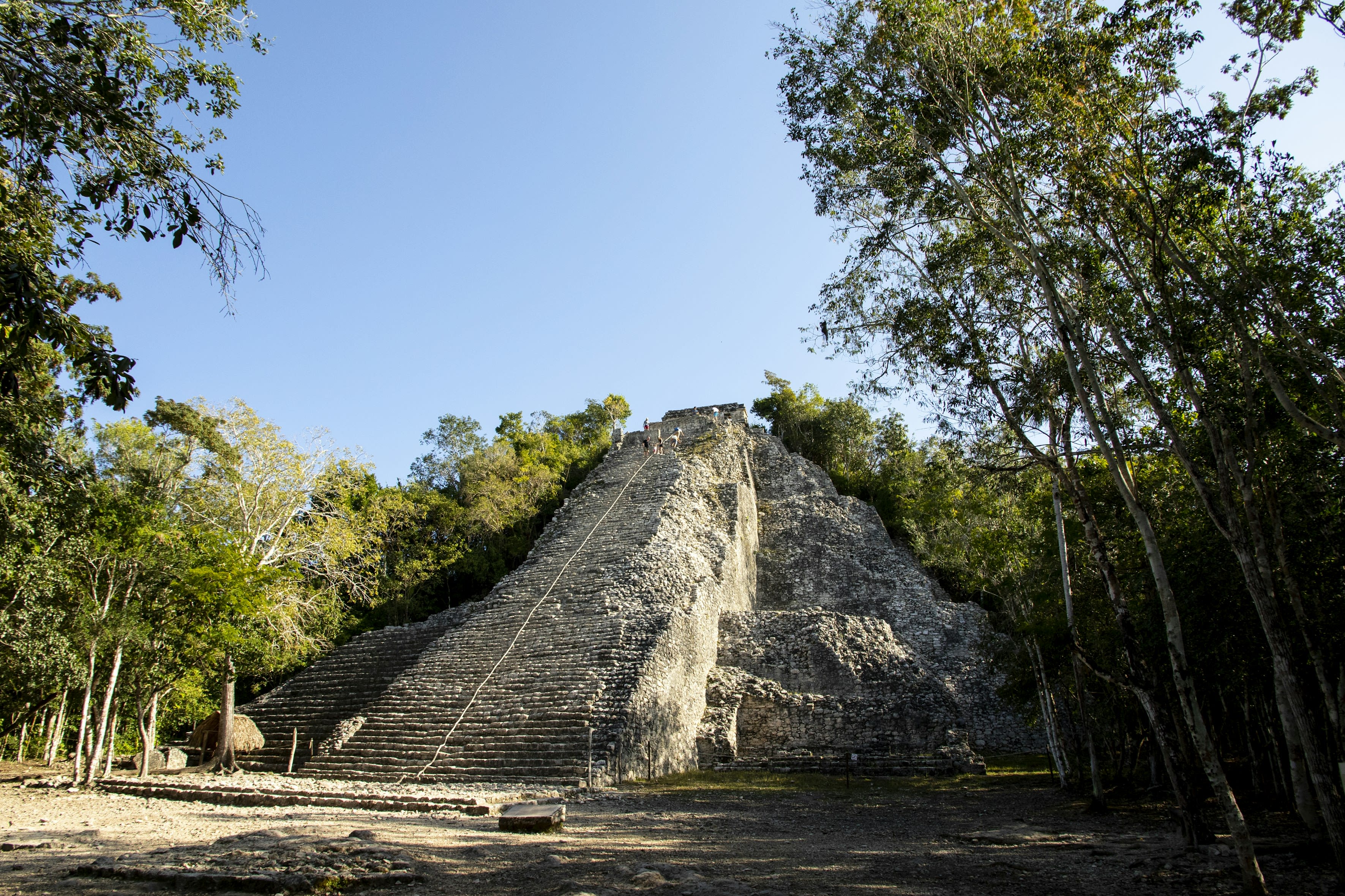
Coba
Cobá, Quintana Roo, Mexico
Coba is a ancient city of sacred significance. Approximate coordinates: 20.48668, -87.73836. Attributes: built, cultural, archaeological, ceremonial. Tradition: Maya. Mythological context: Mesoamerican. Coba (Spanish: Cobá) is an ancient Maya city on the Yucatán Peninsula, located in the Mexican state of Quintana Roo. The site is the nexus of the largest network of stone causeways of the ancient Maya world, and it contains many engraved and sculpted stelae that document ceremonial life and important events of the Late Classic Period (AD 600–900) of Mesoamerican civilization. The adjacent modern village bearing the same name, reported a population of 1,278 inhabitants in the 2010 Mexican federal census. The ruins of Coba lie 47 km (approx. 29 mi) northwest of Tulum, in the State of Quintana Roo, Mexico. The geographical coordinates of Coba Group (main entrance for tourist area of the archaeological site) are North 19° 29.6’ and West 87° 43.7’. The archaeological zone is reached by a two-kilometer branch from the asphalt road connecting Tulum with Nuevo Xcán (a community of Lázaro Cárdenas, another municipality of Quintana Roo) on the Valladolid to Cancún highway. Coba is located around two lagoons, Lake Coba and Lake Macanxoc. A series of elevated stone and plaster roads radiate from the central site to various smaller sites near and far. These are known by the Maya term sacbe (plural sacbeob) or white road. Some of these causeways go east, and the longest runs over 100 kilometres (62 mi) westward to the site of Yaxuna. The site contains a group of large temple pyramids known as the Nohoch Mul, the tallest of which, Ixmoja, is some 42 metres (138 ft) in height. Ixmoja is among the tallest pyramids on the Yucatán peninsula, exceeded by Calakmul at 45 metres (148 ft). Coba was estimated to have had some 50,000 inhabitants (and possibly significantly more) at its peak of civilization, and the built up area extends over some 80 km2. The site was occupied by a sizable agricultural population by the first century. The bulk of Coba s major construction seems to have been made in the middle and late Classic period, about 500 to 900 AD, with most of the dated hieroglyphic inscriptions from the 7th century (see Mesoamerican Long Count calendar). However, Coba remained an important site in the Post-Classic era and new temples were built and old ones kept in repair until at least the 14th century, possibly as late as the arrival of the Spanish. Cobá lies in the tropics, subject to alternating wet and dry seasons which, on average, differ somewhat from those in the rest of the northern peninsula, where the rainy season generally runs from June through October and the dry season from November through May. At Cobá, rain can occur in almost any time of the year, but there is a short dry period in February and March, and a concentration of rain from September through November. Located in Tulum, Quintana Roo, Mexico.
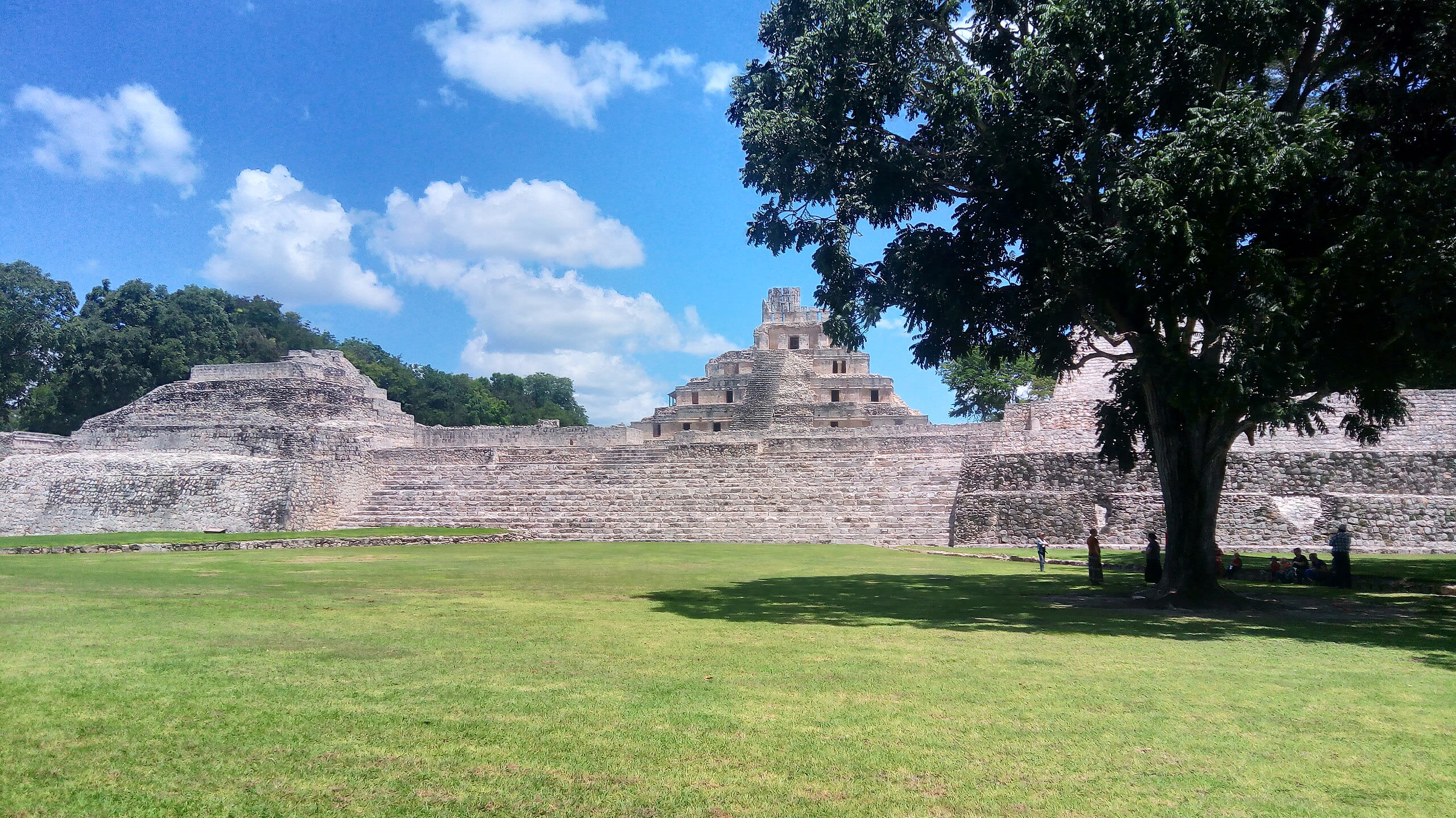
Edzna Archaeological Zone
Municipio de Campeche, Campeche, Mexico
Edzna is a archaeological site of sacred significance. Approximate coordinates: 19.59731, -90.22986. Attributes: built, cultural, archaeological, ceremonial. Tradition: Mayan. Mythological context: Mayan. Edzná ( House of the Itzaes ) is a Mayan archaeological site in the north of the Mexican state of Campeche. The site has been open to visitors since the 1970s. The most remarkable building at the site is the main temple located at the plaza. Built on a platform 40 m high, it provides a wide overview of the surroundings. Another significant building located in the plaza is the ball court, composed of two parallel structures. The top rooms of the ball court were possibly used to store images of the gods associated with the events, along with items needed for the games. Edzná was already inhabited by 400 BC, and was abandoned c. 1500 AD. During the time of occupation, a government was set up whose power was legitimized by the relationship between governors and the deities. In the Late Classic period, Edzná was part of the Calakmul polity. The city may have been inhabited by as early as 600 BC, but it took until 200 AD before it developed into a major city. The architectural style of this site shows signs of the Puuc style, although it is far from the Puuc Hills sites. The decline and eventual abandonment of Edzná remains a mystery today. Edzná was discovered in 1907, and the first organized excavations began in 1958. In 1986, coordinating agencies began to employ Guatemalan refugees in the excavation, restoration, and maintenance at Edzná. This project was funded by various international organizations. Located in Campeche, Mexico.
Kabah Archaeological Zone
Santa Elena, Yucatán, Mexico
Kabah is a maya civilization city of sacred significance. Approximate coordinates: 20.24996, -89.65050. Attributes: built, cultural, archaeological, ceremonial. Tradition: Maya. Kabah may refer to: Kabah (Maya site), a Maya civilization city in Yucatán, Mexico Kaaba, the holy building in Mecca, Saudi Arabia Kabah (band), a Mexican pop music group Located in Yucatán, Mexico.
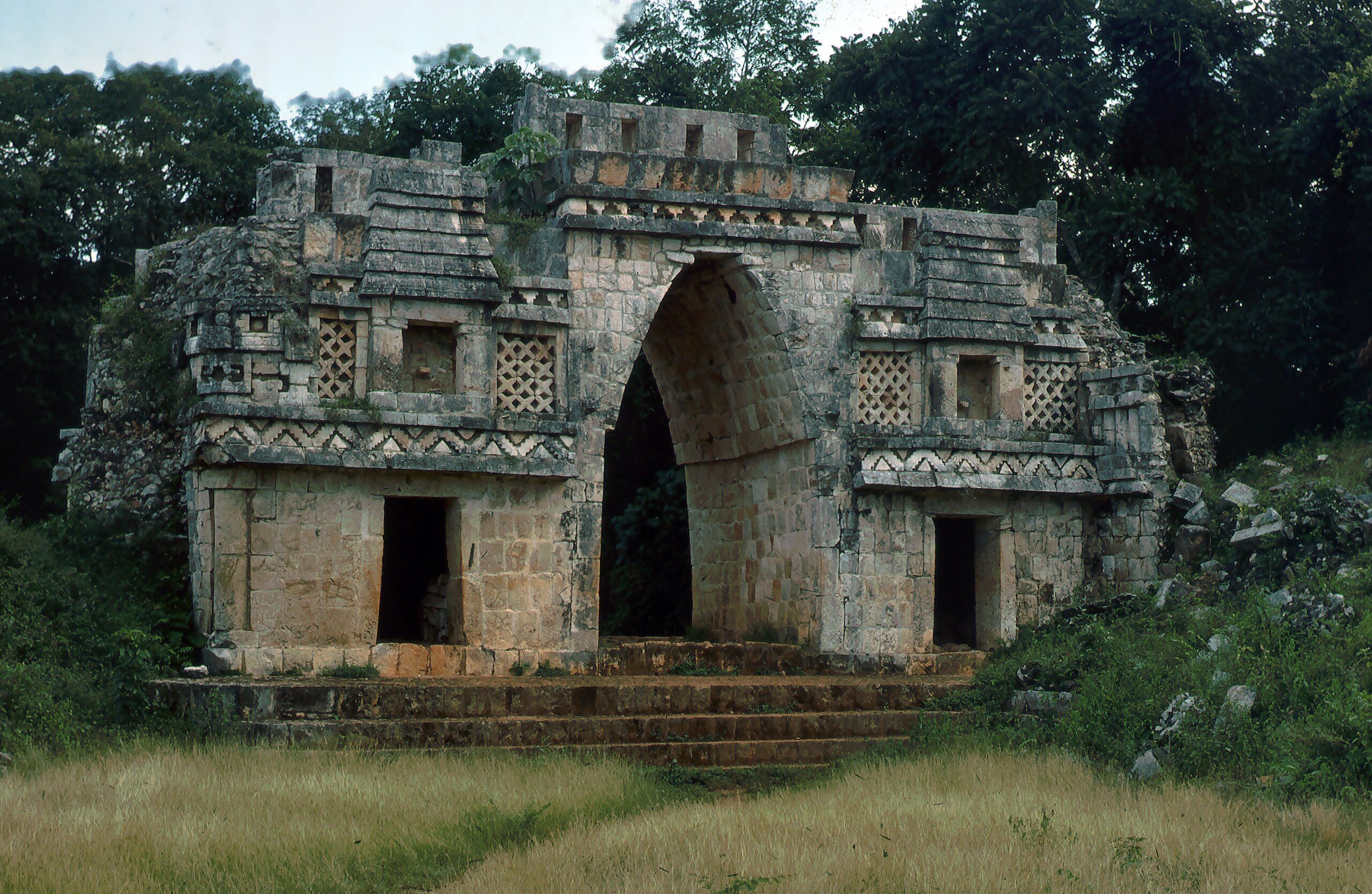
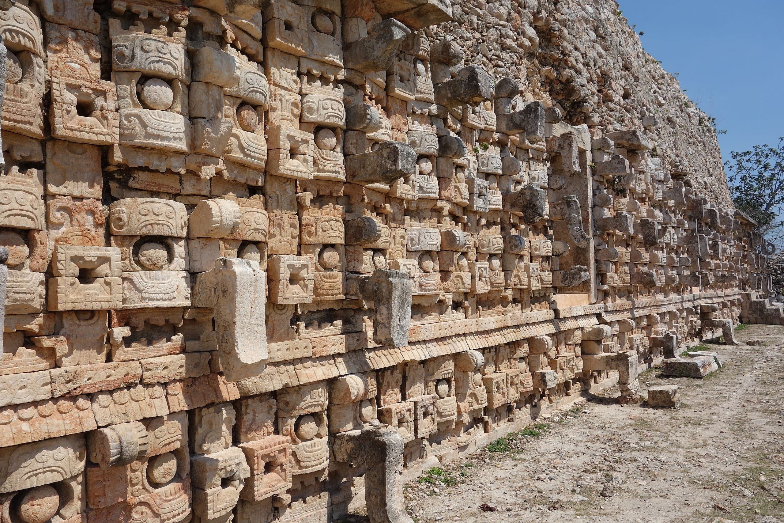
Labna
Santa Elena, Yucatán, Mexico
Labna is a mesoamerican archaeological site of sacred significance. Approximate coordinates: 20.17352, -89.57849. Attributes: built, cultural, archaeological, ceremonial. Tradition: Maya civilization. Recognized as a UNESCO World Heritage Site. Labna (or Labná in Spanish orthography) is a Mesoamerican archaeological site and ceremonial center of the pre-Columbian Maya civilization, located in the Puuc Hills region of the Yucatán Peninsula. It is situated to the south of the large Maya site of Uxmal, in the southwest of the present-day state of Yucatán, Mexico. Labna, Sayil and Kabah were incorporated with Uxmal as a UNESCO World Heritage Site in 1996. Located in Yucatán, Mexico.
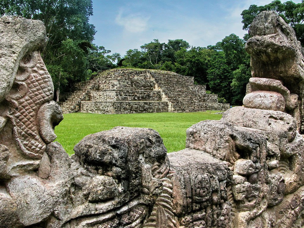
Maya Site of Copan
Copán Ruinas, Copán, Honduras
Copan is a archaeological site of sacred significance. Approximate coordinates: 14.83726, -89.14149. Attributes: built, cultural, archaeological, ceremonial. Tradition: Maya. Recognized as a UNESCO World Heritage Site. Located in Copán Ruinas, Copán, Honduras.
Museum of the Mayan Village at Dzibilchaltun
Mérida, Yucatán, Mexico
Dzibilchaltun is a archaeological site of sacred significance. Approximate coordinates: 21.09427, -89.59642. Attributes: built, cultural, archaeological. Tradition: Maya. Dzibilchaltún (Yucatec Maya: Ts íibil Cháaltun, [d̥z̥ʼiː˧˥biɭ tɕʰɒːl˦˥tuŋ]) is a Maya archaeological site in the Mexican state of Yucatán, approximately 10 miles (16 km) north of the state capital of Mérida. The original name for the site may have been Ch iy Chan Ti Ho. Located in Mérida, Yucatán, Mexico.
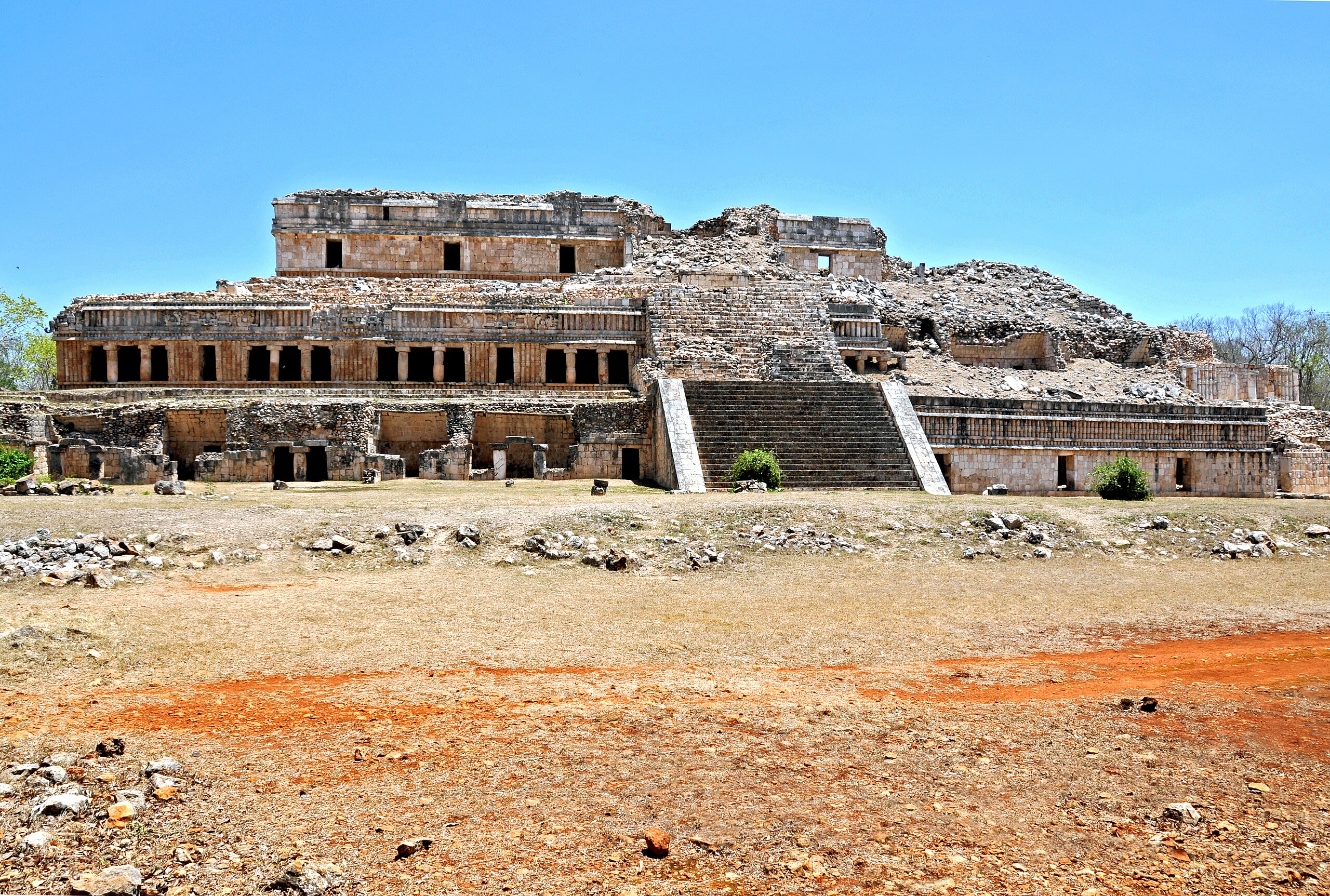
Sayil Archaeological Zone
Santa Elena, Yucatán, Mexico
Sayil is a site of sacred significance. Approximate coordinates: 20.17457, -89.65187. Sayil was a pre-Columbian city built by the Maya people of the Terminal Classic period. It is located in the Mexican state of Yucatán, in the southwest of the state, south of Uxmal. Sayil, Kabah and Labna were incorporated together with Uxmal as a UNESCO World Heritage Site in 1996. Sayil flourished principally, albeit briefly, in the Terminal Classic period. The city reached its greatest extent c. 900 and had a population of 10,000 with an additional 5,000–7,000 living in the surrounding area. A number of badly damaged monuments suggest that Sayil was governed by a local royal dynasty, with wealth among lineages based, at least in part, upon control of the best agricultural lands. The ruins of Sayil include a prominent example of monumental Puuc style architecture, the partially ruined Grand Palace of Sayil. Located in Yucatán, Mexico.
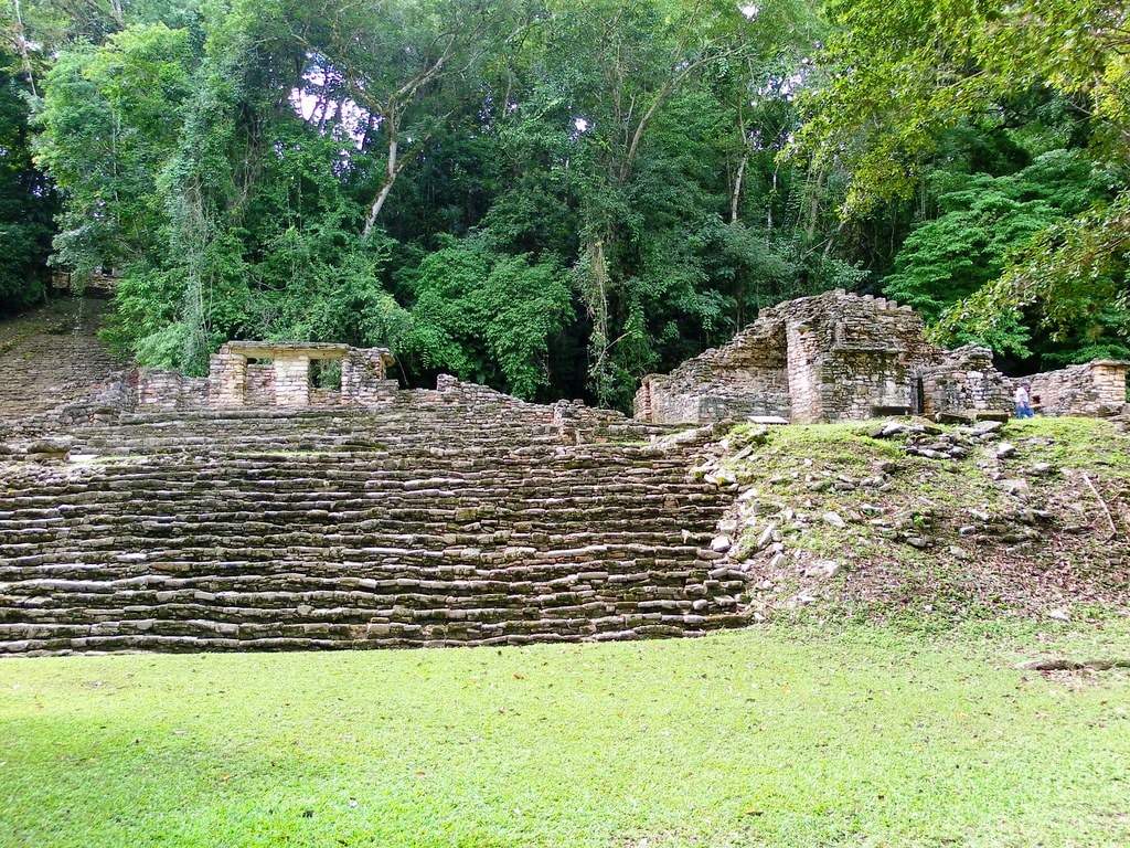
Yaxchilan Archaeological Zone
Ocosingo, Chiapas, Mexico
Yaxchilan is a site of sacred significance. Approximate coordinates: 16.90016, -90.96714. Yaxchilan (pronounced [ʝaʃtʃiˈlan]) is an ancient Maya city located on the bank of the Usumacinta River in the state of Chiapas, Mexico. In the Late Classic Period Yaxchilan was one of the most powerful Maya states along the course of the Usumacinta River, with Piedras Negras as its major rival. Architectural styles in subordinate sites in the Usumacinta region demonstrate clear differences that mark a clear boundary between the two kingdoms. Yaxchilan was a large center, important throughout the Classic era, and the dominant power of the Usumacinta River area. It dominated such smaller sites as Bonampak, and had a long rivalry with Piedras Negras and at least for a time with Tikal; it was a rival of Palenque, with which Yaxchilan warred in 654. The site is particularly known for its well-preserved sculptured stone lintels set above the doorways of the main structures. These lintels, together with the stelae erected before the major buildings, contain hieroglyphic texts describing the dynastic history of the city. Located in Chiapas, Mexico.