Site type guide
Megalithic
Crawlable taxonomy page generated from the current site detail schema and used in the internal linking graph.
Traditions represented here
27 sites
Browse this type across countries, traditions, and sacred landscapes.
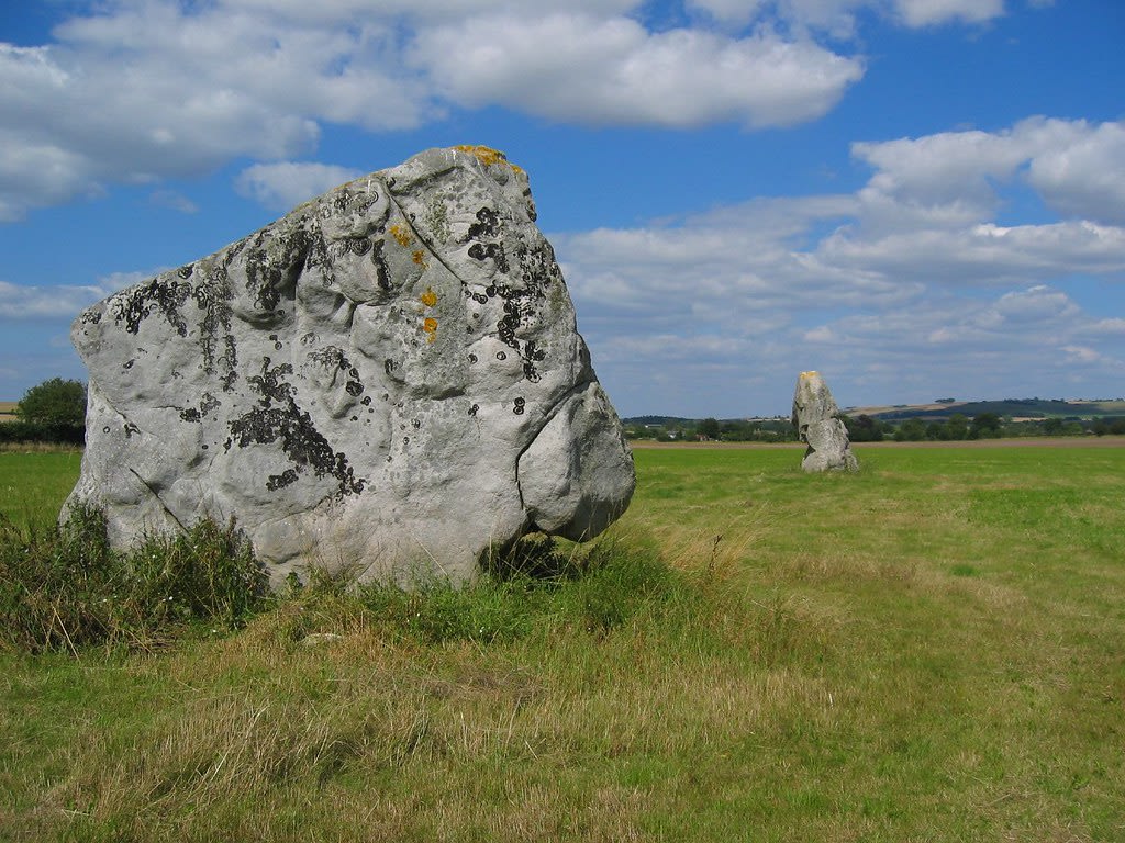
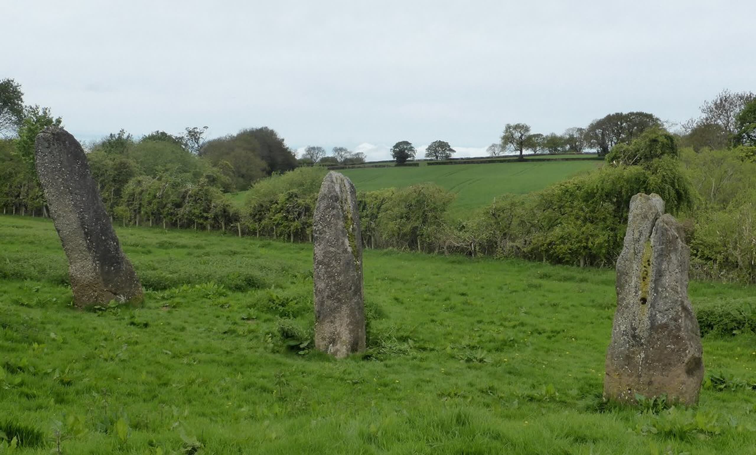
Adam and Eve Stones, Avebury
Beckhampton, England, United Kingdom
Adam and Eve Stones, Avebury is a megalithic monument of sacred significance. Approximate coordinates: 51.42282, -1.87328. Attributes: built, cultural, archaeological.
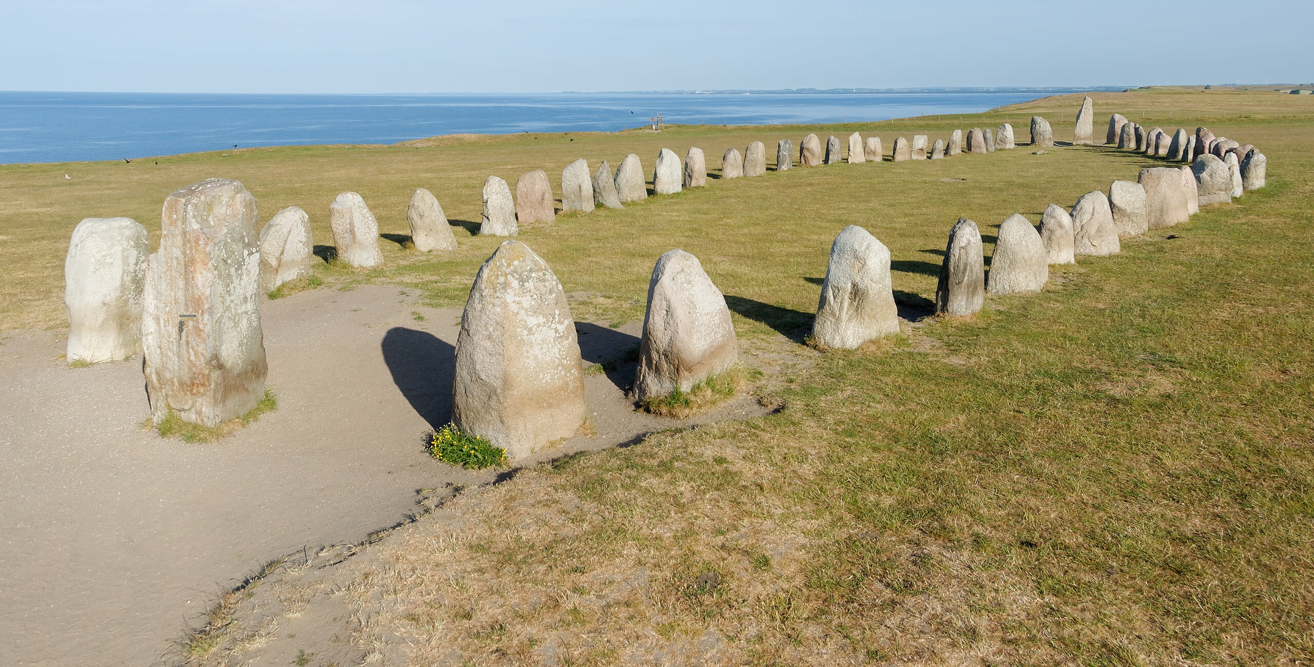
Ale's Stones (Ales Stenar)
Ystads kommun, Skåne län, Sweden
Ales Stenar is a megalithic monument of sacred significance. Approximate coordinates: 55.38247, 14.05474. Attributes: built, cultural, archaeological. Located in Ystads kommun, Skåne län, Sweden.

Almendres Cromlech
Évora, Évora, Portugal
Almendres Cromlech is a megalithic complex of sacred significance. Approximate coordinates: 38.55753, -8.06111. Attributes: built, cultural, archaeological. The Cromlech of the Almendres (Portuguese: Cromeleque dos Almendres/Cromeleque na Herdade dos Almendres) is a megalithic complex (commonly known as the Almendres Cromlech), located 4.5 road km WSW of the village of Nossa Senhora de Guadalupe, in the civil parish of Nossa Senhora da Tourega e Nossa Senhora de Guadalupe, municipality of Évora, in the Portuguese Alentejo. The largest existing group of structured menhirs in the Iberian Peninsula (and one of the largest in Europe), this archaeological site consists of several megalithic structures: cromlechs and menhir stones, that belong to the so-called megalithic universe of Évora , with clear parallels to other cromlechs in Évora District, such as Portela Mogos and the Vale Maria do Meio Cromlech. Located in Évora, Évora, Portugal.

Baltinglass
Baltinglass, The Municipal District of Baltinglass, Ireland
Baltinglass is a megalithic ruins of sacred significance. Approximate coordinates: 52.94704, -6.68322. Attributes: built, cultural, archaeological. Baltinglass, historically known as Baltinglas (Irish: Bealach Conglais, meaning road (or way) of Conglas ), is a town in south-west County Wicklow, Ireland. It is located on the River Slaney near the border with County Carlow and County Kildare, on the N81 road. The town is in a civil parish of the same name. Located in The Municipal District of Baltinglass, Éire / Ireland.

Beinan megalithic site, Nanwang, Beinan
Taitung City, 臺東縣, Taiwan
Beinan megalithic site, Nanwang, Beinan is a megalithic site of sacred significance. Approximate coordinates: 22.79147, 121.11982. Attributes: built, cultural, archaeological. Located in 臺東市, 臺東縣, 臺灣.

Beinan megalithic site, Taitung
Taitung City, 臺東縣, Taiwan
Beinan megalithic site, Taitung is a megalithic of sacred significance. Approximate coordinates: 22.79147, 121.11982. Attributes: built, cultural, archaeological. Located in 臺東市, 臺東縣, 臺灣.
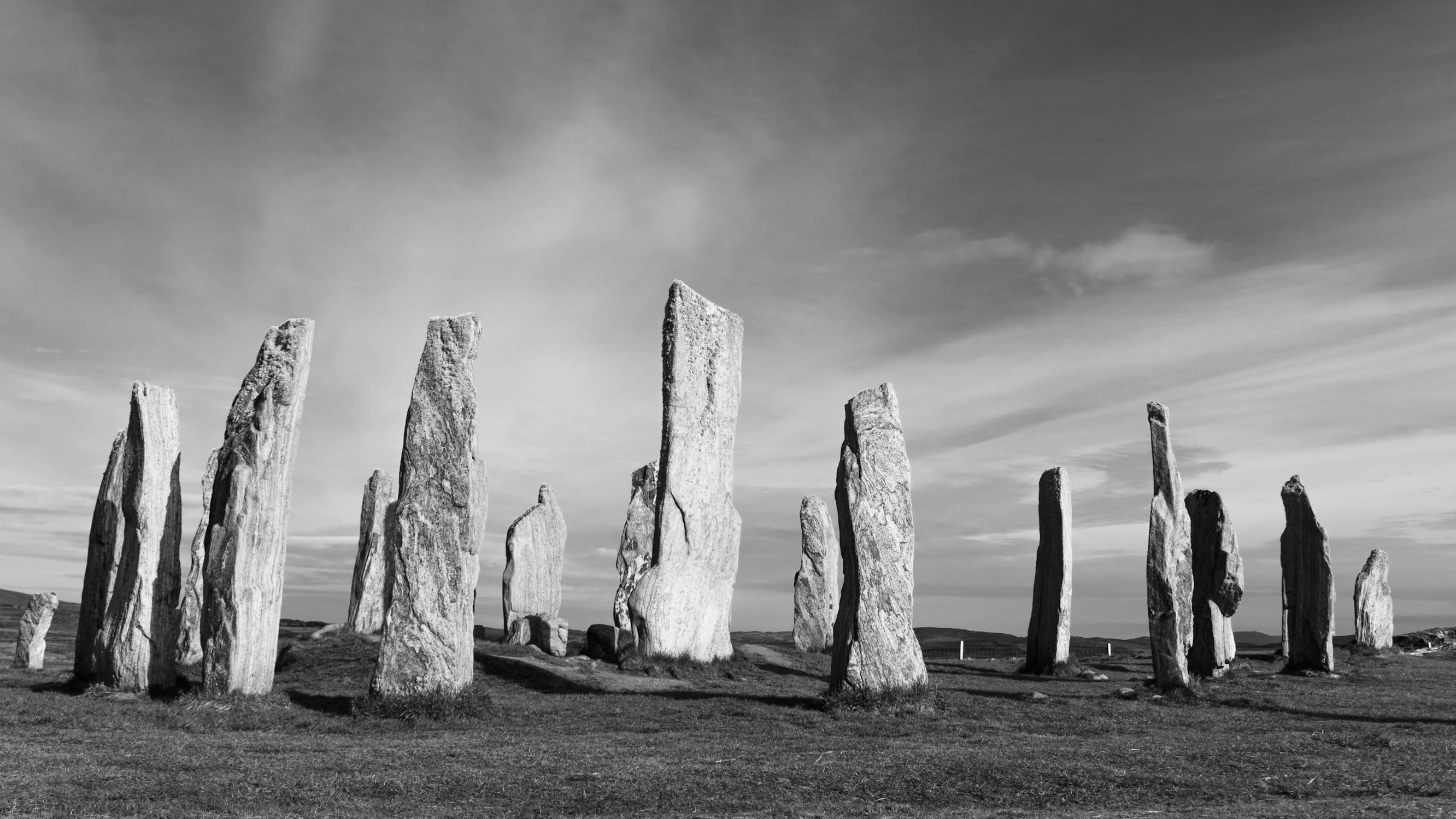
Callanish
Callanish, Isle of Lewis, United Kingdom
Callanish is a megalithic monument of sacred significance. Approximate coordinates: 58.19752, -6.74518. Attributes: built, cultural, archaeological. Calanais (English: Callanish) is a village (township) on the west side of the Isle of Lewis, in the Outer Hebrides (Western Isles), Scotland. Calanais is within the parish of Uig. A linear settlement with a jetty, it is on a headland jutting into Loch Roag, a sea loch 13 miles (21 kilometres) west of Stornoway. Calanais is situated alongside the A858, between Breasclete and Garynahine. The Calanais Stones Calanais I , a cross-shaped setting of standing stones erected around 3000 BC, are one of the most spectacular megalithic monuments in Scotland. A modern visitor centre provides information about the main circle and other lesser monuments nearby, numbered as Calanais II to X. Located in Alba / Scotland, United Kingdom.
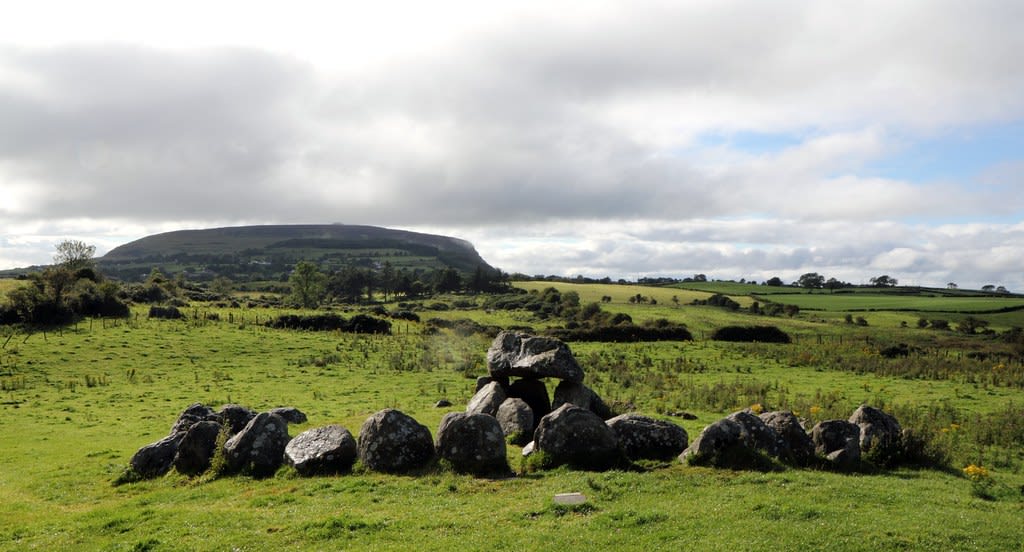
Carrowkeel
County Sligo, Ballymote-Tubbercurry Municipal District, Ireland
Carrowkeel is a megalithic site of sacred significance. Approximate coordinates: 54.05727, -8.37908. Attributes: built, cultural, archaeological. Carrowkeel may refer to the following places in Ireland: Carrowkeel, County Galway, a townland Carrowkeel Megalithic Cemetery, County Sligo Kerrykeel, County Donegal, known as Carrowkeel in census returns, is a village by Mulroy Bay Quigley s Point, sometimes known as Carrowkeel, is a village in County Donegal, north of Derry, on Lough Foyle Located in Ballymote-Tubbercurry Municipal District, Éire / Ireland.
Carrowmore
County Sligo, Sligo Municipal Borough District, Ireland
Carrowmore is a megalithic site of sacred significance. Approximate coordinates: 54.25081, -8.51932. Attributes: built, cultural, archaeological, ceremonial. Tradition: Neolithic. Carrowmore (Irish: An Cheathrú Mhór, the great quarter ) is a large group of megalithic monuments on the Coolera Peninsula to the west of Sligo, Ireland. They were built in the 4th millennium BC, during the Neolithic (New Stone Age). There are thirty surviving tombs, making Carrowmore one of the largest clusters of megalithic tombs in Ireland, and one of the big four along with Carrowkeel, Loughcrew and Brú na Bóinne. Carrowmore is the heart of an ancient ritual landscape which is dominated by the mountain of Knocknarea to the west. It is a protected National Monument. Located in Sligo Municipal Borough District, Éire / Ireland.
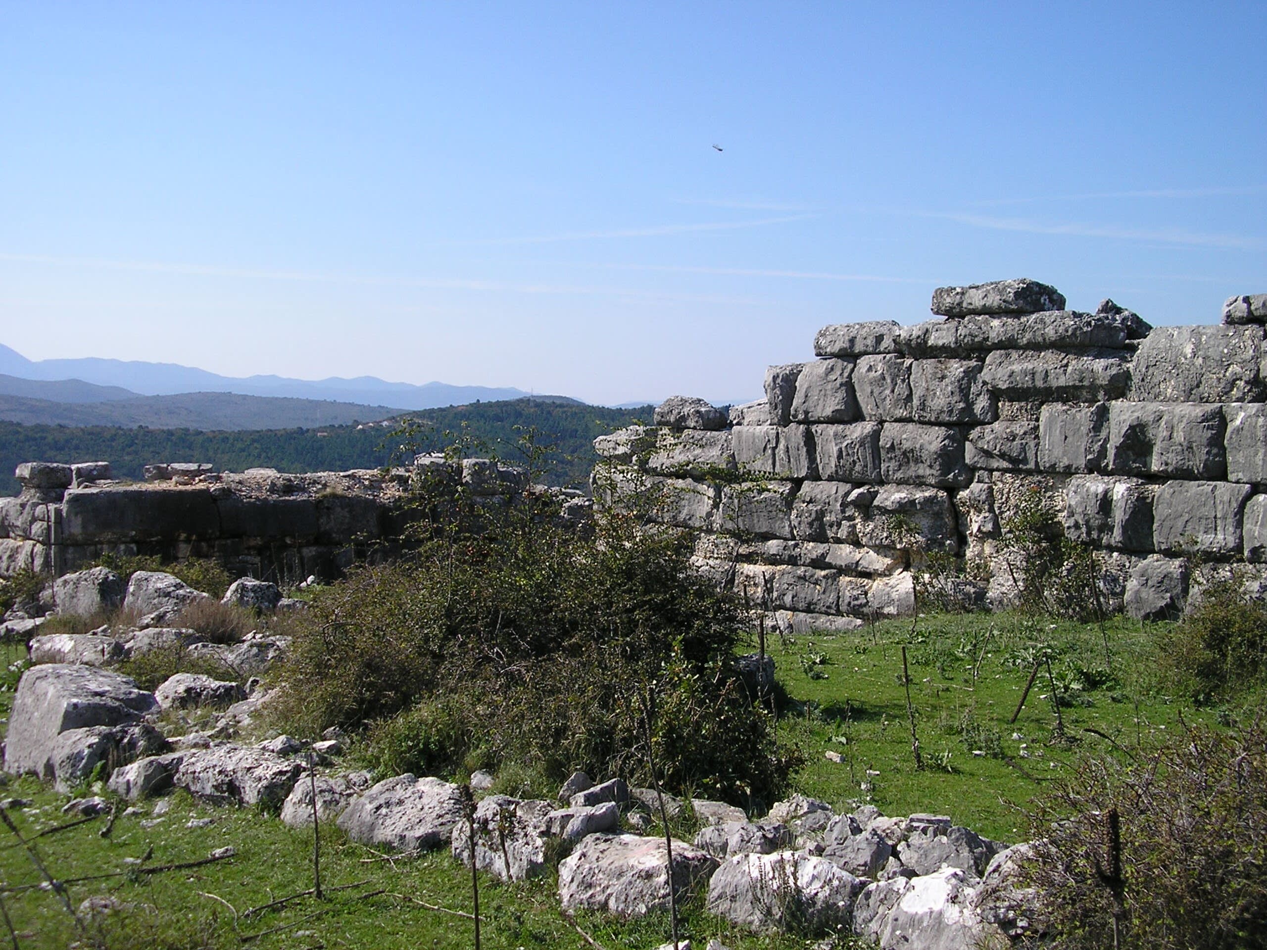
Daorson megalithic site, Bosnia
Poprati, Federation of Bosnia and Herzegovina, Bosnia and Herzegovina
Daorson megalithic site, Bosnia is a megalithic site of sacred significance. Approximate coordinates: 43.10404, 17.92685. Attributes: built, cultural, archaeological. Located in Federacija Bosne i Hercegovine, Bosna i Hercegovina / Босна и Херцеговина.
Devil’s Quoits
West Oxfordshire, England, United Kingdom
Devil’s Quoits is a megalithic circle of sacred significance. Approximate coordinates: 51.74001, -1.40589. Attributes: built, cultural, archaeological. Located in West Oxfordshire, England, United Kingdom.

Dolni Glavana
Dolni Glavanak, Haskovo, Bulgaria
Dolni Glavana is a megalithic stone ring of sacred significance. Approximate coordinates: 41.68410, 25.83319. Attributes: built, cultural, archaeological. Located in Хасково, Bulgaria.

Dragon House Megalithic site, Mount Ochi, Greece
Karystos Municipality, Thessaly and Central Greece, Greece
Dragon House Megalithic site, Mount Ochi, Greece is a megalithic of sacred significance. Approximate coordinates: 38.05980, 24.46680. Attributes: built, cultural, archaeological. Located in Δήμος Καρύστου, Αποκεντρωμένη Διοίκηση Θεσσαλίας - Στερεάς Ελλάδος, Ελλάς.
Dulan megalithic site, Dulan
Donghe, 臺東縣, Taiwan
Dulan megalithic site, Dulan is a megalithic site of sacred significance. Approximate coordinates: 22.88487, 121.21954. Attributes: built, cultural, archaeological. Located in 東河鄉, 臺東縣, 臺灣.

Emmen
Emmen, Drenthe, Netherlands
Emmen is a megalithic site of sacred significance. Approximate coordinates: 52.79317, 6.88819. Attributes: built, cultural, archaeological. Emmen may refer to: Emmen, Netherlands, a town and municipality in the Province of Drenthe FC Emmen, an association football club Emmen, Overijssel, a hamlet in the municipality of Dalfsen Emmen, Switzerland, a city in the Canton of Lucerne Emmen, Germany, a village in the district Gifhorn, Lower Saxony Located in Emmen, Drenthe, Nederland.
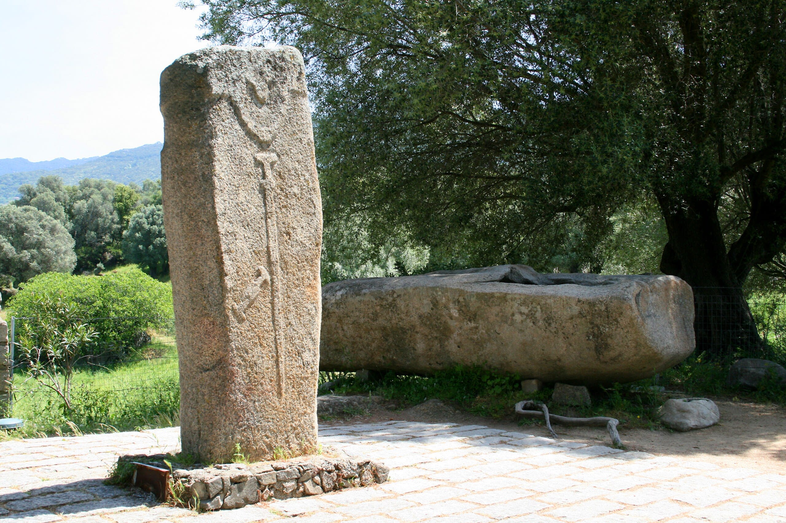
Filitosa
Sollacaro, Corsica, France
Filitosa is a megalithic of sacred significance. Approximate coordinates: 41.74700, 8.87197. Attributes: built, cultural, archaeological. Filitosa is a megalithic site in southern Corsica, France. The period of occupation spans from the end of the Neolithic era and the beginning of the Bronze Age, until around the Roman times in Corsica. Located in Sollacaro, Corse, France.

Gunung Padang megalithic site
Cianjur, West Java, Indonesia
Gunung Padang megalithic site is a megalithic site of sacred significance. Approximate coordinates: -6.99359, 107.05629. Attributes: built, cultural, archaeological. Located in Jawa Barat, Indonesia.
Harold’s Stones
Trellech, Monmouthshire, United Kingdom
Harold’s Stones is a megalithic site of sacred significance. Approximate coordinates: 51.74277, -2.72659. Attributes: cultural, archaeological. Located in Cymru / Wales, United Kingdom.
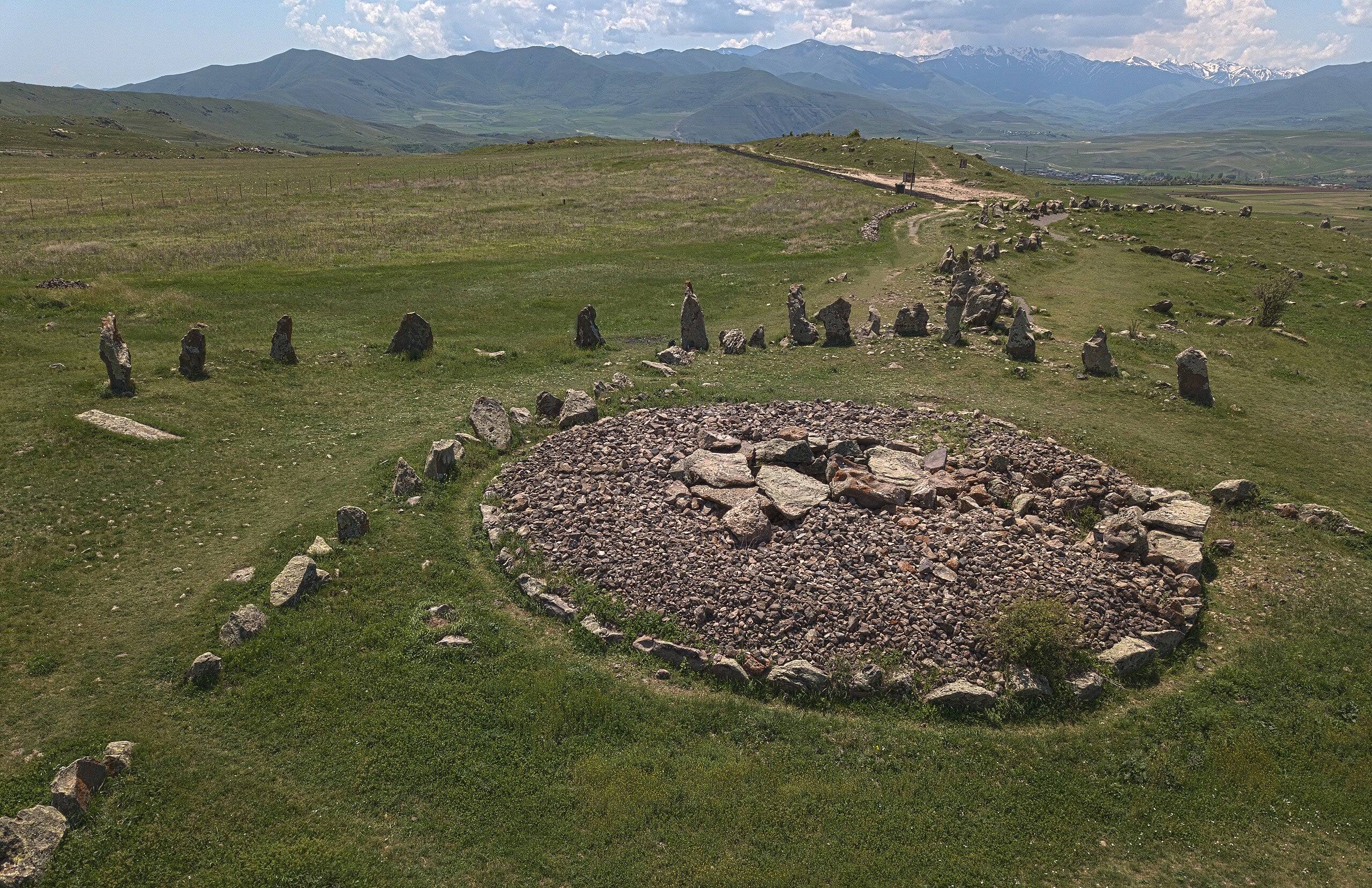
Karahundj
Syunik Province, Armenia
Karahundj is a megalithic site of sacred significance. Approximate coordinates: 39.55173, 46.02873. Attributes: built, cultural, archaeological. Located in Սյունիքի մարզ, Հայաստան.
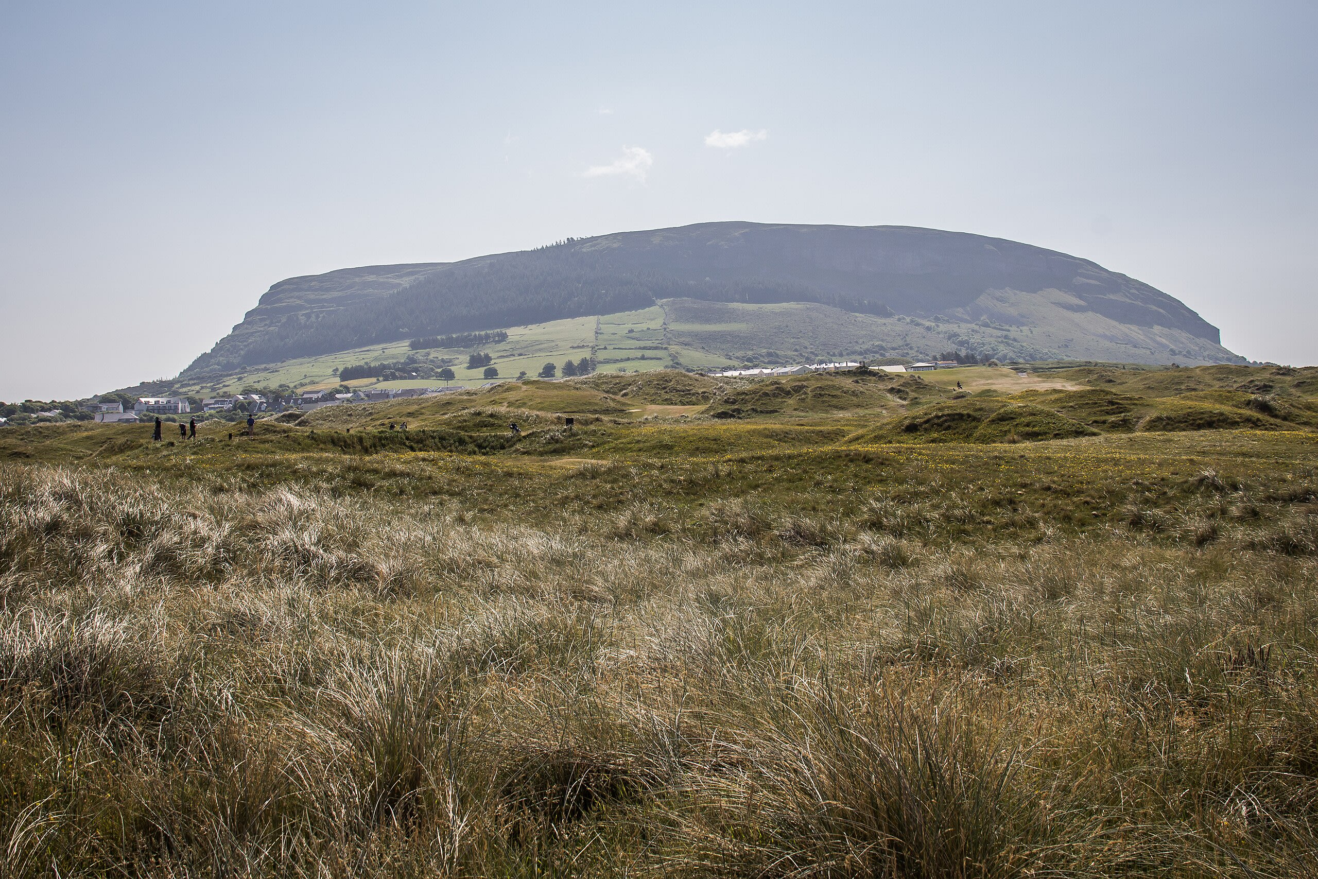
Knocknarea megalthic site, Sligo, Ireland
County Sligo, Sligo Municipal Borough District, Ireland
Knocknarea megalthic site, Sligo, Ireland is a megalithic of sacred significance. Approximate coordinates: 54.25876, -8.57450. Attributes: built, cultural, archaeological. Located in Sligo Municipal Borough District, Éire / Ireland.
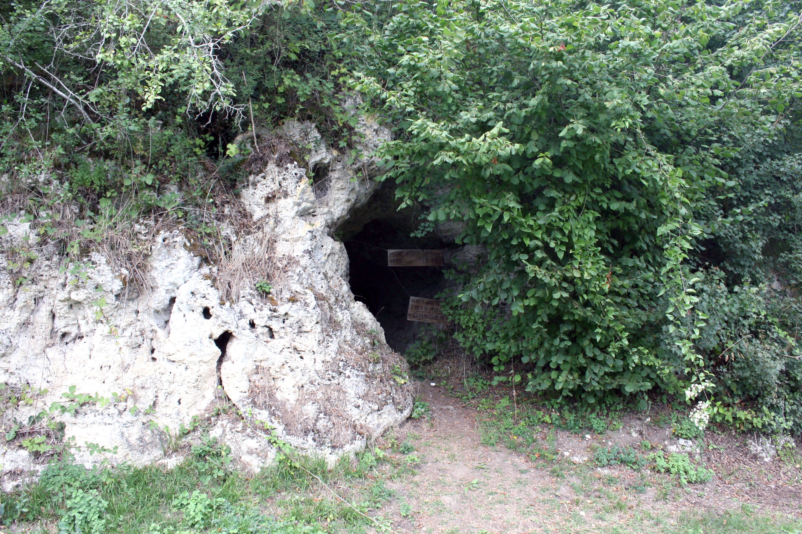
La Grotte des Fées
Châtelperron, Auvergne-Rhône-Alpes, France
La Grotte des Fées is a megalithic of sacred significance. Approximate coordinates: 46.41174, 3.63849. Attributes: natural, cultural, archaeological. La Grotte des Fées is a cave located in Châtelperron, in the central French department of Allier. Located in Châtelperron, Auvergne-Rhône-Alpes, France.
La Roche aux Fées
Essé, Brittany, France
La Roche aux Fées is a megalithic monument of sacred significance. Approximate coordinates: 47.93631, -1.40458. Attributes: built, cultural, archaeological. Tradition: Prehistoric. Mythological context: Fairy folklore. Located in Essé, Bretagne, France.
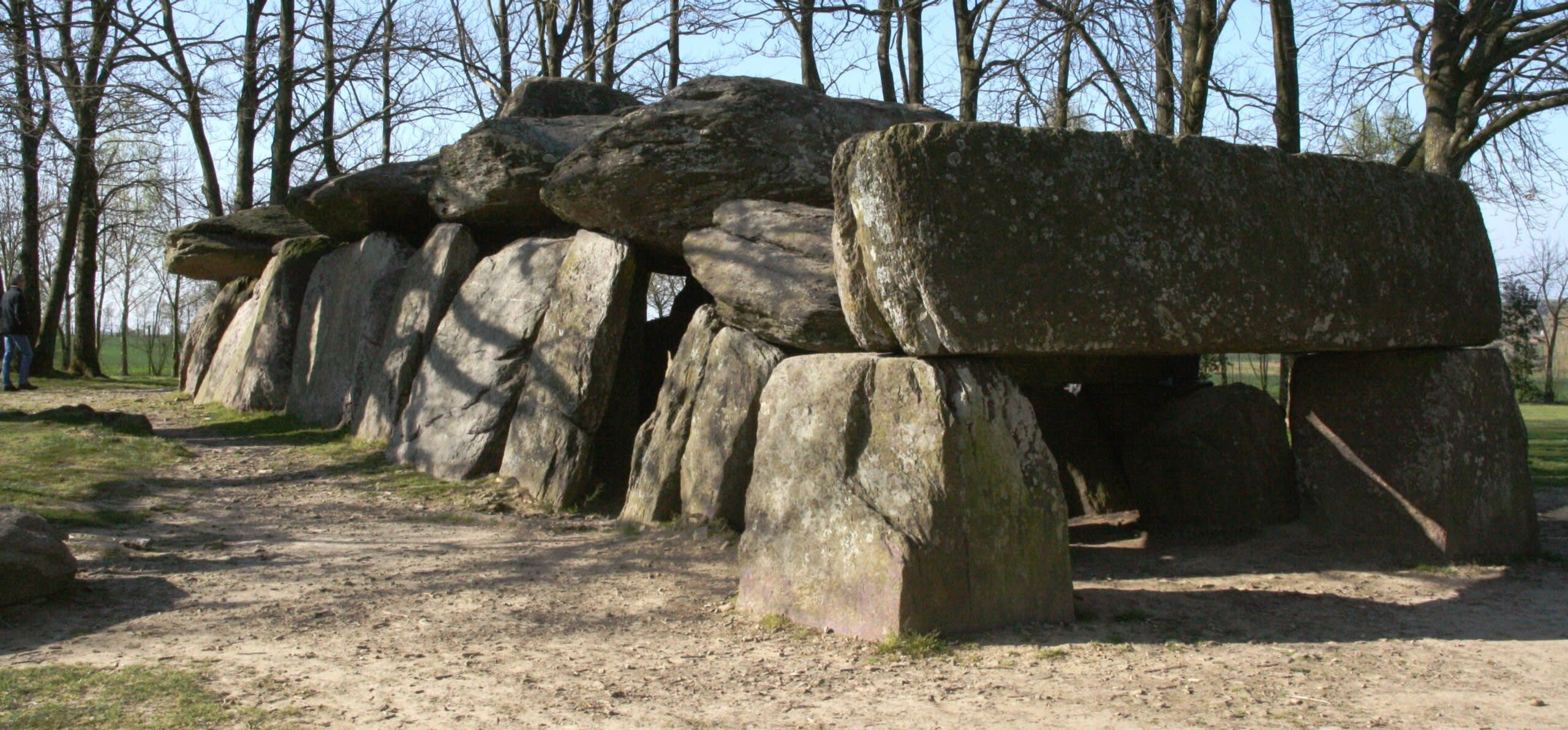
La Table des Marchands, Locmariaquer, France
Locmariaquer, Brittany, France
La Table des Marchands, Locmariaquer, France is a megalithic tomb of sacred significance. Approximate coordinates: 47.57162, -2.94981. Attributes: built, cultural, archaeological. Located in Locmariaquer, Bretagne, France.
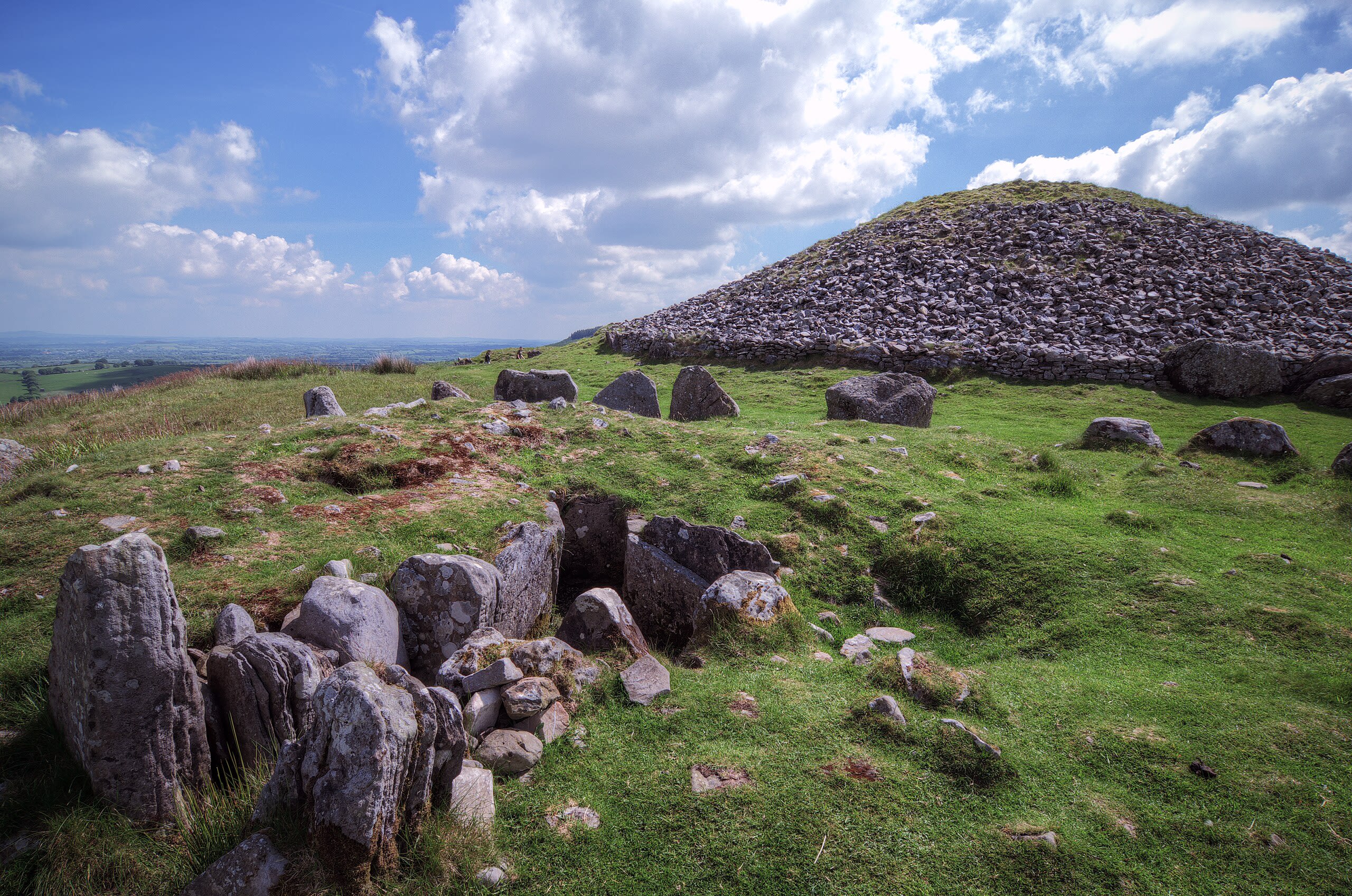
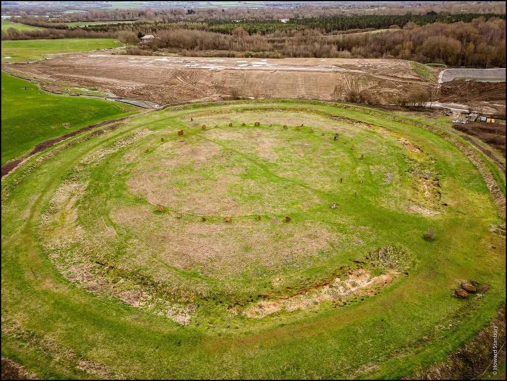
Loughcrew
County Meath, The Municipal District of Kells, Ireland
Loughcrew is a megalithic ruins of sacred significance. Approximate coordinates: 53.74458, -7.11212. Attributes: built, cultural, archaeological. Loughcrew or Lough Crew (Irish: Loch Craobh, meaning lake of the tree ) is an area of historical importance near Oldcastle, County Meath, Ireland. It is home to a group of ancient tombs from the 4th millennium BC, some decorated with rare megalithic art, which sit on top of a range of hills. The hills and tombs are together known as Slieve na Calliagh (Sliabh na Caillí) and are the highest point in Meath. It is one of the four main passage tomb cemeteries in Ireland and is a protected National Monument. The area is also home to the Loughcrew Estate, from which it is named. Located in The Municipal District of Kells, Éire / Ireland.

Malko Tarnovo
Malko Tarnovo, Burgas, Bulgaria
Malko Tarnovo is a megalithic site of sacred significance. Approximate coordinates: 41.97953, 27.52650. Attributes: built, cultural, archaeological. Tradition: Christianity. Malko Tarnovo (Bulgarian: Малко Търново [ˈmaɫko ˈtɤrnovo], Little Tarnovo ; as opposed to Veliko Tarnovo) is a town in Burgas Province, southeastern Bulgaria, 5 km from the Turkish border. It is the only town in the interior of the Bulgarian Strandzha Mountains and lies in Strandzha Nature Park. Malko Tarnovo is the administrative centre of the homonymous Malko Tarnovo Municipality. As of December 2009, the town had 2,449 inhabitants. Christianity is the dominant religion in the town, where an Eastern Orthodox and an Eastern Rite Catholic church exist. According to Lyubomir Miletich s demographic survey of the Ottoman province of Edirne in The Destruction of Thracian Bulgarians in 1913, published in 1918, before the wars Malko Tarnovo was a district centre inhabited by 1,200 Bulgarian Exarchist families and 80 Eastern Catholic Bulgarian families. Before the Balkan Wars (1912–1913), Malko Tarnovo was a township (kaza) of the Kırklareli sanjak in Edirne vilayet as Tırnovacık that was ceded to Bulgaria following the wars. Since 25 October 1913, it has been within the borders of Bulgaria. Located in Бургас, Bulgaria.
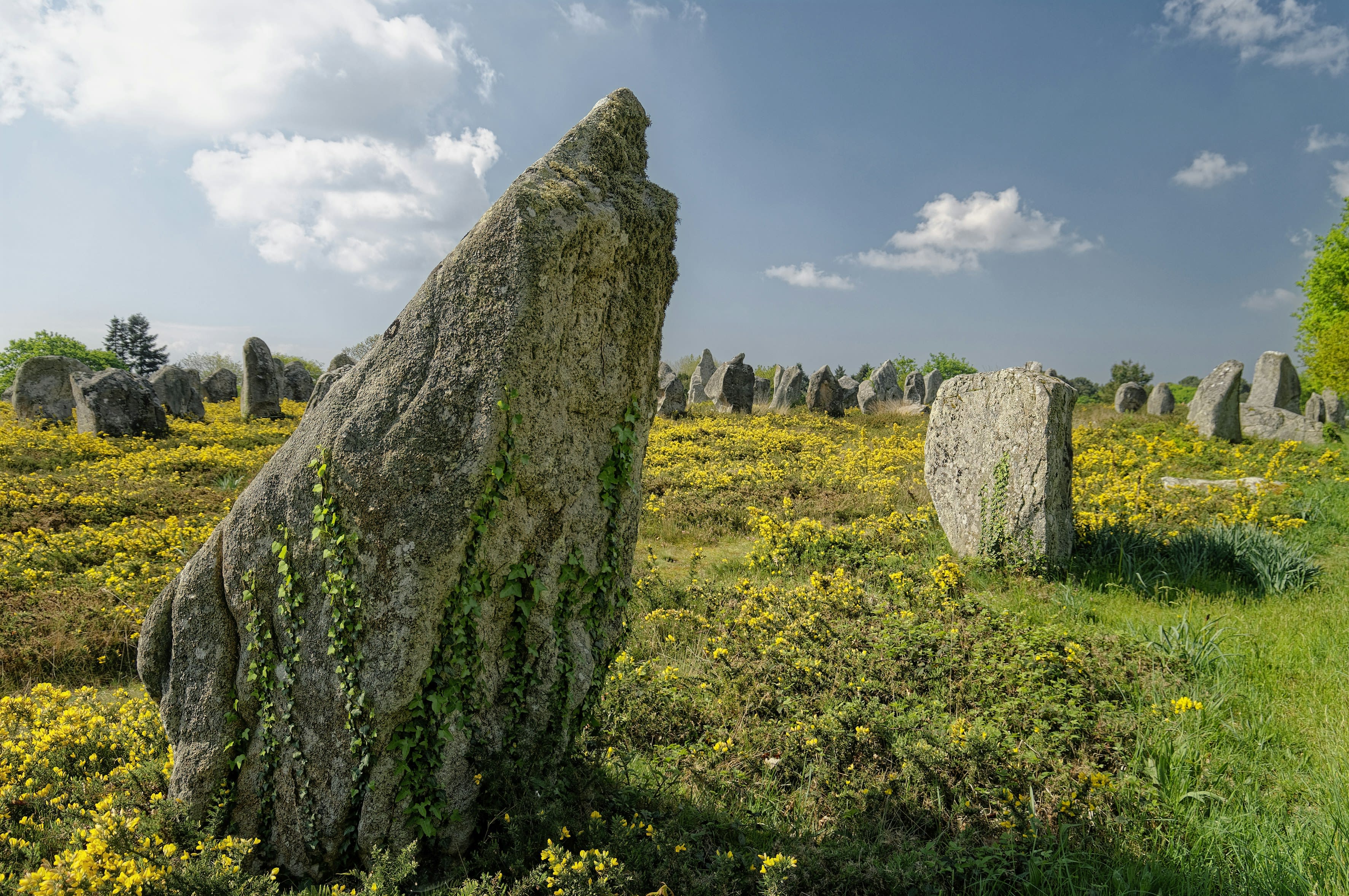
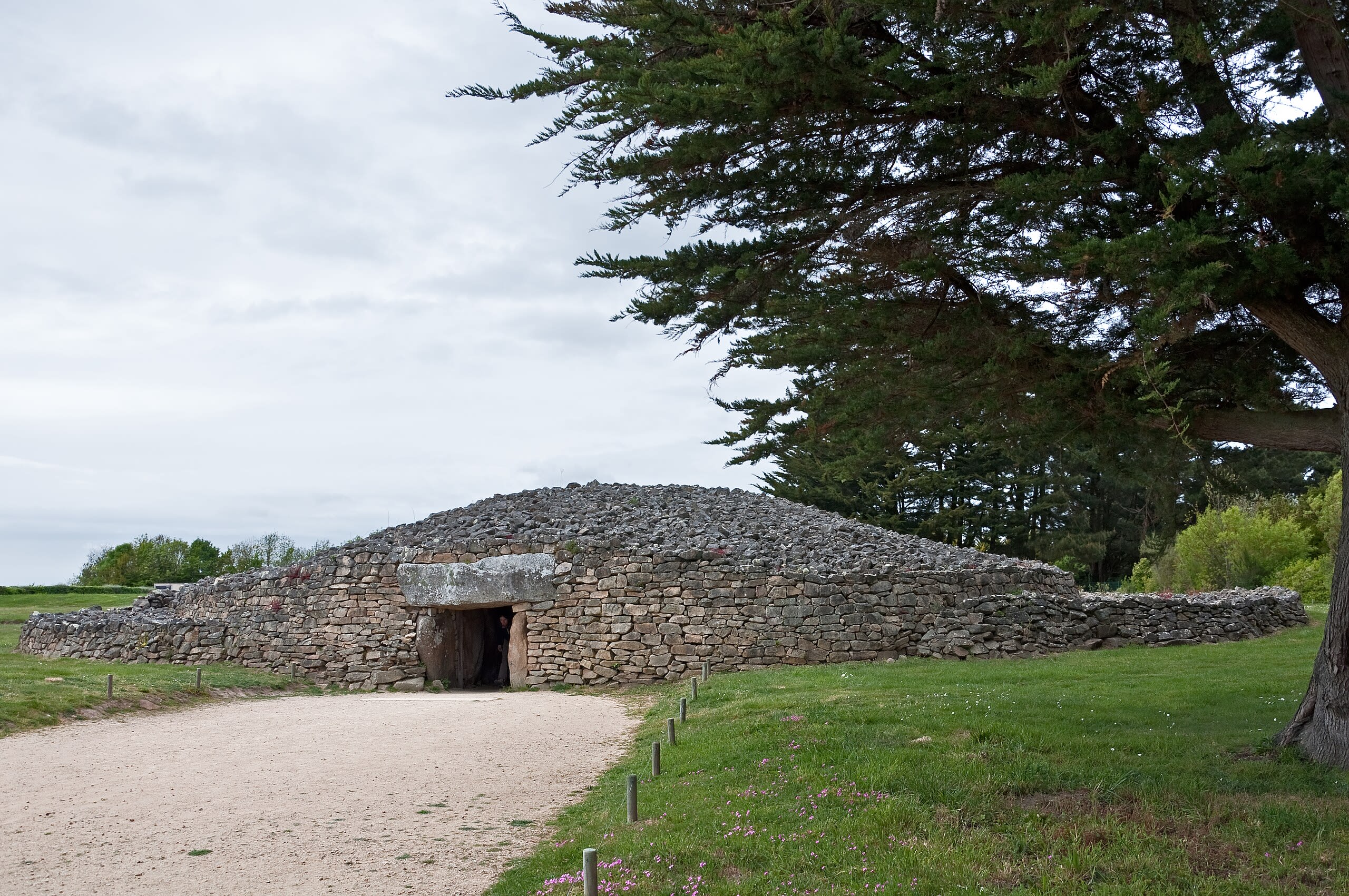
Megaliths of Carnac
Carnac, Brittany, France
Carnac is a megalithic site of sacred significance. Approximate coordinates: 47.59258, -3.08254. Attributes: built, cultural, archaeological. Tradition: Neolithic. Carnac (French pronunciation: [kaʁnak]; Breton: Karnag, pronounced [ˈkaːʁnaɡ]) is a commune beside the Gulf of Morbihan on the south coast of Brittany in the Morbihan department in north-western France. Its inhabitants are called Carnacois in French. Carnac is renowned for the Carnac stones – one of the most extensive Neolithic menhir collections in the world – as well as its beaches, which are popular with tourists. Located on a narrow peninsula halfway between the medieval town Vannes and the seaside resort Quiberon, Carnac is split into two centres: Carnac-Ville and Carnac-Plage (the beachfront). In total there are five beaches, including la Grande Plage, and further to the east, Plage Men Dû and Beaumer. Located in Carnac, Bretagne, France.
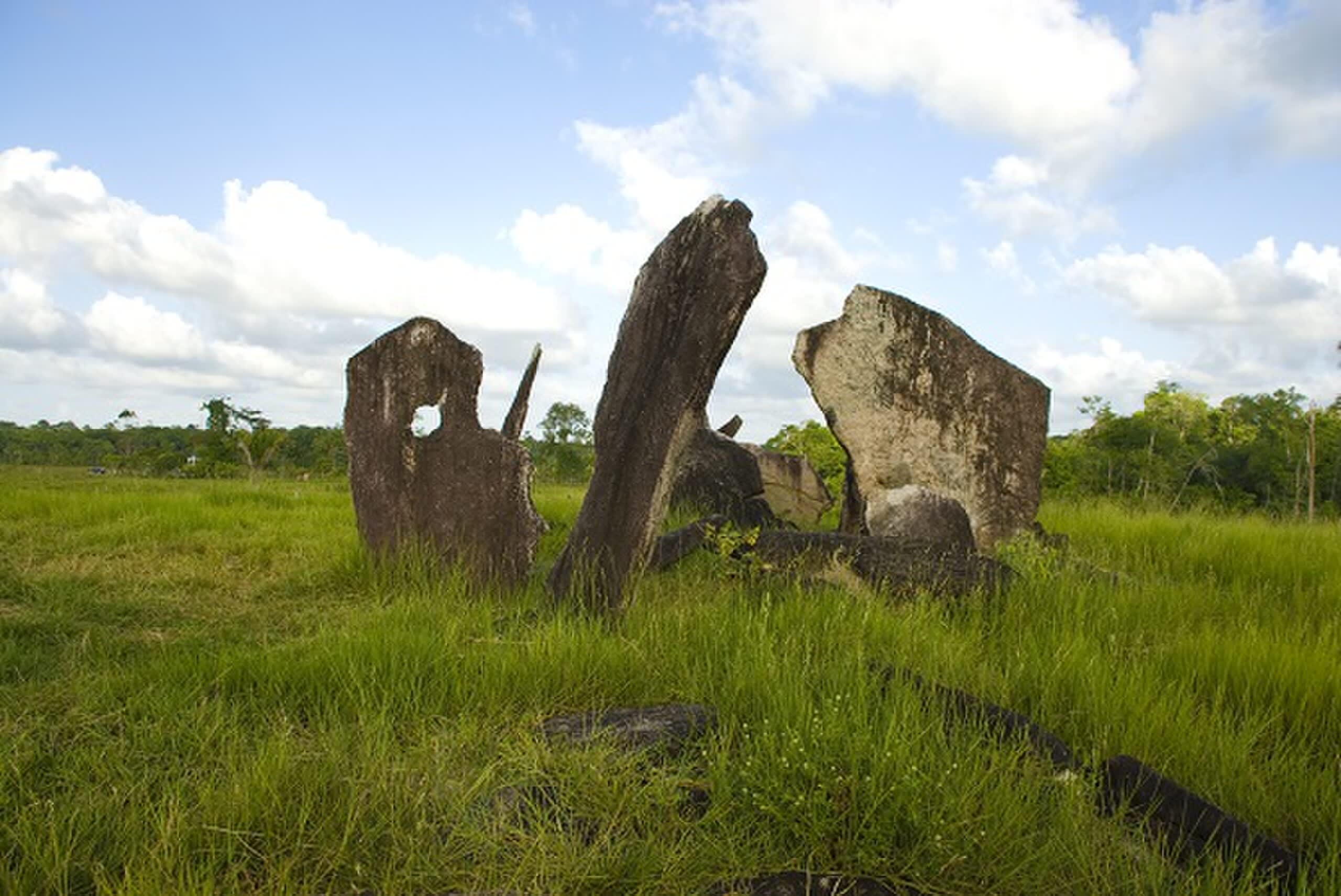
Parque Arqueológico do Solstício
Calçoene, Amapá, Brazil
Parque Arqueológico do Solstício in Calçoene, Amapá, Brazil.