Bulgaria
Burgas
1 site

Malko Tarnovo
Malko Tarnovo (Bulgarian: Малко Търново [ˈmaɫko ˈtɤrnovo], "Little Tarnovo"; as opposed to Veliko Tarnovo) is a town in Burgas Province, southeastern Bulgaria, 5 km from the Turkish border. It is the only town in the interior of the Bulgarian Strandzha Mountains and lies in Strandzha Nature Park. Malko Tarnovo is the administrative centre of the homonymous Malko Tarnovo Municipality. As of December 2009, the town had 2,449 inhabitants. Christianity is the dominant religion in the town, where an Eastern Orthodox and an Eastern Rite Catholic church exist. According to Lyubomir Miletich's demographic survey of the Ottoman province of Edirne in The Destruction of Thracian Bulgarians in 1913, published in 1918, before the wars Malko Tarnovo was a district centre inhabited by 1,200 Bulgarian Exarchist families and 80 Eastern Catholic Bulgarian families. Before the Balkan Wars (1912–1913), Malko Tarnovo was a township (kaza) of the Kırklareli sanjak in Edirne vilayet as "Tırnovacık" that was ceded to Bulgaria following the wars. Since 25 October 1913, it has been within the borders of Bulgaria.
Haskovo
2 sites

Dolni Glavana
Dolni Glavana is a megalithic stone ring of sacred significance. Approximate coordinates: 41.68410, 25.83319. Attributes: built, cultural, archaeological. Located in Хасково, Bulgaria.
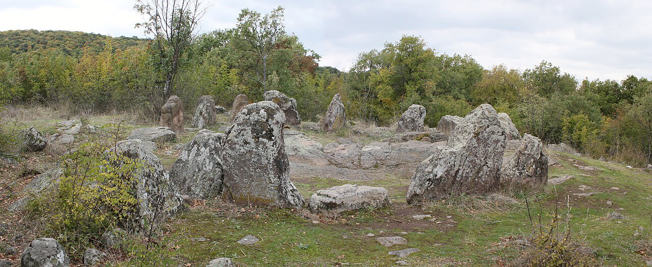
Dolni Glavanak Cromlech
Dolni Glavanak Cromlech in Dolni Glavanak, Haskovo, Bulgaria.
Kardzhali
1 site
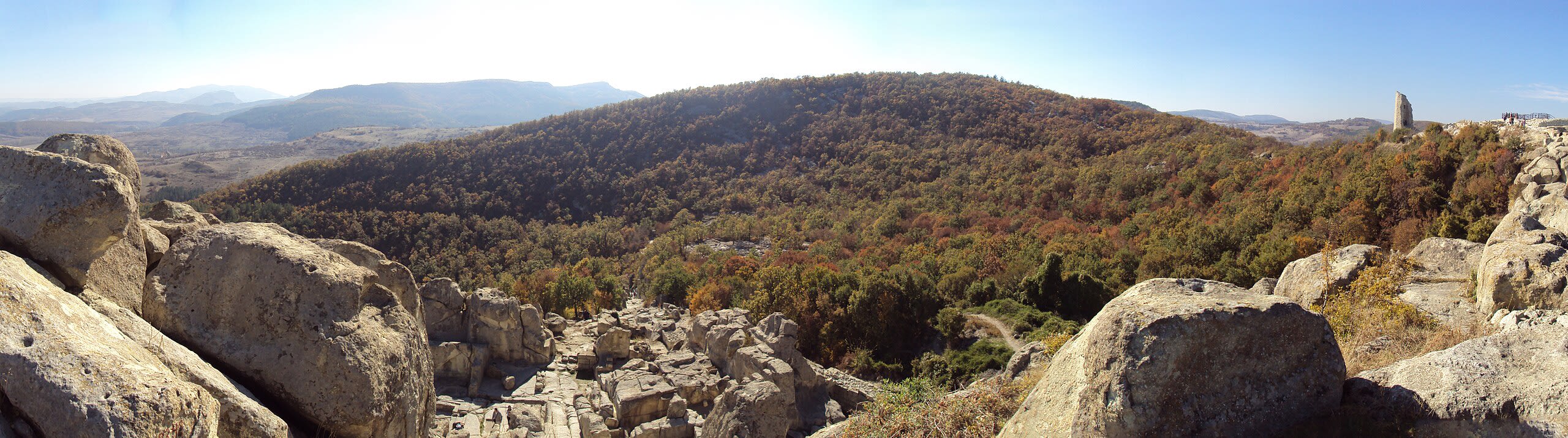
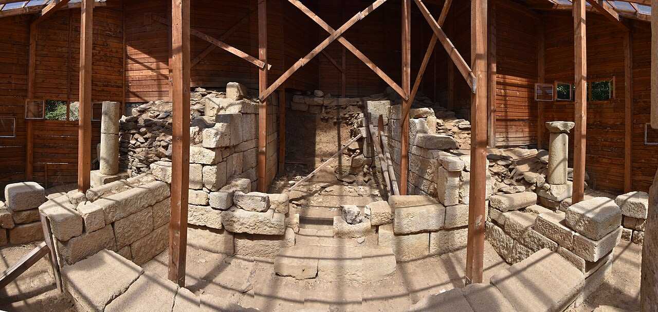
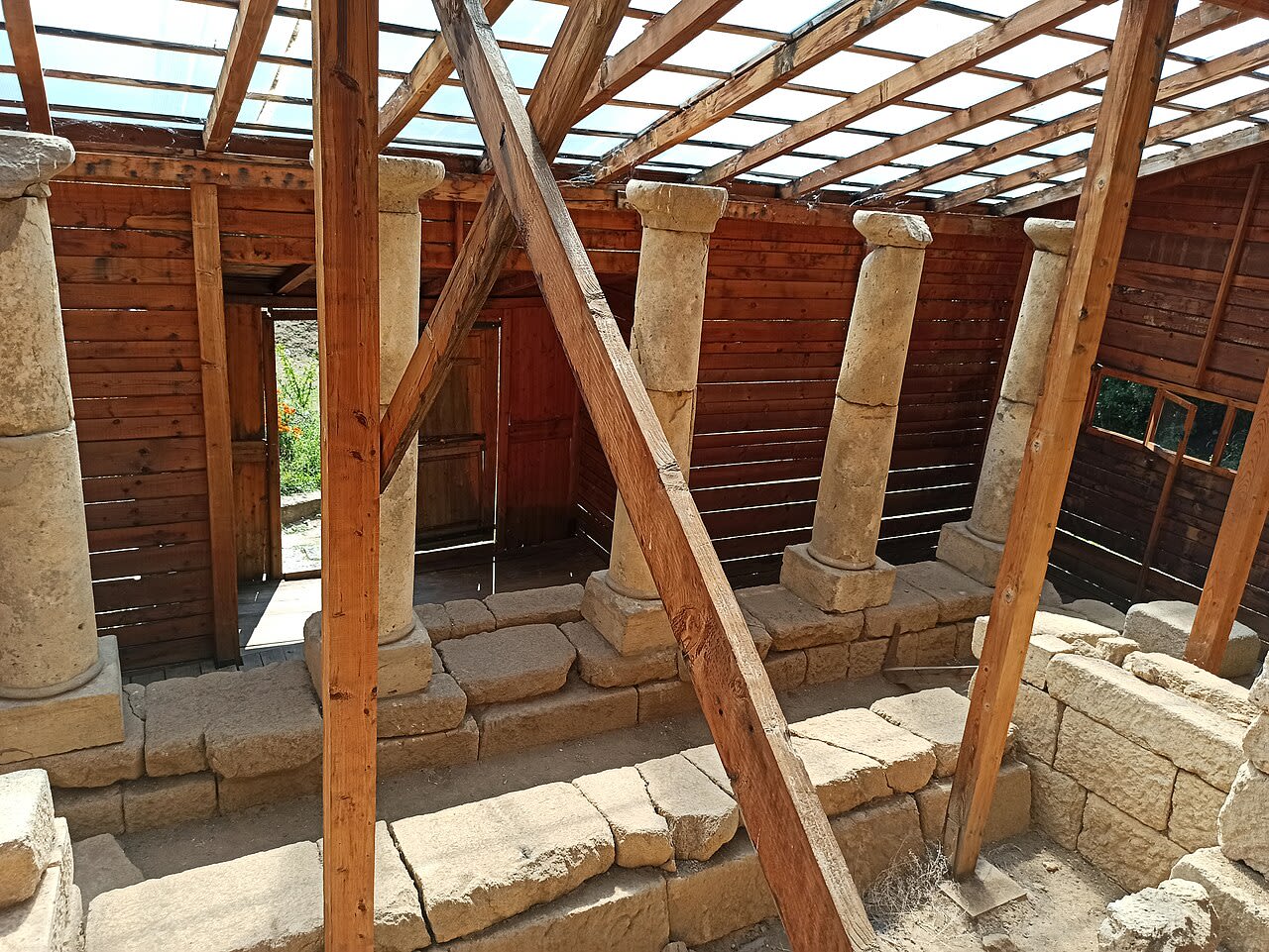
Perperikon
Perperikon (Bulgarian: Перперикон), also Perpericum, is an ancient Thracian city located in the Eastern Rhodope Mountains, 15 km northeast of the present-day town of Kardzhali, Bulgaria on a 470 m high rocky hill, which is thought to have been a sacred place. The village of Gorna krepost ("Upper Fortress") is located at the foot of the hill and the gold-bearing Perpereshka River flows nearby. Perperikon is the largest megalith ensemble site in the Balkans. In the Middle Ages Perperikon served as a fortress.
Kyustendil
1 site
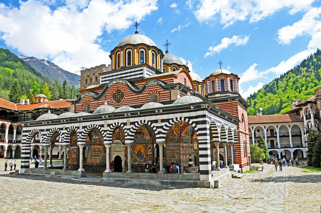
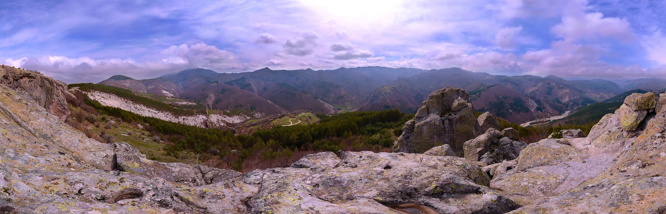
Rila
Rila (Bulgarian: Рила, pronounced [ˈriɫɐ]) is the highest mountain range of Bulgaria, the Balkan Peninsula, and Southeast Europe. It is situated in southwestern Bulgaria and forms part of the Rila–Rhodope Massif. The highest summit is Musala at an elevation of 2,925 m which makes Rila the sixth highest mountain range in Europe after the Caucasus, the Alps, Sierra Nevada, the Pyrenees and Mount Etna, and the highest one between the Alps and the Caucasus. It spans a territory of 2,629 km2 with an average elevation of 1487 m. The mountain is believed to have been named after the river of the same name, which comes from the Old Bulgarian verb "рыти" meaning "to grub". Rila has abundant water resources. Some of the Balkans' longest and deepest rivers originate from Rila, including the Maritsa, Iskar and Mesta rivers. Bulgaria's main water divide separating the Black Sea and the Aegean Sea drainage systems follows the main ridge of Rila. The mountain range is dotted with almost 200 glacial lakes such as the renowned Seven Rila Lakes, and is rich in hot springs in the fault areas at the foothills, including the hottest spring in South-eastern Europe in Sapareva Banya. The mountain range has varied flora and fauna with a number of endemic and relict species and some of the best preserved forests in the country. The biodiversity and the pristine landscapes are protected by Rila National Park which covers much of the mountain; the rest lies within Rila Monastery Nature Park. In addition, there are five nature reserves: Parangalitsa, Central Rila Reserve, Rila Monastery Forest, Ibar and Skakavitsa. The most recognisable landmark of the mountain range is the Rila Monastery, Bulgaria's largest and most important monastery, founded in the 10th century by Saint John of Rila. Due to its outstanding cultural and spiritual value it was declared a UNESCO World Heritage Site in 1983. Rila is also a popular destination for hiking, winter sports and spa tourism, hosting the nation's oldest ski resort Borovets, as well as numerous hiking trails. Some of the most important hydro power stations in Bulgaria are situated in the eastern part of the mountain range, including the Belmeken–Sestrimo–Chaira Hydropower Cascade (1,599 MW), the largest and most complex hydroelectric complex in Bulgaria.
Pernik
1 site
Sacred pit of Garlo
Sacred pit of Garlo, Bulgaria is a site of sacred significance. Approximate coordinates: 42.78708, 22.84821. Located in Перник, Bulgaria.
Plovdiv
7 sites
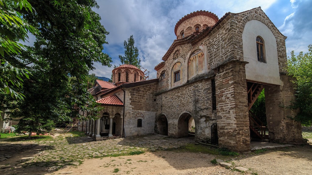
Bachkovo Monastery, Plovdiv
Bachkovo Monastery, Plovdiv, Bulgaria is a monastery of sacred significance. Approximate coordinates: 41.94174, 24.84972. Attributes: built, cultural, pilgrimage. Tradition: Christian. Associated figure: Virgin Mary. Located in Пловдив, Bulgaria.
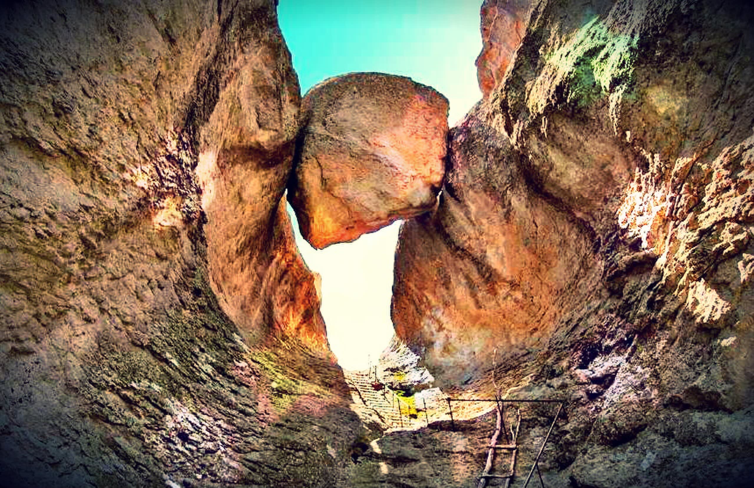
Belintash
Belintash in Near Mostovo (central Rhodope Mountains), Plovdiv, Bulgaria.
Chetinyova Mogila
Chetinyova Mogila is a temple complex of sacred significance. Approximate coordinates: 42.51190, 24.54706. Attributes: built, cultural, archaeological. Located in Пловдив, Bulgaria.
Horizont tumulus
Horizont tumulus, Kozi Gramadi is a tumulus of sacred significance. Approximate coordinates: 42.56408, 24.56587. Attributes: built, cultural, archaeological. Located in Пловдив, Bulgaria.
Karadjov kamak
Karadjov kamak, Mostovo is a thracian rock sanctuary of sacred significance. Approximate coordinates: 41.82335, 24.95078. Attributes: natural, cultural, archaeological, ceremonial. Tradition: Thracian. Mythological context: Thracian. Located in Пловдив, Bulgaria.

Krastova Gora Church, Borovo
Krastova Gora Church, Borovo, Bulgaria is a church of sacred significance. Approximate coordinates: 41.84062, 24.91933. Attributes: built, cultural, pilgrimage. Tradition: Christianity. Located in Пловдив, Bulgaria.
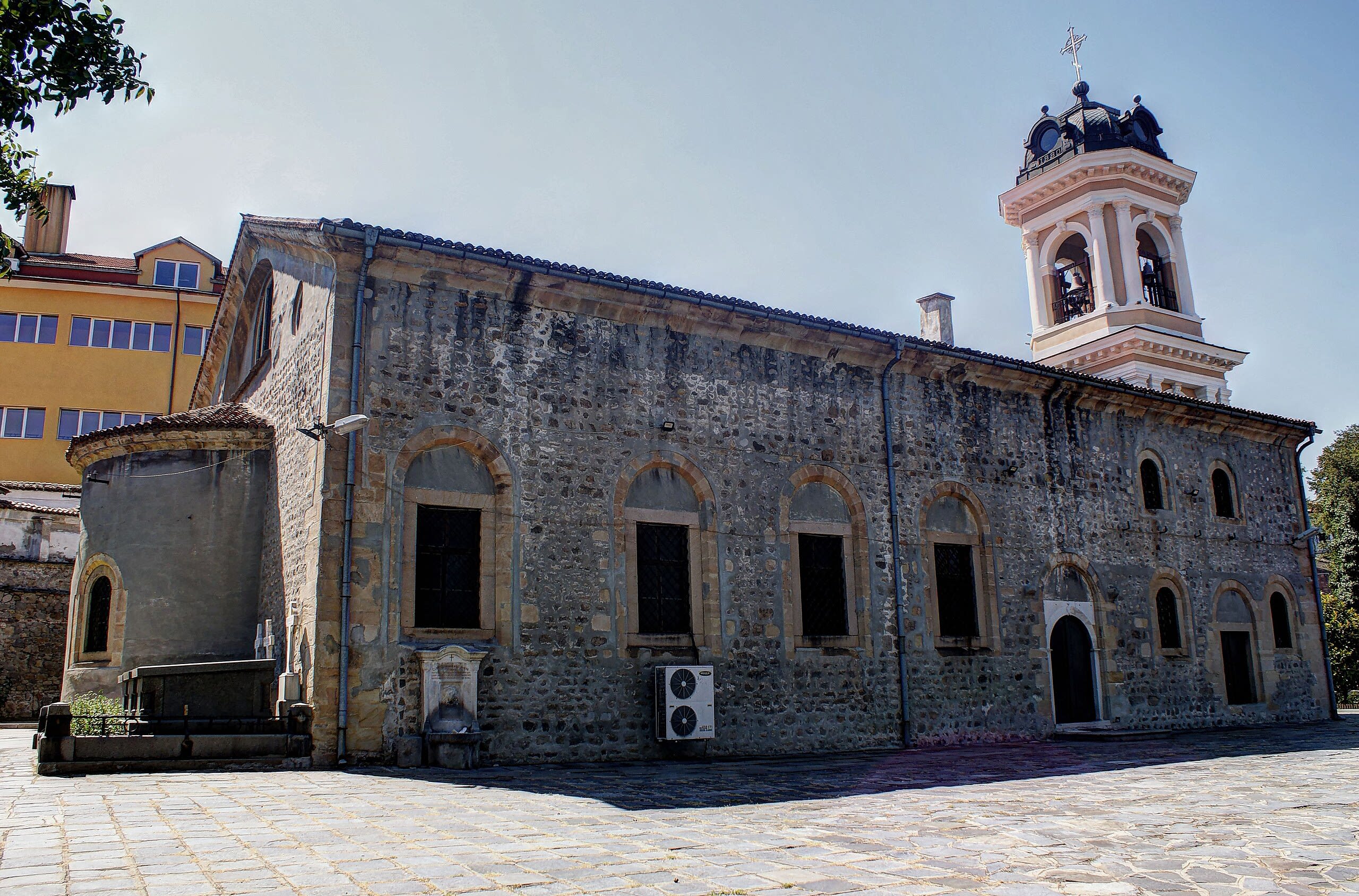
Sveta Bogoroditsa Church
Sveta Bogoroditsa Church in Plovdiv, Plovdiv, Bulgaria.
Razgrad
1 site
Demir Baba Teke, near the village of Sveshtari
Demir Baba Teke, near the village of Sveshtari, Bulgaria is a tekke of sacred significance. Approximate coordinates: 43.73928, 26.75201. Attributes: built, cultural, pilgrimage, ceremonial. Tradition: Bektashi Order. Associated figure: Demir Baba. Located in Малък Поровец, Разград, Bulgaria.
Ruse
1 site
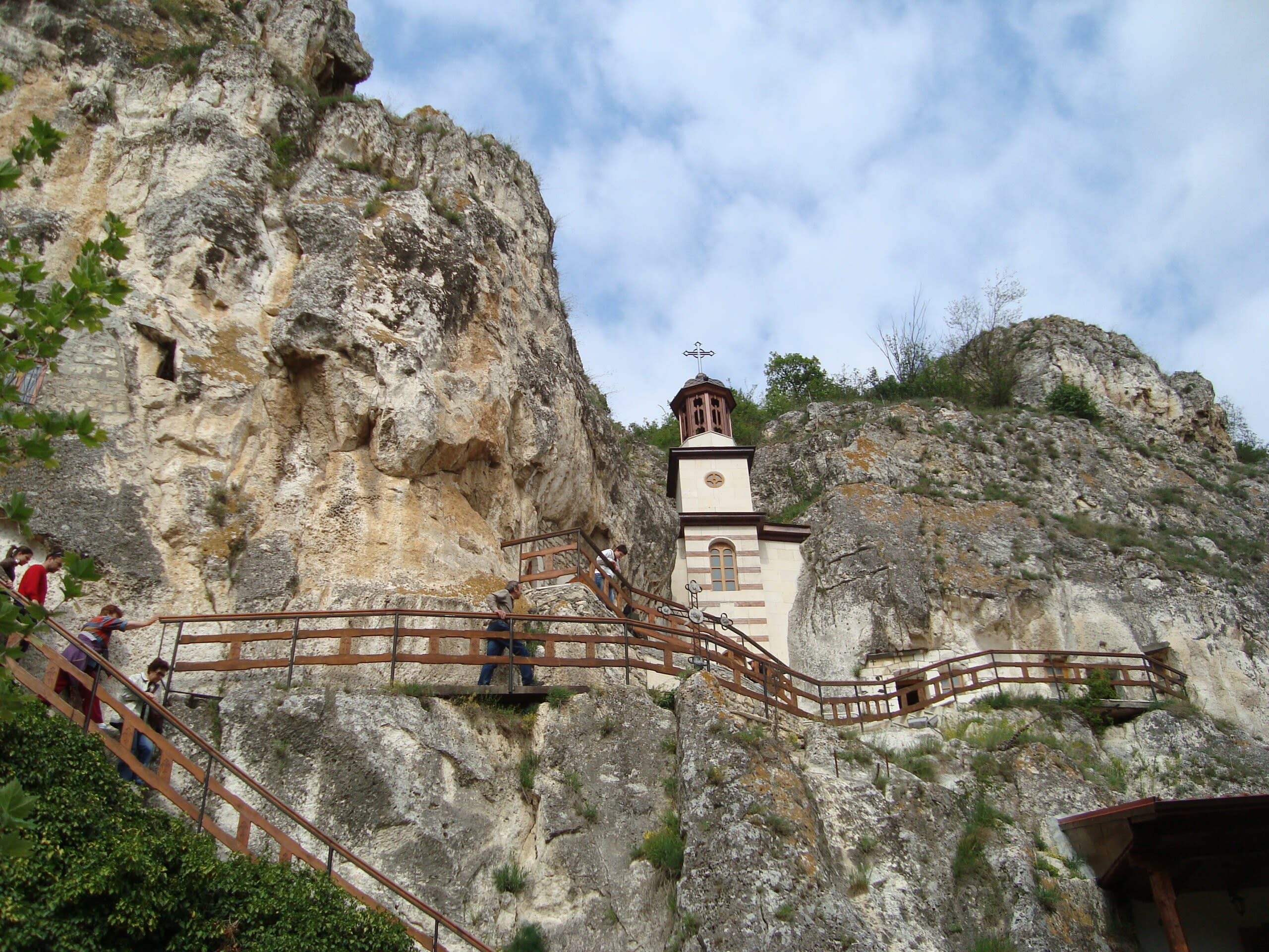
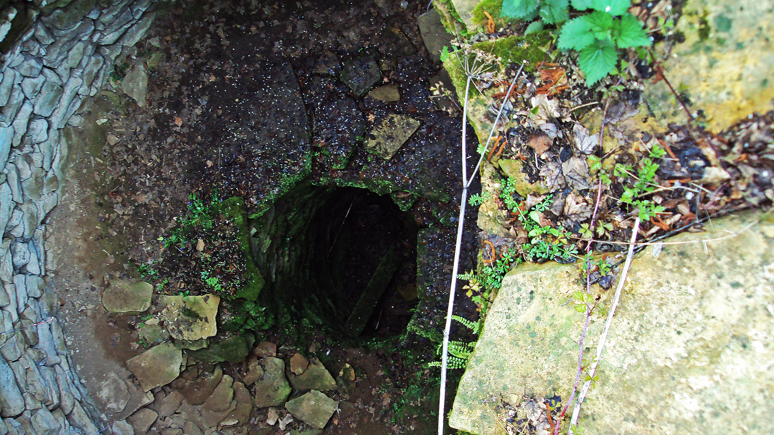
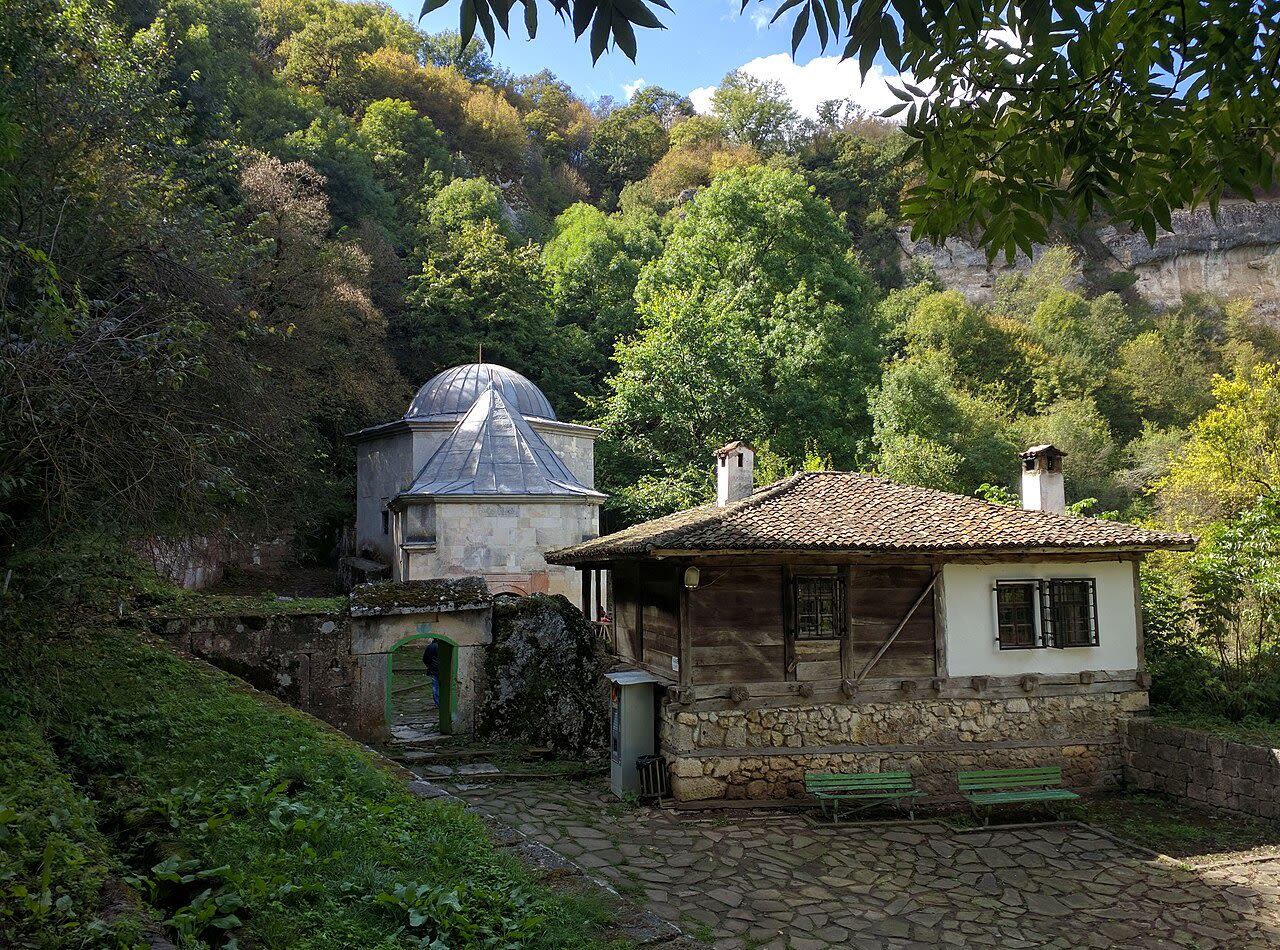
Basarbovo Monastery
Basarbovo Monastery (Bulgarian: Басарбовски манастир) – the Monastery of Saint Dimitar Basarbowski – is a Bulgarian Orthodox cave monastery near the city of Ruse in north-eastern Bulgaria. It has the same name as the nearby village of Basarbovo and lies about 35 metres above the river Rusenski Lom, south of the Danube. Although founded during the Second Bulgarian Empire, the oldest written mention of the monastery dates to the 15th century in an Ottoman tax register. The monastery became famous in the 17th century after the death of St. Dimitar Basarbovski, whom St Paisiy Hilendarski talks about in the book Istoriya Slavyanobolgarskaya. St. Dimitar Basarbovski was a shepherd and led an ascetic life in the rocks of the monastery. He died in 1685. He was buried in the village church, but during the Russo-Turkish War of 1768-1774, General Pyotr Saltykov agreed to transfer his relics to Russia. The road passed through Romania. At that time, that region was suffering through a plague epidemic. The legend tells that when the saint's relics entered Bucharest, people stopped dying from the plague. The residents of the town asked the General to leave the saint's body there. Today his relics are located in Bucharest in the St. St. Constantine and Elena Church. In 1937, Father Hrisant settled in Basarbovo Monastery and revived it. The monastery celebrates its patron on October 26, St. Dimitar's Day. It is the only active cave monastery in the modern history of Bulgaria. It was named a historical landmark in 1978.
Stara Zagora
1 site
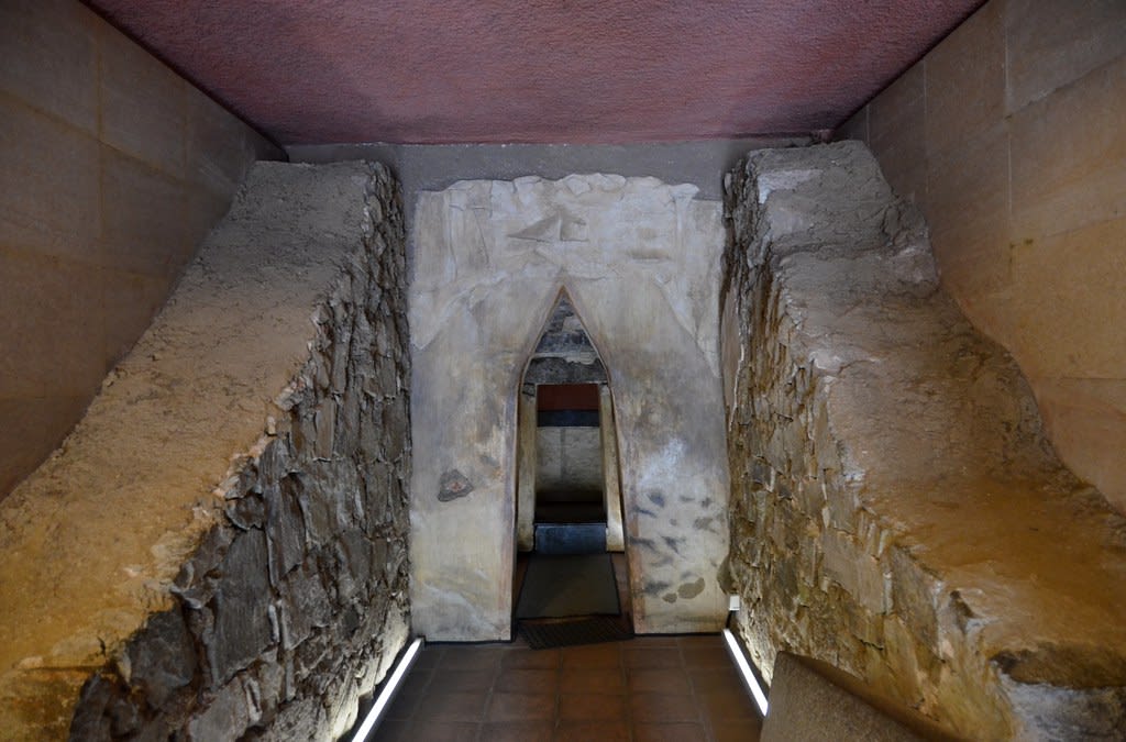
Thracian Tomb of Kazanlak
Thracian Tomb of Kazanlak is a site of sacred significance. Approximate coordinates: 42.62584, 25.39916. Located in Казанлък, Стара Загора, Bulgaria.
Vidin
1 site

Belogradchik
Belogradchik (Bulgarian: Белоградчик, lit. 'Small White Town'; pronounced [bɛɫoɡrɐtˈt͡ʃik]) is a town in Vidin Province, northwestern Bulgaria, and is the administrative centre of the homonymous municipality. The town is situated in the foothills of the Balkan Mountains just east of the Serbian border and about 50 km south of the Danube River. The town is close to the Belogradchik Rocks, which are major tourist attraction. As of 2024, it had a population of 4,601.