Blythe Intaglios
Giant figures etched in desert earth, depicting the Creator and his mountain lion helper
Blythe, California, USA
At A Glance
- Coordinates
- 33.8004, -114.5382
- Suggested Duration
- 30 minutes to 1 hour for ground viewing of all three locations. Longer if you wish to sit and contemplate. The site does not demand extended visits but rewards unhurried attention.
Pilgrim Tips
- Practical desert attire is essential. The site has no shade, and temperatures can exceed 100 degrees Fahrenheit in summer. Wear sun protection: hat, long sleeves if tolerable, sunscreen. Sturdy shoes are advisable for walking between sites. Bring water—more than you think you need.
- Photography is permitted. The figures are difficult to photograph from ground level due to their scale; aerial or drone photography produces better results. If using drones, be aware of other visitors and any posted restrictions. Approach documentation with respect for the site's sacred significance.
- The site has suffered damage from visitors and vehicles in the past. The tire tracks left by General Patton's training exercises in the 1940s remained visible for decades. Current fencing exists because protection was needed. Stay within designated areas. Do not attempt to enter the fenced perimeters around the figures. Do not drive off established roads. Pack out everything you bring in. The desert environment is genuinely harsh. Heat exhaustion is a real risk in summer months. Flash floods occur during rainstorms, particularly in areas with poor drainage. Check weather conditions before visiting and bring adequate water.
Overview
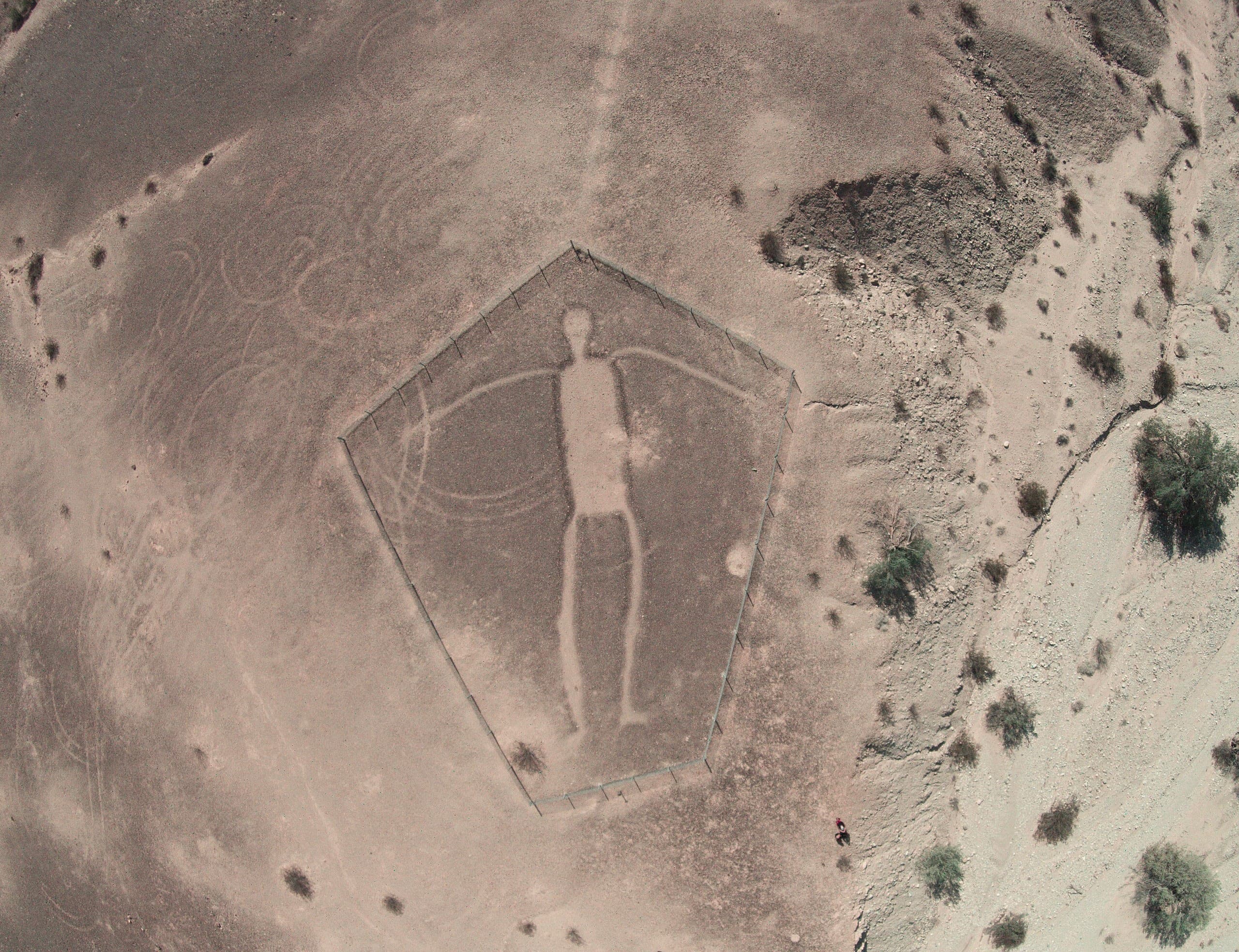
In the Colorado Desert, fifteen miles north of Blythe, six colossal figures lie etched into the earth. The largest stretches 171 feet—a human form visible only from above, created by scraping away dark desert rock to reveal lighter soil beneath. The Mohave and Quechan peoples identify these figures as Mastamho, Creator of Earth and all life, and Hatakulya, the mountain lion who helped bring the world into being. For centuries, the geoglyphs remained known only to those who walked this land.
The Blythe Intaglios present a paradox: art made to be seen from above, created by people who could not fly. Three human figures, two animals, and one spiral lie scattered across three locations in the California desert, the largest human form measuring 171 feet from head to toe. They were made by the simplest of methods—scraping away the dark desert pavement to expose the lighter soil beneath—yet their scale and placement suggest intentions beyond mere decoration.
A pilot named George Palmer spotted them from the air in 1932, flying between Las Vegas and Blythe. For him they were a discovery; for the Mohave and Quechan peoples of the Colorado River, they had always been part of a sacred landscape. According to their understanding, the human figures represent Mastamho, who created the Earth and all life, and the animal figures represent Hatakulya, a mountain lion who assisted in creation. The geoglyphs mark places where mythic events actually occurred.
No tribe claims to have physically constructed the intaglios—yet both Mohave and Quechan acknowledge them as sacred, embedded in a cosmology that connects the living to ancestral realms and the Colorado River's life-giving waters. The figures were used in ritual pilgrimages, in ceremonies honoring creation and mourning the dead. What they mean, and why they were made to be seen from a perspective no human could achieve until the twentieth century, remains genuinely mysterious.
Context And Lineage
The Blythe Intaglios were created by ancestors of modern Yuman-speaking peoples, possibly the Patayan culture, between 900 BCE and 1200 CE. No specific tribe claims authorship, but the Mohave and Quechan acknowledge the figures as sacred representations of Mastamho the Creator and Hatakulya his mountain lion helper. The figures are part of a larger sacred landscape containing over 200 intaglios across the Colorado Desert.
The Mohave and Quechan share a creation narrative in which Mastamho made the Earth and all life. He created the Colorado River by driving his spear into the Rocky Mountains, sending water flowing toward the homeland of the Yuman-speaking peoples. The geoglyphs depict Mastamho and Hatakulya, a mountain lion who assisted in creation.
According to traditional Mohave songs translated by anthropologist A.L. Kroeber, two feline brothers—Hatakulya (mountain lion, with hanging tail) and Numeta (jaguar, with upright tail)—departed ways somewhere to the north. Hatakulya came south. The animal figures at the intaglios may represent moments in this journey. Similar figures near Fort Mojave in Arizona, showing 18-foot-tall forms resembling Mastamho and his twin Kataar, suggest a landscape-wide mythology inscribed in earth.
Importantly, no tribe claims that their ancestors physically constructed the intaglios. The figures are not tribal property but sacred sites embedded in a cosmology shared among Colorado River peoples. They mark places where mythic events occurred—traces of divine activity rather than human creation.
The Blythe Intaglios are the most famous of over 200 intaglios scattered across the Colorado Desert. This larger pattern suggests a tradition of geoglyph-making among Colorado River peoples that extended across the region. The Patayan culture (700-1550 CE), ancestors of modern Yuman-speaking peoples including the Mohave and Quechan, is one archaeological candidate for the builders.
Radiocarbon dates range widely—from 900 BCE to 1200 CE—making cultural attribution difficult. If the animal figures represent horses rather than mountain lions, this would suggest creation after Spanish contact (post-1540), dramatically altering the timeline. Most scholars favor a pre-contact date, but the question remains open.
The intaglios belong to a broader category of large-scale earth art found in deserts worldwide, including the Nazca Lines of Peru. However, direct comparisons risk obscuring the specific Yuman cultural context of the California geoglyphs. These figures are not generic desert art but representations of particular deities within a particular cosmology.
Mastamho
Creator deity in Mohave and Quechan tradition
Hatakulya
Mountain lion helper in creation
George Palmer
Pilot who first reported the intaglios to Western audiences
Boma Johnson
Ethnographer
Why This Place Is Sacred
The Blythe Intaglios occupy a liminal space—figures meant to be seen from above, created by people who walked the earth. The Mohave and Quechan understand them as markers of creation events, places where the boundary between mythic time and ordinary time grows thin. The Colorado River flows nearby, itself a sacred artery in Yuman cosmology, created when Mastamho drove his spear through the mountains.
Something distinguishes places where the sacred is believed to have actually happened. The Blythe Intaglios are not representations of myth made elsewhere; according to Mohave and Quechan tradition, they mark the locations where mythic events occurred. This is where Mastamho walked. This is where Hatakulya passed through. The geoglyphs are traces of divine presence, embedded in the landscape like footprints.
The Colorado River runs nearby, and in Yuman understanding this is no coincidence. Mastamho created the river by driving his spear through the Rocky Mountains, sending water to flow toward the homeland of the Yuman-speaking peoples. The intaglios exist within a sacred geography centered on this life-giving water. To stand here is to stand at a node in that geography—a place where creation's power can still be felt.
There is also the mystery of perspective. The figures are fully visible only from above, yet they were created by people who had no technology of flight. Were they meant for the gods to see? For spirits traveling between realms? The question has no answer. But it invites contemplation of what it means to make something for an audience you can never be part of—art created on faith that someone, something, would see it from the proper height.
The desert itself contributes to the site's quality. Harsh, hot, largely empty of human presence, the landscape strips away distraction. The silence is profound. The scale of the figures, once you understand it, induces a particular kind of vertigo—not of height, but of time and intention.
Scholars and tribal sources agree that the intaglios served ceremonial purposes connected to creation narratives. According to Mohave and Quechan traditions, sacred ceremonial dances were held near the figures to honor creation. The site may have been used during ritual pilgrimages along the Colorado River, with travelers moving from the Land of the Dead toward the place of creation. Some researchers hypothesize the intaglios were stopping points on keruk pilgrimages—the keruk being a mourning ceremony that included re-enactment of the creator's death and recognition of the recently deceased. Rock alignments, cairns, and trails near the figures suggest organized ritual activity.
The intaglios were known to indigenous peoples for centuries before Western documentation began. In 1932, pilot George Palmer spotted them from the air, and archaeologist Arthur Woodward of the Los Angeles Natural History Museum conducted the first survey that same year. Lack of funding during the Depression delayed further investigation until the 1950s, when a National Geographic and Smithsonian expedition brought wider attention.
By then, damage had already occurred. During World War II, General George Patton established desert training grounds in the region. Army vehicles drove over the geoglyphs, leaving tire tracks that remained visible for decades. This damage catalyzed protection efforts: in 1974, the Bureau of Land Management erected fences around the intaglios, and in 1982 they were added to the National Register of Historic Places. The site now lies within the Big Marias Area of Critical Environmental Concern, designated in 1987.
Today the figures are accessible to anyone willing to drive the fifteen miles north from Blythe on Highway 95. They remain on federal land, open at all hours, protected by fences but lacking substantial interpretive facilities. The isolation is both a limitation and a gift.
Traditions And Practice
The ceremonies once performed at the Blythe Intaglios are not fully documented. Historical sources describe ceremonial dances honoring creation, ritual pilgrimages along the Colorado River, and possible use in keruk mourning ceremonies. Contemporary ceremonial practices, if any, are not publicly shared.
According to ethnographic sources, sacred ceremonial dances were held near the intaglios to honor creation. The site was used during ritual pilgrimages along the Colorado River, with travelers moving from the Land of the Dead toward the place of creation. This journey ran south to north, and intaglio sites may have served as stopping points or destinations.
The keruk mourning ceremony, practiced by various Native American groups in southern California, included re-enactment of the creator's death and recognition of people who had died since the last keruk. Some researchers hypothesize the intaglios were stopping points on keruk pilgrimages. Rock alignments, cairns, and trails near the figures suggest organized ceremonial activity, though specific rituals cannot be reconstructed.
No contemporary ceremonial practices at the Blythe Intaglios are publicly documented. The Mohave and Quechan acknowledge the site's sacred significance, but specific current practices, if any, are not shared with outside observers. This absence in public record does not mean absence of practice—only that such practice, if it occurs, remains private.
The Blythe Intaglios offer no organized ceremonies or visitor programs. What the site offers is space for contemplation. Walk slowly between the three locations. Sit with the challenge of seeing figures made for aerial viewing while standing on the ground. Consider why someone would create art for an audience they could never be.
If you learn the Mohave and Quechan interpretation before your visit—that these figures represent Mastamho the Creator and Hatakulya who helped bring the world into being—the experience deepens. You stand not at an archaeological curiosity but at a place where, in indigenous understanding, creation actually happened. Let that understanding inform your presence.
Mohave Creation Cosmology
ActiveThe Mohave understand the human figures as representations of Mastamho, the Creator of Earth and all life. The animal figures represent Hatakulya, one of two mountain lion/persons who helped in Creation. According to Mohave tradition, Mastamho also created the Colorado River by driving his spear into the Rocky Mountains. The geoglyphs mark places where mythic events are thought to have occurred.
Historical ceremonial dances were held near the intaglios to honor creation. The site may have been used during ritual pilgrimages along the Colorado River. Contemporary ceremonial practices at the site are not publicly documented.
Quechan Sacred Geography
ActiveThe Quechan, like the Mohave, associate the human figures with Mastamho and the animal figures with Hatakulya. In Quechan understanding, the geoglyphs are part of a sacred landscape connecting to creation narratives and the Colorado River's life-giving forces. The figures guide spirits of the dead or mark primordial events.
Used historically during ritual pilgrimages along the Colorado River from the Land of the Dead to the place of creation, traveling south to north. Historical use in rituals commemorating myths and for purification through ceremonial dances. Contemporary practices are not publicly shared.
Keruk Mourning Ceremony
HistoricalThe keruk was a mourning ceremony practiced by various Native American groups in southern California. It included re-enactment of the creator's death and recognition of people who had died since the last keruk. Some researchers hypothesize the intaglios served as stopping points on keruk pilgrimages.
The ceremony included re-enactment of the creator's death, honoring the deceased, and ceremonial pilgrimage between sacred sites. Whether the Blythe Intaglios specifically served keruk purposes remains a hypothesis rather than established fact.
Patayan Archaeological Culture
HistoricalOne archaeological hypothesis attributes the intaglios to the Patayan culture, who occupied the region from approximately 700 to 1550 CE. The Patayan were ancestors of modern Yuman-speaking peoples including the Mohave and Quechan, placing the geoglyphs within cultural continuity of Colorado River peoples.
Specific Patayan practices at the intaglios are unknown. General Patayan culture included farming, fishing, and ceramic production along the Colorado River. The culture is defined archaeologically rather than through continuous tradition.
Experience And Perspectives
Arriving at the Blythe Intaglios, you encounter first the desert's scale, then the frustration of seeing monuments made for aerial viewing while standing on the ground. The observation platforms help, but the experience is fundamentally one of imagination—using partial views to construct what you cannot fully see, contemplating why anyone would create art for an impossible audience.
The drive north from Blythe takes you through classic Colorado Desert landscape—creosote flats, distant mountains, wide sky. Fifteen miles of Highway 95 pass quickly, and the turnoff is easy to miss: a small stone cairn, a fenced dirt road, signs reading 'Blythe Intaglios' or 'Giant Earth Figures.' The road is rough but passable in any vehicle. A quarter mile in, you park at the first site.
The immediate sensation is dissonance. You know you are standing beside something monumental—171 feet of human figure—yet what you see from ground level is subtle at best. The difference in soil color between the scraped areas and surrounding desert pavement is visible, but the form does not cohere. The figure was made to be seen from above, and you are not above. Fences keep you at a distance that further obscures.
This is not a failure of the experience but its nature. You are asked to engage imaginatively, to construct from partial evidence what the whole must look like. Photographs help; some visitors bring drone cameras, though their use should be respectful. The observation platforms at each location offer modest elevation, enough to improve the view without fully resolving it.
Three locations hold figures—two intaglios at the first, accessible from the main parking area; a third figure about half a mile further; two more about 2,500 feet southwest. Visiting all of them takes perhaps an hour, less if you move quickly. But speed is not the point. The desert silence, the isolation, the challenge of perceiving what was meant for other eyes—these invite a slower engagement.
The heat is significant much of the year. Summer temperatures often exceed 100 degrees Fahrenheit, and there is no shade. Winter visits are more comfortable but still require preparation: water, sun protection, awareness of your own limits. The desert does not accommodate unprepared visitors.
What visitors often report, beyond the challenge of seeing, is a sense of mystery that persists. Why make these? How did they know the figures were correctly proportioned without being able to see them complete? What ceremonies occurred here? The answers are not available, and that unknowing becomes part of the experience.
The three human figures face different directions, and their orientations may have ceremonial significance, though this is not confirmed. The Colorado River lies to the east, about twenty miles away—too far to see, but present in the geography. If you know the Mohave tradition that Mastamho created the river by driving his spear through the mountains, the proximity gains meaning. You stand in a landscape shaped, in indigenous understanding, by the same creator whose image lies in the earth beside you.
The Blythe Intaglios invite interpretation from multiple frameworks. Scholars approach them as archaeological artifacts created by prehistoric peoples for ceremonial purposes. The Mohave and Quechan understand them as sacred representations of creation deities. Both perspectives agree on the site's significance while emphasizing different dimensions.
Archaeological consensus holds that the Blythe Intaglios were created by prehistoric Native American peoples of the Colorado River region, most likely ancestors of modern Yuman-speaking tribes. The Patayan culture, which occupied the region from approximately 700 to 1550 CE, is one candidate for the builders.
Radiocarbon dates range widely—from 900 BCE to 1200 CE—making precise dating difficult. If the animal figures represent horses (reintroduced to North America by the Spanish), this would suggest post-contact creation, but most scholars favor a pre-contact date based on stylistic and contextual evidence.
Ethnographer Boma Johnson placed the figures within Yuman oral history and cosmology, identifying them as portrayals of mythic characters at places where mythic events occurred. The purpose was likely ceremonial, connected to creation narratives and possibly mourning rituals. The keruk ceremony hypothesis suggests the intaglios served as stopping points on pilgrimage routes.
Over 200 intaglios exist across the Colorado Desert, indicating a regional tradition of geoglyph-making. The Blythe Intaglios are the largest and most famous, but they should be understood as part of a broader sacred landscape rather than isolated monuments.
The Mohave and Quechan identify the human figures as Mastamho, the Creator of Earth and all life, and the animal figures as Hatakulya, a mountain lion who assisted in creation. According to their understanding, the geoglyphs mark places where mythic events actually occurred—traces of divine presence rather than human artistic expression.
Neither tribe claims that their ancestors physically constructed the intaglios. The figures are not tribal property but sacred sites embedded in a shared cosmology. Oral histories describe the geoglyphs as pathways guiding spirits of the dead or as emblematic traces of primordial creation events. The Colorado River, flowing nearby, is itself a creation of Mastamho, who drove his spear through the mountains to bring water to his people.
This perspective does not compete with archaeological interpretation but operates on a different register. The question of who built the figures and when is less important than what they represent and where they stand in a sacred geography.
Some popular sources compare the Blythe Intaglios to the Nazca Lines of Peru, suggesting similarities in purpose or method. While both are large-scale geoglyphs created by prehistoric peoples, direct comparison risks obscuring the specific Yuman cultural context of the California figures. The Blythe Intaglios are not generic desert art but representations of particular deities within a particular cosmology.
No credible alternative theories attribute the figures to non-indigenous builders. The geoglyphs were created by ancestors of peoples who still live in the region and who still hold the figures sacred.
Genuine mysteries remain at the Blythe Intaglios. The exact date of creation cannot be determined with current evidence. The specific identity of the builders—which ancestral group among Colorado River peoples—is unknown. Whether the animal figures represent mountain lions, horses, or other creatures remains debated.
Perhaps most intriguing is the question of perspective. The figures are fully visible only from above, yet they were created centuries before human flight. Were they meant for deities to see? For spirits traveling between realms? For the creators themselves to know existed, even without seeing? The question has no answer, only resonance.
Visit Planning
The Blythe Intaglios are located 15 miles north of Blythe, California on Highway 95. The site is on BLM land, open 24/7, with free admission and no permits required. Accessible by regular passenger vehicles. Bring water and sun protection; summer heat is extreme. Allow 30 minutes to 1 hour for viewing.
Blythe, California (15 miles south) offers motels, gas stations, and basic services. Lake Havasu City, Arizona (approximately 50 miles north) has more extensive lodging options. The site itself has no facilities—no restrooms, no water, no shade structures.
The Blythe Intaglios are sacred to the Mohave and Quechan peoples and have suffered historical damage from vehicles and visitors. Stay within designated areas, do not enter fenced perimeters, and treat the site with the respect due to indigenous sacred heritage.
The fences around the intaglios exist because protection was necessary. General Patton's World War II training exercises left visible tire tracks across the figures. Later visitors also caused damage. The Bureau of Land Management erected barriers in 1974, but damage had already occurred.
Stay within designated pathways and viewing areas at all times. The fences are not suggestions but protections for figures that are irreplaceable. Do not attempt to enter the perimeters for a better view or photograph. The challenge of viewing from ground level is part of the experience; circumventing it degrades what you came to see.
Do not drive off established roads. The desert surface is fragile; vehicle tracks persist for decades. The road to the intaglios is fenced on both sides precisely to prevent further damage to surrounding areas.
Leave nothing at the site. Pack out all trash. Do not leave offerings or objects you consider meaningful. The site does not belong to individual visitors; it belongs to the landscape and to the peoples who hold it sacred.
Photography is permitted, including drone photography, but use these tools respectfully. The figures are sacred to living peoples, not merely archaeological remnants. Approach documentation as a privilege rather than a right.
Finally, be honest about what you do and do not know. The intaglios are mysterious, and that mystery can invite speculation. Resist the temptation to invent explanations or repeat theories that are not grounded in archaeological or indigenous knowledge.
Practical desert attire is essential. The site has no shade, and temperatures can exceed 100 degrees Fahrenheit in summer. Wear sun protection: hat, long sleeves if tolerable, sunscreen. Sturdy shoes are advisable for walking between sites. Bring water—more than you think you need.
Photography is permitted. The figures are difficult to photograph from ground level due to their scale; aerial or drone photography produces better results. If using drones, be aware of other visitors and any posted restrictions. Approach documentation with respect for the site's sacred significance.
Do not leave offerings of any kind. The site is not a personal altar. Whatever meaning you find here, express it through attention rather than objects left behind.
{"Stay within fenced pathways and designated viewing areas","Do not enter the perimeters around the intaglio figures","Do not drive off established roads","Do not touch, walk on, or disturb the geoglyphs","Pack out all trash and belongings","Do not leave offerings or objects at the site"}
Sacred Cluster
Nearby sacred places create the location cluster described in the growth plan. This block is intentionally crawlable and links into the wider regional graph.
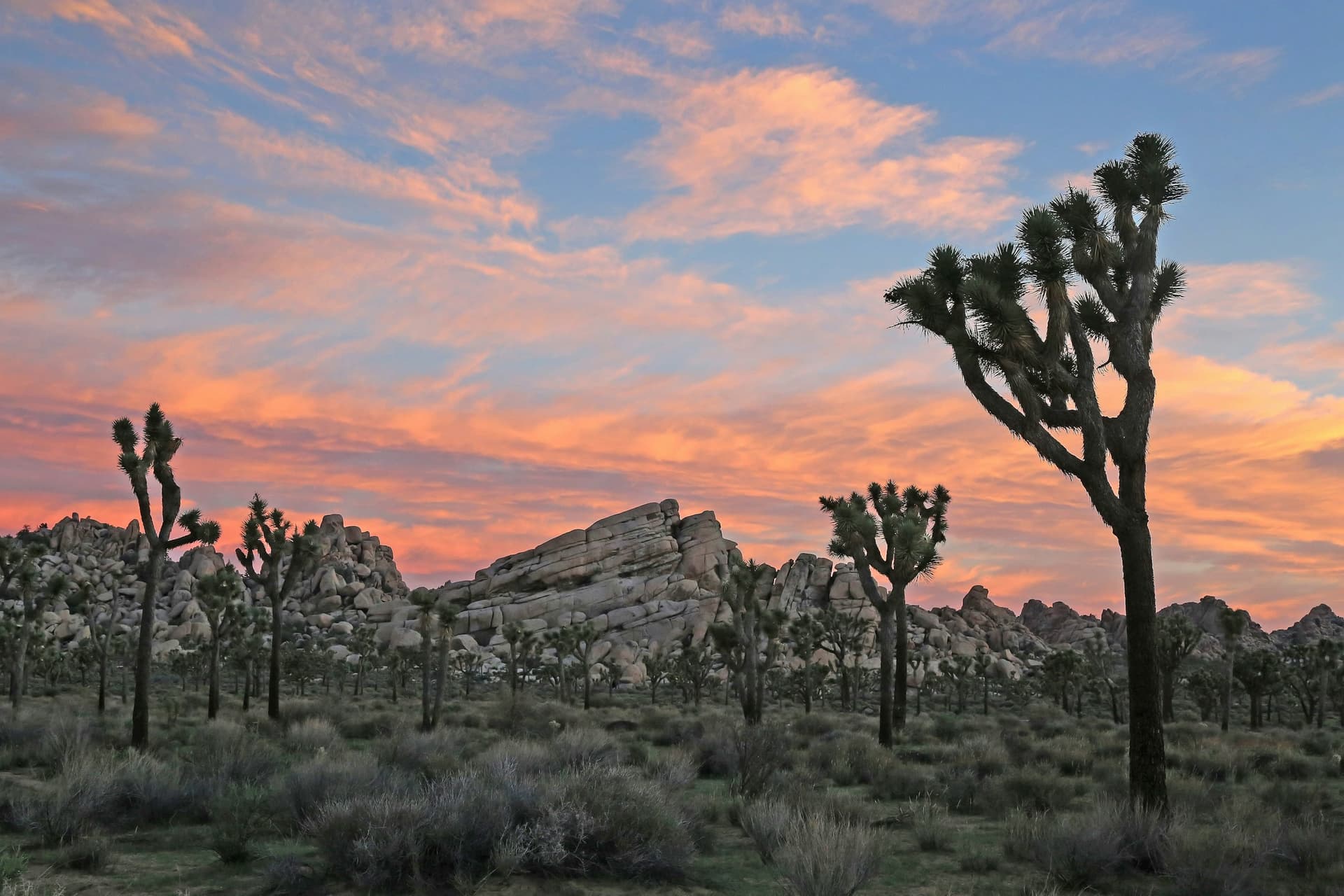
Joshua Tree National Park, California
Joshua Tree, California, United States
126.2 km away
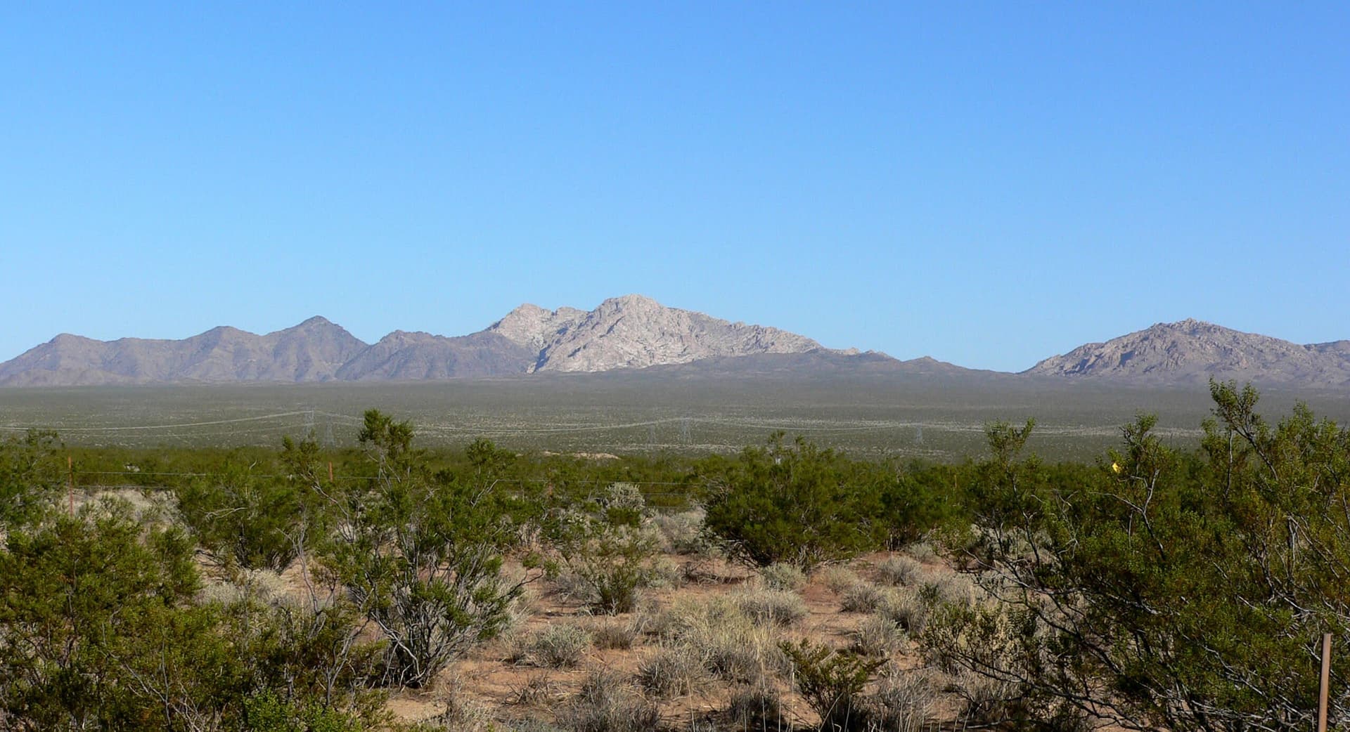
Newberry Mountains, Nevada
Laughlin, Nevada, United States
155.0 km away
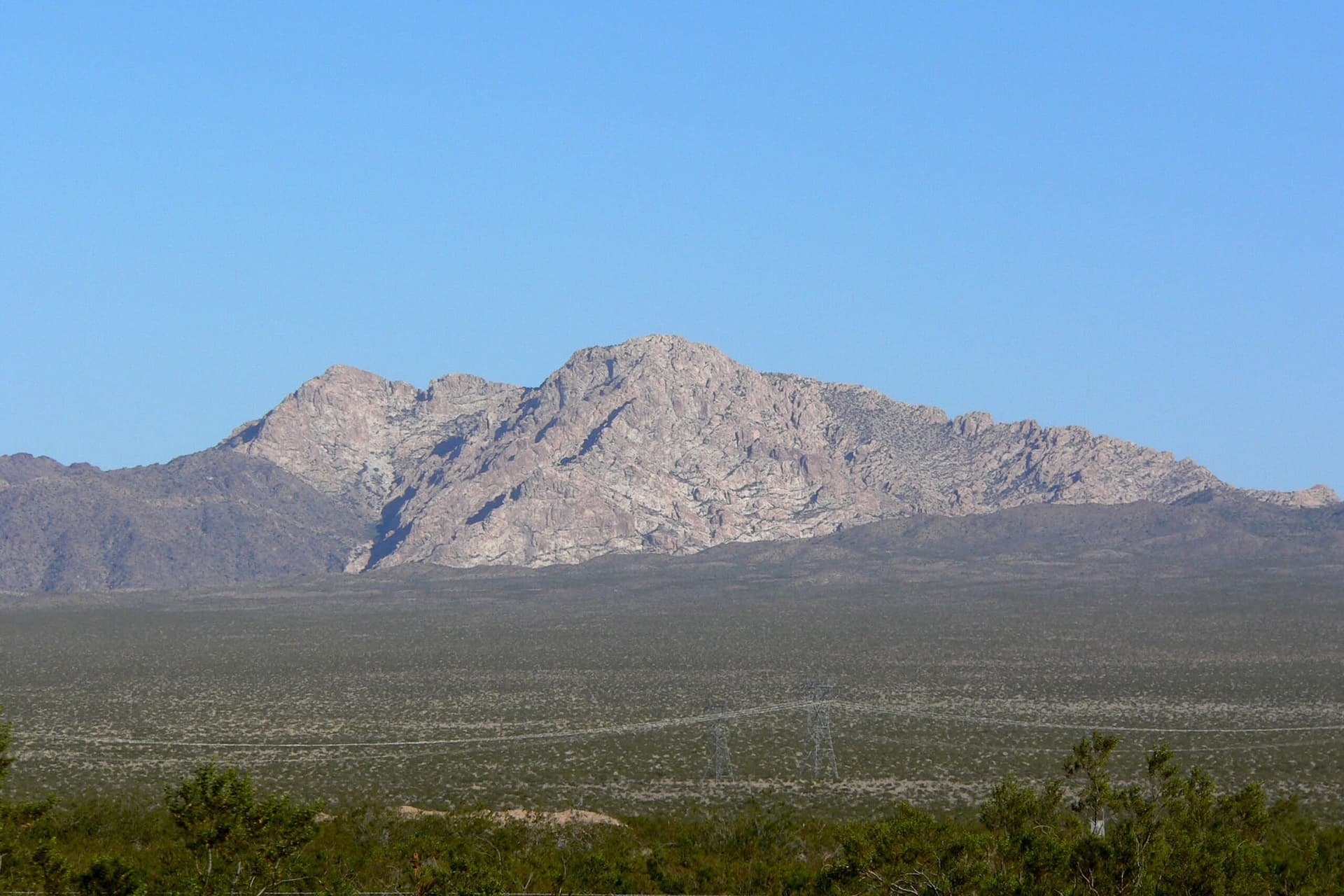
Spirit Mountain, Nevada
Laughlin, Nevada, United States
164.8 km away
Mount San Jacinto, California
Riverside County, California, United States
197.8 km away