Dun Carloway Broch
A 2,000-year-old drystone tower standing nine metres above the Hebridean moorland, still watching over loch and sea
Carloway, Alba / Scotland
At A Glance
- Coordinates
- 58.2696, -6.7941
- Suggested Duration
- 1 to 1.5 hours including the Doune Broch Centre and time to sit with the monument
Pilgrim Tips
- Dress for exposed Hebridean conditions. The broch sits on an elevated, wind-exposed knoll. Waterproof outer layers and warm clothing are essential in any season. Sturdy footwear with good grip is necessary for the uphill path and uneven ground within the monument. Conditions on Lewis can shift from sunshine to rain to gale within an hour.
- Photography is freely permitted. The broch is exceptionally photogenic from multiple angles. The eastern face, where the wall survives to its full nine metres, is the most iconic view. The collapsed western section offers the most instructive architectural perspective. The interior courtyard, the entrance passage, and the gallery spaces within the walls all reward careful composition. Dawn and dusk provide the most atmospheric light. In summer, the low evening sun illuminates the eastern wall face to striking effect.
- The entrance passage requires bending low. The interior has uneven ground and loose stone. The uphill path from the car park is unsurfaced and can be muddy or slippery in wet conditions. The site is fully exposed to Hebridean weather, which can change rapidly. There is no shelter at the broch itself.
Overview
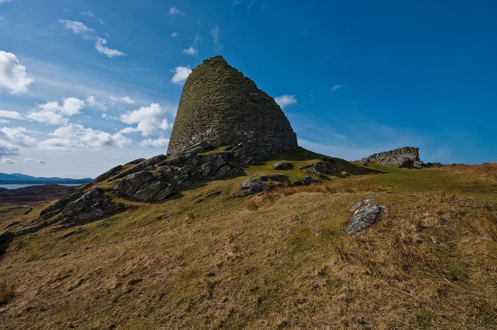
On a rocky knoll above East Loch Roag, the walls of Dun Carloway Broch still rise nine metres without mortar. Built around the turn of the first millennium, this Iron Age tower has outlasted every culture that named it. Norse settlers called the bay Karlavágr. Clan raiders sheltered within its walls. The wind that shaped its builders still crosses the same moorland. The broch endures, asking nothing of you but attention.
You approach from below, climbing a short slope through moorland grass, and the broch reveals itself gradually. First the curve of the surviving eastern wall, dark stone against Hebridean sky. Then the collapsed western face, which rather than diminishing the monument exposes its inner architecture in cross-section: two concentric walls bonded by flat stone lintels, galleries stacked between them, a staircase threading upward through the gap. The builders left no written record, but the walls are their testimony.
Dun Carloway was raised around the 1st century BC or AD by people whose names are lost but whose engineering endures. They chose this knoll for its command of the surrounding landscape: East Loch Roag below, open moorland stretching toward the Atlantic, the hills of Lewis to the east. The broch served as residence, refuge, and assertion of presence. Its single entrance, only 75 centimetres wide and one metre high, required anyone entering to bow. A guard cell watched the passage. Upper floors, now gone, rested on a stone ledge still visible on the inner wall. Life happened here for perhaps a thousand years.
The site was occupied through the post-broch Pictish period into the Norse era. In the 16th century, Morrison cattle raiders sheltered inside these same walls until Donald Cam MacAulay smoked them out with burning heather. The broch was scheduled as a protected monument in 1882, one of the first in Scotland. In 2021, the community of Carloway purchased the visitor centre through the Scottish Land Fund. Each generation has found its own reason to attend to this place. The stones accommodate them all.
Context And Lineage
An Iron Age drystone tower on the west coast of Lewis, built around the 1st century BC/AD, occupied for a millennium, and woven into clan folklore and community identity ever since.
Around the turn of the first millennium, an Iron Age community on the west coast of Lewis undertook a monumental building project. On a rocky knoll commanding views over East Loch Roag, they raised a circular tower of local stone, fitting block to block without mortar, creating walls over three metres thick at the base. The construction required specialist knowledge: the double-wall technique, with two concentric walls bonded by flat lintels and containing internal galleries and a staircase, represents the pinnacle of Atlantic Scottish Iron Age architecture.
The builders are anonymous. No written record survives from this culture. But the broch itself is their most eloquent statement. Its height, perhaps thirteen metres originally, made it visible across the surrounding landscape. The narrow entrance passage, the guard cell, the inward-leaning walls all speak to a society that understood both the practical and symbolic dimensions of architecture. This was not merely a house. It was a declaration.
The broch was inhabited for centuries. Excavation revealed at least three peat-ovens in the northeastern room dating to AD 400-700, indicating pottery production during the post-broch period. Settlement may have continued until approximately AD 1000. The Norse settlers who arrived from the 9th century named the surrounding area Karlavágr, Karl's bay, and the broch became Dun Carloway, its identity shifting with each culture that encountered it.
The most vivid post-construction episode enters the historical record through clan folklore. In the late 16th or early 17th century, members of the Morrison clan of Ness, caught stealing cattle, retreated into the broch. The walls that had stood for over fifteen hundred years proved still defensible. Donald Cam MacAulay, the aggrieved cattle owner, gathered heather and threw burning bundles over the walls, filling the interior with smoke and driving the Morrisons out. The incident speaks to the broch's enduring presence in community life and its remarkable structural integrity.
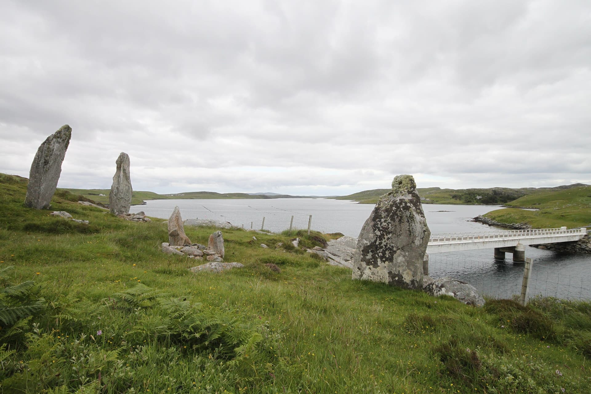
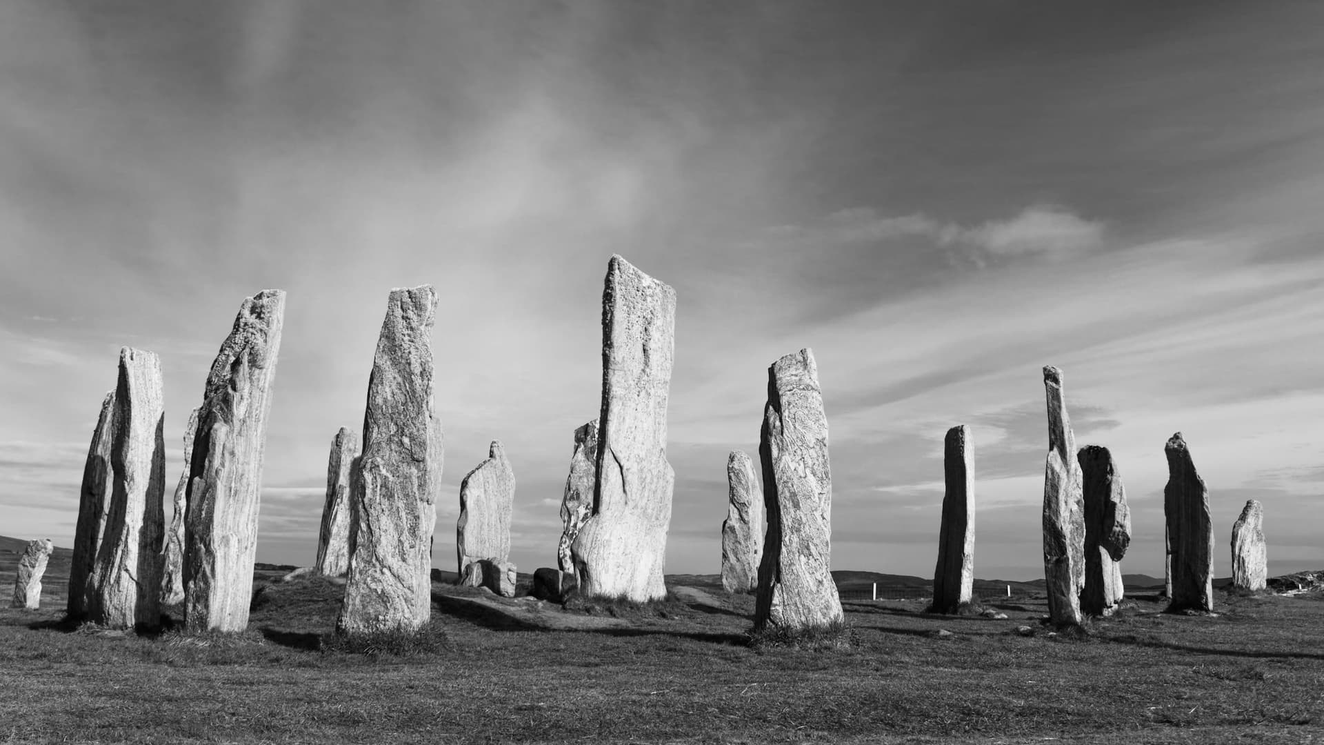
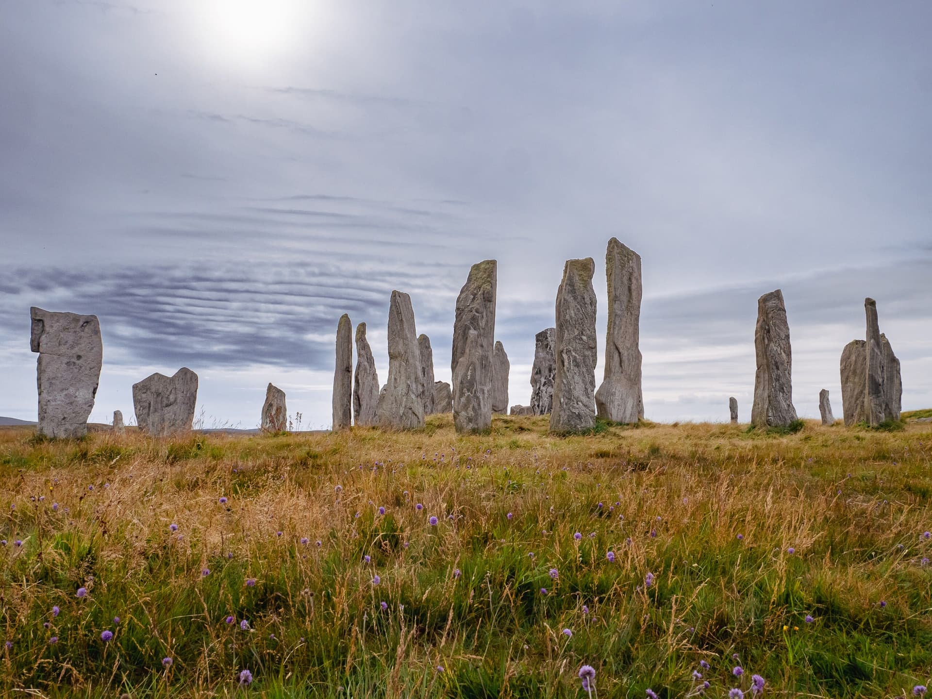
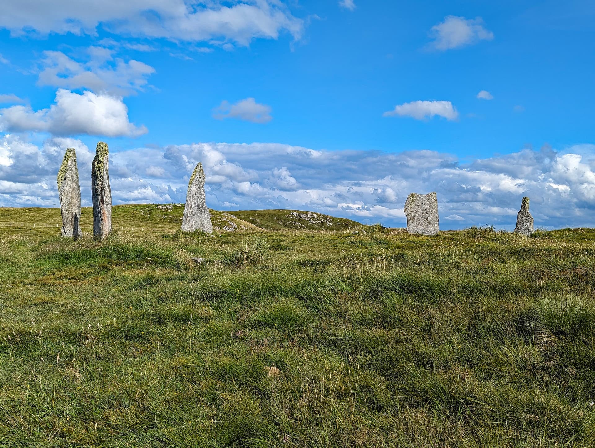
Dun Carloway belongs to the broch-building tradition of Atlantic Scotland, a culture that produced over 500 monumental drystone towers concentrated in the Northern and Western Isles, Caithness, and Sutherland between approximately 100 BC and AD 100. The tradition represents the most sophisticated drystone architecture of prehistoric Europe. Mousa Broch in Shetland, standing to its full original height of thirteen metres, offers the closest comparison for what Dun Carloway once looked like. The Broch of Clickimin in Shetland shows a comparable multi-phase occupation sequence. On Lewis itself, the broch exists within a landscape already ancient when it was built: the Callanish Standing Stones, five miles to the southeast, were raised nearly three thousand years before the first stone of the broch was placed.
Donald Cam MacAulay (Dòmhnall Cam MacAmhlaigh)
Captain F. W. L. Thomas
Iain Crawford
Why This Place Is Sacred
Where Iron Age engineering meets the Hebridean edge, and 2,000 years compress into the texture of unmortared stone.
The thinness of Dun Carloway is structural. It resides not in any recorded spiritual tradition but in the material fact of the place: stone fitted to stone without mortar, standing nine metres tall after two millennia, on an exposed knoll where the Atlantic weather has had every opportunity to bring it down. The survival itself is the thin place. Something in the precision of the building, the understanding of weight and balance, the knowledge passed between generations of builders, has outlasted empires and languages and the very culture that produced it.
The collapsed western wall deepens rather than diminishes this quality. Where the outer skin has fallen away, you see the internal anatomy of the broch: the two concentric walls, the horizontal lintels that bond them, the galleries that run between them like the chambers of a heart. The staircase that rises through the wall thickness is partially exposed, its stone treads worn smooth. You are looking at something that was never meant to be seen, the hidden structure that made the tower possible. The collapse has made the invisible visible.
The approach matters. You climb from the car park through rough moorland, and the modern world falls away with each step. The broch sits on its knoll as it has for twenty centuries, indifferent to your arrival. The wind is usually present. The loch lies below. The horizon is wide in every direction. There is nowhere to hide from the openness of the Hebridean landscape, and the broch does not try. It stands exposed, as it was built to stand.
At certain moments, particularly in early morning or late evening when the light slants low across the moor and the stone takes on warmth, the distance between you and the Iron Age residents of this tower narrows to almost nothing. The same light fell on the same stones. The same wind crossed the same loch. You are standing where they stood, seeing what they saw, minus the timber floors and the hearth smoke and the animals penned at ground level. What remains is the architecture, and the architecture is enough.
Dun Carloway was built as a high-status residence and defensible retreat. The broch combined domestic function with a visible statement of authority and power. Its commanding position, monumental scale, and the investment of communal labour required for its construction all point to a builder of considerable local standing. The single narrow entrance and guard cell speak to defensive concerns, while the internal staircase, galleries, and capacity for multiple timber floors indicate organised household life.
The broch was occupied for approximately a millennium. Post-broch settlement is evidenced by peat-ovens dating to AD 400-700, used for pottery manufacture, found in the northeastern room during excavation. Norse settlers named the surrounding area Karlavágr. In the 16th century, clan conflict brought the Morrison raiders and their MacAulay pursuers into the still-defensible walls. Captain Thomas documented the broch's condition in 1861. It was scheduled as a protected monument in 1882 and placed under state management in 1887. The Doune Broch Centre was established to provide visitor interpretation and was purchased by the Carloway Estate Trust in 2021, bringing heritage stewardship into community ownership.
Traditions And Practice
No active ritual tradition. The broch invites contemplative engagement with deep time, ancestral craftsmanship, and the continuity of human presence on Lewis.
No documented ritual or ceremonial practices are specifically associated with Dun Carloway. The broch's primary function was domestic and defensive. However, recent archaeological scholarship has proposed that broch construction itself may have incorporated ritualized elements, including deliberate orientation choices and the use of geometric proportions with possible cosmological significance. Studies of elliptical brochs in western Scotland have found proportions based on Pythagorean right-angled triangles, suggesting that the building tradition carried inherited knowledge with deeper cultural dimensions than purely practical engineering.
The site is visited as a heritage monument. The Doune Broch Centre provides an interpretive experience recreating the atmosphere and sounds of the inhabited broch. The community ownership model, with the Carloway Estate Trust purchasing the visitor centre in 2021, represents a living practice of heritage stewardship rooted in local identity and connection to place.
Begin at the Doune Broch Centre if it is open. The immersive exhibition offers context that enriches the encounter with the broch itself. Then walk uphill through the moorland, letting the modern world recede with each step.
Before entering, circle the exterior. Observe how the builders worked with the natural rock of the knoll, incorporating outcrops into the foundation. Study the collapsed western section where the internal anatomy of the double wall is exposed. Notice the horizontal lintels bonding the two walls, the gallery spaces, the stone staircase threading upward. You are seeing something the builders never intended to be visible.
Approach the entrance on the northwest side. The passage is 75 centimetres wide and one metre high. Bend to enter. In this gesture you repeat the action of every person who has crossed this threshold across two millennia. Inside, let your eyes adjust. The courtyard is approximately seven metres across. Look for the stone ledge on the inner wall that once supported timber floors. Find the two ground-level chambers within the wall thickness and step inside one. Notice the temperature drop, the change in acoustic quality, the particular darkness of enclosed stone.
After exploring the interior, climb the knoll around the broch to appreciate its position in the landscape. East Loch Roag lies below. The moorland stretches in every direction. On a clear day, you can understand precisely why the builders chose this site. Sit with the view. Consider that the same prospect has been available from this knoll for twenty centuries, and that the broch has been present for all of them.
Allow time for stillness. The broch does not explain itself. It simply stands. The contemplative value of the site lies not in any prescribed practice but in the quality of attention you bring to the encounter.
Iron Age Atlantic Scotland tradition
HistoricalDun Carloway belongs to the broch-building tradition unique to Iron Age Scotland, concentrated in the north and west. Brochs are monumental drystone towers representing the pinnacle of prehistoric architecture in Atlantic Scotland. They appear to have served as high-status residences combining domestic, defensive, and symbolic functions. The tradition flourished roughly from 100 BC to AD 100. Dun Carloway's commanding position above East Loch Roag made it both a defensible position and a visible statement of authority.
Daily domestic life including cooking, animal husbandry at ground level, and sleeping on upper timber floors. Archaeological evidence includes pottery fragments, quern stones for grain grinding, and peat-ash ovens. The double-walled construction with internal staircase, galleries, and guard cell suggests organized social hierarchy and defensive capability.
Post-broch occupation
HistoricalArchaeological evidence demonstrates continued use of Dun Carloway well beyond the primary broch period. Excavation in the northeastern room revealed at least three peat-ovens dating to AD 400-700, used for earthenware pottery manufacture. This indicates the broch remained a significant habitation site through the Pictish period and possibly into the Norse era.
Pottery manufacture using peat-ovens, domestic occupation. Excavation found pottery remains, a quern-stone fragment, and a collection of snail shells in the northeastern room.
Norse-Gaelic heritage
HistoricalThe name Carloway likely derives from the Old Norse Karlavágr, meaning Karl's bay, reflecting the Norse settlement of Lewis from the 9th century AD. Lewis was part of the Kingdom of the Isles under Norse control until 1266. The Norse settlers intermarried with the indigenous Gaelic population, creating the distinctive Norse-Gaelic culture of the Outer Hebrides.
The Norse naming of the site demonstrates how the broch remained a recognized landmark across cultural transitions.
Clan history and folklore
HistoricalA folk tradition records the broch's reuse during clan conflicts. The Morrison clan took refuge inside the broch after being caught stealing cattle. Donald Cam MacAulay drove them out by throwing burning heather over the walls. The tale demonstrates how the broch retained practical defensive value two millennia after construction and how it was woven into the living memory of Hebridean communities.
The episode demonstrates the broch's continued structural integrity and defensive utility centuries after original construction, as well as its role in clan narrative and local identity.
Heritage conservation and community stewardship
ActiveDun Carloway was scheduled as a protected monument in 1882, among the first in Scotland. Captain Thomas documented its condition in 1861. It was placed under state management in 1887. In 2021, the Carloway Estate Trust purchased the Doune Broch Centre with Scottish Land Fund support, bringing visitor interpretation into community ownership alongside Historic Environment Scotland's management of the monument.
Ongoing conservation monitoring by Historic Environment Scotland. Community-led visitor interpretation through the Doune Broch Centre. Archaeological recording and documentation. Heritage education and public access.
Experience And Perspectives
Climb the moorland slope. Bend through the low doorway. Stand inside walls that have held their shape for two thousand years while everything around them changed.
From the small car park beside the Doune Broch Centre, a path leads uphill through moorland grass. The climb is short but purposeful. The broch is not visible from the road; you must earn the sight of it. As you ascend, the landscape opens around you: East Loch Roag to the west, the rough hills of Lewis inland, the vast Hebridean sky above. The broch emerges on its rocky knoll, the surviving eastern wall rising to its full nine metres, the collapsed western face revealing the construction in section.
Pause before entering. The exterior tells its own story. The double-wall construction is visible where stone has fallen, and the galleries between the walls can be traced from outside. The curve of the tower follows the contour of the knoll, the builders working with the rock rather than against it. The walls taper slightly as they rise, a refinement that distributes weight and increases stability.
The entrance is on the northwest side: a passage 75 centimetres wide and one metre high. You must bend to enter, and in that bending you perform the same gesture as everyone who has crossed this threshold for two thousand years. The passage is narrow enough to be defended by a single person. A guard cell opens off it to the right, a small chamber where someone once sat and watched.
Inside, the courtyard is roughly seven metres across. The inner wall face rises around you, still bearing the stone ledge that once supported timber floors. Two chambers open at ground level within the wall thickness, dark and cool. The quality of the space changes immediately: the wind drops, sound becomes enclosed, the scale shifts from the vast Hebridean landscape to an intimate domestic interior.
Walk around the exterior for the full picture. The collapsed western section, far from being a loss, is the most instructive part of the monument. Here you see the two walls in cross-section, the flat stone lintels that bond them, the galleries running horizontally between them, and the staircase that rises through one quarter of the circumference. The original builders would never have expected anyone to see this anatomy. Time has performed the dissection.
From the knoll, the views extend in every direction. East Loch Roag stretches below with its scattered islands. The moorland rolls toward the Atlantic. On a clear day, the landscape feels infinite. The builders chose this position for precisely this command of the surrounding territory. Stand where they stood and the choice is self-evident.
Dun Carloway Broch sits on a prominent rocky knoll above the A858 road on the west coast of Lewis, overlooking East Loch Roag. The entrance passage faces northwest. The surviving high wall is on the east and south. The collapsed section is to the west. The Doune Broch Centre and car park lie downhill to the north.
Dun Carloway is understood through overlapping lenses: archaeological record, clan folklore, heritage conservation practice, and the lived experience of the community that has shared its landscape with the broch for generations.
Archaeological consensus places the broch's construction in approximately the 1st century BC to 1st century AD, within the main floruit of the broch-building tradition across Atlantic Scotland. It is recognised as one of the best-preserved examples in the country, second only to Mousa Broch in Shetland for surviving wall height. The double-walled drystone construction with internal galleries, staircase, and guard cell represents the mature expression of a uniquely Scottish architectural tradition. Excavations conducted in the early 20th century and again in the 1970s revealed post-broch occupation through the sub-Roman period, with at least three peat-ovens dating to AD 400-700 found in the northeastern room, used for earthenware pottery manufacture. Evidence suggests habitation may have continued until approximately AD 1000. Scholarly debate persists regarding the primary function of brochs as a class: whether they served principally as defensive refuges, high-status residences, communal storage facilities, or some combination of all these roles. The prominence of Dun Carloway's position and the investment required for its construction suggest a builder of considerable local authority. The broch was scheduled as a protected monument in 1882, among the earliest in Scotland.
Gaelic oral tradition preserved the story of the Morrison-MacAulay conflict at the broch, embedding the ancient structure in the living memory of Hebridean clan society. The narrative of Donald Cam MacAulay smoking out the Morrison cattle raiders with burning heather is recorded in multiple sources and demonstrates how the broch retained practical relevance and cultural significance across the centuries. The Norse naming of the site, from Karlavágr meaning Karl's bay, reflects a still earlier layer of cultural appropriation, in which the broch was absorbed into the Norse-Gaelic landscape of Lewis. For the community of Carloway, the broch has long functioned as an anchor of local identity. The purchase of the Doune Broch Centre by the Carloway Estate Trust in 2021 represents a contemporary expression of this enduring relationship.
Some researchers have explored cosmological dimensions of broch architecture. Studies of elliptical brochs in western Scotland found that they were constructed around accurately drawn ellipses with proportions based on Pythagorean right-angled triangles, suggesting geometric knowledge potentially inherited from earlier Neolithic traditions. This raises the possibility that broch builders operated within a worldview where architecture encoded cosmological principles. While no specific evidence of such encoding has been documented at Dun Carloway, the broader implication is that the broch-building tradition may have carried layers of meaning beyond the purely functional. The entrance orientation, the proportions of the interior space, and the relationship between the broch and the surrounding landscape may all have been deliberate choices rooted in a shared cultural cosmology that is now largely inaccessible to us.
The precise date of Dun Carloway's construction remains uncertain, with estimates ranging across the 1st century BC and 1st century AD. The identity of the builders, the social organisation that enabled such a project, and the specific cultural context in which the decision to build was taken are all unknown. Whether the broch incorporated cosmological orientations or ritual foundation deposits has not been investigated through modern excavation. The reason for the collapse of the western wall while the eastern wall survived to near-original height is not definitively explained. The nature of the relationship between the broch community and the far older Callanish monument complex, already nearly three thousand years old when the broch was built, remains one of the site's most intriguing open questions.
Visit Planning
Free access year-round on the west coast of Lewis, 35 minutes from Stornoway. The Doune Broch Centre opens seasonally.
Limited accommodation in Carloway village, including the Doune Braes Hotel. More options available in the Callanish area and in Stornoway. Self-catering cottages and bed-and-breakfasts are scattered across the Westside of Lewis. Advance booking is advisable from June through August.
Respect the scheduled monument. Do not climb on walls or remove stones. Leave nothing behind. The broch has survived 2,000 years; help it survive your visit.
Dun Carloway is a Scheduled Ancient Monument, legally protected under Scottish heritage law. While it is freely accessible at all reasonable times, this openness carries a corresponding responsibility. The walls are drystone: every stone is held in place by the weight and friction of its neighbours, not by mortar. Climbing on the walls or dislodging stones risks cascading structural damage to a monument that has maintained its integrity for two millennia. The collapsed western section demonstrates what happens when that integrity fails.
The site belongs to everyone and to no one. It is managed by Historic Environment Scotland on behalf of the people of Scotland. The visitor centre is community-owned through the Carloway Estate Trust. Treat the broch as you would a shared inheritance, because that is what it is.
Be mindful of other visitors. The interior courtyard is intimate and enclosed. In summer, tour groups may arrive. If you seek solitude, early morning or evening visits offer the best chance. The broch rewards quiet attention more than hurried inspection.
Dress for exposed Hebridean conditions. The broch sits on an elevated, wind-exposed knoll. Waterproof outer layers and warm clothing are essential in any season. Sturdy footwear with good grip is necessary for the uphill path and uneven ground within the monument. Conditions on Lewis can shift from sunshine to rain to gale within an hour.
Photography is freely permitted. The broch is exceptionally photogenic from multiple angles. The eastern face, where the wall survives to its full nine metres, is the most iconic view. The collapsed western section offers the most instructive architectural perspective. The interior courtyard, the entrance passage, and the gallery spaces within the walls all reward careful composition. Dawn and dusk provide the most atmospheric light. In summer, the low evening sun illuminates the eastern wall face to striking effect.
Not traditionally associated with offerings. The appropriate expression of regard is careful, non-damaging interaction with the monument and genuine attention to what it communicates through its presence.
Do not climb on the walls. Do not remove stones, artifacts, or any material from the site. Do not light fires. Do not leave litter or any other trace of your visit. Respect the Scheduled Ancient Monument status. Be considerate of other visitors and of the local community.
Sacred Cluster
Nearby sacred places create the location cluster described in the growth plan. This block is intentionally crawlable and links into the wider regional graph.