"A natural stone pyramid bearing pre-Columbian carvings above and colonial tunnels below"
Tierradentro Pyramid
Inza, Cauca, Colombia
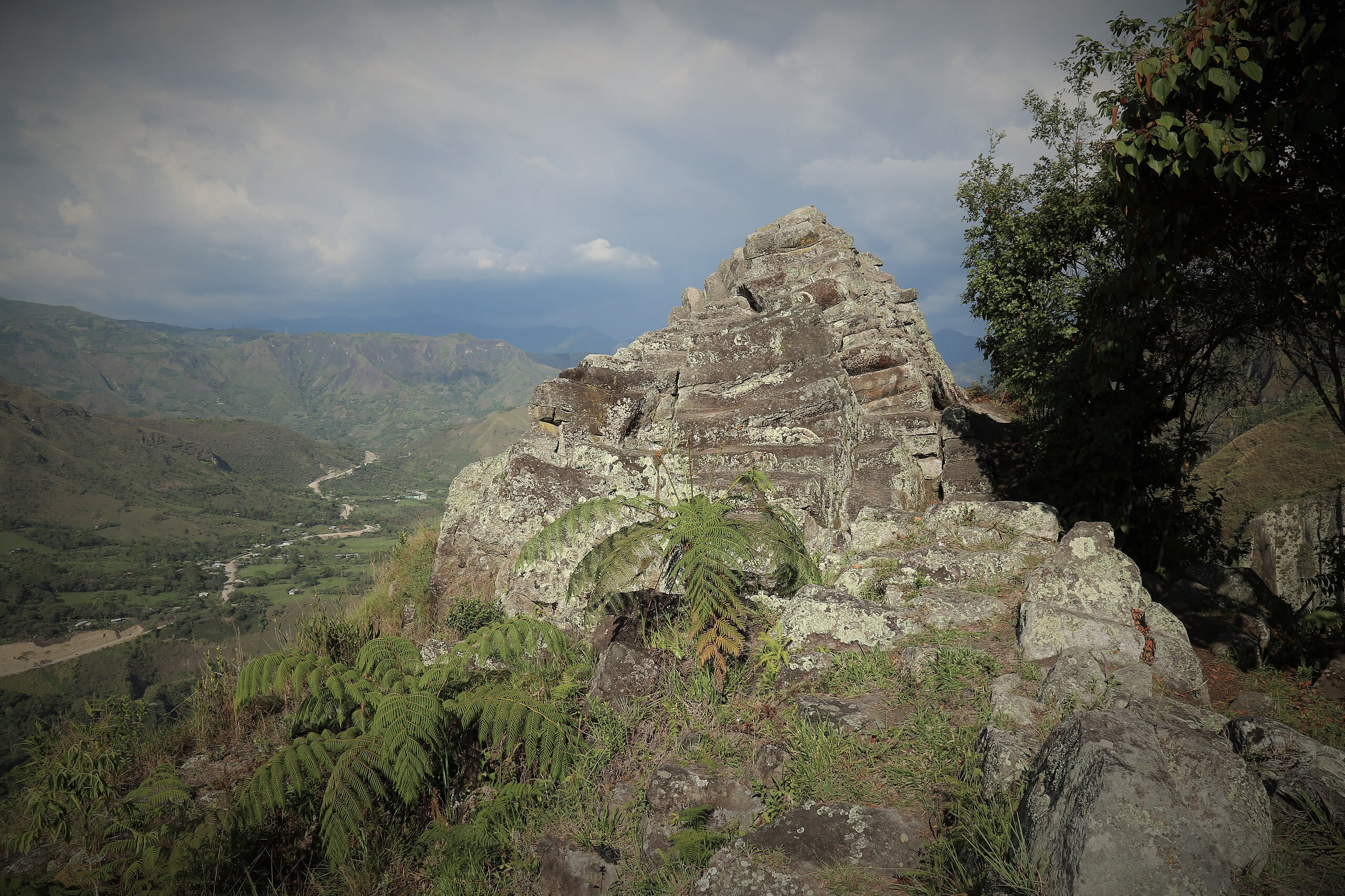
Near the town of Inza, a pyramidal stone formation rises from the Cauca mountainside, bearing the marks of two vastly different encounters. On its summit, pre-Columbian carvings of undetermined date and purpose confirm that the formation held significance for the same cultures that built the nearby Tierradentro hypogea. At its base, tunnels carved by Spanish colonial forces record a different kind of engagement: the search for gold believed to be hidden within the stone.
Weather & Best Time
Plan Your Visit
Save this site and start planning your journey.
Quick Facts
Location
Inza, Cauca, Colombia
Tradition
Site Type
Coordinates
2.5800, -76.0400
Last Updated
Mar 29, 2026
The Tierradentro Pyramid is a natural stone formation with pre-Columbian carvings and Spanish colonial tunnels, located in Nasa indigenous territory near the UNESCO-listed Tierradentro hypogea.
Origin Story
The formation is geological in origin, a volcanic feature shaped by the same forces that created the tuff into which the Tierradentro hypogea were carved. The pre-Columbian carvings on its summit confirm human engagement, though their date, attributed tentatively to the same era as the nearby hypogea culture, remains unconfirmed by dedicated archaeological study. The Spanish colonial tunnels at the base represent a later engagement, driven by the search for gold or building stone.
Key Figures
Pre-Columbian carvers
original makers of summit carvings
The unknown individuals who carved designs on the pyramid's summit, confirming its significance within the broader Tierradentro ceremonial landscape.
Spanish colonial forces
tunnel carvers
The colonial forces who carved tunnels at the base, either seeking gold or quarrying stone. Their work represents the extractive encounter between colonial power and indigenous sacred landscape.
Spiritual Lineage
The lineage at this site is one of layered engagement with the same natural feature: pre-Columbian inscription, colonial extraction, Nasa territorial continuity, and contemporary tourism. No continuous tradition of practice connects these layers; each represents a distinct relationship with the formation.
Know a Sacred Site We Should Include?
Help us expand our collection of sacred sites. Share your knowledge and contribute to preserving the world's spiritual heritage.